1.739 resultados
ref. 1544744like new. unknown
1917Folio, 440p., illus. Hardcover Ex-library, Good condition, top on backstrip split
ref. Q-0070125333McGraw-Hill. Hardcover. New. New. In shrink wrap. Looks like an interesting title! McGraw-Hill hardcover
1987Book is in bright orange cloth HB with black print at spine. Covers show no wear other than two small impact marks at top edge and bumped at lower spine. . Binding is solid and square, covers have sharp corners, exterior shows no other blemishes, text/interior is clean and free of marking of any kind. Dust jacket shows edge wear with small tears, 2" closed tear at lower spine. Heavilly illustrated with b&w photos, some color, floorplans, architectural drawings,, elevations, exteriors, interiors, lots of detail. Originally published on the occasion of the exhibition at the publisher's gallery. Contents include: New York and Hunt, Fraser, Furness and Hewitt, Furness and Evans, Furness and his critics, then section II: Catalogue of selected buildings, including: Rodef Shalom synagogue, Thomas Hockley house, Jefferson medical college hospital, Brazilian pavillion, Kensington national bank, Penn national bank, Undine barge club, Bryn Mawr hotel, Merion cricket club and many others. Copyright 2011 Pistil Books
ref. 03240085.28C2Good. Volume XL: Part II. DJ heavily worn with chips tears and loss to edges. Boards show light shelf and corner wear; binding intact. Text shows occasional pencil marginalia but appears clean otherwise. hardcover
1998As New English Paperback. Mint. 4to. (33 x 33 cm). In English and Turkish. 243 p., color and b/w ills. Erkut Sahinbas. 1968-1998 Mimarlik çalismalari.= 1968-1998 Architectural works. Introduction by C. Abdi Güzer. Sahinbas was born in Istanbul. Graduated from the Tarsus American College in Mersin in 1956. Received his Bachelor of Architecture degree in 1961 from the Middle East Technical University (METU), Ankara. Due to the influence of his proffessors J. Otto Spreckhelsen and Jakko Kaikkonen in METU, he developed an interest in Scandinavian Architecture and worked at the Ahti Korhonen-Eric Krakstorm Office in Copenhagen, Denmark in 1961 -1965. Received his Master of Architecture degree in 1964 from the Danish Royal Academy in Copenhagen where he taught architectural design with Professor Jorgen Bo. After returning back to Ankara in 1966, he taught at METU until 1975. Established his private office in 1968 and has been practicing architecture ever since. Served as the Chairman of the Association of Turkish Architects in Private Practice, between 1996 - 1998. Won the National Architectural Award of the Chamber of Turkish Architects twice; first in 1992 with the Bilkent Amfitheatre project, than in 1996 with the Bilkent University Library Annex.
1935Very Good Swedish Original photograph album. Cloth. Oblong cr. 8vo. (13 x 19 cm). Descriptions in Swedish. Various sized 20 b/w photographs. Other pages blank. Photos: St. Lars ruin.; Humanistiska Laroverket.; Kyrkan.; MAria-Kyrkan, Interiör.; Vardshuset Draken.; Sigtunastiftelsen. Flygfoto.; Posthuset.; Utsikt fran Flickinternatet.; Flickinternatet Berga elevhem.; Sigtuna stiflelsen.; Kyrkan.; Radhusel.; Stadshotellets terrass.; Humanistika Laroverket.; S:t. Olofs ruin.; Lilla torget och Stora gatan.; Gamla Tullstugan.; Sigtunaskolan.; Sigtunastiftelsen, Rosengarden.; Prastgarden, S:t. Pers ruin och 'Pilgrimstugan'.
1878Very Good German Original color map on cloth. A little foxing on cloth. Very good. Folded. Oblong folio. (45 x 51 cm). In German. [MAP of WEST GREECE] L.15. Philiataes (Corfu). Jonisches Meer. Scale: 1/300.000. A sheet of the collection of 'The general map of Central Europe'. appeared in the years between 1873-1876 with the work of Joseph Ritter von Scheda, (1815-1888) who was a general, geographer and cartographer.
1876Very Good German Original color map on cloth. Folded. Oblong folio. (45 x 51 cm). In German. [MAP of OTTOMAN BALKANS] L.14. Berat (Argyrokastro). Shows South Albanian shores, Corfu, Berat et alli. A sheet of the collection of 'The general map of Central Europe'. appeared in the years between 1873-1876 with the work of Joseph Ritter von Scheda, (1815-1888) who was a general, geographer and cartographer.
1876Very Good German Original color map on cloth. Oblong atlas folio. (46 x 52 cm). Toponyms in German. [MAP of BALKANS] J.10. Glina and around. North Bosnia and Herzegovina sheet. A sheet of the collection of 'The general map of Central Europe'. appeared in the years between 1873-1876 with the work of Joseph Ritter von Scheda, (1815-1888) who was a general, geographer and cartographer.
1876Very Good German Original color map on cloth. Oblong atlas folio. (46 x 52 cm). Toponyms in German. [MAP of OTTOMAN BALKANS] L.14. Berat. Shows South Albanian shores, Corfu, Berat et alli. Lithography. (Argyrokastro). A sheet of the collection of 'The general map of Central Europe'. appeared in the years between 1873-1876 with the work of Joseph Ritter von Scheda, (1815-1888) who was a general, geographer and cartographer.
1825Very Good French Original engraved b/w map. Folded. A little foxing. Otherwise very good and clean copy. Folio. (40 x 27 cm). In French. From 'Voyage Egypte et en Syrie.; pendant les années 1783, 1784 et 1785, suivi de considérations sur la guerre des russes et des turks, publiées en 1788 et 1789, Vol. 1 (Egypt chapter). At north, Mer Mediterranee, Syrie,, Alexandrie, Delta, et alli. Also shows Desert d'Arabie, Desert d'Afrique; with El Tih ou Desert de l'Egarement, Bahr ou Mer de Qolzoumm, Mer Rouge, Ancien Thebes, et alli.
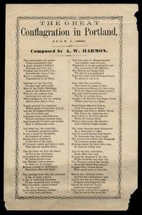
ref. 18941134Single sheet 6 x 9.25 inches 1.25 inch closed tear at upper edge edges chipped horizontal fold toning to lower quadrant. A blog entry by Nancy Noble archivist/cataloger at the Maine Historical Society identifies the poet A. W. Harmon 1812-1901 as a Scarborough carriage smith who published at least fifteen broadside poems on a variety of subjects.
ref. 18941134Single sheet 6 x 9.25 inches 1.25 inch closed tear at upper edge edges chipped horizontal fold toning to lower quadrant. A blog entry by Nancy Noble archivist/cataloger at the Maine Historical Society identifies the poet A. W. Harmon 1812-1901 as a Scarborough carriage smith who published at least fifteen broadside poems on a variety of subjects. books
ref. 67806, L'architecture d'aujourd'hui 1946, 1946 couverture illustre de l'editeur original, 140 pages + 50 ads. bon etat.
ref. 67807, L'architecture d'aujourd'hui 1946, 1946 couverture illustre de l'editeur original, 140 pages + 50 ads. bon etat.
2012New New English Original bdg. Dust wrapper. In publisher's special slip-case. 4to. (34 x 24 cm). In English and Turkish. 751, [1] p. Color and b/w ills. The photograph album of Anatolian Seljuk monuments.= Anadolu Selçuklu eserleri fotograf albümü. A very heavy volume.
1914ref. AUB-8974Neuchâtel Attinger frères 1914. Bel exemplaire relié, reliure pleine toile ornée, 1 des 500 exemplaires numérotés, in-4 (28 x 22), 62 vignettes gravées sur papier cartonné avec serpentes reproduisant des légendes. Rousseurs.
1890Very Good Turkish, Ottoman (1500-1928) Original color map. Folded. Very good. Large oblong 8vo. (21 x 26 cm). In Ottoman script. [MAP of OTTOMAN PROVINCE of EASTERN ROUMELI] Rumeli-yi Sarkî Vilâyeti, Bulgaristan Eyâleti, Edirne Vilâyeti, [Trakya], Selânik Vilâyeti. [East Roumeli, Salonica, Adrianople provinces; Old Zagra Sandjak, Bulgarian State]. Scale: 1/1.500.000. Ottoman Provinces in the Balkan Peninsula.
1890Very Good Turkish, Ottoman (1500-1928) Original color map. Folded. Very good. Large oblong 4to. (19 x 37 cm). In Ottoman script. [MAP of OTTOMAN PROVINCE of ERZURUM] Erzurum Vilâyeti. Province of Erzurum of east Anatolia and its around. Many sandjaks and provinces with their detailed place names. Scale: 1/1.500.000.
1890Very Good Turkish, Ottoman (1500-1928) Original color map. Folded. Very good. Large oblong 8vo. (26 x 26 cm). In Ottoman script. [MAP of OTTOMAN PROVINCE of SIVAS] Sivas Vilâyeti, Trabzon Vilâyeti, Tokat Sancagi. [Sivas and Trabzon Provinces, Tokat Sandjak]. Scale: 1/1.500.000.
1890Very Good Turkish, Ottoman (1500-1928) Original color map. Folded. Very good. Large oblong 8vo. (21 x 26 cm). In Ottoman script. [MAP of OTTOMANT SALONICA -THESSALONIKI-] Selânik Vilâyeti. Ottoman Greece. Scale: 1/1.500.000. It shows Thessaloniki and its around. Manastir Vilayat, At north Kosovo, Siroz Sandjak etc.
1782Very Good French Original b/w map. Oblong folio. (25 x 37 cm). In French. Jean-Denis Barbié, dit Barbié du Bocage , né le 28 avril 1760 à Paris et mort dans cette ville le 28 décembre 1825, est un géographe et cartographe français, doyen de la Faculté de lettres de Paris, membre de l'Institut. It shows Black Sea and its shores with their old toponyms very detailed.
2007As New As New English Original bdg. Dust wrapper. Folio. (34 x 24 cm). In English. 380 p., color and b/w ills. Architectureal achievements of King Abdul-Aziz in the honored area of Makkah, 1924-1953. "This book includes a general survey of the architectural accomplishments of King Abdul-Aziz in the Honored Area of Makkah. Those works include the Holy Kaba, the Al-Haram Mosque, the Zamzam Well, the Mosques, the Water Fountains, the Wells, the Water Dams, Road making, field opening and Airport construction projects, Road stops, Hospitals and others. This book records most of such works of restoration and building. It is also supported by pictures and drawings that shed some light on those projects".
1914Good Turkish, Ottoman (1500-1928) Original color map. Folded. Tears in margins. Slightly stained. Otherwise a good copy. Oblong atlas folio. (50 x 60 cm). In Ottoman script. [MAP of EAST BLACK SEA] Artvin, Rize, Oltu. Shows Artvin and Georgian borders, Rize (Rizeon - Rizunda - Rizini) and Oltu cities and regions. Scale: 1/200.000. Hegira: 1330 = Gregorian: 1914. This is one the serie of the Bonn projection maps which are the first map series in modern techniques in Turkey and the Ottoman Empire. In order to produce these maps covering Turkish territory, Reconnaissance Branch was incorporated into The Mapping Commission. The maps were produced in the datum based on the latitude and longitude of Ayasofya Mosque in equal area Bonn Projection. The field works for the 123 sheets covering the country were conducted by 76 staff. The production was completed in 18 years starting from east west. Field works continued without stopping except in years 1914 and 1920. This map series called also reconnaissance maps contributed a lot to producing 1:25.000 scale maps. Not description on map-maker. Extremely rare.