OR Louis d'Livre Rare Book
Salome Jacques De Mestral DominiqueLivre Rare Book
Lettres À l'Intime de Soi
2001réf. 500189297Albin Michel 2001 179 pages 14x2x21 5cm. 2001. Relié. 179 pages.

Démons et Merveilles · Joinville, France15,00 €
17 168 résultats
1902réf. 4606Couverture rigide. Reliure toile. 252 pages.
1951réf. 39BBWinterthur, Karl Stierlin. 1952. 4°. 5 Bl., Mit einfarbigen Illustr. von Ernst Morgenthaler und Anne Bretscher. Heft.
2001réf. 500189297Albin Michel 2001 179 pages 14x2x21 5cm. 2001. Relié. 179 pages.
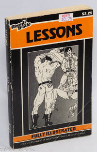
réf. 310485n.p.: no pub no date. Paperback. 190p. explicit line drawings price sticker on cover wear else a good first printing PBO in camp pictorial wraps. Gay pulp fiction. Rough Trade RT420. no pub paperback books
2008réf. 343940Monroe ME: Common Courage Press 2008. Paperback. 456p. wraps first paper edition very good condition. On the Mississippi Freedom Schools of 1964. Common Courage Press paperback books
2008réf. Q-1567513883Common Courage Press 2008-10-01. Paperback. New. In shrink wrap. Looks like an interesting title! Common Courage Press paperback
réf. 0895561395.Gpaperback. Good. Access codes and supplements are not guaranteed with used items. May be an ex-library book. paperback
réf. 3525310633.Gpaperback. Good. Access codes and supplements are not guaranteed with used items. May be an ex-library book. paperback
1842réf. CWEsLÖWE89Paris: Arthus Bertrand & Leipzig: Leopold Michelsen 1842. 1842. 8vo. PP. xii 372. with half-title. Uncut in original printed wrs. spine chipped stitching broken some moderate foxing throughout. Inscribed from the author. First Edition. Löwenstern an Austrian visited North American as part of a trip around the world. He landed at New York on September 8 1837 travelled northward into Canada then south to Philadelphia Baltimore and Washington where he turned west and went down the Mississippi River to New Orleans. The Canadian leg of his trip Niagara Falls Toronto Montreal Quebec is related in Chapters V-VII pp. 85-136. Clark III 196. Howes L-426. Sabin 42505. Signed by Authors. F. Paris: Arthus Bertrand & Leipzig: Leopold Michelsen, 1842. unknown
réf. 2322841439.Gpaperback. Good. Access codes and supplements are not guaranteed with used items. May be an ex-library book. paperback
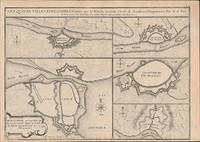
réf. 51-6451Paris: chez l'auteur dans l'Isle du Palais sur le quay de l'orloge a la Sphére Royale avec privilége du Roy 1705-1717. 2 Engraved maps and coats of arms on two leaves.Each 27.3 x 38cm. Contemporary laid paper uniformly time aged.Published in "L'atlas curieux ou Le monde reÌpreseÌnteÌ dans des cartes geÌneÌrales et particulieres du ciel et de la terre : diviseÌ tant en ses quatre principales parties que par eÌtats et provinces et orneÌ par des plans et descriptions des villes capitales et principales et des plus superbes edifices qui les embelissent comme sont les eglises les palais les maisons de plaisance les iardins les fontaines &c. ". OCLC Number / Unique Identifier:79022119.LThe Atlas Curieux is geographic encyclopedia of images and maps of France with detailed views of the grand waterworks at Marly views of the great palaces and chateaux views and plans of the Paris Observatory and samples of military architecture. Issued in six annual parts from 1700-1705 the maps are based on the new observations of the Académie des Sciences and drawn up with the assistance of Philipe de La Hire.ibrary of Congress:The French cartographer and engraver Nicolas de Fer was a master at creating maps that were works of art. The maps that he published were printed during the Baroque period when the decorative arts were characterized by ornate detail. De Fer’s detailed maps and atlases were valued more for their decorative content than their geographical accuracy.Nicolas de Fer was born in 1646. His father Antoine de Fer owned a mapmaking firm. At the age of twelve Nicolas was apprenticed to a Parisian engraver named Louis Spirinx. The family business was starting to decline when his father died in 1673. Nicolas de Fer’s mother Genevieve took over the business after the death of her husband. In 1687 the business was passed on to Nicolas and the profits increased after he took over the firm. Nicolas de Fer was a prolific cartographer who produced atlases and hundreds of single maps. He eventually became the official geographer to King Louis XIV of France and King Philip V of Spain.One of de Fer’s major works is an atlas titled L’atlas curieux The curious atlas. Paris: chez l'auteur dans l'Isle du Palais sur le quay de l'orloge a la Sphére Royale avec privilége du Roy, 1705-1717 unknown
1992réf. 4087DBLuzern, Faksimile Vlg., 1992. 4°. Kommentarband 255 S.; 52 Seiten. 25 ganzseitige, reich mit Gold und Rankenschmuk verzierte Miniaturseiten. Goldgepr. Orig.-Maroquineinband., Halblederband mit Rückenschild. + Wichtig: Für unsere Kunden in der EU erfolgt der Versand alle 14 Tage verzollt ab Deutschland / Postbank-Konto in Deutschland vorhanden +, A|B 2 Bände [2 Warenabbildungen]
1965Texts by Alexandre Cirici-Pellicer. Foreword by F. J. Sànchez Cantòn. Without dustjacket. French Text. Milano, 1965; bound, pp. 243, col. plates, cm 27x32,5. francaise
réf. 51-6453Paris: chez l'auteur dans l'Isle du Palais sur le quay de l'orloge a la Sphére Royale avec privilége du Roy 1705-1717. Engraved map. 27.3 x 38 cm. Contemporary laid paper uniformly time aged.Published in "L'atlas curieux ou Le monde reÌpreseÌnteÌ dans des cartes geÌneÌrales et particulieres du ciel et de la terre : diviseÌ tant en ses quatre principales parties que par eÌtats et provinces et orneÌ par des plans et descriptions des villes capitales et principales et des plus superbes edifices qui les embelissent comme sont les eglises les palais les maisons de plaisance les iardins les fontaines &c. ". OCLC Number / Unique Identifier:79022119.LThe Atlas Curieux is geographic encyclopedia of images and maps of France with detailed views of the grand waterworks at Marly views of the great palaces and chateaux views and plans of the Paris Observatory and samples of military architecture. Issued in six annual parts from 1700-1705 the maps are based on the new observations of the Académie des Sciences and drawn up with the assistance of Philipe de La Hire.ibrary of Congress:The French cartographer and engraver Nicolas de Fer was a master at creating maps that were works of art. The maps that he published were printed during the Baroque period when the decorative arts were characterized by ornate detail. De Fer’s detailed maps and atlases were valued more for their decorative content than their geographical accuracy.Nicolas de Fer was born in 1646. His father Antoine de Fer owned a mapmaking firm. At the age of twelve Nicolas was apprenticed to a Parisian engraver named Louis Spirinx. The family business was starting to decline when his father died in 1673. Nicolas de Fer’s mother Genevieve took over the business after the death of her husband. In 1687 the business was passed on to Nicolas and the profits increased after he took over the firm. Nicolas de Fer was a prolific cartographer who produced atlases and hundreds of single maps. He eventually became the official geographer to King Louis XIV of France and King Philip V of Spain.One of de Fer’s major works is an atlas titled L’atlas curieux The curious atlas. Paris: chez l'auteur dans l'Isle du Palais sur le quay de l'orloge a la Sphére Royale avec privilége du Roy, 1705-1717 unknown
Seltenes Werk über die franz. Gold- u. Silbermarken. Nur in 1020 numerierten Exemplaren erschienen.
2012Testo Italiano, Inglese e Francese. Firenze, 2012; ril., pp. 410, ill., tavv. col., cm 25x31.
1870réf. 53351Paris, Firmin Didot Frères, 1870. Vortitel, Titel, II, 298 S. Mit 1 chromolithograph. Frontispiz u. 43 Abb. im Text u. auf Taf. Gr.-8vo. HLn.
1 vol in-12, 324 pp., fig. in-t., index, broché. Bel exemplaire. [LP-9]
1856In 4° (306 x 240); 78 cc. nn. di cui 37 sono bellissime tavv. litografiche a piena pagina con coloritura coeva. Legatura coeva in peina tela con titolo e ricchi fregi in oro e a secco al piatto anteriore e al dorso. Al piatto posteriore fregi in oro e a secco. Tagli dorati. Ogni tavola protetta da velina. Testo stampato in colore blue. Celebre opere di storia naturale che illustra, con bellissime tavole alcuni dei più spettacolari eventi della natura come vulcani, arcobaleni, valanghe, grotte, montagne di sale, cascate (Niagara), Montagne, Ghiacciai, paesaggi polari ecc. ecc. Il testo è curato da Munerelle mentre i disegni solo dei celebre illustratore francese Lemaitre. Contiene le tavole: Lever de soleil - Orage - Arc-en-ciel - Tremblements de terre - Trombe - Clair de lune - Inondation - Avalanches - Simoun - Aurore boréale - Flux et reflux - Mer et ses courants - Pôle arctique - Pôle antarctique - Vésuve - Volcans sous-marins - Forêts vierges - Déserts - Mines - Terrains aurifères - Glaciers - Sources du Rhin - Puits salants et puits de feu - Geysers - Niagara - Cataractes - Andes - Nil - Grotte d'Antiparos - Ponts naturels - Peter Bot - Chaussée des Géants - Grotte de Fingal - Montagnes de sel - Perle du Rhône - Baume des demoiselles ou Grotte des Fées - Pic d'Adam. Rif. Bibl.: Gumuchian 4546 - 4547.
1970réf. 2080202105500432Institut et Musee Voltaire 1970. Soft Cover. Fine. Number of books: 1 Institut et Musee Voltaire paperback
Paris, Albin Michel, 1966. 4to. mayor; 474 pp. Cubiertas originales.
Das Standardwerk über die Gold- u. Silberschmiede von Douai mit zahlreichen Abbildungen und Punzen.