235 résultats
1750[Figurato Agrimensura] (cm.21) buona mz. pergamena originale, titolo al dorso.-- cc. 2 nn., pp. 158, + 1 c. di indice. Con molte incisioni in legno nel testo, anche a piena pagina, raffiguranti strumenti di agrimensura, figure geometriche, fabbriche rurali e diagrammi. Prima edizione veneta, ricercata per le aggiunte rispetto alla prima del 1727. L' autore è di Verona e questo manuale pratico ebbe molto successo e ristampe varie, vedi lunga nota in Comolli e Maffei. Firma coeva al frontis "Francesco Rigacci di Scrofiano(Siena)". Esemplare bello e fresco. *Riccardi II 262; * Comolli III 89-90; * Riccardi "Geodesia in Italia" II p. 11-12; * Maffei " Verona Illustrata" II 297.[f65] Libro
réf. 72674A Paris, Chez Arthus Bertrand, Mme Huzard, 1825, 1 volume de 22x28 cm environ, (1) ff., 8 pp., 49 planches (6 planches de Botanique, 21 planches concernant les Arbres, 3 planches Arpentage, 1 planche Avenues perpétuelles, 1 planche Carbonisation, 1 planche Insectes, 16 planches Bois de marine), (1) ff. Demi-reliure veau bistre et cartonnage marbré, dos lisse portant titres dorés, gardes marbrées. Feuillets non rognés. Coiffe inférieure fendue, des rousseurs, frottements sur les coupes, bon état pour le reste.
réf. 550Antverpiae ( Anvers ) ; Brugis Fland. ( Bruxelles ) pour les deux parties du 2ème ouvrage ; Parisiis. Ex officina Christophori Plantini ; Ex officina Huberti Goltzij pour les deux parties du 2ème ouvrage ; Apud Egidium Nicolaum Gillios . 1579 Numquam antehac editum ; 1565 pour les deux parties du 2ème ouvrage ; 1588 . 3 ouvrages en 1 vol. , le 2ème étant divisé en 2 parties bien distinctes in - 8 ( 11 x 16 cm ) ( poids = 300 g ) 221 (2) pp.(dont t. ) + 110 (2) pp. (dont les t. ) + 74 (14) pp. (dont t. ) . 66 portraits en médaillons dans le texte . Le 1er ouvrage contient de nombreuses pièces liminaires dont dédicace Ad Isabellam Avstriam Galliae Reginam , Epitaphivm Mariae Isabellae Galliae principis , In Avrelii Victoris historiam , Lectori S. , puis Origo Romanae a Iano et Satvrno conditoribus ... , Sex. Avrelivs Victor de viris illvsrtibvs vrbis Romae ..., Additamentvm virorvm illvstrium... , Avrelii Victoris historiae abbreviatae pars altera , Imp. Romanorvm series , In comment. de origine vrbis Romae And. Schottvs , Avctorvm , Rervm series , De avctore viror illvstrivm , Series virorvm illvstrivm , In Avr. Victoris Historiam Avgvstam notae And. Schotti , Index rervm maxime memorabilivm ... Menda . Le 2ème ouvrage , en deux parties distinctes , contient Hvbert. Goltzivs Iohanni Othoni S. P. D. , Amplissimo viro Domino D. Gvilielmo Ketelero Iohannes Otho Brvgensis S. D. , Ad generosvm bonaeque spei adolescentem Theodorvm Ketelervm Iohannis Othonis Brvgensis Praefata , In Historiam Romanam Introdvctio , puis après le 2ème titre , Sex. Rvfi V. C. dictatoris magistri militvm Breviarivm rervm gestarvm Po. Ro. , Errata , colophon . Le 3ème ouvrage contient : Sex. Ivlii Frontini De colonis libellvs , De limitibvs lex Mamilia , Roscia .... Nomina civitatem Apulia & Calabriae , P. Vellei Paterculi De coloniis ... De coloniis ex Pandect. , M. Portii Catonis ex libris originvm fragmenta , Q. Fabii Pictoris De avreo secvlo et de origine vrbis Romae .. , C. Sempronivs De divisione Italiae & origine vrbis Romae , Myrsilii Lesbii De origine Italiae et Tyrrhenorvm , Coniectvrae qvaedam Io. Opsopoei ... Index , Errata . Au 1er titre , marque typographique au compas d' or avec devise Labor et Constantia . Aux 2ème et 3ème titres , marque à la femme ( Fortuna ? ) qui vide une corne d' abondance avec devise Hvbertas aurea saerculi . Au 3ème titre , marque à trois couronnes avec le quatre de chiffre surmontant deux G affrontés et devise Hic Labor . Plein vélin rigide à petit recouvrement . Titre manuscrit de l' ouvrage principal au dos ( plus ou moins effacé ) . Tranches bleues . Pages plus ou moins jaunies , rares rousseurs , une mouillure angulaire pp. 5 - 6 du dernier ouvrage . Bon ex. . ( Collat. complet ) .
1800Cartonatura coeva alla rustica con titolo calligrafato su tassello al dorso, qualche traccia del tempo al solo dorso). Centinaia fra tabelle, figure geometriche e vignette xilografiche intercalate nel testo, raffiguranti, tra l’altro, mappe, boschi, alberi, case, fiumi, strumenti di misurazione, chiese e campanili, botti da vino, fieno e legna. Testatine e fregi xilografici. Bell'esemplare, molto genuino, con belle carte senza difetti e con ampi margini. Alcuni fascicoli risultano parzialmente scuciti dall’insieme. Seconda edizione (la prima è del 1763) di importante trattato di agrimensura dedicato alla misurazione dei terreni, dei fiumi, dei confini, dei vasi vinari, del legname, dei mucchi di grano, alle tecniche per la corretta conservazione del fieno, etc. Tommaso Guerrino (Milano, 1733-1778) fu associato all’Accademia delle Belle Arti di Milano. Cfr. Riccardi, I, 639. Sc. M.
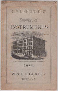
1880réf. 5842Troy NY: W & L E Gurley Co. 1880. Later Edition. Original publisher's printed wrappers. A very good copy; short tear in front wrapper no loss; some hand soiling not offensive. 8vo. There is a large fldg. frontis. and text illus. throughout. One of the company's catalogs of selected instruments that were being sold at reduced prices. There is a large folding frontispiece of a light mountain transit. The catalog is 56 pages and is represented by the firm as including the latest improvements in its line of instruments. See Romaine. W & L E Gurley Co. unknown books
18738vo., Fourth Edition, with 16 engraved plates (a number double-page), and 115 woodcuts and numerous tables in the text; handsomely bound in red full morocco, back gilt with five raised bands, second and fourth compartments lettered and ruled in gilt, all other compartments tooled and ruled in gilt, uncut, original catalogue preserved, a most attractive copy ideal as a gift or for presentation. With 56pp publisher's catalogue bound in at end. Written for the use of junior officers of the Royal Engineers and those of the Honourable East India Company's Service, Frome's extensive treatise was first published from REE Chatham in 1839. Its value as a standard text was swiftly recognised in both military and civilian sectors and the third edition was exhausted by 1862. This is the fourth (first Warren) edition, considerably expanded as well as revised. A lovely copy.
1969Approximately 340 pages in total. Originally printed in 1885. "Until recently the only comprehensive work on the Admiralty Hydrographic Department this book still remains one of the most important books on the history of hydrography... Particularly useful in providing information about the lesser-known hydrographers of the nineteenth century... Also includes a description of the United States coast survey. Contains a new Preface and a list of more than 80 corrections and additions compiled by researchers at the Admiralty." - from dust jacket. Usual library markings. Binding sound. Worthy reference copy. Book
17742 volumi in-12° (mm 156x81), pp. XI, (1), 327, (1); XXII, (2), 348. Legatura coeva in pergamena , titoli in oro su tassello ai dorsi, tagli spruzzati in rosso. La celebre opera di Gregorio Leti, apparsa per la prima volta a Roma nel 1674, non benevola illustrazione della corte pontificia in cui l'autore si cela sotto lo pseudonimo del Cavalier Lunadoro. Più volte riproposta anche nel secolo successivo, l'edizione che presentiamo è accresciuta da Francesco Antonio Zaccaria, e nella Parte seconda è inserito un capitolo dedicato alle funzioni e all'organizzazione del Tribunale dell'Agricoltura, "una speciale soprantendenza alle cause appartenenti ad animali, a pascoli, campagne, ed altre cose di simil fatta; ed a Persone impiegate in Campestri lavori" (pp. 326-327). Minime bruniture ma buon esemplare. A entrambi i frontespizi nota di possesso datata 1776 ‘Giambattista Motella' e timbro di antica collezione in inchiostro. . .
1674In-4°,(20), 360, (60), 328pp, 3 carte di tavola ripiegate, antiporta, illustrazioni; buone condizioni, legatura in pergamena piena, tassello al dorso. Buona edizione di questa raccolta, curata da Goes, di autori latini sul tema dell'agronomia e dell'agrimensura. In parte già edita nel 1554 da André Turnèbe, fu successivamente Nicolas Rigault (Paris, 1577-1654, erudito letterario e latinista, succeduto a Casaubon nella carica di bibliotecario regio) che ne promosse una nuova edizione a Parigi nel 1614 sotto il titolo Auctores finium regundorum... Entrambe le edizioni risultarono offuscate da codesta del 1674. Il trattato comprende opere di scrittori latini quali: Siculus Flaccus, De conditionibus agrorum; Julius Frontinus, De coloniis libellus e De agrorum qualitate; Hyginus, De limitibus constituendis; Innocentius, De litteris et notis juris exponendis. Le numerose incisioni in rame e legno nel testo rappresentano schematicamente paesaggi rurali con fiumi, monti, case, castelli, boschi, fonti e i simboli usati nelle piante dei catasti agrari romani e nella determinazione dei fondi rurali. Brunet, IV/1195. Bibl. Agronomique, n. 1718: "Ouvrage estimé et recherché; assez rare". In-4 °, (20), 360, (60), 328pp, 3 folded tables, frontispiece, plates; good condition, vellum binding, label at the spine. Good edition of this collection, edited by Goes, of Latin authors on the subject of agronomy and land surveying. Partly already published in 1554 by André Turnèbe, it was subsequently Nicolas Rigault (Paris, 1577-1654, literary scholar and latinist, who succeeded Casaubon in the position of royal librarian) who promoted a new edition in Paris in 1614 under the title Auctores finium regundorum ... Both editions were blurred by this 1674. The treatise includes works by Latin writers such as: Siculus Flaccus, De conditionibus agrorum; Julius Frontinus, De coloniis libellus and De agrorum qualitate; Hyginus, De limitibus constituendis; Innocentius, De litteris et notis juris exponendis. The numerous engravings in the text schematically represent rural landscapes with rivers, mountains, houses, castles, woods, sources and symbols used in the plants of the Roman land registers and in the determination of rural funds. Brunet, IV / 1195. Bibl. Agronomique, n. 1718: "Ouvrage estimé et recherché; assiz rare".
1589réf. 7573CBVenedig, Per Francesco Franceschi, 1589. Kl.-4°. 143 (von 145) Bl., (3) Bl. Mit 2 gef. Tafeln and more than 145 Holzschnitte im Text. Pappband der Zeit, mit Kleisterpapierbezug. + Wichtig: Für unsere Kunden in der EU erfolgt der Versand alle 14 Tage verzollt ab Deutschland / Postbank-Konto in Deutschland vorhanden +
1682Dedicato all'Illustrissimo Francesco Ferroni. Seconda edizione definitiva più completa della prima del 1603. Molto rara e importante per la vastità di argomenti e notizie. Vedi Riccardi I 478 : " Opera interessantissima per la storia dell' aritmetica, ampiamente sviluppata ed applicata anche alla mercatanzia; e per quella della geometria pratica, trovandovisi la descrizione e l'uso degli strumenti allora conosciuti, fra i quali sono notevoli quelli che ora direbbersi celerimensura. In 4to, mm. 1675x235, 1 carta bianca, con ex libris e nota manoscritta di vecchio proprietario + 12 carte non numerate + 551 pagine + 1 carta bianca finale. Molte illustrazioni xilografiche nel testo. Marca tipografica incisa al verso dell'ultima pagina di testo: Lupa che allatta i gemelli, nota manoscritta coeva di possesso, sull'occhietto. Esemplare in barbe, l'opera si occupa di aritmetica, calcolo degli interessi dei cambi, rivelazione delle misure. Legatura coeva in cartone grezzo editoriale, titolo manoscritto, restauro ben eseguito al piede del dorso, rimarginatura della parte bianca alle ultime due carte. Codice inv.3024527
1770réf. 59178France Paris Undated around 1770. Folio. 425 x 28 cm. Loose sewn 4 by 4 leaves in portfolio with ties. Title-page and 9 pp. written in a fine large legible hand but unidentified in brown ink. Having 5 No 1-5 manuscript maps and plans in double folio with some hand-colouring. On good thick paper clean and fine. unknown
1770réf. 59178France (Paris ?), Undated, around 1770. Folio. (42,5 x 28 cm.). Loose, sewn 4 by 4 leaves in portfolio with ties. Title-page and 9 pp. written in a fine, large legible hand, but unidentified, in brown ink. Having 5 (No 1-5) manuscript maps and plans in double folio with some hand-colouring. On good thick paper, clean and fine.
1800in-4, pp. (8), 423, leg. cart. rust. coevo. Con una tav. xilogr. rip. raff. diagrammi. Seconda ediz. (sulla prima del 1763), opera del milanese G. (1733-1778) molto ben illustrata da schemi, diagrammi e scene campestri. Dalla prefazione: “L’Euclide in Campagna divenne quindi in breve tempo il Manuale degli agrimensori, de’ periti, degl’agenti....”. Riccardi I, 639. Lieviss. insignificante alone marginale sulle prime 3 cc. Bell’esempl. in barbe su carta forte. [023]
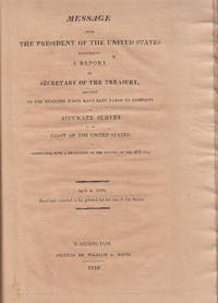
1816réf. 5914Washington DC: William Davis 1816. First Edition. Contemporary half leather. Very good; backstrip powdering; overall toning. Chancery folio I - 8 pp. 2 folding charts; II Indians - 2 3 - 128 pp. 5 folding charts; III Hassler - 4 5 - 10 2 pp. 3 folding charts. The original report by Hassler of his 'buying' trip to Europe in 1811. Hassler was commissioned by Jefferson to undertake the first coast survey. To this end Congress appropriated $50000 for the purchase of instruments. Hassler travelled to Europe but arrived during the wars and was delayed for years. Upon his return this report was issued by the Treasury Dept. that detailed his expenditures for scientific instruments and books as well as chronometers. All the devices makers cost specifications etc. are listed in the report offered here. Hassler's account is bound up with two other Treasury Dept. reports of the same year - separately issued - that provide information on the expenses of the Indian Department and general and particular information on trade with the Indian nations. DSB VI 165-166; DAB VIII 385-386; Poggendorff I 1031. William Davis hardcover books
1763Formato cm. 25x20. Pagine (9), 424, (8). Bella rilegatura in mezza pergamena. Alcune macchie e bruniture ma stato di conservazione molto buono. All'interno sono presenti molte pregevoli incisioni raffiguranti figure geometriche, misurazioni di terreni, botti, balle di fieno, mucchi di grano, altezze di edifici ecc. ed un ritratto ripiegato dell'autore. In fondo sono presenti due lettere del Guerino.
1759réf. 5305Frankfurt & Leipzig: H L Broenner 1759. First Edition. Full contemporary calf raised bands. Very good; spotting throughout. 4to 16 1 - 304 312 correct pp. 24 engraved plates Boehm was a professor of mathematics at the Univ. of Giessen. The book offered here is handbook and manual for surveying accompanied by two appendices that are devoted to surveying over water and underground mine surveying tailored to special needs e.g. driving air shafts. The latter subjects are appended to the text as they pertain to a complete understanding of the science of surveying and were of particular practical use. Boehm's other published books are all in the field of military science artillery etc. and his comments in the Messkunst associate it with his other published work. He appears to have been particularly well informed on the literature of the subject that includes French publications and technically quite adept. He offers suggestions on the construction of special use instruments and apologizes for the omission of any mention of certain kinds of instruments by explaining that they were inaccurate and of little use. In all an excellent treatise on surveying and map making. Poggendorff I 222. H L Broenner hardcover books
1682[Figurato Agrimensura-Matematica] (cm.20,5) ottima piena pergamena molle sec. XVIII, titolo al dorso. -- cc. 6 nn., pp. 551 + 1p. con marca tipografica. Molte illustrazioni n.t. in xilografia di strumenti, schemi, figure ecc. Seconda edizione definitiva più completa della prima del 1603. Molto rara e importante per la vastità di argomenti e notizie. Vedi Riccardi I 478: "Opera interessantissima per la storia dell' aritmetica, ampiamente sviluppata ed applicata anche alla mercatanzia; e per quella della geometria pratica, trovandovisi la descrizione e l' uso degli strumenti allora conosciuti, fra i quali sono notevoli quelli che ora direbbersi celerimensura". Cat. Libri n° 2878-79: "This work is so scarce that it has escaped professor De Morgan. It contains solutions of several indeterminate problems. Amongst the authors quoted by Forestani we find Galigai, Calandri, Lazzisio, Pagani, ecc.". Vecchio restauro al margine del frontis con le prime 5 lettere di (Pratica) ridisegnate. Qualche lieve alone al margine delle prime carte ma esemplare bello nitido e marginoso. * Autori Italiani del '600 1551; * Sotheran Primo Suppl. 1150; * Graesse VIII 309.[f72] Libro
1682[Fig. Agrimensura] (cm.21,5) pieno vitello originale, nervi, dorso in oro con specchi decorati e titolo.-- cc. 6 nn., pp. 551 + 1 p. con marca tipografica. Molte illustrazioni n.t. in xilografia di strumenti, schemi, figure ecc. Seconda edizione definitiva più completa della prima del 1603. Molto rara e importante. Vedi Riccardi I 478: " Opera interessantissima per la storia dell' aritmetica, ampiamente sviluppata ed applicata anche alla mercatanza; e per quella della geometria pratica, trovandosi la descrizione e l' uso degli strumenti allora conosciuti, fra i quali sono notevoli quelli che ora direbbersi di celerimensura". Cat. Libri n° 2878-79: " This Work is so scarce that it has escaped Professor De Morgan. It contains solutions of several indeterminate problems. Amongst the authors quoted by Forestani we find Galigai, Calandri, Lazzisio, Pagani, ecc.". Alcune spellature al dorso e alle cuffie, sei carte (pag. 531) con vecchi strappo restaurato senza perdite, altrimenti esemplare molto bello e nitido. * Autori Italiani del '600 1551; * Sotheran Primo Supplemento 1150; * Graesse VIII 309.[f52] Libro
1815réf. 25378Vergèze 1815 in-folio Manuscrit, reliure plein veau in-folio, mais il ne reste quasiment plus rien du cuir de la reliure initiale, texte manuscrit à l'encre brune, verte et rouge orné de trés nombreuses lettrines calligraphiées en couleurs à l'encre brune, verte et rouge sur toute les pages ainsi que des Calligraphies en ornementation du texte, en bandeaux et culs-de-lampes en couleurs, la Table des matières et sur les 3 dernières pages : Règles d'Arithmétique, collationné complet, 255 pages, Fait à VERGÈZE, le 20 Septembre 1815, chez Mr J. JUEIRAL, signé Auquier (notés en bas de la dernière page avant les pages de Tables),
réf. 83400Ottawa, Lithographed at the Survey Office, 1889, 1 volume in-4 de 265x185 mm environ, 324 pages, demi reliure à coins en cuir noir, dos à 5 nerfs portant titres dorés, orné de filets dorés qui soulignent les nerfs, contient des figures dans le texte et 5 planches hors texte, 1 carte d'envoi de l'auteur. Légères rousseurs sur les pages de garde, petite trace blanche sur le dernier plat, sinon bon état. Un des 50 exemplaires de cette première édition, publiée au sein des Services d'arpentage (Canada), à l'usage des employés de l'équipe. Hommage de l'auteur sous forme de carte. (Nous laissons une enveloppe jointe contenant quelques photographies anciennes sans rapport avec l'ouvrage).
1941réf. 3877Kyiv 1941. Very good. Together 2 views 205 x 325 mm; 8" x 13" printed on cheap thin paper Ad 1: long closed tear through image without loss light staining creasing edges a little frayed; Ad 2: short closed tears along edges two small holes in blank area at lower left light staining. Overall in very condition suitable for exhibition and study. Tragically topical apparently unrecorded views of Kyiv being rude field printings on cheap paper likely created by Nazis during the so-called "First Battle" of Kiev Aug. 23 - Sept. 26 1941 or shortly thereafter. We are mindful that the present views are historically "toxic" but given the context of the current Russian war-crimes against the people of the Ukraine we believe that there is an urgent need for them to be preserved. The first print is a view of Kyiv looking at the city center from the south specifically from the wooded hill of Lysa Hora which had a complex fortification system. During the German occupation the fort became a military plant and tank base. Here Kyiv rises above the Dnipro river on the right. The key below identifies 22 sites mostly of military significance such as buildings bridges power plants hospitals factories churches and cloisters. To each site is assigned a code consisting of a letter or letters and a numeral or numerals: these are certainly map references i.e. K10 L10 F-G7 etc. We have been unable to locate this exact map but large bird's-eye maps of Kyiv taken by the Vermessungs- und Karten-Abteilung survive in the Kiev Polytechnic Museum and also the David Rumsey Collection. That a need for vantage-point views such as ours to accompany such a map seems self-evident. The second is a view of Kyiv taken from the Great Lavra Bell Tower in the Pechersk Lavra monastery strategically positioned in the city center looking towards the Dnieper Valley in the northeast. The key identifies 13 sites likewise militarily important but with the notable inclusion of the "Podol Judenstadt" no. 6 a Jewish neighborhood to the north of the city. Our prints may date before Nov. 3 1941 because on this day just two months into the German occupation of Kyiv a huge explosion brought down the Uspensky Sobor cathedral in the Pechersk Lavra monastery across the courtyard from the Bell Tower from which the present view was drawn. The "Motorized Surveying and Map Detachment" was an integral part of the German military and accompanied the army throughout the European and North African theater. These surveyors photographers and printers traveled with equipment to the front lines sometimes on special trains. The detachments were self-contained and had the capability to print onsite even in the most hostile conditions. Ephemeral views such as the present pair were printed in small numbers for the sole use of German occupying troops. The present prints were purchased by a Munich bookseller from a private collector in Germany along with other documents from the period. NOTA BENE: These prints were both purchased at an auction in Germany in early January 2021 i.e. BEFORE the Russian invasion of Ukraine on February 24 2022. unknown
1941réf. 3877Kyiv 1941. Very good. Together 2 views 205 x 325 mm; 8" x 13" printed on cheap thin paper Ad 1: long closed tear through image without loss light staining creasing edges a little frayed; Ad 2: short closed tears along edges two small holes in blank area at lower left light staining. Overall in very condition suitable for exhibition and study. Tragically topical apparently unrecorded views of Kyiv being rude field printings on cheap paper likely created by Nazis during the so-called "First Battle" of Kiev Aug. 23 - Sept. 26 1941 or shortly thereafter. We are mindful that the present views are historically "toxic" but given the context of the current Russian war-crimes against the people of the Ukraine we believe that there is an urgent need for them to be preserved. The first print is a view of Kyiv looking at the city center from the south specifically from the wooded hill of Lysa Hora which had a complex fortification system. During the German occupation the fort became a military plant and tank base. Here Kyiv rises above the Dnipro river on the right. The key below identifies 22 sites mostly of military significance such as buildings bridges power plants hospitals factories churches and cloisters. To each site is assigned a code consisting of a letter or letters and a numeral or numerals: these are certainly map references i.e. K10 L10 F-G7 etc. We have been unable to locate this exact map but large bird's-eye maps of Kyiv taken by the Vermessungs- und Karten-Abteilung survive in the Kiev Polytechnic Museum and also the David Rumsey Collection. That a need for vantage-point views such as ours to accompany such a map seems self-evident. The second is a view of Kyiv taken from the Great Lavra Bell Tower in the Pechersk Lavra monastery strategically positioned in the city center looking towards the Dnieper Valley in the northeast. The key identifies 13 sites likewise militarily important but with the notable inclusion of the "Podol Judenstadt" no. 6 a Jewish neighborhood to the north of the city. Our prints may date before Nov. 3 1941 because on this day just two months into the German occupation of Kyiv a huge explosion brought down the Uspensky Sobor cathedral in the Pechersk Lavra monastery across the courtyard from the Bell Tower from which the present view was drawn. The "Motorized Surveying and Map Detachment" was an integral part of the German military and accompanied the army throughout the European and North African theater. These surveyors photographers and printers traveled with equipment to the front lines sometimes on special trains. The detachments were self-contained and had the capability to print onsite even in the most hostile conditions. Ephemeral views such as the present pair were printed in small numbers for the sole use of German occupying troops. The present prints were purchased by a Munich bookseller from a private collector in Germany along with other documents from the period. NOTA BENE: These prints were both purchased at an auction in Germany in early January 2021 i.e. BEFORE the Russian invasion of Ukraine on February 24 2022. unknown books
réf. Z1-W-023-00989The Stationery Office Books. Used - Acceptable. Used - Acceptable. Sticker on cover. Ships from UK in 48 hours or less usually same day. Your purchase helps support Sri Lankan Children's Charity 'The Rainbow Centre'. Ex-library with wear and barcode page may have been removed. 100% money back guarantee. We are a world class secondhand bookstore based in Hertfordshire United Kingdom and specialize in high quality textbooks across an enormous variety of subjects. We aim to provide a vast range of textbooks rare and collectible books at a great price. Our donations to The Rainbow Centre have helped provide an education and a safe haven to hundreds of children who live in appalling conditions. We provide a 100% money back guarantee and are dedicated to providing our customers with the highest standards of service in the bookselling industry. The Stationery Office Books unknown