5 880 résultats
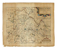
réf. 108176circa 1607-1637. Folio 14 1/2 x 12 3/4” hand-colored engraving 10 1/2 x 12 1/2”. Edges and outer margins chipped and slightly darkened repaired; good. § Early edition probably for Camden’s Britannia in Latin. An accurate illustrative map of Brecknock Shire in South Wales. unknown books
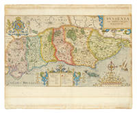
réf. 108178London: circa 1607-1637. 4to. 12 3/4 x 15 1/2” hand-colored engraving 8 5/8 x 15 1/4” with a compass rose the Royal Arms supported by lion and unicorn a sea monster a galleon in full sail and elaborately engraved cartouches to the title the key and the scale. Small drawing in contemporary hand to the verso in ink. Minor foxing to outer margins otherwise a bright colorful copy. § John Norden's map of Sussex from an early edition of William Camden's Britannia. John Norden c. 1547-1625 was an English cartographer chorographer and antiquary. His maps of London and Westminster are the best known representations under the Tudors. He executed maps for William Camden and John Speed’s atlases. [circa 1607-1637]. 4to unknown books
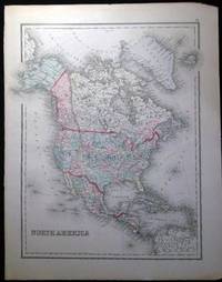
1882réf. 25035Philadelphia PA: O.W. Gray & Son 1882. One sheet printed with 1 map from the 1882 O.W. Gray National Atlas New York Edition: North America. Copyright noted at bottom edge Colton 1855. With hand-coloring in pastel tones; Approx. 14" x 17 1/4" overall size; a little even toning to the paper right margin with a few little edge-nicks; in very good condition. Map. Not Bound. Very Good. O.W. Gray & Son paperback books
1882réf. 25034Philadelphia PA: O.W. Gray & Son 1882. One sheet printed with 2 maps from the 1882 O.W. Gray National Atlas New York Edition: Gray's New Map of Australia by Frank A. Gray 1878 engraved by W.H. Holmes and Palestine. With hand-coloring in pastel tones; Approx. 14 3/8" x 17 1/4" overall size; a little even toning to the paper; in very good condition. . Map. Not Bound. Very Good. O.W. Gray & Son paperback books
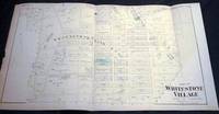
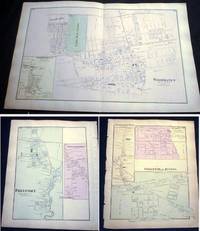
1873réf. 8953New York NY: Beers Comstock & Cline 1873. Original Hand-colored Map of Part of Whitestone Village Southern Part from the Beers Comstock & Cline Atlas of Long Island New York. Three sections folded 15 1/2" x 27 1/2" approx. overall size; somewhat age-toned; top edge with a little scraping; old creasing; in very good condition. . First Edition. Not Bound. Very Good. Beers, Comstock & Cline Paperback books
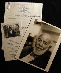
1984réf. 24561New York New York: Photo By Bill Ray 1984. Black and white photograph 8" x 10" on heavy photographic paper; on back is handwritten "For my old and valued friend Bob Greene" and with Harrison's name and the date of April 1984 at the lower border; with the studio stamp of Photo by Bill Ray 350 Central Park West New York. with A group of copy-pages of drawings from the New Yorker by Harrison and presented "for Bob Greene Richard Edes Harrison on his 66th Birthday" with the black and white illustrated memorial service pamphlet for R. E. Harrison 1901 - 1994 Cartographer-Artisan-Birder-Raconteur on the 93rd Anniversary of his Birth March 11 1994. in good condition. Robert S. Greene 1922 - 2013 American writer jazz musician documentarian and historian friend of the artist who innovated U.S. cartography in the 20th century. see Timothy Barney "Richard Edes Harrision and the Cartographic Perspective of Modern Internationalism" U. of Richmond 2012 for his more on his contributions to cartography. Photograph. Soft Cover. Very Good. Photo By Bill Ray Paperback books
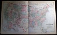
1882réf. 25037Philadelphia PA: O.W. Gray & Son 1882. One sheet from the 1882 O.W. Gray National Atlas New York Edition: Double-page map of the United States with inset of the Territorial District of Alaska formerly Russian America and a smaller inset at top "Sketch Exhibiting the Westward Movement of the Centre of Population from 1790 to 1870."; text on back regarding U.S. population changes; at bottom margin of map copyright dated as 1879 O.W. Gray & Son. With hand-coloring in pastel tones; approx. 28 1/2" x 17 1/4" overall size; a little even toning to the paper with a few little edge-nicks; in very good condition. . Map. Not Bound. Very Good. O.W. Gray & Son paperback books
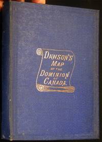
1885réf. 27056Montreal Canada: Dawson Brothers 1885. Color map sectioned on linen; with insets showing the continuation of the map to the Pacific showing British Columbia & Manitoba; Manitoba & connecting territory; Environs of Montreal and an inset of Newfoundland. Front endpaper and a blank back panel of the map with the owner name-stamp of collector George R. Brush M.D. U.S. Navy; in service as a surgeon & medical inspector from 1861-1894. Bound in the original hardcover blue textured cloth boards gilt cover titles patterned-paper endpapers; covers are approx. 4" x 6" size. Map opens to approx. 23 1/2" x 33 3/4" overall; some edge tips wear and dustiness to the covers' binding inner endpaper scraped from linen backing at one corner; map in very good condition. First Edition. Hard Cover. Very Good. Dawson Brothers hardcover books
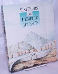
1994réf. 264321Paris: the museum 1994. Paperback. 211p. vivid color reproductions throughout supplemented with modern diagrammatic maps showing different expeditions softbound in 10x8 inch frenchfold wraps. Expect a severe vertical crease to front cover with creasing of several adjacent leaves including titlepage and instances of pencilled comment in three locations: half-title and pages 146 176. A good reading copy the volume remains entirely useful. the museum paperback books
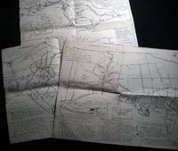
1965réf. 26508Southold Long Island N.Y.: No Publisher Noted 1965. Three folded sectional maps of the Town of Southold Long Island NY. Approx. 14 1/2" x 18" size; printed black on cream paper stock. Section I depicting western portion Laurel Mattituck Cutchogue Nassau Point Robin's Island; Section II Peconic Southold village Bay View Hashamomack Greenport; Section III East Marion Oysterponds - Orient & a Fisher's Island map inset. Each map with its own numbered key-list of locations and short historical notes on them. Some edge tips-wear and soiling little spotting; old fold lines; in good condition. First Edition. Not Bound. Good. No Publisher Noted paperback books
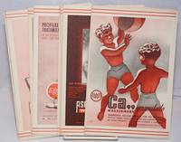
1940réf. 250450no city Spain: Wassermann 1940. Nineteen quarto leaves of alkaline paperstock each folded vertically in half to make nineteen separate advertising brochures of 8.5x5.5 inches all four faces of each brochure printed in colors with a come-on cover; pages within pp.2 & 3 print a detailed doublespread color map back cover mostly text with spot-color touches. Partial set 19 of an original total of 42. Each map features a different region or province in Spain including the Islands and North Africa while exterior covers boast a different medicine medications for the blood or bone for young and old: Take Aspasmol a sedative for spaamodic attacks &c &c. Please note that nos.13 and 37 use the same cover image but deal different meds and differing parts of Spain. All in nice condition clean and sound. Wassermann unknown books
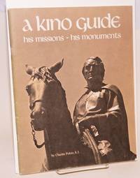
1976réf. 60413Tucson: Southwestern Mission Research Center 1976. 50p. 8.5x11 inches illustrations photos maps reading guide very good later revised printing booklet in stapled pictorial wraps. Southwestern Mission Research Center unknown books
1929réf. 13924New York New York: U.S. Geographical Survey 1929. Department of the Interior U.S. Geological Survey Hempstead Quadrangle; 1929 version of a map edition of 1903 depicting a partially revised shoreline of 1923. Showing contours topography waterways train lines roads and locations of homes; printed in three colors. The back of the map with information on map standard symbols. 20" x 16 1/2" approximate size; some edge tips wear closed edge tear at bottom edge little wrinkling; & back with a darkened panel. In good condition decorative and interesting perspective on Long Island real estate development patterns in the area. PLEASE NOTE: Shipped rolled for safety. . Map. Not Bound. Good. U.S. Geographical Survey Paperback books
1873réf. 8957New York NY: Beers Comstock & Cline 1873. Original Hand-colored Map of Woodhaven with Inset Map of South Woodhaven from he Beers Comstock & Cline Atlas of Long Island New York. 15 1/2" x 24 1/4" approx. overall size; somewhat age-toned; on reverse are maps of Springfield Store Willow Tree Station Inglewood Freeport Greenwich Point; left margin edge-chipped right margin with a few nicks; in very good condition. PLEASE NOTE: Shipped rolled for safety. First Edition. Not Bound. Very Good. Beers, Comstock & Cline Paperback books
1861réf. 627311861. CARTOGRAPHY. CATALOGUE OF THE MANUSCRIPT: Maps Charts and Plans and of the Topographical Drawings in the British Museum. Volume III only. London: Printed by Order of the Trustees 1861. A photostat copy of Vol. 3 in two volumes i.e. a Complete Volume III the final volume of this catalogue. Tall 8vo. brown library binding. Ex-library sun to spine touch of soil dust soil to top-edge. unknown books
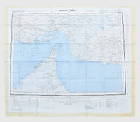
1957réf. 182684London: War Office; Printed for D. Survey WO and AM by Balding and Mansell Ltd 1957. A bright example of this detailed Gulf map Classified "restricted" and issued for military use at the time of the Jebel Akhdar War this double-sided sheet shows much of the modern-day UAE extending northwards from the latitude of Abu Dhabi and the Buraimi Oasis as well as the eastern Arabian Peninsula from the Trucial Coast to Jubail. As with other contemporary GSGS maps the sheet covers six degrees of longitude and highlights towns of significance and other standout features for example oil pipelines and wells water systems and roads and railways. Rayon sheet 630 x 710 mm printed both sides in colour folded as issued. A fine example. unknown
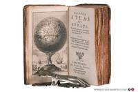
1780réf. 78258Bruxelles: Benoît Le Francq 1780. Full leather hardcover. xx240 pp. illustrated with a black-and-white frontispiece showing Atlas as a child holding up the celestial sphere and 24 old hand-colored folding maps/plates after G. Dellisle. Rare Brussels pocket atlas based on the 5th Amsterdam edition published by B. Vlam in the same year 1780. Includes B. Vlam's bookseller's list at the end. One map has a repaired taped tear and some maps have frayed edges. Bound in a leather cover with various damages. The book is complete and the maps remain visually attractive. Text in French / Français. See pictures. Benoît Le Francq hardcover
1584réf. Map1002Cologne: Goldefridi Kempensis 1584. 2nd Edition . No Binding. Fine. Folio. AN ORIGINAL MAP. Original hand colouring. 47x40cms Folding double page.PLEASE EMAIL FOR PHOTOS. Goldefridi Kempensis unknown
1904réf. 150900Berlin: Kartographische Abteilung der Königlich Preußischen Landesaufnahme 1904. One of just two known complete sets An exceedingly rare large 15-sheet map of China's strategically pivotal Liaodong Peninsula printed for senior German military commanders during the Russo-Japanese War and the Japanese siege of Port Arthur. We have traced one complete set at the Berlin State Library and the University and State Library Darmstadt has an incomplete set of six sheets. For the German army possessing up-to-date information on Liaodong was pressingly essential. Despite being officially neutral during the conflict Germany had significant geopolitical interests in north-eastern China having acted with Russia and France in 1895 to curtail Japanese expansion in East Asia after the First Sino-Japanese War. Russian-Japanese hostilities in particular the gruelling engagements around Port Arthur also threatened to spill over into Germany's nearby maritime territorial concession Qingdao. This highly detailed cartographic production printed at a scale of 1:42000 from Russian military maps from 1898-99 shows settlements of every size topography and spot-heights roads railway lines and other information of use in any potential military operation. 16 untrimmed photolithographed sheets 670 x 630 mm to 170 x 510 mm colour and black and white including 15 map sheets combining to form one large map as well as one key sheet with contemporary supplementary annotations. Generally clean and bright several sheets with fraying in margins 1 sheet with few tape repairs on verso 2 sheets with small loss at head in 1 case just crossing neatline occasional creases. A well-preserved set. unknown
1788réf. GT789London: Charles Dilly in the Poultry et al 1788. eleventh edition . Hardback. Vg. 8vo. x 2 928pp. 20 map plates : 2 engraved illustrations charts maps ; Damp staining to the plates and map in some but compete and tight copy in the original binding. A New System of Modern Geography: or A geographical historical and commercial grammar; and present state of the several kingdoms of the world. : Containing I. the figures motions and distances of the planets according to the Newtonian system and the latest observations. II. A general view of the Earth considered as a planet; with several useful geographical definitions and problems. III. The grand divisions of the globe into land and water continents and islands. IV. The situation and extent of empires kingdoms states provinces and colonies. V. Their climates air soil vegetable productions metals minerals natural curiosities seas rivers bays capes promontories and lakes. VI. The birds and beasts peculiar to each country . XII. The longitude latitude bearings and distances of principal places from London. To which are added I. A geographical index with the names and places alphabetically arranged. II. A table of the coins of all nations and their value in English money. III. A chronological table of remarkable events from the Creation to the present time. Original full calf with red morocco label to the spine. Charles Dilly in the Poultry et al hardcover
1884réf. GT602London: Lett's Son & Co. 1884. No Binding. Vg. Large original folding plan of London. Please email for photos. Green card covers with a printed label. Rather grubby but an attractive map. Lett's Son & Co. unknown
1914réf. GE130England: The Ordnance Survey 1914. 3rd Edition . No Binding. Vg. Folding Sheet. Sheet 100. 3rd edition temporary. Large folding Geological Map of the Sheffield area of Yorkshire. One inch to the mile. Laid on cloth with fine printed colouring. 65x50cms. with eight sections. An attractive and scarce map. The Ordnance Survey unknown
2010réf. GT396New York: Walker Publishing Co. 2010. 1st edition 1st impression . Hardback. Fine/Fine. Folio. 303pp. Full colour d.j. No wear inscriptions fading or marks. A sumptuous production and very heavy. Walker Publishing Co., hardcover
1900réf. GT244Oxford: Chart Publishing Company 1900. Slip Case. Fine. Folding map. 2 Folding Charts and an index booklet encased in a blue slipcase. All contents fine Slipcase a trifle toned.Priced at 47/6. Two linen backed LARGE 18 section colour maps. 75x100 and 75x100cms PLEASE EMAIL FOR PHOTOGRAPHS Chart Publishing Company unknown
1873réf. GT173Exeter: H. Besley & Son 1873. 1st Edition . No Binding. Vg. Folding map. 54x41 cms.A single sheet folding bl/wh. map of Dartmoor laid on white linen backing within a small booklet. Pasted label 'DARTMOOR' Nd but National Lib. of Scotland states 1873. Scarce local map 2 only Copac with local names and details to the locations on the moor. H. Besley & Son unknown