313 résultats
réf. 2805Manuscript 4to. 23.5 x 17.5 cm 2 ff. pencil sketch of arms Marlborough and blank 196 ff. and with 27 drawn folding plates many of which are colored. Bound in contemporary French calf spine gilt in six decorative compartments with title on letterpiece. Excellent with all plates drawn and many some colored in a very professional hand. Very attractive early 18th-century French illustrated manuscript of practical geometry in seven books including individual sections on longimetry planimetry and stereometry—the fundamentals of precision surveying and draftsmanship. The manuscript closely follows but is not identical to Jacques Ozanam's Géométrie Pratique du sr Boulenger Paris 1684 which itself was a revision of La Géométrie pratique Paris 1640 by the mathematician Jean Boulenger. Though the work was reprinted well into the 18th C the present volume seems to follow Ozanam's 1693 edition most closely. Ozanam's book however lacks the drawn and colored figures of the present volume many of which are quite elaborate. The facade of Notre Dame is shown in an exercise for calculating the height of a wall and a segment on proportion features detailed miniature maps of the Brittany coastline identifying towns such as St. Malo and Mont St. Michel. The manuscript exemplifies the early 18th C approach to applied trigonometry—a field that by the mid-17th C was starting to resemble an exact science. Book II defines the common functions sine cosine secant etc.; Book V treats longimetric puzzles such as determining the height of a mountain or a spire or measuring the length of bodies of water; the final two books treat planimetry and stereometry including applied trigonometry—calculating the volumes of real bodies i.e. barrels pipes etc. Those sections of the manuscript that do not appear in Géométrie Pratique—mainly a tract on logarithms and a discussion of surveying instruments—also fall within Ozanam's oeuvre as he published a monograph on compasses in 1673 and a book of logarithmic tables and trigonometric functions in 1685. Jacques Ozanam 1640-1717 was best known for his Récréations mathematiques Paris 1694 which "may be regarded as the forerunner of modern books on mathematical recreations." In addition to Boulenger's work he also revised that of Adriaan Vlacq 1600-1667 and the Jesuit mathematician Claude-François Milliet Dechalles. DSB.10 pp.263-265. [France, early 18th century]. books
1941réf. 3877Kyiv 1941. Very good. Together 2 views 205 x 325 mm; 8" x 13" printed on cheap thin paper Ad 1: long closed tear through image without loss light staining creasing edges a little frayed; Ad 2: short closed tears along edges two small holes in blank area at lower left light staining. Overall in very condition suitable for exhibition and study. Tragically topical apparently unrecorded views of Kyiv being rude field printings on cheap paper likely created by Nazis during the so-called "First Battle" of Kiev Aug. 23 - Sept. 26 1941 or shortly thereafter. We are mindful that the present views are historically "toxic" but given the context of the current Russian war-crimes against the people of the Ukraine we believe that there is an urgent need for them to be preserved. The first print is a view of Kyiv looking at the city center from the south specifically from the wooded hill of Lysa Hora which had a complex fortification system. During the German occupation the fort became a military plant and tank base. Here Kyiv rises above the Dnipro river on the right. The key below identifies 22 sites mostly of military significance such as buildings bridges power plants hospitals factories churches and cloisters. To each site is assigned a code consisting of a letter or letters and a numeral or numerals: these are certainly map references i.e. K10 L10 F-G7 etc. We have been unable to locate this exact map but large bird's-eye maps of Kyiv taken by the Vermessungs- und Karten-Abteilung survive in the Kiev Polytechnic Museum and also the David Rumsey Collection. That a need for vantage-point views such as ours to accompany such a map seems self-evident. The second is a view of Kyiv taken from the Great Lavra Bell Tower in the Pechersk Lavra monastery strategically positioned in the city center looking towards the Dnieper Valley in the northeast. The key identifies 13 sites likewise militarily important but with the notable inclusion of the "Podol Judenstadt" no. 6 a Jewish neighborhood to the north of the city. Our prints may date before Nov. 3 1941 because on this day just two months into the German occupation of Kyiv a huge explosion brought down the Uspensky Sobor cathedral in the Pechersk Lavra monastery across the courtyard from the Bell Tower from which the present view was drawn. The "Motorized Surveying and Map Detachment" was an integral part of the German military and accompanied the army throughout the European and North African theater. These surveyors photographers and printers traveled with equipment to the front lines sometimes on special trains. The detachments were self-contained and had the capability to print onsite even in the most hostile conditions. Ephemeral views such as the present pair were printed in small numbers for the sole use of German occupying troops. The present prints were purchased by a Munich bookseller from a private collector in Germany along with other documents from the period. NOTA BENE: These prints were both purchased at an auction in Germany in early January 2021 i.e. BEFORE the Russian invasion of Ukraine on February 24 2022. unknown
1941réf. 3877Kyiv 1941. Very good. Together 2 views 205 x 325 mm; 8" x 13" printed on cheap thin paper Ad 1: long closed tear through image without loss light staining creasing edges a little frayed; Ad 2: short closed tears along edges two small holes in blank area at lower left light staining. Overall in very condition suitable for exhibition and study. Tragically topical apparently unrecorded views of Kyiv being rude field printings on cheap paper likely created by Nazis during the so-called "First Battle" of Kiev Aug. 23 - Sept. 26 1941 or shortly thereafter. We are mindful that the present views are historically "toxic" but given the context of the current Russian war-crimes against the people of the Ukraine we believe that there is an urgent need for them to be preserved. The first print is a view of Kyiv looking at the city center from the south specifically from the wooded hill of Lysa Hora which had a complex fortification system. During the German occupation the fort became a military plant and tank base. Here Kyiv rises above the Dnipro river on the right. The key below identifies 22 sites mostly of military significance such as buildings bridges power plants hospitals factories churches and cloisters. To each site is assigned a code consisting of a letter or letters and a numeral or numerals: these are certainly map references i.e. K10 L10 F-G7 etc. We have been unable to locate this exact map but large bird's-eye maps of Kyiv taken by the Vermessungs- und Karten-Abteilung survive in the Kiev Polytechnic Museum and also the David Rumsey Collection. That a need for vantage-point views such as ours to accompany such a map seems self-evident. The second is a view of Kyiv taken from the Great Lavra Bell Tower in the Pechersk Lavra monastery strategically positioned in the city center looking towards the Dnieper Valley in the northeast. The key identifies 13 sites likewise militarily important but with the notable inclusion of the "Podol Judenstadt" no. 6 a Jewish neighborhood to the north of the city. Our prints may date before Nov. 3 1941 because on this day just two months into the German occupation of Kyiv a huge explosion brought down the Uspensky Sobor cathedral in the Pechersk Lavra monastery across the courtyard from the Bell Tower from which the present view was drawn. The "Motorized Surveying and Map Detachment" was an integral part of the German military and accompanied the army throughout the European and North African theater. These surveyors photographers and printers traveled with equipment to the front lines sometimes on special trains. The detachments were self-contained and had the capability to print onsite even in the most hostile conditions. Ephemeral views such as the present pair were printed in small numbers for the sole use of German occupying troops. The present prints were purchased by a Munich bookseller from a private collector in Germany along with other documents from the period. NOTA BENE: These prints were both purchased at an auction in Germany in early January 2021 i.e. BEFORE the Russian invasion of Ukraine on February 24 2022. unknown books
réf. DADAX0548374724New unknown
1820IN 8°, pp.10 + 2 c.b. COPERTINA IN BROSSURA D'EPOCA CON FREGI IN ROSSO. DECRETO SULL'ISTITUZIONE DI UN COLLEGIO D'INGEGNERI, ED AGRIMENSORI, IL QUALE IN TUTTO CIO' CHE RIGUARDA INSEGNAMENTO, ED ISTRUZIONE DIPENDERA' DAL DIRETTORE DEL NOSTRO REALE LICEO, E DELLA PUBBLICA ISTRUZIONE. DATO DAL NOSTRO REALE PALAZZO DI LUCCA QUESTO GIORNO 12 NOVEMBRE 1820. FIRMATO : MARIA LUISA e A. MANSI. OTTIMA CONSERVAZIONE.
1947Opera incompleta,disponibile il volume II. Brossura con copertina in cartoncino flessibile, titoli al piatto e al dorso. Segni del tempo e d'usura;piatto anteriore in parte staccato, volume scurito, macchie di conservazione, strappi alle cuffie, bordo sfilacciato, tagli bruniti ed irregolari. All'interno la legatura è lenta,alcune ingiallite, altre con sottolineature ed appunti al margine, perfettamente fruibili. Etichetta adesiva al contropiatto posteriore. Numero di pagine 370. USATO
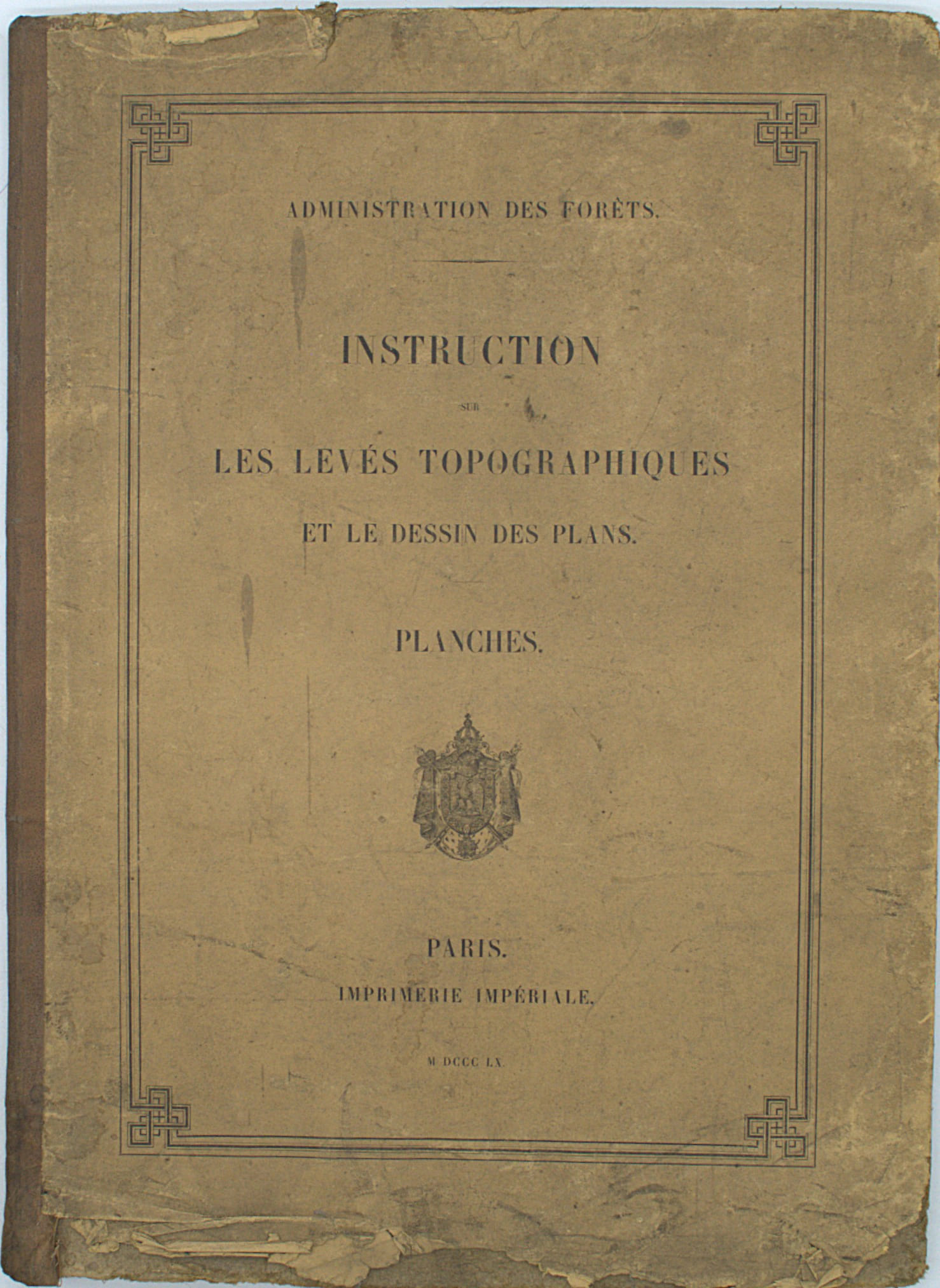
1860réf. PHO-2666Paris, Imprimerie Impériale, 1860, grand in-folio, atlas complet de 25 planches. Reliure éditeur demi percale avec titre au plat (salie, papier décollé), mouillure en pied.
réf. DADAX1436762731New unknown
réf. DADAX1437009476New unknown
2 voll. in-8° (cm. 24,7x17,3), pp. 375, VI + pp. 220, (3) + appendice pp. 15. Bross. edit., piccole manc. ai dorsi, 1° volume parzialmente slegato. Stampa di tipo litografico in eleganti caratteri tipo manoscritto.
réf. SONG0976599104ACSM 0000-00-00. Revised Edition. paperback. Used: Good. 0.00x0.00x0.00. Buy with confidence. Excellent Customer Service & Return policy. ACSM paperback
réf. 0976599104.Gpaperback. Good. Access codes and supplements are not guaranteed with used items. May be an ex-library book. paperback
réf. 0944426689.Gpaperback. Good. Access codes and supplements are not guaranteed with used items. May be an ex-library book. paperback
réf. 0937294705.Gpaperback. Good. Access codes and supplements are not guaranteed with used items. May be an ex-library book. paperback
1912In 8 (cm 17 x 24,5), pp. 208 con illustrazioni nel testo. Brossura editoriale con un paio di aloni al piatto anteriore. Catalogo illustrato non datato, ma ascrivibile al 1912 circa, con gli strumenti della Salmoiraghi per ingegneri e agrimensori fra i quali: teodoliti, tacheometri a nonii, cannocchiali, mire o stadie, pantografi, odometri, istrumenti di meteorologia, termometri, anemometri, ecc...
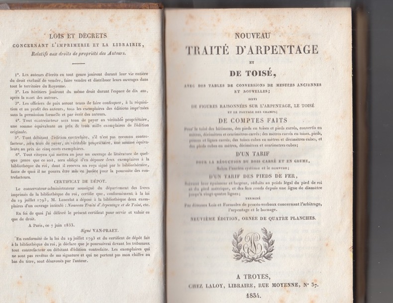
réf. 1726TROYES LALOY 1834- IN8 1/2 basane dos lisse frotté-274p - 4 planches dépliantes-rousseurs éparses
réf. 17411Troyes, Laloy - 1833 - reliure sans élégance, peut-être "d'attente" , dos lissé et titrage doré, 274 pages collationnées, complet des 4 planches dépliantes en 3 volets montées sur onglet. Exemplaire d'usage, déficit de matière en pied, coins émoussés, pagination exempt de rousseur.
réf. DADAX0415306639New unknown
réf. DADAX0415306620New unknown
réf. 6796Tours, Mame; Paris, Poussielgue, 1881.
réf. 550Antverpiae ( Anvers ) ; Brugis Fland. ( Bruxelles ) pour les deux parties du 2ème ouvrage ; Parisiis. Ex officina Christophori Plantini ; Ex officina Huberti Goltzij pour les deux parties du 2ème ouvrage ; Apud Egidium Nicolaum Gillios . 1579 Numquam antehac editum ; 1565 pour les deux parties du 2ème ouvrage ; 1588 . 3 ouvrages en 1 vol. , le 2ème étant divisé en 2 parties bien distinctes in - 8 ( 11 x 16 cm ) ( poids = 300 g ) 221 (2) pp.(dont t. ) + 110 (2) pp. (dont les t. ) + 74 (14) pp. (dont t. ) . 66 portraits en médaillons dans le texte . Le 1er ouvrage contient de nombreuses pièces liminaires dont dédicace Ad Isabellam Avstriam Galliae Reginam , Epitaphivm Mariae Isabellae Galliae principis , In Avrelii Victoris historiam , Lectori S. , puis Origo Romanae a Iano et Satvrno conditoribus ... , Sex. Avrelivs Victor de viris illvsrtibvs vrbis Romae ..., Additamentvm virorvm illvstrium... , Avrelii Victoris historiae abbreviatae pars altera , Imp. Romanorvm series , In comment. de origine vrbis Romae And. Schottvs , Avctorvm , Rervm series , De avctore viror illvstrivm , Series virorvm illvstrivm , In Avr. Victoris Historiam Avgvstam notae And. Schotti , Index rervm maxime memorabilivm ... Menda . Le 2ème ouvrage , en deux parties distinctes , contient Hvbert. Goltzivs Iohanni Othoni S. P. D. , Amplissimo viro Domino D. Gvilielmo Ketelero Iohannes Otho Brvgensis S. D. , Ad generosvm bonaeque spei adolescentem Theodorvm Ketelervm Iohannis Othonis Brvgensis Praefata , In Historiam Romanam Introdvctio , puis après le 2ème titre , Sex. Rvfi V. C. dictatoris magistri militvm Breviarivm rervm gestarvm Po. Ro. , Errata , colophon . Le 3ème ouvrage contient : Sex. Ivlii Frontini De colonis libellvs , De limitibvs lex Mamilia , Roscia .... Nomina civitatem Apulia & Calabriae , P. Vellei Paterculi De coloniis ... De coloniis ex Pandect. , M. Portii Catonis ex libris originvm fragmenta , Q. Fabii Pictoris De avreo secvlo et de origine vrbis Romae .. , C. Sempronivs De divisione Italiae & origine vrbis Romae , Myrsilii Lesbii De origine Italiae et Tyrrhenorvm , Coniectvrae qvaedam Io. Opsopoei ... Index , Errata . Au 1er titre , marque typographique au compas d' or avec devise Labor et Constantia . Aux 2ème et 3ème titres , marque à la femme ( Fortuna ? ) qui vide une corne d' abondance avec devise Hvbertas aurea saerculi . Au 3ème titre , marque à trois couronnes avec le quatre de chiffre surmontant deux G affrontés et devise Hic Labor . Plein vélin rigide à petit recouvrement . Titre manuscrit de l' ouvrage principal au dos ( plus ou moins effacé ) . Tranches bleues . Pages plus ou moins jaunies , rares rousseurs , une mouillure angulaire pp. 5 - 6 du dernier ouvrage . Bon ex. . ( Collat. complet ) .
1988réf. 105790Canberra: Department of Aboriginal Affairs. 1988. Large colour folding map 79 x 88 cm in original printed illustrated wraps. Some wear to edges clean very good condition. "Over 92 million hectares or about 12 per cent of the land area of Australia is held by or on behalf of Aborigines. More than two-thirds of this land is freehold the remainder being reserve leasehold or mission land. The map shows all areas of 10 hectares or more - over 4000 parcels of land - and classifies them by size and type of tenure. Also shown are the 415 centres inhabited by 50 or more Aboriginal people." 2nd Edition. Department of Aboriginal Affairs paperback
1899251pp.avec tables + 1 planche dépliante, 23cm., reliure cart. (dos en toile avec titre doré), bon état, W81268
1899réf. W81268Anvers, Impr. Henri Kennes 1899 251pp.avec tables + 1 planche dépliante, 23cm., reliure cart. (dos en toile avec titre doré), bon état, W81268
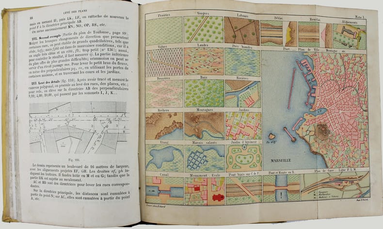
1873réf. ga2397Berger-Levrault et Cie Relié 1873 In-12 (12,7 x 18 cm), reliure demi-chagrin, dos lisse, XII-286 pages, bien complet des planches hors texte ; coiffes et coupes frottées, papier bruni, par ailleurs bon état général. Livraison a domicile (La Poste) ou en Mondial Relay sur simple demande.