Bryson, Thomas; Chambers, George M.MareMagnum

313 risultati
1916288 pages. Index. Black and white diagrams and illustrations. Fold-out 3-panel plan of Newreg Colliery. Intended "to provide students of coal mining and young surveyors with an explanation of the elementary principles which are applied to the practice of mine surveying and with a description of the constructional details of the instruments in common use." - from Preface. Markings throughout. Additional information laid inside back board and affixed to back endpaper. Above-average wear. Reading copy only. Book
1886Legatura coeva in mezza pelle con titoli dorati sul dorso, 8vo cm12x19, pp 81 (1); due tavole litografiche ripiegate in fine, di cui una colori, con esempi di rilevamento basati sul cirocndario del torrente Nure presso Piacenza (“C. Manuelita”), disegno di una diottra azimutale ecc. Non comune.
1833Toulouse, Douldoure 1833. In-16 broché couverture muette de 104 pages avec figures. Bon état
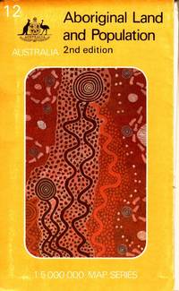
1988rif. 105790Canberra: Department of Aboriginal Affairs. 1988. Large colour folding map 79 x 88 cm in original printed illustrated wraps. Some wear to edges clean very good condition. "Over 92 million hectares or about 12 per cent of the land area of Australia is held by or on behalf of Aborigines. More than two-thirds of this land is freehold the remainder being reserve leasehold or mission land. The map shows all areas of 10 hectares or more - over 4000 parcels of land - and classifies them by size and type of tenure. Also shown are the 415 centres inhabited by 50 or more Aboriginal people." 2nd Edition. Department of Aboriginal Affairs paperback
London, Longman, Brown, Green, and Longmans, 1846, in-16, legatura coeva in piena tela (piatto anteriore staccato), pp. XXIV, 443, [1]. Con figure nel testo.
rif. 0282628533.Gpaperback. Good. Access codes and supplements are not guaranteed with used items. May be an ex-library book. paperback
1835pp. 160, 112. Illustrated with diagrams and drawings. Some damp stain and age stain. Early Lititz ownership. Small loss on front paste down. 12mo. 190 mm. Original full roan binding. Original gold lettered leather spine label. Hardbound. Very good copy. SCIENCE BOX 1
1844rif. 55840Hartford CT: Belknap and Hamersley 1844. 8vo. 160; 112 pp. Numerous woodcut engraved diagrams figures. Contemporary full speckled calf speckled fore-edges tan & gilt morocco spine label minor shelfwear slight rubbing occasional light foxing still an excellent copy. Third edition revised & expanded of this popular American treatise on surveying published originally in 1804 would continue to be updated and revised for over half a century. An edition of Abel Flint’s work was one of the two consulted by Abraham Lincoln while he studied to become a surveyor as it emphasized higher math including logarithms plane geometry and trigonometry. Belknap and Hamersley, unknown
rif. DADAX0548374724New unknown
rif. DADAX1436762731New unknown
rif. DADAX1437009476New unknown
rif. DADAX1412972930New unknown
rif. DADAX1436897505New unknown
rif. DADAX0131481894New unknown
rif. DADAX1436857171New unknown
rif. DADAX1436983266New unknown
rif. DADAX1436995868New unknown
rif. DADAX1401809618New unknown
rif. DADAX3319360175New unknown
rif. DADAX0827339410New unknown
rif. DADAX0700225242New unknown
rif. DADAX0632038489New unknown
rif. DADAX0132766981New unknown
rif. DADAX0134414438New unknown
rif. DADAX0077111141New unknown