Warner, BrianBiblio.com

12 746 résultats
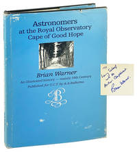
1979réf. amssA. A. Balkema Cape Town and Rotterdam for the University of Cape Town 1979. 1st Edition. Hardcover. Very Good/Fair. signed. Signed by Authors132 pages complete. Signed by Brian Warner on the title page. In general very good condition. The dustjacket is whole entire and strong. It is worn and much scuffed and marked. The spine of the dj is sunned. The cover is handsome and smart. There is mild wear to the shelving edges and corners. It is very secure and sure. The contents are as new throughout. The pages are fresh bright tight clean and clear. fk. Our orders are shipped using tracked courier delivery services. A. A. Balkema, Cape Town and Rotterdam for the University of Cape Town hardcover
1979réf. 26579Cape Town: Published for the University of Cape Town by A.A. Balkema 1979. Very Good/Very Good. Cape Town: Published for the University of Cape Town by A.A. Balkema 1979. First Edition. Signed by Brian Warner with brief inscription to photography historian Larry Schaaf. Octavo. 132 pp. Black and white photographs and illustrations. Illustrated dust jacket. Black boards stamped in gilt. Dust jacket chipped and creased along edges with general scuffing and smudging. Slight lean to boards with moderate shelfwear. Binding is sound and pages unmarked. Published for the University of Cape Town by A.A. Balkema unknown books
réf. 0878405577New. hardcover. New. Satisfaction Guaranteed or your money back. hardcover
1994réf. Q-0878405577Georgetown University Press 1994-10-01. Hardcover. New. In shrink wrap. Looks like an interesting title! Georgetown University Press hardcover
1994réf. 1-0878405577Georgetown University Press 1994. Hardcover. New. 320 pages. 10.25x7.00x1.00 inches. Georgetown University Press hardcover
réf. 0370011112.Ghardcover. Good. Access codes and supplements are not guaranteed with used items. May be an ex-library book. hardcover
réf. 0525260358.Ghardcover. Good. Access codes and supplements are not guaranteed with used items. May be an ex-library book. hardcover
réf. 43870794-nnew. unknown
réf. 139901093X.Ghardcover. Good. Access codes and supplements are not guaranteed with used items. May be an ex-library book. hardcover
réf. Z1-C-052-02067Hodder Education Publishers. Used - Good. Ships from UK in 48 hours or less usually same day. Your purchase helps support Sri Lankan Children's Charity 'The Rainbow Centre'. Ex-library so some stamps and wear but in good overall condition. 100% money back guarantee. We are a world class secondhand bookstore based in Hertfordshire United Kingdom and specialize in high quality textbooks across an enormous variety of subjects. We aim to provide a vast range of textbooks rare and collectible books at a great price. Our donations to The Rainbow Centre have helped provide an education and a safe haven to hundreds of children who live in appalling conditions. We provide a 100% money back guarantee and are dedicated to providing our customers with the highest standards of service in the bookselling industry. Hodder Education Publishers unknown
1867réf. 16543New York: F.W. Beers 1867. First printing. Hardcover. Good overall. Folio 61 maps plus engraved table many folding. This is a rare variant of the Beers atlas. Includes Westchester Putnam & Dutchess County which is unusual. 4pp lithographed prints of Bedford Mahopac North Salem. Maps include New York & Vicinity; New York Brooklyn; West Farms Westchester Morrisania; Town of Yonkers; City of Yonkers; Eastchester Pelham & New Rochelle; Greenburgh; Beekman; Beekman Town; Mamaroneck Scarsdale White Plains; White Plains; Mt. Pleasant and Ossining; Borough of Sing Sing; Town of North Castle; Town of Newcastle inset of Chappaqua; Bedford; Pound Ridge; Lewisboro incl. South Salem; Cortlandt; Peekskill; Yorktown; Somers & North Salem; Philipstown Putnam Valley; Cold Spring & Nelsonville; Carmel; Plan of Carmel Village; Southeast; Patterson & Brewsters Station; Patterson; Kent; Plan of Dutchess County; Plan of Fishkill; Plan of Mattewan; Plan of the Village of Fishkill; Wappingers Falls & Channingville; Town of East Fishkill; Beekman; Poughquag; Pawling; Town of Poughkeepskie; Plan of the City of Poughkeepsie; Town of LaGrange; Unionvale; Dover; Dover Plains & Pawling Station. Plan of the town of Hyde Park and Village of Staatsburg Plans of the villages of Hyde Park and Pleasant Valley Plan of the town of Pleasant Valley Plan of the town of Washington Plans of the villages of Washington Mabbettsville Hart's Village Strandfordville and Bangall Plan of the town of Amenia Plans of the villages of Amenia South Amenia City of Amenia Union and Wassaic Plan of the town of Clinton Plan of the town of Strandford Plans of the towns of Northeast and villages of Millerton including Manhattan Iron Works Plan of the town of Rhinebeck Plan of the borough of Rhinebeck Plans of Rhinecliff and villages of Clinton Hollow and Clinton Corners Plan of the town of Red Hook Plans of the villages of Tivoli Madalin Barrytown Annandale and Upper Red Hook Plan of the village of Red Hook Plans of the town of Milan and villages of Jackson's Corner Milanville Rock City and Lafayetteville Plan of the town and village of Pine Plains. Also 5 lithographic illustrations of homes & farms. bound in rear. Map of NY on onion skin with a 12" closed tear the rest of the folding maps on onion skin and the others on cream paper are in very nice condition. Orig. brown gilt stamped cloth boards marked rubbed black leather spine rubbed. Light damp mark on engravings at the back. Foxing in early margins. F.W. Beers hardcover
1867réf. 12894New York: F. W. Beers A. D. Ellis & G. G. Soule 1867. First printing. Hardcover. Very good condition. A highly unusual variant of Beers atlas of New York with many maps of Dutchess County. Folio 44 maps many folding. Includes Westchester Putnam & lower Dutchess County which is unusual. A nice clean copy. Folding maps on onion skin paper in very good condition. Original publishers binding but with amateur rebacking with dark brown cloth. Gilt bright corners rubbed. The New York general map and the Fishkill map are loose. A very tight and clean copy. Maps include New York & Vicinity; New York & Brooklyn; Westchester West Farms Brooklyn Morrisania; Town of Yonkers; City of Yonkers; Eastchester Pelham & New Rochelle; Greenburgh; Plan of Beekmantown Tarrytown & Irving; Mamaroneck Scarsdale White Plains; White Plains; Mt. Pleasant and Ossining; Borough of Sing Sing; Town of North Castle; Town of Newcastle inset of Chappaqua; Bedford; Pound Ridge; Lewisboro incl. South Salem; Cortlandt; Peekskill; Yorktown; Somers & North Salem; Philipstown Putnam Valley; Cold Spring & Nelsonville; Carmel insetsof Towners Station Southeast Center & Millton; Town of South-East; Brewsters Station & Patterson; Plan of the Town of Patterson; Kent; Outline Plan of Dutchess County; Plan of Fishkill; Plan of Matteawan & Fishkill; Plan of the Village of Fishkill; Wappingers Falls & Channingville; Town of East Fishkill; Plan of the town of Beekman & villages of Beekmanville Poughquag & Greenhaven; Pawling; Town of Poughkeepsie; Plan of the city of Poughkeepsie; Town of LaGrange; Unionvale; Dover Dover Plains South Dover & Pawling Station. Also 11 lithographic illustrations of home & farms on 4pp. F. W. Beers, A. D. Ellis, & G. G. Soule hardcover
1867réf. 013935FW Beers AD Ellis & GG Soule. A seminal 19th century New York atlas with 61 lithographed maps 11 of which fold out and 9 views. Folio measures 18" x 15". 59 pages. Maps are complete. Original brown embossed cloth with gold stamped title corners bumped worn leather split some staining soiling and discoloration. Folding maps on onion skin paper. Front hinge separating. Rear hinge detached. Rips chips and folds to title page and table of contents page. Light foxing and 2 rips to first and third fold out maps. Toning and scattered light foxing throughout. Maps include folding map of New York & Vicinity; New York Brooklyn; West Farms Westchester Morrisania; Town of Yonkers; Eastchester Pelham & New Rochelle; Greenburgh; Mamaroneck Scarsdale White Plains Rye and Harrison; Folding map of Port Chester; Mt. Pleasant and Ossining; Town of North Castle; Town of Newcastle inset of Chappaqua; Bedford; Pound Ridge; Lewisboro incl. South Salem; Cortlandt; Yorktown; Somers & North Salem. Connecticut- Greenwich Rocky Neck Point Mianus Cos Cob Glenville Banksville; Southern Part of Stamford; Folding Plan of the borough of Stamford & villages of North Stamford Long Ridge & High Ridge; Darien; Norwalk & Winnipank; Folding Plan of south Norwalk; Westport and the village of Saugatuck; Westport; Fairfield; Fairfield Southport Black Rock & Greenfield Kill; Bridgeport; Folding Plan of Bridgeport; Stratford; Huntington; Town of Trumble and village of Nichols Farms; Easton; Weston & Villages of Lions Plains and Valley Forge; Wilton & north Wilton; New Canaan; New Canaan & Ridgefield; Ridgefield Titticus & Ridgefield Station; Redding Georgetown; Monroe Stepney & Birdsey's Plain; Newtown; Newtons Sandy Hook & Rocky Glen; Bethel; Danbury & Mill Plain; Danbury; Brookfield & Brookfield Center & Ironworks; New Fairfield; Sherman. . Fair. Hardcover. 1st Edition. 1867. FW Beers, AD Ellis & GG Soule hardcover
2000réf. USD_9780750672504Butterworth 2000. 1st. Hardcover. Used - Like New/Used - Like New. _ Butterworth hardcover
2000réf. AME_9780750672504Butterworth 2000. 1st. Hardcover. New/New. _ Butterworth hardcover
1874réf. 14020Madison WI: Harrison & Warner. Very Good. First Edition. Hardcover. Covers are rubbed on the corners. Fep is soiled. The railroad map is about 16x30" when unfolded. Do I need to say but I will a very scarce book.; Folio 13" - 23" tall; 48 pages . 1874. Harrison & Warner hardcover
1873réf. 54200Chicago IL: Warner & Beers 62 & 64 Lake Street 1873. Atlas folio. 16 x 18.7 in. 3 3 5-91 1 pp. Woodcut-engraved title page 42 hand-coloured steel-engraved maps all w/ nicely executed engraved borders couple double-page additional steel-engraved “Family Records” page filled-out in manuscript inserted. Original front panel stamped in decorative gilt lettering mounted on recent black cloth binding occasional edgewear minor soiling to fore-edges of textblock couple very minor closed tears still VG copy from the library of John Inkster 1828-1908 Scottish-American farmer who immigrated in 1860 to Pilot Township Kankakee IL to farm with his brother James and then continued West to farm in Coast Fork Lane Co. Oregon and finally the Washington Territory in 1881 where he homesteaded near Davenport WT assisted in building Fort Spokane and served as County Commissioner from 1886-1892. First edition of this exceedingly scarce Illinois Atlas published just after the great Chicago Fire of 1871 featuring an unrecorded platt map of Pilot Township in Kankakee County Illinois showing all the properties and property owners in 1872. This atlas also features the Railway map of Illinois City Map of Chicago maps of all the Illinois Counties and large map of the United States. Of special interest are the excellent early western maps of Texas; Minnesota Nebraska and the Dakota Territory; Wyoming Montana and Idaho Territories; Nevada and California along with map of Oregon and Washington and Alaska Territories. The Beers and Warners were successful map publishers in Chicago IL from about 1850 to 1886 and often publishing as Warner & Beers the cartographers produced a series of early state and county atlases and regional maps which were considered the most detailed maps produced at the time of the respective regions. As their Township and County maps often detailed individual homes and landowners they provide invaluable reference tools to researchers historians and genealogists. No copies located of this specific Warner & Beers Atlas in Worldcat; No individual copies located of the Pilot Township Map; See: Portrait & Biographical Record of Kankakee County Illinois 1893 pp. 390-391; An Illustrated History of the Big Bend Country embracing Lincoln Douglas Adams & Franklin Counties 1904 pp. 421-425. Warner & Beers, 62 & 64 Lake Street, hardcover
2017réf. Gyan-9789361587542Facsimile Publisher 2017. Hardcover. New. 28.94 x 22.59 x 2.93 cm. English Facsimile Publisher hardcover
2017réf. Gyan-9789361587542Facsimile Publisher 2017. Hardcover. New. 28.94 x 22.59 x 2.93 cm. English Facsimile Publisher hardcover
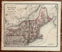
1871réf. 233Chicago: Warner Higgins & Beers 1871. 16 1/2 x 13 1/4 inches. Very good with period wear and minor chipping. Beautiful map of the region in very nice contemporary color by county. An intricate network of railroads is shown throughout. Overall this is an excellent example of the periods' state of the art cartographic publication. Warner, Higgins & Beers unknown
1955réf. RO40150570Calmann-Lévy. 1955. In-8. Relié. Bon état, Couv. convenable, Dos satisfaisant, Intérieur frais. 287 pages.. . . . Classification Dewey : 820-Littératures anglaise et anglo-saxonne
réf. ML1726Couverture rigide P, Calmann Levy 1955, in8 cartonnage éd,287pp Langue: Français
réf. LN9172Exemplaire broché, Calmann Levy 1955. Bon état, papier légèrement jauni
réf. 090767500X.Ghardcover. Good. Access codes and supplements are not guaranteed with used items. May be an ex-library book. hardcover
2006réf. Q-1844153843Pen and Sword Military 2006-09-18. Hardcover. New. In shrink wrap. Looks like an interesting title! Pen and Sword Military hardcover