(Western Electric Company)Biblio.com

10.210 resultados
1883ref. 11061Chicago: Rand McNally & Co 1883. Softcover. Very good. Large octavo 16pp. plus folding illustration at rear. A very good copy in the original printed wrappers with some splitting at the spine and a few nicks but overall sound. The folding plate is in excellent condition. It shows a detailed image of the "Multiple Switch Board for Indianapolis." In 1881 just two years before this pamphlet was produced Alexander Graham Bell purchased the Western Electric Company which scholars have described as a crucial step in the standardization of telephone technology and equipment. Just a few years earlier telephone conversations could only be had between rented pairs of phones attached by a line that had no way to connect to other telephones. The switchboard allowed for operators to manually move connections between lines so that anyone with a telephone could call anyone else with a telephone-at least locally-and the technology rapidly improved from then on. Quite scarce with none in the auction record and just two separately catalogued listings in OCLC NYHS Duke. . Rand, McNally & Co unknown
1821ref. 0005110London: John Murray 1821. First edition. Original Boards. Fine. Lithographs. Octavo 235pp. untrimmed with new paper spine and its original paper label portrait frontispiece foxed The Italian author of the French manuscript gave this work its first appearance in English because "The continent is accustomed to receive the truth with less distrust when it proceeds from Great Britain -Preface." The mss. was transmitted to the translator in detached portions. It includes the Declarations Laws &c of the Carbonari. One large folding lithograph of a meeting of the Carbonari at p.25 3 portraits 2 uniformed plus 6 folding documents in lithographic facsimile at rear. Quite Scarce. John Murray hardcover
1962ref. 2091502135203276Hozokan 1962. Soft Cover. Fine. Size: 31cm Number of books: 1 Hozokan paperback
1994ref. 291699Edmonton: Alberta Canadian Society of Petroleum Geologists and the Alberta Research Council 1994. First edition. hardcover. very good/no dustjacket. 4to oblong. pp.510 Very heavy book additional postage will apply.Signed and inscribed by Mika Madunicky on verso of title page Alberta Canadian Society of Petroleum Geologists and the Alberta Research Council hardcover
1882ref. A569191882. . . . Oblong folio 360x700mm recent cloth leather title piece. Vg. A remarkable folio containing 17 large-scale draughtsman�s ink drawings of the Great Western Railway line between Tilehurst and Didcot England covering a 17-mile stretch at the extraordinary scale of 25 inches to the mile. Executed with meticulous precision these plans depict track layouts associated fields parish boundaries stations bridges and buildings as it passes the Thames River. Each sheet bears the stamp �Great Western Railway 25165 Engineers� Office Paddington� dated 1882 and initialled. The sequence begins with Sheet No. 37: �Parish of Tilehurst / Parish of St. Mary�s Reading� and concludes with Sheet No. 53: �Parish of Didcot / Parish of East Hagborne.� Of particular interest are the contemporary red ink annotations consisting of queries or requests for clarification likely in the hand of a senior engineer. These marginalia provide a rare insight into the working methods and exacting standards of the period. It forms an invaluable record of Victorian railway engineering practice. Beyond their technical value the drawings possess a striking aesthetic quality exemplifying the artistry of the 19th-century draughtsman. They offer not only a tangible link to the golden age of steam railway but also a unique object of railwayana. hardcover
ref. DADAX0826312667New unknown
19548vo., with frontispiece, plates and maps in the text, and endpaper maps in red; full dark red crushed morocco, sides with gilt frame border, back with raised bands, second and fourth compartments lettered and ruled in gilt, all other compartments tooled in gilt, gilt top, hand-made endpapers, ribbon marker, custom-made clip-case, an elegant copy ideal as a gift or for presentation. Reasonably detailed history of the service (Middle East, Western Desert, Europe) of one of the most renowned allied armoured formations of WWII. Includes OOB, commanders and senior staff, and a fascinating account of the creation of the famous divisional emblem. Enser, p.35 ; Smith, p.273.
1794Full leather. 8vo. 68; 108 pages. 22 cm. First edition. Two volumes bound together: Book the first. Wrote under the direction of the Lord God, and published by His sacred command; it being the first sign of warning for the benefit of all nations. Containing, with other great and remarkable things, not revealed to any other person on earth, the restoration of the Hebrews to Jerusalem, by the year 1798: under their revealed prince and prophet. / A revealed knowledge of the prophecies & times, particularly of the present time, the present war, and the prophecy now fulfilling. The year of the world 5913. Book the second. Containing, with other great and remarkable things, not revealed to any other person on earth, the sudden and perpetual fall of the Turkish, German, and Russian empires, wrote under the direction of the Lord God, and published by his sacred command, it being a second sign of warning for the benefit of all nations, by the man that will be revealed to the Hebrews as their prince and prophet. Two volumes constituting the major work of Richard Brothers, the founder of Anglo Israelism; born Dec. 25, 1757, at Placentia, Newfoundland; died at London Jan. 25, 1824. Brothers described himself as the nephew of the Almighty, because he considered that he was descended from one of the brothers of Jesus, and claimed that on Nov. 17, 1795, he would be revealed as the prince of the Hebrews and ruler of the world. Before that date, however, he had been removed to a lunatic asylum, where he wrote his Revealed Knowledge of the Prophecies (1794) , A Description of the New Jerusalem (1801) , and The New Covenant Between God and His People (a posthumous work, 1830) . Brothers seems to have been the first person to claim that the English are descendants of the Lost Ten Tribes; and his views are still referred to with respect by the adherents of Anglo-Israelism. His Description of the New Jerusalem contains a series of plates of the various officials of the new kingdom which was to be restored in Palestine under his leadership. These officials are all dressed in the court costume of George III. (1906 Jewish Encyclopedia) . Later full leather binding, with pastedown red leather gilt title on spine, decorative marbled boards over leather. Subjects: Bible - Prophecies - Early works to 1800. Prophets - England. Prophecies (Occultism) . Jews - Restoration. Private revelations. Brothers, Richard, 1757-1824 - Prophecies. Bible - Prophecies. OCLC lists 31 copies of volume one alone, 13 copies of volumes one and two together. A set sold at auction in 2013 for almost USD 1100. Light rubbing to extremities, old ink notes in margins of a few pages, otherwise very fresh and clean. Great condition. (KH-1-20)
1401ref. 37139CORA 14/01/1994. 1. softcover. .WENN ES DUNKEL WIRD CORA paperback
19588vo., First Edition, with fine portrait frontispiece and 65 plates and maps (a number full-page) on 39; handsomely bound in full dark green crushed morocco, sides with gilt frame border, back with raised bands, second and fourth compartments lettered and ruled in gilt, all other compartments tooled in gilt, gilt top, hand-made endpapers, ribbon marker, a most attractive copy ideal as a gift or for presentation. One of the key military memoirs of the twentieth century, this is as much an autobiography as a soldier's account of war. Written entirely by 'Monty' himself (in pencil, as so many of his official communications were composed), this characteristically straightforward (and often politically outspoken) account covers boyhood, early service with the Warwickshires, WWII and beyond (notably, about a third of the work covers his post-war career as CIGS and after). For technical military detail we look to the author's other works; here we find the simple account of a 'soldier who kept the faith'. A great read from one of the unforgettable leaders of his times. Baxter 268; Enser, p.277.
19508vo., Second Impression, with portrait frontispiece, 10 plates on 7, 2 full-page maps in the text and front and rear endpaper maps; handsomely bound in full burgundy crushed morocco, sides with gilt frame border, back with raised bands, second and fourth compartments ruled and lettered in gilt, all other compartments tooled in gilt, gilt top, hand-made endpapers, ribbon marker, custom-made board slip-case, a most attractive copy ideal as a gift or for presentation. SIGNED BY THE AUTHOR ON TITLE. The first dedicated biography was a huge success and has been many times reprinted and reissued. SIGNED COPIES ARE VERY SCARCE. Enser, p. 374.
1930Very Good German Original autograph letters signed, concert programs and one ticket of Bruno Walter and Jose Iturbi in 23 September 1932 by Anita Tiedcke, letters by and to Anita Tiedcke, Muhiddin Erel and Suna and Sevim Erels. Includes 54 concert programs, booklets and leaflets which some of them are handwritten, typewritten and mostly original prints. Some programs contains Anita Tiedcke's violin parts, early ones in Berlin (1930s), and later period ones in Istanbul. Especially typescript Istanbul programs (such as Aysegül Sarica's ones) are extremely rare and very important collection on Turkish history of classical music. One special designed hand written and drawn concert program titled "In Mozart Reich - Weihnachts Konzert gespielt von Nannerl u. Wolfgang Mozart. 24 autograph letters from and to all family members. Letters belong to Anita Tiedcke, are especially important for which include legal correspondences about Anita Tiedcke's conversion to Islam with her musician identity and musical history. Anita Tiedcke changed her name as 'Emine Erel' after conversion to Islam and marriage. Suna and Sevim Erels' letters also talk about music mostly. They are written in German usually, but some of them are in Turkish. Also the collection contains some book lists, catalogues. Anita Tiedcke completed her musical education at the Conservatory of Hamburg with the violonist Erika Besserer. After her marriage to Muhiddin Erel, she continued her musical studies in Istanbul and worked as an instructor at the Municipal Conservatory. In 1945, she was appointed as the mayor of the Istanbul Municipal Symphony Orchestra. The couple had two daughters, Suna and Sevin. Suna Erel was not content with the conservatory, but she also graduated from the Münch Hochschule für Musik Academy. Professor Suna Erel, who worked at Mimar Sinan University for many years, retired 8 years ago. For his achievements, the German government awarded Suna Erel the Beethoven medal. Muhiddin Erel was a Turkish professor and doctor. He was the founder of Ege University Medicine Faculty in 1955. Extremely rare and fine collection.
ref. DADAX0198166478New unknown
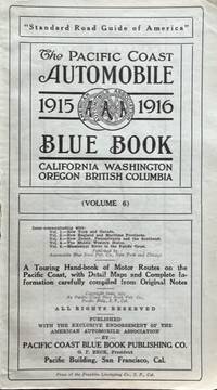
1915ref. 59020San Francisco CA: Pacific Coast Blue Book Publishing Co. Pacific Building Press of the Franklin Linotyping Co. 1915. Tall 8vo. 908 pp. printed on blue-tinted paper throughout. Numerous text maps several maps photo-illustrated ads illustrated ads Shell Oil Co. service station colour lithograph ads on rear endpapers. Limp publisher’s calf gilt lettering on front cover Shell gilt logo advertisement on back cover ex-lib markings on endpapers title perforated stamp on title chipping & wear to fore-edges rebacked w/ renewed lettering on spine linen tape joint repairs at gutter margins of endpapers still a good copy which was a Multnomah County Library duplicate sold through their Title Wave bookstore at some point. First edition thus of this surprisingly scarce automobile travel tour guide for California Oregon Washington and British Columbia prior to World War I. This volume edited by Beck combined the four different Automobile Club Pacific Coast Blue Books issued for California Oregon British Columbia & Washington separately 1912 with the 1915 edition including revised driving regulations specific instructions on driving the Golden Gate Presidio the Univ. of California as well as scenic drives in Oregon Washington & British Columbia. These Blue Books offered complete maps of every motor road running directions at every fork and turn with mileages points of interest ferry and steamship schedules and extensive illustrated ads for all the potential motorist’s needs such as garages service stations hotels and restaurants. Worldcat locates 2 copies UCLA U of W. Pacific Coast Blue Book Publishing Co., Pacific Building, Press of the Franklin Linotyping Co., unknown
1883ref. 27755Perth: Goverment Printer 1883. Robert Fairbairn the prominent 19th century Western Australian magistrate is the appointee to whom this "Minute" is aimed. He would soon be in charge of the Kimberley district and Wrenfordsley was at the time of this writing the Acting Governor of Western Australia. Unusually this is not recorded on either Trove or the State Library of Western Australia. The "minute" advises Mr. Fairbairn on his duties which will involve ".those of the Judge the Collector of Customs and the Registrar". and he advises "the Magistrate to take his own notes of the evidence and not to trust to his clerk." It is most interesting for the directions of caution in meting out punishment to the aboriginal community. "As the dispenser of justice to an uncivilised race it is all important that he should appear to act with judicial calmness and deliberation." Settlers were to be discouraged from taking the law into their own hands. And the statues prohibiting the supply of liquor to natives were to be strictly enforced so that "in the remote and . peaceful wilds of the Kimberley country the white man's curse will long remain unknown." An early reader has commented at the top "This is good" and has also highlighted various sections of interest. At the time of this writing Wrenfordsley was Acting Governor of Western Australia however he had a long career in law as solicitor Attorney General of Jamaica Chief Justice of Western Australia and Chief Justice of Fiji. Foolscap folio 3pp black text on cream paper. At the end of page printed H.T. Wrenfordsley Administrator. 13-3-83." A notation on verso in ink "Notes of Wrenfordsley on Justice duties." Top edge ruffled small puncture top right pin mark two period folds overall very good. Goverment Printer unknown
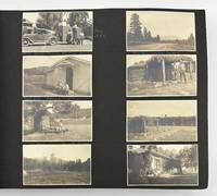
1935ref. 3380Various locations in Colorado New Mexico Arizona Wyoming and Utah 1935. Very good plus. Seventy-four leaves illustrated with 485 photographs and picture postcards between 2 x 3 inches and 4.75 x 6.75 inches occasionally annotated in manuscript in white pencil. Oblong folio. Contemporary black textured cloth string tied. Small stain near right edge of front cover. Internally very clean and well organized. A voluminous collection of photographs picturing the lives and travels of Pat and Marge Williams centered on their ranch in Colorado. The images capture the landscape and buildings on the ranch both exterior and interior as well as the livestock grain fields and more. Several photographs capture farming activities including the harvesting of the alfalfa crop and the threshing of the wheat. The album also includes photos of the area around the ranch and within Colorado in places such as North Park Estes Park Cheyenne Plains Grand Lake and Fort Collins with images of Long's Peak Mary's Lake Spanish Peaks Big Fish Lake White River Trapper's Lake and others. The album also features locations visited by the compiler in the American West and Southwest with informative photos of Taos Mountain Cimarron Canyon Kit Carson's house the pueblos and ruins in Taos and Puye House Rock Valley Bryce Canyon Zion Canyon and other sites in New Mexico Arizona Wyoming and Utah. Some of the original photographs and postcards feature Native American subjects such as Native American women in Taos "Victoriano Sisneras and Wife" in Puye and Navajo rug weavers at work in Arizona. Other interesting images depict a "Hopi Watch Tower" in the Grand Canyon the Mojave Desert "Old Fort Bridger" in Wyoming "Dinosaur tracks near Tuba City" and the Colorado River Bridge at Lee's Ferry. The final eighteen leaves encompassing about ninety-six photos and postcards mostly the latter record numerous scenes in various locations in Mexico. A far-reaching collection of vernacular images and pictorial postcards capturing numerous locations in the American West and Southwest during the mid-1930s. unknown
1935ref. 3380Various locations in Colorado New Mexico Arizona Wyoming and Utah 1935. Very good plus. Seventy-four leaves illustrated with 485 photographs and picture postcards between 2 x 3 inches and 4.75 x 6.75 inches occasionally annotated in manuscript in white pencil. Oblong folio. Contemporary black textured cloth string tied. Small stain near right edge of front cover. Internally very clean and well organized. A voluminous collection of photographs picturing the lives and travels of Pat and Marge Williams centered on their ranch in Colorado. The images capture the landscape and buildings on the ranch both exterior and interior as well as the livestock grain fields and more. Several photographs capture farming activities including the harvesting of the alfalfa crop and the threshing of the wheat. The album also includes photos of the area around the ranch and within Colorado in places such as North Park Estes Park Cheyenne Plains Grand Lake and Fort Collins with images of Long's Peak Mary's Lake Spanish Peaks Big Fish Lake White River Trapper's Lake and others. The album also features locations visited by the compiler in the American West and Southwest with informative photos of Taos Mountain Cimarron Canyon Kit Carson's house the pueblos and ruins in Taos and Puye House Rock Valley Bryce Canyon Zion Canyon and other sites in New Mexico Arizona Wyoming and Utah. Some of the original photographs and postcards feature Native American subjects such as Native American women in Taos "Victoriano Sisneras and Wife" in Puye and Navajo rug weavers at work in Arizona. Other interesting images depict a "Hopi Watch Tower" in the Grand Canyon the Mojave Desert "Old Fort Bridger" in Wyoming "Dinosaur tracks near Tuba City" and the Colorado River Bridge at Lee's Ferry. The final eighteen leaves encompassing about ninety-six photos and postcards mostly the latter record numerous scenes in various locations in Mexico. A far-reaching collection of vernacular images and pictorial postcards capturing numerous locations in the American West and Southwest during the mid-1930s. unknown books
1937ref. 19407Wilmington DE: Culture Publications Inc. 1937. Touch of wear to lower right corner reading crease at front cover/spine a fine copy. 19407. Octavo single issue cover by Ward pictorial wrappers. Pulp magazine. Culture Publications, Inc. unknown
1936ref. 43666Chicago: Rand McNally & Company 1936. 1936. First edition. 8vo. 8 1/2" x 9" Art-Deco color printed wrappers folds to 4 1/4" x 9" 24 pp. including covers color-printed throughout with 11 double-page color-illustrated pictorial maps lettering printed in red blue & white. From the library of David H. Kenyon 1918-2011 former Lockheed engineer & military sales manager as well as aviation consultant for Pan American TWA and the Venezuelan Airlines and later President of the Southern California Wing of the OX5 Aviation Pioneers. First edition of this scarce and wonderfully illustrated airway map based on the very popular Gay Geography pictographic maps published the year before by Ruth Taylor White which inspired an entire generation of cartographic illustrators and imitators. This work opens with map showing the Lindbergh Line stretching from Los Angeles to New York followed by pictographic maps showing humorous cartoon figures and sites across the country through Kingman Winslow Albuquerque Amarillo Wichita Kansas City St. Louis Indianapolis Columbus Pittsburgh Philadelphia Chicago and New York. Each of these maps contain small figures depicting cliche characters at work and play including cowboys American Indians loggers farmers aviators prisoners in Joliet manufacturing and more. Worldcat locates 2 copies NY Public Library and Newberry Proof copy; See: Griffin Mapping Wonderlands: Illustrated Cartography pp. 192-193. Near fine bright copy of a scarce title. Rand McNally & Company, 1936. unknown
1980ref. 2092902137503222Yoshikawakobunkan 1980. Soft Cover. Fine. Size: B5 size Number of books: 2 sets in a box Yoshikawakobunkan paperback
1940ref. 106704Perth Western Australia: Government Printer. 1940. 1st ed. quarto 24 large colour folding maps in original printed cloth-backed boards. Boards worn to the edges. All maps in near fine condition. The maps volume originally issued with the text volume. This volume complete with the 24 large colour folding geological maps of the region as well as mine plans and cross-sections surveyed for mining puropses. Rare with all maps. 1st Edition. Cloth Backed Boards. Government Printer hardcover
ref. SONG0199333424Used: Good unknown
192340 pages. Oblong 12" x 9.5". Circa 1923. Profusely illustrated with glorious contemporary black and white photos. Considerable supporting text. A sumptuous promotional work intended to highlight the investment potential of the British Columbia Electric Railway Company and its subsidiary companies: Vancouver Power Company Limited; Vancouver Island Power Company Limited; Western Power Company of Canada Limited; Vancouver Gas Company Limited; Victoria Gas Company Limited. Very attractive gilt lettering and decoration upon chocolate brown front cover. Clean and fresh with very light wear. Discrete prior owner's name atop front cover. Two short openings to fore-edge of front cover. An exceptional and rare copy of this exquisite vintage item. Book
1933ref. 63488Berlin, Neues Verlagshaus für Volksliteratur, o. J. (1931-1933). 8°. Je Heft 32 S., Spätere HLwd.-Bde. m. den eingebundenen illustr. Vorderdeckeln der Orig.-Umschläge (Hefte 1-100, 77a u. 80a) u. illustr. OHefte (Hefte 81a u. 101-140).
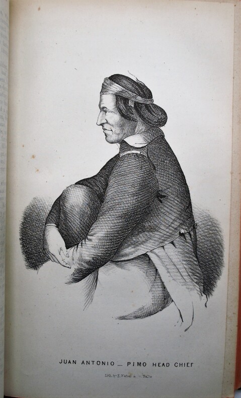
1848ref. PHO-2174Washington, Wendell and Van Benthuysen, Printers, 1848. Octavo. xvi, 416 pages. Contemporary half calf, smooth spine gilt with author and title, red edges, stamp on title. Hinge cracked, small loose and label on spine. Large folding map detached and showing browning along the folds. First edition, Senate issue. 30th Congress, 1st Session, Senate, Executive No. 7. Illustrated with 43 plates, including three battle plans of the Mexican–American War (among them the Battle of Pueblo de Los Angeles), early views of California settlements (including San Diego), ethnographic portraits, and botanical plates, and accompanied by the large folding engraved map (33 × 75 inches, environ 84x190cm) The report documenting the military reconnaissance conducted in 1846–1847 during the Mexican–American War by Lieutenant-Colonel William H. Emory of the Corps of Topographical Engineers. The text is divided into two distinct parts : a narrative of the journey itself, combining geographical, logistical, and military observations, followed by extensive appendices presenting the scientific results of the expedition, including meteorological and astronomical observations, geological notes, and natural history data. A primary source for the history of the American Southwest. The plates provide early visual documentation of California, Native American populations, scientific observations, and contemporary military operations. The large folding engraved map, entitled Military Reconnoissance of Arkansas, Rio del Norte, and Rio Gila (dated 1847), is the cartographic centerpiece of the work. Compiled from original field observations, it provides the first comprehensive official mapping of the regions traversed by the expedition, integrating military routes, topography, settlements, barometric profiles, and tables of distances and elevations. The present example corresponds to the second and finalized state. Demi veau époque, dos lisse avec auteur et titre, tranches rouges, cachet au titre, charnière fendues, carte détachée et présentant des brunissures aux plis. Rapport officiel du Sénat sur la reconnaissance de 1846–1847, associant le récit de l’expédition et des annexes scientifiques. Illustré de planches et accompagné de la grande carte dépliante gravée, second état, document cartographique majeur de la guerre américano-mexicaine. Ch.3E