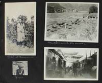
réf. 80817A substantial archive of 779 original photographs documenting a young woman homesteader's life in North Dakota and Eastern Oregon beginning around 1910 through the 1940s. Photos are generally about 3" x 5" or the reverse a few smaller including some wallet-size images and several larger up to approximately 9" x 6". 102 are loose photos; the remainder are laid into four well-composed albums of varying dimensions as ennumerated below. About one third of album images are captioned though none are dated. Overall condition is Very Good with occasional rippling to images that have been pasted onto album leaves; occasional mild fading to the earliest photographs; five album images missing though very possibly present among loose photos. Idella Cook née McElrath was born in 1894 to a farming family in Dakota County Minnesota about twenty miles south of Minneapolis. The U.S. Census of 1910 shows the McElraths still residing in Orchard Lake Minnesota; but around that time the family appears to have emigrated to Plaza North Dakota in the sparsely-populated northwest corner of the state near the present-day Fort Berthold Indian Reservation. Idella remained in North Dakota until 1917 when she relocated to Klamath Falls Oregon possibly in the company of her future husband a druggist professional photographer and traveling salesman named Roy H. "Doc" Cook. The couple married in 1922. In Klamath Falls Idella learned photography and darkroom work presumably under the tutelage of Mr. Cook then in 1929 the couple opened a general store "Idella's" that operated continuously until 1947 and then until 1978 under new owners selling groceries curios photographs of local scenery and folk remedies. All of these phases of Idella Cook's life are captured in the current archive as is a one-year sojourn 1925-6 in Hawaii. However the bulk of material contained in two thick albums is devoted to the relatively brief interval - no more than six years - between the family's arrival in North Dakota and Idella's departure to Oregon in 1917. Idella's precise status in North Dakota is difficult to pinpoint. Her 1972 obituary in the Klamath Falls Herald and News states: ".as a young girl she staked out a claim on a homestead in North Dakota.17 miles from the nearest town" implying that she had emigrated to North Dakota on her own. However the photographs present here clearly show Idella in the presence of her family members including her younger sister Izetta born in 1904 and looking eight or nine years old in the earliest photos; another photo shows a stout man leading two draft horses captioned "Papa". A January 1913 notice in a Minot ND newspaper The Ward County Independent lists an "N.G. McElrath" almost certainly a transcription error for "U.G. McElrath" Idella's father as one of a group of about 200 settlers activating to carve a new county out of the the northeastern portion of the Bertholdt Reservation which had been opened to non-Indian settlement in 1910. So while it is clear that Idella's family settled in Plaza at some point between April 1910 and January 1913 it is not clear that Idella had yet ventured out as a homesteader. Assuming then that these photos date from the period 1911 to 1912 Idella would have been seventeen or eighteen years old - not precisely a "young girl;" also not old enough to claim a parcel under the Homestead Act but certainly old enough to strike out on her own. Not until 1917 when she is 21 do we find land office records in Idella's name - as the purchaser of four parcels totalling sixty acres near the now-defunct town of Sanish which was later inundated in the construction of Lake Sakakawea in 1953. Shortly after the purchase of those parcels Idella appears to have moved to Oregon. Idella's dependent status notwithstanding these are extraordinary photographs. The earliest images present a vivid picture of the windswept and desolate existence of the area's early settlers. The brand-new town of Plaza founded in 1908 is well represented looking rather like a 1950s cowboy movie set with horse-drawn carriages far outnumbering motorcars on the towns main street. Also represented in a number of photographs is the now-disappeared hamlet of Sanish a town which was inundated in the creation of Lake Sakakawea in 1953. Also lost in that event were many square miles of land sacred to the Mandan Hidatsa Arikara Nation whose members are also a constant presence in Cook's photographs; one important series of photographs captures a large Indian pow-wow likely held on the newly-established Fort Berthold Reservation around 1910. Though the albums are extensively captioned providing a wealth of information on the early settlement and demography of the region they are occasionally wanting for specifics of date and/or locale leaving much deductive work to be done to pinpoint locations and events. Of almost equivalent interest are the many photographs taken and developed by Idella after her move to Klamath Falls around 1917. These were still early days in eastern Oregon with many towns only coming into being in the 1890's and provide a wealth of grass roots historical detail that cannot be found outside primary source materials like this. unknown books
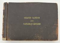
1910réf. 3375Numerous locations including New Mexico Arizona California but mostly British Columbia 1910. About very good. Forty-six leaves illustrated with 232 photographs between 3.25 x 5.5 inches including forty small panoramic images measuring around 3.5 x 12 inches some manuscript annotations some images captioned in the negative. Oblong folio. Contemporary pebbled leather stamped in gilt "Grand Canyon and Canadian Rockies" on the front cover formerly string tied but binding and leaves now loose. One image roughly removed from the album minor chipping to some leaves but otherwise minor wear. An unusual and wholly engrossing collection of western American vernacular photography titled in manuscript on the first page "Views taken by M.H. Fussell of trip taken by Sarah E. Fussell and himself to Los Angeles to attend Amer. Med. Asso. On return trip via Canadian Rockies camping at Emerald Lake near Field Canada as seen by pictures." The author of this inscription was Dr. Milton Howard Fussell 1855-1921 longtime Philadelphia physician and instructor of clinical medicine at the University of Pennsylvania who was the head of the Medical Ward at Episcopal Hospital until shortly before his death. Dr. Fussell must have also had a passion for photography as the present photographs were apparently taken by him along the course of his trip to the west coast with many of the pictures displaying Dr. Fussell's captions in the negative. A few of the captions are written backwards adding to the amateur character of Dr. Fussell's otherwise well-composed pictures. While on the way to California Dr. Fussell's photographs begin in Chicago with a couple of small panoramas of Lincoln Park but the scene swiftly shifts to the American West with images of Native Americans among them shots of "Indian children" and an "Indian Village" a "Pueblo at Laguna" numerous shots of New Mexico Las Vegas Raton and Albuquerque several small panoramic scenes of the majestic Grand Canyon and more. During their visit to the Grand Canyon Dr. and Mrs. Fussell took the chance to snap portraits of each other under which the annotation reads "The climbers. It took 12 hours to make the trip up & down. Hot!!!" On the way to California Dr. Fussell also took a couple of images of Kansas and Nevada before proceeding to snap about a half dozen pictures of the Sacramento Valley. The photographs from this point forward constituting the majority of the pictures in the album concentrate on the latter half of Dr. and Mrs. Fussell's expedition to British Columbia and the Canadian Rockies. After visiting Victoria and Vancouver the Fussells stayed at Camp Crusoe on Emerald Lake. This portion of their trip includes a few more images of the travelers themselves including a shot of Sarah with a large dead black bear. In addition to several small panoramas of Emerald Lake Dr. Fussell captures scenes of the natural wonders of British Columbia such as Mt. Burgess Mt. Wapta Bow Valley Yoho River Emerald Glacier Valley of Ten Peaks Kicking Horse Canyon Bow River Lake Louise Moraine Lake Mirror Lake Fraser River and more. The last few leaves feature other scenes in British Columbia and elsewhere with a street scene in Banff a view of the "Prairie Town of Suscatchewan B.C." a handful of pictures featuring the Sierra Nevadas and several photos captioned "Over the Coast Range" taken from a train. A unique photographic record of a West Coast excursion taken by a notable Philadelphian and his wife in the early 20th century. unknown books
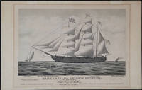
1876réf. 23907Boston: Forbes Lith. Mfg. Co. 1876. First edition. This scarce tinted lithograph was issued to commemorate the escape of Irish political prisoners from Fremantle W.A. on April 17th 1876. The Fenians are shown rowing towards the bark which is under full sail. The Catalpa is flying a flag with the initials "J T R" - for John T Richardson the ship's agent. A pennant with the letter C the Fenian flag and the American flag are also flying. The police boat is in hot pursuit and the British steamship "Georgette" is steaming in from a distance. Among the Fenians freed in this effort was John Boyle O'Reilly who became a leading citizen in Boston and was later to edit the 'Boston Pilot'. Captain George Anthony an American whaling captain out of New Bedford Massachusetts recruited a crew for this mission and set sail for Western Australia where two Fenian agents John Breslin and Tom Desmond had already established themselves with aliases. With several delays the day for the escape was set for the 17th of April when most of the convict garrison was distracted by watching the Perth Yacht Club regatta. Captain Anthony who refused to surrender the escaped prisoners to the British later sold his story to Zephaniah W. Pease who published the account in 'The Catalpa Expedition'. See also Laubenstein 'The Emerald Whaler'. On its arrival in New York in August of 1876 the Catalpa was met with great crowds; jubilant celebrations were held in the US and Ireland. 17 x 13" on paper 22 x 14 1/4". For information on the artist E. N. Russell see Blasdale Artists of New Bedford pp 160-161; Kendall Prints 28; Ingalls 318. OCLC: 191908718 1 copy at the Boston Athenaeum. Trove 45254 at the Australian National Maritime Museum; and 57714676 at the State Library of Western Australia. Professionally deacidified. In very good condition. A rare print important for its depiction of an important Western Australian colonial event. Forbes Lith. Mfg. Co. unknown
réf. 44211Japan and Western Medicine. Oranda jin Geka ryoji no zu Dutch Surgery in Nagasaki. Original pen ink and watercolor drawing on light brown-toned silk with 4 vertical lines of Japanese characters in the upper left corner. Japan: late 18th or early 19th century. 483 x 363 mm. mounted as a scroll at a modern date on light grey silk backed with paper with a half-round hanging rail with braided ribbon attached at the top and a suspension bar at the foot measuring 914 x 443 mm. overall; preserved in a custom-made wooden box. A few tiny pinholes in upper corners of image but fine with the coloring fresh and bright. This striking image showing an amputation carried out by a Dutch surgeon in Japan was most likely painted in the late eighteenth or early nineteenth century during Japan's self-imposed period of national isolation. The hand-painted image is related but by no means identical to a Nagasaki woodblock print titled "Surgery by a Dutch Physician" one of many popular souvenir prints depicting scenes unique to Nagasaki which at the time was the sole point of contact between Japan and the outside world. See our reproduction of the print. It may be that our scroll is the original of the image; however it is also possible that both hand-painted and woodcut versions of the image were produced simultaneously. Western surgery came to Japan in the sixteenth and seventeenth centuries via the Portuguese who in 1543 became the first Europeans to make direct contact with Japan and the Dutch who became the only European nation allowed to trade with Japan after Japan's expulsion of the Portuguese in 1639. Surgeons attached to the Dutch East India Company established practices at the island of Dejima in Nagasaki Bay which led to the formation of several Japanese schools of surgery based on European methods. "This aspect of Western medicine known as K m -ry geka or 'Surgery of the Red-Haired' has had a profound effect on the development of surgical practice in Japan" Van Gulik p. 37. Van Gulik "Dutch surgery in Japan" in Red-Hair Medicine: Dutch-Japanese Medical Relations ed. Beukers et al. pp. 37-50. . unknown
réf. 44211Japan and Western Medicine. Oranda jin Geka ryoji no zu Dutch Surgery in Nagasaki. Original pen ink and watercolor drawing on light brown-toned silk with 4 vertical lines of Japanese characters in the upper left corner. Japan: late 18th or early 19th century. 483 x 363 mm. mounted as a scroll at a modern date on light grey silk backed with paper with a half-round hanging rail with braided ribbon attached at the top and a suspension bar at the foot measuring 914 x 443 mm. overall; preserved in a custom-made wooden box. A few tiny pinholes in upper corners of image but fine with the coloring fresh and bright. This striking image showing an amputation carried out by a Dutch surgeon in Japan was most likely painted in the late eighteenth or early nineteenth century during Japan's self-imposed period of national isolation. The hand-painted image is related but by no means identical to a Nagasaki woodblock print titled "Surgery by a Dutch Physician" one of many popular souvenir prints depicting scenes unique to Nagasaki which at the time was the sole point of contact between Japan and the outside world. See our reproduction of the print. It may be that our scroll is the original of the image; however it is also possible that both hand-painted and woodcut versions of the image were produced simultaneously. Western surgery came to Japan in the sixteenth and seventeenth centuries via the Portuguese who in 1543 became the first Europeans to make direct contact with Japan and the Dutch who became the only European nation allowed to trade with Japan after Japan's expulsion of the Portuguese in 1639. Surgeons attached to the Dutch East India Company established practices at the island of Dejima in Nagasaki Bay which led to the formation of several Japanese schools of surgery based on European methods. "This aspect of Western medicine known as K m -ry geka or 'Surgery of the Red-Haired' has had a profound effect on the development of surgical practice in Japan" Van Gulik p. 37. Van Gulik "Dutch surgery in Japan" in Red-Hair Medicine: Dutch-Japanese Medical Relations ed. Beukers et al. pp. 37-50. . unknown books
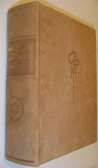
1913réf. 559a9589British Columbia: British Columbia Historical Association 1913. Book. Fine. Hardcover. Signed by Authors. First Edition. Folio - over 12" - 15" tall. Unread. As new. Number 216 of limited edition of 350 copies. Signed by co-author R.E. Gosnell. "Few publications if any of similar size and excellence have been produced in Canada." - From Editor's Foreword. Part I includes 210 pages and eighteen chapters which constitute "a survey of events from the earliest times down to the Union of the Crown Colony of British Columbia with the Dominion of Canada." Part II is "a history mainly political and economic of the Province since Confederation up to the present time." Part I is preceded and followed by dozens of tissue-protected black and white portraits of individuals influential in the early history of the province complete with their brief biographies upon the tissue. Part II comprises eighteen chapters over 226 pages plus 5 pages of addenda followed by dozens of tissue protected portraits of "some of the men conspicuous as present day factors in development." Top edge gilt. Gilt lettering upon backstrip. Marbled endpapers. Exceptionally clean bright and unmarked with zero wear. Brown suede exterior appears as fresh as the day it was applied over 100 years ago. This majestic fourteen pound tome measures 13" x 10.5" x 4". A magnificent acquisition for any serious collector of British Columbia history. A better copy will not be found. Lowther 1607 Hale 2523 Edwards & Lort 3177 Strathern 495. British Columbia Historical Association Hardcover
1978réf. ZB393453Western Agricultural Economics Association 1978. Price HAS BEEN REDUCED by 10% until Monday Nov. 2 weekend sale item volumes 3-5 7-8 10-11 13 15-21 1978-1996 complete volumes partly bound ex library overall good-very good PRICE IS FOR THE LOT. - If you are reading this this item is actually physically in our stock and ready for shipment once ordered. We are not bookjackers. Buyer is responsible for any additional duties taxes or fees required by recipient's country. Photos available upon request. Western Agricultural Economics Association unknown
1905réf. 3538Copper River Valley Ak 1905. Very good. Forty-five printing-out paper photographs between 3.25 x 3.25 and 4 x 6 inches plus three real photo postcards. Minor wear a few creases occasional light soiling. A unique collection of almost fifty images capturing scenes in and around Copper Center in the Copper River Valley of Alaska in the years after gold was first found there in 1898. The images document pioneers panning for gold running dog sled teams posed in front of early wooden buildings in a bleak snow-covered landscape and more as well as capturing shots of a riverside mill a wooden bridge scenery on the Copper River and the majesty of the surrounding forests. A handful of the images capture pioneer women and children posed for the camera in winter clothing worn to combat the bitter Alaskan winters. One image pictures three men and two dogs standing outside the Hotel Holman an early Copper Center roadhouse that began in a tent but was opened in a wooden structure in 1899; the present image captures the post-1899 wooden structure. The Holman Hotel was established in July 1898 by Copper Center's first resident Andrew Holman in order to provide shelter for prospectors on their way to the Klondike gold fields. Copper Center is located northeast of Anchorage and served as a brief but important way station for gold prospectors in southeastern Alaska; one image here apparently pictures the early riverside settlement or is perhaps an early view of Anchorage. A rare view of Alaskan life in an uncommonly-seen settlement during the first decade of the 20th century. unknown
1905réf. 3538Copper River Valley Ak 1905. Very good. Forty-five printing-out paper photographs between 3.25 x 3.25 and 4 x 6 inches plus three real photo postcards. Minor wear a few creases occasional light soiling. A unique collection of almost fifty images capturing scenes in and around Copper Center in the Copper River Valley of Alaska in the years after gold was first found there in 1898. The images document pioneers panning for gold running dog sled teams posed in front of early wooden buildings in a bleak snow-covered landscape and more as well as capturing shots of a riverside mill a wooden bridge scenery on the Copper River and the majesty of the surrounding forests. A handful of the images capture pioneer women and children posed for the camera in winter clothing worn to combat the bitter Alaskan winters. One image pictures three men and two dogs standing outside the Hotel Holman an early Copper Center roadhouse that began in a tent but was opened in a wooden structure in 1899; the present image captures the post-1899 wooden structure. The Holman Hotel was established in July 1898 by Copper Center's first resident Andrew Holman in order to provide shelter for prospectors on their way to the Klondike gold fields. Copper Center is located northeast of Anchorage and served as a brief but important way station for gold prospectors in southeastern Alaska; one image here apparently pictures the early riverside settlement or is perhaps an early view of Anchorage. A rare view of Alaskan life in an uncommonly-seen settlement during the first decade of the 20th century. unknown books
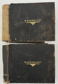
1923réf. 5280Various locations in the American Southwest and West 1923. About very good. Two oblong folio photograph albums bound in brown pebbled leather each titled in gilt on front cover "WANDERLUST" containing a total of 266 full-page vernacular and professional photographs. First albums: 146 leaves illustrated with 128 full-page landscape photographs each around 6 x 8 inches or slightly larger and occasional manuscript or hand-fashioned sectional title pages and maps. Second volume: 148 leaves illustrated with 138 photographs and occasional manuscript or hand-fashioned sectional title pages. All contents mounted one per page to recto of each leaf. Spines perished but holding strong boards worn scuffed and soiled. Contents noticeably curled with minor to moderate dust-soiling throughout. A studio photograph of a young man is laid-in to the first album likely the compiler of the albums but sadly unidentified. An elaborately-produced pair of vernacular photograph albums documenting an epic cross-country train excursion in 1923 by a well-to-do but anonymous traveler from New York comprised of over 260 full-page photographs. The photographs are a mixture of silver gelatin images printing out paper prints handcolored photographs and a handful of cyanotypes. Most of the images appear to be taken by the traveler en route but some images may have been bought along the way. The images largely picture the landscape or architecture seen along the way with a healthy number of images showing the railroad and the railcars themselves with many images taken at train depots. The occasional manuscript sectional title pages denote the regions of travel as the compiler moved west to California and then eventually back east towards home. The first album begins with a manuscript title leaf quoting the text of Gerald Gould's poem "Wanderlust" supplemented by two small drawings and two thumbnail photographs. A map on the second leaf traces the voyage from New York down through the American South and Southwest to California and back to New York through Arizona Colorado and the Midwest. Thereafter the album is comprised mostly of full-page photographs grouped together by location with anywhere from a few to several images per section. The first section in the first album shows the first major stop on the trip -- Washington D.C. and Mount Vernon; this section contains photographs of the Capitol the Lincoln Monument other D.C. buildings and several on the grounds of George Washington's home at Mount Vernon. The album then includes sections featuring New Orleans six photographs; the route between New Orleans and El Paso five images including the train depot at Langtry Texas; El Paso five shots featuring the city and street views; Juarez Mexico eight shots mostly either street scenes or a bullfight; "Thru New Mexico and Arizona" four images; The Apache Trail in Arizona nineteen shots mostly desert landscapes but with some buildings along the trail; and onward through the Carriso Gorge seven photos to California beginning at Coronado Beach eight photographs. The remainder of the first album features California locations namely San Diego sixteen images mostly missions; Pasadena ten photos mostly featuring gardens; Catalina Island eight shots of the island scenery or the bay; Los Angeles eight views in Santa Monica Venice and Ocean Park; and ending with fourteen images featuring missions and other notable structures in Santa Barbara. The second volume picks up the excursion in Del Monte California featuring fifteen scenes in Carmel by the Sea and Monterey. The photographic journey of California then continues to Santa Cruz and the Big Trees five shots; San Francisco eleven views around the city and in the Japanese gardens; Mt. Tamalpais a dozen shots of elevated vistas big trees and forests; Yosemite National Park twenty park views; Mariposa Big Trees seven shots; and ends with the Glenwood Mission Inn in Riverside twenty-two images of the hotel grounds and other local scenery and missions around Riverside. The remainder of the album features photographs from the Grand Canyon in Arizona twenty-six images mostly landscapes but with a few featuring Native American ceremonies and Colorado Springs twenty landscapes and other views of the city surrounding desert Pikes Peak and so forth. Concerned mostly with scenery of the American South Southwest and West Coast the compiler did not see fit to record photographs of the remainder of his trip back home to New York. In addition to the information contained in the photographs here the elaborate materiality custom matching albums with matching gilt titles to the front board handcrafted sectional title pages the hand-drawn and traced map and the nature of the organization of the albums arranged in the order of travel from east to west and back east again speaks volumes about the importance the compiler placed on the trip. Substantially documented western travel albums are growing rare in the market and the present example is one of the most carefully-assembled examples we have ever seen. unknown
1923réf. 5280Various locations in the American Southwest and West 1923. About very good. Two oblong folio photograph albums bound in brown pebbled leather each titled in gilt on front cover "WANDERLUST" containing a total of 266 full-page vernacular and professional photographs. First albums: 146 leaves illustrated with 128 full-page landscape photographs each around 6 x 8 inches or slightly larger and occasional manuscript or hand-fashioned sectional title pages and maps. Second volume: 148 leaves illustrated with 138 photographs and occasional manuscript or hand-fashioned sectional title pages. All contents mounted one per page to recto of each leaf. Spines perished but holding strong boards worn scuffed and soiled. Contents noticeably curled with minor to moderate dust-soiling throughout. A studio photograph of a young man is laid-in to the first album likely the compiler of the albums but sadly unidentified. An elaborately-produced pair of vernacular photograph albums documenting an epic cross-country train excursion in 1923 by a well-to-do but anonymous traveler from New York comprised of over 260 full-page photographs. The photographs are a mixture of silver gelatin images printing out paper prints handcolored photographs and a handful of cyanotypes. Most of the images appear to be taken by the traveler en route but some images may have been bought along the way. The images largely picture the landscape or architecture seen along the way with a healthy number of images showing the railroad and the railcars themselves with many images taken at train depots. The occasional manuscript sectional title pages denote the regions of travel as the compiler moved west to California and then eventually back east towards home. The first album begins with a manuscript title leaf quoting the text of Gerald Gould's poem "Wanderlust" supplemented by two small drawings and two thumbnail photographs. A map on the second leaf traces the voyage from New York down through the American South and Southwest to California and back to New York through Arizona Colorado and the Midwest. Thereafter the album is comprised mostly of full-page photographs grouped together by location with anywhere from a few to several images per section. The first section in the first album shows the first major stop on the trip -- Washington D.C. and Mount Vernon; this section contains photographs of the Capitol the Lincoln Monument other D.C. buildings and several on the grounds of George Washington's home at Mount Vernon. The album then includes sections featuring New Orleans six photographs; the route between New Orleans and El Paso five images including the train depot at Langtry Texas; El Paso five shots featuring the city and street views; Juarez Mexico eight shots mostly either street scenes or a bullfight; "Thru New Mexico and Arizona" four images; The Apache Trail in Arizona nineteen shots mostly desert landscapes but with some buildings along the trail; and onward through the Carriso Gorge seven photos to California beginning at Coronado Beach eight photographs. The remainder of the first album features California locations namely San Diego sixteen images mostly missions; Pasadena ten photos mostly featuring gardens; Catalina Island eight shots of the island scenery or the bay; Los Angeles eight views in Santa Monica Venice and Ocean Park; and ending with fourteen images featuring missions and other notable structures in Santa Barbara. The second volume picks up the excursion in Del Monte California featuring fifteen scenes in Carmel by the Sea and Monterey. The photographic journey of California then continues to Santa Cruz and the Big Trees five shots; San Francisco eleven views around the city and in the Japanese gardens; Mt. Tamalpais a dozen shots of elevated vistas big trees and forests; Yosemite National Park twenty park views; Mariposa Big Trees seven shots; and ends with the Glenwood Mission Inn in Riverside twenty-two images of the hotel grounds and other local scenery and missions around Riverside. The remainder of the album features photographs from the Grand Canyon in Arizona twenty-six images mostly landscapes but with a few featuring Native American ceremonies and Colorado Springs twenty landscapes and other views of the city surrounding desert Pikes Peak and so forth. Concerned mostly with scenery of the American South Southwest and West Coast the compiler did not see fit to record photographs of the remainder of his trip back home to New York. In addition to the information contained in the photographs here the elaborate materiality custom matching albums with matching gilt titles to the front board handcrafted sectional title pages the hand-drawn and traced map and the nature of the organization of the albums arranged in the order of travel from east to west and back east again speaks volumes about the importance the compiler placed on the trip. Substantially documented western travel albums are growing rare in the market and the present example is one of the most carefully-assembled examples we have ever seen. unknown books
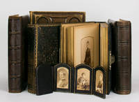
réf. 100720The photographs cartes de visite and cabinet cards depict Annie Griffith Roberts her first husband Dr James Hawkins her second husband Dr Edward Bruce Robertson and Oriana one of the children of the second marriage. The Robertsons came to Australia in 1887; Oriana married into the Moodie family of 'Wando Dale' Coleraine Victoria. Of primary importance are the approximately 50 portraits featuring prominent members of pioneering Western District pastoral families: the Camerons of 'Dunan'; the Edgars of Pine Hills; the Gardiners of Nangwary; the McConochies of Konongwootong; and the Trangmars of Burswood. The photographs are contained in five full-leather quarto albums and an attractive arch-topped six-panel folding panoramic frame for cartes de visite in full morocco. 6 items. unknown
1920réf. 6535Various locations near San Diego 1920. Good. 48 leaves containing 344 photographs. Oblong octavo. Original black cloth gilt. Light wear to covers rubbed. Black paper leaves many loose or crumbling at edges. Many images captioned in white ink throughout. A fascinating vernacular photo album that contains nearly 350 well-executed images of agricultural California in the years before the Great Depression. The album depicts San Diego-area farmers of the 1920s and illustrates rural life of early ranchers in the surrounding areas of Escondido San Pasqual Valley Julian and Ramona. The compiler was a young woman whose family was working at or with the Linton Ranch in North San Diego County. The Ranch was locally famous as a pioneering livestock and homesteading hub where its managers oversaw tens of thousands of head of sheep horses and cattle across the regional valleys. The album mostly features vernacular photos of the compiler her relatives and friends next to their properties such as fields or ranches amidst livestock and engaged in various agricultural activities such as pitching hay casting a bovine handling mules harnessing animals etc. Several photos show them during leisure time hiking posing for photos and the like. Several show sporting events such as basketball or men in football kit. One odd image is captioned "China" and depicts a group of Chinese children; the image below it has street signs in English and Chinese and might be from a local Chinatown. About fifteen rare amateur photos show the newly-commissioned North Island Naval Air Station during or shortly after the end of World War I. The compiler apparently took the photos while visiting her friends in naval service. The images show aerial views of the North Island Battle ship Oregon sea planes and group portraits of UN Navy Sailors. The California series also includes photos of an Escondido dam Lake Wohlford Dam "basketball game at Ramona" Balboa Stadium and the Bishop's School in San Diego. Overall a very interesting and detailed series of vernacular photographs that depict agricultural life in Southern California prior to the transformational Dust Bowl period. unknown
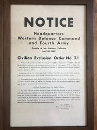
1942réf. 222721942. Japanese InternmentWWII Framed original broadside issued April 24 1942 by the Western Defense Command enforcing Executive Order 9066 by the compulsory removal of Japanese Americans from a designated district of Los Angeles. The broadside directs "all persons of Japanese ancestry both alien and non-alien" to present themselves for relocation initiating their forced transfer to government custody. This document dates to the first phase of the federal mass incarceration program that uprooted more than 120000 Japanese Americans approximately two-thirds of whom were United States citizens. Civilian Exclusion Order No. 41 Large format broadside framed. Western Defense Command and Fourth Army. San Francisco: U.S. Army April 24 1942. The notice mandates that a "responsible member of each family and each individual living alone" report to a designated Civil Control Station between April 25 and April 26 1942 and warns that failure to comply would result in criminal penalties under Public Law No. 503 and possible immediate apprehension. The text specifies the geographic boundaries of the exclusion zone within Los Angeles and outlines the administrative procedure for removal including reporting instructions and compliance requirements. The exceptionally fast pace of mass incarceration is especially evident here as the poster issued April 24 commands representatives to report immediately over the following two days for instruction and mandates all Japanese and Japanese-Americans be vacated from the area by May 1 the following week. During this period immigrants and citizens alike were suddenly ripped from their homes schools and jobs forced to say good-bye to neighbors loved ones and pets and pack whatever belongings were permitted by the U.S. government for internment of an indeterminate length of time. Posted publicly in affected neighborhoods across California Oregon and Washington exclusion orders such as this were a key part of the first phase of Japanese American mass incarceration. They introduced military command into neighborhood-level enforcement and a suspension of civil liberties for the West Coast Japanese immigrant population. The order is dated less than five months after the attack on Pearl Harbor when the U.S. was rapidly expanding federal emergency powers on the home front parallel to increasing involvement in WWII abroad. Exhibiting some damage including folds creases pinholes and several small tears at edges with a some in the center many have been repaired with acid-free archival tape en verso. No loss to paper. Overall good condition. A rare and historically significant artifact of wartime racial profiling and a sobering reminder of the fragility of constitutional protections during times of crisis. unknown
1920réf. 6535Various locations near San Diego 1920. Good. 48 leaves containing 344 photographs. Oblong octavo. Original black cloth gilt. Light wear to covers rubbed. Black paper leaves many loose or crumbling at edges. Many images captioned in white ink throughout. A fascinating vernacular photo album that contains nearly 350 well-executed images of agricultural California in the years before the Great Depression. The album depicts San Diego-area farmers of the 1920s and illustrates rural life of early ranchers in the surrounding areas of Escondido San Pasqual Valley Julian and Ramona. The compiler was a young woman whose family was working at or with the Linton Ranch in North San Diego County. The Ranch was locally famous as a pioneering livestock and homesteading hub where its managers oversaw tens of thousands of head of sheep horses and cattle across the regional valleys. The album mostly features vernacular photos of the compiler her relatives and friends next to their properties such as fields or ranches amidst livestock and engaged in various agricultural activities such as pitching hay casting a bovine handling mules harnessing animals etc. Several photos show them during leisure time hiking posing for photos and the like. Several show sporting events such as basketball or men in football kit. One odd image is captioned "China" and depicts a group of Chinese children; the image below it has street signs in English and Chinese and might be from a local Chinatown. About fifteen rare amateur photos show the newly-commissioned North Island Naval Air Station during or shortly after the end of World War I. The compiler apparently took the photos while visiting her friends in naval service. The images show aerial views of the North Island Battle ship Oregon sea planes and group portraits of UN Navy Sailors. The California series also includes photos of an Escondido dam Lake Wohlford Dam "basketball game at Ramona" Balboa Stadium and the Bishop's School in San Diego. Overall a very interesting and detailed series of vernacular photographs that depict agricultural life in Southern California prior to the transformational Dust Bowl period. unknown books
1942réf. 222721942. Japanese InternmentWWII Framed original broadside issued April 24 1942 by the Western Defense Command enforcing Executive Order 9066 by the compulsory removal of Japanese Americans from a designated district of Los Angeles. The broadside directs "all persons of Japanese ancestry both alien and non-alien" to present themselves for relocation initiating their forced transfer to government custody. This document dates to the first phase of the federal mass incarceration program that uprooted more than 120000 Japanese Americans approximately two-thirds of whom were United States citizens. Civilian Exclusion Order No. 41 Large format broadside framed. Western Defense Command and Fourth Army. San Francisco: U.S. Army April 24 1942. The notice mandates that a "responsible member of each family and each individual living alone" report to a designated Civil Control Station between April 25 and April 26 1942 and warns that failure to comply would result in criminal penalties under Public Law No. 503 and possible immediate apprehension. The text specifies the geographic boundaries of the exclusion zone within Los Angeles and outlines the administrative procedure for removal including reporting instructions and compliance requirements. The exceptionally fast pace of mass incarceration is especially evident here as the poster issued April 24 commands representatives to report immediately over the following two days for instruction and mandates all Japanese and Japanese-Americans be vacated from the area by May 1 the following week. During this period immigrants and citizens alike were suddenly ripped from their homes schools and jobs forced to say good-bye to neighbors loved ones and pets and pack whatever belongings were permitted by the U.S. government for internment of an indeterminate length of time. Posted publicly in affected neighborhoods across California Oregon and Washington exclusion orders such as this were a key part of the first phase of Japanese American mass incarceration. They introduced military command into neighborhood-level enforcement and a suspension of civil liberties for the West Coast Japanese immigrant population. The order is dated less than five months after the attack on Pearl Harbor when the U.S. was rapidly expanding federal emergency powers on the home front parallel to increasing involvement in WWII abroad. Exhibiting some damage including folds creases pinholes and several small tears at edges with a some in the center many have been repaired with acid-free archival tape en verso. No loss to paper. Overall good condition. A rare and historically significant artifact of wartime racial profiling and a sobering reminder of the fragility of constitutional protections during times of crisis. unknown books
1945réf. 61-1310US Army Dec. 1945 1945. Parts 1-6 in Three massive volumes. Recent black cloth binding with gilt spine lettering. Offset printing. Evidence of Yamashita's war crimes. 382 exhibits. Photos. Illustrations. Maps. Facsimilies of documents. Very heavy set. Near Fine Set. 1st. Hardcover. Near Fine. US Army, Dec. 1945 hardcover
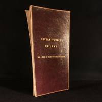
1890réf. 948F10London: Not Stated c1890 . Leather. Good. 17.5" by 9.5". Anonymous. An annotated and hand coloured lithograph map of the Severn Tunnel Railway belonging to the office of the Great Western Railway's Chief Engineer's Office. A vanishingly scarce lithograph map of the Severn Tunnel a tunnel linking South Gloucestershire to Monmouthshire built under the estuary of the River Severn and reaching a length of 4 miles 628 yards or 7012 m.Large portions of the map have been partially hand coloured with extensive annotations in both pencil and ink.With several stamps reading both 'Great Western Railway Chief Engineers Office Paddington' and 'To Be Returned to Chief Engineer's Plan Office G. W. R. Paddington' to both the recto and verso of the map.During the period of the tunnel railway's construction Chief Engineers of GWR included Joseph Armstrong William Dean and George Armstrong.The map is divided into fourteen plates mounted on linen and folding concertina style bound in morocco boards. The front board reads 'Severn Tunnel Railway: From 54 Miles 60 Chains to 7 Miles 50 Chains'.The majority of the pencil annotations detail the owner's and acreage of the pieces of land the railway runs through with the local Parishes of different sections of the railway also detailed. Further annotations include measurements and depths reference numbers for deeds and details of freeholds.A fascinating and very scarce map with a clear association to GWR the company responsible for constructing the tunnel offering insight into the land surrounding the tunnel. In the original limp morocco covered boards. Light rubbing to boards. Internally map mounted on linen and folding concertina style. Map significantly age toned with handling marks throughout. Large portion of map hand coloured with extensive pencil and ink annotations. Stamps throughout to both the recto and verso of the map. Good Not Stated hardcover
1588Rarissima carta geografica dell'Africa Occidentale, con gli arcipelaghi delle Canarie e Azzore.La mappa è tratta dal 'Geografia di M. Livio Sanuto : distinta in XII libri : ne quali, oltra l'esplicatione di molti luoghi di Tolomeo, e della Bussola, e dell'Aguglia, si dichiarano le Prouincie, Popoli, Regni... dell'Africa. Con XII tauole di esse Africa in dissegno di rame / aggiuntiui de piu tre Indici da M. Giouan Carlo Saraceni... ; [aiutato a ciò da Giulio suo fratello, che di propia mano tagliò tutti li Rami'.Si tratta del primo atlante dedicato esclusivamnete all'Africa, con le tavole disegnate da Livio Sanuto e finemente tradotte in rame dal fratello Giulio. L'opera venne pubblicata postuma a Venezia nel 1588, da Damiano Zenaro ed a cura di Carlo Saraceni.Incisione in rame, restauri perfettamente eseguit alla piega centrale ed a dei fori di tarlo presenti nella parte superiore ed inferiore, per il resto in ottimo stato di conservazione.Rara ed affascinante mappa dell'Africa. A very rare map of Western Africa, showing the Canary Islands & Azores.The map is taken form 'Geografia di M. Livio Sanuto : distinta in XII libri : ne quali, oltra l'esplicatione di molti luoghi di Tolomeo, e della Bussola, e dell'Aguglia, si dichiarano le Prouincie, Popoli, Regni... dell'Africa. Con XII tauole di esse Africa in dissegno di rame / aggiuntiui de piu tre Indici da M. Giouan Carlo Saraceni... ; [aiutato a ciò da Giulio suo fratello, che di propia mano tagliò tutti li Rami'.First printed atlas of Africa, published postumously by Sanuto's friend Saraceni who added the tables of contents and the preface on the life of the author.The maps were drawn by Sanuto and finely engraved by his brother Jules. The atlas is divided into twelve books, the first containing notes on scientific observation, the declination of the magnetic needle and corrections to the work, the second explains the divisions of Sanuto's prospective description of the world, and the other ten on Africa which was the only section he completed before his death.Livio Sanuto (c.1520-1576), was a Venetian cosmographer, mathematician and maker of terrestrial globes. Sanuto was one of the so-called Lafreri school of engravers, whose output signalled the transition between the maps of Ptolemy and the maps of Mercator and Ortelius. Livio and his brother Giulio, planned a massive and comprehensive atlas to include maps and descriptions of the whole world, which he believed would be more accurate than any previously published. Unfortunately, he died in 1576 having only completed 12 maps of Africa. The 12 maps were eventually published in 1588 by Livio's brother Giulio, under the title "Geografia Di M. Livio Sanuto..." . In the compliation of this and the other African maps, Sanuto relied on Gastaldi's 1564 map and Portuguese sea charts for the mapping of the coasts and for information about the interior, used accounts by Duarte Barbosa and João de Barros. After its publication in 1588, this work was copied by other leading map makers for nearly a century afterwards.Seas are decorated with contemporary sailing vessels and monsters.Etching with engraving, some expert repairs at the central folds and at worm holes along the upper and lower edge, otherwise in good condition. Betz, The Mapping of Africa, p. 145; Norwich, 15; Almagià 1946.
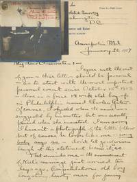
1940réf. List3440United States France and Germany 1940. Approximately 469 total items. Fifty-nine pieces of loose correspondence one with four photographs affixed. In large letter album approximately 199 pieces of written material: 118 pieces of incoming correspondence twenty-one drafts of outgoing correspondence and sixty other. 139 photographs: nine cabinet cards thirty-three smaller mounted or framed photos eleven CDVs or tintypes nineteen in small photo album sixty-six loose photographs and one real photo postcard. Eight pieces of loose miscellaneous written material totaling sixty-four pages; nine forms applications etc; forty-five clippings generally affixed to notebook pages; and ten pieces of unsorted ephemera. Written material generally dating from about 1891–1928. Photographic material and ephemera generally dating from about 1870s or earlier to 1943. Letter album with covers detached and damage to edges of paper very good plus; other material generally excellent. Overall very good to excellent. Charles Colt Yates 1868–1944 was born in Binghamton New York. He received a BS in Physics and an MS in Civil Engineering from the Case School of Applied Science now Case Western Reserve University before joining the US Coast and Geodetic Survey in 1892. Yates’ work with the USC&GS took him around the US and abroad; his work included observing the earth’s surface density in Hawaii; surveying Lake Pontchartrain the Alaska–Yukon border and the Aleutian Islands; surveying and ship-building in the Philippines and Hong Kong; and surveying the oyster bars in Maryland and Delaware. Offered here is a large collection of photographic and written material belonging to Yates. The photographs are almost entirely family shots. Subjects are generally identified verso by their initials and include Yates; his grandparents James Dennison Colt and Abigail Weber; his parents Walter Lloyd Yates and Charlotte Colt; and especially his brother Alonzo Colt Yates sister-in-law Elizabeth Deming and their children Evelyn and Lloyd Deming Yates. The written material relates to Yates’ work and includes incoming correspondence particularly work assignments sent by the Survey’s various superintendents; Yates’ drafts of outgoing correspondence; field expense forms—providing a look at the more quotidian activities of the Survey’s researchers—and departmental circulars; resumes and applications; notes and article drafts; and newspaper clippings. The latter generally relate to either the 1916 controversy around Woodrow Wilson’s scientific appointments particularly of E. Lester Jones or to the 1916 and 1928 Merchant Marine Acts. The merchant marine issue preoccupied Yates as several of his letters and articles concern the subject; other of his articles are an 1898 “Report on the Establishment of a Self Registering Tide Gauge at Morehead City N.C” and a 1914 report on oceanography. Early in his career Yates apparently wanted out of the Survey writing to several different people seeking a teaching position and explaining that his “desire to become a teacher and ultimately a professor is so great that I am willing to make a considerable sacrifice” in terms of pay July 16 1896. Of course there would have been upsides to leaving the Survey as working conditions at the time were far from ritzy; for instance fellow officer Alex S. Christie wrote of the employee at the Sandy Hook tidal station in New Jersey: “Where now located on the west side of this sand spit the observer is completely isolated and threatens to resign. He has no love for nature and no resources within himself. I could be very happy there.” July 26 1892 Similarly Superintendent William Ward Duffield attempted to convince Yates that the conditions on the Alaska-Yukon boundary survey were more tolerable than he might think: “It might pertinently be added here that the American Transportation and Trading Company has a number of stations on the Yukon and carries a large stock of goods including drugs etc. at points near the boundary. The country is better supplied with means of existence and communication than was supposed sometime ago.” February 29 1896 As references for a teaching position Yates offered his Case classmate and highly decorated electrical engineer Comfort Avery Adams then at Harvard and Case president Cady Staley. Yates corresponded occasionally with Staley including helping him with research by among other things giving him honest advice on the use of a theodolite: “From a personal experience: to approach a Vertical Circle without ever having seen one and having had it explained by a textbook is not only awkward but an embarrassing experience and perhaps even a disastrous experience when the proper approach of the level correction is reached.” February 24 1897 Another Case affiliate with whom Yates corresponded was Albert A. Michelson then at the University of Chicago. Michelson is best known for the 1887 Michelson-Morley experiment a test of the speed of light performed at Case with Edward W. Morley and the assistance of Comfort Adams then a student. Yates had sent Michelson an observation of some kind—though he did not save the draft of this outgoing letter—and Michelson responds with several pages of reasoning: “I scarcely think it likely that refraction is the cause of the color observed – but even if this were the case it would not help matters much. The angle subtended by the spectrum could certainly not be less than 10” if a consistent color could be appreciated . Nevertheless I would recommend that the color phenomenon be carefully observed and recorded – for it may throw light on other matters of importance – even tho not of immediate practical use.” March 8 1896 Yates also kept up with his Case classmates; several letter drafts in the archive are addressed “dear Classmates” and seem to be part of a semi-regular correspondence where the former classmates would update each other on their careers and lives though only Yates’ outgoing mail is represented. Yates writes a particularly interesting letter to his classmates describing his time in the Philippines and Hong Kong the surveying of which had become part of the USC&GS’s duties after the US assumed control of the territory: “I was just leaving for a surveying cruise along the south west coast of Samar Island the island General ‘Jakey’ Smith and brother officers made so famous by their approved ‘water cure’ and other ancient methods of obtaining information from the natives. We had an excellent Thanksgiving’s dinner in Jakey’s former residence the ‘bungalow’ at Tacloban and although many of his officers were still there I feel quite certain that water was not mentioned but their liquid method of obtaining information was probably even more effective. No doubt the natives of Samar are well subdued at least we judged so from the fact that when they saw any of our boats put off from the ship they immediately abandoned house and home to the old and crippled. Apparently Americans are to be trusted in reference to these two classes. Disappearing streaks of red skirts indicating retreating females were sometimes seen but our male ‘little brown brother’ was rarely discovered even on a run. This was quite a change from our previous experiences in other parts of the Philippines which had not received the benefit of the same intimate contact with our methods of civilization. In fact we were usually accompanied along the beach by a swarm of men women and children of all sizes and ages who though always polite and gentle were a nuisance sometimes through unintentionally getting in the way of our work.” October 15 1903 The “water cure” was a form of torture similar to waterboarding often used by American soldiers during the Philippine-American War. General Smith was infamous not for use of the “water cure” but for his orders during the Pacification of Samar to execute everyone over age ten and turn the island into a “howling wilderness”; during the campaign several thousand civilians were killed. Later Yates explained to his classmates that he had had a nervous breakdown while stationed in Asia following the death of his only child at five months old and was sent home January 20 1907. He was assigned to survey oyster fields for the Maryland Shell Fish Commission which he described as “surrounded by politicians as our work seems to be the political issue of the State”. In fact at this time Yates seems to have become more interested in politics especially the Merchant Marine acts mentioned earlier. He sent out his article titled “By-products and Relative Values of a Merchant Marine” to several potential publishers and also corresponded with Congressmen regarding the act including Jesse D. Price of Maryland Frank P. Woods of Iowa and Joshua W. Alexander of Missouri. He wrote to the latter who was the 1916 act’s sponsor: “If you succeed in passing the Bill you will deserve oceans of credit and even if you fail you will have gained the sincere admiration of those who have studied the subject and know the great aggregate of vested shipping interests both foreign and domestic which are fighting you so hard because they fear the results to their personal interest of the founding of a real American Marine which would be brought about by the passage of your Bill.” May 16 1916 Yates was also interested in the 1928 Act which concerned shipbuilding—having built ships for the Survey in Hong Kong and Wisconsin—and wrote an article that year giving suggestions for it. Otherwise the more recent contents of the archive are mainly ephemera of Yates’ brother diplomat Alonzo Colt Yates 1864–1950 including an ID card and passport. Overall a unique collection of an employee of the US government’s first and for a long time only scientific agency the archive provides a look at the agency’s activities at home and across the globe. It also provides some history of the early days of the Case School of Applied Science especially the activities of early alumni and faculty. unknown
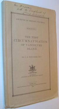
1914réf. 724a7836Victoria BC: Government of British Columbia B.C. 1914. Book. Good. Paperback. First Edition. 8vo - over 7¾" - 9¾" tall. 69 pages. Complete with 8 protected map plates. Signed and inscribed by E.O.S. Scholefield Archivist of British Columbia atop front cover. Pages 3-4 constitute a letter of submittal by Mr. Scholefield to the Honourable Henry Esson Young Provincial Secretary. This work "represents the first bulletin of the British Columbia Provincial Archives Department." - page 3. "Vindicates the contention of Captain Vancouver that his ships were the first to complete the navigation of the inner channels which separate Vancouver Island from the British Columbia mainland." - M. Menzies. Errata neatly affixed to verso of Map List. Map plate V loose but present. Rough cut edges. Contents clean unmarked and lightly toned. Short openings to bottom edges of beige card covers. Strathern 399. Government of British Columbia (B.C.) Paperback
1925réf. 1729801925. THE WESTERN SHADE CLOTH COMPANY. Color Harmony with Luxor Shades. 47 colour plates and 14 coloured sample sheets. Oblong folio 277 x 342 mm publisher's decorated cloth. Chicago: William Volker 1925. A fine copy of this rare elaborately produced work containing many plates with cut-outs. Not listed on OCLC. hardcover
1940réf. List3440United States France and Germany 1940. Approximately 469 total items. Fifty-nine pieces of loose correspondence one with four photographs affixed. In large letter album approximately 199 pieces of written material: 118 pieces of incoming correspondence twenty-one drafts of outgoing correspondence and sixty other. 139 photographs: nine cabinet cards thirty-three smaller mounted or framed photos eleven CDVs or tintypes nineteen in small photo album sixty-six loose photographs and one real photo postcard. Eight pieces of loose miscellaneous written material totaling sixty-four pages; nine forms applications etc; forty-five clippings generally affixed to notebook pages; and ten pieces of unsorted ephemera. Written material generally dating from about 1891–1928. Photographic material and ephemera generally dating from about 1870s or earlier to 1943. Letter album with covers detached and damage to edges of paper very good plus; other material generally excellent. Overall very good to excellent. Charles Colt Yates 1868–1944 was born in Binghamton New York. He received a BS in Physics and an MS in Civil Engineering from the Case School of Applied Science now Case Western Reserve University before joining the US Coast and Geodetic Survey in 1892. Yates’ work with the USC&GS took him around the US and abroad; his work included observing the earth’s surface density in Hawaii; surveying Lake Pontchartrain the Alaska–Yukon border and the Aleutian Islands; surveying and ship-building in the Philippines and Hong Kong; and surveying the oyster bars in Maryland and Delaware. Offered here is a large collection of photographic and written material belonging to Yates. The photographs are almost entirely family shots. Subjects are generally identified verso by their initials and include Yates; his grandparents James Dennison Colt and Abigail Weber; his parents Walter Lloyd Yates and Charlotte Colt; and especially his brother Alonzo Colt Yates sister-in-law Elizabeth Deming and their children Evelyn and Lloyd Deming Yates. The written material relates to Yates’ work and includes incoming correspondence particularly work assignments sent by the Survey’s various superintendents; Yates’ drafts of outgoing correspondence; field expense forms—providing a look at the more quotidian activities of the Survey’s researchers—and departmental circulars; resumes and applications; notes and article drafts; and newspaper clippings. The latter generally relate to either the 1916 controversy around Woodrow Wilson’s scientific appointments particularly of E. Lester Jones or to the 1916 and 1928 Merchant Marine Acts. The merchant marine issue preoccupied Yates as several of his letters and articles concern the subject; other of his articles are an 1898 “Report on the Establishment of a Self Registering Tide Gauge at Morehead City N.C” and a 1914 report on oceanography. Early in his career Yates apparently wanted out of the Survey writing to several different people seeking a teaching position and explaining that his “desire to become a teacher and ultimately a professor is so great that I am willing to make a considerable sacrifice” in terms of pay July 16 1896. Of course there would have been upsides to leaving the Survey as working conditions at the time were far from ritzy; for instance fellow officer Alex S. Christie wrote of the employee at the Sandy Hook tidal station in New Jersey: “Where now located on the west side of this sand spit the observer is completely isolated and threatens to resign. He has no love for nature and no resources within himself. I could be very happy there.” July 26 1892 Similarly Superintendent William Ward Duffield attempted to convince Yates that the conditions on the Alaska-Yukon boundary survey were more tolerable than he might think: “It might pertinently be added here that the American Transportation and Trading Company has a number of stations on the Yukon and carries a large stock of goods including drugs etc. at points near the boundary. The country is better supplied with means of existence and communication than was supposed sometime ago.” February 29 1896 As references for a teaching position Yates offered his Case classmate and highly decorated electrical engineer Comfort Avery Adams then at Harvard and Case president Cady Staley. Yates corresponded occasionally with Staley including helping him with research by among other things giving him honest advice on the use of a theodolite: “From a personal experience: to approach a Vertical Circle without ever having seen one and having had it explained by a textbook is not only awkward but an embarrassing experience and perhaps even a disastrous experience when the proper approach of the level correction is reached.” February 24 1897 Another Case affiliate with whom Yates corresponded was Albert A. Michelson then at the University of Chicago. Michelson is best known for the 1887 Michelson-Morley experiment a test of the speed of light performed at Case with Edward W. Morley and the assistance of Comfort Adams then a student. Yates had sent Michelson an observation of some kind—though he did not save the draft of this outgoing letter—and Michelson responds with several pages of reasoning: “I scarcely think it likely that refraction is the cause of the color observed – but even if this were the case it would not help matters much. The angle subtended by the spectrum could certainly not be less than 10” if a consistent color could be appreciated . Nevertheless I would recommend that the color phenomenon be carefully observed and recorded – for it may throw light on other matters of importance – even tho not of immediate practical use.” March 8 1896 Yates also kept up with his Case classmates; several letter drafts in the archive are addressed “dear Classmates” and seem to be part of a semi-regular correspondence where the former classmates would update each other on their careers and lives though only Yates’ outgoing mail is represented. Yates writes a particularly interesting letter to his classmates describing his time in the Philippines and Hong Kong the surveying of which had become part of the USC&GS’s duties after the US assumed control of the territory: “I was just leaving for a surveying cruise along the south west coast of Samar Island the island General ‘Jakey’ Smith and brother officers made so famous by their approved ‘water cure’ and other ancient methods of obtaining information from the natives. We had an excellent Thanksgiving’s dinner in Jakey’s former residence the ‘bungalow’ at Tacloban and although many of his officers were still there I feel quite certain that water was not mentioned but their liquid method of obtaining information was probably even more effective. No doubt the natives of Samar are well subdued at least we judged so from the fact that when they saw any of our boats put off from the ship they immediately abandoned house and home to the old and crippled. Apparently Americans are to be trusted in reference to these two classes. Disappearing streaks of red skirts indicating retreating females were sometimes seen but our male ‘little brown brother’ was rarely discovered even on a run. This was quite a change from our previous experiences in other parts of the Philippines which had not received the benefit of the same intimate contact with our methods of civilization. In fact we were usually accompanied along the beach by a swarm of men women and children of all sizes and ages who though always polite and gentle were a nuisance sometimes through unintentionally getting in the way of our work.” October 15 1903 The “water cure” was a form of torture similar to waterboarding often used by American soldiers during the Philippine-American War. General Smith was infamous not for use of the “water cure” but for his orders during the Pacification of Samar to execute everyone over age ten and turn the island into a “howling wilderness”; during the campaign several thousand civilians were killed. Later Yates explained to his classmates that he had had a nervous breakdown while stationed in Asia following the death of his only child at five months old and was sent home January 20 1907. He was assigned to survey oyster fields for the Maryland Shell Fish Commission which he described as “surrounded by politicians as our work seems to be the political issue of the State”. In fact at this time Yates seems to have become more interested in politics especially the Merchant Marine acts mentioned earlier. He sent out his article titled “By-products and Relative Values of a Merchant Marine” to several potential publishers and also corresponded with Congressmen regarding the act including Jesse D. Price of Maryland Frank P. Woods of Iowa and Joshua W. Alexander of Missouri. He wrote to the latter who was the 1916 act’s sponsor: “If you succeed in passing the Bill you will deserve oceans of credit and even if you fail you will have gained the sincere admiration of those who have studied the subject and know the great aggregate of vested shipping interests both foreign and domestic which are fighting you so hard because they fear the results to their personal interest of the founding of a real American Marine which would be brought about by the passage of your Bill.” May 16 1916 Yates was also interested in the 1928 Act which concerned shipbuilding—having built ships for the Survey in Hong Kong and Wisconsin—and wrote an article that year giving suggestions for it. Otherwise the more recent contents of the archive are mainly ephemera of Yates’ brother diplomat Alonzo Colt Yates 1864–1950 including an ID card and passport. Overall a unique collection of an employee of the US government’s first and for a long time only scientific agency the archive provides a look at the agency’s activities at home and across the globe. It also provides some history of the early days of the Case School of Applied Science especially the activities of early alumni and faculty. unknown books
1925réf. 1729801925. THE WESTERN SHADE CLOTH COMPANY. Color Harmony with Luxor Shades. 47 colour plates and 14 coloured sample sheets. Oblong folio 277 x 342 mm publisher's decorated cloth. Chicago: William Volker 1925. A fine copy of this rare elaborately produced work containing many plates with cut-outs. Not listed on OCLC. hardcover books
1419réf. 64620Astoria OR: W.W. Clark Contractor & Construction Co. 1914-1916. Oblong 4to. 12 x 8.75 in. 88 leaves unnumbered. with 124 mounted silver gelatin photographs sized from 5 x 7 in. up to 8 x 10 in. nearly all w/ specific location details and dates w/in negatives at lower fore-edges w/ most leaves featuring 2 photos mounted to horizontal orientation on each recto. Original half-calf Pacific Stationery & Printing Co. post-binder two brass screwposts at gutter margin occasional rippling & thumbing to fore-edges of album leaves a few photos w/ slight over-exposure minor bumping at corners still a VG exemplar w/ ownership marking on ffep. This apparently unique souvenir photo album was prepared by the famed contractor carefully visually documenting the modernization and infrastructure of the Port of Astoria Oregon following its establishment just four years before in order to provide critical infrastructure to compete with Portland Seattle and Tacoma as fast expanding deepwater commercial ports. These images depict the driving of the first pilings in January 1914 arrival of the Dredge Washington in September 1914; the massive construction project and logs in order to build first Pier 1 as well as the firewall foundations for bulkhead sheet piling anchors new slips and construction equipment. By December 1914 the photos indicate the beginnings of the construction of Pier 2; steam cranes and equipment working on the bulkheads beginnings of the tile walls; and panoramic birds-eye views from the nearby hillsides of the progressing work.By February 1915 Clark’s crews had begun erecting the brick masonry buildings on Pier 2 using terra cotta brick tiles supplied by the National Fire Proofing Co. in order to cut down on fire risk from the tremendous amount of timber used in construction. Other photos show the laying of water supply and sewage pipes power three rail tracking for trolleys & rail lines on Pier two; installation of Fenestra Steel Monilor Sashes for windows in warehouses and a marvelous shot of the “Chief” pile driver for the J.A. McEachern Co. Contractors driving the last brace pile May 2 1915. Following the photo series detailing the fill sand behind the piers from dredging near Alameda Ave. there are photos showing the rock delivered through the dredge as well the Herringbone tracks added for rail access to the massive warehouses and finally views of the finished piers Port of Astoria with shipping docking alongside. The album closes with the significant project for introducing the massive grain elevator silos flourmill and other attributes to contribute to the project. At the outbreak of World War I Astoria had improved its commercial maritime shipping capacity improved infrastructure tremendously to take advantage of shipping but in 1919 following World War I shipbuilding companies and other export industries suffered along with the rest of the Pacific Northwest in a deep economic depression as well as plunge in demand for logs and overseas shipping demand. Although logging and salmon canning would continue to be vibrant the Port of Astoria never achieved close to the volume of any of the other Pacific Northwest deepwater ports including Portland Tacoma or Seattle. Clark 1863-1935 was perhaps one of the most significant large project contractors in the West Coast. He constructed the Bell Street Terminal in Seattle WA; oversaw the laying of tracks for the Great Northern RR and Milwaukee RR West of the Cascades; built the bridges on the Pacific Highway Cut-off between Everett WA & Marysville WA and also oversaw for the Moran Brothers shipyard in Seattle the construction of the Battleship Nebraska BB-14 a 14948-ton Virginia Class battleship. W.W. Clark [Contractor & Construction Co.], unknown