Stacey, Duncan; Stacey, SusanBiblio.com
8785 risultati
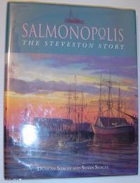
1994rif. 744a0078Madeira Park British Columbia Canada: Harbour Publishing Co. Fine in Fine dust jacket. 1994. First Edition. Hardcover. 1550171100 . "The combination of text and visual history offers readers a privileged glimpse of the glory days of one of the coast's major industries." - dust jacket. 152 pages. Index. Bibliography. Copiously illustrated with archival black and white photography. Prior owner's name atop half-title page else clean bright and unmarked with lightest wear. Dust jacket now preserved in Brodart cover. Lovely copy.; 4to - over 9¾" - 12" tall; BRITISH COLUMBIA HISTORY FISHERIES CANADA Salmonopolis: The Steveston Story Richmond Vancouver Salmon Processing Industry History Fisheries . Harbour Publishing Co. hardcover
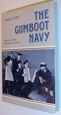
1988rif. 321a8252Canada: Oolichan. Fine in Very Good dust jacket. 1988. First Printing. Hardcover. 0889820910 . 159 pages including black and white photographic plates. Memories of the men who served in the Fishermen's Reserve - a special naval unit formed to patrol the coast of British Columbia during World War II. Very light wear to clean bright and unmarked book. Light wear to dust jacket. Very nice copy.; 8vo - over 7¾" - 9¾" tall; The Gumboot Navy Canadian Royal Navy Fishermen's Reserve History Canada Naval Militia History World War II 2 1939-1945 Naval Operations Canadiana black and white photographic plates. Memories of the men who served in the Fishermen's Reserve - a special . Oolichan hardcover
2012rif. 431H4269Canada: Harbour Publishing Co. Good in Good dust jacket. 2012. First Printing. Hardcover. 1550175734 . Signed and briefly inscribed by author upon half-title page. 287 pages. List of sources footnotes index. Map endpapers. Illustrated in black and white. "Jean de Fuca Francis Drake James Cook George Vancouver and the race for the fabled Northwest Passage. A sea venture tied up with piracy political loyalty and betrayal all bound up in a web of international intrigue this book is an indispensable contribution to the history of discover on the Northwest Coast." - dust jacket. Unmarked with average wear. Binding intact. Dust jacket now preserved in glossy new archival-grade Brodart. A sound copy.; 8vo - over 7¾" - 9¾" tall; Strait of Juan De Fuca - Discovery and Exploration Navigation - History Explorers - Spain - History Explorers - Great Britain - History Spain - history Naval Great Britain - History Naval Jean de Fuca Francis Drake James Cook George Vancouver; Signed by Authors . Harbour Publishing Co. hardcover
rif. B9781165177134New. unknown
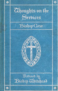
rif. A894Lippincott 1899. Hbk 16mo silver gilt titles over blue boards illus portrait frontis of Bp. Coxe revisions to the 1860 edition include the addition of notes on services other than the Sunday Service and Daily Prayer and a selection of Bp. CoxeÕs hymns the title page in this copy is not present prev ownerÕs inscr on fep but otherwise the book is intact a very clean bright and tight copy scarce in the original Lippincott, 1899 hardcover
rif. B9781166487263New. unknown
rif. B9781166213343New. unknown
rif. B9781167076923New. unknown
rif. B9781166211769New. unknown
rif. B9781168963031New. unknown
rif. B9781164558972New. unknown
1986rif. 41302015West Vancouver BC: The Corporation of the District of West Vancouver B.C. Fine. 1986. First Edition. Hardcover. 0889257493 . "A history of independent courageous people who dared to be first who dared to meet the challenges of a wilderness who dared to leave their comfortable surrounds in "civilized" Britain and Europe and who dared to be leaders in a new land and in a new mountain and marine-oriented Municipality. This is the story of those people." - Don Lanskail Mayor. 350 pages including index and black and white illustrations. Gift greetings upon dedication page and small erasure atop front endpaper else clean bright and unmarked with very light wear. Excellent copy in attractive glossy boards. Hale & Barman 756. ; 8vo - over 7¾" - 9¾" tall; Ramsey Bruce A Place of Excellence - a Chronicle of West Vancouver 1912-1987 350 pages including index and black and white illustrations. "A history of independent courageous people who dared to be first who dared to meet the challenges of a wildern . The Corporation of the District of West Vancouver B.C. hardcover
2012rif. 277623Edmonton Alberta: Capital Colour 2012. First edition. Paperback. Very Good/No dustjacket. 4to. pp. 526 b/w and color illustration sketch maps. Capital Colour paperback
1992rif. 715c9492Victoria British Columbia Canada: Sono Nis Press. Fair. 1992. First Edition. Paperback. 1550390236 . 168 pages. Footnotes. Bibliography. Index. Dozens of high-quality reproductions of archilval black and white photos. "Returns us to the beckoning spirit of early times in Victoria B.C. and the more leisured ways of our parents and grandparents." - from back cover. Heavily worn and soiled with usual library markings. Binding intact. A worthy reading copy.; 8vo - over 7¾" - 9¾" tall; Victoria British Columbia Vancouver Island Streetcar Street Car History Urban Transportation Street Railroads History . Sono Nis Press paperback
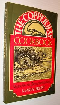
1992rif. 318c6814Canada: Harbour Publishing. Good. 1992. First Edition. Paperback. 1550170643 . 160 pages. Index. 120 recipes created specially for guests of the Copper Bay Lodge. Contents clean and unmarked but for a bit of writing to last page. Moderate external wear. A sound copy.; 8vo - over 7¾" - 9¾" tall; The Copper Bay Cookbook: Recipes from the Queen Charlotte Islands Cookery British Columbia Canadian . Harbour Publishing paperback
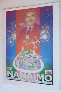
1993rif. 744a9461Nanaimo BC Canada: The Nanaimo Times. Good. 1993. First Edition. Paperback. A 34 page booklet which may have been included with local newspapers. Many black and white illustrations. Average wear. Unmarked. Sound copy.; 4to - over 9¾" - 12" tall; Nanaimo Marine Festival Bathtub Race July 17-25 1993 British Columbia Vancouver Island Frank Ney Mayor . The Nanaimo Times paperback
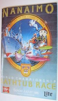
1985rif. 744a9584Nanaimo BC Canada: Loyal Nanaimo Bathtub Society. Good. 1985. First Edition. Paperback. 80 pages. A detailed overview of the big event complete with many black and white illustrations. Average wear. Binding sound. Unmarked. Quality copy.; 8vo - over 7¾" - 9¾" tall; Nanaimo World Championship Bathtub Race Sunday July 21st 1985 - Souvenir Program Vancouver Island . Loyal Nanaimo Bathtub Society paperback
1846rif. 25916Paris: French Admiralty chart 1846. Very rare early map of the south west coast of Western Australia just 17 years after the founding of the colony. The map covers much of the Western Australian coast from the Dampier Archipelago in the north Broome Exmouth Gulf Shark Bay Perth Geographe Bay Cape Leeuwin Albany all the way to Port Lincoln in South Australia. To our knowledge the only copy held in an Australian institution is at the State Library of Western Australia. It is not recorded in the collection of National Library of Australia collection nor other Australian institutions. It is very interesting for the early inland detail. The areas around Perth and Fremantle are shown extending inland to Beverley York Bejoording Toodjoy and Northam on the Swan River with the Swan Avon & Moore Rivers. There are 4 insets: Plan de la entree de la Riviere Cygnes Swan River et de l'Ile Rottnest J. L. Stokes; Plan de Port Grey nomme aussi Baie Champion Captain Wickham Plan du Havre Peel dans la Baie Warnbro Lieut. J. S. Roe Plan de la Baie Warnbro J.S. Roe. Coastal features include Baie de l'Esperence; Houtmann's Abrolhos; Albany north east of Albany a mountain described as "Montagne escarpee visible a 10 lieues"; Golfe Exmouth with a prominent Cape Nord Ouest. Depth soundings are taken all around the coast. Daussy maps are rare. The State Library of Western Australia holds two. Their copy of this map bears the "Prix deux francs" lower right; with an applied printed chart sellers label from P. Sauvat Bordeaux below the rule on the lower right. They also hold the following: "Carte des mers Australes partie comprise entre les méridiens du Cap de Bonne Espérance et du Port du Roi Georges" cartographic material / dressée par M. Daussy Ingénieur Hydrographe en Chef ; gravé par Jacobs ; écrit par J.M. Hacq. MAPR0000018. This map is recorded as Tooley 1470 and Libraries Australia ID 23501679 which calls it "Rare". Centered below the margin - Ecrit de J. M. Hacq Grave par Jacobs lower left Noo. 1111 in upper right margin. Printed area 34.5 x 23.25" with very large margins 40 1/4 x 27 1/2". Backed with tissue on the center fold and margin edges supporting some small closed tears. In magnificent condition overall. An extremely rare map especially in this condition. French Admiralty chart unknown
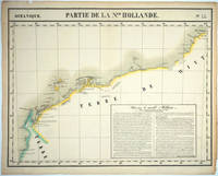
1827rif. 25576Brussels: P. Vandermaelen 1827. An early map of the Exmouth Western Australia area from the North West Cape to Roebuck Bay. Lithograph with original outline color 15 3/4 x 21". Scale ca. 1:1 650 000. Plate no. 44 Partie de La Nlle. Hollande in vol. 6 Oceanique of Atlas Universal de Geographie Physique Politique Statistique et Mineralogique" by P. Vandermaelen 1827. Tooley 1286; Phillips 749; Bib ID 1553060. P. Vandermaelen unknown
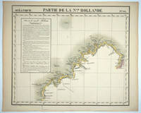
1827rif. 25575Brussels: P. Vandermaelen 1827. Maps. Very good condition. An early map of the Broome & the Kimberly Western Australia area from P. Cantheaume to Cambridge Gulf including the Lacepede Islands. Broome is at the bottom of the Dampier Peninsula called "C. Boileau." Lithograph with original outline color 25 x 21.5". Plate no. 35 Partie de La Nlle. Hollande in vol. 6 Oceanique of Atlas Universal de Geographie Physique Politique Statistique et Mineralogique" by P. Vandermaelen 1827. Tooley 1282; Phillips 749; Bib ID 30855. P. Vandermaelen unknown
1947rif. 25851Perth: Department of Lands and Surveys 1947. Cadastral map showing land use and zoning with notes on soil and vegetation. Includes locality plan. Originally dated 22.9.37 this is "Reprint 26.3.47". Manuscript additions in pencil in the top margin. The SLWA holds the 1937 version- "Townsite of Manjimup Nelson District cartographic material Western Australia. Department of Lands and Surveys. Map Dept. of Lands & Surveys W.A. 1937. Available at 3rd Floor Map Stack Call number: 35/11/MANJ 1937 plus 1 more. 1 map ; 54 x 69 cm. encapsulated in plastic. Notes "22/9/37" Cadastral map showing land use and zoning with notes on soil and vegetation. Includes locality plan. Part of collection: Townsite maps Western Australia. Department of Lands and Surveys unknown
1933rif. 25852Perth: Department of Lands and Surveys 1933. Cadastral map showing land use. Includes plan showing townsite boundary. Version dated "6.2.33". Addition of lots 185-200 on upper right to town plan printed in red. The earliest held by SLWA seems to be ca. 1950. Call Number 9024.P3G46 1 map ; 58 x 76 cm. encapsulated in plastic. Western Australia. Department of Lands and Surveys. Map Dept. of Lands & Surveys W.A. 1937. Available at 3rd Floor Map Stack Call number: 35/11/MANJ 1937 plus 1 more. Call Number 9024.M25G46 Related titles Townsite maps Western Australia. Description 1 map ; 54 x 69 cm. encapsulated in plastic. Part of collection: Townsite maps Western Australia. Department of Lands and Surveys unknown
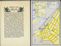
1932rif. 249231932. Wraps. Very good condition. Folded hand sheet with brief history of Western Australia and description of the highlights of Perth and Fremantle. With two printed color maps of Perth and Fremantle showing the Orient Line Offices and Orient Line Berths as well as tram lines & taxi service loosely inserted. Hand sheet 10 1/4 x 8"; maps 5 x 7 3/4" paperback
1920rif. 243371920. Very good condition. 11 b&w real photographs printed titles on the back including a great view of South Beach with a view over the wharves and a crowd in their holiday best crossing the railway line looking towards the Indian Ocean and a view of Convict Bridge with automobiles crossing over. The other images are: the War Memorial panorama of the wharves the Town Hall and High Street High Street showing the store front of Samuel's "The Big Tailors the Swan River another view of High Street the Post Office shipping on the Harbour and Round House Arthur's Point. These were perhaps the majority of a set of photographs issued for tourists. Photographs measure 3 1/2 x 2 1/2" unknown
1900rif. 22027Perth: Sands & McDougall 1900. Very good condition. Two lithographed beer labels one on red paper and printed in red and black the second on cream paper and printed in black and both with the brewery's logo. Bottled by H. Sherwood & Co. Esplanade Perth. 3 1/2 x 2 3/4" Sands & McDougall unknown