Moses HyamsonBiblio.com
11 170 résultats
réf. 45126804-nnew. unknown
réf. B9781015748873Hardback. New. hardcover
réf. 026039338X.Ghardcover. Good. Access codes and supplements are not guaranteed with used items. May be an ex-library book. hardcover
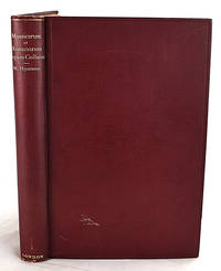
1913réf. 020914Henry Frowde - Oxford University Press 1913. Hardcover. Very Good. Hardcover book in very good condition. Light wear to boards. Light foxing to endpapers and pastedowns. Toning to textblock. Interior pages bright and unmarked binding tight. Questions welcome. We ship internationally from the United States and Canada every week. If buying internationally please be aware that additional charges may apply for heavier books. We guarantee a safe quick and secure transaction. 10 years in online bookselling experience. Henry Frowde - Oxford University Press hardcover
réf. 1333700180.Gpaperback. Good. Access codes and supplements are not guaranteed with used items. May be an ex-library book. paperback
1913réf. 1910070101Henry Frowde - Oxford University Press 1913-01-01. First Edition. Hardcover. Very Good. 0x0x0. The Evolution of Western Jurisprudence lvi 300 pages : illustrations ; 23 cm. Bound in publisher's cloth. Hardcover. Good binding and cover. Facsimile of Berlin ms. followed by Latin and English text on opposite pages. From the library of Hugh J. Fegan Dean of Georgetown University Law School. Henry Frowde - Oxford University Press hardcover
1999réf. 39369Bergisch Gladbach: Lübbe, 1999. 912 S. 8°. Bibl.- Einbd.
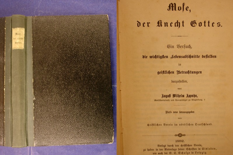
1882réf. 24982rlEisleben / Leipzig, Christlicher Verein / Schulze, 1882. einfaches privates Halbleinen, mit möglicherweise der Originalbroschur entnommenem kleinen Ausschnitt des Rückenschildes, ca.DinA 5, 359 Seiten, Einband mit stärkeren Gebrauchsspuren, Knickspuren, berieben und bestoßen, Rücken an den Enden leicht aufgerissen, Schnitt fleckig, gebräunt und bestoßen, Seiten gewellt, Seiten papierbedingt stärker gebräunt, einige Seiten eingerissen, stockfleckig, trotz der deutlichen Gebrauchs- und/oder Altersspuren ausreichender Zustand
1867608p. + Numerous Full Page Steel Engravings and a large folding map of the World as known to the Ancient and Sacred Writers, Hartford, CT, torn at one fold. Ruled in black throughout. Ownership label of H.S. Kriebel on rear fly leaf. Age stained. All edges marbled. 235 mm. Original full cloth binding decorated in gold. Slight loss at extremities. Spine slightly faded. Hardbound. Very good. RELIGION BOX 2
2000Text in English with some Greek; summary in Dutch. ; Proefschrift (Diss. ) ; 242 pages
2000Very light soiling to front panel. Bottom corner of front wrap and first 3 pages lightly corner-creased. Minor shelfwear. ; Text in English with some Greek; summary in Dutch. ; Proefschrift (Diss. ) ; 242 pages
réf. B9781013524776Hardback. New. hardcover
réf. 1024025357.Ghardcover. Good. Access codes and supplements are not guaranteed with used items. May be an ex-library book. hardcover
2010réf. Q-1423484452Hal Leonard 2010-12-01. Paperback. New. In shrink wrap. Looks like an interesting title! Hal Leonard paperback
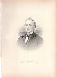
réf. 025515W. W. Preston & Co. Publishers Print. VG. No Binding. No date circa 1880s sized about 7.5 x 10.5 inches very clean and bright. Subject was born February 8 1806 at Stafford Tolland County Connecticut. He married Rachel Jennings in 1827. They had 6 children only one - Esther - survived past infancy. Suitable for framing. W. W. Preston & Co., Publishers
réf. 042882563X.Ghardcover. Good. Access codes and supplements are not guaranteed with used items. May be an ex-library book. hardcover
réf. 5255848like new. unknown
réf. 1023829142.Ghardcover. Good. Access codes and supplements are not guaranteed with used items. May be an ex-library book. hardcover
réf. 0548295085.Gpaperback. Good. Access codes and supplements are not guaranteed with used items. May be an ex-library book. paperback
réf. 1163620815.Gpaperback. Good. Access codes and supplements are not guaranteed with used items. May be an ex-library book. paperback
réf. Z1-I-009-02073Ktav Pub & Distributors Inc. Used - Good. Ships from UK in 48 hours or less usually same day. Your purchase helps support Sri Lankan Children's Charity 'The Rainbow Centre'. Shows some signs of wear but in good overall condition. 100% money back guarantee. We are a world class secondhand bookstore based in Hertfordshire United Kingdom and specialize in high quality textbooks across an enormous variety of subjects. We aim to provide a vast range of textbooks rare and collectible books at a great price. Our donations to The Rainbow Centre have helped provide an education and a safe haven to hundreds of children who live in appalling conditions. We provide a 100% money back guarantee and are dedicated to providing our customers with the highest standards of service in the bookselling industry. Ktav Pub & Distributors Inc unknown
1998Gutes Ex.; Umschl. leicht berieben. - Stifter des jüdisch-christlichen Gottesglaubens oder Herold altägyptischer Weisheit? Dieses sind die beiden Moses-Bilder, die uns zum einen durch die Bibel, zum anderen durch Sigmund Freuds "Der Mann Moses und die monotheistische Religion" bekannt sind. Jan Assmann erzählt in seinem neuesten Buch die Geschichte der Deutungen, denen die Person Mosis im Laufe der Jahrhunderte unterworfen wurde. (Verlagstext) / INHALT : Vorwort --- I Gedächtnisgeschichte und das Bild Ägyptens --- Die Mosaische Unterscheidung. --- Israel und Ägypten. --- Die Ziele der Gedächtnisgeschichte. --- Gedächtnisgeschichte und Diskursgeschichte. --- Moses und die europäische Ägypten-Rezeption. --- II Unterdrückte Geschichte, verdrängte Erinnerung Moses und Echnaton --- Echnaton: Die erste Gegenreligion. --- Aussätzige und Juden: Moses als Echnaton in griechischen und lateinischen Texten. --- Gegenreligion und religiöse Übersetzbarkeit in der Alten Welt. --- III Sinn und Ursprung des Gesetzes: John Spencer als Ägyptologe --- Normative Inversion als Mnemotechnik des Vergessens: Maimonides. --- Akkommodation: Die Inkulturation des Gesetzes --- Hieroglyphen und Gesetze: sub cortice legis. --- Hen kai pan - Ägyptens geheime Theologie nach Ralph Cudworth. --- IV Wahrheit und Mysterium: William Warburton --- Aus der Sicht eines Deisten: John Toland. --- Mysterium oder die Schizophrenie der Heiden: William Warburton. --- Dinge und Zeichen: Die Grammatologie der Idolatrie und des Geheimnisses. --- V Der Namenlose und der All-Eine --- Jehovah sive Isis: Karl Leonhard Reinhold. --- Die Natur und das Erhabene: Friedrich Schiller --- Hen kai pan - die Wiederkehr des ägyptischen Kosmotheismus. --- VI Sigmund Freud: Die Wiederkehr des Verdrängten --- Das Kaleidoskop der Zitate und die Entstehung des Freudschen Texts. --- Moses der Ägypter und der Ursprung des Monotheismus --- Die Verdopplung des Moses und die Zweigleisigkeiten der jüdischen Überlieferung. --- Wiederholung und Verdrängung: Vatermord und der Ursprung der Religion. --- Sensus historicus: Freuds Version des Euhemerismus. --- (u.a.)
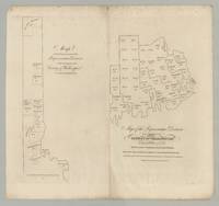
réf. 6460Portland ca 1832. Engraving 13.5” x 14.5” sheet size. Previously unrecorded map by Moses Greenleaf of Washington County Maine intended for a never-realized second volume of his Survey of the State of Maine. The map is stripped to its essentials showing Washington County and its state-representative districts in outline presumably based on reapportionment following the Census of 1830. The voting population for each town and unincorporated “plantation” is given though only in the northern part of the county at left are their boundaries delineated. Given the map’s purely political purpose Greenleaf has entirely eschewed the topographical detail of his earlier maps of the state. The map’s unfinished appearance suggests it might be an early proof particularly when it is compared with a companion map of York County also produced by Greenleaf at the time and presently known in a single example discussed below. Moses Greenleaf Greenleaf was a towering figure in the mapping of the state of Maine devoting his life to ever-improved mapping of the region. The pinnacle of his career came in 1829 when he published his new and substantially updated wall map of Maine. This was complemented by a text volume A Survey of the State of Maine and accompanying atlas the first atlas of the state and the third of any state of the Union. The map is a remarkable achievement widely heralded but the Survey of the State of Maine is also of the first importance a wide-ranging summation of the present state of Maine particularly valuable for commercial and economic data. Greenleaf however ever the perfectionist acknowledged the deficiencies of the work and announced his intention of issuing a second volume: “…it was intended to devote some portion of the work to a distinct consideration of the absolute and relative wealth of the State and its different component parts – value and importance of its lands – facilities for – kinds extent and expediency of internal improvements and its general resources; but the time when the publication must be completed was limited and an important part of the materials for these subjects could not be obtained until after this time. It was thought better therefore to omit their introduction altogether for the present; in the hope that circumstances will permit at a future time a more extended notice of them and under greater advantages for useful results than was possible at present.” Preface to A Survey of the State of Maine The largest single handicap to Greenleaf’s career was simply that the market for high-quality maps of Maine was too small for his projects to be commercially viable. Consider for example the 1829 wall map text volume and atlas which had cost him six years of his time and more than $12000 out of pocket for surveys engraving printing &c. He had 565 sets printed and offered by advance subscription at $16 a set but by early 1830 barely 100 of these had been sold. At this point though only after much debate the State rescued him by stepping in and purchased 400 sets at the full subscription price. Seemingly undeterred by the parlous financial prospects of the project and by the number of sets still in circulation Greenleaf continued to work on improving his materials. In 1832 he republished the wall-map of Maine but very few examples of that printing can be traced. In parallel our map and the companion map of York County mentioned earlier are the only known evidence that Greenleaf started work on his projected second volume of the Survey of the State of Maine Although there might be reference amongst the papers in the Moses Greenleaf archive in the Maine State Archives. Unfortunately the volume was never completed – and it may not even have advanced very far – possibly due to Greenleaf’s financial struggles but certainly ending with Greenleaf’s death on March 20 1834 aged fifty-six. Rarity and references We are aware of an example recently acquired by the Osher Map Library but the map is absolutely unrecorded in the general bibliographic literature the specialized biographical and bibliographical literature on Greenleaf and the mapping of Maine and the standard databases for the antiquarian market. It must be noted however that we acquired five examples in a large lot of Greenleaf material purchased by a third party at a Vermont auction in 2020. Not in OCLC; Phillips Maps of America; Walter Macdougall Settling the Maine Wilderness Wilderness – Moses Greenleaf His Maps and His Household of Faith 1777-1834 2006; Edgar Crosby Smith Moses Greenleaf Maine’s first map-maker a biography … also a bibliography of the maps of Maine 1903; Edward Thompson Important Maine Maps Books Prints and Ephemera 2003; or Thompson Printed Maps of the District and State of Maine 1793-1860 2010. Neither Antique Map Price Record nor Rare Book Hub show any record of the map having appeared on the antiquarian market. Macdougall Smith and Thompson all provided useful background on Greenleaf and his work. It is also worth noting that Greenleaf’s companion map of the representative districts of York County see Thompson Printed Maps of the District and State of Maine p.96 is recorded in but a single example in the Benton L. Hatch Collection in the University of Maine’s Fogler Library Special Collections See Thompson Printed Maps of the District and State of Maine pp. 96-97. Hatch was Associate Librarian for Special Collections at the University of Massachusetts who built a substantial collection of material on the history of Maine and Massachusetts. In view of his lifetime interest it seems likely that given the opportunity he would have acquired any others of the series he encountered. Appendix: An accounting of Greenleaf’s 1829 project A rough balance sheet for the 1829 publications can be reconstructed from contemporary documents. The wall-map and text volume with atlas were offered by advance subscription at $16 a set. A report of proceedings in the state legislature recorded that “It appears that Mr. G. was induced by encouragement from the Legislature to extend his original plan and incur great additional expense in order to present a work more valuable to the state. The engraving printing &c. cost $8351 81 surveys &c. about 4000 and Mr. G has devoted more than 6 years of his time to the work. The Legislature of 1828 granted $1000 to aid him in his labors. 565 copies were printed of which 458 remain unsold.” Hallowell American Advocate February 27 1830. A second report estimated that Greenleaf’s personal contribution be valued at $9000 Portland Christian Monitor February 25 1830. This gives as a rough guide income of $2700 against an actual cost of $12350 or a notional cost of $21350. In view of the scale of the loss Greenleaf made an appeal for relief submitting a lengthy memorial in January 1830 Maine State Archives. After much debate in the legislature it was agreed that the state would purchase 400 sets at the subscription price of $16 and the state would give Greenleaf a “a notice for $2000 redeemable in no longer time than 15 years and to be paid out of the proceeds of the Public Lands” Portland Eastern Argus February 26 1830. While the Maine government acted partly out of realization of a debt of honor to Greenleaf there was also a general feeling that the success of Greenleaf’s mapping project would bring all manner of benefits not least in driving land sales by the state. However the state also ended up with more copies than it could use so there was a heavy drive to sell sets to the school districts in particular and offices and officers of state at Washington Hallowell American Advocate January 21 1832 but also to gift sets to to Maine’s representatives in Congress to all the other states and so on. CONDITION: Very good light foxing and creasing small hole in maring at top of vertical fold. Offered in partnership with Boston Rare Maps. [Portland, ca 1832] unknown
réf. 6460Portland ca 1832. Engraving 13.5” x 14.5” sheet size. Previously unrecorded map by Moses Greenleaf of Washington County Maine intended for a never-realized second volume of his Survey of the State of Maine. The map is stripped to its essentials showing Washington County and its state-representative districts in outline presumably based on reapportionment following the Census of 1830. The voting population for each town and unincorporated “plantation” is given though only in the northern part of the county at left are their boundaries delineated. Given the map’s purely political purpose Greenleaf has entirely eschewed the topographical detail of his earlier maps of the state. The map’s unfinished appearance suggests it might be an early proof particularly when it is compared with a companion map of York County also produced by Greenleaf at the time and presently known in a single example discussed below. Moses Greenleaf Greenleaf was a towering figure in the mapping of the state of Maine devoting his life to ever-improved mapping of the region. The pinnacle of his career came in 1829 when he published his new and substantially updated wall map of Maine. This was complemented by a text volume A Survey of the State of Maine and accompanying atlas the first atlas of the state and the third of any state of the Union. The map is a remarkable achievement widely heralded but the Survey of the State of Maine is also of the first importance a wide-ranging summation of the present state of Maine particularly valuable for commercial and economic data. Greenleaf however ever the perfectionist acknowledged the deficiencies of the work and announced his intention of issuing a second volume: “…it was intended to devote some portion of the work to a distinct consideration of the absolute and relative wealth of the State and its different component parts – value and importance of its lands – facilities for – kinds extent and expediency of internal improvements and its general resources; but the time when the publication must be completed was limited and an important part of the materials for these subjects could not be obtained until after this time. It was thought better therefore to omit their introduction altogether for the present; in the hope that circumstances will permit at a future time a more extended notice of them and under greater advantages for useful results than was possible at present.” Preface to A Survey of the State of Maine The largest single handicap to Greenleaf’s career was simply that the market for high-quality maps of Maine was too small for his projects to be commercially viable. Consider for example the 1829 wall map text volume and atlas which had cost him six years of his time and more than $12000 out of pocket for surveys engraving printing &c. He had 565 sets printed and offered by advance subscription at $16 a set but by early 1830 barely 100 of these had been sold. At this point though only after much debate the State rescued him by stepping in and purchased 400 sets at the full subscription price. Seemingly undeterred by the parlous financial prospects of the project and by the number of sets still in circulation Greenleaf continued to work on improving his materials. In 1832 he republished the wall-map of Maine but very few examples of that printing can be traced. In parallel our map and the companion map of York County mentioned earlier are the only known evidence that Greenleaf started work on his projected second volume of the Survey of the State of Maine Although there might be reference amongst the papers in the Moses Greenleaf archive in the Maine State Archives. Unfortunately the volume was never completed – and it may not even have advanced very far – possibly due to Greenleaf’s financial struggles but certainly ending with Greenleaf’s death on March 20 1834 aged fifty-six. Rarity and references We are aware of an example recently acquired by the Osher Map Library but the map is absolutely unrecorded in the general bibliographic literature the specialized biographical and bibliographical literature on Greenleaf and the mapping of Maine and the standard databases for the antiquarian market. It must be noted however that we acquired five examples in a large lot of Greenleaf material purchased by a third party at a Vermont auction in 2020. Not in OCLC; Phillips Maps of America; Walter Macdougall Settling the Maine Wilderness Wilderness – Moses Greenleaf His Maps and His Household of Faith 1777-1834 2006; Edgar Crosby Smith Moses Greenleaf Maine’s first map-maker a biography … also a bibliography of the maps of Maine 1903; Edward Thompson Important Maine Maps Books Prints and Ephemera 2003; or Thompson Printed Maps of the District and State of Maine 1793-1860 2010. Neither Antique Map Price Record nor Rare Book Hub show any record of the map having appeared on the antiquarian market. Macdougall Smith and Thompson all provided useful background on Greenleaf and his work. It is also worth noting that Greenleaf’s companion map of the representative districts of York County see Thompson Printed Maps of the District and State of Maine p.96 is recorded in but a single example in the Benton L. Hatch Collection in the University of Maine’s Fogler Library Special Collections See Thompson Printed Maps of the District and State of Maine pp. 96-97. Hatch was Associate Librarian for Special Collections at the University of Massachusetts who built a substantial collection of material on the history of Maine and Massachusetts. In view of his lifetime interest it seems likely that given the opportunity he would have acquired any others of the series he encountered. Appendix: An accounting of Greenleaf’s 1829 project A rough balance sheet for the 1829 publications can be reconstructed from contemporary documents. The wall-map and text volume with atlas were offered by advance subscription at $16 a set. A report of proceedings in the state legislature recorded that “It appears that Mr. G. was induced by encouragement from the Legislature to extend his original plan and incur great additional expense in order to present a work more valuable to the state. The engraving printing &c. cost $8351 81 surveys &c. about 4000 and Mr. G has devoted more than 6 years of his time to the work. The Legislature of 1828 granted $1000 to aid him in his labors. 565 copies were printed of which 458 remain unsold.” Hallowell American Advocate February 27 1830. A second report estimated that Greenleaf’s personal contribution be valued at $9000 Portland Christian Monitor February 25 1830. This gives as a rough guide income of $2700 against an actual cost of $12350 or a notional cost of $21350. In view of the scale of the loss Greenleaf made an appeal for relief submitting a lengthy memorial in January 1830 Maine State Archives. After much debate in the legislature it was agreed that the state would purchase 400 sets at the subscription price of $16 and the state would give Greenleaf a “a notice for $2000 redeemable in no longer time than 15 years and to be paid out of the proceeds of the Public Lands” Portland Eastern Argus February 26 1830. While the Maine government acted partly out of realization of a debt of honor to Greenleaf there was also a general feeling that the success of Greenleaf’s mapping project would bring all manner of benefits not least in driving land sales by the state. However the state also ended up with more copies than it could use so there was a heavy drive to sell sets to the school districts in particular and offices and officers of state at Washington Hallowell American Advocate January 21 1832 but also to gift sets to to Maine’s representatives in Congress to all the other states and so on. CONDITION: Very good light foxing and creasing small hole in maring at top of vertical fold. Offered in partnership with Boston Rare Maps. [Portland, ca 1832] unknown books
réf. 2608138like new. unknown