ORTELIUS, AbrahamBiblio.com

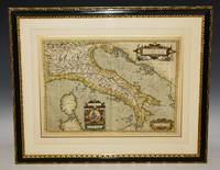
1584rif. 001117Antwerp: Christopher Plantin 1584. Map. Fine. Framed. Size: 377 x 485 mm. Framed size: 580 x 465mm. Hand-coloured engraved map published in the Theatrum Orbis Terrarum. Wooden moulding frames glazed and mounted late 20th century. In fine condition only a small two spots in a upper part. A beautiful map of Poland and Lithuania part of the Baltic Sea title in cartouche at lower left in Latin scale at top left decorated sleigh with a horse. . Christopher Plantin Hardcover
1584rif. 001118Antwerp: Christopher Plantin 1584. Map. Fine. Framed. Size: 328 x 447 mm. Framed size: 580 x 465mm. Hand-coloured engraved map published in the Theatrum Orbis Terrarum. Wooden moulding frames glazed and mounted late 20th century. In fine condition. A beautiful map of Transilvania with parts of Valachia with 3 decorative cartouches. Christopher Plantin Hardcover
1932rif. 37433New York: The Frank A. Munsey Company 1932. First Edition. Pictorial wrappers. A set of eleven consecutive issues of Argosy that include the complete first appearance of The Pirates of Venus serialized in seven issues of Burn Witch Burn! serialized in six issues and a Zorro novelette by Johnston McCulley. Cover art by Paul Stahr and Robert A. Graef. Pages are toned tiny chips to spine ends and edges October 8 has a 5 x 2 cm chip to upper corner of front cover. Average condition is very good-. Overall an appealing set better than usually found.; Octavo. The Frank A. Munsey Company unknown
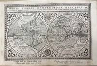
1705rif. 16453Amsterdam 1705. Unusual double-hemisphere map of the world illustrating the success of the Dutch East and West India Companies throughout the world. With text above and below sailing ships lions and the figure of Europa seated inside a native fort. Showing California as an island incomplete Australia and New Zealand and the west coast of America extending toward Asia. From Chatelain's 'Atlas Historique'. Uncolored . Image size: 18 x 13". References: MCC 2 Tooley - Antarctica #54. Very good. unknown
1864rif. WB163441864. Hardcover. Very Good. Rare broadside tipped into a copy of The Early Life of Abraham Lincoln: Containing many unpublished documents and unpublished reminiscences of Lincoln's early friends. TARBELL Ida M. Assisted by James McCann Davis. Published by McClure New York 1896. The broadside printed in two columns presents the platforms of the Republicans who in June in Baltimore nominated Lincoln and the Democrats who in August in Chicago nominated McClellan. hardcover
1864rif. WB163441864. Hardcover. Very Good. Rare broadside tipped into a copy of The Early Life of Abraham Lincoln: Containing many unpublished documents and unpublished reminiscences of Lincoln's early friends. TARBELL Ida M. Assisted by James McCann Davis. Published by McClure New York 1896. The broadside printed in two columns presents the platforms of the Republicans who in June in Baltimore nominated Lincoln and the Democrats who in August in Chicago nominated McClellan. hardcover books
1617rif. M10653Arnhem The Netherlands: Antonii Magini c.1617. Very Good. Notes: Latin text and blank verso. Rare World map taken from Ioannis Antonii Magini's Geographia Tum Veteris Tum Nova. It is published in Arnhem in 1617 and edited by Jan Janssonius. The map is specially engraved for this publication by Abraham Goos inspired by the map of Girolamo Porro of 1597 a reduction of the Mercator globe. Size : 172x246 mm 6.77x9.69 Inches Coloring: Black & White Category: Maps World; Antonii Magini unknown
1939rif. 050513Chicago: University of Chicago Press 1939. First Edition . Hardcover. Good/No Dust Jacket. An ex-library copy in heavy maroon cloth containing these five items each bound in retaining the original paper front cover but not the rear cover. All are first edition/first printings from 1944 1962 1961 1939 and 1939. The usual ex-libris markings to covers and endpapers and with accession stamps to the covers of Neurath Edel and Woodger. Kuhn has brief pencil library accession markings. All text is clean/unmarked. Cover soiling but none within. University of Chicago Press hardcover
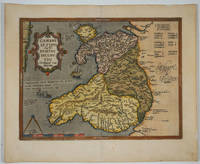
1609rif. 15882Antwerp 1609. The first printed map of Wales with title translated as "Map of Wales by the author Humphrey Lhuyd the Welshman from Denbigh". Based on Mercator's 1564 wall map of the British Isles and Lhuyd's manuscript map of 1568. Ornate cartouche sailing ship and sea monsters. Latin text on verso. Van den Broecke and van den Broecke-Günzburger's Ortelius Map No. 21; 300 copies of this edition were printed. Image size: 19 1/2 x 14 1/2". Paper size: 23 x 18 3/4". Two stray printer's marks at lower margin otherwise very good. unknown
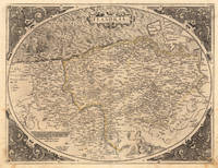
1572rif. 21509Antwerpen: Platin 1572. Other. In excellent condition. 385 by 503mm 15 by 19 inches. Original antique copper engraving uncolored as published. This very decorative antique map shows Flanders from Greuelinge in the west to Brussels in the east and Schouwen in the north and Lens in the south. The corners of the oval map are engraved with the cardinal points. In the North Sea are 2 sailing ships that fire with cannons a decorative compass rose and a sea monster. The title is engraved in the center of a very nice cartoushe. Ortelius was born on 14 April 1527 in the city of Antwerp which was then in the Habsburg Netherlands modern-day Belgium. The Orthellius family were originally from Augsburg a Free imperial city of the Holy Roman Empire. In 1535 the family had fallen under suspicion of Protestantism. Following the death of Ortelius's father his uncle Jacobus van Meteren returned from religious exile in England to take care of Ortelius. Abraham remained close to his cousin Emanuel van Meteren who would later moved to London. In 1575 he was appointed geographer to the king of Spain Philip II on the recommendation of Arias Montanus who vouched for his orthodoxy. He travelled extensively in Europe and is specifically known to have traveled throughout the Seventeen Provinces; in southern western northern and eastern Germany e.g. 1560 15751576; France 15591560; England and Ireland 1576; and Italy 1578 and perhaps twice or thrice between 1550 and 1558. Beginning as a map-engraver in 1547 he entered the Antwerp Guild of Saint Luke as an illuminator of maps. He supplemented his income trading in books prints and maps and his journeys included yearly visits to the Frankfurt book and print fair where he met Gerardus Mercator in 1554. In 1560 however when travelling with Mercator to Trier Lorraine and Poitiers he seems to have been attracted largely by Mercator's influence towards the career of a scientific geographer. Wikipedia Platin unknown
1587rif. 28094Antwerp: Ortelius 1587. Maps. Overall in very good condition. A very nice example of Ortelius' famous map of the Kingdom of Prester John with later hand color. It is from a Latin edition of Ortelius' Theatrum Orbis Terrarum the first modern atlas of the world. Cartographica Neerlandica Background for Ortelius Map No. 175. The map is difficult to date. The following details correspond to the aforementioned bibliography - it is consistent with 175.2 as the coastline has hatching extended from about 3 to about 6 mm signifying from 1587 & beyond. The ship in the lower left corner has a vessel attached to its mast. In the first state this vessel has vertical hatching. Now this is changed to horizontal hatching. In this copy the frame around the map has curved oval hatching around its oval ornaments. The sea was not re-engraved in later editions and as they are strongly engraved in this copy it would indicate an earlier edition. There is a watermark of two crossed arrows measuring 10 cm in length. The last line of text on the verso reads "uerit vide Jacobum Nauarchum in sua epistola Asiatica & Gerardum Mercatorem in sua universali tabula. 89". "Ortelius 1579 is penciled on the verso by an unknown person but that is unknown. The map centers on "Africva" in a strange configuration which goes from the coast of Benin and the "Mare Aethiopicum" to the Arabian Sea titled "Barbaricus Sinus". Arabia Felix covers the area of Saudi Arabia and adjoining countries with the Red Sea between the Arabian Penninsula and the coast of Africa. Mecca Medina and Jerusalem are noted with large buildings indicating their importance and colored red. Prester John was a mythical African King waging a war against the Muslim Infidels from his Kingdom in Central Africa. Add the Byzantine Patriarch Crusaders Islamic Saracens the Portuguese and a fake letter for this For centuries from the receipt of a fake letter from Prester John to the Byzantine Patriarch Europeans searched for Prester John initially in Asia and later in Africa. The Crusaders hoped that Prester John would join with Europeans in the protection of the Holy Lands from the Islamic Saracens and in the protection of all Europe from the Mongols. In the late 1400s and early 1500s the Portugese searched for Prester John in East Africa through they did eventually find a Christian kingdom in Abyssinia. A dedication to King David of the Bible is in the upper left of map. Above the dedication is the coat of arms of Prester John. Elephants and other figures adorn the map. Copper engraving with period hand color 17.5 x 15" with wide margins. Text in Latin on the verso. Two small wormholes in the top margin. Ortelius unknown
1598rif. 13293451598. A map of the Holy Land by Abraham Ortelius dated 1598 first issued in 1584 as a part of Theatrum Orbit Terrarium. In Very Good condition with age toning and a central crease. Matted but not framed. w 26.5 in. x h 22 in. Shelved at Rockville PS 1101 #25. Based on material collected by the Dutch Astronomer Peter Laicksteen who travelled to the Holy Land in 1556. Christian Sgrooten here written "Schrot" royal geographer to King Phillip II of Spain produced a nine-sheet map of Palestine in 1570 from Laikstain's information. This map was condensed into the present form by Abraham Ortelius. Ortelius the creator of the first modern atlas collected and edited maps from all over Europe for his book. Many of the original mapmakers rose to fame solely through Ortelius's decision to include their maps in his atlas. Laicksteen took thorough and accurate notes and the original Laicksteen and Sgrooten map contained improvements over earlier maps. For instance the River Kishon is here shown as flowing from the mountains near the Sea of Galilee not as was previously thought from the Sea of Galilee itself. However the Levantine coastline Sgrooten and Ortelius depicted is hardly recognizable to modern eyes. The map is replete with fanciful bays and peninsulas though some of the most recognizable features of the coastline such as the outcrops of land at Haifa and Beirut are absent. Ortelius had originally used another map of the Holy Land by cartographer Tilleman Stella in the early editions of the Theatrum Orbis Terrarum. It covered a far more extensive territory including part of Egypt and Syria. Oddly the coastline in this first map was much more accurate than in the Sgrooten map. Laicksteen and Sgrooten's original map included a small inset with an extended geography. However their mapping of the Dead Sea and surrounding areas was so controversial that Ortelius chose to leave out this region completely. The strange anecdote written in the Dead Sea is Ortelius's own addition. It describes how the Dead Sea was once a fertile valley but was transformed by an act of God into a barren sea to punish the wickedness of Sodom and Gomorrah. In the bottom left hand corner is a hand colored illustration of the story of Jonah. Above the luscious cartouche Ortelius has added three miniatures featuring the Crucifixion the Nativity and the Resurrection of Christ. The French text on the verso a long-winded description with little relevance to the map was changed to a more "reader-friendly" version shortly after the publication of this edition. 525 copies were made of this edition of Ortelius's map. 1329345. Special Collections - Upstairs. unknown
1598rif. 13293451598. A map of the Holy Land by Abraham Ortelius dated 1598 first issued in 1584 as a part of Theatrum Orbit Terrarium. In Very Good condition with age toning and a central crease. Matted but not framed. w 26.5 in. x h 22 in. Shelved at Rockville PS 1101 #25. Based on material collected by the Dutch Astronomer Peter Laicksteen who travelled to the Holy Land in 1556. Christian Sgrooten here written "Schrot" royal geographer to King Phillip II of Spain produced a nine-sheet map of Palestine in 1570 from Laikstain's information. This map was condensed into the present form by Abraham Ortelius. Ortelius the creator of the first modern atlas collected and edited maps from all over Europe for his book. Many of the original mapmakers rose to fame solely through Ortelius's decision to include their maps in his atlas. Laicksteen took thorough and accurate notes and the original Laicksteen and Sgrooten map contained improvements over earlier maps. For instance the River Kishon is here shown as flowing from the mountains near the Sea of Galilee not as was previously thought from the Sea of Galilee itself. However the Levantine coastline Sgrooten and Ortelius depicted is hardly recognizable to modern eyes. The map is replete with fanciful bays and peninsulas though some of the most recognizable features of the coastline such as the outcrops of land at Haifa and Beirut are absent. Ortelius had originally used another map of the Holy Land by cartographer Tilleman Stella in the early editions of the Theatrum Orbis Terrarum. It covered a far more extensive territory including part of Egypt and Syria. Oddly the coastline in this first map was much more accurate than in the Sgrooten map. Laicksteen and Sgrooten's original map included a small inset with an extended geography. However their mapping of the Dead Sea and surrounding areas was so controversial that Ortelius chose to leave out this region completely. The strange anecdote written in the Dead Sea is Ortelius's own addition. It describes how the Dead Sea was once a fertile valley but was transformed by an act of God into a barren sea to punish the wickedness of Sodom and Gomorrah. In the bottom left hand corner is a hand colored illustration of the story of Jonah. Above the luscious cartouche Ortelius has added three miniatures featuring the Crucifixion the Nativity and the Resurrection of Christ. The French text on the verso a long-winded description with little relevance to the map was changed to a more "reader-friendly" version shortly after the publication of this edition. 525 copies were made of this edition of Ortelius's map. 1329345. Special Collections - Upstairs. unknown books
rif. #[12548]Amsterdam Jean Schipper 1670. 4to. Contemporary speckled vellum spine ribbed. With engraved title page folding engraved plate showing different incarnations and 5 engraved illustrations 3 fullpage. 163714 pp. First French edition. - First published in Dutch De open-deure tot het verborgen heydendom Leyden 1651. 'This is the earliest European account of Hinduism in Southern India. Rogerius left in 1630 and worked in Palicatta Coromandel for ten years. He then went to Batavia where he served the Portuguese Church for five years. He repatriated in 1647 and settled in Gouda where he died in 1649' Landwehr VOC. This is the first work in Europe to publish the translation of a piece of Sanscrit literature the Sayings of Bhartrhari on pp. 291-339. The curious plates depict processions ceremonies and self-chastisement. This copy belonged to François Pétis de la Croix 1653-1713 with his owner's entry and purchase date August 28 1697 and his notes and comments in the margins. Pétis de la Croix son of the king's interpreter for oriental languages was educated to succeed his father. He was an eminent orientalist spoke arab turkish and the languages of Persia Tartar and Ethiopia. He was an attaché to the navy the Foreign Office and interpretor to the King Howgego p.812. Roger prepared probably the most thorough description of south-Indian Hinduism to be published before the end of the 19th century Howgego p.903. The first authentic record of Hindu culture as practised by the Tamil Brahmins of South India. - A fine association copy. Landwehr VOC 652; Tiele 928; Cat. NHSM I p.251. hardcover
rif. 89118Belgium Abraham ORTELIUS 1579 Issue of 1584. Beautiful Hand Coloured Original Antique Engraved Map. Framed and mounted by “P.J. Radford Sussex.” Engraved surface approx 19 x 14 inches. Overall 28 x 23 inches. In very good condition. Beautifully coloured. Stunning bright colouring to cartouches. Good strong impression. Vertical centre fold present and correct. Some minor tanning to edges from mount. Else an excellent clean and bright map. With decorative cartouches. Later hand colouring. Belgium, Abraham ORTELIUS, 1579 (Issue of 1584) unknown
1968rif. 1309FACKELVERLAG 1968. 1. hardcover. Dracula Maloftege! FACKELVERLAG hardcover
1653rif. 1712080008Paris: Chez ledit Bosse 1653-01-01. First Edition. Hardcover. Good. Small octavo 18.5 x 11 cm. Bound in contemporary speckled leather boards rebacked and rehinged. 5 raised bands gilt spine with loss. Speckled page ends. 1 preliminary leaf 75 1 pages. Illustrated with added engraved title and 32 leaves of plates. Two folding plates. Last few leaves and rear most plate damp stained. This copy has the final folding plate dated 1669. Abraham Bosse's 1602-1676 rare sequel to Maniere universelle des principes de Mr. Desargues. Bosse applies Desargues' methods to angled and curved surfaces. "His Moyen universelle. paid particular attention to the illusionistic projection of perspective onto ceilings and vaults of various configurations" Kemp Science of Art pp. 123-4. Provenance: Early signature of Randolph Greenway of Thavies Inn Holborn London 1725. Includes card states "From the library of John Bianchi owner of the Merrymount Press Boston. Purchased from Starr bros. booksellers Cambridge Mass. in 1949." Brunet I 1127. Chez ledit Bosse hardcover
1967rif. 33108PAWLAK MANFRED 1967. 1. softcover. Dracula PAWLAK, MANFRED paperback
rif. 122744London printed for R. and W. Mount and T. Page 1717. . Small 4to 22.5 x 15.5 cm; title laid down one folding diagram separate title page for the tables contemporary ownership inscription to ffep Toft Hall bookplate to front pastedown; contemporary full sprinkled calf spine rubbed with a little loss to spine caps boards ruled in gilt edges sprinkled red corners bumped and exposed a very good copy; 10 64 2 302 39 1 pp. An early edition of Mathematical Tables a comprehensive work that covers logarithms from 1 to 101000. Three of the four authors Briggs then Wallis then Halley consecutively held the Savilian Professorship of Geometry one of the oldest and most prestigious mathematical chairs in Britain. Briggs is known for inventing the common or indeed Briggsian logarithm Wallis is credited with the introduction of the infinity symbol and Halley's most notable achievements came in the field of astronomy having 'Halley's Comet' named after him. ESTC T93841 London, printed for R. and W. Mount, and T. Page, 1717. hardcover
rif. AT 9789386062017USA Edition . New. Brand New! Fast Delivery This is an International Edition and ship within 24-48 hours. Deliver by FedEx and Dhl & Aramex UPS & USPS and we do accept APO and PO BOX Addresses. Order can be delivered worldwide within 6-10 days and we do have flat rate for up to 2LB. Extra shipping charges will be requested if the Book weight is more than 5 LB. This Item May be shipped from India United states & United Kingdom. Depending on your location and availability. unknown
rif. 100425aafS.d., XIXe siècle, 10 x 15 cm, aquarelle origiale, signée ‘A. H.’, encadrement en bois doré (17 x 22.5 cm).
1570rif. 3399Very Good. 1570. 16th century map with original hand-colored outlines of the region of Poictou. Decorative cartouche. Some foxing most apparent to margins. Otherwise a handsome copy. Please see image. Plate size approximately 19 1/2 x 14 in. Overall size approx. 21 1/4 x 16 3/4 in 537 x 425 mm.; 1 pages; All shipments through USPS insured Priority Mail. .
1587rif. 239611Antwerp: Abraham Ortelius 1587. unbound. Map. Uncolored engraving. Image measures 14" x 19.5". These two maps on one sheet detail areas of western Mexico above and the Greater Antilles below. Ortelius created them from information compiled by other mapmakers such as Mercator Guttierez and Alsons de Sata Cruz. These sources allowed him to include a wealth of detailed information that is mostly if not entirely accurate. Above the map of western Mexico shows the area around Culiacan and the Spanish settlement of Villa S. Michaels which was notable in the period for its silver mines. It begins at the Yucatan and extends through the Cayman Magnus and the Caymanes. The map below illustrates the Greater Antilles including Cuba Hispaniola Jamaica St. Jois Insula St. Johns the Bahamas Virgin Islands and the Windward Islands all in impressive detail. The section of South Florida also shows suggestion of the Florida Keys which was uncommon for these period. A notable error is that the Tropic of Cancer is labelled as the Tropic of Capricorn. A highly decorative note with strapwork and foliage fills the acific Ocean to the left of Mexico and provides information about the upper map. The lower map also has a framed cartouche with birds perched atop it. Two ship illustrations float in the choppy seas around the islands. The map is a first state from the 1587 French edition of Ortelius's "Theatrum Orbis Terrarum." It is in good condition with no chips or tears. Stain at the center seam in the lower margin not affecting the image some overall stains. French text on verso. Abraham Ortelius 1527--1598 a Flemish cartographer and geographer is widely regarded as one of the important and influential cartographers in history. He is known for his "Theatrum Orbis Terrarum" which was the first modern atlas. This map is an uncommon uncolored example of this wonderful map by Ortelius. Abraham Ortelius unknown
1587rif. 239611Antwerp: Abraham Ortelius 1587. unbound. Map. Uncolored engraving. Image measures 14" x 19.5". These two maps on one sheet detail areas of western Mexico above and the Greater Antilles below. Ortelius created them from information compiled by other mapmakers such as Mercator Guttierez and Alsons de Sata Cruz. These sources allowed him to include a wealth of detailed information that is mostly if not entirely accurate. Above the map of western Mexico shows the area around Culiacan and the Spanish settlement of Villa S. Michaels which was notable in the period for its silver mines. It begins at the Yucatan and extends through the Cayman Magnus and the Caymanes. The map below illustrates the Greater Antilles including Cuba Hispaniola Jamaica St. Jois Insula St. Johns the Bahamas Virgin Islands and the Windward Islands all in impressive detail. The section of South Florida also shows suggestion of the Florida Keys which was uncommon for these period. A notable error is that the Tropic of Cancer is labelled as the Tropic of Capricorn. A highly decorative note with strapwork and foliage fills the acific Ocean to the left of Mexico and provides information about the upper map. The lower map also has a framed cartouche with birds perched atop it. Two ship illustrations float in the choppy seas around the islands. The map is a first state from the 1587 French edition of Ortelius's "Theatrum Orbis Terrarum." It is in good condition with no chips or tears. Stain at the center seam in the lower margin not affecting the image some overall stains. French text on verso. Abraham Ortelius 1527--1598 a Flemish cartographer and geographer is widely regarded as one of the important and influential cartographers in history. He is known for his "Theatrum Orbis Terrarum" which was the first modern atlas. This map is an uncommon uncolored example of this wonderful map by Ortelius. Abraham Ortelius unknown books
rif. DADAX0933711018Brand: Traditional Pr 0000-00-00. hardcover. New. 5.75x1.00x9.25. Buy with confidence. Excellent Customer Service & Return policy. Brand: Traditional Pr hardcover