ORTELIUS, AbrahamBiblio.com
27.901 Ergebnisse
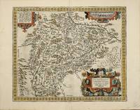
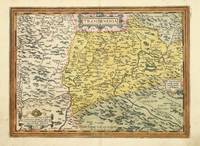
Best.-Nr. 7028Antwerp: 1575-80. No binding. Very Good. 310 x 430 mm. in fine early wash colour in very good condition. This map of Transilvania is derived from that of Sambucus 1566 itself drawn from Honter in 1532. This example with Latin text to the verso is from the first 1580 edition. Within five years of first publication Ortelius had to replace the plate with this one. This is a fine example of the first state of four. The map extends to cover parts of Poland Slovakia Romania & Hungary. Karrow 1993 65/1 pp. 459-60; Meurer 2004 p. 226; Tibor 1987 73; Van den Broecke 1996 153.1. 1575-[80] unknown
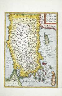
Best.-Nr. 6997Antwerp: 1570-79. No binding. Very Good. 325 x 230 mm. in good modern wash colour in good condition. This is the left side only from a double page map sheet that contained two smaller maps at the right. This half features a well engraved map of Turkey which is oriented with the north to the left. The map is derived from the extremely rare map of Giacomo Gastaldi as published by Paolo Forlani in Venice 1564. It depicts the whole of Asia Minor or present day Turkey in excellent detail and includes the important islands of Cyprus Rhodes and Crete. It was published in the first edition of Abraham Ortelius' 'Theatrum Orbis Terrarum' in 1570 the first modern atlas. This example was issued in the Latin text edition of 1579 with the pagination 88 to the verso. Van den Broecke 1996 174a; refer Woodward 1990 'The Maps and Prints of Paolo Forlani' 26.01; Zacharakis 1992 1613. 1570-[79] unknown
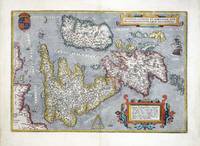
Best.-Nr. 6982Antwerp: 1570-87. No binding. Good. 345 x 500 mm. in fine modern wash colour a small wormhole by the cartouche lower right repaired otherwise in good condition. This is one of the most recognisable of all the early maps of the British Isles. It was published by Abraham Ortelius in his 'Theatrum Orbis Terrarum' first published in 1570 the first modern atlas. This example was issued in the French text edition of 1587 with the pagination 9 to the verso. The map is derived from Gerard Mercator's eight sheet wall map of 1564. It is a beautifully designed plate with a nice balance between accurate cartographic information and ornate decoration. The map is orientated with north to the right and the Royal Coat of Arms are depicted upper left. Shirley speculates that the engraver was Frans Hogenberg. Van Den Broecke 1996 16; Shirley 1991 British Isles no. 86. 1570-[87] unknown
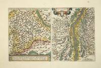
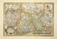
Best.-Nr. 8614Antwerp: 1584-98. No binding. Very Good. 305 x 490 mm. recent full wash colour in good condition. The second of two single page maps of Bavaria Germany published by Abraham Ortelius in the 'Theatrum Orbis Terrarum'. This one is distinguished by the title being at the bottom of the map. It is derived from the map by Erhart Reich published in woodcut in 4 sheets in 1540. Regensberg is easily identified near the centre with 'Nurnberg' to the left of the map. Paired with it is a map of the region surrounding Strasbourg. It is derived from Daniel Specklin's three-sheet map of the Alsace issued in 1576. This French text issue was published in 1598. Van den Broecke 112; Karrow 63. 1584-[98] unknown
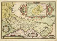
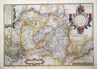
Best.-Nr. 7030Antwerp: 1579-80. No binding. Very Good. 360 x 510 mm. early wash colour in very good condition. This is Abraham Ortelius' fine map of the region of Cremona from the 'Theatrum Orbis Terrarum'. It was first published in 1579 this example with German text to the verso is from an edition issued the following year. Cartographically it is derived from a manuscript map of the area by Antonio Campi which was not finally published until 1583. The map extends from Mantua in the east to Cremona Piacenza and Crema in the west. The inset map of Crema is after a printed map by Paolo Forlani issued in 1570. Van den Broecke 1996 no. 127. 1579-[80] unknown
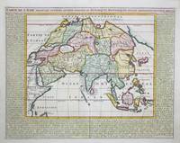
Best.-Nr. 9410Amsterdam: c.1719. No binding. Very Good. 380 x 485 mm. in recent full wash colour good condition. This map of Asia with surrounding descriptive text was published in the encyclopaedic seven volume 'Atlas Historique' by Henri Abraham Chatelain 1684-1743. Koeman II p. 33; Shirley 'Atlases in the BL' T.Chat-1a; Van Waning 'Chatelain's Atlas Historique' in IMCoS Journal 120 pp. 7-15. c.1719 unknown
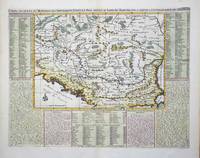
Best.-Nr. 9347Amsterdam: c.1715. No binding. Very Good. 360 x 460 mm. in recent wash colour and good condition. An attractive map of the Balkans region of south east Europe centred on the River Danube. It is surrounded by descriptive text in French. It was published in the second volume of the encyclopaedic atlas by Henri Abraham Chatelain 1684-1743 entitled 'Atlas Historique ou Nouvelle Introduction a l'Histoire a la Chronologie & a la Geographie'. It was issued from 1705 to 1720 in 7 volumes. Koeman II p. 33; Phillips 579; Shirley 'Atlases in the BL' T.Chat-1a; Van Waning 'Chatelain's Atlas Historique' in IMCoS Journal 120 pp. 7-15. c.1715 unknown
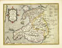
Best.-Nr. 10630Amsterdam: 1573-87. No binding. Very Good. 370 x 495 mm. fine recent full wash colour with French text to the verso in good condition. 'The first separate map of the whole of Wales in its second state it was compiled in 1568 by Humphrey Llwyd 1527-68 or Lhuyd a Welshman from Denbigh' Roberts. It was first published in the 'Theatrum Orbis Terrarum' by Abraham Ortelius in 1573 but according to Karrow was engraved by 1572. A letter from October 1572 written by the diplomat and historian Daniel Rogers and asks Ortelius to send him two copies so that he may augment them 'with the ancient castles neglected by Fludd Lluyd but noticed by a friend of mine' Karrow. It illustrates the three main regions of Venedotia Gwynedd Povisia Powys and Dehenbartia Deheubarth. Placenames are provided in Welsh English and Latin. Provenance: acquired from Doreen Green 1990; private collection. Booth 1977 no. 2; Evans 1964 pp. 4-5; Karrow 1993 50/1.1; Parker 2017 p. 87; Roberts 1994 1; Van Den Broecke 1996 no. 21. 1573-[87] unknown
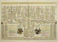
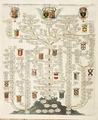
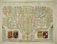
Best.-Nr. 10383Amsterdam: 1708. No binding. Very Good. 360 x 525 mm. recent wash colour in good condition. A display of the family tree of the House of Bavaria including coats of arms. It was published in the second volume of the encyclopaedic atlas by Henri Abraham Chatelain 1684-1743 entitled 'Atlas Historique ou Nouvelle Introduction a l'Histoire a la Chronologie & a la Geographie'. It was issued from 1705 to 1720 in 7 volumes. Koeman II p. 33; Phillips 579; Shirley 'Atlases in the BL' T.Chat-1a; Van Waning 'Chatelain's Atlas Historique' in IMCoS Journal 120 pp. 7-15. 1708 unknown
Best.-Nr. 10702Amsterdam: 1708. No binding. Very Good. 625 x 515 mm. folding as issued full wash colour in good condition. A magnificent display of the family tree of the House of Austria including 20 coats of arms. It includes the nobility of Spain Portugal France Italy Germany and Austria. Several tables identify the Arms which are keyed using letters running all the way around the outside of the image. It was published in the second volume of the encyclopaedic atlas by Henri Abraham Chatelain 1684-1743 entitled 'Atlas Historique ou Nouvelle Introduction a l'Histoire a la Chronologie & a la Geographie'. It was issued from 1705 to 1720 in 7 volumes. Koeman II p. 33; Phillips 579; Shirley 'Atlases in the BL' T.Chat-1a; Van Waning 'Chatelain's Atlas Historique' in IMCoS Journal 120 pp. 7-15. 1708 unknown
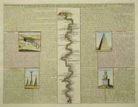
Best.-Nr. 9350Amsterdam: c.1715. No binding. Very Good. 375 x 490 mm. in recent wash colour and good condition. This plate contains a central map of the River Nile flanked either side by illustrations of the antiquities found in its valley. The illustrations are fully described in French. It was published in the sixth volume of the encyclopaedic atlas by Henri Abraham Chatelain 1684-1743 entitled 'Atlas Historique ou Nouvelle Introduction a l'Histoire a la Chronologie & a la Geographie'. It was issued from 1705 to 1720 in 7 volumes. Koeman II p. 33; Phillips 579; Shirley 'Atlases in the BL' T.Chat-1a; Van Waning 'Chatelain's Atlas Historique' in IMCoS Journal 120 pp. 7-15. c.1715 unknown
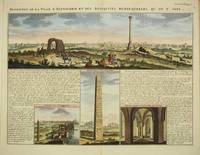
Best.-Nr. 9716Amsterdam: c.1719. No binding. Very Good. 375 x 485 mm. in recent full wash colour good condition. This interesting plate describes the city of Alexandria in Egypt. The view above is taken from the old town marked by the central column looking towards the current town. Below are three vignettes featuring the Obelisk the ruins of the Palace of Cleopatra and an interior. These are flanked with historical notes and links to the images. It was published in the sixth volume of the encyclopaedic atlas by Henri Abraham Chatelain 1684-1743 entitled 'Atlas Historique ou Nouvelle Introduction a l'Histoire a la Chronologie & a la Geographie'. It was issued from 1705 to 1720 in 7 volumes. Koeman II p. 33; Phillips 579; Shirley 'Atlases in the BL' T.Chat-1a; Van Waning 'Chatelain's Atlas Historique' in IMCoS Journal 120 pp. 7-15. c.1719 unknown
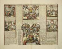
Best.-Nr. 8978Amsterdam: 1708. No binding. Very Good. 345 x 450 mm. full wash colour in good condition. This plate illustrates the ecclesiastical civil and military structure of Knights of Malta the Teutonic Order structures with ancient lineage. It was published in the second volume of the encyclopaedic atlas by Henri Abraham Chatelain 1684-1743 entitled 'Atlas Historique ou Nouvelle Introduction a l'Histoire a la Chronologie & a la Geographie'. It was issued from 1705 to 1720 in 7 volumes. Koeman II p. 33; Phillips 579; Shirley 'Atlases in the BL' T.Chat-1a; Van Waning 'Chatelain's Atlas Historique' in IMCoS Journal 120 pp. 7-15. 1708 unknown
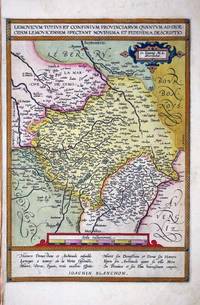
Best.-Nr. 8846Antwerp: 1570-89. No binding. Very Good. 340 x 235 mm. in full early wash colour in good condition. An attractive map depicting the region of Limousin in south western France with the city of Lymoges Limoges near the centre of the map. This map was drawn from that by Jean Fayen 1530-1616 published in the 'Theatre Francois' by Maurice Bougereau in 1594. It was first published in the 1598 French edition of Abraham Ortelius' 'Theatrum Orbis Terrarum' the first modern atlas of the world. This example is removed from its accompanying map of Blois and lacks any text to the verso. As such it is difficult to determine the edition but from the paper size we may deduce it was an earlier one. Van den Broecke 1996 43; Meurer pp. 132-3. 1570-[89] unknown
Best.-Nr. 9344Antwerp: 1579-80. No binding. Good. 350 x 505 mm. in recent wash colour otherwise in good condition. FIRST GERMAN EDITION. An attractive bordered map depicting the region of Westphalia Germany extending from Cologne in the right to Bremen and Emden in the left or north. This map was first published in Abraham Ortelius' 'Theatrum Orbis Terrarum' in 1579 the first modern atlas of the world. This example with German text is from the first edition in that language published in 1580. It is derived from a manuscript map by Christian Sgroten from 1565. Van den Broecke M. 91; Meurer pp. 132-3. 1579-[80] unknown
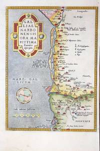
Best.-Nr. 9346Antwerp: 1570-1580. No binding. Very Good. 300 x 220 mm. in recent wash colour in good condition. A nice example of Ortelius' map of southern France with north to the right. It extends from Oranges in the north to Narbonne in the west and Marseille in the east. This map was introduced to the Ortelius atlas in the first edition of 1570. This example is from the 1580 German text issue. According to Van den Broecke Charles de l'Ecluse 1510-63 was asked by Ortelius to produce a map of the region which turned out to be not particularly accurate. in 1595 'Adam la Planche wrote Ortelius Hessels letter 279 that he had obtained from Pierre Pithou a manuscript map of Ile de France attributed to Francois de la Guillotiere'. Meurer p. 128; Van den Broecke M. 48a. 1570-[1580} unknown
Best.-Nr. 10375Antwerp: 1570-98. No binding. Very Good. 350 x 510 mm. in recent wash colour otherwise in good condition. An attractive bordered map depicting the region of Saxony Germany with the city of Leipzig near the centre. This map was published in the first edition of Abraham Ortelius' 'Theatrum Orbis Terrarum' in 1570 the first modern atlas of the world. This example with French text on the verso is from the 1598 edition. It is derived from a map by Johann Criginger 1521-71. Van den Broecke M. 93; Karrow 22/1; Meurer pp. 132-3. 1570-[98] unknown
Best.-Nr. 10671Antwerp: 1592-1598. No binding. Very Good. 385 x 460 mm. with recent full wash colour in good condition. This map of Salzburg in Austria in Abraham Ortelius' 'Theatrum Orbis Terrarum' is from the only French edition to include this plate issued in 1598. It is the second of two maps of the region produced by Ortelius and first introduced in 1592. Ortelius credits Marcus Secznagel with being the cartographer. Born in Salzburg circa 1520 he produced a woodcut map of the region printed by Hans Baumann in 1551 no example survives. Karrow 1993 68.1; Van den Broecke 1996 108. 1592-[1598] unknown
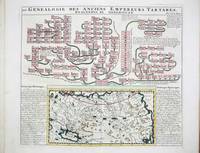
Best.-Nr. 9679Amsterdam: c.1719. No binding. Very Good. 370 x 430 mm. in recent full wash colour good condition. This map of Tartary or northern Asia is accompanied by a large genealogy of Genghis Khan 1162-1227. The Mongol Empire which he founded became one of the largest in human history. The mapis flanked with historical notes. It was published in the fifth volume of the encyclopaedic atlas by Henri Abraham Chatelain 1684-1743 entitled 'Atlas Historique ou Nouvelle Introduction a l'Histoire a la Chronologie & a la Geographie'. It was issued from 1705 to 1720 in 7 volumes. Koeman II p. 33; Phillips 579; Shirley 'Atlases in the BL' T.Chat-1a; Van Waning 'Chatelain's Atlas Historique' in IMCoS Journal 120 pp. 7-15. c.1719 unknown
Best.-Nr. 9719Amsterdam: c.1719. No binding. Very Good. 380 x 465 mm. in recent full wash colour good condition. This chart displays the family tree of the House of Stuart whose English reign begins with James I and extends through Charles I and II and James II. It was published in the second volume of the encyclopaedic atlas by Henri Abraham Chatelain 1684-1743 entitled 'Atlas Historique ou Nouvelle Introduction a l'Histoire a la Chronologie & a la Geographie'. It was issued from 1705 to 1720 in 7 volumes. Koeman II p. 33; Phillips 579; Shirley 'Atlases in the BL' T.Chat-1a; Van Waning 'Chatelain's Atlas Historique' in IMCoS Journal 120 pp. 7-15. c.1719 unknown
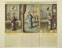
Best.-Nr. 9353Amsterdam: 1719. No binding. Very Good. 380 x 435 mm. full wash colour in good condition. This plate describes the elaborate clothing of the Emperor of China and his entourage. The elaborate interior furnishings of the palace are also beautifully displayed. These are described below. It was published in the fifth volume of the encyclopaedic atlas by Henri Abraham Chatelain 1684-1743 entitled 'Atlas Historique ou Nouvelle Introduction a l'Histoire a la Chronologie & a la Geographie'. It was issued from 1705 to 1720 in 7 volumes. Koeman II p. 33; Phillips 579; Shirley 'Atlases in the BL' T.Chat-1a; Van Waning 'Chatelain's Atlas Historique' in IMCoS Journal 120 pp. 7-15. 1719 unknown
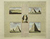
Best.-Nr. 9349Amsterdam: c.1715. No binding. Very Good. 370 x 430 mm. in recent wash colour and good condition. This plate illustrates and describes the pyramids of Egypt. The illustrations are fully described in French. It was published in the sixth volume of the encyclopaedic atlas by Henri Abraham Chatelain 1684-1743 entitled 'Atlas Historique ou Nouvelle Introduction a l'Histoire a la Chronologie & a la Geographie'. It was issued from 1705 to 1720 in 7 volumes. Koeman II p. 33; Phillips 579; Shirley 'Atlases in the BL' T.Chat-1a; Van Waning 'Chatelain's Atlas Historique' in IMCoS Journal 120 pp. 7-15. c.1715 unknown
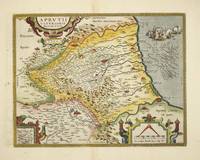
Best.-Nr. 10379Antwerp: 1590-98. No binding. Good. 330 x 425 mm. recent wash colour in good condition. The map is derived from that of Natale Bonifacio 1538-92 which was published in Rome in 1587. Three years later Abraham Ortelius used the map for his 'Theatrum'. This example with Spanish text to the verso comes from the 1612 edition. Van den Broecke no. 138; Meurer p. 118. 1590-[98] unknown
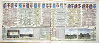
Best.-Nr. 9713Amsterdam: c.1719. No binding. Very Good. 405 x 965 mm. two sheets joined as one in recent full wash colour good condition. This fine large two sheet decorative plate features the House of Valois. The large family tree bears four vignette views below of the Place Royale Tuilleries and Palais du Luxembourg in Paris. It was published in the final seventh volume of the encyclopaedic atlas by Henri Abraham Chatelain 1684-1743 entitled 'Atlas Historique ou Nouvelle Introduction a l'Histoire a la Chronologie & a la Geographie'. It was issued from 1705 to 1720 in 7 volumes. Koeman II p. 33; Phillips 579; Shirley 'Atlases in the BL' T.Chat-1a; Van Waning 'Chatelain's Atlas Historique' in IMCoS Journal 120 pp. 7-15. c.1719 unknown
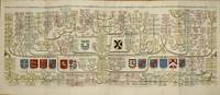
Best.-Nr. 10437Amsterdam: 1708. No binding. Very Good. 385 x 950 mm. two sheets joined as one as issued in full wash colour and good condition. A magnificent display of the genealogical family tree of the mediaeval period of English history. The Royal families of Plantagenet's and the Dukes of Normandy leading to the House of York on the left side and the House of Lancaster on the right side both illustrating the Wars of the Roses. The coats of arms of Edward the Confessor and 13 others adorn the plate. It was published in the second volume of the encyclopaedic atlas by Henri Abraham Chatelain 1684-1743 entitled 'Atlas Historique ou Nouvelle Introduction a l'Histoire a la Chronologie & a la Geographie'. It was issued from 1705 to 1720 in 7 volumes. Koeman II p. 33; Phillips 579; Shirley 'Atlases in the BL' T.Chat-1a; Van Waning 'Chatelain's Atlas Historique' in IMCoS Journal 120 pp. 7-15. 1708 unknown