28 034 résultats
1979réf. 9005983Franklin Center: Franklin Library 1979. Hardcover. Fine Condition. The 100 Greatest Masterpieces of American Literature. Bound in the publisher's original green composition leather with the covers and spine stamped in gilt and with an oxblood leather spine label stamped in gilt. Three raised bands on the spine. All edges gilt. Silk moire end papers. Franklin Library hardcover books
1598réf. 16774Antwerp: Platin 1598. Other. A very good example a small older mended clear split in the upper centerfold. 350 by 460mm 13 by 18 inches. Original antique copper engraving published 1598 in a French textedition of the Theatrum Orbis Terrarum. Finely hand-colored in wash and outline. The map is ornated with three cartouches in the lower right corner the title cartouche in the upper right corner we find a small cartouche with privilegium and in the upper left corner a small cartouche with a milage scale. Villages and towns are shown as miniature views moreover the map is ornated with ships sea monsters and animals as well a compass rose in the sea. Ortelius was born on 14 April 1527 in the city of Antwerp which was then in the Habsburg Netherlands modern-day Belgium. The Orthellius family were originally from Augsburg a Free imperial city of the Holy Roman Empire. In 1535 the family had fallen under suspicion of Protestantism. Following the death of Ortelius's father his uncle Jacobus van Meteren returned from religious exile in England to take care of Ortelius. Abraham remained close to his cousin Emanuel van Meteren who would later moved to London. In 1575 he was appointed geographer to the king of Spain Philip II on the recommendation of Arias Montanus who vouched for his orthodoxy. He travelled extensively in Europe and is specifically known to have traveled throughout the Seventeen Provinces; in southern western northern and eastern Germany e.g. 1560 15751576; France 15591560; England and Ireland 1576; and Italy 1578 and perhaps twice or thrice between 1550 and 1558. Beginning as a map-engraver in 1547 he entered the Antwerp Guild of Saint Luke as an illuminator of maps. He supplemented his income trading in books prints and maps and his journeys included yearly visits to the Frankfurt book and print fair where he met Gerardus Mercator in 1554. In 1560 however when travelling with Mercator to Trier Lorraine and Poitiers he seems to have been attracted largely by Mercator's influence towards the career of a scientific geographer. Wikipedia Broe. 28 Platin unknown
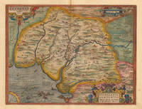
réf. 1776Europe: Antverpiæ"/Antwerp. "ex Officiana Plantiana" . Plantijn Christoffel. 1595. Copper engraved map of part of Andaluzia Spain from Ortelius' "Theatrum Orbis Terrarum" 1595 edition; black & white. Latin text to verso. The map focuses on the area surrounding Seville; sea battle off Cadiz; fish & monsters. Good dark impression. Abraham Ortelius 1527-1598 Flemish Cartographer . produced the first modern Atlas "Theatrum Orbis Terrarum" in 1570. printed by Aegidus Coppen Diest. There were numerous editions thereafter with texts in various languages; the printing of such was taken over by Chrstoffel Plantijn in 1579 . Ortelius himself drew all the maps in manuscript before passing them to the printers. there is conjecture that he may have engraved some of the plates as well The 1595 Latin text edition is the most complete produced during his lifetime containing all the maps of the 1593 edition plus those of the the"Additamentum" and the"Pareragon" or Ancient geography. The " Additamenta" were supplements to the original Atlas; at the same time Ortelius replaced some maps with new ones showing the same place; some plates were also reworked . Ortelius was Geographer Royal To Phillip II of Spain from 1575. He also worked closely with Braun & Hogenburg on the "Civitas Orbis Terarum". After his death the plates were purchased by Jan Baptiste Vrients in 1601 who published further editions until 1612. Van de Krogt :3; .Koeman: Ort29 18 74; van.de. Broecke:28. Europe Spain & Portugal Andalusia Hispalensis Conventus Antverpiæ"/Antwerp. "ex Officiana Plantiana" . Plantijn Christoffel. 1595 unknown
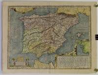
réf. 1773Europe: Antverpiæ"/Antwerp. "ex Officiana Plantiana" . Plantijn Christoffel. 1595. Copper engraved map of the Iberian PeninsularSpain & Portugal from Ortelius' "Theatrum Orbis Terrarum" 1595 edition; black & white. Latin text to verso. Ships & monsters to sea. Good dark impression; smudge to lower left corner of blank margin; spot close to "Cartegena". Abraham Ortelius 1527-1598 Flemish Cartographer . produced the first modern Atlas "Theatrum Orbis Terrarum" in 1570. printed by Aegidus Coppen Diest. There were numerous editions thereafter with texts in various languages; the printing of such was taken over by Chrstoffel Plantijn in 1579 . Ortelius himself drew all the maps in manuscript before passing them to the printers. there is conjecture that he may have engraved some of the plates as well The 1595 Latin text edition is the most complete produced during his lifetime containing all the maps of the 1593 edition plus those of the the"Additamentum" and the"Pareragon" or Ancient geography. The " Additamenta" were supplements to the original Atlas; at the same time Ortelius replaced some maps with new ones showing the same place; some plates were also reworked . Ortelius was Geographer Royal To Phillip II of Spain from 1575. He also worked closely with Braun & Hogenburg on the "Civitas Orbis Terarum". After his death the plates were purchased by Jan Baptiste Vrients in 1601 who published further editions until 1612. Van de Krogt :3; .Koeman: Ort2916 7; van.de. Broecke:25. Europe Spain & Portugal Iberian Peninsular Antverpiæ"/Antwerp. "ex Officiana Plantiana" . Plantijn Christoffel. 1595 unknown
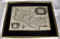
1606réf. 2008060188Antwerp : Theatrum Orbis Terrarum 1606. Maps. Very Good. Ortelius' map of late 16th Mexico A handsome map in very good condition. Map under glass mounted in gilt frame. Map dimensions is 50 x 34 cm 19.5 x 13 inches in frame 66 x 51.5 cm. Double-page engraved map of southwestern Mexico. The map shows Spanish strongholds including Mexico City Lake de Bhapala Chapilacum Mare Guadelajara Tuxpan and Indian towns. Early hand-color. Large cartouche on upper right corner. Text in Latin. "The first printed real Map of New Spain" Wagner 119; Van den Broecke 13. Theatrum Orbis Terrarum unknown
1603réf. W2303Antwerp Belgium: Jan Baptiste Vrients 1603. 14 3/4 inches by 19 3/8 inches on a 16 5/8" by 21 3/4" sheet of laid paper. Latin text on the verso. van den Broecke 193. Abraham Ortelius was a Flemish scholar who moved to Antwerp to become a bookseller and cartographer. This map of ancient Spain is from his PARERGON published as an appendix to the THEATRUM ORBIS TERRARUM the world's first true atlas as well as the most authoritative and commercially successful atlas of the late 16th and early 17th centuries. Although it is dated 1586 in one cartouche this map actually is a second state printed between 1601 and 1612 as indicated by the stipple engraving in the ocean & seas and by the line through the word "Cinniana" in line 8 of the descriptive text within the cartouche in the lower right corner. The map is in very good condition: generally clean and bright with barely a hint of toning and minor soiling limited to the blank margins. Madrid bookseller's stamp and brief handwritten comment and signature in the margin on the verso. Original. Single Sheet. Very Good. Folio - over 12" - 15" tall. Map. Jan Baptiste Vrients
1624réf. 8030Antwerp: Plantin-Moretus 1624. Copper engraving 37.5 x 49.5 cms modern hand colour small burn hole in table of peoples and places Latin text on verso. Our example was published by Balthasar Moretus at the Plantin Press in the final edition of the Parergon. Ortelius's Theatrum Orbis Terrarum is generally considered the first modern atlas of the world originally published in 1570. Ortelius gathered and selected the best available cartographic knowledge and presented it in a single volume duly credited and finely engraved in a consistent style with explanatory text. The Theatrum was very decorative and hugely popular amongst the wealthy and educated running into over forty editions in Latin and the major European languages. For Ortelius himself however his accompanying atlas of ancient geography the Parergon was a "personal work" Koeman. He seems to have regarded himself first and foremost as an antiquary and rather than copying other people's maps he drew the originals himself; they were subsequently engraved for him by the master engraver Jan Wierix. The results have to be evaluated as the most outstanding engravings depicting the wide-spread interest in classical geography in the 16th century Koeman. Koeman Atlantes Neerlandici Ort 46; Van den Broecke 193.3. Map Plantin-Moretus unknown
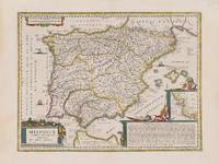
1662réf. 200014AG1662. Amsterdam Janssonius c.1662. Original hand-coloured copper engraving. Plate Size: 49.2 cm x 37 cm. Sheet Size: 59.8 cm x 45 cm. Original map. Very good condition. Faint hint of foxing along left fore edge. Centre fold as issued. Latin text on reverse. Koeman I 6000H:1.2. Border with longitudinal and latitudinal information. A richly detailed and very interesting map showing Roman Hispania - the Iberian Peninsula and the Balearic Islands. The three Ancient Roman provinces organised by the emperor Augustus of Hispania Citerior et Tarraconensis Hispania Baetica and Lusitania Hispania are shown on the map. Northern tip of Africa 'Hispania Transfretana Sive Tingitana Qua et Mauritania' pictured also. Relief shown pictorially with rivers mountains and significant towns and cities depicted. Large decorative cartouche with finely detailed Classical allusions in lower right section of map contains an inset box showing the coastal area around 'Gades' Cadiz. Cartouche also lists numerous place names of uncertain location in Latin. Bar-scales within cartouche in top right corner of the map. Decorative title cartouche in lower left corner. Three ships are also pictured suggesting the region's maritime importance. 'Mare Mediterraneum Internum' and 'Ocean Atlanticus Quod et Mare Hesperium Vespertinum Occiduum et Externum' are also listed. Abraham Goos 1590 c. 1643 was a Dutch cartographer publisher and engraver. He made globes maps of North America a comprehensive map of European coastlines and the first printed Hebrew language map of The Holy Land. His first teacher was Jodocus Hondius 15631612 a renowned map-maker whose son-in-law was Johannes Janssonius. After Hondius died his son-in-law Jan Janssonius took over Hondius's business and continued the partnership with Goos. One of Hondius' specialties was the manufacture of globes and Goos and Janssonius continued this regularly modifying them as more geographical information became available. In 1616 he published Nieuw Nederlandtsch Caertboeck an atlas of the Seventeen Provinces in 23 maps and one of the first atlases of the Netherlands; Johannes Janssonius 1588-1664 was a renowned geographer and publisher of the seventeenth century when the Dutch dominated map publishing in Europe. unknown
réf. 0265337313.Ghardcover. Good. Access codes and supplements are not guaranteed with used items. May be an ex-library book. hardcover
réf. 1332678904.Gpaperback. Good. Access codes and supplements are not guaranteed with used items. May be an ex-library book. paperback
réf. 0666172811.Ghardcover. Good. Access codes and supplements are not guaranteed with used items. May be an ex-library book. hardcover
réf. 1333176155.Gpaperback. Good. Access codes and supplements are not guaranteed with used items. May be an ex-library book. paperback
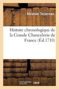
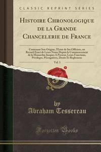
réf. ria9782019696665_inpPaperback. New. New Book; Fast Shipping from UK; Not signed; Not First Edition; Histoire chronologique de la Grande Chancelerie de France . Tome premier contenant son origine l'estat de ses officiers un recueil exact de leurs noms depuis le commencement de la monarchie jusques à présent leurs fonctions. Par A paperback
réf. 0365858757.Gpaperback. Good. Access codes and supplements are not guaranteed with used items. May be an ex-library book. paperback
réf. 0366362305.Ghardcover. Good. Access codes and supplements are not guaranteed with used items. May be an ex-library book. hardcover
réf. 1390122328.Ghardcover. Good. Access codes and supplements are not guaranteed with used items. May be an ex-library book. hardcover
réf. 0260978027.Ghardcover. Good. Access codes and supplements are not guaranteed with used items. May be an ex-library book. hardcover
réf. 026664712X.Gpaperback. Good. Access codes and supplements are not guaranteed with used items. May be an ex-library book. paperback
réf. 1390093735.Gpaperback. Good. Access codes and supplements are not guaranteed with used items. May be an ex-library book. paperback
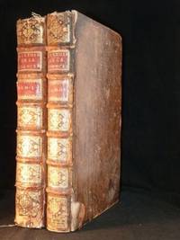
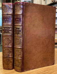
1710réf. 42386à Paris: Chez Pierre Emery 1710. Fine. Chez Pierre Emery à Paris 1710 26 x 38.50 cm 2 volumes reliés New expanded edition the first in two volumes with important tables published at the Chancellor's request. The original first appeared in 1676; it was continued in this edition by René Le Comte for the supporting documents for the period 1676-1705 furthermore the material compiled by Tessereau was entirely reworked for this new edition. Contemporary full brown sheep binding. Spine with six raised bands decorated with gilt compartments and fleurons as well as red morocco title and volume labels. All edges speckled red. Spine worn lacking headcaps and with losses to the sheep. Scuffing and corners slightly bumped. Contemporary bookplate pasted on pastedowns. Major source on the history of the Chancellery in France; this institution as ancient as the monarchy was formed by the body of chancellors such as the chancellor the keeper of the seals the great auditors secretaries of the king of the grand college the treasurers controllers wax-heaters and other officers the chancellery being today nothing more than the ministry of justice. Tessereau assembled a collection of precious documents for the historian on the officers of the chancellery their functions and prerogatives on the various chancelleries in the kingdom. It is more a compilation and publication of documents than a historian's work but the work is no less important. Chez Pierre Emery hardcover
réf. 1143253116.Gpaperback. Good. Access codes and supplements are not guaranteed with used items. May be an ex-library book. paperback
réf. 2019696665.Gpaperback. Good. Access codes and supplements are not guaranteed with used items. May be an ex-library book. paperback
réf. 2329018398.Gpaperback. Good. Access codes and supplements are not guaranteed with used items. May be an ex-library book. paperback
réf. 2013085362.Gpaperback. Good. Access codes and supplements are not guaranteed with used items. May be an ex-library book. paperback
1685réf. 74414Paris: Chez Federic Leonard 1685. 8vo. Two volumes French text. xxx 542 ; iv 543-686 78 table des matieres 16 memoire 8 preface table des chapitres 184 examen pp. Full sheepskin with raised bands morocco title-labels and a decorative gilt-tooled spine. Red edges & marbled endpapers. Head and tail reinforced with paper repair extremities have been coloured. Overall in very good shape with minor cracks to spine and occasional small marks or dents. Bindings solid. Stamp of the Broussonnet Library to title-pages and two further small ink inscriptions to title and verso of ffep of vol. 1. Bookplate residue to endpapers. Generally pleasant and clean internally especially vol. 1 with some occasional foxing and toning as to be expected. Decorative headpieces/ tailpieces and initials. Vol. 2 contains 'Examen de La Liberte Originaire de Venise' translated from the Italian. . Very Good. Full Sheep. Revised and Corrected. 1685. Chez Federic Leonard 1685 unknown