22 613 résultats
réf. #[61003]Leyden Cornelis de Pecker 1766. Later extended edition. Plano oblong 6 loose sheets. Good condition edges slightly frayed. On title page in ink: 'tot 11 January 1766': possibly written by Ryckhuysen. Signed at the last heraldic sheet by G. van Ryckhuysen. 43 x 56 cm. Title printed in black and red in an ornamental border 1 large engraved dedication with large city-ams of Leiden 4 sheets with in total 775 coats-of-arms until 1766 1 pag. register. HP11 unknown
réf. #[61000]Leyden C. Heyligert en A. en J. Honkoop 1785. Later extended edition. Plano oblong 6 loose sheets. Good condition. 43 x 56 cm. Title printed in black and red in an ornamental border 1 large engraved dedication with large city-ams of Leiden 4 sheets with in total 791 coats-of-arms 1 pag. register. HP10 unknown
réf. 61001Leyden Cornelis de Pecker 1758. First edition. Plano oblong 6 loose sheets. Good condition edges slightly frayed. Signed at the last heraldic sheet by G. van Ryckhuysen. 43 x 56 cm. Title printed in black and red in an ornamental border 1 large engraved dedication with large city-ams of Leiden 4 sheets with in total 755 coats-of-arms 2 pag. register. HP11 unknown
réf. 185284406X.Gpaperback. Good. Access codes and supplements are not guaranteed with used items. May be an ex-library book. paperback
réf. 1852846143.Gpaperback. Good. Access codes and supplements are not guaranteed with used items. May be an ex-library book. paperback
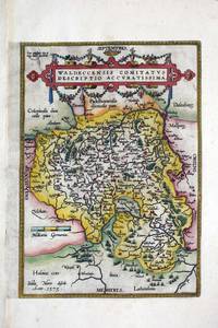
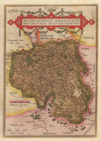
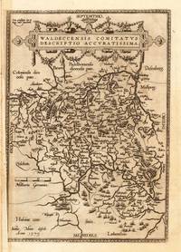
réf. 8324Antwerp: c.1580. No binding. Good. 315 x 225 mm. in recent wash colour good condition. This map was first published in the Latin edition of Abraham Ortelius' 'Theatrum Orbis Terrarum' in 1579 the first modern atlas of the world. This is the right half of a folio sheet map which depicts the region of Waldeck derived from Justus Meurs' six-sheet map of the region published in 1572. Van den Broecke 98b; Meurer p. 202. c.1580 unknown
réf. 2260313Contentum Ltd. Loose sheet. New. High-quality art print based on an original work from the Rijksmuseum. Created in the 17th century 1684. Professionally printed on premium fine-art paper Museum Etching museum quality in size A3. The artwork is printed with a white border museum-style presentation. Contentum Ltd. unknown
1584réf. 10309Antwerpen: Platin 1584. In sehr gutem Erhaltungszustand. 31.3 x 223 cm 12.25 x 875 inches. Hand-Colored Original Copperplate Engraving by Abraham Ortelius depicting Waldeccensis Comitatus Descriptio Accuratissima. Published Antwerpen Platin 1584. Sheet: 31.3 x 223 cm 12.25 x 875 inches. A fine and original hand-colored example of Ortelius's celebrated cartographic work documenting this region of Germany with the precision and decorative artistry characteristic of the 15800s. Abraham Ortelius 1527-1598 was a Flemish cartographer and geographer from Antwerp widely regarded as the creator of the first modern atlas. His landmark publication Theatrum Orbis Terrarum 1570 set the standard for atlas-making for the next century presenting uniform copper-engraved maps with scholarly commentary. By Ortelius's death the Theatrum had appeared in 25 editions in seven languages. In 1575 King Philip II of Spain appointed him Royal Geographer. His maps engraved with extraordinary precision are among the most sought-after in antique cartography held in collections including the Plantin-Moretus Museum in Antwerp the Library of Congress and the British Library.This original copperplate engraving with original hand coloring depicts the region of Waldeccensis Comitatus Descriptio Accuratissima published in Antwerpen Platin 1584. The map records the political and geographic boundaries of the region as understood in 1584 offering a fascinating window into the history of German territorial organization. Sheet measures 31.3 x 223 cm 12.25 x 875 inches. Professionally restored; the image area is fully intact and displays well. Retains its original contemporary hand coloring. Ready to frame. Broe. 98 b; Koeman Ort. 21; Platin unknown
1608réf. 11191Antwerpen: Juan B. Vrients 1608-12. In sehr gutem Erhaltungszustand. 31.3 x 223 cm 12.25 x 875 inches. Hand-Colored Original Copperplate Engraving by Abraham Ortelius depicting Waldeccensis Comitatus Descriptio Accuratissima. Published Antwerpen Juan B. Vrients 1608. Sheet: 31.3 x 223 cm 12.25 x 875 inches. A fine and original hand-colored example of Ortelius's celebrated cartographic work documenting this region of Germany with the precision and decorative artistry characteristic of the 16000s. Abraham Ortelius 1527-1598 was a Flemish cartographer and geographer from Antwerp widely regarded as the creator of the first modern atlas. His landmark publication Theatrum Orbis Terrarum 1570 set the standard for atlas-making for the next century presenting uniform copper-engraved maps with scholarly commentary. By Ortelius's death the Theatrum had appeared in 25 editions in seven languages. In 1575 King Philip II of Spain appointed him Royal Geographer. His maps engraved with extraordinary precision are among the most sought-after in antique cartography held in collections including the Plantin-Moretus Museum in Antwerp the Library of Congress and the British Library.This original copperplate engraving with original hand coloring depicts the region of Waldeccensis Comitatus Descriptio Accuratissima published in Antwerpen Juan B. Vrients 1608-12. The map records the political and geographic boundaries of the region as understood in 1608-12 offering a fascinating window into the history of German territorial organization. Sheet measures 31.3 x 223 cm 12.25 x 875 inches. In good condition overall with minor signs of age appropriate for a 17th-century engraving. Minor defects: centerfold as issued. Ready to frame. Broe. 98b; Juan B. Vrients unknown
réf. 0886874726New. paperback. New. Satisfaction Guaranteed or your money back. paperback
1990réf. Q-0886874726Topper Books 1990-01-01. Paperback. New. In shrink wrap. Looks like an interesting title! Topper Books paperback
réf. 3384382412.Ghardcover. Good. Access codes and supplements are not guaranteed with used items. May be an ex-library book. hardcover
2010réf. BN199431Kessinger Publishing LLC 2010. 2010. Softcover. Waare Oeffening Der Planten Waar In De Rechte Aart Natuire En Verborgene Eigenschappen Der Boomen Heesteren Kruiden Ende Bloemen 1682 Waare Oeffening Der Planten Waar In De Rechte Aart Natuire En Verborgene Eigenschappen Der Boomen Heesteren Kruiden Ende Bloemen 1682 Abraham Munting Kessinger Publishing, LLC paperback
réf. 1167245652.Gpaperback. Good. Access codes and supplements are not guaranteed with used items. May be an ex-library book. paperback
réf. 1120953294.Gpaperback. Good. Access codes and supplements are not guaranteed with used items. May be an ex-library book. paperback
réf. 194838Contentum Ltd. Loose sheet. New. Contentum Ltd. unknown
réf. 194839Contentum Ltd. Loose sheet. New. Contentum Ltd. unknown
réf. 194837Contentum Ltd. Loose sheet. New. Contentum Ltd. unknown
réf. 194836Contentum Ltd. Loose sheet. New. Contentum Ltd. unknown
réf. 59-2640Vischer ca. 17th cent. Original engraving on laid paper. 20 x 16 inches. Vischer, ca. 17th cent. unknown
2018réf. x-0567683613Bloomsbury T & T Clark 2018. Paperback. New. 224 pages. 9.25x6.00x0.50 inches. Bloomsbury T & T Clark paperback
réf. 0483245968.Ghardcover. Good. Access codes and supplements are not guaranteed with used items. May be an ex-library book. hardcover
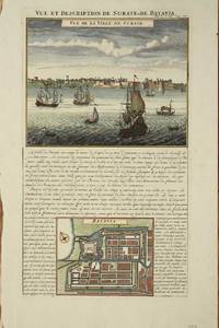
réf. 8616Amsterdam: c.1715. No binding. Good. 375 x 220 mm. with recent wash colour in good condition. With a fine view of the harbour and town of Surate on the northwest coast of India along with a plan of Batavia Jakarta the present-day capital of Indonesia. Surate was an English trading post in India the first. Batavia became the capital of the Dutch East India Company. At this point in time the Dutch dominated the trade in the Spice Islands of the East Indies. c.1715 unknown
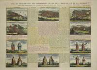
réf. 9205Amsterdam: c.1715. No binding. Very Good. 375 x 495 mm. recent full wash colour in good condition. This plate focuses on Armenia and illustrates five key towns including Tiblsi and five further vignettes of costumes. It was published in the fifth volume of the encyclopaedic atlas by Henri Abraham Chatelain 1684-1743 entitled 'Atlas Historique ou Nouvelle Introduction a l'Histoire a la Chronologie & a la Geographie'. It was issued from 1705 to 1720 in 7 volumes. Koeman II p. 33; Phillips 579; Shirley 'Atlases in the BL' T.Chat-1a; Van Waning 'Chatelain's Atlas Historique' in IMCoS Journal 120 pp. 7-15. c.1715 unknown
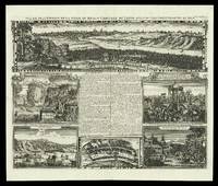
1417réf. 15862Amsterdam 1714-1720. 437 by 519mm. 17.25 by 20.5 inches. Engraved sheet with five views and a plan. A folio sheet with five views and one plan of locations in Japan from Henri Abraham Chatelain's 'Atlas Historique'. The French text in the middle described the cities of Kyoto and Tokyo. The views are of Kyoto the Dutch settlement of Deshima two views of the town and temple Sakai a Japanese marriage ceremony and the persecution of Christian martyrs. Deshima was the base of the Dutch East India Company and one of the few areas in which European traders were allowed during the sakoku period. The 'Atlas Historique' was an ambitious work covering genealogy cosmography topography heraldry and chronology. unknown