3 202 résultats
1978Slight wear to DJ. Corners slightly bumped. ; One of the world's great cities in great historical detail; B&W Illustrations; 8vo; 272 pages
1969Small inscription on front end paper. No other marks or inscriptions. A lovely clean very tight copy with bright unmarked yellow cloth boards and no bumping to corners. Price clipped dust jacket not marked with a little faint creasing and a nick to upper rear edge. 144pp. A history of Edinburgh aimed mainly at the younger reader.
1907Boards with light rubbing to extremities. Endpapers browned. Minor spotting to fore edge and bottom edge. Front hinge has a bit of play; 21 tissue guarded plates from watercolors by John Fulleylove ; Ex-Library; 8vo 8" - 9" tall; 175 pages
2008No marks or inscriptions. No creasing to covers or to spine. A very clean very tight copy with bright unmarked boards and bumping to lower rear corner. 176pp. Essentially a book of lovely photographs presenting an up-to-date picture of the Scottish capital accompanied by a short history.
1947Edinburgh, both past and present (in the famous series of books published by Batsford covering most placces in Britain) 112p. plates. index map & illus on endpapers (Previous owner inscription on ffep) Book
1912207p., illus. 24 tipped-in color plates Hardcover Good condition
réf. 1022124986.Gpaperback. Good. Access codes and supplements are not guaranteed with used items. May be an ex-library book. paperback
réf. 1020882786.Ghardcover. Good. Access codes and supplements are not guaranteed with used items. May be an ex-library book. hardcover
réf. 46301189like new. unknown
1851réf. 200139AG1851. London & New York John Tallis & Company 1851. Large Original steel engraving / Vintage map. Drawn and engraved by John Rapkin. Illustrated and Engraved by D. Pound. Plate Size: 51 cm x 36.5 cm. Sheet Size: 51.5 cm x 37.2 cm. Vintage 19th century map / city-plan in very good condition. This Map is beautifully framed. Price includes worldwide free shipping per UPS Courier Framed. Published in the Illustrated Atlas And Modern History Of The World Geographical Political Commercial & Statistical Edited By R. Montgomery Martin. Handsome town-plan of Edinburgh in Scotland. The The Water of Leith can be seen running through Scotland's capital city. Railways street and district areas of the city are also included. The Salisbury Crags Carlton Hill and the Castle Rock are all shown. Decorative scrolling and title cartouche around the edges of the map. One of the few double page plans published by Tallis. The project of 'The Illustrated Atlas' was designed to be finished just in time for the anxiously awaited "Great Exhibition of the Works of Industry of All Nations" or The Great Exhibition sometimes referred to as the Crystal Palace Exhibition in reference to the temporary structure in which it was held was an international exhibition that took place in Hyde Park London from 1 May to 11 October 1851. It was the first in a series of World's Fairs exhibitions of culture and industry that became popular in the 19th century and it was a much-anticipated event. The Great Exhibition was organized by Henry Cole and Prince Albert husband of the reigning monarch Queen Victoria. It was attended by numerous notable figures of the time including Charles Darwin Samuel Colt members of the Orléanist Royal Family and the writers Charlotte Brontë Charles Dickens Lewis Carroll George Eliot and Alfred Tennyson. Music for the opening was under the direction of Sir George Thomas Smart and the continuous music from the exhibited organs for the Queen's procession was "under the superintendence of William Sterndale Bennett". Wikipedia unknown
réf. RGW20169Steel engraving large margins a little foxing unknown
2013Book in as new condition. The history of Edinburgh's Airport which began life as a military airfield in 1916 until after the Second World War when Edinburgh Corporation took it over to operate civilian flights. It was not fully demilitarised until 1960. Very well illustrated.
1974Previous owner's inscription inside. Approx. 40 pages; full of b&w photos. Staple-bound. A bit musty smelling. Oblong. Staple-bound.
1960No marks or inscriptions. No creasing to covers. A very clean very tight booklet with bright unmarked boards and no bumping to corners. 31pp. An illustrated guide with the story of Edinburgh Castle through the centuries.
19601st edition. VG pbk. 18363. eng
196032 pages, illustrated, crease to front cover. eng
196032 pages, illustrated, plan eng
1975Booklet in mint condition. 37pp. Guide to Edinburgh Castle.
1963Two fine unused publications in their original as-delivered well-scuffed envelope, dated 1963. No marks or inscriptions. No creasing to covers or to spines. Very clean crisp very tight booklets with bright unmarked boards and no bumping to corners. One booklet has a trace of foxing to rear. Fold-out map inside rear cover in perfect condition. 88 + 96pp.
19874to., First Edition, with a coloured frontispiece and very numerous monochrome photographs (a number full-page) in the text; original photographic wrappers, a very good, bright, clean copy.
1975Near fine/neaar fine (price clipped dj lightly rubbed at corners, neat signature front free endpaper else all clean tight and bright without fault) octavo 287pp. History of Edinburgh tracing its development as a town and also detailing many of the famous and interesting people who lived within its limits. 27 b/w plates, plan, and illustrated endpapers.
19478vo., First Edition, with coloured frontispiece, 3 coloured plates, 109 monochrome plates on 64, a double-page map and endpaper maps; pale blue cloth, backstrip lettered in darker blue, a near fine copy in unclipped dustwrapper. Published in Batsford's fine 'British Towns and Cities' series.
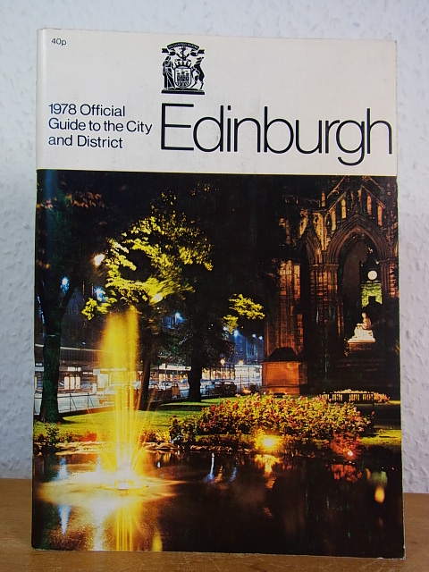
1978réf. 115219The City of Edinburgh District Council, 1978. 21 cm ; broschiert
198712 pages, illustrated. eng
1987271 pages, illustrated, maps. eng