William Shakespeare; Peter Holland [ed]Biblio.com
13.666 resultados
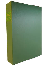
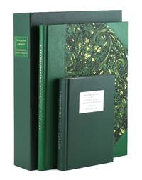
2008ref. 34064London: Folio Society / Oxford University Press 2008. Fine. London: Folio Society / Oxford University Press 2008. First "Letterpress Shakespeare" Edition Limited to 3750 copies of which this is no. 607. Two volumes; folio and octavo; folio volume bound in three-quarter green morocco over marbled paper-covered boards gilt-lettered spine; octavo volume bound in green gilt-lettered cloth; the set housed in original green cloth clamshell box; 82; ix12751pp. A Fine set. Folio Society / Oxford University Press unknown
2008ref. 010081London: The Folio Society 2008. The Folio Society Letterpress edition of A Midsummer Night's Dream Limited to 3750 hand-numbered copies. Edited by Peter Holland. This copy is numbered 772. The concept of the Folio Society's Letterpress Shakespeare is that Shakespeare's text be magnificently printed from the latest "Oxford Shakespeare" edition under the general editorship of Stanley Wells in a fine large folio attractively bound in green half-goatskin with marbled-paper sides. The introduction and commentary are reserved to a separate specially-bound commentary volume so that the text-volume remains uncluttered and harmonious. The volume containing the original text comes hand-bound in green Nigerian goatskin leather. In a half leather binding. blocked in gold with hand-marbled paper sides. Gilded top edge and matching green ribbon page marker. Printed in 16 point 'Monotype' Baskerville with Caslon display Set in hot metal and printed by letterpress on Zerkall mould-made paper. The volume measures 10 X 14 inches. The commentary volume which includes the text of the play with full explanatory notes is bound in green buckram and measures 7.5 X 5.75 inches. Both volumes are housed in a Solander presentation box also bound in green buckram with a green leather gilt lettered title label. Measuring 15.25 X 11 X 2.75 inches. Number 772 of 3750 copies. Both volumes and the Solander box are all in fine condition. . Limited Edition. Hard Cover. Fine/No Jacket. The Folio Society Hardcover
2008ref. 147829London: Folio Society 2008. First Edition; First Printing. Hardcover. Fine in a Fine slipcase. Hand marbled boards bound with Nigerian goat skin. Number 1455 of 3750 numbered copies. Folio Society hardcover
2008ref. 34064London: Folio Society / Oxford University Press 2008. Fine. London: Folio Society / Oxford University Press 2008. First "Letterpress Shakespeare" Edition Limited to 3750 copies of which this is no. 607. Two volumes; folio and octavo; folio volume bound in three-quarter green morocco over marbled paper-covered boards gilt-lettered spine; octavo volume bound in green gilt-lettered cloth; the set housed in original green cloth clamshell box; 82; ix12751pp. A Fine set. Folio Society / Oxford University Press unknown books
ref. 1469649438.Gpaperback. Good. Access codes and supplements are not guaranteed with used items. May be an ex-library book. paperback
2018ref. x-1469649438Univ of North Carolina Retired 2018. Paperback. New. 397 pages. 10.75x8.50x1.00 inches. Univ of North Carolina Retired paperback
2013ref. Q-0071829792McGraw-Hill Education 2013-11-13. Hardcover. New. In shrink wrap. Looks like an interesting title! McGraw-Hill Education hardcover
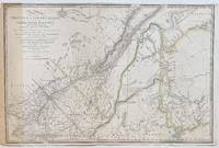
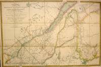
1840ref. 3208221840. Map. Outline color. 22 1/2 x 34 1/8 inches. Important map of the Lower Province of Canada Quebec and Maine. Based on the surveys done by Holland in the 18th c. The map mentions the Treaty of Peace between the US and Britain included the setting of the boundary between the two nations on the River Saint Croix. Samuel Johannes Holland was a Dutch-born Royal Engineer and first Surveyor General of British North America. James Wyld Senior 1790-1836 was a distinguished British mapmaker known for producing maps and globes. He served as Geographer to George IV and William IV. Map shows some offsetting. Some verso reinforcements along original folds. Minor spotting and edge wear dampstains and toning. Otherwise in good condition. This lovely map of is a fine example of his work. unknown
1840ref. M2717London: Wyld James 1840. Very Good. Size : 570x868 mm 22.44x34.17 Inches Coloring: Original Hand Coloring Category: Maps Canada East Quebec; Maps Canada East New Brunswick; Maps United States New England States; Wyld, James unknown
1840ref. 3208221840. Map. Outline color. 22 1/2 x 34 1/8 inches. Important map of the Lower Province of Canada Quebec and Maine. Based on the surveys done by Holland in the 18th c. The map mentions the Treaty of Peace between the US and Britain included the setting of the boundary between the two nations on the River Saint Croix. Samuel Johannes Holland was a Dutch-born Royal Engineer and first Surveyor General of British North America. James Wyld Senior 1790-1836 was a distinguished British mapmaker known for producing maps and globes. He served as Geographer to George IV and William IV. Map shows some offsetting. Some verso reinforcements along original folds. Minor spotting and edge wear dampstains and toning. Otherwise in good condition. This lovely map of is a fine example of his work. unknown books
ref. 3841712991.Gpaperback. Good. Access codes and supplements are not guaranteed with used items. May be an ex-library book. paperback
1976ref. C206468London: Holland & Holland 1976. Paperback . Very Good. 2 vols. Quartos. Collection and history volume and facsimile of the 1910-2 catalogue volume in maroon card folder. Each with slight bump to corner folder slightly edge worn otherwise near very good indeed. Holland & Holland, paperback
1976ref. 20399Holland & Holland. 1976. Paperback. Very Good-. Bound in a softbound folder with paper covers. Some wear to the edges of the covers and one small tear to the paper at the top of the spine. Two soft bound books are in the paper enveolpe inside the pockets of the covers. . Holland & Holland paperback
1976ref. 60-53London: Holland & Holland 1976. 1976. 71p. Photos. Line drawings. Large Wraps. In Original burgundy folder with Facsimile Reprint of the 1910-1912 Catalogue 72p. Both Fine Copies. Large Paperback. Fine. London: Holland & Holland, 1976. Paperback
1985ref. 253134OH: Willowisp 1985. Softcover. Illustrated by Don Robison. Fine in wrappers an as new paperback copy. Pages and cover are clean. Willowisp unknown books
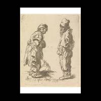
ref. 698243Contentum Ltd. Loose sheet. New. High-quality art print based on an original work from the Ycba. Created in the 18th century 1755. Professionally printed on premium fine-art paper Photo Matt Fibre in size A2. The artwork is printed with a white border museum-style presentation. Contentum Ltd. unknown
ref. 698242Contentum Ltd. Loose sheet. New. High-quality art print based on an original work from the Ycba. Created in the 18th century 1755. Professionally printed on premium fine-art paper Museum Etching museum quality in size A3. The artwork is printed with a white border museum-style presentation. Contentum Ltd. unknown
ref. 698245Contentum Ltd. Loose sheet. New. High-quality art print based on an original work from the Ycba. Created in the 18th century 1755. Professionally printed on premium fine-art paper Museum Etching museum quality in size A2. The artwork is printed with a white border museum-style presentation. Contentum Ltd. unknown
ref. 698244Contentum Ltd. Loose sheet. New. High-quality art print based on an original work from the Ycba. Created in the 18th century 1755. Professionally printed on premium fine-art paper Photo Rag Bright White premium quality in size A2. The artwork is printed with a white border museum-style presentation. Contentum Ltd. unknown
1969ref. 70990Veenman & Zoenen, Wageningen 1969. 47 S. mit Abbildungen und in 3 Tasche beiliegenden mehrfach gefalteten Karten, Groß 8°, Original-Karton (Softcover), Bibliotheks-Exemplar (ordnungsgemäß entwidmet) mit kleinem Papier-Rückenschild, Stempel auf Titel, Einband leicht knitterig, insgesamt gutes und innen sauberes Exemplar,
1989ref. RHOLPIC00drpHolland House 1989. Fine. Holland Dave. A Pictorial History of The Lone Ranger: From Out of the Past. Granada Hills CA: Holland House 1989. 1st edition. 444pp. Indexed. Illustrated. Bibliography. Oblong 4to. Brown pebbled leather with gilt lettering. Book condition: Near fine. Dust Jacket Condition: Near fine. In DJ protector. From the TV show to comics and everything in between this books has it all for any fan of The Lone Ranger and the people who brought him to life. Holland House hardcover
1989ref. RHOLPIC00drpHolland House 1989. Fine. Holland Dave. A Pictorial History of The Lone Ranger: From Out of the Past. Granada Hills CA: Holland House 1989. 1st edition. 444pp. Indexed. Illustrated. Bibliography. Oblong 4to. Brown pebbled leather with gilt lettering. Book condition: Near fine. Dust Jacket Condition: Near fine. In DJ protector. From the TV show to comics and everything in between this books has it all for any fan of The Lone Ranger and the people who brought him to life. Holland House hardcover books
1779ref. 33200London 1779. Engraved and aquatint map period hand colouring. 14 lettered references large inset with title as above. Rare revolutionary chart of the Hudson River showing the American defenses on the eve of the Battle of Fort Montgomery. On October 6 1777 a British force led by Lieutenant General Sir Henry Clinton attacked Forts Montgomery and Clinton from the landward side where the American defenses were only partially completed. Support from cannon fire from British ships on the Hudson River that had passed through the chevaux de frise on the lower river. By the end of the day both forts had fallen to the British who burned the forts and tore down the stonework buildings. However the battle was a pyrrhic victory for the British. The campaign against the forts caused delays in reinforcing General John Burgoyne at Saratoga where Americans forced the British surrender ten days later at the Battle of Saratoga before Clinton's forces could arrive. The present map which depicts the Forts and the River defenses prior to the battle is from The Atlantic Neptune the finest large scale sea atlas of the United States and Canadian Atlantic coastline ever produced. The maps in the atlas were produced over a seven-year period 1775-82 and are well known for their accurate portrayal of various sounds bays bars harbors as well as navigational hazards. This atlas was used extensively by the Royal Navy during the American Revolution. Des Barres studied under the great mathematician Daniel Bernoulli at the University of Basel before continuing on to the Royal Military College at Woolwich. On the outbreak of the Seven Years war in 1756 he joined the British Royal American Regiment as a military engineer. He came to the attention of General James Wolfe who appointed him to be his aide-de-camp. From 1762 Des Barres was enlisted to survey the coastlines of Nova Scotia Newfoundland and the Gulf of St.Lawrence while his colleague Samuel Holland charted the New England coast and further south. In 1774 Des Barres returned to England where he began work on the Neptune. His dedication to the project was so strong that often at his own expense he continually updated and added new charts and views up until 1784. That year he returned to Canada where he remained for a further forty years becoming a senior political figure and a wealthy land owner and living to the advanced age of 103. The Atlantic Neptune was the first British sea atlas of her North American colonies and one of the most important achievements of eighteenth century cartography. With an official commission from the Royal Navy Des Barres published the first volume in London in 1775 which was soon followed by further volumes. Des Barres' monumental endeavor eventually featured over two-hundred charts and aquatint views many being found in several states. All of the charts were immensely detailed featuring both hydrographical and topographical information. The Neptune met with the highest acclaim from the beginning and is today widely regarded as superior to all other atlases produced during its time. Henry Stevens identified only a single state of this chart issued coloured or uncoloured which appeared in some examples volume four part two of the Atlantic Nepture; the map however is not listed in the engraved list of maps for that section and given the rarity was likely not issued in all copies. National Maritime Museum: Henry Stevens Collection: HNS156; Cf. Phillips Atlases 1198; Hornsby Surveyors of Empire: Samuel Holland J.F.W. Des Barres and the Making of the Atlantic Neptune 2011. unknown
1779ref. 33200London 1779. Engraved and aquatint map period hand colouring. 14 lettered references large inset with title as above. Rare revolutionary chart of the Hudson River showing the American defenses on the eve of the Battle of Fort Montgomery. On October 6 1777 a British force led by Lieutenant General Sir Henry Clinton attacked Forts Montgomery and Clinton from the landward side where the American defenses were only partially completed. Support from cannon fire from British ships on the Hudson River that had passed through the chevaux de frise on the lower river. By the end of the day both forts had fallen to the British who burned the forts and tore down the stonework buildings. However the battle was a pyrrhic victory for the British. The campaign against the forts caused delays in reinforcing General John Burgoyne at Saratoga where Americans forced the British surrender ten days later at the Battle of Saratoga before Clinton's forces could arrive. The present map which depicts the Forts and the River defenses prior to the battle is from The Atlantic Neptune the finest large scale sea atlas of the United States and Canadian Atlantic coastline ever produced. The maps in the atlas were produced over a seven-year period 1775-82 and are well known for their accurate portrayal of various sounds bays bars harbors as well as navigational hazards. This atlas was used extensively by the Royal Navy during the American Revolution. Des Barres studied under the great mathematician Daniel Bernoulli at the University of Basel before continuing on to the Royal Military College at Woolwich. On the outbreak of the Seven Years war in 1756 he joined the British Royal American Regiment as a military engineer. He came to the attention of General James Wolfe who appointed him to be his aide-de-camp. From 1762 Des Barres was enlisted to survey the coastlines of Nova Scotia Newfoundland and the Gulf of St.Lawrence while his colleague Samuel Holland charted the New England coast and further south. In 1774 Des Barres returned to England where he began work on the Neptune. His dedication to the project was so strong that often at his own expense he continually updated and added new charts and views up until 1784. That year he returned to Canada where he remained for a further forty years becoming a senior political figure and a wealthy land owner and living to the advanced age of 103. The Atlantic Neptune was the first British sea atlas of her North American colonies and one of the most important achievements of eighteenth century cartography. With an official commission from the Royal Navy Des Barres published the first volume in London in 1775 which was soon followed by further volumes. Des Barres' monumental endeavor eventually featured over two-hundred charts and aquatint views many being found in several states. All of the charts were immensely detailed featuring both hydrographical and topographical information. The Neptune met with the highest acclaim from the beginning and is today widely regarded as superior to all other atlases produced during its time. Henry Stevens identified only a single state of this chart issued coloured or uncoloured which appeared in some examples volume four part two of the Atlantic Nepture; the map however is not listed in the engraved list of maps for that section and given the rarity was likely not issued in all copies. National Maritime Museum: Henry Stevens Collection: HNS156; Cf. Phillips Atlases 1198; Hornsby Surveyors of Empire: Samuel Holland J.F.W. Des Barres and the Making of the Atlantic Neptune 2011. unknown books
2018ref. 1-1887752935Fons Vitae 2018. Paperback. New. tra blg edition. 208 pages. 8.75x5.75x1.00 inches. Fons Vitae paperback