11.078 resultados
2005ref. 1411552New York: W.W. Norton & Company 2005. First edition. Hardcover. Octavo Volume One only: lxviii 435 pages. In Very Good condition with a Very Good dust jacket. Spine is illustrated with black and white print on red banner. Boards in red cloth. This is volume 1 of the 8-volume set titled “The Presidential Recordings Lyndon B. Johnson”. This is the first volume of the 3-volume subset comprising the title “The Kennedy Assassination and the Transfer of Power”. The ISBN is for the 3-volume subset. NOTE: Shelved in Netdesk Column BB. 1411552. FP New Rockville Stock. W.W. Norton & Company hardcover books
1976ref. 475335Princeton NJ : Princeton University Press 1976. First Edition. Hardcover. Very good copy in the original gilt-blocked tan cloth boards slightly scuffed and with light wear to the panel edges and endbands. Edges and prelims slightly foxed with the interior remaining tight bright and clean. A well-preserved example overall. Physical description; 1019 pages ; 28 cm. Subjects; Classical antiquities – Encyclopedias. Excavations Archaeology – Encyclopedias. Historic sites – Encyclopedias. Cities and towns Ancient – Encyclopedias. Archaeology. Greece – Antiquities. Rome – Antiquities. Princeton, NJ : Princeton University Press hardcover
2017ref. x-0691654204Princeton University Press 2017. Hardcover. New. 1068 pages. 11.00x8.50x2.36 inches. Princeton University Press hardcover
1976ref. 33609Princeton University Press. Very Good in Good dust jacket. Hardcover. Light bump to 1 corner. Light wear to base of spine. Front endpaper tanned. Very Minor shelfwear to book. Former owner's name in pencil to ffep. Dustjacket has edgewear with chipping and small tears. DJ spine slightly sunned.; One-volume source of information on sites that show remains from the Classical period. Starts from the mid eighth century B. C. Which marks the expansion of Classical culture to the west with the Hellenic colonization of Sicily and South Italy and to the eastern shore of the Aegean. Ends with the Sixth century CE but excludes Early Christian sites of the fourth and fifth centuries.; 1019 pages . 1976. 0691035423 . Princeton University Press hardcover
2017ref. x-0691617104Princeton University Press 2017. Paperback. New. reprint edition. 1068 pages. 11.00x8.50x2.09 inches. Princeton University Press paperback
1981ref. LIFI00221New York: Dodd Mead & Company 1981 WYSIWYG pricing--no added shipping charge for standard shipping within USA. Review Copy. Quarter black cloth light grey paper-covered boards red foil titles on spine red endpapers xi 177 pp. Corners lightly bumped else fine. DJ has a 1 cm tear extremities lightly rubbed; in Brodart archival cover. Publisher's review slip giving date of publication as 21 Sept 1981 promotional letter & card and author's photo laid in. This is a novel about the wife of a Provisional IRA member who is jailed for bank robbery. She becomes a pawn "in a deadly game played by the police and the guerillas struggling for supremacy in the blood-stained streets of Belfast." Shipping weight 2 lbs. First Edition. . Near Fine/Near Fine. 23½ X 16 cm. Dodd, Mead & Company Hardcover
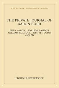
2026ref. LRB25047516Paris: Editions Recreasoft 2026 Language: English. Approximately 542 pages. English: Print-on-demand reprint. Original edition : 1903. Text in English. This volume presents the private journal of Aaron Burr one of the most controversial figures in early American history. Compiled and edited by William Holland Samson the text offers a unique insight into Burr's personal reflections political views and daily life. The edition was originally printed in a limited run of 250 copies for private distribution highlighting its rarity and historical significance. Book images are non-contractual. Editions Recreasoft. Softcover. New. Editions Recreasoft paperback
1964ref. 226148DLondon: Chapman and Hall 1964. Hardcover. Fine/Very Good. 29 b/w plates many diagrams within the text. 546 pages clean and clear. Clean white endpapers with previous owner's name in ink on both front and back paste-down endpapers. Grey cloth cover with gilt titles on the spine. White DJ with blue and grey titles. Spine slightly yellowed. FINE/VG Chapman and Hall hardcover
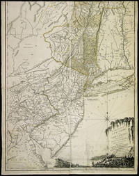
1776ref. 36226London: Printed for Robt. Sayer and John Bennett August 17 1776. Large and Detailed Map of Colonial North America Including Quebec and Montreal This famous map is one of the best for the provinces of New York and New Jersey during the colonial period. It is the fourth state described by McCorkle following versions published circa 1768 in 1775 and earlier in 1776. "The map includes western Connecticut and Massachusetts and most of Vermont. In 1775 the title became 'The Provinces of New York and New Jersey; with part of Pensilvania and the Province of Quebec'.Three insets were added in this state: A chart of the mouth of the Hudson River; A plan of the City of New York; Plan of Amboy.The following year the date changed to 1776. Later in the same year the title was extended to include 'Corrected and improved from the original materials by Govern.r Pownall' and Holland's rank was given as Major" - McCorkle. The present copy is the final version described by McCorkle. THE PROVINCES OF NEW YORK AND NEW JERSEY is in effect a large-scale map of the Hudson River and its tributaries including the Mohawk and settlement in New York is almost entirely confined to the banks of the Hudson and Mohawk rivers. The unexplored Adirondack County is left almost entirely blank with a lengthy notation that begins "Beaver Hunting Country of the Confederated Indians." Pennsylvania extends north into western New York state almost as far as the Mohawk Vermont is shown attached to New York with each existing township identified and the map extends north into Quebec beyond Montreal. Interesting notations on the country are scattered across the face of the map. For instance in Pennsylvania an area with little detail is simply noted as "endless mountains." The map is beautifully decorated with a pastoral title cartouche suggestive of the Hudson Palisades in the lower right corner. The map was created by Samuel Holland Surveyor General for the Northern District of North America. As a result of the French and Indian War 1755-63 Great Britain had acquired a new American Empire for which there were few adequate maps. Two new offices of surveyor general for the American colonies were established in 1763-64. The colonies were divided at the Potomac River into a northern and southern district and the respective surveyors appointed were Samuel Holland and Gerard De Brahm. Holland conceived of a general survey of North America east of the Mississippi to be based upon geodetic principles on a scale of one inch to one mile but work was interrupted in 1775 by the outbreak of the American Revolution. A very good copy of Holland's large and important map which includes western New England and portions of Quebec. Engraved map consisting of eight folio sheets backed on linen 54½ x 21¾ inches with contemporary color outlining and shading of some boundaries and geographic features. Slightly soiled occasional minor stains a few old repairs no loss of text. In a brown cloth slipcase. A very good copy. DEGREES OF LATITUDE fig. 21. PHILLIPS ATLASES 1166 number 17. McCORKLE 768.3 775.6 776.13. hardcover
1776ref. 36226London: Printed for Robt. Sayer and John Bennett August 17 1776. Large and Detailed Map of Colonial North America Including Quebec and Montreal This famous map is one of the best for the provinces of New York and New Jersey during the colonial period. It is the fourth state described by McCorkle following versions published circa 1768 in 1775 and earlier in 1776. "The map includes western Connecticut and Massachusetts and most of Vermont. In 1775 the title became 'The Provinces of New York and New Jersey; with part of Pensilvania and the Province of Quebec'.Three insets were added in this state: A chart of the mouth of the Hudson River; A plan of the City of New York; Plan of Amboy.The following year the date changed to 1776. Later in the same year the title was extended to include 'Corrected and improved from the original materials by Govern.r Pownall' and Holland's rank was given as Major" - McCorkle. The present copy is the final version described by McCorkle. THE PROVINCES OF NEW YORK AND NEW JERSEY is in effect a large-scale map of the Hudson River and its tributaries including the Mohawk and settlement in New York is almost entirely confined to the banks of the Hudson and Mohawk rivers. The unexplored Adirondack County is left almost entirely blank with a lengthy notation that begins "Beaver Hunting Country of the Confederated Indians." Pennsylvania extends north into western New York state almost as far as the Mohawk Vermont is shown attached to New York with each existing township identified and the map extends north into Quebec beyond Montreal. Interesting notations on the country are scattered across the face of the map. For instance in Pennsylvania an area with little detail is simply noted as "endless mountains." The map is beautifully decorated with a pastoral title cartouche suggestive of the Hudson Palisades in the lower right corner. The map was created by Samuel Holland Surveyor General for the Northern District of North America. As a result of the French and Indian War 1755-63 Great Britain had acquired a new American Empire for which there were few adequate maps. Two new offices of surveyor general for the American colonies were established in 1763-64. The colonies were divided at the Potomac River into a northern and southern district and the respective surveyors appointed were Samuel Holland and Gerard De Brahm. Holland conceived of a general survey of North America east of the Mississippi to be based upon geodetic principles on a scale of one inch to one mile but work was interrupted in 1775 by the outbreak of the American Revolution. A very good copy of Holland's large and important map which includes western New England and portions of Quebec. Engraved map consisting of eight folio sheets backed on linen 54½ x 21¾ inches with contemporary color outlining and shading of some boundaries and geographic features. Slightly soiled occasional minor stains a few old repairs no loss of text. In a brown cloth slipcase. A very good copy. DEGREES OF LATITUDE fig. 21. PHILLIPS ATLASES 1166 number 17. McCORKLE 768.3 775.6 776.13. hardcover books
ref. 1331089212.Gpaperback. Good. Access codes and supplements are not guaranteed with used items. May be an ex-library book. paperback
ref. 0366510126.Ghardcover. Good. Access codes and supplements are not guaranteed with used items. May be an ex-library book. hardcover
2014ref. SBBI-mon0000163204Hay House Inc 2014. cards. Very Good. Most of our very good books have only minor imperfections such as shelf wear consistent with a new book that's sat on a bookshop shelf for a year or two. Occasionally we may miss other minor imperfections as we have to grade books at speed. Our books are dispatched from a Yorkshire former cotton mill. We list via barcode/ISBN so please note that the images are stock images and may not be the exact copy you receive furthermore the details about edition and year might not be accurate as many publishers reuse the same ISBN for multiple editions and as we simply scan a barcode or enter an ISBN we do not check the validity of the edition data when listing. If you're looking for an exact edition please don't order at least not without checking with us first although we don't always have time to check. We aim to dispatch prompty the service used will depend on order value and book size. We can ship to most countries see our shipping policies. Payment is via Abe only. Hay House Inc unknown
ref. ANAIS-1401940250Lifestyles. other. Good. 4x2x5.5. Buy with confidence. Excellent Customer Service & Return policy. Lifestyles unknown
ref. Prakash-9781401940256HAY HOUSE. Paperback. New. HAY HOUSE paperback
ref. Prakash-9781401940256HAY HOUSE. Paperback. New. HAY HOUSE paperback
ref. 336863626X.Gpaperback. Good. Access codes and supplements are not guaranteed with used items. May be an ex-library book. paperback
ref. 0484433466.Ghardcover. Good. Access codes and supplements are not guaranteed with used items. May be an ex-library book. hardcover
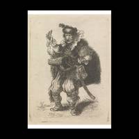
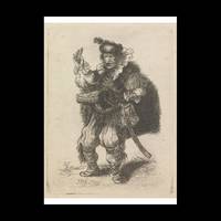
ref. 698413Contentum Ltd. Loose sheet. New. High-quality art print based on an original work from the Ycba. Created in the 18th century 1756. Professionally printed on premium fine-art paper Museum Etching museum quality in size A2. The artwork is printed with a white border museum-style presentation. Contentum Ltd. unknown
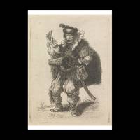
ref. 698412Contentum Ltd. Loose sheet. New. High-quality art print based on an original work from the Ycba. Created in the 18th century 1756. Professionally printed on premium fine-art paper Photo Rag Bright White premium quality in size A2. The artwork is printed with a white border museum-style presentation. Contentum Ltd. unknown
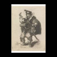
ref. 698410Contentum Ltd. Loose sheet. New. High-quality art print based on an original work from the Ycba. Created in the 18th century 1756. Professionally printed on premium fine-art paper Museum Etching museum quality in size A3. The artwork is printed with a white border museum-style presentation. Contentum Ltd. unknown
ref. 698411Contentum Ltd. Loose sheet. New. High-quality art print based on an original work from the Ycba. Created in the 18th century 1756. Professionally printed on premium fine-art paper Photo Matt Fibre in size A2. The artwork is printed with a white border museum-style presentation. Contentum Ltd. unknown
1958ref. 239242New York: Julian Press 1958. Hardcover. Very Good/Very Good. First edition. Very good or better in a Very good plus dust jacket. Hardcover and dust jacket both lightly rubbed at spine ends and corners dust jacket soiled and worn faded. Julian Press hardcover books
1995ref. Cambridge-9780521485432Cambridge University Press 1995. PAPERBACK. New. Cambridge University Press paperback
1995ref. Cambridge-9780521485432Cambridge University Press 1995. PAPERBACK. New. Cambridge University Press paperback