6 553 résultats
2026réf. Gyan-9788167370877Gyan Publishing House 2026. Hardcover. New. 22.59 x 14.34 x 8.3 cm. English Gyan Publishing House hardcover
2004réf. DADAX0313324255By 2004-04-30. hardcover. New. 6.15x0.62x9.21. Buy with confidence. Excellent Customer Service & Return policy. By hardcover
réf. A9780198510482Paperback / softback. New. This book covers the basic mechanics and the underlying principles of orthodontics for the undergraduate dentistry student. It covers the biology of tooth movement and the appliances used to move the teeth. There are also chapters on dental materials as they apply to the field of orthodontics along with multidisciplinary treatment and problems associated with orthodontic tooth movement. paperback
réf. SKU0216852Fairchild Books 2018-02-22. Paperback. Good. Textbook May Have Highlights Notes and/or Underlining BOOK ONLY-NO ACCESS CODE NO CD Ships with Tracking Fairchild Books paperback
réf. 30619421like new. unknown
réf. 33807660-nnew. unknown
réf. 055750497X.Gpaperback. Good. Access codes and supplements are not guaranteed with used items. May be an ex-library book. paperback
1789réf. lib54434BC12T & I Egerton 1789-1790. Hardcover. Very Good. good solid and tight in original binding with leather spine pages all very good Marbleized boards 16 paltes complete T & I Egerton hardcover
2011réf. NewJan2018-9780538477017Cengage Learning 2011-04-29. Paperback. New. 0x0x0. New US Edition Textbook Ships with Emailed Tracking from USA Cengage Learning paperback
1616Carta geografica tratta dal Tabularum Geographicarum contractarum libri septem di Petrus Bertius, edizione latina del 1616. L'opera contiene 219 carte che illustrano questa nuova versione della geografia del Bertius, per la prima volta pubblicata nel 1612 con le carte di Barent Langenes. Le carte derivano dal grande atlante di Mercator/Hondius, delle quali molte rappresentano una semplice riduzione. "After the death of Cornelis Claesz in 1609, Jodocus Hondius II became the new publisher of the work, composed by 7 parts in 1, with engraved title-page and 220 full-page engraved maps in text. All the maps were newly engraved and slightly larger in size, because Hondius was not able to acquire the original plates. With the new plates the work was definitely improved and enjoyed a growing demand of the public, which at that time had the choice between the Atlas Minor by Mercator and Bertius' Tabularum Geographicarum. The 219 plates, with the oval world map appearing twice, were produced to illustrate a new version of the geography of Bertius, published in 1616. According to King, their correct attribution is by Hondius, after Mercator and Hondius, taken from Bertius, who was only responsible for revising his text again" [cfr. G. King, Miniature Antique Maps]. Incisione in rame, perfette condizioni. A superior rival to the pocket Ortelius atlas appeared about 1598, under the imprint of Barent Langenes and Cornelis Claesz. Claesz also published the Tabularum Geographicarum contractarum libri septem, edition with texy by Petrus Bertius, in 1600. After the death of Cornelis Claesz in 1609, Jodocus Hondius II became the new publisher of the work, composed by 7 parts in 1, with engraved title-page and 220 full-page engraved maps in text. All the maps were newly engraved and slightly larger in size, because Hondius was not able to acquire the original plates. With the new plates the work was definitely improved and enjoyed a growing demand of the public, which at that time had the choice between the Atlas Minor by Mercator and Bertius' Tabularum Geographicarum. The 219 plates, with the oval world map appearing twice, were produced to illustrate a new version of the geography of Bertius, published in 1616. According to King, their correct attribution is by Hondius, after Mercator and Hondius, taken from Bertius, who was only responsible for revising his text again. "After the death of Cornelis Claesz in 1609, Jodocus Hondius II became the new publisher of the work, composed by 7 parts in 1, with engraved title-page and 220 full-page engraved maps in text. All the maps were newly engraved and slightly larger in size, because Hondius was not able to acquire the original plates. With the new plates the work was definitely improved and enjoyed a growing demand of the public, which at that time had the choice between the Atlas Minor by Mercator and Bertius' Tabularum Geographicarum. The 219 plates, with the oval world map appearing twice, were produced to illustrate a new version of the geography of Bertius, published in 1616. According to King, their correct attribution is by Hondius, after Mercator and Hondius, taken from Bertius, who was only responsible for revising his text again" [cf. G. King, Miniature Antique Maps]. Copperplate, in very good conditions. Koeman p. 42; King p. 96/99.
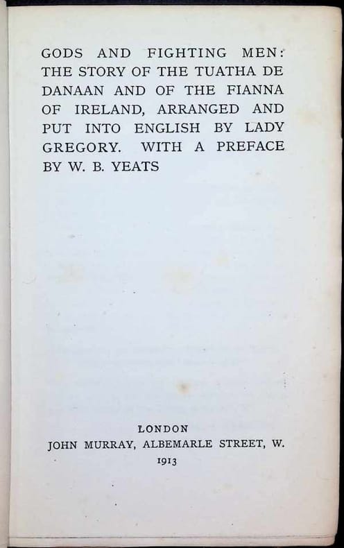
1913réf. 027188London 1913 JOHN MURRAY Hardcover
1795Carta tratta dalla rara raccolta di carte geografiche denominata Atlante Geografico, prima stesura delle opera dell’abate Bartolomeo Borghi, pubblicata in Siena dal Pazzini Carli. Molte delle carte, datate tra il 1788 ed il 1800, sono incise da Agostino Costa e poi successivamente inserite nell’opera Atlante generale dell'ab. Bartolommeo Borghi, pubblicato a Firenze nel 1819.Bartolomeo Borghi, che Vermiglioli (Biografia degli scrittori perugini, 1829) definisce "uno dei migliori geografi dell'Europa", nacque nel 1750 a Monte del Lago, piccola frazione del comune di Magione, in provincia di Perugia, sulle rive del Trasimeno. Ordinato sacerdote nel 1774, trascorse i primi anni del suo mandato nel paese natale, poi a Magione e quindi a Sorbello (Cortona).Appassionato studioso di geografia, applicò dapprima le sue conoscenze all'analisi delle terre a lui più familiari: nel 1770 scrisse Descrizione geografica, fisica e naturale del Lago Trasimeno (che sarà tuttavia data alle stampe per la prima volta solo nel 1821), e nel 1791 pubblicò negli atti dell'Accademia etrusca di Cortona una Dissertazione sopra l'antica geografia dell'Etruria, Umbria e Piceno, arricchendo entrambe le opere di una carta delle regioni descritte. Intanto la sua fama di cartografo, oltre che di geografo, cresceva, tanto da fargli ottenere le nomine a membro delle Accademie Cortonese e Reale di Firenze, e procurargli l'incarico, da parte di Pietro Leopoldo, di delineare la carta del catasto pubblico di Cortona e del contado di Castiglione.Nello stesso tempo gli orizzonti geografici della sua attività si allargavano sensibilmente, e se nell'Atlante Novissimo, illustrato ed accresciuto sulle osservazioni, e scoperte fatte dai più celebri e più recenti cartografi di Antonio Zatta (Venezia 1779-1785) il suo contributo fu ancora legato all'area toscana, nell'Atlante geografico che si pubblicò a Siena da Pazzini Carli tra il 1798 ed il 1800 il Borghi tracciò la maggior parte delle carte e spaziò dalle province del Sud-Est dell'Inghilterra, al Regno di Danimarca, alla Romania.Una sorta di prova generale, quest'ultima, della sua opera più importante, quell'Atlante generale dell'ab. Bartolommeo Borghi, pubblicato a Firenze nel 1819. L'Atlante, corredato da brevi descrizioni storiche, politiche, civili e naturali che introducono le carte relative ai territori afferenti a ciascun Impero o Regno illustrato, rispecchia il nuovo assetto geo-politico attuato dal Congresso di Vienna. Map taken form the very rare Atlante Geografico, the first draft of the abbot Bartolomeo Borghi, published in Siena by Pazzini Carli. Many of the mapss, dated between 1788 and 1800, are engraved by Agostino Costa and then later incorporated in the work of AB Atlante Generale di Bartolomeo Borghi, published in Florence in 1819.Bartolomeo Borghi, who Vermiglioli (Biography of writers Perugini, 1829) calls "one of the best geographers of Europe", was born in 1750 in Monte del Lago, a small fraction of the town of Mansfield, in the province of Perugia, on the shores of Lake Trasimeno. Ordained in 1774, spent the first years of his term in his hometown, then to Mansfield and then Sorbello (Cortona).A passionate student of geography, first applied his knowledge to the analysis of land more familiar to him: he wrote in 1770 Description geographical, physical and natural Lake Trasimeno (which will however be given to the press for the first time only in 1821), and 1791 published in the Proceedings of Etruscan Cortona a dissertation on the geography of ancient Etruria, Umbria and Piceno, enriching both the works of a map of the regions described. Meanwhile, his fame as a cartographer, as well as a geographer, was growing, so that he get the nomination as a member of the Royal Academies of Florence and Cortona, and give him the job, by Pietro Leopoldo, to outline the paper's public land Cortona and the county of Castiglione.At the same time the geographical horizons of its activities widened considerably, and if in the Atlas Novissimo, illustrated and amplified the observations and discoveries made by the most recent and most famous cartographer Antonio Zatta (Venice 1779-1785) his contribution was still related area of Tuscany, in the Atlas geographic monthly published in Siena by Pazzini Carli between 1798 and 1800 the villages drew most of the cards and spaced from the provinces of South-East of England, the Kingdom of Denmark, Romania.A sort of dress rehearsal, the latter, his most important work, quell'Atlante General of AB. Bartolomeo Borghi, published in Florence in 1819. The Atlas, accompanied by brief descriptions of historical, political, civil and natural to introduce the papers relating to the territories belonging to each United Empire or illustrated, reflects the new geo-political structure implemented by the Congress of Vienna.
1801Carta tratta da " Atlas géographique dressé sur les meilleures cartes de ces derniers terms.." edito a Venezia nel 1801. Acquaforte, coloritura coeva, alcune ossidazioni per il resto in ottimo stato di conservazione. Molto Rara. Map taken from "Atlas géographique dressé sur les cartes de ces derniers Meilleures terms .." published in Venice in 1801. Etching, original outline colour, some foxing otherwise in excellent condition. Very Rare.
1756Carta geografica tratta dal raro "Introduction a la Geographie" di G. Louis Le Rouge, pubblicato a Parigi tra il 1747 ed il 1756, a "Paris, chez l'Auteur, Prault le fils, la Veuve Robinot, 1756".L'opera, che l'autore definisce come "Atlas Nouveau Portatif à l'Uage des Militaires et du Voyageur', contiene 86 carte geografiche.Incisione in rame, coloritura coeva dei contorni, in ottimo stato di conservazione. Map taken from the "Introduction a la Geographie" published from 1747 and 1756, printed in "Paris, chez l'Auteur, Prault le fils, la Veuve Robinot, 1756".The work, which the author defines as "Atlas Nouveau Portatif à l'Usage des Militaires et du Voyageur", contains 86 maps.Copperplate with original outline colour, very good conditions.
réf. ria9780470656433_inpHardback. New. New Book; Fast Shipping from UK; Not signed; Not First Edition; Language Development and Language Impairment offers a problem-based introduction to the assessment and treatment of a wide variety of childhood language developmental disorders. hardcover
réf. 23943098-nnew. unknown
réf. ria9781394211128_inpPaperback / softback. New. New Book; Fast Shipping from UK; Not signed; Not First Edition; N/A paperback
réf. 1529235782.Ghardcover. Good. Access codes and supplements are not guaranteed with used items. May be an ex-library book. hardcover
réf. 0538454334.Gpaperback. Good. Access codes and supplements are not guaranteed with used items. May be an ex-library book. paperback
1990réf. Q-038797329XSpringer 1990-09-07. Hardcover. New. New. In shrink wrap. Looks like an interesting title! Springer hardcover
réf. 35894928-nnew. unknown
1978réf. 131066London: Robson Lowe Ltd. 1978. Hardcover. very good. xii 130pp. Small octavo. Green cloth covered boards with gilt lettering on spine. Ends of spine and corners very lightly bumped. Endpapers lightly discoloured. B/W and colour photographs and illustrations throughout. "Ready for sale table" stamp on rear free endpaper. In dust jacket lightly discoloured with some light wear to edges. A very nice copy. Includes a small errata sheet loosely place inside. very good A complete record of the Chinese Postal Service supplemented with many detailed images. A rare book. 1978 Robson Lowe Ltd. hardcover
1946réf. 6447Mollie Bennett Lupe Memorial Fund 1946. 1st edition. Hardcover. FINE. 507pp. index extensive bib. No owner's names. Two color printed paper labels on spine and upper board. Superior copy in every way. Interesting chapter on Indian medicine appendix of several hundred early Texas doctors. A graduate of Johns Hopkins in 1909 Dr. Nixon practiced medicine in Texas for 56 years and he covers much more here than his professional interest in medicine of his day as well as Native Indian medicinal practices the Spanish period French Doctors early Mexican period 1821-1836 and the Republic. BASIC 153. HOWES N161. Mollie Bennett Lupe Memorial Fund, hardcover
2021réf. __0170451119Cengage Australia 2021. Paperback. New. 7th edition. 616 pages. 10.08x8.54x0.94 inches. Cengage Australia paperback
1981réf. DADAX0313220948By 1981-02-10. hardcover. New. 5.50x0.75x8.50. Buy with confidence. Excellent Customer Service & Return policy. By hardcover