235 Ergebnisse
Best.-Nr. DADAX0486231917New unknown
1984Mm 125x190 Collana "Storia della Civiltrà" - Volume rilegato in tela con copertina figurata, sovraccoperta originale, 420 pagine con 8 tavole in nero fuori testo. Opera in ottime condizioni; spedizione in 24 ore dalla conferma dell'ordine.
1988Best.-Nr. europe612Gallimard, "L'Arpenteur / Domaine italien", 1988, 13 x 21,5, 498 pages sous couverture imprimée et jaquette illustrée. Traduit de l'italien par Jean et Marie-Noëlle Pastureau.
Gd in-8°, 220 pages, 74 ill. hors texte N&B, broche, couverture illustree Ex. non coupe DEDICACE par lauteur. [GE-3] 74 illustrations et une carte.
2013Best.-Nr. ABE-1673643676384208 PAGES-21 CM X 29,7 CM-LA TRANSITION PALEOLITHIQUE INFERIEUR-MOYEN DANS L'OUEST ARMORICAIN: L'EXEMPLE DE LA COUCHE 4 DU SITE DE MENEZ-DREGAN I (PLOUHINEC, FINISTERE)-LES LAMES A COCHES DU SECOND MESOLITHIQUE: DES OUTILS DEDIES AU TRAVAIL DES PLANTES?-PREHISTOIRE ET SYSTEME D'INFORMATION GEOGRAPHIQUE PROCESSUS APPLIQUE A UNE OCCUPATION EPIPALEOLITHIQUE-DU DANUBE A LA MOSELLE DECOUVERTES DE PLAQUETTES RETOUCHEES NEOLITHIQUES EN SILEX BAVAROIS A LINTGEN (LUXEMBOURG) ET A TREVES-ZEWEN (ALLEMAGNE)-LA GRAMMAIRE DES DECORS CERAMIQUES DU NEOLITHIQUE ANCIEN DANUBIEN DES BASSINS DU RHIN, DE LA MEUSE ET DE LA SEINE: ENTRE NORME ET TRANSGRESSION-LE DEPOT DE HACHES A DOUILLE DE TYPE ARMORICAIN DU HALLSTATT D1-D2 DE TRELLY (MANCHE) INTERPRETATIONS A PARTIR DES ANALYSES CHIMIQUES ELEMENTAIRES-ACTUALITES SCIENTIFIQUES-COMPTES RENDUS-(2D)
Best.-Nr. 65134 parties en un volume in folio reliure éditeur cartonnée crème avec titre doré au dos et sur le premier plat.Tome 1: Fezzan-Tripolitaine Tunisie,couverture avec titre bleu blanc rouge,illustré,GP éditeur 63 pages illustrations photographiques 15 décembre 1944.Tome 2:le corps expéditionnaire français dans la campagne d’Italie même couverture 79 pages,illustrations photographiques GP éditeur février 1945.Tome 3:Libération du territoire même couverture 95 pages,illustrations photographiques GP éditeur mai 1945:Tome 4:Du Rhin au Danube couverture avec titre illustré gaufré,bleu blanc rouge 95 pages,GP éditeur novembre 1949 Complet un coin émoussé, mors supérieur droit renforcé, intérieur très bon état. Bon état d’ensemble
Best.-Nr. 9408Braun et cie 1945
2001Best.-Nr. 1135332001 Musée de la Civilisation gallo-romaine, lyon - 2001 - In-8, broché, couverture illustrée - 119 p. - Riche iconographie in texte en couleurs et en N&B
Hardcover fort in-4°, 558 pp, abdtt illustré en noir et (surtout) en couleurs, cartonnage illustré de l'editeur. Tres bel exemplaire, tres frais. [PLC-13]
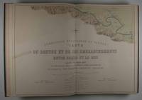
1874Best.-Nr. 47511Leipzig: F. A. Brockhaus 1874. First edition. Hardcover. vg- to vg. Elephant Folio. 6 leaves 60 Nos. I-LIX plus XXXIb plates two of them folding the others doubled-paged. Original three-quarter red morocco over green pebbled cloth tightened with twelve original metal pegs with gilt lettering and decor embossed medallion of cover gilt lettering and raised bands on spine. Marbled endpapers. Maps of the Danube delta and comparative plans of the mouth and of some river sections of the Soulina arm showing the last works which were carried out there by the European Commission according to the projects of Sir Chr. A. Hartley its leading engineer following the collection of comparative plans published by the commission in 1867. The commission of the Danube River Commission Européenne was authorized by the Treaty of Paris 1856 following the end of the Crimean War and is considered the most successful international commission to control the Danube Delta commerce. It was the precursor of the League of Nations the U.N. and the EU. This extensive atlas with detailed maps charts and technical plans was compiled by the Commission to present the regulations put in place at the Danube Delta between 1857 and 1867 the first decade of neutrality of the region. It contains a detailed folding map of the Danube delta 30 x 50" / 1:100000 rendered in color lithography as all plates showing ports Danube canals and their depth compared to Russian measurements of 1829. The second folding map also showing the Danube Delta and additional maps showing various parts of the delta and its distributaries in detail followed by charts and technical plans. All plates printed to double pages. Text in French. Binding with some wear bump at lower right corner closed tear at tail of spine with very light scuffing rubbed and very light soiling. Large map reinforced with brown tape on verso bleeding through and small 3 x 2/12/" taping on front with two and a half inch closed tear here. Light foxing of endpapers and first few pages. Brown spots on plates XXI through XVII barely affecting lithographs mostly at margins of five plates. Binding in overall good interior in very good- to very good condition. F. A. Brockhaus hardcover
1874Best.-Nr. 47511Leipzig: F. A. Brockhaus 1874. First edition. Hardcover. vg- to vg. Elephant Folio. 6 leaves 60 Nos. I-LIX plus XXXIb plates two of them folding the others doubled-paged. Original three-quarter red morocco over green pebbled cloth tightened with twelve original metal pegs with gilt lettering and decor embossed medallion of cover gilt lettering and raised bands on spine. Marbled endpapers. Maps of the Danube delta and comparative plans of the mouth and of some river sections of the Soulina arm showing the last works which were carried out there by the European Commission according to the projects of Sir Chr. A. Hartley its leading engineer following the collection of comparative plans published by the commission in 1867. The commission of the Danube River Commission Européenne was authorized by the Treaty of Paris 1856 following the end of the Crimean War and is considered the most successful international commission to control the Danube Delta commerce. It was the precursor of the League of Nations the U.N. and the EU. This extensive atlas with detailed maps charts and technical plans was compiled by the Commission to present the regulations put in place at the Danube Delta between 1857 and 1867 the first decade of neutrality of the region. It contains a detailed folding map of the Danube delta 30 x 50" / 1:100000 rendered in color lithography as all plates showing ports Danube canals and their depth compared to Russian measurements of 1829. The second folding map also showing the Danube Delta and additional maps showing various parts of the delta and its distributaries in detail followed by charts and technical plans. All plates printed to double pages. Text in French. Binding with some wear bump at lower right corner closed tear at tail of spine with very light scuffing rubbed and very light soiling. Large map reinforced with brown tape on verso bleeding through and small 3 x 2/12/" taping on front with two and a half inch closed tear here. Light foxing of endpapers and first few pages. Brown spots on plates XXI through XVII barely affecting lithographs mostly at margins of five plates. Binding in overall good interior in very good- to very good condition. F. A. Brockhaus hardcover books
Best.-Nr. 3402PARIS, Presses de la cité - 1978 - in-_ broché, couverture ilustréee - 216 pages - Propre
Best.-Nr. 421155Presses De La Cité Paris 1978 In-8 carré ( 205 X 130 mm ) de 216 pages, broché sous couverture illustrée. Bel exemplaire. ) ) )
Best.-Nr. 34678Edition de 1977, pliures au dos, aspect jauni, intérieur propre.
Best.-Nr. AM11217NBBroché. 1977. 222 pages. Plis sur le dos de la couverture. Photos sur demande.
1977Best.-Nr. R160030912Presses de la Cité. 1977. In-12. Broché. Bon état, Couv. convenable, Dos frotté, Intérieur frais. 220 pages.. . . . Classification Dewey : 364-Criminologie
1977Best.-Nr. RO20031367PRESSES DE LA CITE. 1977. In-8. Broché. Bon état, Couv. fraîche, Dos satisfaisant, Intérieur frais. 220pp. . . . Classification Dewey : 364-Criminologie
Best.-Nr. SONG186046467XUsed: Good unknown
Best.-Nr. SONG190767764XUsed: Good unknown
1978Best.-Nr. 31672Paris Presses De La Cité 1978 Petit In-8 Collection "Coup d'Oeil" - 418 pp + 1 ff Table des matières - Fac-similés du Général de Gaulle, des "soldats perdus" de Tulle prisonniers pour l'honneur et du Général Raoul Salan (entre autres) compris dans la pagination - Reproductions photographiques non comprises dans la pagination
1692In 8, pp. 14 + (2b). Br. rifatta. Pubblicazione della canzone 'Il Danubio' dedicata alla vittoria conseguita da Leopoldo I contro i Turchi. La Guerra austro-turca duro' dal 1683 al 1699. Dopo la vittoriosa seconda battaglia di Mohács del 1687, l'obiettivo dell'esercito austro ungarico divenne Belgrado, la citta' fortificata alla confluenza della Sava con il Danubio, che era occupata dai turchi fin dal 1521. L'assedio ebbe inizio nell'agosto del 1688; la citta' fu presa dopo che entrambe le parti avevano subito enormi perdite.
1910Best.-Nr. 34376Paris Plon-Nourrit 1910 Volumes totalement débrochés, cachets de bibliothèque sur les couverturrs sales, intérieurs corrects, cartes et plans en place, Tome premier 1793-1799 Siège de Mayence - Armée de Rhin-Moselle - Armées du Danube et du Rhin, XXXI-459 pp , 3 plans et cartes - Tome second : 1800 - 1803 - Armée du Rhin - Bonaparte et Decaen - Départ pour l'Inde, volumes conservés sous des liseuses adaptées, 400 pp et tableaux et 3 cartes
Best.-Nr. 84996Paris, Imprimerie Générale de Ch. Lahurie, 1866-1870, 1 volume de 250x320 mm environ, 133-109 pages, demi chagrin vert sapin, dos lisse portant titres et filets horizontaux dorés. Ex-libris sur la première garde de couleurs. Coins et coupes émoussés, rousseurs, petites déchirures sans manque sur certaines cartes dépliantes, sinon bon état.
1938Mm 130x205 Prima edizione - Brossura editoriale illustrata con sovraccoperta, 198 pagine con 32 illustrazioni in bicromia fuori testo. Segni d'uso al dorso della sovraccoperta, peraltro esemplare molto ben conservato con interno fresco e godibile. SPEDIZIONE IN 24 ORE DALLA CONFERMA DELL'ORDINE.
1982331 pages. Topics include: They Who Mine the Ground; Richfield Miner; Lee Cheung; Cass Kilkot, Consulting Miner; Incident at the Dollar a Day Cabin; Long Bar; The Love Story of the Blue Danube and Yosephine; Rafe Oswik's Mine Shaft; The Lost Blue Grouse Gold Mine; The Bear Claim Cabin; Usual library markings. Modest wear. Tight and square. A sound copy. Book