248 Ergebnisse
Best.-Nr. SONG0812232763Used: Good unknown
1934Mm 150x220 Brossura di pp. 393 con XIV tavole fuori testo, un'ampia gora interessa la quarta di copertina ma non il teto in buone condizioni. SPEDIZIONE IN 24 ORE DALL'ORDINE.
1975This is a very good hardcover copy in a very good dust jacket of the first Greek edition. Completely clean inside and out. Dust jacket lightly toned. Text completely in Greek. This is the first Greek edition of Focas' work: 'The Lower Danube River in the southeastern European political and economic complex from antiquity' to the Conference of Belgrade of 1948, published in English in 1987. 30 black & white photographic plates. 10" high X 7" wide, 478 pages. Printed in Greece by Stavros Georgiadis, for the Institute for Balkan Studies, Serial No 144 Thessaloniki, October 1975. This book will be securely wrapped and packed in a sturdy box and shipped with tracking.
1914In 4, pp. 14 con ill. n.t. Br. ed.
Best.-Nr. 35502286, Paris, Charpentier, 1932; in-12 broché. 190 pp. EDITION ORIGINALE.
1976Mm 120x200 Collana "Classici della Società italiana". Brossura originale, 206 pagine. Copia in perfette condizioni pari al nuovo. Spedizione in 24 ore dalla conferma dell'ordine.
1916Very Good Turkish, Ottoman (1500-1928) Original color map. Folded. Oblong atlas folio. (50 x 60 cm). In Ottoman script. Scale: 1/200.000. [MAP of EAST ANATOLIA - ERZERON] [Erzurum:] Oltu, Artvin, Hasankale, Ispir. This is one the serie of the Bonn projection maps which are the first map series in modern techniques in Turkey and the Ottoman Empire. This is one the serie of the Bonn projection maps which are the first map series in modern techniques in Turkey and the Ottoman Empire. In order to produce these maps covering Turkish territory, Reconnaissance Branch was incorporated into The Mapping Commission. The maps were produced in the datum based on the latitude and longitude of Ayasofya Mosque in equal area Bonn Projection. The field works for the 123 sheets covering the country were conducted by 76 staff. The production was completed in 18 years starting from east west. Field works continued without stopping except in years 1914 and 1920. This map series called also reconnaissance maps contributed a lot to producing 1:25.000 scale maps. Not in Ataturk Library and TBMM Library.
1911Very Good Turkish, Ottoman (1500-1928) Original color map on cloth. Oblong atlas folio. (49 x 60 cm). Toponyms in Turkish with Arabic letters. In Ottoman script. Scale: 1/25.000. [MAP of ISTANBUL / CONSTANTINOPLE] Küçükköy, Petnahor, Makriköy, Kagidhane [Kagithane]. A rare Istanbul map including some old Byzantine toponyms.
1920Very Good Turkish, Ottoman (1500-1928) Original color map on cloth. Oblong atlas folio. (44 x 58 cm). Scale: 1/200.000. Toponyms in Ottoman script /Turkish with Arabic letters). Shows southwest of the Gallipoli Peninsula [and the Hellespont], Edremid Gulf, Tenedos, and North Aegean shores of Anatolia]. Folded. This is one of the series of the Bonn projection maps which are the first map series in modern techniques in Turkey and the Ottoman Empire. In order to produce these maps covering Turkish territory, Reconnaissance Branch was incorporated into The Mapping Commission. The maps were produced in the datum based on the latitude and longitude of the Ayasofya Mosque in equal area Bonn Projection. The field works for the 123 sheets covering the country were conducted by 76 staff. The production was completed in 18 years starting from east-west. Fieldworks continued without stopping except in the years 1914 and 1920. This map series called also reconnaissance maps contributed a lot to producing 1:25.000 scale maps. Hegira: 1336 = Gregorian: 1920. Not description on map-maker. Extremely rare.
Best.-Nr. SONG8433902547Used: Good unknown
2011Best.-Nr. 2122974Warsaw (Warschau): Center for Research on the Antiquity of Southeastern Europe 2011. 172 Seiten. Mit zahlreichen farbigen Abbildungen. 4° (30 x 21 cm). Orig.-Broschur. [Softcover / Paperback].
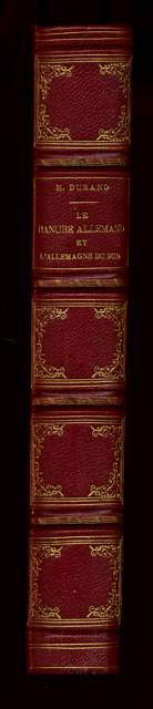
1863Best.-Nr. DEZ-950Tours, Mame, 1863. In-8, demi chagrin, dos à nerfs orné de fleurons et de filets dorés, titre doré, toutes tranches dorées, 498 pp. Ouvrage illustré de nombreuses illustrations hors texte en noir par Girardet. Plats restaurés, dos légèrement insolés, quelques rousseurs.
TOURS, Mame et Cie - 1863 - In-8, 25 x 16 cm - Reliure Editeur - Dos à 4 nerfs, - Toutes tranches dorées - Gravure frontispice et gravures PP HT - 498 pages - Rousseurs habituelles.
Best.-Nr. 2334TOURS, Mame et Cie - 1863 - In-8, 25 x 16 cm - Reliure Editeur - Dos à 4 nerfs, - Toutes tranches dorées - Gravure frontispice et gravures PP HT - 498 pages - Rousseurs habituelles.
Best.-Nr. 92610Mame et Cie, 1863, 498 p., demi-reliure, dos ornés de caissons dorés aux entre-nerfs, reliure frottée, des rousseurs sur les pages.
1863Best.-Nr. 4614Voyage dans la Forêt-Noire, la Bavière, l’Autriche, la Bohème, la Hongrie, l’Istrie, la Vénétie, et le Tyrol. Nombreux hors texte. 1/2 chagrin rouge, dos à nerfs orné de caissons dorés, tranches dorées. bon Tours Mame 1863 1 volume in-4°
Best.-Nr. 1507In 8 percaline éditeur rouge,titre doré au dos et sur le premier plat avec encadrement noir et doré.Faux-titre,frontispice illustré,titre,498 pages tranches dorées,illustrations hors-texte gravées sur bois de Karl Girardet.Mame et Cie 1863.rousseurs éparses habituelles.
1863Best.-Nr. 87074Ad. Mame et Cie, imprimeurs-Libraires 1863 In-4. Reliure éditeur demi-chagrin rouge, dos à faux-nerfs encadrés de fers dorés, 497 pp. Coiffe de tête arrachée, mouillure continue en pied sur les 60 premières pages, sinon intérieur frais.
Best.-Nr. SONG0304322474Used: Good unknown
1982331 pages. Topics include: They Who Mine the Ground; Richfield Miner; Lee Cheung; Cass Kilkot, Consulting Miner; Incident at the Dollar a Day Cabin; Long Bar; The Love Story of the Blue Danube and Yosephine; Rafe Oswik's Mine Shaft; The Lost Blue Grouse Gold Mine; The Bear Claim Cabin; Usual library markings. Modest wear. Tight and square. A sound copy. Book
1938Mm 130x205 Prima edizione - Brossura editoriale illustrata con sovraccoperta, 198 pagine con 32 illustrazioni in bicromia fuori testo. Segni d'uso al dorso della sovraccoperta, peraltro esemplare molto ben conservato con interno fresco e godibile. SPEDIZIONE IN 24 ORE DALLA CONFERMA DELL'ORDINE.
Best.-Nr. 84996Paris, Imprimerie Générale de Ch. Lahurie, 1866-1870, 1 volume de 250x320 mm environ, 133-109 pages, demi chagrin vert sapin, dos lisse portant titres et filets horizontaux dorés. Ex-libris sur la première garde de couleurs. Coins et coupes émoussés, rousseurs, petites déchirures sans manque sur certaines cartes dépliantes, sinon bon état.
1910Best.-Nr. 34376Paris Plon-Nourrit 1910 Volumes totalement débrochés, cachets de bibliothèque sur les couverturrs sales, intérieurs corrects, cartes et plans en place, Tome premier 1793-1799 Siège de Mayence - Armée de Rhin-Moselle - Armées du Danube et du Rhin, XXXI-459 pp , 3 plans et cartes - Tome second : 1800 - 1803 - Armée du Rhin - Bonaparte et Decaen - Départ pour l'Inde, volumes conservés sous des liseuses adaptées, 400 pp et tableaux et 3 cartes
1978Best.-Nr. 31672Paris Presses De La Cité 1978 Petit In-8 Collection "Coup d'Oeil" - 418 pp + 1 ff Table des matières - Fac-similés du Général de Gaulle, des "soldats perdus" de Tulle prisonniers pour l'honneur et du Général Raoul Salan (entre autres) compris dans la pagination - Reproductions photographiques non comprises dans la pagination
1692In 8, pp. 14 + (2b). Br. rifatta. Pubblicazione della canzone 'Il Danubio' dedicata alla vittoria conseguita da Leopoldo I contro i Turchi. La Guerra austro-turca duro' dal 1683 al 1699. Dopo la vittoriosa seconda battaglia di Mohács del 1687, l'obiettivo dell'esercito austro ungarico divenne Belgrado, la citta' fortificata alla confluenza della Sava con il Danubio, che era occupata dai turchi fin dal 1521. L'assedio ebbe inizio nell'agosto del 1688; la citta' fu presa dopo che entrambe le parti avevano subito enormi perdite.