TirolBiblio.com
2.285 Ergebnisse
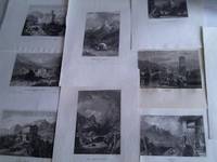
Best.-Nr. 1m6131Kunstanstalt des bibliographischen Instituts Hildburghausen um 1850. Gesamtgröße je ca. 29 3 cm x 195 cm. Größe der Darstellung je ca. 154 cm x 105 cm. - Enthalten: Bergveste Trostberg in Tyrol/Das alte Schloss von Trient/Trient in Tirol/Burg Landbeck in Tyrol/Insbruck in Tyrol/Veste Klumm im Innthale in Rirol/Haus des Sandwirth`s Hofer in Tyrol 2 x/Schloss Ambras in Tyrol/Der Gollinger Fall in Tyrol - unknown
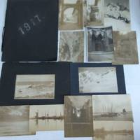
Best.-Nr. 5f48291917. 12 S. Kalenderband kartonierter Einband mit Kordelbindung quart teils leicht fleckig. - Die Fotos zeigen das Johanniskloster zu Stralsund Fischerhafen Hiddensee am Meer Kattenberg in Tirol Kaiserklamm usw. - unknown
1946Best.-Nr. BB33636Innsbruck: Tyrolia 1946. paperback. gebraucht gut Original-Karton-Band ohne Schutzumschlag Einband etwas fleckig sonst GUTES EXEMPLAR. 21x30 cm. 12 Seiten. Heft 3: Die Besitzverhältnisse in Südtirol. 14 Seiten. Heft 4: Authoritative voices on the question of the south tyrol. 18 Seiten. Heft 5: Ethnographische Karte von Südtirol 1910. 8 Seiten. Heft 6: Das Hitler-Mussolini-Abkommen über Südtirol und seine Folgen. 7 Seiten Für Ihre Zufriedenheit versenden wir mit DHL und ausschließlich mit Trackingcode für eine sichere Sendungsverfolgung! Weitere Angebote unter antiquariat-kastanienhof Tyrolia paperback
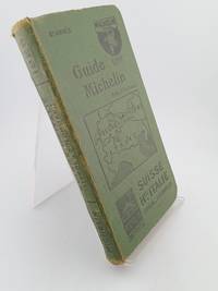
1926Best.-Nr. 5822gMichelin. Fair. Hardcover. 1926. 352 pages. Cover worn Text tanned . Michelin hardcover
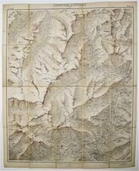
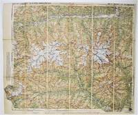
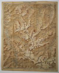
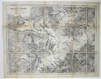
Best.-Nr. 53147Leipzig & Berlin Giesecke & Devrient. Herausgeben v. Deutschen u Oesterreichischhen Alpen Verein. 1897. Colour printed map overall 68 x 55 cm. Scale of 1 to 25000. Stamford's small label " Edward Stanford Ltd. Cartographers to the King.12 13 & 14 Long Acre" dissected into 20 panels folded to 20 x 12 cm. backed on cloth marbled endpapers Edward Stanford Ltd. Cartographers to the King.12 13 & 14 Long Acre and 43 Whitehall label to upper cover titled by hand" Oetzthal & Stubai Gurgl" with ownershoip of L.G. Killby.Covers the area from Gurglthal Obergurgl etc in the NW to Meran SE Leipzig & Berlin Giesecke & Devrient. Herausgeben v. Deutschen u, Oesterreichischhen Alpen Verein. 1897. hardcover
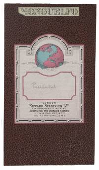
Best.-Nr. 53113Florence: Istituto geografico Militaire 1928. Anno VII. Colour printed map overall 44.5 x 44 cm. Covers area from Sasso Longo N to Ausser Villgraten E to Croda dei Baranci S and Val di Tures E. Scale of 1 to 100000. Stamped "Riporduzione vietate" and with Stamfords stamp" Edward Stanford Ltd. Cartographers to the King.12 13 & 14 Long Acre and Whitehall House 43 Whitehall SW1" dissected into 12 sections folded to 19.5 x 11 cm.backed on cloth brown mock leather backing covers printed title label "Mongueflo" and label of Edward Stanford Ltd. Cartographers to the King.12 13 & 14 Long Acre and 43 Whitehall label to upper cover titled by hand "Pustental". [Florence]: Istituto geografico Militaire 1928. Anno VII hardcover
Best.-Nr. 53114Vienna: Istituto Geografico Militaire Deutschen u Oesterreichischhen Alpen Verein. 1926. Colour printed map overall 94 x 61 cm. Scale of 1 to 25000. Stamfords small label " Edward Stanford Ltd. Cartographers to the King.12 13 & 14 Long Acre and Whitehall House 43 Whitehall SW1" dissected into 24 sections folded to 20 x 12 cm. backed on cloth brown mock leather backing covers printed title label "Mongueflo" and label of Edward Stanford Ltd. Cartographers to the King.12 13 & 14 Long Acre and 43 Whitehall label to upper cover titled by hand "Mormolata". Ownership inscription of L.Killby added to front label. Killby was a specialist in cotton writing papers on its production in inter alia the Sudan and Trinidad. Vienna: Istituto Geografico Militaire Deutschen u, Oesterreichischhen Alpen Verein. 1926. hardcover
Best.-Nr. 53152Vienna: Druck u. Verlag: Kartogr. Anstalt G. Freytag & Berndt A.G. 1936. Overall 60 x 71 cm. colour printed mapdissected into 18 panels backed on linen folding into red cloth backing Stanford label to upper cove with "Pinzgau" in pencil Ownership inscription L. Killby. Vienna: Druck u. Verlag: Kartogr. Anstalt G. Freytag & Berndt A.G. 1936 hardcover
Best.-Nr. BN157170Salzburg Pustet 2006. Softcover. Hans Gangoly. Konversationen. Hans Gangoly. Konversationen. Aut. Architektur und Tirol. Hgg. Salzburg, Pustet 2006. paperback
1976Best.-Nr. BN213143Innsbruck Wien München : Verlagsanstalt Tyrolia 1976. 1976. Hardcover. Von allerley Werkleuten und Gewerben : Eine Bildgeschichte der Tiroler Wirtschaft Von allerley Werkleuten und Gewerben : Eine Bildgeschichte der Tiroler Wirtschaft Kammer der Gewerblichen Wirtschaft für Tirol Hg. Egg Erich Wolfgang Pfaundler und Meinrad Pizzinini Innsbruck, Wien, München : Verlagsanstalt Tyrolia hardcover
Best.-Nr. BN296781Der gehörlose Bär Der gehörlose Bär Gehörlosenverband Tirol unknown
Best.-Nr. BN323546Akademska knjiga. Hardcover. Ekonomija za opste dobro Ekonomija za opste dobro Zan Tirol Akademska knjiga hardcover
Best.-Nr. BN376423Haymon-Verlag. Die Engel-Familie: Musikanten aus Reutte in Tirol erobern die Welt Albrich-Warger Silvia Die Engel-Familie: Musikanten aus Reutte in Tirol erobern die Welt Albrich-Warger Silvia Die Engel-Familie: Musikanten aus Reutte in Tirol erobern die Welt Albrich-Warger Silvia Haymon-Verlag unknown
2009Best.-Nr. BN513562Wien / Springer 2009. 2009. Konstantmodern. Fünf Positionen zur Architektur. Atelier 5 Gerhard Garstenauer Johann Georg Gsteu Rudolf Wäger Werner Wirsing. Konstantmodern. Fünf Positionen zur Architektur. Atelier 5 Gerhard Garstenauer Johann Georg Gsteu Rudolf Wäger Werner Wirsing. Architektur - aut. architektur und tirol Hrsg. Wien / Springer unknown
Best.-Nr. 50240076like new. unknown
Best.-Nr. 50240076-nnew. unknown
2025Best.-Nr. __3706564432Studienverlag GmbH 2025. Hardcover. New. 448 pages. German language. 8.46x1.34x10.39 inches. Studienverlag GmbH hardcover
Best.-Nr. 8120310497.Gpaperback. Good. Access codes and supplements are not guaranteed with used items. May be an ex-library book. paperback
1830Best.-Nr. 20600AB1830. Innsburck ca. 1830 61 : 695 cm. Grenzkolorierte lithographierte Karte. Die sehr seltene Karte ist in 7 Kreise eingeteilt: I. Oberinntal - II. Unterinntal - III. Ousatertal - IIII. Bozen - V. Trient - VI. Rovereto - VII. Vorarlbereg. Die Karte reicht im Osten bis Lienz im Westen bis zum Boden see im Süden bis zum Gardasee und im Norden bis Füssen. Im linken unteren Rand mit Einteilung der Kreise und darunter Zeichenerklärung: Städte Märkte Dörfer Chauseen Landstraßen Landwege schiffbare Flüße Poststationen etc. - Mehrfah gefaltet stellenweise kleine Randeinrisse. unknown
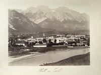
1890Best.-Nr. 19267AB1890. O.O. ca. 1890. 19 : 245 cm. Photographie auf festem Karton montiert. Schöne frühe photographische Ansicht. unknown
Best.-Nr. 53149Leipzig & Berlin Giesecke & Devrient. Herausgeben v. Deutschen u Oesterreichischhen Alpen Verein. 1896. Colour printed map overall 68 x 55 cm. Scale of 1 to 25000. Stamford's small label " Edward Stanford Ltd. Cartographers to the King.12 13 & 14 Long Acre" dissected into 20 panels folded to 20 x 12 cm. backed on cloth marbled endpapers Edward Stanford Ltd. Cartographers to the King.12 13 & 14 Long Acre and 43 Whitehall label to upper cover titled by hand" Oetzthal & Stubai Sölden-Ranalt" With ownership inscription of L.G. Killby Leipzig & Berlin Giesecke & Devrient. Herausgeben v. Deutschen u, Oesterreichischhen Alpen Verein. 1896. hardcover
Best.-Nr. 53150Suttgart: H. Petters. Herausgeben v. Deutschen u Oesterreichischhen Alpen Verein. 1913. Overall 63 x 81 cm. dissected into 21 panels one panel inverted laid on linen and folding to 21.5 x 10.5 cm marbled endpapers paper label. Ownership inscription of L. Killby. Suttgart: H. Petters. Herausgeben v. Deutschen u, Oesterreichischhen Alpen Verein. 1913 unknown
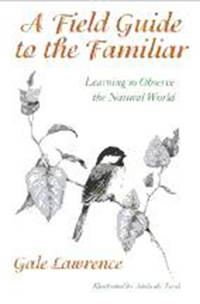
Best.-Nr. B9780874518658Paperback / softback. New. A book for anyone seeking a deeper understanding of the natural world paperback
1998Best.-Nr. Q-0874518652University Press of New England 1998-03-15. Paperback. New. In shrink wrap. Looks like an interesting title! University Press of New England paperback
Best.-Nr. 31821780like new. unknown