WERDERMANN, E.;Livre Rare Book
Filho, Lourenco und Ricardo RamosAntiquariat.de
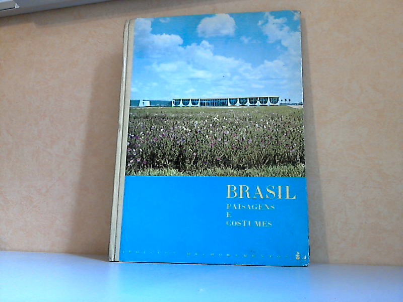
Brasil - Paisagens e Costumes
1962réf. 42542Säo Paulo, Edicoes Melhoramentos, 1962. 87 Seiten , 32 cm, Hardcover/Pappeinband
Antiquariat Ardelt · Allemagne6,95 €
4 224 résultats
réf. 18612, Neudamm, Neumann, 1933, Gebunden, Halbleinen, 170 x 245mm., 123pp., illustriert ( Farbe und S/W ).
1962réf. 42542Säo Paulo, Edicoes Melhoramentos, 1962. 87 Seiten , 32 cm, Hardcover/Pappeinband
1999réf. 166130London: Christie's 1999. Paperback. VG. Clean and tight contents. Color-illustrated wraps; white back cover green spine with white lettering. 97 pp. Nearly 90 color plates and illustrations. Exposition in Brazil for sale at auction at Christie's in London April 29 1999. Text in Portuguese. Christie's paperback
1999réf. 166130London: Christie's 1999. Paperback. VG. Clean and tight contents. Color-illustrated wraps; white back cover green spine with white lettering. 97 pp. Nearly 90 color plates and illustrations. Exposition in Brazil for sale at auction at Christie's in London April 29 1999. Text in Portuguese. Christie's paperback books
2008Sao Paulo, Ministerio da Cultura de Brasil, 2008. 64 p. 4º mayor. Rústica editorial. Muy buen ejemplar. Catálogo de la exposición celebrada en ARCO en 2008. Edición bilingüe español-inglés
2003réf. GAM2476Sao Paulo, Terragraph, 2003. 166 Seiten, zahlr. fotogr. Abb., H 25 x 20 cm, OKart. - Guter Zustand. broschiert/ Taschenbuch/ paperback
Buenos Aires, Espasa Calpe, 1946 (Austral). 4to. menor; 259 pp. Cubiertas originales.
197022x15. 223p. Firma anterior poseedor.
1111Introduction by M. B. Lourenco Filho in English, French, Spanish and German. Photographs of Brasil with full details of exposure, 44 pictures. Some small marks on covers. Top back cover corner bumped and worn. Last three pages have small surface tears to lower corner, most likely stuck together at some time.
Santiago de Compostela, Porto y Cía. Editores, 1957. Algunas ilustraciones en b/n. 410p. 4º. Holandesa con lomo de piel con dorados algo deslucida. Guardas decoradas. Leves puntos de óxido en algunas páginas. Ex libris. Muy buen ejemplar.
réf. 9786550520380LVM EDITORA. new. Baseado no document�rio de sucesso a LVM Editora e a Brasil Paralelo trazem em comemorao aos 200 anos da Independncia do Brasil o livro de uma das obras mais aclamadas do pblico brasileiro: Brasil: A ltima Cruzada. Resgatando as nossas origens tanto o document�rio quanto o livro retomam a gl�ria do descobrimento do Brasil e mostram por meio de entrevistas e de uma extensa pesquisa hist�rica que a nao foi constru�da com sacrif�cio honra coragem e por pessoas das quais devemos sentir orgulho. Pois um povo sem mem�ria sem identidade � um povo deriva sem hist�ria sem legado e sem futuro. LVM EDITORA unknown
1960Broché. 26 pages.
réf. 16680o.J. von Alcantara. 1825-26 Regent von Portugal, 1826 König, dankte ab, 1822-31 Kaiser von Brasilien. 1798 - 1834. Fast Halbfigur in Uniform. Stahlstich von Fr. Stöber. 163 x 107 mm.
réf. 20961o.J. von Alcantara. 1825-26 Regent von Portugal, 1826 König, dankte ab, 1822-31 Kaiser von Brasilien. 1798 - 1834. Brustbild in Uniform, mit Dreispitz, in der Rechten eine Schriftrolle haltend. Lithographie bei Ducarme. Ca. 160 x 145 mm.
réf. 1567o.J. regierte 1831-1889. Schaffte die Sklaverei in Brasilien ab. 1825 Rio de Janeiro - 1891 Paris. Brustbild. Stahlstich von Weger. 210 X 150 mm.
réf. 14442o.J. regierte 1831-1889. Schaffte die Sklaverei in Brasilien ab. 1825 Rio de Janeiro - 1891 Paris. Ganze Figur, stehend, im Krönungsornat. Srahlstich von Duncan um 1855. 185 x 158 mm.
1851réf. 2004AG1851. London & New York J & F. Tallis 1851. Original steel engraving / Vintage map. Drawn and engraved by John Rapkin. Partly hand-coloured. Plate Size: 23.9 cm x 34.3 cm. Sheet Size: 27.5 cm x 37.4 cm. Vintage 19th century map in very good condition. John Tallis 7 November 1817 3 June 1876 was an English cartographic publisher. His company John Tallis and Company published views maps and atlases in London from roughly 1838 to 1851. Tallis set up as a publisher with Frederick Tallis in Cripplegate in 1842; the business moved to Smithfield in 1846 and was dissolved in 1849. From 1851 to 1854 Tallis operated as John Tallis and Company. He started The illustrated news of the world and national portrait gallery of eminent personages in 1858 selling it for £1370 in 1861; it folded in 1863. Wikipedia The most important project John Tallis undertook was the 'Illustrated Atlas' from 1851. The original map we offer here was part of this exceptional Atlas and all the maps it contained are still today considered as the last reminder of an era of lavish map production. Tallis worked the project together with John Rapkin 1815-1876 and it was Rapkin's style and talent that we have to thank for when we marvel at these maps today. What makes these maps so special is the detail of engraved vignettes that surround the map and often show indigenous scenes people in their environment and even more so historical buildings or historical views of towns and cities architecture and landscape. The project of 'The Illustrated Atlas' was designed to be finished just in time for the anxiously awaited "Great Exhibition of the Works of Industry of All Nations" or The Great Exhibition sometimes referred to as the Crystal Palace Exhibition in reference to the temporary structure in which it was held was an international exhibition that took place in Hyde Park London from 1 May to 11 October 1851. It was the first in a series of World's Fairs exhibitions of culture and industry that became popular in the 19th century and it was a much anticipated event. The Great Exhibition was organized by Henry Cole and Prince Albert husband of the reigning monarch Queen Victoria. It was attended by numerous notable figures of the time including Charles Darwin Samuel Colt members of the Orléanist Royal Family and the writers Charlotte Brontë Charles Dickens Lewis Carroll George Eliot and Alfred Tennyson. Music for the opening was under the direction of Sir George Thomas Smart and the continuous music from the exhibited organs for the Queen's procession was "under the superintendence of William Sterndale Bennett". Wikipedia unknown
1935158pp., 22cm.
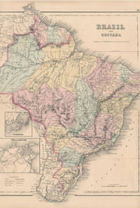
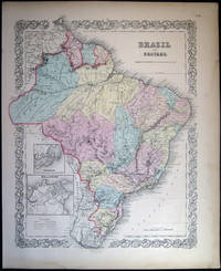
1855réf. 28012New York: J.H. Colton & Co 1855. 13 3/4" X 16½" image 13¼" X 16¼". Hand colored. Near fine. Faint age toning. A beauty clean margined and striking. Small insets at lower left showing "Pernambuco" and "Rio de Janeiro." Full text "The Republic of Chili" on verso. J.H. Colton & Co unknown
1857réf. 030220New York City NY: J.H. Colton & Co. 1857. Hand-colored map; with decorative border. Separate text sheets with Brazil and Guyana demographic details. Map printed for use in Colton's uncommon Advertising Atlas of America 1857; American companies used the publication of this atlas as an advertising vehicle to promote their businesses. The atlas made use of the same maps used in the 1855 printing with many of them having that imprint date. Richard Swainson Fisher authored the accompanying geographical statistical and historical descriptions. Approx. 15" x 18 1/2" overall size. A little edge-toning to the paper; faint old discoloration at right margin. In good condition. Note: Shipped rolled for safety. . Map. Good. J.H. Colton & Co.
1857630 p. 16 b&w plates 2 col. plates 2 maps (1 fold.) Hardcover Very good condition, One col. plated re-attached head & foot of spine chipped
1957réf. 2091502135417701Not Available 1957. Soft Cover. Fine. Number of books: 1 Not Available paperback
1905réf. 57772London Edward Stanford 1905. 95 x 955 cm. A large lithographed map of Brazil lithographed in colours original linen-backed and folded in 35 sections. Folded in the original cloth-case with the original printed title-label preserved. A fine copy. hardcover