[Creek War of 1836 - Indian Removal - Florida - Plantation Economy] Manley, Hiram (attributed)Biblio.com
2 668 résultats
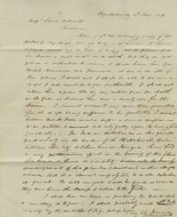
1836réf. BK0192Apalachicola Florida 1836. Autograph letter signed one closely written page on a folded sheet 7 ¾ x 9 ½. Old folds light toning and scattered minor staining. Very good. An account of the effects of the Creek War of 1836 on commerce along the Chattahoochee River written from Apalachicola by the Florida lawyer Hiram Manley 1802-1853. A native of Easton Massachusetts and an 1825 graduate of Harvard Manley practiced law in territorial Florida and later served as a judge. His involvement in the region's commercial development is documented in February 1838 when he joined a five-man committee in Apalachicola petitioning Congress for permission to import iron duty-free for four steamboats intended to navigate the Apalachicola Chattahoochee and Flint rivers.1 Writing to a northern mercantile firm concerning a protested draft Manley explains that he has been unable to obtain a sight draft from the local bank and intends to travel through Pensacola to Mobile to secure funds. Business in Apalachicola is nearly finished for the season and the fighting upriver has made the collection of outstanding debts almost impossible: "The Indian disturbances in this quarter particularly on the banks of the Chattahoochee River between this City & Columbus in Georgia have had a very prejudicious effect on the business of this place this season & have so completely broken into the business arrangements of the Planters & Merchants in their Neighborhood that it is almost impossible to make Collections at present - the debts are good & will be paid as soon as they can leave the camps & return to the Field." The letter was written shortly after the June 9 engagement at Shepherd's Plantation south of Columbus in which Creek forces attacked Georgia militia inflicting heavy casualties. The fighting formed part of the Creek resistance to fraudulent land transactions encroachment by white settlers and the prospect of forced removal from Alabama. Manley's account documents the immediate commercial consequences farther downriver where militia mobilization had interrupted plantation business and left merchants unable to collect debts even as their own obligations fell due. 1 Petition and Papers of Isaac Gage Praying for Leave to Import Iron Vessels Free of Duty 25th Cong. 3rd sess. H. Doc. 92 Congressional Serial Set 346 1839. . unknown
1916réf. 40693Washington D.C.: Published by the United States Coast and Geodetic Survey 1916. Nautical chart printed on heavy paper stock. Colored. A rare coastal survey of Florida from Sanibel Island to Fort Myers Beach including Naples and Marco Island. Established by President Thomas Jefferson in 1807 as the Survey of the Coast the U.S. Coast and Geodetic Survey was the United States' first civilian scientific agency. This agency has followed its mission to survey the U.S. coastline create nautical charts of the coast and help increase maritime safety since its founding and has often played fascinating roles in significant chapters of U.S. history. It served in all theaters of the Civil War in the service of the Union Army and Navy pioneered acoustic exploration in the wake of the sinking of the Titanic and during WWI it worked to detect enemy submarines. In addition this agency worked to survey and produce detailed maps and renderings of the U.S. coast. These nautical survey maps commonly referred to as "T-sheets" provide fascinating insights into the history of the United States coastline which has and will continue to shift. These maps are the most important data source for understanding the physical and ecological characteristics of the U.S. shoreline. The present map is a highly detailed and accurate sea chart of the coast around Fort Myers and an important historical view of a developing Florida. Published by the United States Coast and Geodetic Survey unknown
1916réf. 40732Washington D.C.: Published by the United States Coast and Geodetic Survey 1916. Large folding nautical chart printed on heavy paper stock. Colored. A rare original coastal survey of Cape Sable and Everglades National Park. Established by President Thomas Jefferson in 1807 as the Survey of the Coast the U.S. Coast and Geodetic Survey was the United States' first civilian scientific agency. This agency has followed its mission to survey the U.S. coastline create nautical charts of the coast and help increase maritime safety since its founding and has often played fascinating roles in significant chapters of U.S. history. It served in all theaters of the Civil War in the service of the Union Army and Navy pioneered acoustic exploration in the wake of the sinking of the Titanic and during WWI it worked to detect enemy submarines. In addition this agency worked to survey and produce detailed maps and renderings of the U.S. coast. These nautical survey maps commonly referred to as "T-sheets" provide fascinating insights into the history of the United States coastline which has and will continue to shift. These maps are the most important data source for understanding the physical and ecological characteristics of the U.S. shoreline. The present map is a highly detailed and accurate sea chart of the Everglades and an important historical view of a developing Florida. Published by the United States Coast and Geodetic Survey unknown
1916réf. 40731Washington D.C.: Published by the United States Coast and Geodetic Survey 1916. Large folding nautical chart printed on heavy paper stock. Uncolored with minor wear. A rare original coastal survey of Florida along Everglades National Park and including Marco Island. Established by President Thomas Jefferson in 1807 as the Survey of the Coast the U.S. Coast and Geodetic Survey was the United States' first civilian scientific agency. This agency has followed its mission to survey the U.S. coastline create nautical charts of the coast and help increase maritime safety since its founding and has often played fascinating roles in significant chapters of U.S. history. It served in all theaters of the Civil War in the service of the Union Army and Navy pioneered acoustic exploration in the wake of the sinking of the Titanic and during WWI it worked to detect enemy submarines. In addition this agency worked to survey and produce detailed maps and renderings of the U.S. coast. These nautical survey maps commonly referred to as "T-sheets" provide fascinating insights into the history of the United States coastline which has and will continue to shift. These maps are the most important data source for understanding the physical and ecological characteristics of the U.S. shoreline. The present map is a highly detailed and accurate sea chart of the Everglades National Park and an important historical view of a developing Florida. Published by the United States Coast and Geodetic Survey unknown
1920réf. 40728Washington D.C.: Published by the United States Coast and Geodetic Survey 1920. Large folding nautical chart printed on heavy paper stock. Colored with minor wear and small loss to the top margin. A rare original coastal survey of the St Johns River and Lake George in north-central Florida bisected into two parts. Established by President Thomas Jefferson in 1807 as the Survey of the Coast the U.S. Coast and Geodetic Survey was the United States' first civilian scientific agency. This agency has followed its mission to survey the U.S. coastline create nautical charts of the coast and help increase maritime safety since its founding and has often played fascinating roles in significant chapters of U.S. history. It served in all theaters of the Civil War in the service of the Union Army and Navy pioneered acoustic exploration in the wake of the sinking of the Titanic and during WWI it worked to detect enemy submarines. In addition this agency worked to survey and produce detailed maps and renderings of the U.S. coast. These nautical survey maps commonly referred to as "T-sheets" provide fascinating insights into the history of the United States coastline which has and will continue to shift. These maps are the most important data source for understanding the physical and ecological characteristics of the U.S. shoreline. The present map is a highly detailed and accurate sea chart of the Lake George region and an important historical view of a developing Florida. Published by the United States Coast and Geodetic Survey unknown
1920réf. 53711Fort Pierce FL: n.p. 1920-1931. Oblong 4to. 12.25 x 7.5 in. 24 silver gelatin linen-backed photographs dated & negative number in lower margin of image each mounted on linen hinge sized 6.75 x 10.25 in. Contemporary limp pebbled leather post-binder yapp edges nickel-plated screw posts at gutter margin rounded corners wear rubbing w/o spine wear & minor loss to couple corners still a G exemplar with photos in excellent condition. This remarkable promotional photo album provides a series of photographs documenting the impact of the explosion of development interest in Florida during the Roaring 20s by offering a visual record over 11 years of the building and opening of the Port of Fort Pierce. The album opens with an image dated May 8 1921 showing the last 100 yards to be cut for the a 100 foot wide and 4 foot deep channel the Tuscawilla dredge finishing the last portions of the cut and finally the opening of the Fort Pierce Inlet to the sea which would scour the channel to a depth of 12 feet. A photo dated April 10 1924 shows the operation to dredge the inlet down to 25 feet in order to allow freighters and steamships to enter the Port. Due to erosion local interest began construction of another jetty in 1926 which is shown with railroad tracks stretching to the sea in December 1927 followed by images of the historic dredger the Corozal which had worked on digging the Panama Canal and was capable of dredging to a depth of 50 feet. Finally in Nov. 1929 the Port opened for business with the 4-masted lumber schooner Catherine Scott picking up a load of lumber for delivery to Cuba Feb. 5 1930 followed by the 2339 gross ton SS Betty Weems a Baltimore & Carolina Steamship Company freighter arriving amidst inaugural celebrations of the use of the Fort Pierce Port and opening. There are an addition number of photos up to July 1931 showing such ships as the oil tanker SS Herbert G. Wylie the SS Lillian a freighter owned and operated by A.H. Bull & Co. of New York and a number of other Baltimore & Carolina Steamships. Although the Port had been finished and opened by the end of 1929 the Great Depression and land bust in Florida resulted in such land developments as Indrio and San Lucie never being completed and the area would eventually prove successful as a Naval Amphibious Training Base during World War II with over 140000 troops trained and processed during the War. n.p., hardcover
1811réf. 13130Pass Christian West Florida present-day Mississippi: June 4 1811. 3pp. on a single folio sheet addressed and docketed on verso of integral leaf postmarked at New Orleans on June 14. Original mailing folds a few fold line separations some with old small tape repairs light toning and foxing. Very good condition. An intriguing manuscript letter from Lieut. W.M. Littlejohn to Lieut. Charles Kitchell Gardner written from Pass Christian then in Orleans Territory now in Mississippi. Lieutenant Littlejohn was stationed at a United States Army cantonment at Pass Christian which was established in the aftermath of the rebellion in the Republic of West Florida in 1810. The army was dispatched to the area to keep the peace between the parties namely the United States Spain & factions supporting the Republic of West Florida. Littlejohn's letter opens with the news that his passage took him through Natchez Baton Rouge and New Orleans on his way to Pass Christian. Littlejohn then provides an informative then somewhat jarring assessment of Pass Christian: "This place is most delightfully situated on the sea shore & abounds with fish crabs & oysters -- it is also said to be the most healthy part of the country but that is counterbalanced by the total want of female society & the sea breeze & bathing which adds life & vigour wastes their precious gifts for nothing." Littlejohn then describes his quarters and doubles down on the lack of female companionship: "The cantonment is well built & convenient for the number it was intended for but not being sufficient for the last detachment we have to commence our own quarters which is no contemptible undertaking at this hot season with men unaccustomed to the climate & without tools to work with. This is the first time I have been in a country where there were no Ladies & on that account would prefer being at Washington where there is such elegant society." In the course of describing the setting weather general situation at the camp and so forth Littlejohn names the companies of troops present several of the officers some of the movements of said officers and more. He comments on the lack of significant activity noting that "there is not the smallest hope of any fighting with the Spaniards" though he does expect "a small skirmish between two great men" at some point. All artifacts of military activity from this era in Orleans Territory east of New Orleans are extremely scarce as is the New Orleans postmark from its pre-statehood period. June 4 unknown
1836réf. BK0192Apalachicola Florida 1836. Autograph letter signed one closely written page on a folded sheet 7 ¾ x 9 ½. Old folds light toning and scattered minor staining. Very good. An account of the effects of the Creek War of 1836 on commerce along the Chattahoochee River written from Apalachicola by the Florida lawyer Hiram Manley 1802-1853. A native of Easton Massachusetts and an 1825 graduate of Harvard Manley practiced law in territorial Florida and later served as a judge. His involvement in the region's commercial development is documented in February 1838 when he joined a five-man committee in Apalachicola petitioning Congress for permission to import iron duty-free for four steamboats intended to navigate the Apalachicola Chattahoochee and Flint rivers.1 Writing to a northern mercantile firm concerning a protested draft Manley explains that he has been unable to obtain a sight draft from the local bank and intends to travel through Pensacola to Mobile to secure funds. Business in Apalachicola is nearly finished for the season and the fighting upriver has made the collection of outstanding debts almost impossible: "The Indian disturbances in this quarter particularly on the banks of the Chattahoochee River between this City & Columbus in Georgia have had a very prejudicious effect on the business of this place this season & have so completely broken into the business arrangements of the Planters & Merchants in their Neighborhood that it is almost impossible to make Collections at present - the debts are good & will be paid as soon as they can leave the camps & return to the Field." The letter was written shortly after the June 9 engagement at Shepherd's Plantation south of Columbus in which Creek forces attacked Georgia militia inflicting heavy casualties. The fighting formed part of the Creek resistance to fraudulent land transactions encroachment by white settlers and the prospect of forced removal from Alabama. Manley's account documents the immediate commercial consequences farther downriver where militia mobilization had interrupted plantation business and left merchants unable to collect debts even as their own obligations fell due. 1 Petition and Papers of Isaac Gage Praying for Leave to Import Iron Vessels Free of Duty 25th Cong. 3rd sess. H. Doc. 92 Congressional Serial Set 346 1839. . unknown books
1916réf. 40693Washington D.C.: Published by the United States Coast and Geodetic Survey 1916. Nautical chart printed on heavy paper stock. Colored. A rare coastal survey of Florida from Sanibel Island to Fort Myers Beach including Naples and Marco Island. Established by President Thomas Jefferson in 1807 as the Survey of the Coast the U.S. Coast and Geodetic Survey was the United States' first civilian scientific agency. This agency has followed its mission to survey the U.S. coastline create nautical charts of the coast and help increase maritime safety since its founding and has often played fascinating roles in significant chapters of U.S. history. It served in all theaters of the Civil War in the service of the Union Army and Navy pioneered acoustic exploration in the wake of the sinking of the Titanic and during WWI it worked to detect enemy submarines. In addition this agency worked to survey and produce detailed maps and renderings of the U.S. coast. These nautical survey maps commonly referred to as "T-sheets" provide fascinating insights into the history of the United States coastline which has and will continue to shift. These maps are the most important data source for understanding the physical and ecological characteristics of the U.S. shoreline. The present map is a highly detailed and accurate sea chart of the coast around Fort Myers and an important historical view of a developing Florida. Published by the United States Coast and Geodetic Survey unknown books
1916réf. 40732Washington D.C.: Published by the United States Coast and Geodetic Survey 1916. Large folding nautical chart printed on heavy paper stock. Colored. A rare original coastal survey of Cape Sable and Everglades National Park. Established by President Thomas Jefferson in 1807 as the Survey of the Coast the U.S. Coast and Geodetic Survey was the United States' first civilian scientific agency. This agency has followed its mission to survey the U.S. coastline create nautical charts of the coast and help increase maritime safety since its founding and has often played fascinating roles in significant chapters of U.S. history. It served in all theaters of the Civil War in the service of the Union Army and Navy pioneered acoustic exploration in the wake of the sinking of the Titanic and during WWI it worked to detect enemy submarines. In addition this agency worked to survey and produce detailed maps and renderings of the U.S. coast. These nautical survey maps commonly referred to as "T-sheets" provide fascinating insights into the history of the United States coastline which has and will continue to shift. These maps are the most important data source for understanding the physical and ecological characteristics of the U.S. shoreline. The present map is a highly detailed and accurate sea chart of the Everglades and an important historical view of a developing Florida. Published by the United States Coast and Geodetic Survey unknown books
1916réf. 40731Washington D.C.: Published by the United States Coast and Geodetic Survey 1916. Large folding nautical chart printed on heavy paper stock. Uncolored with minor wear. A rare original coastal survey of Florida along Everglades National Park and including Marco Island. Established by President Thomas Jefferson in 1807 as the Survey of the Coast the U.S. Coast and Geodetic Survey was the United States' first civilian scientific agency. This agency has followed its mission to survey the U.S. coastline create nautical charts of the coast and help increase maritime safety since its founding and has often played fascinating roles in significant chapters of U.S. history. It served in all theaters of the Civil War in the service of the Union Army and Navy pioneered acoustic exploration in the wake of the sinking of the Titanic and during WWI it worked to detect enemy submarines. In addition this agency worked to survey and produce detailed maps and renderings of the U.S. coast. These nautical survey maps commonly referred to as "T-sheets" provide fascinating insights into the history of the United States coastline which has and will continue to shift. These maps are the most important data source for understanding the physical and ecological characteristics of the U.S. shoreline. The present map is a highly detailed and accurate sea chart of the Everglades National Park and an important historical view of a developing Florida. Published by the United States Coast and Geodetic Survey unknown books
1920réf. 40728Washington D.C.: Published by the United States Coast and Geodetic Survey 1920. Large folding nautical chart printed on heavy paper stock. Colored with minor wear and small loss to the top margin. A rare original coastal survey of the St Johns River and Lake George in north-central Florida bisected into two parts. Established by President Thomas Jefferson in 1807 as the Survey of the Coast the U.S. Coast and Geodetic Survey was the United States' first civilian scientific agency. This agency has followed its mission to survey the U.S. coastline create nautical charts of the coast and help increase maritime safety since its founding and has often played fascinating roles in significant chapters of U.S. history. It served in all theaters of the Civil War in the service of the Union Army and Navy pioneered acoustic exploration in the wake of the sinking of the Titanic and during WWI it worked to detect enemy submarines. In addition this agency worked to survey and produce detailed maps and renderings of the U.S. coast. These nautical survey maps commonly referred to as "T-sheets" provide fascinating insights into the history of the United States coastline which has and will continue to shift. These maps are the most important data source for understanding the physical and ecological characteristics of the U.S. shoreline. The present map is a highly detailed and accurate sea chart of the Lake George region and an important historical view of a developing Florida. Published by the United States Coast and Geodetic Survey unknown books
1811réf. 13130Pass Christian West Florida present-day Mississippi: June 4 1811. 3pp. on a single folio sheet addressed and docketed on verso of integral leaf postmarked at New Orleans on June 14. Original mailing folds a few fold line separations some with old small tape repairs light toning and foxing. Very good condition. An intriguing manuscript letter from Lieut. W.M. Littlejohn to Lieut. Charles Kitchell Gardner written from Pass Christian then in Orleans Territory now in Mississippi. Lieutenant Littlejohn was stationed at a United States Army cantonment at Pass Christian which was established in the aftermath of the rebellion in the Republic of West Florida in 1810. The army was dispatched to the area to keep the peace between the parties namely the United States Spain & factions supporting the Republic of West Florida. Littlejohn's letter opens with the news that his passage took him through Natchez Baton Rouge and New Orleans on his way to Pass Christian. Littlejohn then provides an informative then somewhat jarring assessment of Pass Christian: "This place is most delightfully situated on the sea shore & abounds with fish crabs & oysters -- it is also said to be the most healthy part of the country but that is counterbalanced by the total want of female society & the sea breeze & bathing which adds life & vigour wastes their precious gifts for nothing." Littlejohn then describes his quarters and doubles down on the lack of female companionship: "The cantonment is well built & convenient for the number it was intended for but not being sufficient for the last detachment we have to commence our own quarters which is no contemptible undertaking at this hot season with men unaccustomed to the climate & without tools to work with. This is the first time I have been in a country where there were no Ladies & on that account would prefer being at Washington where there is such elegant society." In the course of describing the setting weather general situation at the camp and so forth Littlejohn names the companies of troops present several of the officers some of the movements of said officers and more. He comments on the lack of significant activity noting that "there is not the smallest hope of any fighting with the Spaniards" though he does expect "a small skirmish between two great men" at some point. All artifacts of military activity from this era in Orleans Territory east of New Orleans are extremely scarce as is the New Orleans postmark from its pre-statehood period. June 4 unknown books
réf. DADAX0813012732New unknown
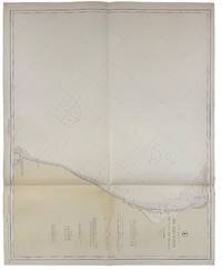
1917réf. 40682Washington D.C.: Published by the United States Coast and Geodetic Survey 1917. Nautical chart printed on heavy paper stock. Colored. A rare coastal survey of the Pensacola area including Destin Fort Walton Santa Rosa Island and Pensacola Beach. Established by President Thomas Jefferson in 1807 as the Survey of the Coast the U.S. Coast and Geodetic Survey was the United States' first civilian scientific agency. This agency has followed its mission to survey the U.S. coastline create nautical charts of the coast and help increase maritime safety since its founding and has often played fascinating roles in significant chapters of U.S. history. It served in all theaters of the Civil War in the service of the Union Army and Navy pioneered acoustic exploration in the wake of the sinking of the Titanic and during WWI it worked to detect enemy submarines. In addition this agency worked to survey and produce detailed maps and renderings of the U.S. coast. These nautical survey maps commonly referred to as "T-sheets" provide fascinating insights into the history of the United States coastline which has and will continue to shift. These maps are the most important data source for understanding the physical and ecological characteristics of the U.S. shoreline. The present map is a highly detailed and accurate sea chart of the Pensacola area and an important historical view of a developing Florida. Published by the United States Coast and Geodetic Survey unknown
1917réf. 40682Washington D.C.: Published by the United States Coast and Geodetic Survey 1917. Nautical chart printed on heavy paper stock. Colored. A rare coastal survey of the Pensacola area including Destin Fort Walton Santa Rosa Island and Pensacola Beach. Established by President Thomas Jefferson in 1807 as the Survey of the Coast the U.S. Coast and Geodetic Survey was the United States' first civilian scientific agency. This agency has followed its mission to survey the U.S. coastline create nautical charts of the coast and help increase maritime safety since its founding and has often played fascinating roles in significant chapters of U.S. history. It served in all theaters of the Civil War in the service of the Union Army and Navy pioneered acoustic exploration in the wake of the sinking of the Titanic and during WWI it worked to detect enemy submarines. In addition this agency worked to survey and produce detailed maps and renderings of the U.S. coast. These nautical survey maps commonly referred to as "T-sheets" provide fascinating insights into the history of the United States coastline which has and will continue to shift. These maps are the most important data source for understanding the physical and ecological characteristics of the U.S. shoreline. The present map is a highly detailed and accurate sea chart of the Pensacola area and an important historical view of a developing Florida. Published by the United States Coast and Geodetic Survey unknown books
2013réf. LB260907011Z61Florida Bar Continuing Legal Education Publication 2013. 7th. paperback. Very Good. 9x6x0. Hardback--corner of first blank page is clipped--otherwise excellent condition--NO DUST COVER Florida Bar Continuing Legal Education Publication paperback
réf. DADAX0813044219New unknown
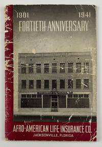
1941réf. 12634N.p. likely Jacksonville Fl. 1941. 4612pp. Original pictorial wrappers stapled. Substantial creasing rubbing dust-soiling and overall wear to wrappers. Faint foxing and spotting to initial and terminal leaves but mostly clean internally. Very good. A rare pamphlet celebrating the fortieth anniversary of the Afro-American Life Insurance Company an important African-American-owned-and-operated insurance company in Florida. The work includes reproductions of congratulatory letters to the company from Florida governor Spessard Holland and others portraits and information on the company’s founders passages on the history of the company information on the successes of the company’s current operations and more. The work is interspersed throughout with a legion of photographs showing the company at work scenes from various branch offices the company’s Funeral Services Division and so forth. "Florida's First African-American Insurance Company -1901-2001. The Afro-American Insurance Company formerly the Afro-American Industrial and Benefits Association was founded in 1901 to provide affordable health insurance and death benefits to the state's African-Americans. Founded by the Reverend E.J. Gregg E.W. Latson Abraham Lincoln Lewis A.W. Price Dr. Arthur W. Smith J.F. Valentine and the Reverend J. Melton Waldron the Afro's first office at 14 Ocean Street was destroyed by the great Jacksonville Fire two months after it opened on May 3 1901. It then moved to 621 Florida Avenue the home of treasurer and future president Abraham Lincoln Lewis 1865-1947. From their next home office at 105 E. Union Street the company wrote millions of dollars of insurance policies and started district offices in Georgia Alabama Louisiana and Texas." - Historical marker at the site of the company's original location in Jacksonville. OCLC reports just two copies at Howard and the University of North Florida. unknown
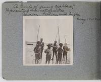
1901réf. 2885Various locations in Florida 1901. About very good. 16 leaves illustrated with thirty-two original vernacular photographs all 3.5 x 3.5 inches most with manuscript captions in ink above the images. Oblong octavo. Contemporary gray paper wrappers white titles on front cover. Spine mostly split a few shallow chips to edges. Internally clean. A small but important vernacular photograph album containing rare views of the devastation wrought by the Great Fire of 1901 in Jacksonville Florida which took place on May 3 1901. The most destructive event in the history of Jacksonville the Great Fire swept through 146 city blocks destroying over 2000 buildings killing seven people and leaving almost 10000 residents without homes. It is considered the third-largest urban fire in United States history after the Great Chicago Fire and the 1906 San Francisco conflagration. The photographs in the present album were taken by an unidentified passenger aboard the Clyde Line steamer Comanche. Eight of the images capture the scene in devastated Jacksonville including a shot of the ruins of the Windsor and St. James hotels shots from atop the "Jacksonville Government Building" a group picture of the city guard "ruins of Jacksonville Court House" "An unknown ruin" a crowded scene at the Jacksonville wharf and a distant shot showing "Ruins of Jacksonville taken from Steamer Comanche May 12." All of the photographs of Jacksonville are dated in manuscript on May 12 1901 nine days after the Great Fire. In addition to the Jacksonville pictures other identified locations along the photographer's voyage include the Hillsborough River near Tampa the Tampa Court House scenes around the Tampa Bay Hotel family pictures in Florida the Comanche and its crew Fort Sumter and four views around Charleston. One particularly notable photograph shows six boys standing in shallow water holding fishing nets likely near Tampa. The image is captioned "A group of young crabbers representing three nationalities American Italian and Negro May 10 1901. unknown
1917réf. 40711Washington D.C.: Published by the United States Coast and Geodetic Survey 1917. Large folding nautical chart printed on heavy paper stock. Colored. A rare original coastal survey of Charlotte Harbor including Boca Grande and the Charlotte Harbor estuary Florida's second largest estuary and fabled home of mythical pirate Jose Gaspar during Florida's second Spanish period. Established by President Thomas Jefferson in 1807 as the Survey of the Coast the U.S. Coast and Geodetic Survey was the United States' first civilian scientific agency. This agency has followed its mission to survey the U.S. coastline create nautical charts of the coast and help increase maritime safety since its founding and has often played fascinating roles in significant chapters of U.S. history. It served in all theaters of the Civil War in the service of the Union Army and Navy pioneered acoustic exploration in the wake of the sinking of the Titanic and during WWI it worked to detect enemy submarines. In addition this agency worked to survey and produce detailed maps and renderings of the U.S. coast. These nautical survey maps commonly referred to as "T-sheets" provide fascinating insights into the history of the United States coastline which has and will continue to shift. These maps are the most important data source for understanding the physical and ecological characteristics of the U.S. shoreline. The present map is a highly detailed and accurate sea chart of Charlotte Harbor and an important historical view of a developing Florida. Published by the United States Coast and Geodetic Survey unknown
1811réf. 41305Washington City: A. & G. Way 1811. The report of the congressional committee appointed to evaluate the government of Mississippi Territory and the petition of the residents of West Florida what is now the southernmost portions Mississippi and Alabama to be annexed to that territory. The United States had supported the bloodless coup of Americans resident in what was then Spanish territory and annexed the land over Spain's bitter protests. Given the commercial stranglehold New Orleans and Louisiana would have on the region if West Florida were annexed to it thus giving Louisiana almost exclusive access to the Gulf the committee relying heavily on recent census data recommends that Mississippi be admitted to the Union and that West Florida as defined in the 1763 Treaty of Paris be annexed to it. The argument concludes: "The formation of new states on the southern extremity of the United States ought not to be delayed." An important step forward in the development of the Deep South. Scarce. Modern half calf and marbled boards. Lightly foxed. Very good. SHAW & SHOEMAKER 24296. hardcover
1941réf. 12634N.p. likely Jacksonville Fl. 1941. 4612pp. Original pictorial wrappers stapled. Substantial creasing rubbing dust-soiling and overall wear to wrappers. Faint foxing and spotting to initial and terminal leaves but mostly clean internally. Very good. A rare pamphlet celebrating the fortieth anniversary of the Afro-American Life Insurance Company an important African-American-owned-and-operated insurance company in Florida. The work includes reproductions of congratulatory letters to the company from Florida governor Spessard Holland and others portraits and information on the company’s founders passages on the history of the company information on the successes of the company’s current operations and more. The work is interspersed throughout with a legion of photographs showing the company at work scenes from various branch offices the company’s Funeral Services Division and so forth. "Florida's First African-American Insurance Company -1901-2001. The Afro-American Insurance Company formerly the Afro-American Industrial and Benefits Association was founded in 1901 to provide affordable health insurance and death benefits to the state's African-Americans. Founded by the Reverend E.J. Gregg E.W. Latson Abraham Lincoln Lewis A.W. Price Dr. Arthur W. Smith J.F. Valentine and the Reverend J. Melton Waldron the Afro's first office at 14 Ocean Street was destroyed by the great Jacksonville Fire two months after it opened on May 3 1901. It then moved to 621 Florida Avenue the home of treasurer and future president Abraham Lincoln Lewis 1865-1947. From their next home office at 105 E. Union Street the company wrote millions of dollars of insurance policies and started district offices in Georgia Alabama Louisiana and Texas." - Historical marker at the site of the company's original location in Jacksonville. OCLC reports just two copies at Howard and the University of North Florida. unknown books
1901réf. 2885Various locations in Florida 1901. About very good. 16 leaves illustrated with thirty-two original vernacular photographs all 3.5 x 3.5 inches most with manuscript captions in ink above the images. Oblong octavo. Contemporary gray paper wrappers white titles on front cover. Spine mostly split a few shallow chips to edges. Internally clean. A small but important vernacular photograph album containing rare views of the devastation wrought by the Great Fire of 1901 in Jacksonville Florida which took place on May 3 1901. The most destructive event in the history of Jacksonville the Great Fire swept through 146 city blocks destroying over 2000 buildings killing seven people and leaving almost 10000 residents without homes. It is considered the third-largest urban fire in United States history after the Great Chicago Fire and the 1906 San Francisco conflagration. The photographs in the present album were taken by an unidentified passenger aboard the Clyde Line steamer Comanche. Eight of the images capture the scene in devastated Jacksonville including a shot of the ruins of the Windsor and St. James hotels shots from atop the "Jacksonville Government Building" a group picture of the city guard "ruins of Jacksonville Court House" "An unknown ruin" a crowded scene at the Jacksonville wharf and a distant shot showing "Ruins of Jacksonville taken from Steamer Comanche May 12." All of the photographs of Jacksonville are dated in manuscript on May 12 1901 nine days after the Great Fire. In addition to the Jacksonville pictures other identified locations along the photographer's voyage include the Hillsborough River near Tampa the Tampa Court House scenes around the Tampa Bay Hotel family pictures in Florida the Comanche and its crew Fort Sumter and four views around Charleston. One particularly notable photograph shows six boys standing in shallow water holding fishing nets likely near Tampa. The image is captioned "A group of young crabbers representing three nationalities American Italian and Negro May 10 1901. unknown books
1917réf. 40711Washington D.C.: Published by the United States Coast and Geodetic Survey 1917. Large folding nautical chart printed on heavy paper stock. Colored. A rare original coastal survey of Charlotte Harbor including Boca Grande and the Charlotte Harbor estuary Florida's second largest estuary and fabled home of mythical pirate Jose Gaspar during Florida's second Spanish period. Established by President Thomas Jefferson in 1807 as the Survey of the Coast the U.S. Coast and Geodetic Survey was the United States' first civilian scientific agency. This agency has followed its mission to survey the U.S. coastline create nautical charts of the coast and help increase maritime safety since its founding and has often played fascinating roles in significant chapters of U.S. history. It served in all theaters of the Civil War in the service of the Union Army and Navy pioneered acoustic exploration in the wake of the sinking of the Titanic and during WWI it worked to detect enemy submarines. In addition this agency worked to survey and produce detailed maps and renderings of the U.S. coast. These nautical survey maps commonly referred to as "T-sheets" provide fascinating insights into the history of the United States coastline which has and will continue to shift. These maps are the most important data source for understanding the physical and ecological characteristics of the U.S. shoreline. The present map is a highly detailed and accurate sea chart of Charlotte Harbor and an important historical view of a developing Florida. Published by the United States Coast and Geodetic Survey unknown books