Florida, Richard (Author)Biblio.com

2 717 résultats
2005réf. x-041594886XRoutledge 2005. Hardcover. New. 1st edition. 198 pages. 9.00x6.00x0.75 inches. Routledge hardcover
2017réf. BN401098Cengage Learning Inc 2017. 2017. Softcover. Principles of Geotechnical Engineering SI Edition Principles of Geotechnical Engineering SI Edition Braja California State University Sacramento Das Khaled Florida Atlantic University Sobhan Cengage Learning, Inc paperback
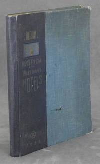
1938réf. 0086079Miami Beach FL: Davis and Campbell 1938. Hardcover. Very Good. 1938. Hardcover folio spiral-bound in cloth-backed boards. 196 pp. profusely illustrated with b&w photos. Very Good. Rubbing and light soil to the boards; corners worn; faint dampstain to upper corner of the first 10 pages only; otherwise clean and unmarked. A rare book -- OCLC locates only 10 copies. A showcase of the area at its peak includes The Hollywood Beach Hotel Stetson University the Gulfstream Apartments Whitman Kenmore Hotel El Comodoro Miramar as well as sections on Cuba Key West Palm Beach Tampa Winter Haven and many many more. Davis and Campbell hardcover
1878réf. 23581Louisville KY: Richmond and Lousville Medical Journal Book and Job Steam Press 1878. Paperback. Mr. Livingston's signed copy of a pamphlet pertaining to Florida as a suitable "health resort" for Northern patients by Frederick Lente MD. Dr. Lente 1823 - 1883 was the primary surgeon at the West Point Foundry Cold Spring NY during the Civil War. He served at the Foundry from 1851 to 1870; later he was head of gynecology and children's health at the University of the City of New York and founder of the American Academy of medicine. Livingston was a member of a family of the Hudson River Valley which at one point owned some 900000 acres of land and about three dozen mansions in the area giving the area the nickname "Livingston Valley". 8vo 56pp errata slip bound in. Printed paper wrappers. Wrappers chipped at edges and marked. Good condition but fragile. OCLC: 1648852. Richmond and Lousville Medical Journal Book and Job Steam Press paperback
réf. DADAX1138525286Routledge 2019-10-02. 1. hardcover. New. 5.98x0.00x9.02. Buy with confidence. Excellent Customer Service & Return policy. Routledge hardcover
2013réf. x-0415633605Routledge 2013. Hardcover. New. 256 pages. 9.25x6.25x1.00 inches. Routledge hardcover
réf. DADAX0151307482New unknown
2026réf. x-1032971754Taylor & Francis Ltd 2026. Hardcover. New. 240 pages. 9.18x6.12x9.45 inches. Taylor & Francis Ltd hardcover
1990réf. x-1850007594Falmer Pr 1990. Hardcover. New. 2nd sub edition. 242 pages. 9.75x6.50x0.50 inches. Falmer Pr hardcover
1854réf. 308253Tallahassee FL: Office of the Floridian & Journal Printed by Dyke & Williams 1854. First Edition. Hardcover. Very good. A nicely-bound volume collecting the Florida House and Senate proceedings for 1854–55. Each journal—the message of Governor James E. Broome to the legislature and a daily report of the activities of the legislative bodies—are followed by the same appendix of "Documents Accompanying the Governor's Message." House Journal pagination: 340 Journal 54 Documents pages. Senate Journal pagination: 337 Journal 54 Documents pages. With a final blank leaf. Contents generally very good no separate wrappers as issued. Pages tanned and foxed as usual. This volume is finely bound in three-quarter's leather and marbled paper-covered boards. The spine has raised bands and is stamped in gilt. A truly lovely period-style binding. Office of the Floridian & Journal, Printed by Dyke & Williams hardcover
1858réf. 361605Tallahassee FL: Office of the Floridian & Journal Printed by Jones & Dyke 1858. First Edition. Hardcover. Very good. With most of the legislature's time taken up with questions of infrastructure particularly the Florida railroad Governor Madision S. Perry uses his annual address to warn of coming conflict with the north and to encourage the spread of slavery. This is a nicely-bound volume of the daily legislative log and the accompanying state office reports. The session ran from November 22 1858 to January 15 1859. In his prescient call for funding a militia an action that the legislature does not appear to have discussed seriously Gov. Perry warns that "the late elections in the non-slaveholding States forebode no good to us in the South. He would be a false sentinel who under the present aspect of affairs would cry peace" pp. 27–28. He then observes that many White Floridians are ambivalent about slavery and he encourages the legislature to make changes in the law to encourage slaveholding another action the lawmakers seem to have not spent much time on. Another subject that Perry devotes time to is the forcible removal of Native Americans from Florida. After twenty years of conflict the federal government had recently declared victory and ended the war. Both the governor and the legislature make appeals in this document to continue the effort until all the Seminoles and other tribes are gone from the state. 456 journal 70 reports pages. According to the daily log the print run of this issue was 700 copies. Contents heavily foxed; title page laid down on paper; some loss to the margins; fifth gathering duplicated in error; corner loss to final leaves of the reports section with no loss of text. Finely bound in three-quarter's leather and marbled paper-covered boards. The spine has raised bands and is stamped in gilt. A truly lovely period-style binding. Office of the Floridian & Journal, Printed by Jones & Dyke hardcover
2003réf. x-0415931207Routledge 2003. Hardcover. New. 1st edition. 224 pages. 9.00x6.25x0.75 inches. Routledge hardcover
réf. 5557176like new. unknown
2026réf. x-1032385944Taylor & Francis Ltd 2026. Hardcover. New. 146 pages. 9.18x6.12x9.45 inches. Taylor & Francis Ltd hardcover
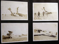
1918réf. 030201Miami Florida: USMC 1918. Over 170 individual images including over 25 larger format 5" x 8" size depicting biplanes seaplanes in flight on the ground in wrecks and being salvaged. Photos pasted-on black album paper pages coming loose from the old post-and-cord binding covers loose and about gone; album approx. 7" x 11" size horizontal format. Photos also include various personnel including a few close-ups and of officers on base and at various duties with occasional views of the town and surrounding areas. Many of the aircraft are training biplanes of the Curtiss Jenny classification with several having their fuselage numbers clearly visible. A few of the photographs are professionally taken by the Miami photography studio of R.B. Hoit with his identifications in the plate. Several dramatic images show grounded and damaged planes and the results of air crashes. At least one of the smaller snapshots show a plane with the fuselage side-marking "Marine Flying Field Miami Florida." A few small 'targeting' photos show aircraft coming into attack range; others show the ground area. Several images give aircraft information "Ng Sea Plane - Curtiss Oxx 6 Motor" HIS - L Flying Boat Liberty Motor." There are also a few photos of blimps. A couple of photos show a downed aircraft in shallow water and being 'salvaged' by personnel floating around attempting to move the plane. Research indicates that "The U. S. Marine Corps leased the old Curtiss Flying Field from Glenn Curtiss. used for training Marine aviators and the first Marine Corps airfield solely used by Marine aircraft. The Marine Flying Field Miami was in operation from March 1918 until September 25 1919 located on the north side of the Miami River at approximately NW 33rd Avenue Miami. The First Marine Aviation Force commanded by Captain Cunningham was formed on April 15 1918 and the four squadrons of this Force designated "A" "B" "C" and "D" rapidly trained for combat flying Curtiss JN-4's and Thomas-Morse Scouts. They were augmented by some 80 Navy pilots who transferred to the Marine Corps in anticipation of a more rapid deployment to the war zone." Information on this USMC base from the Don Boyd pbas website page on this base who also credits Mark Lincoln In addition to the military photographs which are the majority there is a 1911-12 freshman H.S. class photo location unknown; family photographs a few train-schedules pasted-in along with a couple of handwritten notes one by a child; and travel scenery from town and country. A couple of images show a partially-completed Mt. Rushmore South Dakota with George Washington's features the only visible portrait; with other Western America scenery forest & lake vistas mountain ranges; and photographs of folks camping hunting & fishing and the results. A few of the photos edge-and-corner chipped; mostly all in good condition. . Photograph Album. Soft Cover. Good. USMC paperback
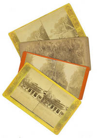
1880réf. 2391081880. Albumen prints on thick printed card curved corners. A trifle dusty one card with adhesive burn else images near fine. Albumen prints on thick printed card curved corners. Views include Palemettos on the St. John's River St. Augustine market and entrance to the city a staged hunting scene with a heron and alligator a canals and a wagon hitched to a cow titled "The Lightning Express; Or the Team of a Florida Cracker". unknown
1880réf. 2391081880. Albumen prints on thick printed card curved corners. A trifle dusty one card with adhesive burn else images near fine. Albumen prints on thick printed card curved corners. Views include Palemettos on the St. John's River St. Augustine market and entrance to the city a staged hunting scene with a heron and alligator a canals and a wagon hitched to a cow titled "The Lightning Express; Or the Team of a Florida Cracker". unknown books
1829réf. 31631Washington: Gales & Seaton 1829. "A collection of Spanish and French ordinances affecting land titles in Florida compiled by Joseph M. White of Florida who was employed as assistant counsel on behalf of the U.S.The documents p.12-277 are in the original language with English translations" - Servies. Despite the 1828 date given in the imprint this document from the second session of the 20th Congress was actually printed in 1829. Scarce. Contemporary legal sheep black and red gilt morocco labels. Minor foxing. Very good. SERVIES 1466. unknown
1829réf. 31631Washington: Gales & Seaton 1829. "A collection of Spanish and French ordinances affecting land titles in Florida compiled by Joseph M. White of Florida who was employed as assistant counsel on behalf of the U.S.The documents p.12-277 are in the original language with English translations" - Servies. Despite the 1828 date given in the imprint this document from the second session of the 20th Congress was actually printed in 1829. Scarce. Contemporary legal sheep black and red gilt morocco labels. Minor foxing. Very good. SERVIES 1466. unknown books
1886réf. 41223Washington D.C.: Published by the United States Coast and Geodetic Survey 1886. Large folding nautical chart printed on heavy paper stock. Colored with minor wear. A rare original survey of the United States Atlantic Coast from Florida to Georgia to South Carolina to North Carolina. Map includes Cape Canaveral Daytona St. Augustine Fernandina Cumberland Island St. Simons Island Sappelo Island Savannah Hilton Head Beaufort Hunting Island Edisto Island James Island Folly Island Charleston Sullivans Island Isle of Palms Pawleys Island Myrtle Beach Bald Head Island Wilmington Wrightsville Jacksonville Emerald Isle Morehead Beaufort New Bern and Cape Hatteras. Established by President Thomas Jefferson in 1807 as the Survey of the Coast the U.S. Coast and Geodetic Survey was the United States' first civilian scientific agency. This agency has followed its mission to survey the U.S. coastline create nautical charts of the coast and help increase maritime safety since its founding and has often played fascinating roles in significant chapters of U.S. history. It served in all theaters of the Civil War in the service of the Union Army and Navy pioneered acoustic exploration in the wake of the sinking of the Titanic and during WWI it worked to detect enemy submarines. In addition this agency worked to survey and produce detailed maps and renderings of the U.S. coast. These nautical survey maps commonly referred to as "T-sheets" provide fascinating insights into the history of the United States coastline which has and will continue to shift. These maps are the most important data source for understanding the physical and ecological characteristics of the U.S. shoreline. The present map is a highly detailed and accurate sea chart of the United States Atlantic Coast from Florida to North Carolina and an important historical view of the developing states. Published by the United States Coast and Geodetic Survey unknown
1886réf. 41223Washington D.C.: Published by the United States Coast and Geodetic Survey 1886. Large folding nautical chart printed on heavy paper stock. Colored with minor wear. A rare original survey of the United States Atlantic Coast from Florida to Georgia to South Carolina to North Carolina. Map includes Cape Canaveral Daytona St. Augustine Fernandina Cumberland Island St. Simons Island Sappelo Island Savannah Hilton Head Beaufort Hunting Island Edisto Island James Island Folly Island Charleston Sullivans Island Isle of Palms Pawleys Island Myrtle Beach Bald Head Island Wilmington Wrightsville Jacksonville Emerald Isle Morehead Beaufort New Bern and Cape Hatteras. Established by President Thomas Jefferson in 1807 as the Survey of the Coast the U.S. Coast and Geodetic Survey was the United States' first civilian scientific agency. This agency has followed its mission to survey the U.S. coastline create nautical charts of the coast and help increase maritime safety since its founding and has often played fascinating roles in significant chapters of U.S. history. It served in all theaters of the Civil War in the service of the Union Army and Navy pioneered acoustic exploration in the wake of the sinking of the Titanic and during WWI it worked to detect enemy submarines. In addition this agency worked to survey and produce detailed maps and renderings of the U.S. coast. These nautical survey maps commonly referred to as "T-sheets" provide fascinating insights into the history of the United States coastline which has and will continue to shift. These maps are the most important data source for understanding the physical and ecological characteristics of the U.S. shoreline. The present map is a highly detailed and accurate sea chart of the United States Atlantic Coast from Florida to North Carolina and an important historical view of the developing states. Published by the United States Coast and Geodetic Survey unknown books
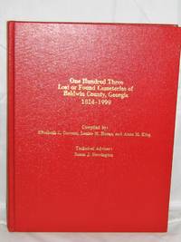
1998réf. 0022516Milledgeville Ga.: Boyd Publishing Company Inc. 1998. First Edition. . Hardcover. Near Fine/None Issued. NF/0/1st ed. Clean and tight--just the thing if you like to buy your research material by the pound!This hefty volume is in excellent shape; it has some shallow abrasions on the front cover-you have to hold the book up to the light to see them. Gold gilt lettering to front and spine all present. There's a short inscription on the front pastedown"To June and Burl- Merry Christmas '98-- Eugenia and "Sis". Two of the three editors signed the front free endpapers--names only. No writing or marking to this mamoth collection of cemetery records. 759pp. Records broken down into three section according to location in cemetery. Location Maps Cross Reference Listings to Former Lot Owners in the Andrews Directory Index to Military Veterans Revolutiornary to Vietnam Government Official Index Glossary and Abbreviations Index to Every Known Grave. A wonderful example of polished and exact research. I own this book and can have it in the mail tomorrow. Boyd Publishing Company, Inc. hardcover
réf. DADAX1561643610New unknown
2025réf. x-1009363557Cambridge University Press 2025. Hardcover. New. 2nd revised edition edition. 726 pages. 8.50x1.50x11.00 inches. Cambridge University Press hardcover
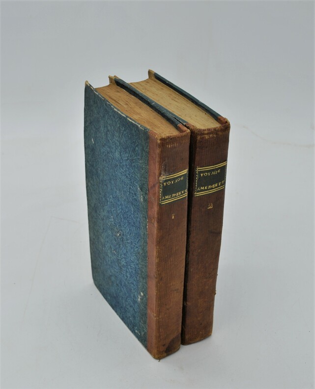
1793réf. PHO-760Paris La Villette 1793. 2 vol. in-8, (4)-336 pp. et (4)-453 pp., relié papier époque avec pièce de titre verte, tranches jaunes , plats frottés , illustré de 3 planches dont 2 dépliantes .