Department, Boston PoliceBiblio.com

10 246 résultats
réf. 0666361665.Ghardcover. Good. Access codes and supplements are not guaranteed with used items. May be an ex-library book. hardcover
1937réf. 200152Boston 1937. hardcover. very good. Illus. 8vo tan boards. Boston 1937. vg Published by the Banks and Trust Companies of Boston unknown books
réf. B138437-2Boston 2001. 20pp. 52 illus. partly color. 4to. Wraps. Boston, 2001. paperback books
1855pp. 203, 8 [Publisher's catalogue]. Light age stain. Early manuscript ownership of Maggie Becksmith, Middletown, (PA) on first fly leaf. Small 8vo. 185 mm. Original full brown embossed cloth binding. Head and tail of spine rubbed. Very good. Hardbound. First American Edition. Born in Kennett Square, Chester County, PA, Bayard Taylor (1825-1878) was a popular and influential American poet, literary critic, journalist, translator, and travel author. AI BX 1
1991réf. 62065New York: David R. Godine 1991. First Edition; First Printing. Hardcover. Very Good in a Very Good dust jacket. Page 121/122 is missing.; 11.80 X 9.20 X 0.80 inches; 192 pages. David R. Godine hardcover
2008réf. DADAX186094826XImperial College Press 2008-01-01. Illustrated. hardcover. New. 6.35x0.68x9.01. Buy with confidence. Excellent Customer Service & Return policy. Imperial College Press hardcover
réf. 1332063489.Gpaperback. Good. Access codes and supplements are not guaranteed with used items. May be an ex-library book. paperback
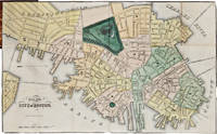
réf. 62491Boston: Published by Charles Stimpson 1829. Scarce and Charming Street Plan of Boston A scarce separately-issued pocket map edition of this folding map of the city of Boston originally printed in the Boston Directory for 1829. The Boston Directory first appeared in 1789 and was printed more or less consistently by a variety of publishers through the early 20th century. Publisher Charles Stimpson who took over with partner John Frost in 1820 turned the irregularly printed directory into a yearly affair bundled with the Boston Advertiser. A similar plan of Boston appeared in their first edition and was continually updated as the city grew and evolved. This is the first edition published with only Stimpson's name on the imprint and the detailed street plan represents Boston at a period of considerable change. The filling of Mill Pond which began in 1807 for example was only completed in 1828 making this an early example of a city plan which shows the streets of the finished project and the newly constructed and somewhat controversial Warren Bridge see Charles River Bridge v. Warren Bridge 1837. While this map is primarily found in the 1829 edition of Stimpson's directory a small number of copies were issued separately as pocket maps folding into a gilt leather folder and completed with neat hand-coloring. In her book Gaining Ground: A History of Landmaking in Boston historian Nancy Seashores attributes the maps in Stimpson's directories from 1828 to 1838 to copper engraver Hazen Morse originally of Haverhill. This copy belonged to Captain Crofton Thomas Croasdaile Vandeleur 1808-1876 a member of the prominent Irish Vandeleur family. Vandeleurs spent centuries as members of parliament soldiers or both; descendants Joe and Giles Vandeleur participated in Operation Market-Garden in the Second World War and were featured as characters in the 1977 film A Bridge Too Far. An interesting and detailed snapshot of Boston during a time of growth and expansion quite rare in the separately-issued pocket map format as here. OCLC locates copies of the 1829 map at only five institutions: the British Library the American Antiquarian Society the Massachusetts Historical Society the Boston Public Library and the Newberry Library. Folding into contemporary roan gilt binding 3¼ x 2¾ inches. Map trimmed to the neatline minor splitting along some folds. Contemporary ownership inscription of "Cap't Crofton Vandeleur 34th Reg't" on verso see below. Very good. OCLC 760222152 1021281603 556668729. Nancy Seasholes Gaining Ground: A History of Landmaking in Boston Boston: MIT Press 2003 p.441. hardcover books
réf. 62491Boston: Published by Charles Stimpson 1829. Scarce and Charming Street Plan of Boston A scarce separately-issued pocket map edition of this folding map of the city of Boston originally printed in the Boston Directory for 1829. The Boston Directory first appeared in 1789 and was printed more or less consistently by a variety of publishers through the early 20th century. Publisher Charles Stimpson who took over with partner John Frost in 1820 turned the irregularly printed directory into a yearly affair bundled with the Boston Advertiser. A similar plan of Boston appeared in their first edition and was continually updated as the city grew and evolved. This is the first edition published with only Stimpson's name on the imprint and the detailed street plan represents Boston at a period of considerable change. The filling of Mill Pond which began in 1807 for example was only completed in 1828 making this an early example of a city plan which shows the streets of the finished project and the newly constructed and somewhat controversial Warren Bridge see Charles River Bridge v. Warren Bridge 1837. While this map is primarily found in the 1829 edition of Stimpson's directory a small number of copies were issued separately as pocket maps folding into a gilt leather folder and completed with neat hand-coloring. In her book Gaining Ground: A History of Landmaking in Boston historian Nancy Seashores attributes the maps in Stimpson's directories from 1828 to 1838 to copper engraver Hazen Morse originally of Haverhill. This copy belonged to Captain Crofton Thomas Croasdaile Vandeleur 1808-1876 a member of the prominent Irish Vandeleur family. Vandeleurs spent centuries as members of parliament soldiers or both; descendants Joe and Giles Vandeleur participated in Operation Market-Garden in the Second World War and were featured as characters in the 1977 film A Bridge Too Far. An interesting and detailed snapshot of Boston during a time of growth and expansion quite rare in the separately-issued pocket map format as here. OCLC locates copies of the 1829 map at only five institutions: the British Library the American Antiquarian Society the Massachusetts Historical Society the Boston Public Library and the Newberry Library. Folding into contemporary roan gilt binding 3¼ x 2¾ inches. Map trimmed to the neatline minor splitting along some folds. Contemporary ownership inscription of "Cap't Crofton Vandeleur 34th Reg't" on verso see below. Very good. OCLC 760222152 1021281603 556668729. Nancy Seasholes Gaining Ground: A History of Landmaking in Boston Boston: MIT Press 2003 p.441. hardcover
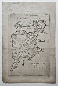
1784réf. 3834This extremely scarce map of Boston appeared as part of the Geographical Gazetteer of the Towns in the Commonwealth of Massachusetts a work issued in parts as a supplement to The Boston Magazine from October 1784 through December 1785. The map appeared with the October 1784 issue of The Boston Magazine. Wheat & Brun note that this map is based largely on Norman's Plan of the Town of Boston with the Attack on Bunkers-Hill. published in the Boston edition of An Impartial History of the War in America in 1781. The present map covers a somewhat smaller geographic area and on a modestly larger scale than the map that appeared in An Impartial History. It also adds/eliminates/changes some street names and landmarks making it more than a direct re-engraving and suggesting the involvement of a cartographer -- perhaps Osgood Carleton with whom Norman collaborated on several maps and charts in the late 18th and early 19th centuries. Norman's 1781 Plan was itself sourced directly from the map appearing in the English edition of An Impartial History 1778. Although the present map is not listed in the Boston Engineering Department's List of Maps of Boston Published Subsequent to 1600 1904 it is referenced in the listing for a 1789 version of the map that had apparently been re-engraved for Norman's Boston Directory 1789. Very scarce. No examples listed for sale in the Antique Map Price Record 1983-2011 and we not aware of any other examples being offered in the past twenty years. A lovely example of one of the most uncommon 18th century maps of Boston. References: Wheat & Brun Maps and Charts Published in America before 1800: 242. Jolly Maps of America in Periodicals before 1800: 402. Lewis: A Guide to Engravings in American Magazines 1741-1810: p. 3. Stauffer American Engravers Upon Copper and Steel: 2361. Condition: A strong image. Soiling and some darkening to plate area apparently as printed. Blank area of upper right corner skillfully replaced and three short fold separations repaired on the reverse. ICN 7760. [Greenleaf and Freeman].
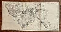
1948réf. 464Boston: Chief Engineer Boston & Maine Railroad 1948. 24 x 11 3/4 inches. Very good. This is a highly detailed map of the Boston & Maine trackage in Boston Cambridge Somerville Everett and Medford. The main terminal is shown center left. The rails are individually shown yielding a spellbinding visual presentation. The combination of multiple railroads yielded complex patterns of railroad penetration. Boston Harbor is in the lower left. The Navy Yard receives several rails split off from the main ganglion. Overall this is a graphic presentation of post WWII rail commerce in the city of Boston. Chief Engineer, Boston & Maine Railroad unknown
réf. 1024195996.Ghardcover. Good. Access codes and supplements are not guaranteed with used items. May be an ex-library book. hardcover
réf. 1378141539.Gpaperback. Good. Access codes and supplements are not guaranteed with used items. May be an ex-library book. paperback
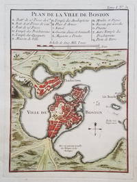
1764réf. 3845Classic Map of Boston from 1764 This classic map of Boston and the immediately surrounding area aooeared near the end of the French & Indian War. The map is from Bellin's Petit Atlas Maritime in 1764. A 16-item legend above the map identifies various public buildings churches and fortifications. Condition: Very good. Clear dark impression with attractive hand color. Age toning at the edges. Wide margins. Crease in lower right margin outside of platemark. ICN 7512.3 From Petite Atlas Maritime.
réf. 1019810793.Ghardcover. Good. Access codes and supplements are not guaranteed with used items. May be an ex-library book. hardcover
réf. ria9783744822862_inpPaperback. New. New Book; Fast Shipping from UK; Not signed; Not First Edition; Dies sind die Geschichten des kleinen aber doch schon ziemlich erwachsenen Jungen Pit der in einer wirklich schönen Stadt lebt in Holiday. Allerdings könnte er auch überall auf dieser Welt leben. Denn die Abenteuer die er so durchst paperback
réf. ria9783744836760_inpPaperback. New. New Book; Fast Shipping from UK; Not signed; Not First Edition; Dies sind die Geschichten des kleinen aber doch schon ziemlich erwachsenen Jungen Pit der in einer wirklich schönen Stadt lebt in Holiday. Allerdings könnte er auch überall auf dieser Welt leben. Denn die Abenteuer die er so durchst paperback
réf. 3744822869.Gpaperback. Good. Access codes and supplements are not guaranteed with used items. May be an ex-library book. paperback
réf. 3744836762.Gpaperback. Good. Access codes and supplements are not guaranteed with used items. May be an ex-library book. paperback
réf. 3744852466.Gpaperback. Good. Access codes and supplements are not guaranteed with used items. May be an ex-library book. paperback
réf. ria9783744852463_inpPaperback. New. New Book; Fast Shipping from UK; Not signed; Not First Edition; Dies sind die Geschichten des kleinen aber doch schon ziemlich erwachsenen Jungen Pit der in einer wirklich schönen Stadt lebt in Holiday. Allerdings könnte er auch überall auf dieser Welt leben. Denn die Abenteuer die er so durchst paperback
réf. 3744822664.Gpaperback. Good. Access codes and supplements are not guaranteed with used items. May be an ex-library book. paperback
réf. ria9783744822664_inpPaperback. New. New Book; Fast Shipping from UK; Not signed; Not First Edition; Dies sind die Geschichten des kleinen aber doch schon ziemlich erwachsenen Jungen Pit der in einer wirklich schönen Stadt lebt in Holiday. Allerdings könnte er auch überall auf dieser Welt leben. Denn die Abenteuer die er so durchst paperback
réf. 3744816311.Gpaperback. Good. Access codes and supplements are not guaranteed with used items. May be an ex-library book. paperback
réf. 3744854930.Gpaperback. Good. Access codes and supplements are not guaranteed with used items. May be an ex-library book. paperback