[Japan; Korea; Taiwan; Map]Biblio.com
2 138 résultats
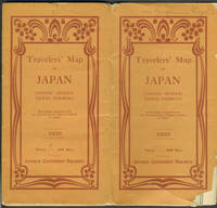
1933réf. 25597Tokyo: Japanese Government Railways 1933. Wraps. Good overall. Large folding map of Japan which unfolds to 32 panels 8 panels wide by 4 panels deep with many insets including Taiwan; General Map of Japan showing China and Manchoukuo; Osaka and Cities Near By; Tokyo and Vicinity; Hokkaido; and Karafuto Saghalien. Verso of map with printed text titled "Principal Cities and Noted Places in Japan"; includes Yokohama Tokyo KamakuraYokosuka Hakone Atami Mt. Fuji Nikko Karuizawa Matsushima Lake Towada Hokkaido Karafuto Nagoya Kyoto Amano Hashidate Nara Osaka Kobe Miyajima Shimonoseki Kyushu Nagasaki Unzen Beppu Mt. Aso and Kagoshima. Orange Art Deco style printed wrappers with some loss at lower front cover which only affects the map at the lower left side in an area of ocean slightly rubbed at wrapper edges owner name in ink Benjamin Riegel at top of front wrapper otherwise very good condition. Japanese Government Railways paperback
réf. 110834Maps of the four main islands of Japan and the Korean Peninsula are surrounded by borders of cherry blossom and bamboo with scenes of Mt Fuji a pagoda and birds on the wing. Major cities are shown on the maps; Korea has Pyongyang Seoul and Pusan with '38° LINE' in a much larger font across the centre. The album 275 × 390 mm contains three series of commercially produced small photographic views loosely inserted behind photo-corners 40 hand-coloured views of Japan; 56 black and white views of Tokyo; and 40 black and white views of the Kure-Hiro district as well as 11 larger personal photographs of Bangkok. The last three items in the album are more significant: they are professionally produced photographs of two destroyers of the RAN - HMAS 'Anzac' D59 and HMAS 'Warramunga' D123 - and a large group portrait of three officers and twelve sailors of the 'Warramunga'. Both these ships served in the Korean War. The album and its contents appear to have been purchased by one of the crew members of the 'Warramunga' after she became one of the first Australian warships assigned to the Far East Strategic Reserve in 1955. unknown
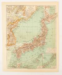
1902réf. 174898Leipzig.: Bibliographisches Institut. 1902-1908. Map printed in colour 27.2 x 21.4 cm inset colour key to territorial administration by country inset "western continuation of the main chart" including the Gulf of Tschili and Tsientsin and two insets at the foot of the map to the Kuril and the Ryuku Islands text in Geman central fold slight edge toning but in very good condition. Attractive map text in German prepared for Meyers Großes Konversations-Lexikon. . Bibliographisches Institut unknown
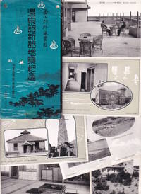
1920réf. 223564Japan.: 海雲台温泉合資会社. Kaiundai Onsen Goshi Kaisha. Circa 1920's. Eight black and white postcards presented in a paper folder. The cards are all in very good condition the paper folder is worn with two small punch holes along upper edge a sellotape stain long lower edge. Very good. A set of eight black and white postcards of Haeundae Hot Spring Resort near Busan South Korea produced in the colonial era probably 1920s and published in Japan. The postcards are contained in a decorative sleeve and show the modern buildings of the hot spring resort the surrounding coastal landscape and interior shots of the Japanese style rooms and the big hot spring tubs with women and children enjoying their baths. The postcards were produced at a time when the Japanese government was enthusiastically encouraging Japanese tourism to the colony of Korea and this spa resort probably run by Japanese owners appears to be part of the growing network of Japanese tourist sites in Korea Taiwan and later Manchuria. . 海雲台温泉合資会社. [Kaiundai Onsen Goshi Kaisha]. unknown
1996réf. LFA015daRevue trimestrielle de l'Institut international de géopolitique : environ 100 pages, format 210 x 280 mm, illustrée, brochée couverture couleurs sous jacquette illustrée
réf. 234849S.l., Imprimerie A.I.A., s.d. (1952) 2 vol. in-4, 506 pp., nbses ill. in-t. et 24 cartes ou croquis dépliants sous chemise, broché, sous chemise. La chemise protégeant les 2 volumes est abîmée avec des manques au second plat.
réf. 201402223, Xandu les humanoides associés, 1984 ; in-4, 118 pp., cartonnage de l'éditeur.
1986réf. 0055911986 Special expedition postcard with Nepal R.3 stamp postmarked Kathmandu 29 May 1986. Signed by six team members. A near fine copy. Signed by the Expedition Team. First Edition. unknown
réf. 38009901Korea late 18th-early 19th century 1780-1810. Eight color gouache pastel tinted maps ca. 57.5 x 90.1 cm.contemporary re-backing very solid clean examples complete set of all provinces hand-painted gouache manuscripts. RARE & OBSCURE . . . . A RARE & COMPLETE SET OF ANTIQUARIAN MANUSCRIPT KOREAN . . . YI PERIOD PROVINCIAL MAPS . . "P'ALTO CHIDO" OR "EIGHT PROVINCES MAPS" . . . DELUXE ELEPHANT FOLIO SIZE SHEETS . . . HAND-COLORED GOUACHE PASTELS . This is a very RARE & COMPLETE set of eight Korean provincial manuscript maps. Drawn circa 1780-1810 by an unsigned Korean cartographer. These maps are of historical importance giving place names isolating the time frame. . Painted on very thin finely hand-made mulberry-fiber tissue paper contemporary re-backed with a stiff hand-made paper. Beautifully hand-painted & colored in gouache pastels. . The record shows several reliable verities of manuscript maps showing the eight ancient Korean provinces. . Commonly these maps had no title cartographer's name date or other critical bibliographic colophon data. This is a common theme with Korean manuscript maps. . Political divisions of Korea are by and large mostly stable making name comparisons easier. . PROBABLE MAP TITLES INCLUDE: . a. The "SINJUNG-TONGGUK-YOJI-SUNGNAM:" "EIGHT SEPARATE MAPS EACH SHOWING ONE COMPLETE PROVINCE OF THE EIGHT KOREAN PROVINCES similar in intention to the "P'ALTO CHIDO." . The eight provinces were established during the Chosen dynasty 1392-1910 alternately and commonly called the Yi dynasty. . The eight provinces are from the north to south: . 1. Hamgyong 2. P'yong'an 3. P'yongyang 4. Kangwon 5. Hwanghae 6. Kanghwa 7. Kyongsang 8. Cholla'ungch'ong . During the Sejo reign 1455-68 Yang Songji made the first "P'Alt-do "P'ALTO CHIDO" type maps of the eight provinces this type and style became the "standard" for future examples. There after his style and format were copied by others for centuries. . b. A second version and style of the above eight provinces maps is called "TONGGUK CHIDO: MAP OF THE EASTERN COUNTRY i.e. KOREA" showing a compressed northern frontier along Manchuria the characteristic "CHONG CH'OK" style. . c. A third similar map: "P'ALDO-CHONGDO: A SINGLE MAP SHOWING THE EIGHT PROVINCES OF KOREA." . These maps are pictorially beautiful and artistically drawn in detail. Graphics expressing a primitive naive folk charm depicts prominent geological landscape features. Mountain ranges hills forests in green streams/rivers blues political district seats distinctively painted cartouches box-like in various differing colors for each province. Roads paddy coastal shore line & islands in blue tints with other features nicely colored. . There are a large number of name throughout each map all written in Hanzi traditional Chinese characters called "Hanja" in Korean as was the common practice at that time for Koreans. There are no Hangul characters at all. The Hanja identify navigational directions names of surrounding ocean harbors beaches geographical names city towns villages mountains rivers roads and the like. . Each of the eight maps illustrates a complete single province. Within each of the various political divisions and boundaries outlined and named. . RARITY OF KOREAN ANTIQUITIES: Antiquarian Korean examples are sparse when compared to items of the same period in China and Japan. Korean works are less than 10% of those created elsewhere. . Fewer Korean items were made survived and preserved. The attrition rate: bad weather unstable ancient mud building structures fires natural disasters earthquakes war and other factors diminished the remaining examples. . Those the numbers that come to marked are steadily reduced while the value continues to appreciate. Many never return to market when acquired by institutions or private collectors who eventually donate to museums. . DATING THESE MAPS: These were mostly undated. . There are three possible methods of dating. . a. BY PLACE NAME: there are details in the reference books about county seat names being colored or put in various kinds of 'boxes' on the map depending on that according to the resources approximate dates can be derived. . b. PAPER TECHNOLOGY & FIBERS: Koreans have been using hand-made mulberry bark and fiber paper from the Zhenguan period AD 627-649 printing Buddhist sutras by woodblocks on similar kinds of paper. . These two technologies papermaking and woodblock printing was transmitted to Japan around 700 AD. . Since that time both Koreans & Japanese have utilized mulberry paper Washi in Japanese to woodblock print and paint a large variety of items including maps books and single page works. . By comparing the paper of these maps with known dated printed Japanese books a very close approximate date can be derived. . These Korean map papers are nearly identical to dated woodblock-printed Japanese examples we have. It is therefore highly possible these maps were painted on hand-made mulberry paper from circa 1780-1810 period. . In ancient times sheet size was limited to a small size then joined to other sheets to create a large size single sheet. These maps are of that format. See McCune below where he states the kind of paper used which matches our examples. . CONDITION: Per McCune we summarize: as usual these maps were folded several times from their creation time so they could be safely stored and carried in small 'book' format in covers with a tied string. See McCune below. . Being painted on very fine & thin hand-made mulberry paper most all examples were eventually re-backed. Ours as typical have period re-backing using the same character hand-made mulberry fiber paper of a thicker quality. . They are well preserved however nevertheless as usual there remains some old original wear at the folds the expected light water stains dustiness with other typical very minor flaws for an item of this grand size being 200 years old. These do not detract from the overall excellent impression and stunning appeal. . RARITY: . The complete set is RARE! The work is nicely executed in a firm hand with artistic value illustrating artistically hills mountains and other features of the map pictorially. It is not only a map but a work of art. Tastefully colored in subtle pastels nice representation of water rives and sea. . Such early and beautifully artistic examples seldom come to market. . A RARE AND FRESH EXAMPLE NEVER BEEN ON THE MARKET IN THE LAST 120 YEARS ! . PROVENANCE: These items were acquired from a former missionary's estate who was stationed in Korea from circa 1900-1930's. They have been in this private collection since and have never been on the market. . Color scans are posted to our website. . REFERENCES: . TOOLEY Ronald V. et al.: Article: Shannon McCune: SOME KOREAN MAPS pp.70-102 with illustrations. McCUNE Shannon.: KOREAN MAPS OF THE YI DYNASTY KOREAN CULTURE Korean Consulate General L.A. Ca. Sept. 1983 pp.21-31 34 back cover color plate color & b.w. illustrated. . He discusses "P'ALTO CHIDO""EIGHT PROVINCES MAP" origins maps without scale and were copies of a Korean scholar named Won his title was: Haksaeng works based on Chong Ch'ok's 1390-1475 TONGGUK CHIDO MAP OF THE EASTERN COUNTRY then modified by Won to be the more typical "P'ALTO CHIDO" "EIGHT PROVINCES MAP" but in his new style. This new style clearly resembles our maps in layout format color of county seats and similar boxes around them and other critical details. KOREAN CONSUL GENERAL KOREAN CULTURE September 1983 pp.21-31 34 color map on back cover color and b.w. illustrated. . It was from these maps that the later versions similar to ours eventually emerged mostly by Imperial Order by the ".Yi Dynasty court specifically decreed that both magistrates and governors should prepare up-to-date maps of their territories udder their supervision." p.25. HARLEY J.B. ed. et al.: CARTOGRAPHY IN THE TRADITIONAL EAST AND SOUTHEAST ASIAN SOCIETIES. Ahead of Title: THE HISTORY OF CARTOGRAPHY Vol. 2 Book 2 an excellent article by Gari Ledyard: CARTOGRAPHY IN KOREA pp. 235-345239 figures 10.23 10.24 et al. NAKAMURA Hiroshi.: EAST ASIA IN OLD MAPS. . --. NIHON KO CHIZU TAISEI: GREAT COLLECTION OF OLD JAPANESE MAPS MONUMENTA CARTOGRAPHICA JAPONICA . --. OLD CHINESE WORLD MAPS PRESERVED BY THE KOREANS. Article in IMAGO MUNDI IV 1958. LEE Chan. CH'AN Yi.: OLD MAPS OF KOREA. Han'guk ko chido. By: Ch'an Yi Hong-gyu Che Han'guk Tosogwanhak Yon'guhoe. He discusses and illustrates a good number of similar examples. On pp.226-27 he outlines an early Yi Dynasty example of: THE MAP OF EIGHT provinces found in TONGGUK YOJI SUNGNAM Chong Sang-gi's Tongguk Chido. These manuscripts were on large paper one province per sheet. Many other fine related examples are illustrated & discussed. . --. OLD MAPS OF KOREA: HISTORICAL SKETCH. He traces the early origins of Early Yi dynasty1392-1910 Eight Provinces Map origins and progressions excellent lucid article with illustrations and references to Yi HOE's MAP OF EIGHT PROVINCES. Excellent essay on provincial maps. SHIN Michael D. ed.: KOREAN HISTORY IN MAPS: From Prehistory to the Twenty-First Century. British Museum similar examples cited: commons-wikimedia-org/wiki/Category:Room_67_British_Museum# /media/File:Map_of_the_Jeolla_Province_British_Library_c.27. f.14_fol.12_n02.jpg Library of Congress: Young Il Kim: dong-kookyu-do: A RECENTLY DISCOVERED MANUSCRIPT OF A MAP OF KOREA. Imago Mundi vol.21 1967 pp.31-49 illustrated. . . unknown
1952réf. LFA-126730536Revue de 87 pages, format 145 x 195 mm, brochée, publiée en 1952, bon état
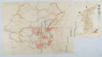
1902réf. 220266Japan. No date. Circa1902. Two very attractive colour folded manuscript maps one showing China and the other Korea. Map of China: Watercolour map 48 x 63.5cm. Closed tear now professionally repaired. Map of Korea: Finely detailed watercolour map a few tiny holes very neatly repaired on the verso with archival washi. 33 x 24.5cm Two delicate hand-painted maps one of China and one of Korea produced by a Japanese student cartographer named Koike Tokushige 小池徳重. The undated map of China appears to have been produced in the first five years of the twentieth century: a time when Japan had recently colonized Taiwan and when Japanese economic and political interest in the region was rapidly expanding. The inscription on the map suggests that it was a third year college project. But the high level of detail suggests that the artist had considerable experience of map making. The map of China shows the main provinces rivers major transport routes the Great Wall and the location of key cities although the names of the cities are not included. It also shows outlines of the Korean Peninsula Taiwan and the Japanese island of Kyushu but not the rest of Japan. The map of Korea is more detailed. It provides an accurate outline of the Korean Peninsula with careful hatching indicating changes in elevation. Rivers and major road routes are shown on the map and the locations of major towns are marked though only Busan and Incheon are named. Dotted lines show coastal sea routes and routes between Kyushu and Busan and between Incheon and China. The map shows the Gyeongin railway line between Seoul and Incheon which was completed in 1899 and route of the Gyeongbu railway line between Busan and Seoul whose construction started from both ends in 1901. But the map depicts only small sections of this line close to Seoul and Busan as being completed with the rest more lightly outlined to show the projected route implying that the map was drawn around 1901-1902 and certainly before the Gyongbu line was opened in 1904. Inserted text gives the land area and population of Korea. Rather strangely though the figure given for the Korean population is vastly underestimated. Ikeda gives this as 5.7 million when in fact at that time is was around 18 million. . unknown
réf. ORD-15527Paris. Imprimerie de l'Union des Femmes Françaises. (1951). In-8 (137 x 202mm) broché, couverture rouge illustrée d'une photo en noir et blanc, 48 pages, très nombreuses photos dans et hors texte. Accablante enquête sur les atrocités commises par les troupes américaines et celles de Syng-Man-Rhee en Corée. Assez bon exemplaire, peu courant.
réf. 201312564Seoul, Hotel lotte, 1989 ; in-4, 150 pp., cartonnage de l'éditeur. Ouvrage en bon état.
2004réf. 16392Paris Association du Salon D'Automne 2004 1 Un fort volume broché de format in 8° de 460 pp. sur papier couché; entièrement illustré; couverture à rabats. Artistes des Amériques; artistes Chinois; Coréens... Peinture. Sculpture. Photographie. Gravure. Mobilier. Arts Décoratifs. Mosaïque; plusieurs centaines de reproductions d'oeuvres en couleurs le plus souvent.
réf. 200913338Kalmthout-anvers, Walter beckers éditeur, 1971 ; grand in-8, 275 pp., cartonnage de l'éditeur (noir).
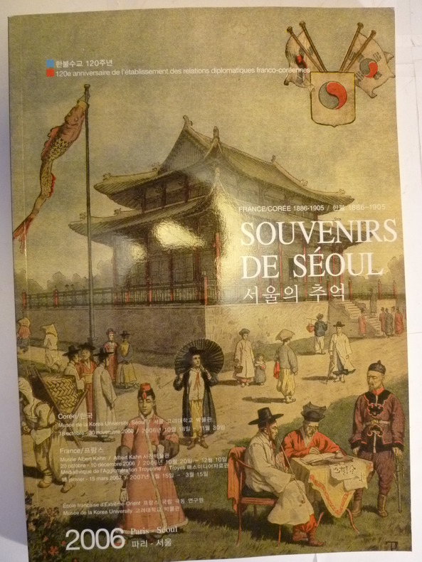
réf. 3433Paris, Séoul, Ecole Française d'Extrême-Orient, Musée de la Korea University, 2006. 1 volume in-4, broché, couverture souple illustrée, 254 pp., richement illustré de documents photographiques en noir et blanc et en couleurs, état de neuf.
1925réf. 64345Tokyo Japan: Japanese Government Railways; Chosen Government Railways; South Manchuria Railway Company et al. Toppan Printing Co. 1925. Oblong 4to. 8.6 x 8 in. 2 72 18 columns i.e. 46 pp. printed in double columns throughout although some ads are double-column size and in red & black decorative red borders. With text illustrations & diagrams in red 4 colour maps 1 4-column or double-page. photo illustrations throughout. Self-printed colour-illustrated softcovers front cover art of Mt. Fuji by Hokusai colour map back cover for the N.Y.K. & O.S.K. Steamship lines slight dustsoiling very faint tidemark at foot of spine slight edgewear still a VG bright copy. First edition of this combination land promotion and travel brochure later available at the Japanese pavilion in the ill-fated 1926 Sesquicentennial International Exposition held in Philadelphia PA. Potential Asia travelers are supplied with travel information steamship instructions details on the Railways including the J.G.R. places to visit in Taiwan Formosa; cities sites and experiences in Korea along the Chosen Government Railway line as well as travel through Japanese-controlled Manchuria China during the Roaring 20’s. Worldcat locates 1 copy U of DE. [Japanese Government Railways; Chosen Government Railways; South Manchuria Railway Company, et al. (Toppan Printing Co.)], paperback
1910réf. 64663London UK: Chatto & Windus 1910. Tall 8vo. xvi 1 247 1 pp. Colour frontisp. 23 colour sepia tinted and colour-tinted plates 1 large folding colour map. Green publisher’s cloth illustration in blind black lettering front cover gilt lettering on spine some minor wear rubbing minor bumping head of spine still a VG bright partially uncut & unopened copy. First edition of this British woman adventurer and artist who published this as her follow-up to the 1909 “Face of China” and later expanded with “Wanderings in Chinese Turkestan” in 1914. These travel observations illustrations and account focus on her experiences as Japan has taken over Korea and begun expanding into Manchuria as well as Russian Empire areas in the aftermath of the 1905 Russo-Japanese War. Kemp 1860-1939 and her travel companion May Meiklejon MacDougal focused on local schools the welfare of women the roles of encroaching Western Christian missionaries and their impact on Asian societies. Chatto & Windus, hardcover
réf. 8738Paris, C.T, Loo & Cie, 1974. 1 plaquette in-8, brochée, 84 pp., enrichie de très nombreuses reproductions photographiques hors texte, en noir et blanc, bon état.
2008réf. LFA-126747112N° 461 (Décembre 2008) : revue de 82 pages, format 215 x 285 mm, illustrée, brochée couverture couleurs, bon état
1989réf. 2091502135408964Not Available 1989. Soft Cover. Fine. Number of books: 1 Not Available paperback
1979réf. 2111902156002142Ethnological Society of Japan 1979. Soft Cover. Fine. The book is in fine condition. Ethnological Society of Japan paperback
1951Milano, 1951, 3 giugno, copia del "Corriere della Sera" con titolo ed articolo in prima pagina.
1951Genova, 1951, 1 aprile, copia del "Corriere del Popolo" con titolo ed articolo in prima pagina.
1907Milano, 1907, estratto con copertina posticcia muta, pp. 1024/1026 con ill. - !! ATTENZIONE !!: Con il termine estratto (o stralcio) intendiamo riferirci ad un fascicolo contenente un articolo di rivista, sia che esso sia stato stampato a parte utilizzando la stessa composizione sia che provenga direttamente da una rivista. Le pagine sono indicate come "da/a", ad esempio: 229/231 significa che il testo è composto da tre pagine. Quando la rivista di provenienza non viene indicata é perchè ci è sconosciuta. - !! ATTENTION !!: : NOT A BOOK : “estratto” or “stralcio” means simply a few pages, original nonetheless, printed in a magazine. Pages are indicated as in "from” “to", for example: 229/231 means the text comprises three pages (229, 230 and 231). If the magazine that contained the pages is not mentioned, it is because it is unknown to us.