2001réf. x-9810247621World Scientific Pub Co Inc 2001. Hardcover. New. 520 pages. 8.50x6.25x1.00 inches. World Scientific Pub Co Inc hardcover
1851réf. 200120AG1851. London Edinburgh & Dublin J.& F. Tallis 1851. Original steel engraving / Vintage map. Drawn and engraved by John Rapkin. Partly hand-coloured. Illustrations by H. Warren and Enrgaved by J.H. Kernot. Plate Size: 33 cm x 25.5 cm. Sheet Size: 37.4 cm x 27.3 cm. Vintage 19th century map in very good condition. Published in the Illustrated Atlas And Modern History Of The World Geographical Political Commercial & Statistical Edited By R. Montgomery Martin. Beautifully bordered and fascinating map of Japan and Korea. The names of the major islands of Japan - Kiosiou Sitkokfi Shikoku and Niphon Honshu and the southern tip of 'Matsmai or Yersqi' Hokkaido are included on the map. Below the elbow of Honshu can be seen the tiny island of Fatsisio - the 'place of exile for the Grandees of Japan.' The map's nomenclature is interesting: Tokyo not yet the capital is named as Yedo while the then-capital Kyoto appears as 'Meaco'. Across the Korean Strait modern Seoul appears as 'Han y'. As these maps were being published both of these ancient and distinctive states Korea - the 'Hermit Kingdom' - and Japan - isolated under the centuries' long under the sakoku policy - were having to acclimate to increased Western influence in their region. The 1853-54 U.S. diplomatic and military naval expedition under Commodore Perry would force the establishment of diplomatic relations between Japan and the western "Great Powers" and eventually to the collapse of the ruling Tokugawa shogunate and the Meiji Restoration. Japan would partially embrace the West and western influences and emerge as a burgeoning regional power eventually establishing control over Korea by the early 20th century - at the beginning a calamitous half-century for the region. John Tallis 7 November 1817 3 June 1876 was an English cartographic publisher. His company John Tallis and Company published views maps and atlases in London from roughly 1838 to 1851. Tallis set up as a publisher with Frederick Tallis in Cripplegate in 1842; the business moved to Smithfield in 1846 and was dissolved in 1849. From 1851 to 1854 Tallis operated as John Tallis and Company. He started The illustrated news of the world and national portrait gallery of eminent personages in 1858 selling it for £1370 in 1861; it folded in 1863. Wikipedia The most important project John Tallis undertook was the 'Illustrated Atlas' from 1851. The original map we offer here was part of this exceptional Atlas and all the maps it contained are still today considered as the last reminder of an era of lavish map production. Tallis worked the project together with John Rapkin 1815-1876 and it was Rapkin's style and talent that we have to thank for when we marvel at these maps today. What makes these maps so special is the detail of engraved vignettes that surround the map and often show indigenous scenes people in their environment and even more so historical buildings or historical views of towns and cities architecture and landscape. The project of 'The Illustrated Atlas' was designed to be finished just in time for the anxiously awaited "Great Exhibition of the Works of Industry of All Nations" or The Great Exhibition sometimes referred to as the Crystal Palace Exhibition in reference to the temporary structure in which it was held was an international exhibition that took place in Hyde Park London from 1 May to 11 October 1851. It was the first in a series of World's Fairs exhibitions of culture and industry that became popular in the 19th century and it was a much-anticipated event. The Great Exhibition was organized by Henry Cole and Prince Albert husband of the reigning monarch Queen Victoria. It was attended by numerous notable figures of the time including Charles Darwin Samuel Colt members of the Orléanist Royal Family and the writers Charlotte Brontë Charles Dickens Lewis Carroll George Eliot and Alfred Tennyson. Music for the opening was under the direction of Sir George Thomas Smart and the continuous music from the exhibited organs for the Queen's procession was "under the superintendence of William Sterndale Bennett". Wikipedia unknown
195380 pages. Features: Many sensational color ladies' fashion ads; Cover photo of Dwight Eisenhower with Robert A. Taft; Interesting one-page RCA ad featuring the transistor; What Course for the Powerful Mr. Robert A. Taft?; The Iron Barrier - photos from seven frontiers where the Communists face the rest of the world - Korea, Turkey, Austira, Indo-China, Yugoslavia, Germany and Iran; Anatomy of the Russian Communisty Party - from a small band of hunted revolutionaries it has developed into a sanctuary for the privileged; U.S. and U.N. - The Choices Before Us - criticisms from the American public; We can live longer - but for What?; Danger in What We Don't Know - high school seniors show appalling ignorance of the world they live in; Class of '53 - The men leaving college this year are perhaps the most popular in years - with business, industry and the military competing; Bill Mauldin's cartoon art from three wars; Then and Now - Celebrated German Aeronaut Hugo Eckener; One page photo-illustrated ad for State of Israel Bonds entitled "Out of the Desert... A Great Chemical Industry" with photos of the new fertilzier and chemical plant at Haifa; Nice one-page ad for the 1953 Nash Rambler; Fantastic one-page color ad for colorful Crosley plastic (bakelite?) radios; Nice color ad for Cheer laundry detergent; Photos of home interior designed by architect Oskar Stonorov; Samuel Plotkin - New York City's expert on food contamination, detects it largely by tasting; Rare one-page color ad for F.W. Woolworth Co. Easter treats; and more. Above-average external wear. Unmarked. A worthy vintage copy. Book
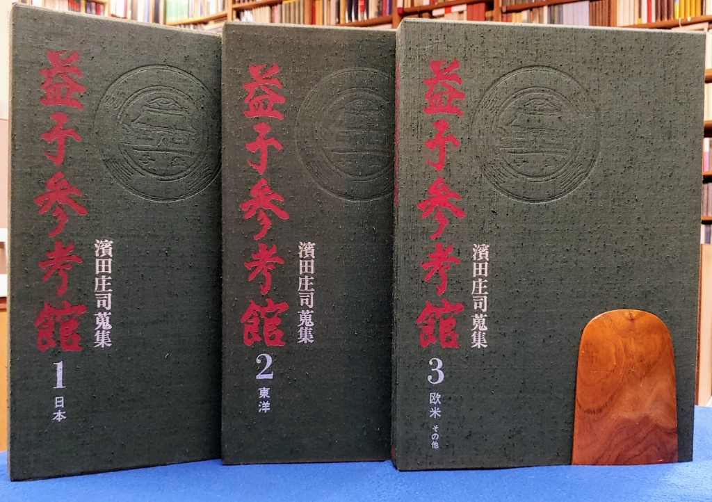
1979réf. 24493Tokyo, Gakken / Gakushu Kenkyusha, 1978-1979. 3 volumes complete: Vol. 1: Nihon. [Japanese folk arts.]. - Vol. 2: Toyo. [Asian folk arts: mainly from China and Korea.]. - Vol. 3: Obei sonota / O-Bei, sono-ta. [Folk arts of Europe, the Americas and other places.]. - Text in Japanese; captions and essays by Bernard Leach and Hiroshi Mizuo also in English. 230; 228; 229 pages with numerous illustrations (some color). Fol. (38 x 27 cm), Original gray cloth bindings with illustrated original dust jackets in original cloth slipcases with two-tone title lettering in red and silver. [9 Warenabbildungen]
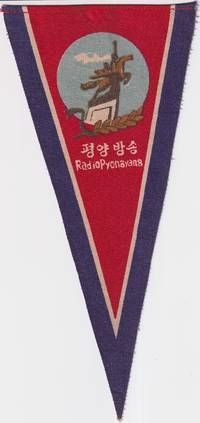
1960réf. 219665No publication details. circa1960s –70s based on design and material. Printed fabric pennant promoting Radio Pyongyang North Korea’s official broadcasting service. The image shows a stylised monument of two figures possibly symbolising industry and broadcasting with a laurel motif and radio waves under a red sky. Text in both Korean and English. Radio Pyongyang. “평양 방송” translates directly as Pyongyang Broadcasting. Text in Korean and English. 23.5 height x 11cm at top edge. A scarce example of early North Korean visual propaganda. Radio Pyongyang was founded in October 1945 and inaugurated programming with a live broadcast of Kim Il Sung's victory speech when he returned to Pyongyang at the end of WWII. The image on this pennant features a statue of two figures a worker and a peasant woman carrying a sheaf of rice riding the mythical horse Chollima symbolising speed strength and the spirit of the North Korean people. The Chollima movement which began in 1956 encouraged citizens to achieve extraordinary production and labour targets indicated by the sheaf of wheat symbolic of agricultural abundance. Radio Pyongyang helped to disseminaate the ideals of the Chollima movement and this pennant probably dates from after the Chollima Monument was unveiled in 1961. Provenance: Bought in China by a western collector in the late 20th century. . No publication details. unknown
2019réf. BN335564Die Gestalten Verlag 2019. 2019. Two Wheels South: A Motocycle Adventure from Brooklyn to Ushuaia: An Adventure Guide for Motorcycle Explorers Two Wheels South: A Motocycle Adventure from Brooklyn to Ushuaia: An Adventure Guide for Motorcycle Explorers GestaltenRobert Klanten und Matias Corea Die Gestalten Verlag unknown
1820Carta geografica, antica ed originale, con coloritura coeva ai confini. La mappa edita nella città tedesca di Weimar è stata disegnata nel 1820 e rappresenta il territorio della Cina e della Penisola Coreana. Rara edizione
Ulrico Hoepli, Editore Libraio della Real Casa Milano, 1895. Con 37 silografie nel testo, 2 tavole a colori e la Carta della Corea e del Teatro della Guerra (che non risulta). In 4to piccolo, front. in rosso / nero pp. IX, 278 (con lunga Appendice), leg. orig. in t. percallina azzurra con titoli in bianco. Raro a reperirsi e di grande interesse storico - politico. Legatura con imperfezioni del tempo, interno molto ben conservato. .
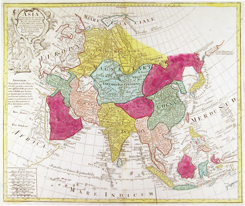
1770réf. 1606Augsburg, Lotter, 1770. Ritter, Lotter S. 126. - Mit figürlicher Kartusche, Schriftkasten und "Annotatio". - Die dekorative Karte umfasst ganz Asien, einschließlich Ostindien. Japan ist mit dem Festland durch ein Land verbunden, das als Terra Yeco bezeichnet wird (ungefähr die Lage des heutigen Hokkaido). Weiter im Nordwesten befindet sich die fiktive "Terra de la Compagnie", während Korea als Halbinsel dargestellt wird. Ostsibirien, noch unerforscht, fehlt völlig. In der Darstellung Südostasiens nehmen Indochina, Indonesien und die Philippinen allmählich ihre wahren Umrisse an. - Insgesamt wohlerhaltenes Exemplar.
1952réf. 65131952 Pekin 1952 fort volume In8 659 pages très grandes planches dépliantes et reproductions photographiques dans le texte
1906réf. 41143BBLondon:, W. Heinemann, 1906. Lex.-8°. XII, 473 S., zahlreiche sw-Abbildungen, Leinen (Besitzervermerk auf Innedeckel; altersgemäss gut erhalten)
1916Pages 482-576 + 30 pages of ads. Features: The "Brides" Special - when Swiss girls were regularly shipped to southern Chile to marry ranchers; Winter-Sport Mountaineering - how to avoid its dangers - article with photos; The Wreck of the 'County of Anglesea' - fight for the life of a capsized ship; Wanderings in Northern Persia - II - article with first-ever published photos of Kelat-i-Nadiri, the Gibraltar of Persia, and many other photos; A Fiery Ordeal - surviving a 1904 volcano on Mount Kloet on the island of Java; Down the Amazon from Source to Mouth, part VII; From Job to Job Around the World, Part II - fantastic travelogue of two young Americans in Japan and Korea with wonderful photos; The Saving Shadow - Rev. Wm. F. Rigge of the Creighton University Observatory uses shadows to help acquit a man facing serious charges; A Motor-Boat in Mexico - the villagers had never seen anything like it;; The Marchwood Ghost Mystery - A Highland Regiment soldier committed suicide in 1885 and his ghost was supposed to haunt the sentry's beat;;"The Heathen Chinee" - principally concerned with the Chinaman's attitude towards railways - also tells some quaint stories about the 'spirits of wind and water' which rule his actions during and after his life - article with great photos, especially all the Chinese aboard a Shanghai-Nanking Railway engine they had fled only a week before; and more. Average wear. Unmarked. Binding intact. A sound vintage copy. Book
1996245 pages. Signed and warmly inscribed by Editor to his mentor upon title page. Copy number 254 of 550 printed in this first edition. Black and white illustrations from photos. Colour photographic plates. "Fly a daylight low level mission in the early days of the war with a pilot and navigator in a B-26 Invader, fastest USAF prop-driven light bomber of the day, as they roar down the railroad tracks toward Sinanju... Attack a locomotive at night in northwest Korea's Mig Alley... Read the short biographies of some of the men who lived and died in that long forgotten war... Read about those dedicated professionals who worked 16 to 18 hours a day to keep the airplanes flying... Be a guest of the mayor of Hiroshima six short years after the United States destroyed that city... And, most importantly, find out what it was like to be a member of an elite night intruder squadron who maintained the lonely vigil of overflying North Korea's lines of communication leading to the battle line." - from dust jacket. Clean, bright and unmarked with negligible wear. Dust jacket now preserved in glossy new archival-grade Brodart. A superb copy. Book
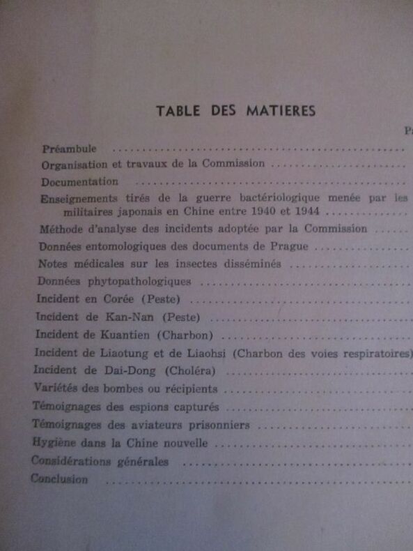
réf. 234849S.l., Imprimerie A.I.A., s.d. (1952) 2 vol. in-4, 506 pp., nbses ill. in-t. et 24 cartes ou croquis dépliants sous chemise, broché, sous chemise. La chemise protégeant les 2 volumes est abîmée avec des manques au second plat.
réf. 110834Maps of the four main islands of Japan and the Korean Peninsula are surrounded by borders of cherry blossom and bamboo with scenes of Mt Fuji a pagoda and birds on the wing. Major cities are shown on the maps; Korea has Pyongyang Seoul and Pusan with '38° LINE' in a much larger font across the centre. The album 275 × 390 mm contains three series of commercially produced small photographic views loosely inserted behind photo-corners 40 hand-coloured views of Japan; 56 black and white views of Tokyo; and 40 black and white views of the Kure-Hiro district as well as 11 larger personal photographs of Bangkok. The last three items in the album are more significant: they are professionally produced photographs of two destroyers of the RAN - HMAS 'Anzac' D59 and HMAS 'Warramunga' D123 - and a large group portrait of three officers and twelve sailors of the 'Warramunga'. Both these ships served in the Korean War. The album and its contents appear to have been purchased by one of the crew members of the 'Warramunga' after she became one of the first Australian warships assigned to the Far East Strategic Reserve in 1955. unknown
1964réf. 197821964. Anonymous photographs of African American soldiers stationed in Korea and Europe produced c. 1960s document Black military service during the Cold War and provide primary-source evidence for the study of U.S. Army deployments racial integration in the post-World War II military and lived experience within forward operating environments near geopolitical flashpoints. The images place African American servicemen at installations including Camp Kaiser in South Korea located within proximity to the Korean Demilitarized Zone and in European urban and alpine settings indicating rotational or multi-theater deployment. The archive supports research into the role of Black soldiers in Cold War containment strategy as well as the everyday conditions mobility and social environments encountered by enlisted personnel across Asia and Europe during a period of sustained global military presence. Archive of 24 original black and white silver gelatin photographs c. 1960s primarily measuring approximately 4" x 3". At least half of the images are identified as taken in Korea with multiple captions including "Camp Kaiser" "Korean Home" "Village" and "CO Area" situating the group within a U.S. Army installation environment composed of cinder block structures and Quonset huts approximately 60 miles north of Seoul and within range of North Korean artillery positions. One overhead view shows the full layout of Camp Kaiser while other images depict African American soldiers in field conditions described as "Cold Wet" trekking and camping in rugged terrain. Additional Korean scenes include a soldier leaning against a tank marked "Kimchee" and an airfield photograph showing a chrome fighter jet surrounded by personnel alongside additional aircraft including a biplane. European photographs include a parade observed from an apartment window in a German-speaking alpine town featuring a float labeled "General Knuller" as well as street-level images of crowds deployed fire engines and soldiers observing from a Volkswagen Beetle. One image shows an African American soldier standing outside a synagogue marked by a Star of David with a flag bearing the inscription "Troop Att 1964" indicating interaction with local religious or commemorative sites. The photographs align with the global positioning of U.S. forces during the Cold War particularly in South Korea following the Korean War armistice and across Western Europe as part of NATO-aligned defense strategy. African American soldiers serving in an officially desegregated military after 1948 participated in these deployments while navigating both military hierarchy and broader social transformations associated with the Civil Rights era. The archive captures a range of activities from patrol and training environments to civic encounters and public events offering a geographically dispersed visual record of Black military presence within U.S. Cold War operations. Light wear and minor handling present; captions and details remain legible; overall very good condition. unknown
1964réf. 197821964. Anonymous photographs of African American soldiers stationed in Korea and Europe produced c. 1960s document Black military service during the Cold War and provide primary-source evidence for the study of U.S. Army deployments racial integration in the post-World War II military and lived experience within forward operating environments near geopolitical flashpoints. The images place African American servicemen at installations including Camp Kaiser in South Korea located within proximity to the Korean Demilitarized Zone and in European urban and alpine settings indicating rotational or multi-theater deployment. The archive supports research into the role of Black soldiers in Cold War containment strategy as well as the everyday conditions mobility and social environments encountered by enlisted personnel across Asia and Europe during a period of sustained global military presence. Archive of 24 original black and white silver gelatin photographs c. 1960s primarily measuring approximately 4" x 3". At least half of the images are identified as taken in Korea with multiple captions including "Camp Kaiser" "Korean Home" "Village" and "CO Area" situating the group within a U.S. Army installation environment composed of cinder block structures and Quonset huts approximately 60 miles north of Seoul and within range of North Korean artillery positions. One overhead view shows the full layout of Camp Kaiser while other images depict African American soldiers in field conditions described as "Cold Wet" trekking and camping in rugged terrain. Additional Korean scenes include a soldier leaning against a tank marked "Kimchee" and an airfield photograph showing a chrome fighter jet surrounded by personnel alongside additional aircraft including a biplane. European photographs include a parade observed from an apartment window in a German-speaking alpine town featuring a float labeled "General Knuller" as well as street-level images of crowds deployed fire engines and soldiers observing from a Volkswagen Beetle. One image shows an African American soldier standing outside a synagogue marked by a Star of David with a flag bearing the inscription "Troop Att 1964" indicating interaction with local religious or commemorative sites. The photographs align with the global positioning of U.S. forces during the Cold War particularly in South Korea following the Korean War armistice and across Western Europe as part of NATO-aligned defense strategy. African American soldiers serving in an officially desegregated military after 1948 participated in these deployments while navigating both military hierarchy and broader social transformations associated with the Civil Rights era. The archive captures a range of activities from patrol and training environments to civic encounters and public events offering a geographically dispersed visual record of Black military presence within U.S. Cold War operations. Light wear and minor handling present; captions and details remain legible; overall very good condition. unknown books
réf. wa587Broché TRES RARE. Deux volumes in-4 (21,5 x 27,2 cm), dont un volume broché contenant le texte (506 pp.) avec illustrations en noir et blanc, et une chemise contenant croquis et cartes renseignées, sans date (années 50) ; pliures aux dos, traces et marques d'usure sur les plats, quelques rousseurs, par ailleurs intérieur frais, assez bon état général. Livraison a domicile (La Poste) ou en Mondial Relay sur simple demande.
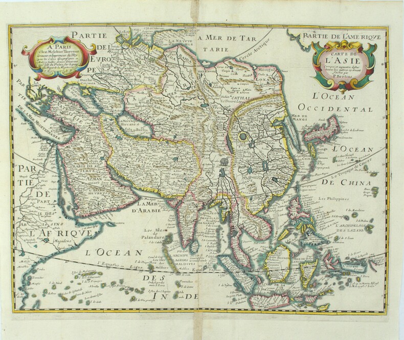
1639réf. PHO-2226Paris, Melchior Tavernier, 1639, 378x345mm, cuvette 360x280mm, renfort au pli, manque 1mm au centre
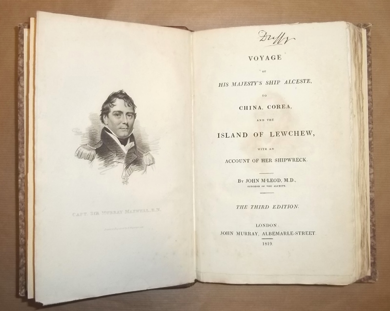
1819réf. 16825London, Murray, 1819. The third edition. VI S., 1 Bl., 339 S. 1 Porträt, 5 kolorierte Tafeln und 1 gefalt. Karte (alles in Kupferstich). Gr.-8°. HLdr. des 20. Jahrhunderts mit Rückentitel (etw. bestoßen). [6 Warenabbildungen]
1959réf. 51804Seuil, coll. « Court Métrage » 1959 “Court-métrages 1.” In-8 oblong, cartonnage éditeur, 140 pp. Couverture lég. passé. Très bon exemplaire.
1953réf. 212881953. African American military photo album 1953-1960 documenting the service and personal life of a Black U.S. Air Force serviceman across multiple postings during and after the Korean War. The album records military duty daily routines and interpersonal relationships within an increasingly integrated armed forces providing visual evidence of African American participation in Cold War military infrastructure. The material captures both overseas deployment in Korea and domestic life across U.S. bases situating individual experience within broader patterns of military service and social change following desegregation. Album comprises 101 black-and-white silver gelatin photographs most measuring approximately 3.5" x 3.5" mounted on black pages with corner mounts. Early images place the serviceman at Kessler Air Force Base in Mississippi followed by extensive documentation of his time in Korea likely associated with the 650th Aircraft Control and Warning Squadron as indicated by a tent marked with unit insignia. Photographs show military encampments with tents and barracks vehicles including trucks and jeeps and groups of soldiers engaged in daily routines. One caption identifies "Our home in Korea" accompanying images of base infrastructure. Additional scenes include a USO performance at "K-6 Korea 54" where servicemen gather beneath a "Camp Shows" banner. The album continues with postings at Ellsworth Air Force Base in South Dakota and locations in Alaska where winter conditions specialized vehicles and outdoor activities are visible. Social and interpersonal life is extensively documented with repeated appearances of individuals identified as "Daril" "Bunky" "Peanuts" and others shown in uniform at leisure and in group settings. Domestic scenes include family gatherings such as "Roger's Birthday Party June 59" and images of women and children identified as "Mary" "Rochelle" and "Teresa" indicating sustained family connections. Travel photographs include roadside markers such as "Welcome to Illinois" and "Entering Indiana" while Alaska-based images depict community events including dog sled races and local festivals. Created during the transitional period following the desegregation of the U.S. military these photographs provide a sustained record of African American service members operating within integrated units while maintaining personal and family networks across geographic distances. The combination of overseas deployment domestic postings and family life offers a comprehensive view of military and social experience during the 1950s. Album pages show some loss and covers are detached; photographs remain sharp with strong tonal quality and are largely well-preserved; overall very good condition. This album offers an extensive documentary record of African American military life and community formation in the Korean War and early Cold War period. unknown
1953réf. 212881953. African American military photo album 1953-1960 documenting the service and personal life of a Black U.S. Air Force serviceman across multiple postings during and after the Korean War. The album records military duty daily routines and interpersonal relationships within an increasingly integrated armed forces providing visual evidence of African American participation in Cold War military infrastructure. The material captures both overseas deployment in Korea and domestic life across U.S. bases situating individual experience within broader patterns of military service and social change following desegregation. Album comprises 101 black-and-white silver gelatin photographs most measuring approximately 3.5" x 3.5" mounted on black pages with corner mounts. Early images place the serviceman at Kessler Air Force Base in Mississippi followed by extensive documentation of his time in Korea likely associated with the 650th Aircraft Control and Warning Squadron as indicated by a tent marked with unit insignia. Photographs show military encampments with tents and barracks vehicles including trucks and jeeps and groups of soldiers engaged in daily routines. One caption identifies "Our home in Korea" accompanying images of base infrastructure. Additional scenes include a USO performance at "K-6 Korea 54" where servicemen gather beneath a "Camp Shows" banner. The album continues with postings at Ellsworth Air Force Base in South Dakota and locations in Alaska where winter conditions specialized vehicles and outdoor activities are visible. Social and interpersonal life is extensively documented with repeated appearances of individuals identified as "Daril" "Bunky" "Peanuts" and others shown in uniform at leisure and in group settings. Domestic scenes include family gatherings such as "Roger's Birthday Party June 59" and images of women and children identified as "Mary" "Rochelle" and "Teresa" indicating sustained family connections. Travel photographs include roadside markers such as "Welcome to Illinois" and "Entering Indiana" while Alaska-based images depict community events including dog sled races and local festivals. Created during the transitional period following the desegregation of the U.S. military these photographs provide a sustained record of African American service members operating within integrated units while maintaining personal and family networks across geographic distances. The combination of overseas deployment domestic postings and family life offers a comprehensive view of military and social experience during the 1950s. Album pages show some loss and covers are detached; photographs remain sharp with strong tonal quality and are largely well-preserved; overall very good condition. This album offers an extensive documentary record of African American military life and community formation in the Korean War and early Cold War period. unknown books
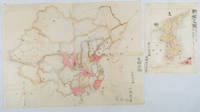
1902réf. 220266Japan. No date. Circa1902. Two very attractive colour folded manuscript maps one showing China and the other Korea. Map of China: Watercolour map 48 x 63.5cm. Closed tear now professionally repaired. Map of Korea: Finely detailed watercolour map a few tiny holes very neatly repaired on the verso with archival washi. 33 x 24.5cm Two delicate hand-painted maps one of China and one of Korea produced by a Japanese student cartographer named Koike Tokushige 小池徳重. The undated map of China appears to have been produced in the first five years of the twentieth century: a time when Japan had recently colonized Taiwan and when Japanese economic and political interest in the region was rapidly expanding. The inscription on the map suggests that it was a third year college project. But the high level of detail suggests that the artist had considerable experience of map making. The map of China shows the main provinces rivers major transport routes the Great Wall and the location of key cities although the names of the cities are not included. It also shows outlines of the Korean Peninsula Taiwan and the Japanese island of Kyushu but not the rest of Japan. The map of Korea is more detailed. It provides an accurate outline of the Korean Peninsula with careful hatching indicating changes in elevation. Rivers and major road routes are shown on the map and the locations of major towns are marked though only Busan and Incheon are named. Dotted lines show coastal sea routes and routes between Kyushu and Busan and between Incheon and China. The map shows the Gyeongin railway line between Seoul and Incheon which was completed in 1899 and route of the Gyeongbu railway line between Busan and Seoul whose construction started from both ends in 1901. But the map depicts only small sections of this line close to Seoul and Busan as being completed with the rest more lightly outlined to show the projected route implying that the map was drawn around 1901-1902 and certainly before the Gyongbu line was opened in 1904. Inserted text gives the land area and population of Korea. Rather strangely though the figure given for the Korean population is vastly underestimated. Ikeda gives this as 5.7 million when in fact at that time is was around 18 million. . unknown
réf. 239365Édimbourg, Archibald Constable [printed by James Ballantyne], Londres, Hurst, Robinson, 1826 in-16, [2] ff. n. ch., ii pp., 322 pp., demi-veau bouteille à coins, dos à faux-nerfs orné de filets, guirlandes et caissons dorés, pièce de titre fauve, double filet à froid sur les plats, tranches mouchetées (reliure de l'époque). Coiffe inférieure frottée, charnières frottées, coins abîmés.