51 resultados
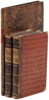
1843ref. E01482 volumes. xxxvii23878 ad pages with frontispiece woodcuts in text and 7 steel-engraved plates; vi2474 pages with frontispiece woodcuts in texts and 10 steel-engraved plates. Royal octavo 9¼x5½" in publisher's original green cloth spine lettered in gilt covers decorative blind stamped. First Edition. In 1825 Edward Belcher accompanied Frederick William Beechey's expedition to the Pacific and Bering Strait as a surveyor. In 1836. he commanded a surveying ship on the north and west coasts of Africa and in the British seas. Belcher took up the work which Beechey had left unfinished on the Pacific coast of South America. He was on board the bomb vessel HMS Sulphur which was ordered to return to England in 1839 by the Trans-Pacific route. Belcher made various observations at a number of islands which he visited having been delayed by being dispatched to take part in the war in China in 1840. On 26 January 1841 the then Commander Belcher landed on Possession Point at the north shore Hong Kong Island and made the first British survey of Hong Kong harbor. After the war's end in 1842 he reached home and for his services was made a Knight Bachelor in the following year. He was then engaged in HMS Samarang in surveying work in the East Indies the Philippines Geomun-do Port Hamilton and other places until 1847. In 1852 Belcher led the last and largest Admiralty expedition to rescue Sir John Franklin. He was also to look for his former surveying officer in Hong Kong Richard Collinson and Robert McClure whose ships had not been seen after entering the Bering Strait. He did a great deal of sledge exploration rescued McClure and abandoned four of his five ships in the ice. He had five ships: Assistance Belcher Resolute Henry Kellett second mate George Nares the steam tenders PioneerSherard Osborn and Intrepid Leopold McClintock and the depot ship North Star William Pullen. Belcher and one tender were to enter Wellington Channel where Franklin was thought to be while Kellett was to go west to Melville Island and look for Collinson and McClure. North Star was to stay at Beechey Island as a supply base. He left the Nore in April 1850. By early winter Assistanceand Pioneer were frozen in at Northumberland Sound to the north of Wellington Channel while Resolute and Intrepid were frozen in off Melville Island Arctic—the first ships this far west since William Edward Parry in 1819. A great deal of exploration was done by man-hauled sledges. In April 1853 Leopold McClintock and others left the Resolute on sledges and returned 105 days later having covered 1400 miles and discovered Prince Patrick Island. Another party went west and discovered Robert McClure whose ship was frozen in at Mercy Bay. Belcher went north by sledge and found a channel at the northern tip of Devon Island hinting that Franklin might have used it to escape to Baffin Bay. When the ice broke up that summer he pushed his ships up Wellington Channel and became trapped again. By February 1854 Belcher was becoming increasingly worried about the safety of his ships and men. In April he ordered Kellett to abandon his ships and return by sledge to North Star. Belcher abandoned his two ships in late July. Aided by two ships that showed up at Beechey Island Phoenix and Breadalbane the whole party returned to England. Belcher went through a court martial which was automatic for any captain who had lost a ship. He was exonerated but his sword was returned to him 'without observation'. He never again received an active command. Curiously Resolute broke free of the ice and drifted all the way to Davis Strait where it was picked up by an American whaler. Condition: Some staining and wear to covers spines a bit faded ends chipped and worn rear joint of Vol. I with chipping and loss; hinges repaired at endpapers some light foxing and occasional mostly marginal damp staining within the three folding maps which should be loose in a pocket not present; overall good uncommon in the original cloth. Henry Colburn hardcover books
1717ref. E01353559index pages 36 of 37 maps and copper cuts of the coasts harbor cities plants and other curiosities comprising: 14 plates 3 folding 22 maps charts or plans 14 folding. title page printed in red and black. Printed from the author's original plates inserted in the Paris edition. Lacks the frontispiece map. Royal octavo 9 3/4" x 7 3/4" bound in leather with raised spine bands and red label with gilt lettering. Postscript by Dr Edmund Halley and an account of the settlement commerce and riches of the Jesuits in Paraguay. Palau 94965 Sabin 25926 Nissen ZBI 1433 Hill p117 First English edition. Frézier was educated in Paris and served as lieutenant of infantry from 1702 til 1707 when he entered the engineer corps. In 1712 the government sent him to examine the condition of the Spanish colonies in America. After visiting the principal points in Peru Chili and Brazil he returned to Marseilles. He pointed out several mistakes in the "Relation" of Father Feuille and this led to a bitter controversy between the two travelers. Frézier introduced the large Chili strawberry into France. First published in France in 1714. The first edition into English is preferable to the French original "because it contains Halley's. postscript which corrects certain geographical errors made by Frézier" Hill. "The first part of this book gives an interesting account of the voyage from France around Cape Horn. The second part relates to the voyage along the coasts of Chile and Peru describing the chief towns and cities. Frézier a man of observation brought back information of considerable geographical and scientific value. Much data is included about the native inhabitants. Condition: Rebacked with original spine label laid down; lacking frontispiece map and binder's leaf free endpapers renewed intermittent foxing else a very nice copy. Jonah Bowyer hardcover books
1918ref. 880611918. SIBERIAN EXPEDITION. Teikoku Gunjin Kyoiku-kai editors. SHIBERI JIHEN KINEN SHASHIN-CHO. Tokyo Taisho Tsushinsha Taisho 7 1918 Oblong folio bound western-style in cloth gilt. Illustrated throughout in collotype. Photos and cations on the International Siberian Expedition in support of the Whites against the Red Army in which the Japanese played a prominent role. 4 page folding panorama of Vladivostok harbor and views of the cities the countryside troops inhabitants diplomats war preparations etc. etc. One can feel the Winter coming. Very good condition throughout. Very scarce. unknown books
1695ref. E0561xxiv21612 pages with frontispiece folding map and eight engraved costume plates. Duodecimo 6 ¼" x 3 ½" early full calf later spine label. First Edition in English. First published in French the prior year which was published without the plates. François Pidou de Saint Olon was a French diplomat under Louis XIV. In 1682 he was nominated as the first French resident envoy to the Republic of Genoa following the Bombardment of Genoa. He was then sent as an envoy to Madrid. In 1689 François Pidou was appointed ambassador to the court of Sultan Moulay Ismail for the signing of a commercial treaty and to release prisoners now slaves of Barbary corsairs of Salé for 233 including 29 bedridden Moroccan prisoners held by the French. His mission was not successful however he continued to stay more than three weeks more in Morocco. The book gains particular interest through its author's position as ambassador giving him access not always voluntary to areas of Moroccan society previously unrecorded by travelers. There are detailed descriptions of Moroccan dress and the book is beautifully illustrated with eight engraved plates of Moroccan men and women in traditional costume. Condition: With the fine copper engraved frontispiece of the overall state of Morocco which is quite rare and is often found missing in most copies. Joints cracking spine chipped at edges; foxing else very good. R. Bently hardcover books
1831ref. E01322 volumes. xxi472 pages with three maps two folding and one double page figures and 13 plates; iv452 pages with 10 plates some folding tables and appendices. Octavo 9 1/2" x 5 1/2" Bound in contemporary half leather with marbled boards and gilt lettering to spine. Ferguson 1418; Hill I p. 19; Howes B309; Lada-Mocarski 95; Sabin 4347. Second edition published after quarto edition of the same year. Frederick William Beechey 17 February 1796 – 29 November 1856 was an English naval officer and geographer. He was the son of Sir William Beechey RA and was born in London. 1806 he entered the Royal Navy and saw active service during the wars with France and America. In 1818 he served under Lieutenant afterwards Sir John Franklin in David Buchan's Arctic expedition of which at a later period he published a narrative. In the following year he accompanied Lieutenant W. E. Parry in HMS Hecla. In 1821 he took part in the survey of the Mediterranean coast of Africa under the direction of Captain afterwards Admiral William Henry Smyth. He and his brother Henry William Beechey made an overland survey of this coast and published a full account of their work in 1828 under the title of Proceedings of the Expedition to Explore the Northern Coast of Africa from Tripoly Eastward in 1821-1822. In 1825 Beechey was appointed to command the HMS Blossom. His task was to explore the Bering Strait in concert with Franklin and Parry operating from the east. In the summer of 1826 he passed the strait and a barge from his ship reached 71°23'31" N. and 156°21'30" W. near Point Barrow which he named a point only 146 miles west of that reached by Franklin's expedition from the Mackenzie river. The whole voyage lasted more than three years and in the course of it Beechey discovered several islands in the Pacific and an excellent harbor near Cape Prince of Wales. In July 1826 he named the three islands in the Bering Strait. Two were the Diomede Islands that Vitus Bering had named in 1728: "Ratmanoff Island" Big Diomede and "Krusenstern Island" Little Diomede. Beechey called the uninhabited third islet "Fairway Rock" which is still its contemporary name. One of his crew Petty Officer John Bechervaise gave a detailed account of the voyage in his Thirty Six Years if a Seafaring Life by an Old Quartermaster published privately in 1839. In 1831 there appeared his Narrative of a Voyage to the Pacific and Beering's Strait to Co-operate with the Polar Expeditions 1825-1828. In 1835 and the following year Captain Beechey was employed on the coast survey of South America and from 1837 to 1847 carried on the same work along the Irish coasts. He was appointed in 1850 to preside over the Marine Department of the Board of Trade. In 1854 he was made rear-admiral and in the following year was elected president of the Royal Geographical Society. Beechey Island where Sir John Franklin wintered is named after him. Condition: Name neatly excised from head corner of titles small inconspicuous stamp to last pages. Inner hinges beginning marble to boards rubbed some stains to map. some toning to some plates some plates not bound in order to the printer but are all accounted for corners gently bumped else about a very good set. Henry Colburn and Richard Bentley hardcover books
1733ref. E05532 volumes. 8xxiv616471 pages with 4 maps ad view one folding and 3 plates one folding; 2693892 pages with 1 map and 6 plates. Quarto 10 1/4" x 10 1/4" bound in half leather with raised spine bands and gilt lettering to spine over marbled boards. Borba de Moraes page I:453; European Americana 733/146; Sabin 38591 First edition. Joseph-François Lafitau was a French Jesuit missionary ethnologist and naturalist. He is best known for his use of the comparative method in the field of scientific anthropology the discovery of ginseng and his writings on the Iroquois. Lafitau was the first of the Jesuit missionaries in Canada to have a scientific point of view. Lafitau is considered the first of the modern ethnographers and a precursor of scientific ethnology for his work on the Iroquois. He developed a model of studying peoples that involved describing existing cultures on their own terms—not in comparison to European society. He distinguished generic and specific traits transforming the "generic savage" into specific tribal groups. He explained that "only from specific identities can genetic relations be inferred." Furthermore he was the first to declare "contemporary primitive cultures throw light upon the culture of ancient people and vice versa. Lafitau is remembered for applying the comparative method with a greater level of competency than any of his contemporaries. Through original field observations he was able to critique the works of earlier writers on Primitive peoples. By using the Comparative Method Lafitau rejected all theories of social and cultural change and instead used his study to demonstrate the similarities in customs practices and usages of the Native North Americans with diverse peoples from different continents and centuries. He consistently relied on the doctrine of degeneration: all men originally shared one religion with one God but over time as people migrated to separate margins of the earth where they then lost touch with the values and traditions of this one true religion and culture. Therefore Lafitau believed in the "psychic unity of mankind" and the doctrine of primitive monotheism. His major work written in French was first published in 1724 in Paris. It is entitled Customs of the American Indians Compared with the Customs of Primitive Times Moeurs des Sauvages Amériquains Comparées aux Moeurs des Premiers Temps and is 1100 pages in total. In 1974 William Fenton and Elizabeth Moore made the first translation into English available. Lafitau published two other works. One Histoire de Jean de Brienne Roy de Jérusalem et Empereur de Constantinople Paris 1727 was released before he returned to Canada; it is little known and seldom seen. A two-volume Histoire des découvertes et conquestes des Portugais dons le Nouveau Monde . . . 1733 appeared after he came home to France. Frequently found in libraries it is not just a compilation of original sources but an attempt to make available to French readers a story of exploration and adventure otherwise denied to them; in the chronicles he sees a long development of customs hitherto unnoticed such as he had reported in the Mœurs; from them understood only he says in the original languages of the people who practice them he builds his "system" or philosophy of history and once more he is concerned too with the relation between custom and natural history or ecology. Condition: Beautifully rebound in half leather. Faint dampening to second volume; early owner's signatures on title pages inked stamps of St Charles Borromeo Seminary on front paste-downs and first title page lacks frontispiece else a very good to fine set. Chez Saugrain pere, quai des Augustins, au coin de la rue Chez Saugrain pere, quai des Augustins, au coin de la rue Pavee, a la hardcover books
1855ref. E05582 volumes. xx383 pages with hand colored frontispiece 3 maps in pockets plates many colored; vii41923 ad pages with color frontispiece and plates some colored. Small quarto 10 1/2" x 6 3/4" bound in original publisher's pictorial brown cloth with blind-stamped cover with gilt pictorial in gilt. Notes on the Natural History by John Richardson. Abbey Travel 645; Arctic Bibliography 1241; Books on Ice 5.8a; Hill 106; Sabin 4389; TPL 3409 First edition. Belcher's five-ship 1852-54 expedition in search of Franklin would be the last official British attempt. On the HMS Assistance Belcher successfully navigated through the Wellington Channel but beset by ice was unable to return to Lancaster Sound and was forced to abandon the ship. This account of the expedition also includes several essays on the natural history of the region by Richardson Owen Bell Salter and Reeve. Condition: Minor wear re-backed with parts of original back-strips laid down; minor foxing short separations at folds to the largest map; inked stamps on title pages Edinger bookplates else a good set internally very good. Lovell Reeve hardcover books
1700ref. E0566xxiii43313 table pages with two folding maps of the Marsianes and Guam. Duodecimo 6 1/2 x 3 1/4" bound in contemporary full sheep with red label in gilt spine and five raised spine bands speckled red end pages. Brunet 28230 Cioranescu 41783 First edition. Charles Le Gobien was a French Jesuit writer founder of the Lettres édifiantes et curieuses a collection of reports from Jesuit missionaries in China. It is a major source of information for the history of Catholic missions and life in China in those times. Le Gobien was born at Saint-Malo Brittany. He entered the Society of Jesus on 25 November 1671. As professor of philosophy and especially while procurator of the Franco-Chinese mission he sought in a series of papers to awaken interest in the work of Christianizing Eastern Asia. In 1697 appeared at Paris his Lettres sur les progréz de la religion à la Chine. Apropos of Chinese Rites controversy he published among other things Histoire de l'édit de l'empereur de la Chine en faveur de la religion chrétienne avec un éclaircissement sur les honneurs que les Chinois rendent à Confucius et aux morts Paris 1698; and in the year 1700: Lettre à un Docteur de la Faculté de Paris sur les propositions déférées en Sorbonne par M. Prioux. Under the same date there appeared in Paris the Histoire des Isles Mariannes nouvellement converties à la religion chrétienne. The second part translated into Spanish by J. Delgado is found in the latter's Historia General de Filipinas Manila 1892. In 1702 Père Le Gobien published Lettres de quelques missionnaires de la Compagnie de Jésus écrites de la Chine et des Indes Orientales; this was the beginning of the collection soon to become celebrated under the title of Lettres édifiantes et curieuses écrites des missions étrangéres par quelques missionnaires de la Compagnie de Jésus. The first eight series were by Le Gobien the latter ones by Fathers Du Halde Patouillet Geoffroy and Maréchal. The collection was printed in thirty-six volumes duodecimo Paris 1703–76 and reissued in 1780-81 by Fathers Yves de Querbeux and Brotier in twenty-six volumes duodecimo omitting the prefaces. New editions appeared in 1819 1829–32 and 1838-43. One abridgment in four volumes octavo was entitled Panthéon Littéraire by L. Aimé Martin 1834–43. A partial English translation came out in London in 1714. The publication incited the Austrian Jesuit Stöcklein to undertake his Neuer Welt Bott about 1720 at first considered merely a translation but soon an independent and particularly valuable collection five volumes folio in forty parts substantially completing the Lettres Edifiantes. This is a history of the Christian missions in the Marianas or Ladrones Islands in the north-western Pacific the principal island of which is Guam. Reprinted in the text are several letters from early missionaries Medina Clain Sanvitores &c. The Jesuit mission was established there by Diego Luis de Sanvitores. Father Le Gobien never visited the Mariana islands but based his account chiefly on the relations and letters of missionaries sent to him from Rome Spain the Netherlands etc. Includes a letter by P. Clain about the discovery of the Caroline Islands. Condition: Rebacked with original spine laid down provenance: Jesuit College library with old stamps to front free endpaper half title and title page else about very good. Nicolas Pepie hardcover books
1799ref. biblio160First French edition of Bartram's Travels which chronicled his explorations of the southern British colonies in North America from 1773–1777 2 volumes. 457 pages with frontispiece engraved portrait by Bovinet Mico Chlucco Grana King of the Seminoles and one folding plate; 436 pages without title with large folding map by J.B. Poirson engraved by Alexandre Blondeau and folding plate. Octavo 8 1/4" x 5 1/4" bound in half leather with six spine compartments with red and black labels in gilt over original marbled boards. Translated by Pierre Vincent Benoist. Sabin 3871; Palau 251346; Howes B223; Field 94 First French edition. William Bartram was an American naturalist. The son of the naturalist John Bartram. As a boy he accompanied his father on many of his travels to the Catskill Mountains the New Jersey Pine Barrens New England and Florida. In 1773 he embarked upon a four-year journey through eight southern colonies. Bartram made many drawings and took notes on the native flora and fauna and the native American Indians. In 1774 he explored the St. Johns River where he had memorable encounters with aggressive alligators and also visited a principal Seminole village at Cuscowilla where his arrival was celebrated with a great feast. He met Ahaya the Cowkeeper chief of the Alachua band of the Seminole tribe. When Bartram explained to the Cowkeeper that he was interested in studying the local plants and animals the chief was amused and began calling him Puc Puggy the flower hunter. Bartram continued his explorations of the Alachua Savannah or what is today Paynes Prairie. William Bartram wrote of his experiences exploring the Southeast in his book Travels through North & South Carolina East & West Florida the Cherokee Country the Extensive Territories of the Muscogulges or Creek Confederacy and the Country of the Chactaws Containing an Account of the Soil and Natural Productions of Those Regions Together with Observations on the Manners of the Indians published in 1791 and which is today simply known as Bartram's Travels. It was considered at the time one of the foremost books on American natural history. Many of Bartram's accounts of historical sites were the earliest records including the Georgia mound site of Ocmulgee. In addition to its contributions to scientific knowledge Travels is noted for its original descriptions of the American countryside. Bartram's writing influenced many of the Romantic writers of the day. William Wordsworth Samuel Taylor Coleridge and François René de Chateaubriand are known to have read the book and its influence can be seen in many of their works. Ephraim George Squier and Edwin Hamilton Davis in their book Ancient Monuments of the Mississippi Valley name Bartram as "the first naturalist who penetrated the dense tropical forests of Florida." Condition: Some rubbing to original boards page 143 of volume one has small burn mark affecting text half title bound upside down in back old water stain to plate of volume two. Fold-out map has repair to first fold internally pages are clean and free of toning and foxing else a very good copy. Chez Carteret et Brosson and Dogour Duran hardcover books
1957ref. E0551From the Spanish discovery to the opening of the Civil War 5 volumes in 6. Volume One: The Spanish Entrada to the Louisiana Purchase 1540-1804 xiv264 pages with color frontispiece map and 275 maps many folding and index; Volume Two: From Lewis and Clark to Fremont 1804-1845 xiii281 pages with colored frontispiece map 143 additional maps some folding and index. Volume Three: From the Mexican War to the Boundary Surveys 1846-1854 xiii349 pages with colored frontispiece map 322 additional maps and index; Volume Four: From the Pacific Railroad Surveys to the Onset of the Civil War 1855-1860 xiii260 pages with color frontispiece map an additional 127 maps some folding and index; Volume Five From the Civil War to the Geological Survey Part One: xviii222 pages with color frontispiece map and an additional 152 maps; Volume Five From the Civil War to the Geological Survey Part Two: 223-487 pages with 124 maps and index. Folio 14 1/2" x 10 1/2" bound in quarter green leather with gilt lettering to spines. volume I printed by the Grabhorn Press; volumes II-V printed by Taylor & Taylor and James Printing based on the designs of Edwin and Robert Grabhorn. First edition limited to 1000 copies. Carl Wheat's Mapping of the Trans-Mississippi West is a comprehensive and readable cartographic history of the American West. The first three volumes of the work are by necessity bulky and out sized to accommodate the many maps contained with their covers. These beautifully printed books present a truly graphic picture of the exploration and peopling of the vast unknown land west of the Mississippi. The author does not merely present a catalog of significant maps of each era but tells the exciting story of many facets of history that resulted in their making-of the hard journeys the hazardous exploits the motivation the mysticism the misunderstandings and the strange blend of fact imagination false geographic concept and political necessity which were consummated in the engraver's work. These volumes will provide exciting text for the casual reader and have become eminent source book for the student and scholar. Condition: A near fine set. Due to the size and/or weight of this lot extra shipping and/or handling charges may apply. Institute of Historical Cartography hardcover books
1802ref. E01512 volumes with Atlas. 4xxiv385 pages with xxii-xxiv lists books of voyages available from the publisher; 4418 pages with appendix containing vocabularies of the languages of Yukagir Yakut Tungoose Kamchatka the Aleutian Islands and Kadiak and inex. Atlas with title list of plates 14 engraved plates & large folding engraved map. Text volumes are small octavo 7¾" x 4½" 19th century quarter calf & boards spines tooled in gilt morocco lettering pieces; atlas is quarto 11" x 7½" in period tree calf spine tooled in gilt. Translated by J Castéra. Howes S-117 First French Edition. Martin Sauer was an English civil servant who knew Russian French and German. He became acquainted with Joseph Billings in St Petersburg in the 1780s. He agreed to join Billings expedition as his secretary and interpreter. It was agreed that he would write the official account but there is some controversy about his actives when he returned to St Petersburg in 1794. It has been suggested that he left hurriedly for England with much of the important archival material from the voyage including diaries and secret reports so that he could publish a record of the expedition before Russian authorities and scholars in the Academy of Sciences could review its details. Sauer's An account of the Geographical and Astronomical Expedition to the Northern Parts of Russia was published in London in 1802. It contains an abundance of detail about eastern Siberia and the Aleutian Islands and records the expeditions visits to Kodiak Island Prince William Sound and the coast south as far as Yakutat Bay. The chart was made by Aaron Arrowsmith from Sauer's notes and Billings observations and the whole complements well the other contemporary accounts of the expedition by the cartographer Gavriil Sarychev and the naturalist Carl Heinrich Merck. Aaron Arrowsmith 1750–1823 was an English cartographer engraver and publisher and founding member of the Arrowsmith family of geographers. He moved to Soho Square London from Winston County Durham when about twenty years of age and was employed by John Cary the engraver and William Faden. He became Hydrographer to the Prince of Wales ca. 1810 and subsequently to the King in 1820. In January 1790 he made himself famous by his large chart of the world on Mercator projection. Four years later he published another large map of the world on the globular projection with a companion volume of explanation. Condition: Some rubbing and wear to coves of both atlas and text volumes some chipping to spine ends small gouge at back of atlas and stamp to front end paper else in very good condition. Chez F Buisson hardcover books
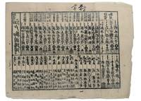
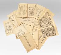
1853ref. 347481853. Three woodblock-printed sheets on mulberry paper. Mild edge wear old folds. A detailed revealing group of late Tokugawa samurai reference sheets recording the names ranks stipends heraldry standards and service obligations through which the shogunate and Edo public understood military readiness at the moment of Perry's arrival. Commodore Matthew C. Perry anchored off Uraga at the entrance to Edo Bay in July 1853. His arrival made visible the vulnerability of the Tokugawa capital and produced an immediate demand for information about coastal defence domain strength and the lords responsible for guarding the approaches to Edo. Kawaraban and related broadsides answered that demand in compressed visual form combining names crests military symbols income figures and geographical or administrative data. The first printed sheet appears to be an earlier roster of Edo office-holders or guard personnel. Its tabular format with names offices crests and standards records the recognitional system already in place within Tokugawa administration before the Perry crisis sharpened the public appetite for such information. The manuscript sheet is ruled into a large grid with headings formed from the twelve zodiac signs and the four seasons including Rat Ox Tiger Hare and the seasonal headings. The entries appear to record named houses Lords or retainers against recurring seasonal and cyclical categories probably for service attendance or ceremonial obligation. The third sheet is headed "Rekko yushinroku" here translated as "Register of Valiant Retainers of the Lords." It lists major daimyo houses and their principal retainers with domain or house headings names titles stipend figures in koku family crests standards and related insignia. Visible regional or house designations include "Kaga" "Owari" "Kii" "Satsuma" "Higo" and "Tosa." The sheet gives a graphic register of the daimyo world mobilised or imagined as mobilised around the defence of Edo Bay. Together the sheets preserve the administrative and visual language of Tokugawa defence at a moment of acute pressure. They are not formal shogunal orders and the first sheet may predate Perrys arrival but they show how late Edo Japan translated rank obligation military identity and coastal defence into portable tabular form. Their compression the names of Lords and retainers the scale of domains the crests and standards by which armed households could be recognised and the bureaucratic habits of a regime suddenly forced to account for its capacity to defend the country reveals these documents' immediacy and importance. unknown books
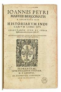
1588ref. E05544-5702 blank28 pages with woodcut device on title woodcut historiated initials and decorations. Folio 12 1/2" x 8 1/4" bound in contemporary vellum. European Americana 588/57; Palau 146976; Sabin 146976 Western Travellers in China 11 First edition of Maffei's great history of India. Ten Latin editions two in Italian and two in French appeared before 1621. Based on primary material it still remains a valuable account today. The work is divided into 16 books. Most of it deals with the Portuguese conquests and Jesuit missionary work in the East Indies and India up to about 1557 Borba de Moraes page 508 "a classic work on the subject . writes extensively about Brazil describing it very accurately"; Maffie was the firs author to use Jesuit letters extensively as well as many secular sources including Fernando Mendes Pinto. Condition: Contemporary velum with moderate wear re-backed in vellum with original spine label laid down; minor worming and foxing intermittent moderate damp staining pages 410 and 419 blank due to a printing error; early inscription and inked stamped on title page new end papers and paste-downs else a good to very good copy. Apud Philippum Juncatam hardcover books
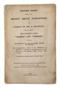
1856ref. 69186London. 1856. Parliamentary "Blue Book" on the Search for Franklin A rare Parliamentary paper relating to the lost Franklin expedition. This "blue book" a series of parliamentary reports named for their original blue paper wrappers contains a wealth of information about Franklin's expedition including detailed correspondence on the Second Grinnell Expedition with Kane's report and the Hudson's Bay Company's expedition down the Back River under Anderson and Stewart. Also includes Richard King's proposal to venture down the Back River to Montreal Island; the recovery and subsequent disposal of the Resolute; Collinson's report on Franklin relics; correspondence on the rewards for Franklin searches; and a list of American officers and men entitled to receive the Arctic Medal known today as the Polar Medal and given out by the British government to "all persons of every rank and class who have been engaged in the several Expeditions to the Arctic Regions whether of discovery or search between the years 1818 and 1855". Sir John Franklin's doomed 1845 expedition his fourth to the Arctic and third as commander set out in 1845 to search for the fabled Northwest Passage. In September 1846 the expedition's ships became trapped in the ice off of King William Island which would be their final resting place. The crew spent the next year and a half trapped there before attempting to walk south dying along the way in the arctic tundra hundreds of miles from the nearest European settlements. After three years without word the British Admiralty launched a massive search for the missing ships. Spurred by a large reward many expeditions from Britain and the United States set out on the hunt beginning in 1848 and continuing through the next decade. The British Parliament printed occasional reports of the various expeditions and related Arctic subjects during that time. These reports became known as the Arctic "blue books." One of the scarcer Franklin items rarely appearing on the market and with only a handful recorded in OCLC. Folio. Gathered signatures stitched. Soiling and edge wear to outer leaves minor scattered foxing else very good. ARCTIC BIBLIOGRAPHY 45249. TPL 3659. LANDE S910. unknown books
ref. 50306For the lot of approximately 250 items $6000. a Correspondence with various government officials hunting guides and others involved with preparing and carrying out the trip including14 letters to Furlong typed and autograph one accompanied by four photographs of members of the expedition with trophies; five retained copies of letters from Furlong to the correspondents four telegrams seven typed and manuscript recapitulations of various aspects of the trip e.g. titles for the "Dance of the Nandi" film and a three page typed press release on the expedition dated Nairobi 27 March 1930 accompanied by a photograph of Furlong and two bearers with a leopard he has killed. b Two hunting licenses issued by the Uganda Protectorate to Furlong 22 April 1930 one "For a First Elephant" the other a "Visitor's Full Game License." c Three maps period road map of Kenya and Uganda published by Bullows and Roy for the Royal East Africa Automobile Assn.; Map Showing Cairo-Mombasa Route published by the Sudan Survey Dept Khartoum 1929; and a period National Geographic Society map of Africa. d An account book narrow 12mo 19 pp. 22 March - 8 June 1930 and approximately 125 receipts most partly printed for a wide range of services and material necessary for the trip. e 21 photographs in addition to those mentioned above many picturing Furlong in the field with his rifle and trophies some with Furlong's notations on verso and 34 unused photo postcards featuring tribesmen animals and scenery of East Africa. f 42 promotional pamphlets ca. 1925-1934 for the various parts of Africa along Furlong's route 36 of which are unrecorded on OCLC. The pamphlets were issued by African railway companies and governmental agencies outfitters e.g. Thomas Cook and "Safari Africa Limited" London ship lines and other travel agencies and taxidermy concerns. g A wooden carved string instrument from the Para Mountains in present day Tanzania with Furlong's ownership label "Col. Wellington Furlong / c/o Safariland Ltd. / Musical Instrument / Para Mountains" still attached; the instrument is shaped like a hollowed-out bread tray 27 x 7 1/2 inches three holes in the shape of crosses in the bottom six strings stretched across the opening. Furlong 1874-1967; American explorer army officer author artist and photographer embarked on this big game expedition in 1930 partly as an effort to recover relics of Sir Henry M Stanley in East and Central Africa. Gateway to the Sahara New York 1909 is among several books he published. A member of the Explorers Club he was the first American to explore the interior of Tierra del Fuego 1907-1908. Most of his personal papers are held by the Stefansson Collection at Dartmouth. unknown books
1747ref. BOOKS00585324548 pages with three folding engraved maps present southern part of South America; part of the Pacific Ocean and the track of the Centurion round the world. Octavo 8 1/4" x 5 1/2" bound in full leather with five raised spine bands with red label to spine in gilt lettering with decorative blind-stamped ruled edges. Compiled from papers and other materials of the Right Honourable George Lord Anson and published under his direction by Richard Walter M.A. Chaplain of his Majesty's Ship the Centurion in that expedition. Hill I pp 317-138. Third edition. "This is the official account of Anson's voyage. England at war with Spain in 1739 equipped eight ships under the command of George Anson to harass the Spaniards on the western coast of South America for the purpose of cutting off Spanish supplies of wealth from the Pacific area. Lord Anson who was a friend and patron of Benjamin Robins after returning from the voyage around the world in the Centurion appears to have entrusted to Robins for revision the account of the voyage which had been compiled from the journals by his chaplain Richard Walter. It is probable that Robins revised and edited the work wrote an introduction and added dissertations." Hill. Perhaps the most popular account of maritime adventure of the eighteenth century. Anson's account of harrying the Spanish of South America and the taking of the Manilla galleon with treasure with a contemporary value of $800000 and his circumnavigation has long enjoyed a distinguished place as a masterpiece in descriptive travel. Condition: Some small closed tears at the edges of the maps. Rebound in tooled leather with raised bands. Over all a very good to fine copy. John and Paul Knapton and Office of the Lord High Admiral hardcover books
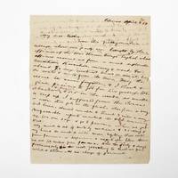
1854ref. 369733Palmas Panama 1854. 2pp. single 4to sheet. With: Carte-de-visite photograph of Mayo signed and inscribed to his sister on verso. Folds minor separations. 2pp. single 4to sheet. With: Carte-de-visite photograph of Mayo signed and inscribed to his sister on verso. Seeking a low-level train or canal route to bridge the Atlantic and Pacific Oceans in late 1853 President Franklin Pierce ordered a U.S. Naval exploring expedition to participate in an international attempt affiliated with a venture by the Atlantic and Pacific Junction Company. Although ships from Great Britain New Grenada and the United States were involved the principle overland portion of the expedition through 40 miles of dense jungle would be led by Lieutenant Isaac G. Strain who had previously led exploring expeditions in Brazil Baja California and Chile. With a party of 27 officers and men and including the author of the present letter they entered the jungle on January 20 1854. Problems began almost immediately. While puting ashore a boat was swamped and a portion of the party's provisions lost. Next the route Strain had been tasked with following contained no gap in the cordillera as had been previously believed. Led through the jungle by several groups of indigenous people the promise of a few days hike turned into months of wandering in the jungle before being abandoned by the guides. Subsisting on plantains and bananas and drinking river water Stain divided his men with an advance party striking out to seek rescue. On March 9 forty-nine days after starting from Caledonia Bay Strain and his advance party reached Yavisa; it would be another nearly three weeks before the main body was rescued but not before at least five had died of starvation or disease. Sometimes compared with the trials of the crew of the Essex or the members of the Donner Party the men on the Darien expedition endured extreme harship and resorted to unspeakable things. This remarkable letter was written by one of the expedition's survivors shortly after his rescue and return to civilization. George Upshur Mayo 1834-1896 was born into a prominent family in Norfolk VA. He attended the Virginia Military Institute served as an assistant engineer on the Strain Expedition was involved in the United States Geodetic Survey and was later a major in the Confederate Army. Here he writes: "My dear father From this filthy native village where our party are brought by the officers of the war steamer Virago English whose officers rescued us from a most deplorable condition starvation misery & want for about 70 days without bread or meat living on roots & nuts from the trees. May the rescue be never forgotten & I thank & give praises to God for his goodness. We abandoned & buried 4 or 5 in the woods as unable to keep up. I suffered from the cusano a worm that gets in the flesh also from a very bad knee. Almost unable to travel 3 miles a day. Unfavorable reports reached the U.S. concerning us. We are safe & go to Panama when we get well. My mind is out of sorts by medicine & sickness & my hand too weak to write more legibly. Will write from Panama or Aspinwall a respectable letter there. We are 100 miles from Panama. Had the party 8 days provisions only in the woods yet nothing to shield us from wind & storm & no change of garments. The suffering was intense & the rescue came at the most dreadful & important for our safety. I with 3 others on the river bank washing at sundown when the canoes came in sight. Captain Strain had no pants or underdraws to protect him from the briars & vermin. God be praised for rescue. Love to Annie. . . . In all probability will meet the Cyane at Aspinwall." A remarkable first-hand account of a desperate struggle for survival. unknown books
1856ref. E05603 volumes: xvii1537 pages with 90 lithographs plates including the usual expunged bathing plate many in color including 3 "facsimiles" of Japanese woodblock prints 2 folding; 6 maps and charts 2 folding; 79 woodcuts in the text; 2414414-1xi pages with 4 color lithographs of Chinese scenes; 2 uncolored natural history engraved plates; 6 hand-colored lithographs of birds; 10 hand-colored steel-engravings of fish; 5 lithographs of shells 2 hand-colored; 16 diagram plates of winds and currents; 14-page facsimile of Japanese language version of the U.S.-Japan treaty; 17 folding charts on 16 sheets; numerous woodcuts in the text; xliii17051 pages woodcut star charts throughout. Volume III titled "United States Japan Expedition. Observations on the zodiacal light from April 2 1853 to April 22 1855 . by Rev. George Jones A.M. chaplain United States Navy". Quarto 11½ x 8 ¾" bound in the original blind stamped cloth. Volume 1 rebacked with the original cloth spine laid down. Hill 1332; Sabin 30968 Stabbed signature of the author included. First edition of the House Issue. Detailed and profusely illustrated account of Perry's expedition to open Japan to the West; Upon his return to the U.S. his chief duty for the following year was to compile his reports of the expedition aided by Francis Hawks. The first volume has the account of the voyage and lithographs of the travel; the second volume has the natural history reports by D.S. Green and others and includes hand-colored plates of Japanese fishes and shells. In addition to the artist W. Heine from whose drawings a great number of the lithographs were made the daguerreotypist E. Brown Jr. went on the expedition taking what were undoubtedly the earliest photographic images of Japan many of them reproduced lithographically in this work. This copy with the nude bathing plate which was not included on the list of plates and not issued in all copies. In advance of his voyage to the Far East Commodore Perry read widely amongst available books about Tokugawa Japan. His research even included consultation with the increasingly well-known Japanologist Philipp Franz von Siebold who had lived on the Dutch island of Dejima for eight years before retiring to Leiden in the Netherlands. In 1852 Perry embarked from Norfolk Virginia for Japan in command of a squadron in search of a Japanese trade treaty. Aboard a black-hulled steam frigate he ported Mississippi Plymouth Saratoga and Susquehanna at Uraga Harbor near Edo modern Tokyo on July 8 1853. His actions at this crucial juncture were informed by a careful study of Japan's previous contacts with Western ships and what could be known about the Japanese hierarchical culture. He was met by representatives of the Tokugawa Shogunate who told him to proceed to Nagasaki where there was limited trade with the Netherlands and which was the only Japanese port open to foreigners at that time. Perry refused to leave and demanded permission to present a letter from President Millard Fillmore threatening force if he was denied. Perry ordered his ships to attack several buildings around the harbor to demonstrate US naval power. The Commodore was fully prepared for more hostilities if his negotiations with the Japanese failed and threatened to use unrestrained fire if the Japanese refused to negotiate. He sent two white flags to them telling them to hoist the flags when they wished a bombardment from his fleet to cease and to surrender. Perry's ships were equipped with new Paixhans shell guns capable of wreaking great destruction with every shell. The Japanese military forces could not resist Perry's modern weaponry; the term "Black Ships" in Japan would later come to symbolize a threat imposed by Western technology. Perry returned in February 1854 with twice as many ships finding that the delegates had prepared a treaty embodying virtually all the demands in Fillmore's letter. Perry signed the Convention of Kanagawa on March 31 1854 and departed mistakenly believing the agreement had been made with imperial representatives. The agreement was made with the Shogun the de facto ruler of Japan. On his way to Japan Perry anchored off Keelung in Formosa modern day Taiwan for ten days. Perry and crew members landed on Formosa and investigated the potential of mining the coal deposits in that area. He emphasized in his reports that Formosa provided a convenient mid-way trade location. Formosa was also very defensible. It could serve as a base for exploration as Cuba had done for the Spanish in the Americas. Occupying Formosa could help the US to counter European monopolization of the major trade routes. President Franklin Pierce declined the suggestion remarking such a remote possession would be an unnecessary drain of resources and that he would be unlikely to receive the consent of Congress. When Perry returned to the United States in 1855 Congress voted to grant him a reward of $20000 in appreciation of his work in Japan. Perry used part of this money to prepare and publish a report on the expedition in three volumes titled Narrative of the Expedition of an American Squadron to the China Seas and Japan. He was also advanced to the grade of rear-admiral on the retired list when his health began to fail as a reward for his services in the Far East. Condition: Wear and fading to cloth large map repair at with archival tape several others with stub tears and splitting to folds; light foxing spine ends rubbed with a few with chips corners bumped and rubbed through. Accompanied with encapsulated and graded signature of the author else good to very good. Due to the size and weight additional postage will be required. A O P Nicholson hardcover books
ref. 7712Several dozen manuscripts in various formats incl. long folded sheets stitched pamphlets sewn volumes and letters. Japan: ca. 1853-63. A substantial group of documents revealing internal high-level debates and discussions in response to Commodore Perry’s landings and later controversies that arose as Western powers established a foothold in Japan. This is an exceptional collection filled with top-secret information on government intrigues as the Japanese state responded to aggressive foreign expansion and dissenting groups within the government urging top-to-bottom reforms. The manuscripts touch upon pivotal events in Japan’s history: –Commodore Perry’s two expeditions July 1853 & February-March 1854 and the resulting ratification of the Treaty of Shimoda. –Japanese translations of the treaties signed with the United States Russia France and the United Kingdom from 1854 to 1858. –The assassination of Ii Naosuke in March 1860 also known as the Sakuradamon Incident which precipitated a violent backlash against foreigners under the banner of Sonno joi “Honor the Emperor expel the barbarians”. –General dissatisfaction with the bakufu and efforts to reform it. –The attempted assassination of Ando Nobumasa a chief councillor during this period. –The Namamugi Incident in September 1862 when the British merchant Charles L. Richardson was killed by Satsuma domain warriors. –The bombardment of Kagoshima August 1863. Among all these materials we must highlight several examples of manuscript kengen proposals and commentaries written by aristocrats with policy advice on the difficult situations faced by the Japanese state. These offer compelling perspectives on the most pressing dilemmas of the day. While they were not composed by the decision-makers these documents are filled with the minutiae and data employed in the policy-making process. All of the items are in a fine state of preservation. ⧠John McMaster “Alcock and Harris. Foreign Diplomacy in Bakumatsu Japan” Monumenta Nipponica Vol. 22 No. 3/4 1967 pp. 305-367. unknown books
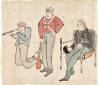
1853ref. 34749Edo 1853. Watercolour and ink drawing on Japanese paper. A contemporary Japanese watercolour of Commodore Perry and members of his expedition produced at the moment of the American squadron’s arrival in Japan and the opening of sustained diplomatic contact between Japan and the United States. This lively drawing belongs to the immediate visual culture generated by Commodore Matthew C. Perry's arrival in Japan in 1853. Perry entered Edo Bay in July 1853 to deliver President Fillmore's request for a treaty and returned the following year leading to the Treaty of Kanagawa on 31 March 1854. The event prompted wide Japanese interest in the appearance dress equipment and conduct of the visiting Americans and images of the "Black Ships" and their crews circulated in manuscript painted and printed form. The composition presents three American figures isolated against the paper ground arranged almost as a study of types. At right Commodore Perry is shown seated in a chair wearing a dark naval coat and holding his hat. At center stands an armed crewman or marine in a red jacket holding a musket upright; at left another crewman kneels while looking through a telescope or spyglass. The emphasis falls on uniform posture weaponry and optical instrument details that would have marked the Americans as visually and technologically unfamiliar to Japanese observers. The drawing is especially interesting as a Japanese interpretation of the expedition distinct from the official American pictorial record produced by artists such as Wilhelm Heine. The Japanese manuscript images such as the present work preserve a different perspective shaped by local observation report and curiosity. unknown books
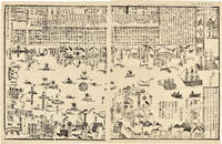
1855ref. 46844Tokyo ca. 1855. Japanese Print of Perry's Ships in Tokyo Harbor Large wood block print comprised of two sheets showing the disposition of the Japanese soldiers and ships in preparation for the arrival of Commodore Perry's American fleet seen sailing into Tokyo harbor at the right side of the image. The top third of the print is comprised of text in Japanese characters. Three large American ships dominate the right side of the print while several smaller boats dot the rest of the harbor. The whole is dotted with Japanese characters denoting various people and places around the harbor. Perry first arrived in Japan on July 8 1853 with a fleet of four ships flying his pennant on the steam frigate Susquehanna. This first visit lasted ten days and culminated on July 14 with Perry's presentation of a letter from the President of the United States to the Japanese commissioners. Perry then absented himself for seven months returning on February 11 1854 for a stay of over four months. He negotiated a treaty opening Japan to trade with the western world providing for a U.S. consul in Japan and protecting visiting ships and crews. Perry's visit to Japan remains one of the most important events in the diplomatic history between western and eastern nations. A handsome print showing the Japanese side of this important historic event. 24½ x 16 inches. Matted. Old fold lines some minor wear and soiling. Near fine. unknown books
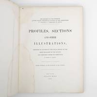
1872ref. 373132New York: Jules Bien 1872. First edition. Limited to 100 copies. 65 lithographed plates many folding preceded by 4pp. text. 4to. Original green cloth boards upper cover lettered in gilt rebacked endpapers renewed. Dampstaining. First edition. Limited to 100 copies. 65 lithographed plates many folding preceded by 4pp. text. 4to. This book was prepared to illustrate the work of the Hayden survey. It contains numerous panoramic illustrations many on folding sheets depicting sites in Wyoming Utah Colorado and Montana. This report contains the bulk of Henry Wood Elliott's art work for the Hayden Survey see preceding entry most of which was published nowhere else. These images are important because of their scientific contribution to several fields historical significance documentation of the Hayden expedition and their beauty and attention to detail. Elliott's illustrations were among the early images of many locations in the new territories of the West. From an edition of 100 copies issued in advance of the text. The Prefatory Note states p. 3: "A small edition of one hundred copies of the Profiles and Sections are issued in advance of the text for the purpose of placing them in the hands of the principal geologists in this country and in Europe. The first issue of two thousand copies in colors will be published with descriptions in about one year." We find no evidence that a subsequent edition in color was ever printed and it is stated of the present work in the Checklist of United States Public Documents 1789-1909 Washington: Government Printing Office 1909: "Originally intended to illustrate v. 4 of quarto series of reports but never thus used." The Hayden Survey was the most important of the four major government surveys of the American West undertaken after the Civil War the others being Powell King and Wheeler. Collectively these surveys filled in the map of the United States using accurate scientific methods to chart the land and investigate not only its geology but natural resources wildlife and plants as well. Schmeckebier Catalogue and Index of the Publications of the Hayden King Powell and Wheeler Surveys p. 32 #3 Jules Bien unknown books
1857ref. 375531New York: G. P. Putnam & Co 1857. One of 150 copies of the unofficial issue. Text: 4 777 1pp. Atlas: 100 engraved plates. 4pp. 2 vols. 4to text and folio atlas. Modern half russet morocco and cloth covered boards. Heavy foxing to the plates in the atlas small chip at fore-edge of atlas title minor dampstaining at lower outer corner of plates tape repair to final leaf of text. Provenance: University of Chicago ink stamp and blindstamp deaccession stamp. One of 150 copies of the unofficial issue. Text: 4 777 1pp. Atlas: 100 engraved plates. 4pp. 2 vols. 4to text and folio atlas. A very rare set of the text and plates of Asa Gray's report on the botany of the Wilkes Expedition illustrated with 100 engraved plates of plants collected by the first scientific expedition conducted by the United States Navy. The United States Exploring Expedition circumnavigated the globe under the command of Charles Wilkes between the summer of 1838 and the summer of 1842. The Wilkes Expedition "was the first American scientific expedition of any size charged to 'extend the bounds of Science and promote the acquisition of knowledge' and was one of the most ambitious Pacific expeditions ever attempted" Forbes. The Expedition represents "the first governmental sponsorship of scientific endeavor and was instrumental in the nation's westward expansion. Specimens gathered by expedition scientists became the foundation collections of the Smithsonian Institution. Significant American contributions in the fields of geology botany conchology anthropology and linguistics came from the scientific work of the expedition. Wilkes's evaluations of his landfalls influenced later U.S. positions in those areas" DAB. The Narrative of the expedition was first published in 1844 but the separately-issued scientific reports and atlases for the United States Exploring Expedition were published over a long period of time; the Expedition returned in 1842 and the final volume did not appear until 1874. Because of their limited issue and historical importance all the separately-issued scientific reports and atlases from the Expedition are highly sought after though they very rarely appear on the market. Gray's report is specifically on the "phanerogamia" seed plants or flowering plants collected during the four year voyage. The history of the publication of the many scientific reports that resulted from the Wilkes Expedition is filled with difficulties in their writing and production and Gray's botanical report is exemplary of these difficulties. "The preparation of the reports on the botanical collections brought back by the Expedition proved to be one of the worst headaches encountered during the course of the entire publication" Haskell. Asa Gray was one of the most acclaimed botanists of his era and he was the original selection as botanist for the Wilkes Expedition. In the time between his appointment and the expedition's departure in 1838 however Gray accepted the position of Professor of Botany at the University of Michigan and so he resigned from Charles Wilkes's command and was replaced by William Rich. Rich completed his botanical report in 1846 and submitted it to Wilkes who found it wholly unacceptable. Eventually Asa Gray was asked to study the specimens gathered on the expedition and to produce this report which he agreed to do and which he worked on for three years. Gray initially planned for a two-volume text report and an atlas including 300 folio plates. In the end the text was issued in one large volume and the atlas contained 100 plates drawn by the talented botanical artist Isaac Sprague. The botanical specimens described in the text and depicted in the atlas come primarily from throughout the Pacific Rim including the islands of the South Pacific Hawaii Singapore the Philippines Australia New Zealand and several countries in South America - predominantly Brazil and Chile. The total number of texts published from the voyage of the United States Exploring Expedition is massive - a total of twenty-four volumes of narrative and scientific reports. Asa Gray's botanical report is designated as Volume XV. As with Charles Wilkes's narrative account of the United States Exploring Expedition Gray's botanical report was issued in "official" and "unofficial" editions. The official edition of Gray's report was published by Sherman & Son of Philadelphia in an edition of 100 copies each of text and plates and the unofficial edition was issued by Putnam of New York in an edition of 150 copies again as quarto text and folio plates. Either edition is exceedingly rare in commerce as they were mostly intended for presentation or for placement in research libraries. Sabin writing in 1875 comments that "owing to some mistake a large number of copies of the Atlas were sold by auction unbound and without the letterpress the result is that odd volumes are comparatively common - whole sets are scarce." Actually the text or atlas individually or the two volumes together are exceedingly rare in the market. A highly desirable scientific report from the Wilkes Expedition with an atlas of 100 attractive plates with text by the noted botanist Asa Gray. Haskell 61 and 63; Rosove 354-10.A2 and 355-6.A2 both text and atlas described as "rare"; Sabin 28368; Meisel II pp.668-669; Nissen 2153; Stafleu 2129 2130; Pritzel 3529; Forbes 1993. Not in Spence G. P. Putnam & Co unknown books
1853ref. 347471853. 9 3/4 x 6 7/8 inches. 31; 31; 61pp. plus a loose sheet. Worming not affecting legibility occasionally touching a letter. Some dampstaining and dust soiling. Original paper wrappers stitched as issued. Contemporary manuscript annotations in red ink in one volume Vital contemporary Japanese manuscript accounts of Commodore Matthew C. Perry's arrival in Uraga Bay in July 1853 preserving official documentary and observational responses by Japanese officials and participants to the encounter that transformed Japan's relations with the wider world. The first manuscript Uraga kurofune ni kansuru comprises an official account of events following Perry's arrival off Uraga. The volume is especially notable for its contemporary red-ink annotations indicating active correction or revision of the text. It records the encounter from within the administrative world of the Tokugawa shogunate as Japanese officials confronted an American squadron that included two steam frigates. The second account Edo Uraga Beikoku fune torai ikken records the arrival of the American ships and provides a contemporary Japanese narrative of the encounter. Its double-page manuscript sketch of the Uraga coastline with the arrangement of Perry's vessels offshore reflects the immediate effort of Japanese observers and officials to describe classify and understand the unfamiliar ships equipment and conduct of the American expedition. The third manuscript Gasshukoku shokan wage utsushi preserves contemporary texts associated with the shogunate's handling of the American communications. Abe Masahiro chief senior councillor in the Tokugawa shogunate accepted the American letter ordered translations of the official letter and related documents and circulated them among daimyo for advice. This manuscript includes Japanese translations of letters from President Millard Fillmore and Commodore Perry presented by the American expedition in July 1853. The accompanying loose manuscript sheet gives a description of one of the Black Ships. Together the three volumes and loose sheet offer a substantial Japanese record of Perry's first visit combining official reporting translated diplomatic correspondence visual observation and contemporary manuscript transmission. They belong to the immediate documentary culture produced by the arrival of the Black Ships before Perry's return in 1854 and the signing of the U.S.-Japan Treaty of Peace and Amity at Kanagawa. unknown books
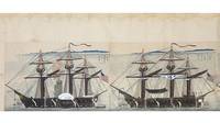
ref. 11288Japan: ca. 1854-55. An impressively assembled scroll that portrays the second American expedition to Japan February-March 1854 led by Commodore Perry; much of it is focused on the American vessels that anchored menacingly off the coast. Seven of the nine ships in the American fleet are carefully portrayed with notes on the estimated numbers of cannons and crewmembers. Steam-powered ships with black smoke gushing from the stacks and rows of powerful cannons shocked the Japanese most of whom had never seen such a demonstration of advanced military technology. The observations in this scroll must have been crucial to inform the decision-making of Japanese officials. "Black Ship Scrolls" conveying eyewitness reports were disseminated among the Japanese elite and kept top secret. Our scroll was presumably created for a high-ranking Japanese official since any information on the American interlopers was carefully controlled by the local authorities to maintain public order in the face of an anticipated foreign invasion. Compared to other depictions of the foreigners which frequently showed them as caricatures hairy oversized red-faced and blue-eyed the more dignified portraits in our scroll demonstrate the increasing familiarity between the Japanese and American contingents. In the years following Japan's opening to the West Japanese artisans produced countless scrolls commemorating the American expeditions catering to the tourist trade and as gifts to visiting dignitaries. Mass-produced with foreigners' preferences in mind these scrolls took liberties with the events that transpired straying far from the earliest accounts and sketches. They pale in comparison with the elaborate and scrupulous illustrations found in this early scroll. Though the later mass-produced scrolls are easily found on the market examples like ours presumably created for a Japanese official or nobleman remain greatly treasured for their revealing depictions. We have ordered the scroll into 15 individual scenes most of which have a contemporary manuscript caption translated below: I. Three sailors in the American marching band two of whom are uniformed drummer boys. The band led the American march to Yokohama where negotiations between the two nations were held in a newly constructed reception hall. The Japanese manuscript caption reads: "Illustration of musicians." II. Two sailors with swords sheathed are holding their muskets with bayonets fixed. A fine indigo ink has been employed to depict the uniform on the left. Caption: "Rank: Sergeant/Soldier." III. Commodore Perry on the right faces a sailor who may be the conductor of the American expedition's marching band. Perry is depicted rather sympathetically compared to exaggerated and even outlandish portraits that depict him as quite large hairy and red-faced. The artist has once more used a deep indigo to capture the color of the uniforms. Caption: "Ambassador Perry/Conductor Commandant." IV. A larger portrait of a lone sailor probably an officer clutching his sheathed sword and clenching his fist. Caption: "Foreigner Captain landed near Kanagawa." V. An elaborate and realistic portrait of Perry capturing even the individual hairs on his head and the wrinkles on his face. Caption: "American Envoy Perry." VI. A portrait of Perry's chief-of-staff Henry A. Adams done by the same artist as Perry's portrait. Caption: "American Vice Envoy Adams." VII. upper portion A very long horizontal painting of the American column marching to the Yokohama reception hall for negotiations regarding the opening of Japan to American trade. There are more than 100 armed Americans soldiers following the marching band. The top of this sheet has been slightly cropped cutting off part of the American flag in the middle. Caption: "Illustration of American landing column." VIII. lower right A sizable rendering of the USS Vandalia a sloop-of-war that joined the Perry Expedition in late 1853. Caption: "Name of ship: Vandalia 20 cannons 200 crewmembers." Minuscule mended wormholes to the image. IX. lower left The USS Saratoga another sloop-of-war. Caption: "Name of ship: Saratoga 20 cannons 200 crewmembers." Expertly mended wormholes touching the image hardly visible. X. upper portion A panoramic view with a fleet of 23 American rowboats headed to shore. Mending to the top of the scroll. XI. right lower portion The USS Mississippi a steam frigate that was part of the first expedition. Caption: "Name of ship: Mississippi 8 cannons 240 crewmembers." XII. left lower portion The USS Southampton a storeship. Caption: "Name of ship: Southampton 6 cannons 50 crewmembers." Expert mending of wormholes affecting the image. XIII. USS Supply a supply ship. Caption: "Name of ship: Supply 6 cannons 40 crewmembers." Wormholes repaired and with some foxing. XIV. USS Lexington a supply ship. Caption: "Name of ship: Lexington 26 cannons 50 crewmembers." Repaired wormholes and small sections of the white wash used for the sails have come off. XV. USS Susquehanna a steam frigate. Caption: "Name of ship: Susquehanna 6 cannons 240 crewmembers." Careful mending of wormholes to head and tail of scroll. In very good condition; there are a number of wormholes all expertly restored to the point that most are invisible to the naked eye and some browning and speckles to blank segments of the scroll. Two unidentified ownership seals next to the illustration of the USS Vandalia no. VIII. Housed in a custom-made 20th-century wooden box. ⧠Renata V. Shaw "Japanese Picture Scrolls of the First Americans in Japan" in The Quarterly Journal of the Library of Congress Vol. 25 No. 2 April 1968 pp. 134-53. For helpful recapitulations of accounts from the Japanese and Americans William McOmie The Opening of Japan 1853-1855: A Comparative Study of the American British Dutch and Russian Naval Expeditions to Compel the Tokugawa Shogunate to Conclude Treaties and Open Ports to Their Ships 2006. unknown books