Ost-Asien, Preussische Expedition NachBiblio.com

1758 resultados
ref. DADAX0270814183Wentworth Press 2018-07-28. hardcover. New. 6.14x1.13x9.21. Buy with confidence. Excellent Customer Service & Return policy. Wentworth Press hardcover
ref. 115722London Harrison & Sons 1923. . First edition; 4to; 15 plates one folding diagram 12 figures in text five folding maps in rear pocket light water stain to inner margin; publisher's original paper wrapper; a very good copy; xiii 40pp. A detailed scientific report from the 'Terra Nova' expedition with maps photographs and diagrams of the Ross Archipelago. Authored by Frank Debenham later founder and first director of the Scott Polar Research Institute. Rosove 293-9. A1. London, Harrison & Sons, 1923. unknown
ref. 115723London British Museum 1921. . First edition; 4to; eight figures in text one plate leaf; publisher's original paper wrapper; a fine copy; pp. 101-130. Geological report from the 'Terra Nova' expedition detailing the sedimentary rock formations of South Victoria Land with maps diagrams and photographs. Rosove 292-5. London, British Museum, 1921. unknown
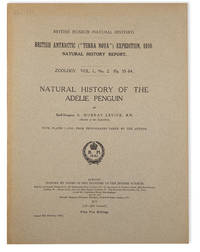
ref. 115685London British Museum 1915. . First edition; 4to; 21 photographic plates; publisher's original paper wrapper; a fine copy; pp. 55-84 xxi. The first monograph on the Adelie penguin by zoologist G. Murray Levick a member of Robert Falcon Scott's 'Terra Nova' expedition. Rosove 292-14. London, British Museum, 1915. unknown
ref. 115716London Harrison & Sons 1921. . First edition; 4to; four figures in text; publisher's original paper wrapper; a fine copy; viii 46pp. An official report into the auroral observations made at Cape Evans and Cape Adare during Captain Scott's 'Terra Nova' expedition. Rosove 293-5. A1. London, Harrison & Sons, 1921. unknown
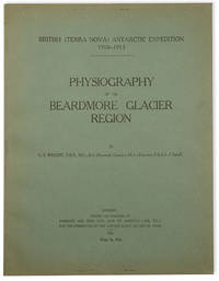
ref. 115720London Harrison & Sons 1923. . First edition; 4to; 15 plate leaves including six panoramas 38 illustrations in all three figures in text folding map in rear pocket; publisher's original paper wrappers; a fine copy; vii 25pp. First edition of this scarce scientific report detailing the geological and glaciological observations of the Beardmore Glacier region collected during the 'Terra Nova' expedition. Particularly notable for its inclusion of numerous photographs and sketches by Edward Wilson as well as a fold-out map tracing the journey to the South Pole. Rosove 293-12. A1. London, Harrison & Sons, 1923. unknown
ref. 115688London British Museum 1930. . First edition; 4to; 24 figures in text 16 plates 9 in colour; publisher's original paper wrapper date inscribed in ink to front cover; a fine copy; pp. 103-193 xvi. A rare publication authored by esteemed ornithologists Percy Lowe and Norman Kinnear who compiled their own research with the observations and illustrations of the late Edward Wilson who died with Captain Scott on their ill-fated return from the South Pole. Together they produced a comprehensive account of bird species observed during the 'Terra Nova' expedition. Rosove 292-42. London, British Museum, 1930. unknown
ref. 115717London Harrison & Sons 1921. . First edition; 4to; four photographic plates to the rear; publisher's original paper wrapper; a fine copy; iii 106pp. A report on the pendulum observations made by Charles Seymour Wright during Captain Scott's 'Terra Nova' expedition. Rosove 293-6. A1. London, Harrison & Sons, 1921. unknown
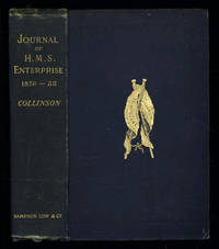
1889ref. 035576London: Sampson Low Marston Searle & Rivington. 1889. 1st Edition 1st Printing. Hardcover. Good/No Jacket. 8vo - over 7¾ - 9¾" tall. Good. Publishers cloth embossed with gilt lettering and emblem to upper cover. Front hinge cracked. Gift inscription in contemporaneous hand to free front endpaper. A touch of foxing. Two of the maps have a dog-eared fore-edge where they have not been folded quite flush with the page edges. Illustrated with tissue-guarded colour frontispiece of the ship tissue-guarded portrait of the author and 6 fold-out maps. xi i 531pp 32pp of publishers ads to rear. FIRST EDITION of the posthumously published journal by the captain who came closest to the site where Franklin's expedition ended. "In 1849 Collinson was appointed to command an expedition for the relief of Sir John Franklin by way of the Bering Strait; he himself had command of the Enterprise and with him was Commander Robert Le Mesurier McClure in the Investigator. The two ships sailed together from Plymouth on 20 January 1850 but unfortunately separated in the neighbourhood of Cape Horn and did not meet again. The Enterprise passed Point Barrow Alaska on 21 August but the ice forced Collinson to return south and winter in Hong Kong. In 1851 he was again hampered by ice and in 1852 was frozen in at Cambridge Bay for the winter. In 1853 the Enterprise was caught in the ice at Camden Bay and there passed a third winter. She reached Point Barrow on 8 August 1854 after being shut up in the Arctic entirely on her own resources for upwards of three years. Of the many who had searched for Franklin Collinson came closest to the place where the expedition had ended. Collinson's addition to geographical knowledge on this Arctic trip was very considerable and would have been tantamount to the discovery of the north-west passage had this not been already actually achieved by the men of the Investigator" DNB. Arctic Bibliography 3351; Hill 337; Ricks p 68; Tourville 986. Sampson Low, Marston, Searle, & Rivington. hardcover
2009ref. DADAX1418175714University of Michigan Library 2009-04-28. hardcover. New. 6.00x0.44x9.00. Buy with confidence. Excellent Customer Service & Return policy. University of Michigan Library hardcover
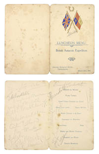
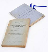
ref. 950041907-1913. . A collection of six menus and one souvenir programme various sizes and dates concerning the Nimrod British Antarctic Expedition. Preserved in archival sleeves within a blue morocco-backed fold-over box with chemise. A rare opportunity to obtain a collection of signed printed ephemera from Shackleton's first Antarctic expedition 1907-1909 during which Shackleton reached 'Farthest South' and achieved the first ascent of Mount Erebus. with the provenance of the Ship's chief engineer. The collection comprises: 1. 'To Celebrate the birthdays of our Shipmates H.J. Dunlop; & W.A.R. Michell at "Latitude 40"S. 30'/ Longitude 50"E.30'' manuscript menu in red and black ink on printed card signed on the reverse by Michell Murray Davis Mackintosh Mackay Dunlop and Captain England headed with the printed National Antarctic Expedition badge Nimrod added in ink 8vo 15.5 x 11.2 cm. Menu for a meal to celebrate the birthdays of four shipmates of the Nimrod given whilst en route to Christchurch - at this point half way between South Africa and the Kerguelen Islands. Signed by four of the ship's officers and three of the eventual shore party. Food includes Potage. Dominion Crême D'Unloppè and Dessert. Abricot au Shackleton. 18 October 1907. 2. 'Complimentary Dinner Given to Lieutenant Shackleton and the Scientists and Officers of the Antarctic Expedition of 1907' menu signed by Shackleton Bernard Day William Roberts and 7 others 4pp. upper cover printed in gilt with the 'Antarctic Expedition S.Y. Nimrod 1907'. emblem in blue 12mo 11.3 x 8.8 cm. Christchurch Freeman's Rooms. 19 December 1907. Menu given for members of the Nimrod expedition by the Canterbury establishment. Shackleton was presented with a copper salver made from bolts taken from Nelson's ship Victory and Bishop Julius gave his blessing at an event attended by some eighty local dignitaries. 3. Menu held for the 'British Antarctic Expedition' dinner held at the Canterbury Club Christchurch signed by Shackleton Wild Edgworth Davis and approximately 30 others 4pp. oval photographic illustration of polar scenes on upper and lower cover signatures on inside and lower pages punch holes at fore-edge 8vo 15.5 x 10.5 cm. 30 December 1907. Nimrod arrived at Lyttleton harbour on 25 March 1909 to a heroic welcome by the New Zealand public. The 'luncheon' held at the United Service Hotel the following day appears to have been a relatively intimate one the menu signed by Shackleton all but 2 members of the Shore Party and 3 of the ship's officers but none of the usual local dignitaries and was apparently unreported in the press. 4. 'Luncheon Menu. British Antarctic Expedition. United Service Hotel Christchurch' signed by Shackleton and eighteen other members of the British Antarctic Expedition. 4-page menu the upper cover colour-printed with British flags. 26 March 1909. 5. 'Philosophical Institute of Canterbury. Complimentary Banquet to Lieut. E.H. Shackleton M.V.C. the Shore Party and Officers of the S.Y. Nimrod on their return from Antarctica' signed by John K. Davis Nimrod's first officer Henry Dunlop and 24 other attendees 4-page menu the upper cover printed with map of the South Pole showing position reached by Discovery and Nimrod split at fold. 3 April 1909. The banquet at the Philosophical Institute was a public affair at which 'a standing ovation was given to Shackleton and loud applause as he responded to the many toasts to the expedition. He said that 'They always felt dissatisfied with what might have been done. but on that plateau with no 'grub' inside them. they were forced to turn back. There had been no gentle maidens to rest their heads upon!' This was a reference to a duet that had been sung earlier in the evening and was received with laughter' The Press 5/4/09 p.8. 6. 'South Polar Dinner given by John Howard Mcfadden. June 13. 1913' large-format menu card embellished with an original watercolour oval vignette by George Marston the Nimrod artist of a polar scene man sledge and tent against snow-covered mountains large penguin and decoration signed by the artist on the vignette 28.4 x 19.4 cm. the oval vignette c.6.8 x 9.5 cm. Oddenino's Imperial Restaurant. 13 June 1913. Celebratory menu illustrated by George Marston. 'One wealthy friend was so far interested as to give an Antarctic dinner at a famous restaurant to all the available men who had been in the far South. The table was transformed into a picture of the Antarctic with artificial snow and real ice where large models of the Nimrod and the Aurora were placed at the edge of an ice-barrier thickly peopled by penguins and Marston the Antarctic artist painted special menu cards. It was a gay gathering enlivened towards the close by songs from Harry Lauder; but alas! the rich and kindly host did not pursue his hospitality to the point of providing transportation for his guests to revisit the haunts they longed for' The Life of Sir Ernest Henry Shackleton 1923 pp.191-2. 7. Souvenir programme. 4to 'Sir Ernest Shackleton to give his Popular Lecture entitled Nearest the South Pole at the Music Hall Chester' signed twice by Shackleton 'E.H. Shackleton' in ink on the map once at the location of Farthest South and once in the lower margin 4 pages first page printed in red and black with photographic portrait of Shackleton. 21 February 1910. A souvenir from Shackleton's extensive fund-raising lecture tour following the British Antarctic Expedition of 1907-9 during which Shackleton reached 'Farthest South' and achieved the first ascent of Mount Erebus. The series of talks accompanied by lantern slides proved hugely popular with audiences. An account of a similar lecture in Edinburgh describes his charismatic style of delivery: "'In the centre' he said 'you see the South Pole. Now you've seen as much as anybody else has ever seen". Hearty laughter greeted this opening as he knew it would. He had an orator's gift for dramatic effect and his humour was timed to perfection.' 'A born leader of men' article RSGSexplorers.com. 1907-1913. unknown
1893ref. 2712376Adelaide: C.E. Bristow 1893. Wrappers torn at edges but well repaired as are the boards of the map section. Octavo complete with maps; original wrappers and boards preserved in a brown morocco bookform box. First edition: one of 500 copies printed of the narrative of one of the last great Australian exploring expeditions written by the leader of the expedition and complete with its maps. Lindsay led this extensive expedition - it ran to eight men forty-four camels and five Afghan camel drivers - organised by the South Australian Branch of the Royal Geographical Society and equipped by Sir Thomas Elder to explore the unknown interior between South Australia and the west coast and to look for Leichhardt. Lindsay's exhaustive report includes the surveyor L.A. Wells's journal of the expedition. Also included is an extensive Aboriginal vocabulary collected by Wells from the Pidong tribe at the head of the Murchison River the Minninng tribe at Fraser Range from the Everard Ranges at Mount Illbillee and from the "Wallawe" tribe at Yarragabie Station Western Australia. He states "Appended is a list of native names which I have collected from four tribes met with during the expedition.". The separate large folding maps are original lithographs coloured to illustrate geological changes. Compiled and drawn by both Lindsay and Wells these maps show in great detail the earlier discoveries of Giles Gosse Forrest and Hunt as well as the route taken by the Elder explorers. . C.E. Bristow unknown
ref. DADAX1585740519Brand: Lyons Press 0000-00-00. First Edition. paperback. New. 5.25x1.25x8.00. Buy with confidence. Excellent Customer Service & Return policy. Brand: Lyons Press paperback
ref. 8522Copenhagen: Munksgaard 1967-69 London: Curzon Press 1988. First edition. Some light wear to the paper-covered boards of volumes I-III volume IV as new; a bright and clean set in very good condition. Pp. vol. I: pp. 129 33 black-and-white photo-plates; vol. 2: pp. 164 140 full page plates black-and-white photos and line-drawings 2 plates are double foldouts of the excavation in progress 4 maps or excavation plan views in pocket at rear; vol. III: pp. 53 24 black-and-white photo-plates of human skeletal remains; vol. IV: pp. xii 150 6 38 photo-plates of cave interior and kettle-drums numerous text-figures. vols. I-III: one-quarter green cloth lettered in white on the spine over orange and white pictorial boards lettered in white and black vol. IV: white pictorial boards lettered in black 4to all volume hardback. The contents of each volume are: Volume I: Sai-Yok Stone-Age Settlements in the Kanchanaburi province; Volume II: Ban-Kao Neolithic Settlements with Cemeteries in the Kanchanaburi province Part 1 - Archaeological Materials from the Burials; Volume III: Ban-Kao Neolithic Settlements with Cemeteries in the Kanchanaburi province Part 2 - The Prehistoric Thai skeletons and Volume IV: Surface Finds and Minor Excavations. Archaeological Excavations in Thailand is a voluminous record of the finds of the Thai-Danish Prehistoric Expedition 1960-1962. The first three volumes were published in Copenhagen in 1967-1969. The fourth volume appeared as Occasional Paper no. 1 of the Scandinavian Institute of Asian Studies in 1988. No ownership marks and few signs of use. Copenhagen: Munksgaard, 1967-69 + London: Curzon Press, 1988. First edition. hardcover
ref. 4882New Haven: Connecticut Academy of Arts and Sciences 1934-1936. First edition. Light edge wear to wrappers on the spine many pages un-opened; a tight and clean copy in near fine condition. Pp. iv 483; 8 full page folding plates 1 folding maps 200 text-figures line-drawings. Original printed green wrappers lg 4to 12 x 9.5 inches. Memoirs of the Connecticut Academy of Arts and Sciences volume VIII-X. This work presents the entire results of the Yale North India Expedition as published by the Connecticut Academy of Arts and Sciences. The five volumes contain 24 articles on the geological history Paleolithic stone tools invertebrate and vertebrate fossils and the extant invertebrate and vertebrate faunas collected by the Yale North India Expedition of the 1930s. There are two articles in volume VIII: Hawkes et al. - Palaeolithic human industries in the Northwest Punjab and Kashmir and their geological significance; and De Terra - Geological Studies in the Northwest Himalaya between Kashmir and the Indus valley. Volume IX contains four articles: Wodehouse - The Pleistocene pollen of Kashmir; Branson - A Labrinthodont from the Lower Gondwana of Kashmir; Weller - Permain Trilobites from the Central Himalayas; and Vokes - Unionidae of the Siwaliks Series. Volume X contains 18 articles on the Diptera: Ephydridae; Triclad Turbellaria; Coleoptera: Staphylinidae; Carabidae; Phyllopod Crustacea; Gammarus; Hydracarina; terrestrial Hemiptera-Heteroptera; Rotatoria; Land Isopod; Hirudinea; Myriapods; Diplura; Thysanura; Collembola; Cladocera; and Fishes: Cobitidae Sisoridae and Cyprinidae. Single circular stamp of Staten Island Institute in the lower outer corner of the front wrapper of each volume; no other ownership marks and very few signs of use. New Haven: Connecticut Academy of Arts and Sciences, 1934-1936. First edition. unknown
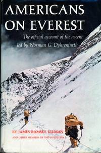
1964ref. 007892Philadelphia PA: J.B. Lippincott 1964. First Edition First Thus . Hardcover. Fine/Good. Stated First Edition. Text/BRAND NEW & Bright. Embossed blue linen boards/NF. DJ/Good; nips chips to edges & small losses to upper/lower spine & lower corners. Dyed upper text edge; map to endpapers. Record of first American ascent of Mt. Everest 1963. Led by Swiss born explorer film-maker and veteran mountaineer Norman G. Dyhrenfurth whose father led international expeditions to Kangechejunga and Batoro in the 1930s. Sponsored by Nat'l Geographic Society the expedition was scientific research in nature; the team was the most academically brilliant . 5 members with doctorates and 8 holding masters degrees. May 22nd 1963. Luther G/ Jerstad and Barry Bishop reach the summit of the South East Ridge via South Col route while Will Usoeld and Tom Hornbein of the West Ridge team conquered the West Ridge/Northface; the two teams rendevous and descend together. July 8th the Expedition was received at the White House by President Kennedy and awarded the Nat'l Georgraphic Society's Hubbard Metal. An exciting chronicle by celebrated author on the subject of mountaineering and official historian for the expedition James Ramsy Ullman 1907 - 1971 who was distinguished by being the oldest member of the team at the age of fifty-five. Illustrated with b/w photographs. J.B. Lippincott hardcover
1857ref. 375531New York: G. P. Putnam & Co 1857. One of 150 copies of the unofficial issue. Text: 4 777 1pp. Atlas: 100 engraved plates. 4pp. 2 vols. 4to text and folio atlas. Modern half russet morocco and cloth covered boards. Heavy foxing to the plates in the atlas small chip at fore-edge of atlas title minor dampstaining at lower outer corner of plates tape repair to final leaf of text. Provenance: University of Chicago ink stamp and blindstamp deaccession stamp. One of 150 copies of the unofficial issue. Text: 4 777 1pp. Atlas: 100 engraved plates. 4pp. 2 vols. 4to text and folio atlas. A very rare set of the text and plates of Asa Gray's report on the botany of the Wilkes Expedition illustrated with 100 engraved plates of plants collected by the first scientific expedition conducted by the United States Navy. The United States Exploring Expedition circumnavigated the globe under the command of Charles Wilkes between the summer of 1838 and the summer of 1842. The Wilkes Expedition "was the first American scientific expedition of any size charged to 'extend the bounds of Science and promote the acquisition of knowledge' and was one of the most ambitious Pacific expeditions ever attempted" Forbes. The Expedition represents "the first governmental sponsorship of scientific endeavor and was instrumental in the nation's westward expansion. Specimens gathered by expedition scientists became the foundation collections of the Smithsonian Institution. Significant American contributions in the fields of geology botany conchology anthropology and linguistics came from the scientific work of the expedition. Wilkes's evaluations of his landfalls influenced later U.S. positions in those areas" DAB. The Narrative of the expedition was first published in 1844 but the separately-issued scientific reports and atlases for the United States Exploring Expedition were published over a long period of time; the Expedition returned in 1842 and the final volume did not appear until 1874. Because of their limited issue and historical importance all the separately-issued scientific reports and atlases from the Expedition are highly sought after though they very rarely appear on the market. Gray's report is specifically on the "phanerogamia" seed plants or flowering plants collected during the four year voyage. The history of the publication of the many scientific reports that resulted from the Wilkes Expedition is filled with difficulties in their writing and production and Gray's botanical report is exemplary of these difficulties. "The preparation of the reports on the botanical collections brought back by the Expedition proved to be one of the worst headaches encountered during the course of the entire publication" Haskell. Asa Gray was one of the most acclaimed botanists of his era and he was the original selection as botanist for the Wilkes Expedition. In the time between his appointment and the expedition's departure in 1838 however Gray accepted the position of Professor of Botany at the University of Michigan and so he resigned from Charles Wilkes's command and was replaced by William Rich. Rich completed his botanical report in 1846 and submitted it to Wilkes who found it wholly unacceptable. Eventually Asa Gray was asked to study the specimens gathered on the expedition and to produce this report which he agreed to do and which he worked on for three years. Gray initially planned for a two-volume text report and an atlas including 300 folio plates. In the end the text was issued in one large volume and the atlas contained 100 plates drawn by the talented botanical artist Isaac Sprague. The botanical specimens described in the text and depicted in the atlas come primarily from throughout the Pacific Rim including the islands of the South Pacific Hawaii Singapore the Philippines Australia New Zealand and several countries in South America - predominantly Brazil and Chile. The total number of texts published from the voyage of the United States Exploring Expedition is massive - a total of twenty-four volumes of narrative and scientific reports. Asa Gray's botanical report is designated as Volume XV. As with Charles Wilkes's narrative account of the United States Exploring Expedition Gray's botanical report was issued in "official" and "unofficial" editions. The official edition of Gray's report was published by Sherman & Son of Philadelphia in an edition of 100 copies each of text and plates and the unofficial edition was issued by Putnam of New York in an edition of 150 copies again as quarto text and folio plates. Either edition is exceedingly rare in commerce as they were mostly intended for presentation or for placement in research libraries. Sabin writing in 1875 comments that "owing to some mistake a large number of copies of the Atlas were sold by auction unbound and without the letterpress the result is that odd volumes are comparatively common - whole sets are scarce." Actually the text or atlas individually or the two volumes together are exceedingly rare in the market. A highly desirable scientific report from the Wilkes Expedition with an atlas of 100 attractive plates with text by the noted botanist Asa Gray. Haskell 61 and 63; Rosove 354-10.A2 and 355-6.A2 both text and atlas described as "rare"; Sabin 28368; Meisel II pp.668-669; Nissen 2153; Stafleu 2129 2130; Pritzel 3529; Forbes 1993. Not in Spence G. P. Putnam & Co unknown
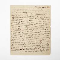
1854ref. 369733Palmas Panama 1854. 2pp. single 4to sheet. With: Carte-de-visite photograph of Mayo signed and inscribed to his sister on verso. Folds minor separations. 2pp. single 4to sheet. With: Carte-de-visite photograph of Mayo signed and inscribed to his sister on verso. Seeking a low-level train or canal route to bridge the Atlantic and Pacific Oceans in late 1853 President Franklin Pierce ordered a U.S. Naval exploring expedition to participate in an international attempt affiliated with a venture by the Atlantic and Pacific Junction Company. Although ships from Great Britain New Grenada and the United States were involved the principle overland portion of the expedition through 40 miles of dense jungle would be led by Lieutenant Isaac G. Strain who had previously led exploring expeditions in Brazil Baja California and Chile. With a party of 27 officers and men and including the author of the present letter they entered the jungle on January 20 1854. Problems began almost immediately. While puting ashore a boat was swamped and a portion of the party's provisions lost. Next the route Strain had been tasked with following contained no gap in the cordillera as had been previously believed. Led through the jungle by several groups of indigenous people the promise of a few days hike turned into months of wandering in the jungle before being abandoned by the guides. Subsisting on plantains and bananas and drinking river water Stain divided his men with an advance party striking out to seek rescue. On March 9 forty-nine days after starting from Caledonia Bay Strain and his advance party reached Yavisa; it would be another nearly three weeks before the main body was rescued but not before at least five had died of starvation or disease. Sometimes compared with the trials of the crew of the Essex or the members of the Donner Party the men on the Darien expedition endured extreme harship and resorted to unspeakable things. This remarkable letter was written by one of the expedition's survivors shortly after his rescue and return to civilization. George Upshur Mayo 1834-1896 was born into a prominent family in Norfolk VA. He attended the Virginia Military Institute served as an assistant engineer on the Strain Expedition was involved in the United States Geodetic Survey and was later a major in the Confederate Army. Here he writes: "My dear father From this filthy native village where our party are brought by the officers of the war steamer Virago English whose officers rescued us from a most deplorable condition starvation misery & want for about 70 days without bread or meat living on roots & nuts from the trees. May the rescue be never forgotten & I thank & give praises to God for his goodness. We abandoned & buried 4 or 5 in the woods as unable to keep up. I suffered from the cusano a worm that gets in the flesh also from a very bad knee. Almost unable to travel 3 miles a day. Unfavorable reports reached the U.S. concerning us. We are safe & go to Panama when we get well. My mind is out of sorts by medicine & sickness & my hand too weak to write more legibly. Will write from Panama or Aspinwall a respectable letter there. We are 100 miles from Panama. Had the party 8 days provisions only in the woods yet nothing to shield us from wind & storm & no change of garments. The suffering was intense & the rescue came at the most dreadful & important for our safety. I with 3 others on the river bank washing at sundown when the canoes came in sight. Captain Strain had no pants or underdraws to protect him from the briars & vermin. God be praised for rescue. Love to Annie. . . . In all probability will meet the Cyane at Aspinwall." A remarkable first-hand account of a desperate struggle for survival. unknown
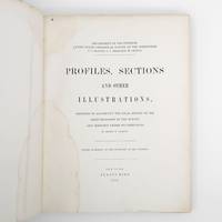
1872ref. 373132New York: Jules Bien 1872. First edition. Limited to 100 copies. 65 lithographed plates many folding preceded by 4pp. text. 4to. Original green cloth boards upper cover lettered in gilt rebacked endpapers renewed. Dampstaining. First edition. Limited to 100 copies. 65 lithographed plates many folding preceded by 4pp. text. 4to. This book was prepared to illustrate the work of the Hayden survey. It contains numerous panoramic illustrations many on folding sheets depicting sites in Wyoming Utah Colorado and Montana. This report contains the bulk of Henry Wood Elliott's art work for the Hayden Survey see preceding entry most of which was published nowhere else. These images are important because of their scientific contribution to several fields historical significance documentation of the Hayden expedition and their beauty and attention to detail. Elliott's illustrations were among the early images of many locations in the new territories of the West. From an edition of 100 copies issued in advance of the text. The Prefatory Note states p. 3: "A small edition of one hundred copies of the Profiles and Sections are issued in advance of the text for the purpose of placing them in the hands of the principal geologists in this country and in Europe. The first issue of two thousand copies in colors will be published with descriptions in about one year." We find no evidence that a subsequent edition in color was ever printed and it is stated of the present work in the Checklist of United States Public Documents 1789-1909 Washington: Government Printing Office 1909: "Originally intended to illustrate v. 4 of quarto series of reports but never thus used." The Hayden Survey was the most important of the four major government surveys of the American West undertaken after the Civil War the others being Powell King and Wheeler. Collectively these surveys filled in the map of the United States using accurate scientific methods to chart the land and investigate not only its geology but natural resources wildlife and plants as well. Schmeckebier Catalogue and Index of the Publications of the Hayden King Powell and Wheeler Surveys p. 32 #3 Jules Bien unknown
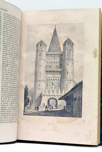
ref. 56216Paris Didot 1846. 4 feuillets. 460 pages. 1 carte dépliante. 91 planches hors-texte. 215x18 Cm. Cartonnage vert de lépoque. Dos lisse. Titre doré. Coins émoussés. Plats un peu frottés. Ouvrage illustré de nombreuses vues costumes portraits etc. Histoire de la Suisse des temps anciens jusqu'au début du 19e siècle suivie de la statistique et la description de chacun des cantons suisses. Il suit une 2e partie beaucoup plus brève sur le Tyrol. Rousseurs. Paris, Didot, 1846. unknown
1857ref. 324349New Haven 1857. Separately-issued offprint from the American Journal of Science and Arts 2nd series Vol. xxiv July 1857. 21-38 pp. plus folding map. 8vo. Period plain green wrappers stitched. Separately-issued offprint from the American Journal of Science and Arts 2nd series Vol. xxiv July 1857. 21-38 pp. plus folding map. 8vo. "Redfield's last contribution to meteorological science was a memoir upon the cyclones or typhoons of the north Pacific Ocean prepared at the request of Commodore Perry to accompany his Narrative of the United States Expedition to Japan; and was printed in the second volume of that work . He showed that the hurricanes of the Pacific followed the same general laws as those of the Atlantic and traced the paths of several remarkable storms among which was one of great force encountered by the steamer 'Mississippi' one of the vessels of Commodore Perry's squadron on route from Simoda to the Sandwich Islands in October 1854" Recollections of John Howard Redfield p. 302. Page 37 includes a description of the Kona or southerly winds of Hawaii as well as the effects of cyclones on the Hawaiian islands. Following its publication within Perry's Narrative in 1856 the work was issued in a slightly more condensed form within the July 1857 issue of the American Journal of Science and Arts. The present separately-issued offprint from the AJSA is the only separately-issued edition of the work. Scarce. Sabin 68512. Not in Forbes unknown
1922ref. 314367Ottawa: F. A. Acland 1922. 5 of 12 parts comprised of the Introduction Preface and errata and parts A B and G. With a duplicate of the Preface part. 5 vols. 8vo. Three in original wrappers. 5 of 12 parts comprised of the Introduction Preface and errata and parts A B and G. With a duplicate of the Preface part. 5 vols. 8vo. Five individual parts from Volume III of the official reports of the Expedition organized and led by Vilhjalmur Stefansson. F. A. Acland unknown
1923ref. 321730Ottawa: F. A. Acland 1923. Vol XII Part B: Physical Characteristics 12 photographic plates. Vol. XII Part C: Osteology: 9 plates. 2 vols. 8vo. Publisher's lettered wrappers. Vol XII Part B: Physical Characteristics 12 photographic plates. Vol. XII Part C: Osteology: 9 plates. 2 vols. 8vo. Two individual wrappered parts from the official reports of the Expedition organized and led by Vilhjalmur Stefansson. Vol. XII part B on the physical characteristics of the Copper River Eskimos by D. Jenness is particularly noteworthy due to its portraits of the aboriginal peoples encountered. F. A. Acland unknown
1928ref. 321731Ottawa: F. A. Acland 1928. Vol XII Part B: Physical Characteristics 12 photographic plates. Vol. XII Part C: Osteology: 9 plates. 3 vols. 8vo. Publisher's lettered wrappers. One part lacking upper wrapper. Vol XII Part B: Physical Characteristics 12 photographic plates. Vol. XII Part C: Osteology: 9 plates. 3 vols. 8vo. Three individual wrappered parts from the official reports of the Expedition organized and led by Vilhjalmur Stefansson. Vol. XII part B on the physical characteristics of the Copper River Eskimos by D. Jenness is particularly noteworthy due to its portraits of the aboriginal peoples encountered. F. A. Acland unknown
1876ref. 895260551Excellent condition but missing the original map that was originally included. 11 fine chromolithographic and 11 lithographic plates. Publication of this report was originally intended for 1861 but the Civil War intervened and prevented publication for another fifteen years. The expedition under Macomb went west from Santa Fe across northern New Mexico and Arizona to the Colorado. The whole drainage of the San Juan had been traced and the relationship of that river with the Colorado clearly established. More important they had also established that the Green River united with the Grand to form the Colorado. The entire maze of intricate canyon country had been threaded and its geography revealed for the first time. In addition Newberry was able to establish numerous stratigraphic columns and to trace the Triassic Jurassic and Carboniferous strata far out across the Colorado River. Newberry.introduced a new level of sophistication into the study of western geology. Government printing office hardcover