1758 resultados
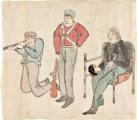
1853ref. 34749Edo 1853. Watercolour and ink drawing on Japanese paper. A contemporary Japanese watercolour of Commodore Perry and members of his expedition produced at the moment of the American squadron’s arrival in Japan and the opening of sustained diplomatic contact between Japan and the United States. This lively drawing belongs to the immediate visual culture generated by Commodore Matthew C. Perry's arrival in Japan in 1853. Perry entered Edo Bay in July 1853 to deliver President Fillmore's request for a treaty and returned the following year leading to the Treaty of Kanagawa on 31 March 1854. The event prompted wide Japanese interest in the appearance dress equipment and conduct of the visiting Americans and images of the "Black Ships" and their crews circulated in manuscript painted and printed form. The composition presents three American figures isolated against the paper ground arranged almost as a study of types. At right Commodore Perry is shown seated in a chair wearing a dark naval coat and holding his hat. At center stands an armed crewman or marine in a red jacket holding a musket upright; at left another crewman kneels while looking through a telescope or spyglass. The emphasis falls on uniform posture weaponry and optical instrument details that would have marked the Americans as visually and technologically unfamiliar to Japanese observers. The drawing is especially interesting as a Japanese interpretation of the expedition distinct from the official American pictorial record produced by artists such as Wilhelm Heine. The Japanese manuscript images such as the present work preserve a different perspective shaped by local observation report and curiosity. unknown books
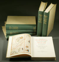
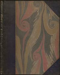
1957ref. E0551From the Spanish discovery to the opening of the Civil War 5 volumes in 6. Volume One: The Spanish Entrada to the Louisiana Purchase 1540-1804 xiv264 pages with color frontispiece map and 275 maps many folding and index; Volume Two: From Lewis and Clark to Fremont 1804-1845 xiii281 pages with colored frontispiece map 143 additional maps some folding and index. Volume Three: From the Mexican War to the Boundary Surveys 1846-1854 xiii349 pages with colored frontispiece map 322 additional maps and index; Volume Four: From the Pacific Railroad Surveys to the Onset of the Civil War 1855-1860 xiii260 pages with color frontispiece map an additional 127 maps some folding and index; Volume Five From the Civil War to the Geological Survey Part One: xviii222 pages with color frontispiece map and an additional 152 maps; Volume Five From the Civil War to the Geological Survey Part Two: 223-487 pages with 124 maps and index. Folio 14 1/2" x 10 1/2" bound in quarter green leather with gilt lettering to spines. volume I printed by the Grabhorn Press; volumes II-V printed by Taylor & Taylor and James Printing based on the designs of Edwin and Robert Grabhorn. First edition limited to 1000 copies. Carl Wheat's Mapping of the Trans-Mississippi West is a comprehensive and readable cartographic history of the American West. The first three volumes of the work are by necessity bulky and out sized to accommodate the many maps contained with their covers. These beautifully printed books present a truly graphic picture of the exploration and peopling of the vast unknown land west of the Mississippi. The author does not merely present a catalog of significant maps of each era but tells the exciting story of many facets of history that resulted in their making-of the hard journeys the hazardous exploits the motivation the mysticism the misunderstandings and the strange blend of fact imagination false geographic concept and political necessity which were consummated in the engraver's work. These volumes will provide exciting text for the casual reader and have become eminent source book for the student and scholar. Condition: A near fine set. Due to the size and/or weight of this lot extra shipping and/or handling charges may apply. Institute of Historical Cartography hardcover books
1836ref. 185920Leipzig: Hirschfeld 1836. Hardcover. G Cover has fading cracking edge/corner damage. Bookblock has age toning. Interior pages have age toning foxing some water staining. Title page has some text work away. Brown leather decorative boards with 2 metal clasps. Decorative carved and colored bookblock. VIII 920 257 pages. Hirschfeld hardcover books
1970ref. 31246Nicosia Cyprus: Republic of Cyprus 1970. 8vo pp. 16. Paper wraps. Illustrated with drawings plans and photographs. VG. Republic of Cyprus unknown books
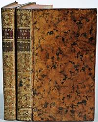
1749ref. E05292 volumes. 182 pages with fold out frontispiece map and three additional folding engravings; 319 pages with seven folding engravings. half-titles in each title pages improperly marked first volume as second and vice versa. Duodecimo 6 1/2" x 3 1/2" bound in original publisher's full uniform contemporary French sponged calf with gilt-tooled spines. First French edition after the 1748 English edition. Henry Ellis was a traveler hydrographer and colonial governor returned from Italy in 1746 just in time to find an expedition to search for a north-west passage on the point of sailing. He appears to have been in easy circumstances; his name stands in the list of subscribers to the north-west expedition and he had sufficient interest to get attached to it nominally as agent for the committee and really as hydrographer surveyor and mineralogist the expedition consisting of two vessels the Dobbs galley of 180 and California of 150 tons left Gravesend on 20 May 1746 joined the Hudson's Bay convoy in Hollesley Bay and finally sailed from Yarmouth on the 31st. They parted from the convoy on 18 June made Resolution Island on 8 July and after a tedious passage through Hudson's Straits rounded Cape Digges on 8 August and on the 11th 'made the land on the west side the Welcome in latitude 64° N.' Bad weather drove them to the southward and prevented their doing anything more that season. They wintered in Hayes River in a creek about three miles above Fort York where a quarrel with the agent of the Hudson's Bay Company gave an unwonted piquancy to the dark and weary days. They suffered much from scurvy the prevalence of which Ellis attributes to their having got two kegs of brandy from Fort York for their Christmas merrymaking and in a minor degree to the 'governor' not permitting the Indians to supply them with fresh provisions. On 29 May 1747 the ice broke up and they were able to warp to the mouth of their creek; on 9 June they got down to Fort York. There they were allowed to get some provisions and stores and on the 24th cleared the river and 'stood to the northward on the discovery'. On 1 July each of the two ships sent away her long-boat but owing apparently to some ill-feeling between the two captains without any prearranged plan for working in concert. The consequence was that they separately went over the same ground discovering naming and examining the several creeks and inlets on the west side of Hudson's Bay the double examination perhaps compensating for the confusion arising from the double naming. Before the season closed in they had satisfied themselves that the only possible exit from Hudson's Bay on the west must be through the Welcome and that very probably there was no way out except that on the east by which they had come in. The result may not seem much; but as it served to put an end to the idea that the passage must lie through Hudson's Bay it was at least so much gain to accurate knowledge. After 21 August the weather broke and they decided in council 'to bear away for England without further delay.' On the 29th they entered Hudson's Straits passed Resolution Island on 9 September and arrived at Yarmouth on 14 Octivwe. Ellis's share in the work of the expedition had really been very slender but the reputation of it has been commonly assigned to him by reason of the narrative which he published the following year under the title A Voyage to Hudson's Bay by the DobbsGalley and California in the years 1746 and 1747 for Discovering a North-West Passage 1748; a work which with many valuable observations on tides on the vagaries of the compass and on the customs of the Eskimos a people then practically unknown mingles a great deal of speculation on the certain existence of the passage on magnetism on fogs on rust and other matters all more or less ingenious but now known to be wildly erroneous. Such as it was the book commended its author to the scientific workers of the day and on 8 February 1748-9 he was elected a fellow of the Royal Society. Possibly in acknowledgment of his scientific labors but more probably by some family interest he was afterwards appointed successively governor of Georgia and of Nova Scotia from which employment he retired about 1770. He seems to have spent his later years as a wanderer on the continent was at Marseilles in 1775 and died at Naples on 21 January 1806. Condition: Some dark spots to spine else a very good copy. Ballard Fils hardcover books
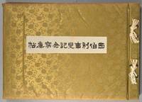
1918ref. 880611918. SIBERIAN EXPEDITION. Teikoku Gunjin Kyoiku-kai editors. SHIBERI JIHEN KINEN SHASHIN-CHO. Tokyo Taisho Tsushinsha Taisho 7 1918 Oblong folio bound western-style in cloth gilt. Illustrated throughout in collotype. Photos and cations on the International Siberian Expedition in support of the Whites against the Red Army in which the Japanese played a prominent role. 4 page folding panorama of Vladivostok harbor and views of the cities the countryside troops inhabitants diplomats war preparations etc. etc. One can feel the Winter coming. Very good condition throughout. Very scarce. unknown books
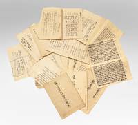
ref. 7712Several dozen manuscripts in various formats incl. long folded sheets stitched pamphlets sewn volumes and letters. Japan: ca. 1853-63. A substantial group of documents revealing internal high-level debates and discussions in response to Commodore Perry’s landings and later controversies that arose as Western powers established a foothold in Japan. This is an exceptional collection filled with top-secret information on government intrigues as the Japanese state responded to aggressive foreign expansion and dissenting groups within the government urging top-to-bottom reforms. The manuscripts touch upon pivotal events in Japan’s history: –Commodore Perry’s two expeditions July 1853 & February-March 1854 and the resulting ratification of the Treaty of Shimoda. –Japanese translations of the treaties signed with the United States Russia France and the United Kingdom from 1854 to 1858. –The assassination of Ii Naosuke in March 1860 also known as the Sakuradamon Incident which precipitated a violent backlash against foreigners under the banner of Sonno joi “Honor the Emperor expel the barbarians”. –General dissatisfaction with the bakufu and efforts to reform it. –The attempted assassination of Ando Nobumasa a chief councillor during this period. –The Namamugi Incident in September 1862 when the British merchant Charles L. Richardson was killed by Satsuma domain warriors. –The bombardment of Kagoshima August 1863. Among all these materials we must highlight several examples of manuscript kengen proposals and commentaries written by aristocrats with policy advice on the difficult situations faced by the Japanese state. These offer compelling perspectives on the most pressing dilemmas of the day. While they were not composed by the decision-makers these documents are filled with the minutiae and data employed in the policy-making process. All of the items are in a fine state of preservation. ⧠John McMaster “Alcock and Harris. Foreign Diplomacy in Bakumatsu Japan” Monumenta Nipponica Vol. 22 No. 3/4 1967 pp. 305-367. unknown books
1799ref. biblio153a1-42 binders direction8 subscribers4c-4204 additional subscribers pages with 7 maps 5 folding and 6 plates. Quarto 11 3/4" x 9 1/2" with new spine in six compartment with red label in gilt over original decorative blind stamped calf boards. Ferguson 329; Sabin 104.633 First edition first printing. Captain James Wilson brought the first British missionaries to Tahiti on ship Duff in 1797. Wilson was a deeply religious man. The missionaries he brought were from the London Missionary Society. There were thirty men six women and three children. Wilson on the Duff also explored and visited many islands in the Pacific some of which had never had any recorded visit by a European. Among these the most important are Mangareva in the Gambier Islands and Pukarua in the Tuamotus. Duff paid a visit as a missionary ship to Tahiti during 1796 as a result Missionary Society has first been established in Tahiti. Three years after the establishment the directors of the Society appointed a committee to consider a suitable memorial for presentation to Wilson for his services in helping to establish the first mission in the South Seas. Wilson fought with the British army during the American War of independence and then served nine years with the East India company. While in India he was captured by Hyder Ali and after a daring bid for escape was imprisoned in the black hole of Seringapatam. After his release he continued service as a captain and despite illness and further dangerous missions accumulated sufficient sources to retire. throughout it all Wilson remained fast in his irreligious opinions. While living in England with his niece however he was converted to an evangelical faith. he felt called to volunteer for missionary service after reading the Evangelical Magazine. Haweis did not know Wilson before receiving a letter volunteering his services in the Pacific. his skills and newfound devotion seemed perfectly suited to the situation and Haweis saw him as "God's man." the Duff arrived at Tahiti on march 5 1797. the settlement at Tahiti of twenty of the missionaries five of them with wives and two children gives further examples of the role of the missionary captain. A pattern of intercourse had already been established by other voyagers according to which the captain of a vessel would take the leading role in meetings. It is therefore not surprising that the focus of the chapter describing the arrival is on meetings between significant island figures and Captain Wilson. For example Manemane a "high priest" Frommo'orea sought Wilson as a tayo or friend not Jefferson the president of the missionaries. The official account of the first mission appeared in 1799 under the lengthy title A missionary voyage to the southern Pacific Ocean performed in the years 1796 1797 1798 in the ship Duff commanded by Captain James Wilson compiled from the journals of the officers and the missionaries; and illustrated with maps charts and views drawn by Mr William Wilson..it was placed firmly within the tradition of the voyages of discovery by an introduction compiled by Samuel Great heed that described previous European contacts with the islands and an appendix "including details never before published of the natural and civil state of Otaheite." the main narrative was taken from Wilson's journal with additions from his son and a journal kept by the missionaries during the period when the Duff was away from Tahiti at Tonga. Wilson dominated the events recorded in the narrative. Condition: Some offset toning from maps occasional foxing water mark to upper margin on some leaves two leaves miss-bound at back re-backed with contemporary blind stamped calf boards. S Gosnell for T Chapman hardcover books
1779ref. BOOKS0003374282 pages lacking the map. Small quarto 10" x 7½" rebound in ¾ morocco & marbled boards spine lettered in gilt top edges gilt. Sabin 22572 First edition. Rare account of travels into the arctic most notably Nova Zemblya to the north of Europe. Twelve years earlier Engel wrote his notable work on explorations on the other side of the Arctic Circle Memoires et observations geographiques et critiques sur la situation des pays septentrionaux de l'Asie et de l'Amerique. Lausanne 1765. Condition: Rubbing to joints and extremities; some minor staining and soiling within hinge professionally repaired else a very good copy. Only five copies found on worldcat. F Sanuel Fetscherin hardcover books
1808ref. E0058ix366 pages. Small octavo 7 1/4" x 4 1/4" in the original leather binding with black label in gilt to spine. Howes:354 First printed in 1806 in London in three volumes. Second printing. Thomas Ashe 1770-1835 was born in Dublin Ireland and was a soldier and memoirist. Much of his life was checkered with intrigue and fraud. His Memoirs and Confessions 1815 is an autobiographical account of 'criminal and delinquent' escapades beginning with the seduction of a girl in France. In America he edited the National Intelligencer and was arrested when attempting to steal treasures from churches in Latin America. His Travels in America first appeared in 1806. The narrative chronicles Ashe's travels by flatboat down the Ohio and Mississippi Rivers in 1806 and is one of the first travelogues written by a foreigner to comment specifically on the American inhabitants of the region. A unrestrained hatred of Americans can be found throughout the work. While the account is interesting and highly readable it was to create quite a stir and added to the wave of anti-British sentiment that would ultimately lead to the War of 1812. Printed Newburyport [Mass.] Reprinted for W. Sawyer and Co. by E.M. Blunt hardcover books
1855ref. E05582 volumes. xx383 pages with hand colored frontispiece 3 maps in pockets plates many colored; vii41923 ad pages with color frontispiece and plates some colored. Small quarto 10 1/2" x 6 3/4" bound in original publisher's pictorial brown cloth with blind-stamped cover with gilt pictorial in gilt. Notes on the Natural History by John Richardson. Abbey Travel 645; Arctic Bibliography 1241; Books on Ice 5.8a; Hill 106; Sabin 4389; TPL 3409 First edition. Belcher's five-ship 1852-54 expedition in search of Franklin would be the last official British attempt. On the HMS Assistance Belcher successfully navigated through the Wellington Channel but beset by ice was unable to return to Lancaster Sound and was forced to abandon the ship. This account of the expedition also includes several essays on the natural history of the region by Richardson Owen Bell Salter and Reeve. Condition: Minor wear re-backed with parts of original back-strips laid down; minor foxing short separations at folds to the largest map; inked stamps on title pages Edinger bookplates else a good set internally very good. Lovell Reeve hardcover books
1831ref. E01322 volumes. xxi472 pages with three maps two folding and one double page figures and 13 plates; iv452 pages with 10 plates some folding tables and appendices. Octavo 9 1/2" x 5 1/2" Bound in contemporary half leather with marbled boards and gilt lettering to spine. Ferguson 1418; Hill I p. 19; Howes B309; Lada-Mocarski 95; Sabin 4347. Second edition published after quarto edition of the same year. Frederick William Beechey 17 February 1796 – 29 November 1856 was an English naval officer and geographer. He was the son of Sir William Beechey RA and was born in London. 1806 he entered the Royal Navy and saw active service during the wars with France and America. In 1818 he served under Lieutenant afterwards Sir John Franklin in David Buchan's Arctic expedition of which at a later period he published a narrative. In the following year he accompanied Lieutenant W. E. Parry in HMS Hecla. In 1821 he took part in the survey of the Mediterranean coast of Africa under the direction of Captain afterwards Admiral William Henry Smyth. He and his brother Henry William Beechey made an overland survey of this coast and published a full account of their work in 1828 under the title of Proceedings of the Expedition to Explore the Northern Coast of Africa from Tripoly Eastward in 1821-1822. In 1825 Beechey was appointed to command the HMS Blossom. His task was to explore the Bering Strait in concert with Franklin and Parry operating from the east. In the summer of 1826 he passed the strait and a barge from his ship reached 71°23'31" N. and 156°21'30" W. near Point Barrow which he named a point only 146 miles west of that reached by Franklin's expedition from the Mackenzie river. The whole voyage lasted more than three years and in the course of it Beechey discovered several islands in the Pacific and an excellent harbor near Cape Prince of Wales. In July 1826 he named the three islands in the Bering Strait. Two were the Diomede Islands that Vitus Bering had named in 1728: "Ratmanoff Island" Big Diomede and "Krusenstern Island" Little Diomede. Beechey called the uninhabited third islet "Fairway Rock" which is still its contemporary name. One of his crew Petty Officer John Bechervaise gave a detailed account of the voyage in his Thirty Six Years if a Seafaring Life by an Old Quartermaster published privately in 1839. In 1831 there appeared his Narrative of a Voyage to the Pacific and Beering's Strait to Co-operate with the Polar Expeditions 1825-1828. In 1835 and the following year Captain Beechey was employed on the coast survey of South America and from 1837 to 1847 carried on the same work along the Irish coasts. He was appointed in 1850 to preside over the Marine Department of the Board of Trade. In 1854 he was made rear-admiral and in the following year was elected president of the Royal Geographical Society. Beechey Island where Sir John Franklin wintered is named after him. Condition: Name neatly excised from head corner of titles small inconspicuous stamp to last pages. Inner hinges beginning marble to boards rubbed some stains to map. some toning to some plates some plates not bound in order to the printer but are all accounted for corners gently bumped else about a very good set. Henry Colburn and Richard Bentley hardcover books
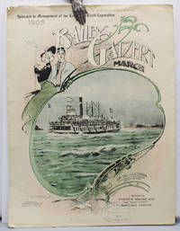
1905ref. 17219Portland Oregon: Published by Fisher Music Co. Lithographed by Anderson & Duniway Co. 1905 First edition of this sheet music as printed for the Lewis and Clark Exposition second edition overall. The sheet music was originally printed in 1902 but is here printed to promote the Lewis and Clark Exposition. The song honors the Bailey Gatzert the most famous Columbia River steamship. Benjamin A. Gifford 1859 – 1936 is considered perhaps Oregon's most famous photographer and his images include the cover photo of the steamship and Multnomah Falls. Original color-printed paper wrappers illustrated with an elaborate border around a color-tinted photo reproduction of the Bailey Gatzert steamship heading up the Columbia River by Benjamin A. Gifford. 10 x 14 in. . . With six text photo reproductions. Some chipping to edges. With the ink ownership stamp of the Portland area piano teacher Lillian R. Bickner 1884 – 1962. A very good copy. "Portland staged its first and only world's fair from June 1 through October 15 1905. During those four and a half months 1588000 paying visitors passed through the gates to the 400-acre fairgrounds on the northwest edge of town…The Lewis and Clark Exposition was conceived so Portland could demonstrate that it could mount a major civic enterprise. The city had had a solid record of economic growth since its founding in 1845 but at the turn of the twentieth century it was competing for investment and immigration with dozens of other cities throughout the American West" Carl Abbott on the Oregon Encyclopedia website. Published by Fisher Music Co., Lithographed by Anderson & Duniway Co., books
1843ref. E01482 volumes. xxxvii23878 ad pages with frontispiece woodcuts in text and 7 steel-engraved plates; vi2474 pages with frontispiece woodcuts in texts and 10 steel-engraved plates. Royal octavo 9¼x5½" in publisher's original green cloth spine lettered in gilt covers decorative blind stamped. First Edition. In 1825 Edward Belcher accompanied Frederick William Beechey's expedition to the Pacific and Bering Strait as a surveyor. In 1836. he commanded a surveying ship on the north and west coasts of Africa and in the British seas. Belcher took up the work which Beechey had left unfinished on the Pacific coast of South America. He was on board the bomb vessel HMS Sulphur which was ordered to return to England in 1839 by the Trans-Pacific route. Belcher made various observations at a number of islands which he visited having been delayed by being dispatched to take part in the war in China in 1840. On 26 January 1841 the then Commander Belcher landed on Possession Point at the north shore Hong Kong Island and made the first British survey of Hong Kong harbor. After the war's end in 1842 he reached home and for his services was made a Knight Bachelor in the following year. He was then engaged in HMS Samarang in surveying work in the East Indies the Philippines Geomun-do Port Hamilton and other places until 1847. In 1852 Belcher led the last and largest Admiralty expedition to rescue Sir John Franklin. He was also to look for his former surveying officer in Hong Kong Richard Collinson and Robert McClure whose ships had not been seen after entering the Bering Strait. He did a great deal of sledge exploration rescued McClure and abandoned four of his five ships in the ice. He had five ships: Assistance Belcher Resolute Henry Kellett second mate George Nares the steam tenders PioneerSherard Osborn and Intrepid Leopold McClintock and the depot ship North Star William Pullen. Belcher and one tender were to enter Wellington Channel where Franklin was thought to be while Kellett was to go west to Melville Island and look for Collinson and McClure. North Star was to stay at Beechey Island as a supply base. He left the Nore in April 1850. By early winter Assistanceand Pioneer were frozen in at Northumberland Sound to the north of Wellington Channel while Resolute and Intrepid were frozen in off Melville Island Arctic—the first ships this far west since William Edward Parry in 1819. A great deal of exploration was done by man-hauled sledges. In April 1853 Leopold McClintock and others left the Resolute on sledges and returned 105 days later having covered 1400 miles and discovered Prince Patrick Island. Another party went west and discovered Robert McClure whose ship was frozen in at Mercy Bay. Belcher went north by sledge and found a channel at the northern tip of Devon Island hinting that Franklin might have used it to escape to Baffin Bay. When the ice broke up that summer he pushed his ships up Wellington Channel and became trapped again. By February 1854 Belcher was becoming increasingly worried about the safety of his ships and men. In April he ordered Kellett to abandon his ships and return by sledge to North Star. Belcher abandoned his two ships in late July. Aided by two ships that showed up at Beechey Island Phoenix and Breadalbane the whole party returned to England. Belcher went through a court martial which was automatic for any captain who had lost a ship. He was exonerated but his sword was returned to him 'without observation'. He never again received an active command. Curiously Resolute broke free of the ice and drifted all the way to Davis Strait where it was picked up by an American whaler. Condition: Some staining and wear to covers spines a bit faded ends chipped and worn rear joint of Vol. I with chipping and loss; hinges repaired at endpapers some light foxing and occasional mostly marginal damp staining within the three folding maps which should be loose in a pocket not present; overall good uncommon in the original cloth. Henry Colburn hardcover books
1717ref. E01353559index pages 36 of 37 maps and copper cuts of the coasts harbor cities plants and other curiosities comprising: 14 plates 3 folding 22 maps charts or plans 14 folding. title page printed in red and black. Printed from the author's original plates inserted in the Paris edition. Lacks the frontispiece map. Royal octavo 9 3/4" x 7 3/4" bound in leather with raised spine bands and red label with gilt lettering. Postscript by Dr Edmund Halley and an account of the settlement commerce and riches of the Jesuits in Paraguay. Palau 94965 Sabin 25926 Nissen ZBI 1433 Hill p117 First English edition. Frézier was educated in Paris and served as lieutenant of infantry from 1702 til 1707 when he entered the engineer corps. In 1712 the government sent him to examine the condition of the Spanish colonies in America. After visiting the principal points in Peru Chili and Brazil he returned to Marseilles. He pointed out several mistakes in the "Relation" of Father Feuille and this led to a bitter controversy between the two travelers. Frézier introduced the large Chili strawberry into France. First published in France in 1714. The first edition into English is preferable to the French original "because it contains Halley's. postscript which corrects certain geographical errors made by Frézier" Hill. "The first part of this book gives an interesting account of the voyage from France around Cape Horn. The second part relates to the voyage along the coasts of Chile and Peru describing the chief towns and cities. Frézier a man of observation brought back information of considerable geographical and scientific value. Much data is included about the native inhabitants. Condition: Rebacked with original spine label laid down; lacking frontispiece map and binder's leaf free endpapers renewed intermittent foxing else a very nice copy. Jonah Bowyer hardcover books
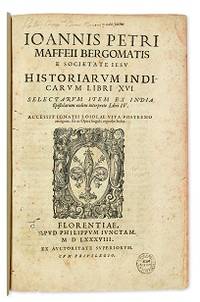
1588ref. E05544-5702 blank28 pages with woodcut device on title woodcut historiated initials and decorations. Folio 12 1/2" x 8 1/4" bound in contemporary vellum. European Americana 588/57; Palau 146976; Sabin 146976 Western Travellers in China 11 First edition of Maffei's great history of India. Ten Latin editions two in Italian and two in French appeared before 1621. Based on primary material it still remains a valuable account today. The work is divided into 16 books. Most of it deals with the Portuguese conquests and Jesuit missionary work in the East Indies and India up to about 1557 Borba de Moraes page 508 "a classic work on the subject . writes extensively about Brazil describing it very accurately"; Maffie was the firs author to use Jesuit letters extensively as well as many secular sources including Fernando Mendes Pinto. Condition: Contemporary velum with moderate wear re-backed in vellum with original spine label laid down; minor worming and foxing intermittent moderate damp staining pages 410 and 419 blank due to a printing error; early inscription and inked stamped on title page new end papers and paste-downs else a good to very good copy. Apud Philippum Juncatam hardcover books
1700ref. E0566xxiii43313 table pages with two folding maps of the Marsianes and Guam. Duodecimo 6 1/2 x 3 1/4" bound in contemporary full sheep with red label in gilt spine and five raised spine bands speckled red end pages. Brunet 28230 Cioranescu 41783 First edition. Charles Le Gobien was a French Jesuit writer founder of the Lettres édifiantes et curieuses a collection of reports from Jesuit missionaries in China. It is a major source of information for the history of Catholic missions and life in China in those times. Le Gobien was born at Saint-Malo Brittany. He entered the Society of Jesus on 25 November 1671. As professor of philosophy and especially while procurator of the Franco-Chinese mission he sought in a series of papers to awaken interest in the work of Christianizing Eastern Asia. In 1697 appeared at Paris his Lettres sur les progréz de la religion à la Chine. Apropos of Chinese Rites controversy he published among other things Histoire de l'édit de l'empereur de la Chine en faveur de la religion chrétienne avec un éclaircissement sur les honneurs que les Chinois rendent à Confucius et aux morts Paris 1698; and in the year 1700: Lettre à un Docteur de la Faculté de Paris sur les propositions déférées en Sorbonne par M. Prioux. Under the same date there appeared in Paris the Histoire des Isles Mariannes nouvellement converties à la religion chrétienne. The second part translated into Spanish by J. Delgado is found in the latter's Historia General de Filipinas Manila 1892. In 1702 Père Le Gobien published Lettres de quelques missionnaires de la Compagnie de Jésus écrites de la Chine et des Indes Orientales; this was the beginning of the collection soon to become celebrated under the title of Lettres édifiantes et curieuses écrites des missions étrangéres par quelques missionnaires de la Compagnie de Jésus. The first eight series were by Le Gobien the latter ones by Fathers Du Halde Patouillet Geoffroy and Maréchal. The collection was printed in thirty-six volumes duodecimo Paris 1703–76 and reissued in 1780-81 by Fathers Yves de Querbeux and Brotier in twenty-six volumes duodecimo omitting the prefaces. New editions appeared in 1819 1829–32 and 1838-43. One abridgment in four volumes octavo was entitled Panthéon Littéraire by L. Aimé Martin 1834–43. A partial English translation came out in London in 1714. The publication incited the Austrian Jesuit Stöcklein to undertake his Neuer Welt Bott about 1720 at first considered merely a translation but soon an independent and particularly valuable collection five volumes folio in forty parts substantially completing the Lettres Edifiantes. This is a history of the Christian missions in the Marianas or Ladrones Islands in the north-western Pacific the principal island of which is Guam. Reprinted in the text are several letters from early missionaries Medina Clain Sanvitores &c. The Jesuit mission was established there by Diego Luis de Sanvitores. Father Le Gobien never visited the Mariana islands but based his account chiefly on the relations and letters of missionaries sent to him from Rome Spain the Netherlands etc. Includes a letter by P. Clain about the discovery of the Caroline Islands. Condition: Rebacked with original spine laid down provenance: Jesuit College library with old stamps to front free endpaper half title and title page else about very good. Nicolas Pepie hardcover books
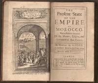
1695ref. E0561xxiv21612 pages with frontispiece folding map and eight engraved costume plates. Duodecimo 6 ¼" x 3 ½" early full calf later spine label. First Edition in English. First published in French the prior year which was published without the plates. François Pidou de Saint Olon was a French diplomat under Louis XIV. In 1682 he was nominated as the first French resident envoy to the Republic of Genoa following the Bombardment of Genoa. He was then sent as an envoy to Madrid. In 1689 François Pidou was appointed ambassador to the court of Sultan Moulay Ismail for the signing of a commercial treaty and to release prisoners now slaves of Barbary corsairs of Salé for 233 including 29 bedridden Moroccan prisoners held by the French. His mission was not successful however he continued to stay more than three weeks more in Morocco. The book gains particular interest through its author's position as ambassador giving him access not always voluntary to areas of Moroccan society previously unrecorded by travelers. There are detailed descriptions of Moroccan dress and the book is beautifully illustrated with eight engraved plates of Moroccan men and women in traditional costume. Condition: With the fine copper engraved frontispiece of the overall state of Morocco which is quite rare and is often found missing in most copies. Joints cracking spine chipped at edges; foxing else very good. R. Bently hardcover books
1790ref. E00534 of 6 volumes. Volume 1: i-ix-372 pages with 23 plates including frontispiece plate of Cook and 4 folding maps; Volume II lacking; Volume III: 793-1184 pages with 11 plates including frontispiece of Possession Bay and 5 fold out maps; Volume IV: 1185-1546 pages with 26 plates including frontispiece of Woman Child and Man of Van Diemen's Land and 6 folding maps; Volume V: 1547-1938 pages with 30 plates including frontispiece of A View of Huaheine and 8 folding maps; Volume VI lacking. Octavo 8 1/2" x 5 1/2" bound in original full leather with red labels to spine with gilt lettering. Abridged by George William Anderson. An earlier Large folio edition by Anderson was published earlier. This edition originally issued in 80 weekly parts and also called the Large octavo edition. M K Beddie: 39 First edition of the bound edition. Captain James Cook RN was a British explorer navigator and cartographer ultimately rising to the rank of Captain in the Royal Navy. Cook made detailed maps of Newfoundland prior to making three voyages to the Pacific Ocean during which he achieved the first European contact with the eastern coastline of Australia and the Hawaiian Islands as well as the first recorded circumnavigation of New Zealand. Cook joined the British merchant navy as a teenager and joined the Royal Navy in 1755. He saw action in the Seven Years' War and subsequently surveyed and mapped much of the entrance to the Saint Lawrence River during the siege of Quebec. This helped bring Cook to the attention of the Admiralty and Royal Society. This notice came at a crucial moment both in his personal career and in the direction of British overseas exploration and led to his commission in 1766 as commander of HM Bark Endeavour for the first of three Pacific voyages. Cook charted many areas and recorded several islands and coastlines on European maps for the first time. His achievements can be attributed to a combination of seamanship superior surveying and cartographic skills courage in exploring dangerous locations to confirm the facts for example dipping into the Antarctic Circle repeatedly and exploring around the Great Barrier Reef an ability to lead men in adverse conditions and boldness both with regard to the extent of his explorations and his willingness to exceed the instructions given to him by the Admiralty. Cook was killed in Hawaii in a fight with Hawaiians during his third exploratory voyage in the Pacific in 1779. Condition: Lacks volume II and VI. First signature of volume one loose inner hinges cracked some interior soiling spine ends and corners of leather rubbed some scuffing to leather else a good set. Printed for A Millar, W Law, and R Cater hardcover books
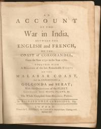
1761ref. E6754xxxiii270215148xix1 pages 14 of 18 engraved plates maps many folding and index. Quarto 10 1/4" x 8 1/4" in original leather binding. First edition. Richard Owen Cambridge was a British poet. He was educated at Eton and at St John's College Oxford. Leaving the university without taking a degree he took up residence at Lincolns Inn in 1737. Four years later he married and went to live at his country seat of Whitminster Gloucestershire. In 1751 he removed to Twickenham where he enjoyed the society of many notable persons. Horace Walpole in his letters makes many jesting allusions to Cambridge in the character of news-monger. His chief work is the Scribleriad 1751 a mock epic poem the hero of which is the Martinus Scriblerus of Alexander Pope John Arbuthnot and Jonathan Swift. The poem is preceded by a dissertation on the mock heroic in which he avows Cervantes as his master. The satire shows considerable learning and was eagerly read by literary people; but it never became popular and the allusions always obscure have little interest for the present-day reader. He made a valuable contribution to history in his Account of the War in India on the Coast of Coromandel from the year 1750 to 1760 1761. He had intended to write a history of the rise and progress of British power in India but this enterprise went no further than this one work as he found that Robert Orme who had promised him the use of his papers contemplated the execution of a similar plan. The Works of Richard Owen Cambridge includes several pieces never before published. It contains an Account of his Life and Characterby his Son George Owen Cambridge 1803 the Scribleriad some narrative and satirical poems and about twenty papers originally published in Edward Moore's paper The World. His poems are included in Alexander Chalmers' English Poets 1816. Condition: Previous owner's name in neatly written dated 1806 on front end paper with his book plate on front past down with his library stamp. Lacks rear free end paper. Front hinge separated back hinge cracked. Lacks the Mongol on horse back plate map of Maratta County view of the attack on Geriah and view of Surat. Front worn spine ends and corners reinforced and repaired new spine label else about very good. Printed for T Jefferys hardcover books
1785ref. BOOKS0033095 volumes: 520 pages with frontispiece tables and six plates; 492 pages with tables 479 pages 587 pages 504 pages with nine plates. Octavo 8" x 5" bound in leather with raised spine bands and black labels with gilt lettering to spine. Complied by John Kent principally from Campbell's Lives of the Admirals Hill page 358 First Dublin edition. A London man of letters Campbell was quite successful with his numerous works of an historical and biographical nature. He collect a large and valuable library. He first published his Lives of the Admirals in four volumes in the years 1742 to 1744. There were several later editions. From 1744 to 1748 he compiled and published what became known as Campbell's enlarged edition of John Harris's Complete collection of voyages and travels originally published in 1702-1705. Campbell also made numerous important contributions to the Biographia Britannica under the signatures E and X including his own noble Scottish ancestors the Campbells. A memoir of him was inserted by Andrew Kippis in this same work. Campbell was an expert on the histories of Spain Portugal France and the British and the Dutch. In 1765he was appointed the royal agent for the province of Georgia and held that office until his death. There are many interesting references to him in James Boswell's Life of Johnson. John Kent published only tow editions of his compilation; this one and one published in London in 1776-1777. Condition: New spines with original leather boards. Volume one closed page edge tears with occasional page edges chipped only affecting margins. volume two damp stain to title gutter some occasional foxing. Some pages stained else a good to very good set Printed for J Williams hardcover books
1844ref. E0023xcii616 pages with bibliography. Octavo 8 1/2" x 5 1/2" bound in contemporary half calf with black spine label and gilt lettering. Publications de la Societe d'Etudes pour la colonisation de la Guyane francaise Number 4. The bibliographical catalogue occupies pages 579-616 and contains descriptions of 240 works on Guiana. Sabin 56097. First edition. French Guiana French: Guyane française officially Guyane is an overseas department French: département d'outre-mer or DOM of France located on the northern coast of South America. It has borders with two nations Brazil and Suriname. Like the other DOMs French Guiana is also an overseas region of France one of the 26 regions of France. Its currency is the euro. The prefecture is Cayenne. The addition of the adjective "French" comes from colonial times when three such colonies existed: British Guiana now Guyana Dutch Guiana now Suriname and French Guiana. The three are still often collectively referred to as the Guianas. French Guiana was originally inhabited by a number of indigenous American people. It was settled by the French during the 17th century. After the Treaty of Paris in 1763 Louis XV sent 12000 settlers to French Guiana to colonise the region. One and a half years later only a few hundred survived.2 Its infamous Île du Diable Devil's Island was the site of penal settlements from 1852 until 1951. More than 70000 French convicts were deported to French Guiana between 1852 and 1939.3 In 1809 a Portuguese-British naval squadron took French Guiana for the Portuguese Empire. With the signing of the Treaty of Paris in 1814 the region was handed back to the French though a Portuguese presence remained until 1817. A border dispute with Brazil arose in the late nineteenth century over a vast area of jungle leading to the short-lived pro-French independent state of Counani in the disputed territory and some fighting between settlers before the dispute was resolved largely in favor of Brazil by the arbitration of the Swiss government. Condition: Front inner hinge cracked rubbing to hinges and corners some internal foxing else a very good copy. Imprimerie de Bethune and Plon hardcover books
1807ref. 83011807. MIRANDA EXPEDITION. The Trials of William S. Smith and Samuel G. Ogden for Misdemeanours had in the Circuit Court of the United States for the New-York District in July 1806 . By Thomas Lloyd Stenographer. New York: I. Riley and Co. 1807. xxxiii 3 287 p. Contemporary mottled sheep very skillfully rebacked in period style retaining original spine label. Occasional light browning else a fine copy. The trial of Smith and Ogden for organizing and underwriting the expedition of Francisco de Miranda from New York to South America to overthrow the Spanish government there and to separate the Spanish colonies from the mother country. unknown books
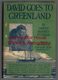
1926ref. 2222001First edition "October 1926". Octavo. Four page foreword by Bob Bartlett. Illustrated with 47 photographs and drawings by the Eskimo Kakutia; endpaper maps. Dust jacket unclipped; few nicks and creases. Very good. 167 pages. Signed and inscribed on verso of frontispiece by the publisher and father of the author: "From one who is merely. David's Dad! G. P. Putnam." G. P. Putnam's Sons hardcover books
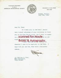
1920ref. 501237"V. Stefansson" in black fountain pen ink on pictorial American Geographical Society letterhead Ottawa Ontario Canada July 9 1920. 8 1/2" x 11"; 1 page; very good. Together with the original typed envelope stamped and postmarked Ottawa Ont. July 9 1920 with two stamps. To Dr. William C. Thro East Northport Long Island New York "Dear Dr. Thro: If I were only in New York I should take instant advantage of your invitation to visit you on the Long Island coast but I shall be spending most of my summer in Canada with only an odd visit to the city. I shall look you up in the fall or whenever I come to be regularly in New York. I hope both you and Mrs. Thro have a delightful summer. V. Stefansson." Stefansson 1879-1962 American ethnologist/explorer/author; lived amongst the Eskimo 1906-07; Canadian/Alaskan Arctic expedition commander 1913-18; consultant to Dartmouth College's Northern Studies program 1947-62. unknown books