DE LA CAILLE (ABBE).Livre Rare Book

1632 resultados
1763ref. P2-7B-14Paris, Guillyn, 1763. In-12 (17x10) relié plein veau époque, dos à nerfs orné, pièce de titre, XXXVI-380pp-2ff. Illustré de figures dans le texte. Carte dépliante en déficit , un cahier mal placé (p168-192 relié p.216)
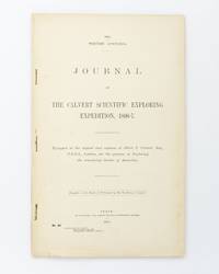
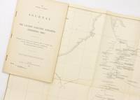
1902ref. 25076Perth: Wm. Alfred Watson Government Printer 1902. First Edition. Paperback. Very Good. Perth Wm. Alfred Watson Government Printer 1902. Foolscap folio 62 pages with 4 illustrations plus a very large folding map 625 × 865 mm. Title-wrappers relatively recently bound in half calf and cloth lettered in gilt on the spine; title leaf slightly marked with trifling loss to the bottom corner-tip; minimal signs of age and use; an excellent copy. Western Australian Parliamentary Paper Number 46 of 1902; only 1200 copies were printed. The 'expedition was fitted out to explore the remaining unknown regions of Australia on similar lines to the Elder expedition'. Lawrence Allen Wells third in command on the ill-fated Elder expedition of 1891-92 was leader. The party set out from Mullewa east of Geraldton on 13 June 1896; lack of water and the gruelling conditions brought the official expedition to an end on 6 November at Noonkanbah Station on the Fitzroy River with two men unaccounted for. It was not until late May of the following year that Wells located the bodies of the missing men his cousin Charles Wells and George Lindsay Jones nephew of the explorer David Lindsay. The detailed accounts of the three search expeditions undertaken by Wells accompanied by Nat Buchanan George Keartland and Sub-Inspector Ord respectively are included. Not least strong on contemporary race relations. Wm. Alfred Watson, Government Printer paperback
1902ref. 125441Perth: Wm. Alfred Watson Government Printer 1902. First Edition. Paperback. Very Good. Perth Wm. Alfred Watson Government Printer 1902. Foolscap folio 62 pages with 4 illustrations plus a very large folding map 625 × 865 mm. Stapled as issued without wrappers; minimal reinforcement to the map near the rusty staples; trifling signs of handling; an excellent copy. Western Australian Parliamentary Paper Number 46 of 1902; only 1200 copies were printed. The 'expedition was fitted out to explore the remaining unknown regions of Australia on similar lines to the Elder expedition'. Lawrence Allen Wells third in command on the ill-fated Elder expedition of 1891-92 was leader. The party set out from Mullewa east of Geraldton on 13 June 1896; lack of water and the gruelling conditions brought the official expedition to an end on 6 November at Noonkanbah Station on the Fitzroy River with two men unaccounted for. It was not until late May of the following year that Wells located the bodies of the missing men his cousin Charles Wells and George Lindsay Jones nephew of the explorer David Lindsay. The detailed accounts of the three search expeditions undertaken by Wells accompanied by Nat Buchanan George Keartland and Sub-Inspector Ord respectively are included. Not least strong on contemporary race relations. McLaren 16633. Wm. Alfred Watson, Government Printer paperback
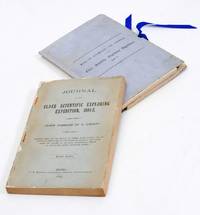
1893ref. 2712376Adelaide: C.E. Bristow 1893. Wrappers torn at edges but well repaired as are the boards of the map section. Octavo complete with maps; original wrappers and boards preserved in a brown morocco bookform box. First edition: one of 500 copies printed of the narrative of one of the last great Australian exploring expeditions written by the leader of the expedition and complete with its maps. Lindsay led this extensive expedition - it ran to eight men forty-four camels and five Afghan camel drivers - organised by the South Australian Branch of the Royal Geographical Society and equipped by Sir Thomas Elder to explore the unknown interior between South Australia and the west coast and to look for Leichhardt. Lindsay's exhaustive report includes the surveyor L.A. Wells's journal of the expedition. Also included is an extensive Aboriginal vocabulary collected by Wells from the Pidong tribe at the head of the Murchison River the Minninng tribe at Fraser Range from the Everard Ranges at Mount Illbillee and from the "Wallawe" tribe at Yarragabie Station Western Australia. He states "Appended is a list of native names which I have collected from four tribes met with during the expedition.". The separate large folding maps are original lithographs coloured to illustrate geological changes. Compiled and drawn by both Lindsay and Wells these maps show in great detail the earlier discoveries of Giles Gosse Forrest and Hunt as well as the route taken by the Elder explorers. . C.E. Bristow unknown
1995ref. 146811Bundaberg: Corkwood Press 1995. Hardcover. Near fine. Bundaberg Corkwood Press 1995 facsimile edition/ 1897. Octavo two volumes iv 86 pages with a frontispiece plus 23 plates many reproduced from original negatives or prints and three of them are here reproduced the correct way round for the first time plus a folding chart 2 folding maps and a very large folding map 1210 × 1210 mm loosely housed in a matching cloth portfolio. Cloth; one corner tip slightly bumped; a near-fine set. Number 52 of only 300 sets the first 30 of which were bound in half leather. Winnecke was the leader of the expedition and in 'the natural order of things these journals and maps should have been published in connection with the scientific and other records of the Horn Expedition as both supplementary and complementary to them'; after a financial disagreement with W.A. Horn the organiser and backer of the venture this did not occur. The first edition appeared as South Australian Parliamentary Paper Number 19 of 1896; it was reissued in this octavo format the following year. McLaren 16969 the original edition - not noting the very large map. 2 items. Corkwood Press hardcover
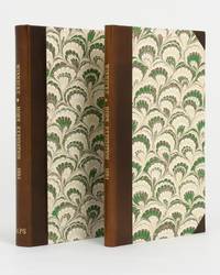
1995ref. 146579Bundaberg: Corkwood Press 1995. Hardcover. Near fine. Bundaberg Corkwood Press 1995 deluxe facsimile edition/ 1897. Octavo two volumes iv 86 pages with a frontispiece plus 23 plates many reproduced from original negatives or prints and three of them are here reproduced the correct way round for the first time plus a folding chart 2 folding maps and a very large folding map 1210 × 1210 mm loosely housed in a matching portfolio. Half calf and marbled papered boards; spines lightly sunned; a near-fine set. Number 15 of only 30 sets of the deluxe issue from a total edition of 300 out of print soon after publication. Winnecke was the leader of the expedition and in 'the natural order of things these journals and maps should have been published in connection with the scientific and other records of the Horn Expedition as both supplementary and complementary to them'; after a financial disagreement with W.A. Horn the organiser and backer of the venture this did not occur. The first edition appeared as South Australian Parliamentary Paper Number 19 of 1896; it was reissued in this octavo format the following year. 2 items. Corkwood Press hardcover
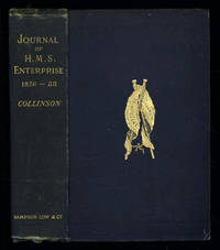
1889ref. 035576London: Sampson Low Marston Searle & Rivington. 1889. 1st Edition 1st Printing. Hardcover. Good/No Jacket. 8vo - over 7¾ - 9¾" tall. Good. Publishers cloth embossed with gilt lettering and emblem to upper cover. Front hinge cracked. Gift inscription in contemporaneous hand to free front endpaper. A touch of foxing. Two of the maps have a dog-eared fore-edge where they have not been folded quite flush with the page edges. Illustrated with tissue-guarded colour frontispiece of the ship tissue-guarded portrait of the author and 6 fold-out maps. xi i 531pp 32pp of publishers ads to rear. FIRST EDITION of the posthumously published journal by the captain who came closest to the site where Franklin's expedition ended. "In 1849 Collinson was appointed to command an expedition for the relief of Sir John Franklin by way of the Bering Strait; he himself had command of the Enterprise and with him was Commander Robert Le Mesurier McClure in the Investigator. The two ships sailed together from Plymouth on 20 January 1850 but unfortunately separated in the neighbourhood of Cape Horn and did not meet again. The Enterprise passed Point Barrow Alaska on 21 August but the ice forced Collinson to return south and winter in Hong Kong. In 1851 he was again hampered by ice and in 1852 was frozen in at Cambridge Bay for the winter. In 1853 the Enterprise was caught in the ice at Camden Bay and there passed a third winter. She reached Point Barrow on 8 August 1854 after being shut up in the Arctic entirely on her own resources for upwards of three years. Of the many who had searched for Franklin Collinson came closest to the place where the expedition had ended. Collinson's addition to geographical knowledge on this Arctic trip was very considerable and would have been tantamount to the discovery of the north-west passage had this not been already actually achieved by the men of the Investigator" DNB. Arctic Bibliography 3351; Hill 337; Ricks p 68; Tourville 986. Sampson Low, Marston, Searle, & Rivington. hardcover
ref. 25070107Ward Lock UK No Date. Hardcover. Good/Fine. Hardcover. 492 pages. PUBLISHING DETAILS: Ward Lock UK No Date. CONDITION: The book itself is in good condition and comes in fine dust jacket. More specifically: Covers have moderate rubbing/wear. Edges of boards have substantial wear. Dust jacket is in excellent condtion. . Pages are lightly tanned. Heavily foxing on last few pages. Marbled edges faded. ABOUT THIS BOOK: Full title: Journal of Researches into the Natural History and Geology of the Countries Visited During the Voyage of H.M.S. "Beagle" Round the World Quantity Available: 1. Category: Natural History & Resources; Exploration. Inventory No: 25070107. Ward, Lock hardcover
ref. 1385144548.Ghardcover. Good. Access codes and supplements are not guaranteed with used items. May be an ex-library book. hardcover
2000ref. 23886Adelaide: Friends of the State Library of South Australia. Fine. 2000. First thus. Hardcover. 1876154314 . With an Introduction by Valmai Hankel portrait frontispiece folding map in a pocket to the rear pastedown endpaper an as new copy. ; Australiana Facsimile Editions No. 221; 225 x 145mm . Friends of the State Library of South Australia hardcover
1828ref. 55033London John Murray Albamarle Street 1828. First Edition. Hardcover. Good Solid Copies Some Uniform Darkening At Spine Area Of All Volumes Label At Volume I I Has An Indentation Hole Some Pages Unopened Vol. V Has Pp.329 and 330 Bound In Twice. 24mo Five Volumes Blue Publisher Cloth Paper Label At Spine. Volume I I I Has Folding Map Labeled General Chart Showing The Discoveries of The Three Perry Voyages Ten Tissue Guarded Plates For All Volumes Images Include Parry The Ships And Eskimo Life. Provenance - These Five Volumes Are from the SItwell Family Library At Weston HALL U. K. THEIR FAMILY SEAT FOR 300 YEARS. THE BOOKs ARRIVED AT WESTON HALL DURING THE TIME OF HARRIET WRIGHTSON 1788-1864 AND COL. HENRY HELY- HUTCHInSON who was the nephew of General Lord Hutchinson later 2nd Earl of Donoughmore London, John Murray, Albamarle Street hardcover
1997ref. 23887Adelaide: Friends of the State Library of South Australia. Fine. 1997. First thus. Hardcover. 1876154101 . Sent by the colonists of South Australia with the sanction and support of the government; including an account of the manners and customs of the aborigines and the state of their relations with Europeans. In two volumes. Edition limited to 600 copies of which the first 99 are numbered and bound in quarter leather this being an unnumbered set bound in cloth. An as new set. ; Australiana Facsimile Editions No. 213; 225 x 145mm . Friends of the State Library of South Australia hardcover
1993ref. 11717Frieding-Andechs : Ambro Lacus, Buch- und Bildverlag, 1993. Expedition zu den letzten Buschleuten im südlichen Afrika 167, [77] S.; 24x21,5 cm illustrierter Pappband / gebundene Ausgabe
1994ref. 154042Hamburg : Carlsen, 1994. 46 S. ; 30 cm OPappband
1971ref. 18666Herford : Busse, 1971. 211 S. Gr. 8°. Bibl.- Einbd.
1922ref. 18376Leipzig F. A. Brockhaus, 1922. XXXII + 744 S. Gr. 8° Groß-Oktav Ln. 2 Bände
1972ref. 15500Radebeul : Neumann, 1972. 192 S. : Ill. (z.T. farb.) Gr. 8°. 6. Aufl. OLwd mit Buntpräg. ohne SU.
ref. 12649FLAMMARION PARIS 1938 Coll. LA VIE EN MONTAGNE. Photographies n&b h.t. 10e mille. 172 pp IN8 Broché Couverture illustrée,
1937ref. 19002Leipzig : F. A. Brockhaus 1937. 191 S. : 100 bunten u. einfarb. Abb. u. 1 Kt. ; gr. 8° Lw., gebundene Ausgabe, Leinen, Rücken etwas ausgeblichen einige Flecken, sonst Exemplar in gutem Erhaltungszustand
1937ref. 1693A. Brockhaus Leipzig, F, 1937. 191S., OLn m. OU (dieser mit Randläsuren und kleineren Fehlstellen), farbiger Kopfschnitt, Stockflecken auf den Vorsätzen, innen ordentlich, Priv NaV, mit einem Geleitwort von Sven Hedin, 100 bunten und einfarbigen Abbildungen und einer Karte. DEA. Ordentliches Exemplar. Good copy. 1. Auflage
ref. BN610349Karluk. Die Geschichte einer verratenen Expedition McKinlay William L and Seib Günter Karluk. Die Geschichte einer verratenen Expedition McKinlay William L and Seib Günter Karluk. Die Geschichte einer verratenen Expedition McKinlay William L and Seib Günter unknown
ref. 98552aafCape Town, Howard Timmins, 1955, in-8vo, Frontispice + 248 p. + 12 p. with illustrations, / 256 p., ill., small legacy stamp on first free flyleaf ‘Guggisberg’, original wrappers with orig. ill. jacket.
1853ref. 347481853. Three woodblock-printed sheets on mulberry paper. Mild edge wear old folds. A detailed revealing group of late Tokugawa samurai reference sheets recording the names ranks stipends heraldry standards and service obligations through which the shogunate and Edo public understood military readiness at the moment of Perry's arrival. Commodore Matthew C. Perry anchored off Uraga at the entrance to Edo Bay in July 1853. His arrival made visible the vulnerability of the Tokugawa capital and produced an immediate demand for information about coastal defence domain strength and the lords responsible for guarding the approaches to Edo. Kawaraban and related broadsides answered that demand in compressed visual form combining names crests military symbols income figures and geographical or administrative data. The first printed sheet appears to be an earlier roster of Edo office-holders or guard personnel. Its tabular format with names offices crests and standards records the recognitional system already in place within Tokugawa administration before the Perry crisis sharpened the public appetite for such information. The manuscript sheet is ruled into a large grid with headings formed from the twelve zodiac signs and the four seasons including Rat Ox Tiger Hare and the seasonal headings. The entries appear to record named houses Lords or retainers against recurring seasonal and cyclical categories probably for service attendance or ceremonial obligation. The third sheet is headed "Rekko yushinroku" here translated as "Register of Valiant Retainers of the Lords." It lists major daimyo houses and their principal retainers with domain or house headings names titles stipend figures in koku family crests standards and related insignia. Visible regional or house designations include "Kaga" "Owari" "Kii" "Satsuma" "Higo" and "Tosa." The sheet gives a graphic register of the daimyo world mobilised or imagined as mobilised around the defence of Edo Bay. Together the sheets preserve the administrative and visual language of Tokugawa defence at a moment of acute pressure. They are not formal shogunal orders and the first sheet may predate Perrys arrival but they show how late Edo Japan translated rank obligation military identity and coastal defence into portable tabular form. Their compression the names of Lords and retainers the scale of domains the crests and standards by which armed households could be recognised and the bureaucratic habits of a regime suddenly forced to account for its capacity to defend the country reveals these documents' immediacy and importance. unknown
1853ref. 347481853. Three woodblock-printed sheets on mulberry paper. Mild edge wear old folds. A detailed revealing group of late Tokugawa samurai reference sheets recording the names ranks stipends heraldry standards and service obligations through which the shogunate and Edo public understood military readiness at the moment of Perry's arrival. Commodore Matthew C. Perry anchored off Uraga at the entrance to Edo Bay in July 1853. His arrival made visible the vulnerability of the Tokugawa capital and produced an immediate demand for information about coastal defence domain strength and the lords responsible for guarding the approaches to Edo. Kawaraban and related broadsides answered that demand in compressed visual form combining names crests military symbols income figures and geographical or administrative data. The first printed sheet appears to be an earlier roster of Edo office-holders or guard personnel. Its tabular format with names offices crests and standards records the recognitional system already in place within Tokugawa administration before the Perry crisis sharpened the public appetite for such information. The manuscript sheet is ruled into a large grid with headings formed from the twelve zodiac signs and the four seasons including Rat Ox Tiger Hare and the seasonal headings. The entries appear to record named houses Lords or retainers against recurring seasonal and cyclical categories probably for service attendance or ceremonial obligation. The third sheet is headed "Rekko yushinroku" here translated as "Register of Valiant Retainers of the Lords." It lists major daimyo houses and their principal retainers with domain or house headings names titles stipend figures in koku family crests standards and related insignia. Visible regional or house designations include "Kaga" "Owari" "Kii" "Satsuma" "Higo" and "Tosa." The sheet gives a graphic register of the daimyo world mobilised or imagined as mobilised around the defence of Edo Bay. Together the sheets preserve the administrative and visual language of Tokugawa defence at a moment of acute pressure. They are not formal shogunal orders and the first sheet may predate Perrys arrival but they show how late Edo Japan translated rank obligation military identity and coastal defence into portable tabular form. Their compression the names of Lords and retainers the scale of domains the crests and standards by which armed households could be recognised and the bureaucratic habits of a regime suddenly forced to account for its capacity to defend the country reveals these documents' immediacy and importance. unknown books
1986ref. 18689Berlin: Verlag Das Neue Berlin, 1986. 311 Seiten , 21 cm Pappeinband mit Schutzumschlag