1 400 résultats
1906réf. 119782Flammarion 1906 Ernest Flammarion Editeur, 12 décembre 1906, XXXVIII-486 p., demi-reliure, plats d'origine conservés, environ 29x20cm, complet de la carte in fine. Des frottements d'usage sans gravité sur la reliure, dos fortement insolé, des rousseurs sur les gardes et la tranche, bon état pour le reste et intérieur bien propre.
1858réf. 1441Alger et Paris, Imprimerie du Gouvernement, Librairie Algérienne de Dubois Frères, Challamel, 1858. In-8 - 17x24,5cm. Broché (une chemise légèrement cartonnée postérieure protège l'ouvrage). 63pp, 1 carte dépliante in fine. Edition originale.Complet de sa carte dépliante de l'itinéraire suivi par M. le Capitaine L. de Colomb, dans sa tournée d'exploration du sud, levée et dessinée par M. de La Ferronnay, officier stagiaire du Bureau Arabe de Geryville. Très rare.
réf. 201848Paris, Plon, 1898 in-8, XXVII-563 pp., frontispice, index, demi-veau tabac, dos à nerfs orné (reliure moderne). Quelques rousseurs.
réf. 201123Paris, Ch. Tanera, 1858 in-8, VII-210 pp., broché. Dos abîmé.
réf. P1-4C-5LILLE et PARIS, A.S. DE DONCOURT, 1885. In-4 (21 x 16), demi- chagrin rouge, plats en percaline rouge ornée au premier plat, dos à 5 nerfs orné, titre doré au dos, toutes tranches dorées. Dos frotté, intérieur frais, quelques rousseurs. Illustré d’une carte dépliante en frontispice et de nombreuses illustrations in et hors-texte. 318 pages – 2 ff. tables des matières et des Vignettes. À la suite : La Perse, 328pp, nombreuses illustrations. Bon exemplaire, rousseurs, Livre de Prix.
réf. 16800Librairie de L. Hachette et Cie. Paris, 1864, petit in-4 demi-chagrin vert, dos à quatre nerfs, toutes tranches dorées. Reliure de l'éditeur. 2ff.-579pp. Frontispice représentant Speke et Grant. Cartes et dessins du capitaine J. A. Grant. Trois cartes hors-texte dont deux à double page en fin d'ouvrage. Très nombreuses gravures en noir dont une quarantaine de planches à pleine page comprises dans la pagination. Première édition française de cette relation de la seconde expédition de Speke à la recherche des sources du Nil blanc. Lors d'un premier voyage en 1858 Speke avait été le premier européen à situer le Lac Tanganyika ainsi qu'un second grand lac qu'il baptise Victoria (Nyanza). Il repart en Afrique en 1860 et il faudra attendre Juillet 1862 pour qu'il atteigne les chutes du Ripon, marquant le point de jonction entre le Nil blanc et le lac Victoria. Son récit est publié en Angleterre en 1863 et traduit en français dès l'année suivante dans cette traduction. Très bel exemplaire à la reliure en parfait état et au papier exempt de rousseur.
réf. 5614Paris, Association d'imprimeurs, 1904. Fort in-8, demi-reliure à coins, photographies et cartes.
réf. 13967P., Hachette, 1893 ; in-4. 2 ff.-IV-395 pp.-(1)-1 carte dépliante en couleurs. Demi-maroquin brun à coins, dos à nerfs, titre et fleurons dorés, filets dorés sur les mors et les coins, tête dorés. Bel exemplaire.
1860réf. P1-3i-6Sans lieu ni date (1860). Atlas in-4 (27x18cm), relié demi-chagrin et coins, dos à 6 nerfs, coins usés, 24pp de texte, 39 planches et 4 cartes dépliantes. COMPLET. Quelques rousseurs.
réf. 230594s.d. à vue : 28 x 39.5 cm - cadre : 39 x 50 cm, encadrée sous verre, cadre postérieur à baguettes dorées.
1855réf. rbr1-mar64Scattered light foxing. 556 pages incl. index; 3 fold-out maps 1 large panorama - chromolithiograph; 10 illustrations one of which is in color. Vol. I only 4 raised bands. gilt lettring on black leather label on spine is VG. 1" portion of Leather missing at top of spine. Leather corners worn and generally edge worn boards. Water staining to side edges of front free endpapers and frontis and title page along with additional water marks of 2 additional fold out maps prior to the beginning of the numbered pages. Not affecting the images of these fold outs. No foxing or internal markings. Front hinge jsut starting to crack. Still a quite good copy in better than average condition. Photos on request. Additional shipping charges will apply based on destination and speed. U. S. Government Printing Office, A. O. P. Nicholson, printer hardcover
19304to [27 x 20 cm]; 2 volumes, xxvi, 568; ix, 569 - 1064 pp, 476 illustrations (some color printed plates) text figures, 9 maps. orig crimson cloth, gilt lettering, dust jackets (rubbed, chipped with one having large section missing), else a fine clean set, with a presentation inscription on the author's card, signed by author to Horace Binney, paperclipped to title with rust mark. A most interesting survey of Liberia and Belgian Congo related to medical and natural conditions. Much of the travel was by foot across Africa. The first volume deals mainly with social and medical conditions, and especially of the little known inhabitants of tribal Liberia and their living conditions but also covers geology, flora, zoology. The second volume is a comprehensive survey of the natural history, with emphasis on birds, mammal, insects and reptiles. Very well illustrated. Not often found with both dust jackets and author's signature. Strong, professor of tropical medicine at Harvard, was accompanied by other physicians and zoologists on the expedition. Conover 659.
Second edition, 8vo, 72pp., with the half-title, disbound. ESTC locates just 2 copies, The British Library and Staatsbibliothek zu Berlin.
1908thick 8vo [24.5 x 16 cm]; xi, 425 pp, numerous plates and frontis from photos by author, some plates with two photos, itinerary, index. original cloth, gilt spine title lettering, spine edge a little rubbed, endpaper name, internal hinge repair, interior is clean and fine in very good+ cover. A picture of this book is available upon request by email. Hand S480. The anthropologist author's earlier work, Indians of Southern Mexico, produced in only a limited edition was highly regarded but consists of mostly photos (but excellent ones), although he published a number of other papers, mostly short, on the subject. This work provides a detailed travel narrative through Oaxaca, Chiapis, parts of Guatemala, Dos Rios to photograph the Otamis of Huixquilucan, to Patzcuaro to study the Tarascans, to Uruapan, Tlaxcala, Cuauhtlantzinco, Zamora, states of Puebla, Hidalgo and many others, travelling by railroad where possible, or steamer, horseback, etc. Based on several expeditions from 1896 to 1901, the author was able to greatly expand his earlier works and produce this important book that preserves much information which is not available elsewhere and of towns and regions that have greatly changed in the last 100 years. 'A first hand, reliable picture. . . an outstanding work' (Emory Bogardus).
réf. 102126Bruxelles, Imprimerie Scientifique Charles Bulens 1910, 360x280mm, en feuille sous cartable demi-percaline à coins, avec lacet. Bel exemplaire.
1869réf. 14451London & Glascow: William Collins Sons & Company. 1869. Hardcover. With two hundred illustrations after drawings by Gustave Dore Berard Lancelot Jules Noel and other eminent artists and six finely engraved maps full coloured title page reads the same for both volumes. Volume 1 first series - xii 820 pages six finely engraved maps full coloured and four others folding panorama of Jerusalem approx 200 other illustrations some full page Volume 2 second series - xii 810 pages six finely engraved maps full coloured and two others approx 200 other illustrations some full page bound in half leather as a matching 2 Volume set front hinge on Vol. 1 has small split at top new endpapers overall a very good set Heavy books may require extra postage cost. . William Collins, Sons & Company hardcover
1880réf. 1309New York: Henry Holt and Company. Very Good. Hardcover. Some fraying to top and bottom spine. Front hinge weakening. Some fraying to rear map margin not effecting printed area. Previous owner's name to front pastedown; Rare. Numerous b&w illustrations and two maps; 8vo; 448 pages . 1880. Henry Holt and Company hardcover
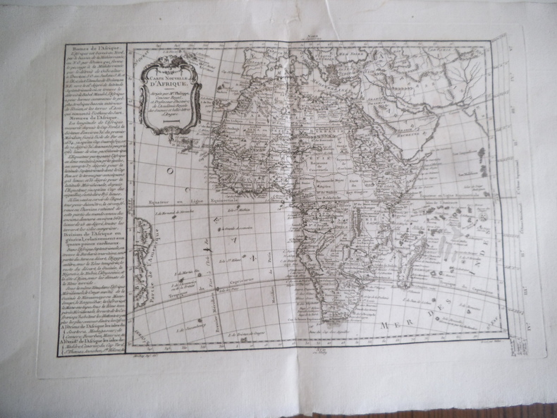
réf. 14521Carte nouvelle de l’Afrique dirigée par M. PHILIPPE dessiné par MOITHEY gravé par VALLET. Gravure sur vergé 41x290mm à la cuvette 530x350mm avec marges. (Pli central et petite déchirure réparée en marge supérieure), carte issue de l’atlas universel dirigé par PHILIPPE de PRETOT.
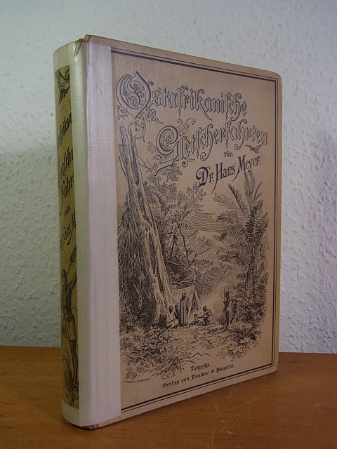
1893réf. 111758Leipzig: Verlag von Duncker & Humblot, 1893. 25,5 cm ; Leinen
1859réf. 70480Harper 1859. Hardcover. Fair. 5 x 7 inches. 340 pp. Illustrated. Folded map at rear. Ex-library book rebound in older buckram cloth spine label stickers on rear cover. Few normal reference non-circulating library markings else interior good text block secure. Title page little soiled scattered light margin foxing. Map has few stains one inch tear to left margin. Ships in box. Professional bookseller for 20 years. Orders shipped daily in cardboard bookfolds. Harper hardcover
1925réf. 22147London: Hutchinson & Co. 1925. First Edition. Original publisher's blue cloth. Good; backstrip sunned & a portion of the cloth scraped by label removal but no accessioning to the volume. 8vo 287 1 - blank pp. folding map and 47 halftone photographic plates inserted. A presentation Dec. 1925 copy from Binney to G R Delaforce on the front free endpaper. A laid in newspaper account of Binney winning a DSO in 1944. Also laid in is an ALs Oct. 9 1955 from someone named Cecil. Three Oxford Univ. Arctic expeditions took place between 1921 and 1924 utilizing the experiences of the preceding trip. The purpose of the final visit in 1924 was to explore the icecap and interior by sledging of North-East Land. The interior comprising appx. 8000 square miles remained unexplored prior to the expedition. Binney was the leader of the excursion that had 14 members including scientists. This is Binney's own narrative of the trip. Arctic Bibliography 1572; not in Howgego. Hutchinson & Co. hardcover books
1818réf. BOOKS0073902 volumes: xxiii557 pages with fold out frontispiece map and two additional maps one folding; vii550 pages with folding frontispiece map tables three maps and appendix. Octavo 8 3/4" x 5 3/4" recased with original leather boards and original spine laid on. Second edition corrected and enlarged. First published in 1817. Hugh Murray was a geographer. Hugh entered the Edinburgh excise office as a clerk but from the first devoted his leisure to literary pursuits publishing The Swiss Emigrants in 1804; two philosophical treatises The Morality of Fiction 1805 and Enquiries respecting the Character of Nations 1808; and another romance Corasmin or the Minister in 1814. In 1816 he was elected a fellow of the Royal Society of Edinburgh to whose Transactions he contributed among other papers one in 1818 On the Ancient Geography of Central and Eastern Asia with Illustrations derived from Recent Discoveries in the North of India. In 1817 he enlarged and completed Dr. Leyden's Historical Account of Discoveries and Travels in Africa. Similar works by him on Asia and North America followed; the former being published in three volumes at Edinburgh in 1820 and the latter in London in 1829. Condition: Recased with original leather spines and covers laid on and new end papers frontispiece map of volume one need of repair at some folds else a good to very good set. Archibald Constable & Company hardcover
1994réf. 139514Bundaberg: Corkwood Press 1994. Hardcover. Near fine. Bundaberg Corkwood Press 1994 facsimile edition/ 1896. Quarto four volumes ii xviii 220; ii iv 432; vi 204; and vi 200 pages with numerous illustrations plus 66 pages of plates several folding 13 in colour and a large folding map. Cloth lightly scuffed; a near-fine set. The purpose of this scientific expedition sponsored by mining magnate and philanthropist William Austin Horn and with Charles Winnecke as commander and surveyor was to examine the MacDonnell Ranges on the not unreasonable premise that 'when the rest of the Continent was submerged the elevated portions of the McDonnell sic Range existed as an island and that consequently older forms of life might be found in the more inaccessible parts'. This in fact proved not to be the case but the expedition of some fourteen weeks and 2000 miles by camel was an outstanding success. 'It was not the intention . to explore a new region . But in the pursuit of natural history the expedition split into independent groups and explored undiscovered areas thus filling in more of the blank spaces in this vast region' Feeken Feeken and Spate. 'These volumes constitute one of the most substantial contributions in nineteenth-century Australian exploration but perhaps more importantly the expedition is a landmark in anthropological history because it resulted in Baldwin Spencer meeting Frank Gillen' Mulvaney. Limited to only 500 sets and sold out on publication. 4 items. Corkwood Press hardcover
1909réf. 19421paris Plon 1909 in-4 demi-basane à coins un fort volume, reliure demi-basane bleu-marine grand in-quarto à coins (half binding sheepskin in-4 with corners) (33,5 x 26 cm), dos long (spine without raised band) décoré or (gilt decoration), titre frappé or (gilt title), pièce de titre sur fond havane avec triple filets or, roulettes or en pied, plats décorés à froid (cover blind-stamping), mors et coins ornés d'une roulette à froid, tête lisse (top edge smooth) dorée (top edge gilt), gouttière et tranche de queue non-rognées, 1ère de couverture imprimée en rouge et noir et illustrée conservée, orné de 17 planches hors-texte dont 4 à double page et 4 d'histoire naturelle, de 8 cartes dont 6 dépliantes ( L'itinéraire de la Belgica dans la Mer de Barents et de Kara ; Plan du Matotchkine Char. Etc.) et de nombreuses figures in-texte et hors-texte en héliogravure et phototypie, fines et légères rousseurs en marge des 6 premières pages, [4] ff + 288p + 39 p de tableaux +[3] ff 18 planches et 8 cartes h.t, 1909 Paris, Librairie Plon Editeur,
1943réf. 2090502124700698Mokuro Bookstore 1943. Soft Cover. Fine. The book is in fine condition. Mokuro Bookstore paperback