1 357 résultats
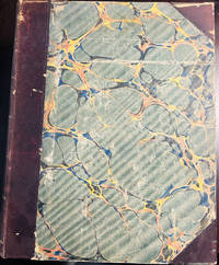
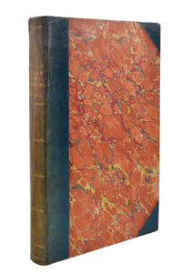
réf. 102116London H.M.S.O. 1877. . First edition; folio 33.5 x 21.5 cm; 16 folding maps a few small splits to folds 16 plates further illustrations in the text; contemporary blue half roan marbled boards lightly faded neat restoration to extremities a very good copy; viii 484 pp. One of the most valuable sources for the history of exploration in northern Canada. The Nares expedition so called after its commander George Nares 1831-1915 sailed in two ships HMS Alert and HMS Discovery in late May of 1875 in quest of the North Pole. The ships reached Lady Franklin Bay on North Ellesmere Island and the Alert went on to reach the extreme north of the island the highest latitude that had yet been reached by a ship. In April 1876 three separate sledge parties set out but the men showed serious signs of scurvy and several members died. Nares was forced to abandon the expedition and returned to England in September that year. Despite the difficulties faced by the expedition it did produce important scientific results including a study of Inuit dog disease and a volume of physical observations. The Nares expedition is one of the best documented Arctic expeditions with eight Parliamentary Blue Books alone devoted to it between 1875 and 1878. Arctic explorer Vilhjalmur Stefansson wrote 'The Arctic Blue Books are beyond comparison the most important tool of knowledge in this field.' London H.M.S.O., 1877. hardcover
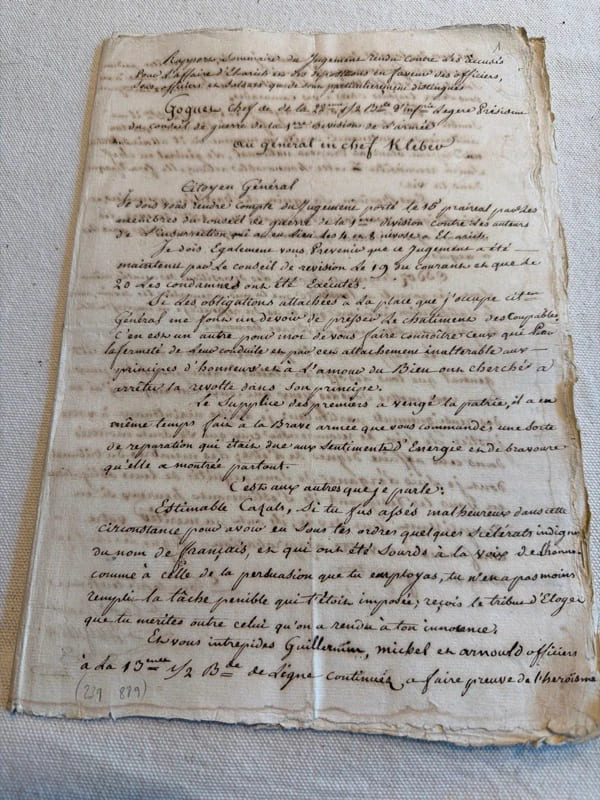
réf. 239889S.l., s.d. (janvier 1800) in-folio, [10] ff. n. ch., couverts de plusieurs écritures très lisibles, en feuilles.
1717réf. E01353559index pages 36 of 37 maps and copper cuts of the coasts harbor cities plants and other curiosities comprising: 14 plates 3 folding 22 maps charts or plans 14 folding. title page printed in red and black. Printed from the author's original plates inserted in the Paris edition. Lacks the frontispiece map. Royal octavo 9 3/4" x 7 3/4" bound in leather with raised spine bands and red label with gilt lettering. Postscript by Dr Edmund Halley and an account of the settlement commerce and riches of the Jesuits in Paraguay. Palau 94965 Sabin 25926 Nissen ZBI 1433 Hill p117 First English edition. Frézier was educated in Paris and served as lieutenant of infantry from 1702 til 1707 when he entered the engineer corps. In 1712 the government sent him to examine the condition of the Spanish colonies in America. After visiting the principal points in Peru Chili and Brazil he returned to Marseilles. He pointed out several mistakes in the "Relation" of Father Feuille and this led to a bitter controversy between the two travelers. Frézier introduced the large Chili strawberry into France. First published in France in 1714. The first edition into English is preferable to the French original "because it contains Halley's. postscript which corrects certain geographical errors made by Frézier" Hill. "The first part of this book gives an interesting account of the voyage from France around Cape Horn. The second part relates to the voyage along the coasts of Chile and Peru describing the chief towns and cities. Frézier a man of observation brought back information of considerable geographical and scientific value. Much data is included about the native inhabitants. Condition: Rebacked with original spine label laid down; lacking frontispiece map and binder's leaf free endpapers renewed intermittent foxing else a very nice copy. Jonah Bowyer hardcover books
réf. 50306For the lot of approximately 250 items $6000. a Correspondence with various government officials hunting guides and others involved with preparing and carrying out the trip including14 letters to Furlong typed and autograph one accompanied by four photographs of members of the expedition with trophies; five retained copies of letters from Furlong to the correspondents four telegrams seven typed and manuscript recapitulations of various aspects of the trip e.g. titles for the "Dance of the Nandi" film and a three page typed press release on the expedition dated Nairobi 27 March 1930 accompanied by a photograph of Furlong and two bearers with a leopard he has killed. b Two hunting licenses issued by the Uganda Protectorate to Furlong 22 April 1930 one "For a First Elephant" the other a "Visitor's Full Game License." c Three maps period road map of Kenya and Uganda published by Bullows and Roy for the Royal East Africa Automobile Assn.; Map Showing Cairo-Mombasa Route published by the Sudan Survey Dept Khartoum 1929; and a period National Geographic Society map of Africa. d An account book narrow 12mo 19 pp. 22 March - 8 June 1930 and approximately 125 receipts most partly printed for a wide range of services and material necessary for the trip. e 21 photographs in addition to those mentioned above many picturing Furlong in the field with his rifle and trophies some with Furlong's notations on verso and 34 unused photo postcards featuring tribesmen animals and scenery of East Africa. f 42 promotional pamphlets ca. 1925-1934 for the various parts of Africa along Furlong's route 36 of which are unrecorded on OCLC. The pamphlets were issued by African railway companies and governmental agencies outfitters e.g. Thomas Cook and "Safari Africa Limited" London ship lines and other travel agencies and taxidermy concerns. g A wooden carved string instrument from the Para Mountains in present day Tanzania with Furlong's ownership label "Col. Wellington Furlong / c/o Safariland Ltd. / Musical Instrument / Para Mountains" still attached; the instrument is shaped like a hollowed-out bread tray 27 x 7 1/2 inches three holes in the shape of crosses in the bottom six strings stretched across the opening. Furlong 1874-1967; American explorer army officer author artist and photographer embarked on this big game expedition in 1930 partly as an effort to recover relics of Sir Henry M Stanley in East and Central Africa. Gateway to the Sahara New York 1909 is among several books he published. A member of the Explorers Club he was the first American to explore the interior of Tierra del Fuego 1907-1908. Most of his personal papers are held by the Stefansson Collection at Dartmouth. unknown
1747réf. BOOKS00585324548 pages with three folding engraved maps present southern part of South America; part of the Pacific Ocean and the track of the Centurion round the world. Octavo 8 1/4" x 5 1/2" bound in full leather with five raised spine bands with red label to spine in gilt lettering with decorative blind-stamped ruled edges. Compiled from papers and other materials of the Right Honourable George Lord Anson and published under his direction by Richard Walter M.A. Chaplain of his Majesty's Ship the Centurion in that expedition. Hill I pp 317-138. Third edition. "This is the official account of Anson's voyage. England at war with Spain in 1739 equipped eight ships under the command of George Anson to harass the Spaniards on the western coast of South America for the purpose of cutting off Spanish supplies of wealth from the Pacific area. Lord Anson who was a friend and patron of Benjamin Robins after returning from the voyage around the world in the Centurion appears to have entrusted to Robins for revision the account of the voyage which had been compiled from the journals by his chaplain Richard Walter. It is probable that Robins revised and edited the work wrote an introduction and added dissertations." Hill. Perhaps the most popular account of maritime adventure of the eighteenth century. Anson's account of harrying the Spanish of South America and the taking of the Manilla galleon with treasure with a contemporary value of $800000 and his circumnavigation has long enjoyed a distinguished place as a masterpiece in descriptive travel. Condition: Some small closed tears at the edges of the maps. Rebound in tooled leather with raised bands. Over all a very good to fine copy. John and Paul Knapton and Office of the Lord High Admiral hardcover
1823réf. 55059London John Murray Albemarle Street 1823. First Edition. Hardcover. Very Good Clean Some Wear To Boards And Calf At Extremities Fade at Upper Spine Area. Sm Quarto Half Calf Spine and Corners Wrapped Marbled Boards. Twenty Six Plates There are Eleven Hand Colored Plates and a second Identical Extra-Illustraterd Uncolored Plates Identical Illustrations with Publisher and Illustrator Credits in The Same Weight Paper not Proof Before Letters B & W Engraving And A Second Hand Colored Followed By Four Plates Of Plants At The End Of The Appendix And Followed By Four Maps The Order Of Which and Titles Are Different Than the Book Index shows: Chart of the Discoveries & Route Northern Land Expedition Under The Command Of Captain Franklin An Outline To Show The Connected Discoveries Of Captains Ross Parry & Franklin in the Years 1818 19 20 21 22 & 23 Which is Hand Colored Showing the Outline Of Water and A Route In Red Line Route From York Factory To Isle A Cumberland House and The Summer & Winter Tracks From There To Isle A La Cross in 1819 & 1820And The Fourth Map is Route Of The Expedition FROM ISLE A LA CROSS TO Fort Providence in 1819 & 20. Provenance: from the SItwell Family Library At Weston Hall U. K. The Sitwell Family Seat For 300 Years. This Book Likely Arrived At Weston Hall During The time Of Harriet W. Wrightson 1788-1864 and Col. Henry HELY- Hutchinson Who Was The Nephew of General Lord Hutchinson later 2nd Earl Of Dronoughmore. It Remained Their Until The Family Sold The Library at Auction in 2021. London, John Murray, Albemarle Street hardcover
réf. H909Washington Beverley Tucker 1856. Three volumes quarto Volume 1 with 88 lithographed plates most tinted three colour facsimiles of Japanese woodblock prints two folding six maps two folding numerous wood-engraved illustrations in text the suppressed nude bathers plate is present !; Volume 2 with 27 illustration plates 18 hand-coloured 16 plates of wind & current diagrams 16 folding maps 14 linen-backed; Volume 3 with 352 wood-engraved star charts. Original cloth rubbed joints with small tears minor wear Text and plates in good condition. First edition the Senate Issue of Perry's account of his historic voyage to Japan in command of a naval expedition which was to lobby the Japanese government to establish diplomatic relations with the United States. The resulting treaty in 1853 ensured better treatment by the Japanese authorities of shipwrecked seamen and permitted American ships to dock at two Japanese ports to refuel and to seek supplies. "The most important result. was that the visit contributed to the collapse of the feudal regime and to the modernization of Japan" Hill. "As one of the chief diplomatic achievements of the 19th century the opening of Japan by the treaty negotiated by Perry will long make the name of Perry memorable. His expedition marked a departure in Occidental policy restricting Japan in American policy respecting the Orient and in Japanese policy respecting the Western world. In June 1855 Perry was ordered to Washington where his chief duty for more than a year was the preparation of a report of his expedition which was published by the government in 1856" DAB. hardcover
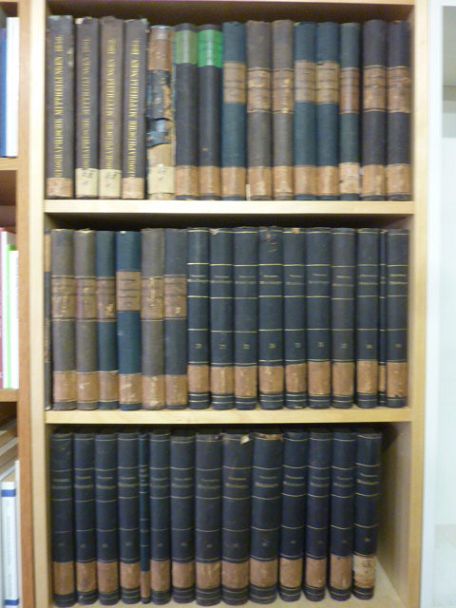
1858réf. 32039ABGotha, J. Perthes, 1858-1906. 4°, jeder Band zwischen ca. 300 und 500 S. mit zahlr. (oftmals farbigen) Ausklapp-Tafeln und Falt-Karten, die ersten 4 Bände (1858-1863) als schwarze original Leineneinbände mit goldener Deckel- und Rückenbeschriftung sowie reicher Deckelbildprägung, der Band 1868 als schlicher schwarzer Pappband der Zeit, dann (1870-1906) Halbleinen-Einbände der Zeit mit Rückenschildern bzw. goldener Rückenbeschriftung und Musterpapierbezügen, alle Bände in Originalausgabe alle Bände unten mit Rückensignaturschildchen, die Rückenkanten der ganz frühen Bände stellenw. angeplatzt, wenige Bände oben am Rücken etwas angerändert, beim schlichten Pappband von 1868 der Rücken beschädigt und mit Fehlstellen (innen aber bindungsstab
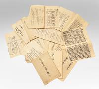
1856réf. 191708Japan: c. 1856. The first Western ships in a newly opened Japan An untraced manuscript record of the Western ships that arrived in Shimoda after Perry signed the Convention of Kanagawa. They include those from his fleet such as the Mississippi and the Macedonian as well as the Russian flagship Diana and many smaller trading vessels about which little information survives. Compiled anonymously the ledger begins on 25 February 1854 and ends on 26 February 1856. Over this period the scribe recorded the names captains armaments and crew compliments of each vessel that arrived in port. While much of this information is available elsewhere for larger American ships such as the Vandalia there are fewer resources that give details on smaller trading ships such as the Lady Pierce Caroline E. Foote Vincennes and Hancock. For example this ledger notes that the Caroline E. Foote docked 21 January to 9 February 1855 arrived with 21 people including 3 women and 2 children a boy aged 9 and a girl aged 5 before ferrying Russian sailors who had been staying in Toda village back to Kamchatka. The scribe also notes the arrival of Russian ships including the flagship Diana. Her captain Yevfimy Putyatin was sent to negotiate the Treaty of Shimoda. In December 1854 the fleet was hit by a tsunami causing the Diana to spin round her mooring 42 times. Three French ships are recorded in the manuscript transcribed as the Napoleon III Havre Constantine and Colbert. We have been unable to trace information about these vessels in other sources. Large octavo 245 x 171 mm ff. 15. Manuscript in red and black on recto and verso of leaves; text in classical Japanese. Original manuscript title leaf paper string koyori tied through one hole. Together with manuscript draft drawing of a Dutch officer 327 x 243 mm stamp of the artist "Toho" in red. Creased as expected a few worm holes internally some repaired otherwise bright: a very good example. unknown
1854réf. 369733Palmas Panama 1854. 2pp. single 4to sheet. With: Carte-de-visite photograph of Mayo signed and inscribed to his sister on verso. Folds minor separations. 2pp. single 4to sheet. With: Carte-de-visite photograph of Mayo signed and inscribed to his sister on verso. Seeking a low-level train or canal route to bridge the Atlantic and Pacific Oceans in late 1853 President Franklin Pierce ordered a U.S. Naval exploring expedition to participate in an international attempt affiliated with a venture by the Atlantic and Pacific Junction Company. Although ships from Great Britain New Grenada and the United States were involved the principle overland portion of the expedition through 40 miles of dense jungle would be led by Lieutenant Isaac G. Strain who had previously led exploring expeditions in Brazil Baja California and Chile. With a party of 27 officers and men and including the author of the present letter they entered the jungle on January 20 1854. Problems began almost immediately. While puting ashore a boat was swamped and a portion of the party's provisions lost. Next the route Strain had been tasked with following contained no gap in the cordillera as had been previously believed. Led through the jungle by several groups of indigenous people the promise of a few days hike turned into months of wandering in the jungle before being abandoned by the guides. Subsisting on plantains and bananas and drinking river water Stain divided his men with an advance party striking out to seek rescue. On March 9 forty-nine days after starting from Caledonia Bay Strain and his advance party reached Yavisa; it would be another nearly three weeks before the main body was rescued but not before at least five had died of starvation or disease. Sometimes compared with the trials of the crew of the Essex or the members of the Donner Party the men on the Darien expedition endured extreme harship and resorted to unspeakable things. This remarkable letter was written by one of the expedition's survivors shortly after his rescue and return to civilization. George Upshur Mayo 1834-1896 was born into a prominent family in Norfolk VA. He attended the Virginia Military Institute served as an assistant engineer on the Strain Expedition was involved in the United States Geodetic Survey and was later a major in the Confederate Army. Here he writes: "My dear father From this filthy native village where our party are brought by the officers of the war steamer Virago English whose officers rescued us from a most deplorable condition starvation misery & want for about 70 days without bread or meat living on roots & nuts from the trees. May the rescue be never forgotten & I thank & give praises to God for his goodness. We abandoned & buried 4 or 5 in the woods as unable to keep up. I suffered from the cusano a worm that gets in the flesh also from a very bad knee. Almost unable to travel 3 miles a day. Unfavorable reports reached the U.S. concerning us. We are safe & go to Panama when we get well. My mind is out of sorts by medicine & sickness & my hand too weak to write more legibly. Will write from Panama or Aspinwall a respectable letter there. We are 100 miles from Panama. Had the party 8 days provisions only in the woods yet nothing to shield us from wind & storm & no change of garments. The suffering was intense & the rescue came at the most dreadful & important for our safety. I with 3 others on the river bank washing at sundown when the canoes came in sight. Captain Strain had no pants or underdraws to protect him from the briars & vermin. God be praised for rescue. Love to Annie. . . . In all probability will meet the Cyane at Aspinwall." A remarkable first-hand account of a desperate struggle for survival. unknown
1856réf. E05603 volumes: xvii1537 pages with 90 lithographs plates including the usual expunged bathing plate many in color including 3 "facsimiles" of Japanese woodblock prints 2 folding; 6 maps and charts 2 folding; 79 woodcuts in the text; 2414414-1xi pages with 4 color lithographs of Chinese scenes; 2 uncolored natural history engraved plates; 6 hand-colored lithographs of birds; 10 hand-colored steel-engravings of fish; 5 lithographs of shells 2 hand-colored; 16 diagram plates of winds and currents; 14-page facsimile of Japanese language version of the U.S.-Japan treaty; 17 folding charts on 16 sheets; numerous woodcuts in the text; xliii17051 pages woodcut star charts throughout. Volume III titled "United States Japan Expedition. Observations on the zodiacal light from April 2 1853 to April 22 1855 . by Rev. George Jones A.M. chaplain United States Navy". Quarto 11½ x 8 ¾" bound in the original blind stamped cloth. Volume 1 rebacked with the original cloth spine laid down. Hill 1332; Sabin 30968 Stabbed signature of the author included. First edition of the House Issue. Detailed and profusely illustrated account of Perry's expedition to open Japan to the West; Upon his return to the U.S. his chief duty for the following year was to compile his reports of the expedition aided by Francis Hawks. The first volume has the account of the voyage and lithographs of the travel; the second volume has the natural history reports by D.S. Green and others and includes hand-colored plates of Japanese fishes and shells. In addition to the artist W. Heine from whose drawings a great number of the lithographs were made the daguerreotypist E. Brown Jr. went on the expedition taking what were undoubtedly the earliest photographic images of Japan many of them reproduced lithographically in this work. This copy with the nude bathing plate which was not included on the list of plates and not issued in all copies. In advance of his voyage to the Far East Commodore Perry read widely amongst available books about Tokugawa Japan. His research even included consultation with the increasingly well-known Japanologist Philipp Franz von Siebold who had lived on the Dutch island of Dejima for eight years before retiring to Leiden in the Netherlands. In 1852 Perry embarked from Norfolk Virginia for Japan in command of a squadron in search of a Japanese trade treaty. Aboard a black-hulled steam frigate he ported Mississippi Plymouth Saratoga and Susquehanna at Uraga Harbor near Edo modern Tokyo on July 8 1853. His actions at this crucial juncture were informed by a careful study of Japan's previous contacts with Western ships and what could be known about the Japanese hierarchical culture. He was met by representatives of the Tokugawa Shogunate who told him to proceed to Nagasaki where there was limited trade with the Netherlands and which was the only Japanese port open to foreigners at that time. Perry refused to leave and demanded permission to present a letter from President Millard Fillmore threatening force if he was denied. Perry ordered his ships to attack several buildings around the harbor to demonstrate US naval power. The Commodore was fully prepared for more hostilities if his negotiations with the Japanese failed and threatened to use unrestrained fire if the Japanese refused to negotiate. He sent two white flags to them telling them to hoist the flags when they wished a bombardment from his fleet to cease and to surrender. Perry's ships were equipped with new Paixhans shell guns capable of wreaking great destruction with every shell. The Japanese military forces could not resist Perry's modern weaponry; the term "Black Ships" in Japan would later come to symbolize a threat imposed by Western technology. Perry returned in February 1854 with twice as many ships finding that the delegates had prepared a treaty embodying virtually all the demands in Fillmore's letter. Perry signed the Convention of Kanagawa on March 31 1854 and departed mistakenly believing the agreement had been made with imperial representatives. The agreement was made with the Shogun the de facto ruler of Japan. On his way to Japan Perry anchored off Keelung in Formosa modern day Taiwan for ten days. Perry and crew members landed on Formosa and investigated the potential of mining the coal deposits in that area. He emphasized in his reports that Formosa provided a convenient mid-way trade location. Formosa was also very defensible. It could serve as a base for exploration as Cuba had done for the Spanish in the Americas. Occupying Formosa could help the US to counter European monopolization of the major trade routes. President Franklin Pierce declined the suggestion remarking such a remote possession would be an unnecessary drain of resources and that he would be unlikely to receive the consent of Congress. When Perry returned to the United States in 1855 Congress voted to grant him a reward of $20000 in appreciation of his work in Japan. Perry used part of this money to prepare and publish a report on the expedition in three volumes titled Narrative of the Expedition of an American Squadron to the China Seas and Japan. He was also advanced to the grade of rear-admiral on the retired list when his health began to fail as a reward for his services in the Far East. Condition: Wear and fading to cloth large map repair at with archival tape several others with stub tears and splitting to folds; light foxing spine ends rubbed with a few with chips corners bumped and rubbed through. Accompanied with encapsulated and graded signature of the author else good to very good. Due to the size and weight additional postage will be required. A O P Nicholson hardcover
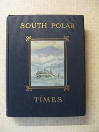
1914réf. 40Smith Elder London 1914. First Edition. Hardcover Original Cloth. Very Good Condition/No Dust Jacket. 1st Edition; This copy is 243 of a limited edition of 350. Volume 1 & 2 were Scott's 1st "Discovery Expedition" whilst this Volume 3 is from his 2nd "Terra Nova" Expedition. Although often sold as a set Volume 3 is a complete book in its' own right. The original broadsheets were produced at Cape Evans to amuse the men on the 'Terra Nova' Expedition. It was designed to be published separately from Volume 1 & 2. Cherry-Garrard was the Editor and typist and Wilson the main illustrator. The 1st issue was presented on Midwinter's Day 1911 the 2nd on 8th September and the 3rd on 15th October. Content included poetry humorous articles illustrations of sledging flags and caricatures. Includes Wilson's moving poem 'The Barrier Silence' and Ponting's hilarious tongue twister 'The Sleeping Bag'. Original covers all page edges gilt. Copiously illustrated drawings in the text and full-page plates from sketches and paintings by E. Wilson H. Ponting and others. Ex Library with stamps on some pages Croydon Library. Spine shaken gutta-percha binding delicate some pages loose as is usual with the 1st Edition. Gutta Percha was used as the binding glue in many early books it is not a difficult job to remove and reback using modern glues The South Polar Times was a magazine written and printed by the members of Antarctic Expeditions during the various voyages they undertook. In 1907 the batches were printed and issued in some 250 copies. The South Polar Times form what is perhaps the most personal of the printed documents to have come out of that most remarkable of periods of Antarctic adventures revealing so many often contradictory aspects of these men's various personalities. It contains a diary of the events of each month a record of the proceedings of the local Debating Society a monthly acrostic humorous notes besides articles of a more solid nature as well as stories sketches of various kinds and poems. One of the corner stones of an Antarctic collection. PLEASE NOTE: This book will incur extra postage and insurance charges. Please contact us for a quote. Limited Edition. Quantity Available: 1. Shipped Weight: Under 5 kilogram. Category: Arctic & Antarctic; Antarctic; 1900-1920; Exploration. Pictures of this item not already displayed here available upon request. Inventory No: 40. . This book is extra heavy and may involve extra shipping charges to some countries. Smith Elder hardcover
réf. 7712Several dozen manuscripts in various formats incl. long folded sheets stitched pamphlets sewn volumes and letters. Japan: ca. 1853-63. A substantial group of documents revealing internal high-level debates and discussions in response to Commodore Perry’s landings and later controversies that arose as Western powers established a foothold in Japan. This is an exceptional collection filled with top-secret information on government intrigues as the Japanese state responded to aggressive foreign expansion and dissenting groups within the government urging top-to-bottom reforms. The manuscripts touch upon pivotal events in Japan’s history: –Commodore Perry’s two expeditions July 1853 & February-March 1854 and the resulting ratification of the Treaty of Shimoda. –Japanese translations of the treaties signed with the United States Russia France and the United Kingdom from 1854 to 1858. –The assassination of Ii Naosuke in March 1860 also known as the Sakuradamon Incident which precipitated a violent backlash against foreigners under the banner of Sonno joi “Honor the Emperor expel the barbarians”. –General dissatisfaction with the bakufu and efforts to reform it. –The attempted assassination of Ando Nobumasa a chief councillor during this period. –The Namamugi Incident in September 1862 when the British merchant Charles L. Richardson was killed by Satsuma domain warriors. –The bombardment of Kagoshima August 1863. Among all these materials we must highlight several examples of manuscript kengen proposals and commentaries written by aristocrats with policy advice on the difficult situations faced by the Japanese state. These offer compelling perspectives on the most pressing dilemmas of the day. While they were not composed by the decision-makers these documents are filled with the minutiae and data employed in the policy-making process. All of the items are in a fine state of preservation. ⧠John McMaster “Alcock and Harris. Foreign Diplomacy in Bakumatsu Japan” Monumenta Nipponica Vol. 22 No. 3/4 1967 pp. 305-367. unknown
réf. 224591Paris, Smith et Buisson, 1812-1817 4 vol. in-8, 17 planches, portrait en frontispice du tome 1, demi-basane noire, dos lisse orné en long, plats de moire noire, roulette dorée en encadrement (reliure de l'époque). Dos un peu frotté, coupes usées. Rousseurs et mouillures marginales.
réf. 50306For the lot of approximately 250 items $6000. a Correspondence with various government officials hunting guides and others involved with preparing and carrying out the trip including14 letters to Furlong typed and autograph one accompanied by four photographs of members of the expedition with trophies; five retained copies of letters from Furlong to the correspondents four telegrams seven typed and manuscript recapitulations of various aspects of the trip e.g. titles for the "Dance of the Nandi" film and a three page typed press release on the expedition dated Nairobi 27 March 1930 accompanied by a photograph of Furlong and two bearers with a leopard he has killed. b Two hunting licenses issued by the Uganda Protectorate to Furlong 22 April 1930 one "For a First Elephant" the other a "Visitor's Full Game License." c Three maps period road map of Kenya and Uganda published by Bullows and Roy for the Royal East Africa Automobile Assn.; Map Showing Cairo-Mombasa Route published by the Sudan Survey Dept Khartoum 1929; and a period National Geographic Society map of Africa. d An account book narrow 12mo 19 pp. 22 March - 8 June 1930 and approximately 125 receipts most partly printed for a wide range of services and material necessary for the trip. e 21 photographs in addition to those mentioned above many picturing Furlong in the field with his rifle and trophies some with Furlong's notations on verso and 34 unused photo postcards featuring tribesmen animals and scenery of East Africa. f 42 promotional pamphlets ca. 1925-1934 for the various parts of Africa along Furlong's route 36 of which are unrecorded on OCLC. The pamphlets were issued by African railway companies and governmental agencies outfitters e.g. Thomas Cook and "Safari Africa Limited" London ship lines and other travel agencies and taxidermy concerns. g A wooden carved string instrument from the Para Mountains in present day Tanzania with Furlong's ownership label "Col. Wellington Furlong / c/o Safariland Ltd. / Musical Instrument / Para Mountains" still attached; the instrument is shaped like a hollowed-out bread tray 27 x 7 1/2 inches three holes in the shape of crosses in the bottom six strings stretched across the opening. Furlong 1874-1967; American explorer army officer author artist and photographer embarked on this big game expedition in 1930 partly as an effort to recover relics of Sir Henry M Stanley in East and Central Africa. Gateway to the Sahara New York 1909 is among several books he published. A member of the Explorers Club he was the first American to explore the interior of Tierra del Fuego 1907-1908. Most of his personal papers are held by the Stefansson Collection at Dartmouth. unknown books
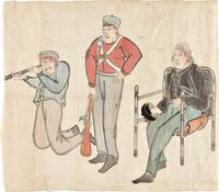
1853réf. 34749Edo 1853. Watercolour and ink drawing on Japanese paper. A contemporary Japanese watercolour of Commodore Perry and members of his expedition produced at the moment of the American squadron’s arrival in Japan and the opening of sustained diplomatic contact between Japan and the United States. This lively drawing belongs to the immediate visual culture generated by Commodore Matthew C. Perry's arrival in Japan in 1853. Perry entered Edo Bay in July 1853 to deliver President Fillmore's request for a treaty and returned the following year leading to the Treaty of Kanagawa on 31 March 1854. The event prompted wide Japanese interest in the appearance dress equipment and conduct of the visiting Americans and images of the "Black Ships" and their crews circulated in manuscript painted and printed form. The composition presents three American figures isolated against the paper ground arranged almost as a study of types. At right Commodore Perry is shown seated in a chair wearing a dark naval coat and holding his hat. At center stands an armed crewman or marine in a red jacket holding a musket upright; at left another crewman kneels while looking through a telescope or spyglass. The emphasis falls on uniform posture weaponry and optical instrument details that would have marked the Americans as visually and technologically unfamiliar to Japanese observers. The drawing is especially interesting as a Japanese interpretation of the expedition distinct from the official American pictorial record produced by artists such as Wilhelm Heine. The Japanese manuscript images such as the present work preserve a different perspective shaped by local observation report and curiosity. unknown
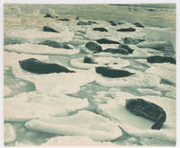
réf. 122915Very Good. A large blue-toned carbon print 358 × 430 mm flush-cut on the original thick card mount recently matted visible image size 351 × 423 mm using archival materials ready for framing or long-term storage in its custom-made Mylar sleeve. Light brown discolouration about the top edge a tidemark is visible on the original mount on the reverse; two tiny surface blemishes; overall in excellent condition. This photograph is reproduced in 'The Home of the Blizzard' Volume 1 page 102 with the caption 'Adelie Land. Weddell seals asleep on pancake ice'. Several pages earlier Mawson writes: 'Seals and penguins on magic gondolas were the silent denizens of this dreamy Venice. In the soft glamour of the midsummer midnight sun we were possessed by a rapturous wonder the rare thrill of unreality' page 53. The print comes from the original 1915 Australian exhibition of Hurley photographs; this was a slightly larger version of the London exhibition held earlier in the same year. The label of the Fine Art Society New Bond Street London is on the verso of this print with the title as above and the catalogue reference number 48 added in ink. The full title of the Australian exhibition catalogue is 'Exhibition of Unique Photographic Pictures taken during the Australasian Antarctic Expedition. Also other Photographic Studies by Frank Hurley' small octavo 16 pages plus 8 full-page plates and the title wrappers; printed in Adelaide by G. Hassell & Son. A small advertisement appeared in the Adelaide 'Advertiser' on Saturday 25 September 1915 announcing a 'South Polar Exhibit. until October 6. This Exhibition is your only opportunity of viewing Historical Relics of the Australasian Antarctic Expedition and Frank Hurley's Unexcelled Photographic Reproductions'. Provenance: Ainslie Roberts AM 1911-1993 surrealist painter illustrator and photographer; president of the Adelaide Camera Club 1944-45 and life member from 1945; by descent. unknown
réf. 122914Very Good. A large black and white gelatin silver photograph 314 × 437 mm flush-cut on the original thick card mount recently matted visible image size 307 × 429 mm using archival materials ready for framing or long-term storage in its custom-made Mylar sleeve. Light discolouration to a thin strip along the bottom edge; overall in excellent condition. This print comes from the original 1915 Australian exhibition of Hurley photographs; this was a slightly larger version of the London exhibition held earlier in the same year. The label of the Fine Art Society New Bond Street London is on the verso of this print with the full title as above and the catalogue reference number 93 added in ink. The full title of the Australian exhibition catalogue is 'Exhibition of Unique Photographic Pictures taken during the Australasian Antarctic Expedition. Also other Photographic Studies by Frank Hurley' small octavo 16 pages plus 8 full-page plates and the title wrappers; printed in Adelaide by G. Hassell & Son. A small advertisement appeared in the Adelaide 'Advertiser' on Saturday 25 September 1915 announcing a 'South Polar Exhibit. until October 6. This Exhibition is your only opportunity of viewing Historical Relics of the Australasian Antarctic Expedition and Frank Hurley's Unexcelled Photographic Reproductions'. Provenance: Ainslie Roberts AM 1911-1993 surrealist painter illustrator and photographer; president of the Adelaide Camera Club 1944-45 and life member from 1945; by descent. unknown
1789réf. 27184Leiden: Etienne Luzac 1789. Small 4to. 8 1/2 x 6 1/4 inches. Woodcut arms of the Netherlands at the head of the first sheet. 4pp. With a 4pp. "Supplement aux Nouvelles Extraordinaires de Divers Endroits du Numero LXXV" inserted. Together 8pp. Unbound. Extremely rare broadsheet containing news of the Malaspina expedition: among the earliest printed records of Spain's greatest scientific voyage to the Pacific Ocean California and the Northwest Coast of America in the 18th century. The extract under the above heading continues: ". Les Corvettes de la Marine Royage la Découverte & l'Entreprenante commandées par Don Alexandre Malespina Capitaine de Frégate ont mìs à la voile de Cadix le 30 Juillet dernier. L'Expédition dont elles son chargées ayant pour objet les progrès des Sciences & de la Géographie elles ont été munies de tout ce qui est nécessaire pour faire un voyage autour du Monde; & outre des Oficiers d'une habilité reconnuë elles ont à bord des Astronomes des Naturalistes des Botanistes des Peintres de Perspective & de Botanique pourvus d'une Collection ample & précieuse d'Instruments de Mathématiques de Physique & Astronomie." Other news in the broadsheet concerns revolutionary events in France including a lengthy speech from Necker given at the National Assembly as well as news from Russia Stockholm the Hague and elsewhere. In 1789 Malaspina and Bustamente drew up plans for this scientific circumnavigation which was to rival Captain Cook the purposes being to chart the most remote regions of America and to observe the political state of America relative to Spain. Alexander Dalrymple assisted them with scientific instruments a brilliant team of scientists was assembled and ships specially constructed. Surveys were made of the east and west coasts of South America they fixed the exact position of Cape Horn correcting Cook's reading. On receipt of orders to investigate the apocryphal Strait of Anian they sailed for Alaska and entered Yakutat Bay at the supposed latitude of the strait where the Malaspina Glacier flows into the sea and followed the coast to Prince William Sound and Nootka. Malaspina surveyed the coast south to California at Monterey Bay and crossed the Pacific in 1791. Two of his officers and Jose de Espinosa y Tello returned north in search of a North-West Passage and published the charts and account of this secondary voyage in 1802. In the Philippines New Zealand and New South Wales Malaspina continued charting before making an easterly passage around the Horn for Spain. "In spite of having commanded Spain's greatest scientific voyage of exploration to the South Seas in the eighteenth century Malaspina is virtually unknown. He had enemies in the Spanish court who suppressed his reports which were not printed until.1885. Some scholars consider the exploits of his five-year voyage as great as those of La Pérouse or of Captain Cook" Hill. Eighteenth century material concerning the voyage is of the utmost rarity. Howgego M26; Cf. Hill 1068. Etienne Luzac unknown books
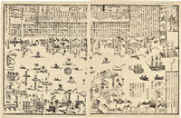
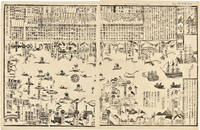
1855réf. 46844Tokyo ca. 1855. Japanese Print of Perry's Ships in Tokyo Harbor Large wood block print comprised of two sheets showing the disposition of the Japanese soldiers and ships in preparation for the arrival of Commodore Perry's American fleet seen sailing into Tokyo harbor at the right side of the image. The top third of the print is comprised of text in Japanese characters. Three large American ships dominate the right side of the print while several smaller boats dot the rest of the harbor. The whole is dotted with Japanese characters denoting various people and places around the harbor. Perry first arrived in Japan on July 8 1853 with a fleet of four ships flying his pennant on the steam frigate Susquehanna. This first visit lasted ten days and culminated on July 14 with Perry's presentation of a letter from the President of the United States to the Japanese commissioners. Perry then absented himself for seven months returning on February 11 1854 for a stay of over four months. He negotiated a treaty opening Japan to trade with the western world providing for a U.S. consul in Japan and protecting visiting ships and crews. Perry's visit to Japan remains one of the most important events in the diplomatic history between western and eastern nations. A handsome print showing the Japanese side of this important historic event. 24½ x 16 inches. Matted. Old fold lines some minor wear and soiling. Near fine. unknown
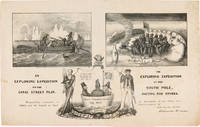
1838réf. WRCAM55549New York: H.R. Robinson 1838. Lithograph 12 1/2 x 20 inches. Light foxing and soiling. Two short closed tears in the right edge and left edge of the sheet. Very good. A very rare print satirizing the recently undertaken United States Exploring Expedition commanded by Charles Wilkes. The Expedition departed in August 1838 and Robinson's eagerness to satirize it and the politicians who supported it is ample evidence that the endeavor was not universally popular. The print is made up of three humorous vignettes. "The upper left is Charles Wilkes in a rowboat with an oarsman and two members of the scientific corps who make observations with a transit or telescope and draw fauna. The upper right image depicts a group of sailors and Charles Wilkes huddled together on the snow surrounded by a ring of polar bears and an upturned rowboat foxes penguins and a campfire. They are flying an inverted U.S. flag to signal distress. At the bottom between the two titles is an inset of the three Navy Commissioners Isaac Chaucey Charles Morris and Alexander S. Wadsworth at sea in a bowl. They are framed by a shield surmounted by a jester and flanked on the left by a man in naval uniform James Kirke Paulding Secretary of the Navy and a sailor with a sad expression on the right" - Harry T. Peters Collection at the Smithsonian Institution online catalogue. The print is "Respectfully inscribed to the Secretaries of the Navy and Army and the Board of Navy Commissioners by their humble servant Robinson Crusoe." Not in Reilly's catalogue of American political prints in the Library of Congress though OCLC does locate a copy at the Library of Congress. That is one of two copies listed on OCLC the other copy is at the American Antiquarian Society. There are also copies in the Peters collection at the Smithsonian and at the Australian National Maritime Museum. OCLC 299947747 752795742. Herman J. Viola ed. MAGNIFICENT VOYAGERS THE U.S. EXPLORING EXPEDITION 1838-1842 Washington 1985 p.13. H.R. Robinson unknown books
1855réf. WRCAM46844Tokyo 1855. 24 1/2 x 16 inches. Matted. Old fold lines some minor wear and soiling. Near fine. Large wood block print comprised of two sheets showing the disposition of the Japanese soldiers and ships in preparation for the arrival of Commodore Perry's American fleet seen sailing into Tokyo harbor at the right side of the image. The top third of the print is comprised of text in Japanese characters. Three large American ships dominate the right side of the print while several smaller boats dot the rest of the harbor. The whole is dotted with Japanese characters denoting various people and places around the harbor. Perry first arrived in Japan on July 8 1853 with a fleet of four ships flying his pennant on the steam frigate Susquehanna. This first visit lasted ten days and culminated on July 14 with Perry's presentation of a letter from the President of the United States to the Japanese commissioners. Perry then absented himself for seven months returning on February 11 1854 for a stay of over four months. He negotiated a treaty opening Japan to trade with the western world providing for a U.S. consul in Japan and protecting visiting ships and crews. Perry's visit to Japan remains one of the most important events in the diplomatic history between western and eastern nations. A handsome print showing the Japanese side of this important historic event. unknown books
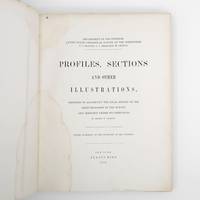
1872réf. 373132New York: Jules Bien 1872. First edition. Limited to 100 copies. 65 lithographed plates many folding preceded by 4pp. text. 4to. Original green cloth boards upper cover lettered in gilt rebacked endpapers renewed. Dampstaining. First edition. Limited to 100 copies. 65 lithographed plates many folding preceded by 4pp. text. 4to. This book was prepared to illustrate the work of the Hayden survey. It contains numerous panoramic illustrations many on folding sheets depicting sites in Wyoming Utah Colorado and Montana. This report contains the bulk of Henry Wood Elliott's art work for the Hayden Survey see preceding entry most of which was published nowhere else. These images are important because of their scientific contribution to several fields historical significance documentation of the Hayden expedition and their beauty and attention to detail. Elliott's illustrations were among the early images of many locations in the new territories of the West. From an edition of 100 copies issued in advance of the text. The Prefatory Note states p. 3: "A small edition of one hundred copies of the Profiles and Sections are issued in advance of the text for the purpose of placing them in the hands of the principal geologists in this country and in Europe. The first issue of two thousand copies in colors will be published with descriptions in about one year." We find no evidence that a subsequent edition in color was ever printed and it is stated of the present work in the Checklist of United States Public Documents 1789-1909 Washington: Government Printing Office 1909: "Originally intended to illustrate v. 4 of quarto series of reports but never thus used." The Hayden Survey was the most important of the four major government surveys of the American West undertaken after the Civil War the others being Powell King and Wheeler. Collectively these surveys filled in the map of the United States using accurate scientific methods to chart the land and investigate not only its geology but natural resources wildlife and plants as well. Schmeckebier Catalogue and Index of the Publications of the Hayden King Powell and Wheeler Surveys p. 32 #3 Jules Bien unknown
1857réf. 375531New York: G. P. Putnam & Co 1857. One of 150 copies of the unofficial issue. Text: 4 777 1pp. Atlas: 100 engraved plates. 4pp. 2 vols. 4to text and folio atlas. Modern half russet morocco and cloth covered boards. Heavy foxing to the plates in the atlas small chip at fore-edge of atlas title minor dampstaining at lower outer corner of plates tape repair to final leaf of text. Provenance: University of Chicago ink stamp and blindstamp deaccession stamp. One of 150 copies of the unofficial issue. Text: 4 777 1pp. Atlas: 100 engraved plates. 4pp. 2 vols. 4to text and folio atlas. A very rare set of the text and plates of Asa Gray's report on the botany of the Wilkes Expedition illustrated with 100 engraved plates of plants collected by the first scientific expedition conducted by the United States Navy. The United States Exploring Expedition circumnavigated the globe under the command of Charles Wilkes between the summer of 1838 and the summer of 1842. The Wilkes Expedition "was the first American scientific expedition of any size charged to 'extend the bounds of Science and promote the acquisition of knowledge' and was one of the most ambitious Pacific expeditions ever attempted" Forbes. The Expedition represents "the first governmental sponsorship of scientific endeavor and was instrumental in the nation's westward expansion. Specimens gathered by expedition scientists became the foundation collections of the Smithsonian Institution. Significant American contributions in the fields of geology botany conchology anthropology and linguistics came from the scientific work of the expedition. Wilkes's evaluations of his landfalls influenced later U.S. positions in those areas" DAB. The Narrative of the expedition was first published in 1844 but the separately-issued scientific reports and atlases for the United States Exploring Expedition were published over a long period of time; the Expedition returned in 1842 and the final volume did not appear until 1874. Because of their limited issue and historical importance all the separately-issued scientific reports and atlases from the Expedition are highly sought after though they very rarely appear on the market. Gray's report is specifically on the "phanerogamia" seed plants or flowering plants collected during the four year voyage. The history of the publication of the many scientific reports that resulted from the Wilkes Expedition is filled with difficulties in their writing and production and Gray's botanical report is exemplary of these difficulties. "The preparation of the reports on the botanical collections brought back by the Expedition proved to be one of the worst headaches encountered during the course of the entire publication" Haskell. Asa Gray was one of the most acclaimed botanists of his era and he was the original selection as botanist for the Wilkes Expedition. In the time between his appointment and the expedition's departure in 1838 however Gray accepted the position of Professor of Botany at the University of Michigan and so he resigned from Charles Wilkes's command and was replaced by William Rich. Rich completed his botanical report in 1846 and submitted it to Wilkes who found it wholly unacceptable. Eventually Asa Gray was asked to study the specimens gathered on the expedition and to produce this report which he agreed to do and which he worked on for three years. Gray initially planned for a two-volume text report and an atlas including 300 folio plates. In the end the text was issued in one large volume and the atlas contained 100 plates drawn by the talented botanical artist Isaac Sprague. The botanical specimens described in the text and depicted in the atlas come primarily from throughout the Pacific Rim including the islands of the South Pacific Hawaii Singapore the Philippines Australia New Zealand and several countries in South America - predominantly Brazil and Chile. The total number of texts published from the voyage of the United States Exploring Expedition is massive - a total of twenty-four volumes of narrative and scientific reports. Asa Gray's botanical report is designated as Volume XV. As with Charles Wilkes's narrative account of the United States Exploring Expedition Gray's botanical report was issued in "official" and "unofficial" editions. The official edition of Gray's report was published by Sherman & Son of Philadelphia in an edition of 100 copies each of text and plates and the unofficial edition was issued by Putnam of New York in an edition of 150 copies again as quarto text and folio plates. Either edition is exceedingly rare in commerce as they were mostly intended for presentation or for placement in research libraries. Sabin writing in 1875 comments that "owing to some mistake a large number of copies of the Atlas were sold by auction unbound and without the letterpress the result is that odd volumes are comparatively common - whole sets are scarce." Actually the text or atlas individually or the two volumes together are exceedingly rare in the market. A highly desirable scientific report from the Wilkes Expedition with an atlas of 100 attractive plates with text by the noted botanist Asa Gray. Haskell 61 and 63; Rosove 354-10.A2 and 355-6.A2 both text and atlas described as "rare"; Sabin 28368; Meisel II pp.668-669; Nissen 2153; Stafleu 2129 2130; Pritzel 3529; Forbes 1993. Not in Spence G. P. Putnam & Co unknown
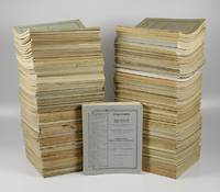
réf. 51581Leiden E. J. Brill 1901-1986. Large 4to ca. 33.0 x 27.0 cm; more than 1200 plates 188 in colour including lithographed and chromolithographed plates some etchings and photographic plates. Partly original printed wrappers partly blind wrappers. = Very rare complete set of the results of the largest oceanographic expedition in Indonesian waters which are renowned for their unsurpassed biodiversity. The expedition was initiated and lead by the Dutch biologist Max Wilhelm Carl Weber 1852-1937. "On 1 November 1898 the Siboga was officially commissioned and left for the Dutch East Indies the same day. On 7 February 1899 the ship arrived in Batavia and sailed on 11 February to the naval port of Surabaya on East Java. After the final preparations there including the removal of all other armament the expedition to investigate the marine fauna and flora of the Indonesian Archipelago as Max Weber described it began on 7 March 1899. When the Siboga returned to Surabaya on 26 February 1900 at the end of the expedition the ship had crossed an area of 1200 miles 1900 km in a north-south direction and 1500 miles 2400 km in an east-west direction covering a distance of more than 12000 nautical miles 22000 km. map of the route of the Siboga In total 181 fishing trips were made with the trawl or dredge during which depth measurements were also taken. In addition other types of nets such as the trawl were used at 103 positions and bottom samples were taken at 96 positions. Although the expedition was primarily focused on the deep sea of the Indonesian Archipelago shallow waters coral reefs and beaches were also investigated. And Weber and his companions also made regular land excursions during which they did not fail to search if appropriate sometimes successfully for scientifically unknown species at local fish markets! The expedition journal includes a total of 323 so-called measuring stations i.e. sea and land locations where the applicable observations catches or finds have been formally recorded. During the expedition a number of times a port was called at for provisions and bunkering of coal but also to send the already collected specimens preserved and packed in glass jars and zinc boxes to the Zoological Laboratory of the University of Amsterdam. There as Weber was later able to ascertain to his great joy they always arrived virtually undamaged. The enormous catch of zoological botanical and geological material that the Siboga Expedition yielded was the work of four scientists. No fewer than 61 scientists 54 zoologists 4 botanists 2 geologists and 1 hydrographer from 10 countries subsequently examined and described the collected material over a period of many decades. The results were published in 148 monographs or 'Livraisons'. The first appeared in 1901 the probably last in 1986." Dutch Wikipedia. Nearly 50 percent of the species described are new to science for example 131 new species of fishes. The Siboga results include even more species than those of the famous Challenger Expedition. Arguably this is te most important Dutch contribution to oceanography and hydrobiology ever. Published over a very long period and therefore rarely found complete. Papers are in German English or French. Three plates in Part 72 in photostat. Some wrappers slightly damaged a few with some staining to the interior otherwise a very good set. Not in Nissen which is downright ridiculous. unknown