1 758 résultats
1854réf. 191943Yokohama: c. 1854. A broadside newsletter kawaraban reporting on the return of the famous castaway Nakahama Manjiro and Perry's second visit to Japan. This example was produced in the year the Japanese isolation policy was ended and talk of foreigners especially Commodore Perry and his "black ships" was rife. Kawaraban were woodblock digests of local news events and scandals cheaply printed and distributed throughout the Edo period. On the left of this example is a short report about Nakahama Manjiro the castaway who lived in America for a decade before returning to Japan in 1851. It is accompanied by an illustration of an American sailor called "Itsuhii" carrying a gun and a compass and a sentence about how he supposedly travelled from Kanagawa to Daisha Gawara before returning to his ship. On the right is an illustration of an item sent floating towards Uraga Bay by Perry's ships with the caption "we do not know what it is". The centre of the page is taken up by an English-Japanese "dictionary" titled Amerika kotoba wakai no utsushi "American Words Translated" which purports to give the translations of common words such as "father" "fish" and "hair". However the translations are not correct: "oranhee" "kyonpo" and "romo" respectively. These words may have been misheard by the author or they may have been a satirical attempt to mock the sound of English. The historian of the English language Sogo Masaaki suggested that perhaps there is some relation to words in Malay. Single sheet 210 x 284 mm woodblock on one side only. Illustrations in text; text in Japanese. Mounted framed with Hawaiian koa wood and glazed 340 x 440 mm. Print bright two small holes on right edge light creasing and dust-soiling; small crack in frame in lower right corner: a very good copy unexamined out of frame. unknown
18738vo [26 x 17.5 cm]; xiv, 370, 16 [ads] pp, 38 hand colored plates, including 32 of birds by Keulemans, 6 of plants, 26 heliotype illus on 16 plates, frontis, colored plates of geological sections, other illus, fldg map (tear at stub) part colored, tables. later cloth with gilt title on front cover, cover lightly rubbed, signature on half title page, lightly foxed on few margins, very good sound and tight copy. A picture of this book is available upon request by email. Kaul 690: "A description of the route from Jammu to Ladakh via Banihal". Wood 383: "Report of an important scientific expedition". Zimmer 298: "The ornithological report contains descriptions of several new species". RGS Catalogue 215. The first 150 pages contains Henderson's travel narrative, with the rest of the book on natural history, mostly on birds by Hume. The narrative describes the 2,000 mile trip each way over a period of six months. The entomological report is by H. W. Bates and the botanical one by Henderson and J. D. Hooker, with a meteorological appendix. Notable especially for its fine plates, the hand colored plates of birds are very attractive.
1890réf. STLB0014Wien u. Olmütz, Eduard Hölzel 1888 und 1890. 8°. IX(1), 150 S. mit 1 kl. Titelvign., 16 Illustr. im Text, auf Tafelseiten sowie auf 1 doppelblattgr. Tafel v. Hans Fischer u. Franz Zimerman, nach Skizzen des Verfassers sowie 1 mehrf. gef., farb. Karte und VIII, 224 S. mit 18 Illustr. v. Ludwig Hans Fischer u. Franz Zimerman nach Skizzen des Verfassers, sowie nach Photographien, und einer (mehrf. gefalteten) farbigen Originalkarte. Leinenbd. d. Zt. m. goldgepr. Rückentit. u. blindgepr. Deckelrahmen. Unteres Kapital u. Ecken bestoßen u. berieben, Text papierbedingt gebräunt u. z. Tl. fingerfleckig, im hint. Falz aufgeplatzt. Henze I, 200 ff. Die überaus seltene Promotionsarbeit des bedeutenden österreichischen Afrika-Forschers Oscar Baumann (1864-1899). Seine gründlichen Aufnahmen über die Besteigung des Durmitors, während einer Reise durch Montenegro im Jahr 1883, bewegten Oskar Lenz, der 1885 die österreichisch-ungarische Kongo-Expedition vorbereitete, ihn einzuladen, die Expedition als Topograph zu begleiten. B. erkrankte jedoch nahe Stanley Falls, und wurde in einem Lager zurückgelassen, wo er während seines Aufenthaltes die Swahili-Sprache erlernte. Seine Rekonvaleszenz verbrachte er auf der Insel Fernando Póo, von deren Hauptstadt aus er eine zweimonatige Rundreise antrat und mit seinen Beobachtungen wertvolle Beiträge zur Kenntnis der Insel und ihrer Bewohner, der Bube, von deren Sprache er zwei Vokabularien zusammenstellte, lieferte. - 1887 promovierte B. in Leipzig mit dem 'Versuch einer Monographie von Fernando Póo', einer Vorarbeit zu vorliegendem Werk. In dem angebundenen Werk beschreibt B. eine Reise, die ihn als Begleiter des deutschen Forschungsreisenden Hans Meyer 1888 nach Ostafrika führte, um den Kilimandscharo zu bezwingen. Die Expedition durchquerte - von der Ostküste ausgehend - die damals noch völlig unbekannte Gebirgslandschaft zwischen den Flüssen Pangani und Umba. Wegen an der Küste ausgebrochener Araber-Unruhen sahen sie sich am südlichen Pare-Gebirge zur Umkehr gezwungen. Das Ergebnis dieser Expedition war die erste topographische Aufnahme von Usambra. Seine kartografischen und ethnologischen Aufzeichnungen waren für die schnell folgende wirtschaftliche Erschließung des Landes von unschätzbarem Wert. (vgl. dazu: Ausstellungskat. ?Abenteuer Ostafrika?. S.147).
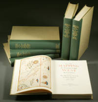
1957réf. E0551From the Spanish discovery to the opening of the Civil War 5 volumes in 6. Volume One: The Spanish Entrada to the Louisiana Purchase 1540-1804 xiv264 pages with color frontispiece map and 275 maps many folding and index; Volume Two: From Lewis and Clark to Fremont 1804-1845 xiii281 pages with colored frontispiece map 143 additional maps some folding and index. Volume Three: From the Mexican War to the Boundary Surveys 1846-1854 xiii349 pages with colored frontispiece map 322 additional maps and index; Volume Four: From the Pacific Railroad Surveys to the Onset of the Civil War 1855-1860 xiii260 pages with color frontispiece map an additional 127 maps some folding and index; Volume Five From the Civil War to the Geological Survey Part One: xviii222 pages with color frontispiece map and an additional 152 maps; Volume Five From the Civil War to the Geological Survey Part Two: 223-487 pages with 124 maps and index. Folio 14 1/2" x 10 1/2" bound in quarter green leather with gilt lettering to spines. volume I printed by the Grabhorn Press; volumes II-V printed by Taylor & Taylor and James Printing based on the designs of Edwin and Robert Grabhorn. First edition limited to 1000 copies. Carl Wheat's Mapping of the Trans-Mississippi West is a comprehensive and readable cartographic history of the American West. The first three volumes of the work are by necessity bulky and out sized to accommodate the many maps contained with their covers. These beautifully printed books present a truly graphic picture of the exploration and peopling of the vast unknown land west of the Mississippi. The author does not merely present a catalog of significant maps of each era but tells the exciting story of many facets of history that resulted in their making-of the hard journeys the hazardous exploits the motivation the mysticism the misunderstandings and the strange blend of fact imagination false geographic concept and political necessity which were consummated in the engraver's work. These volumes will provide exciting text for the casual reader and have become eminent source book for the student and scholar. Condition: A near fine set. Due to the size and/or weight of this lot extra shipping and/or handling charges may apply. Institute of Historical Cartography hardcover
1957réf. E0551From the Spanish discovery to the opening of the Civil War 5 volumes in 6. Volume One: The Spanish Entrada to the Louisiana Purchase 1540-1804 xiv264 pages with color frontispiece map and 275 maps many folding and index; Volume Two: From Lewis and Clark to Fremont 1804-1845 xiii281 pages with colored frontispiece map 143 additional maps some folding and index. Volume Three: From the Mexican War to the Boundary Surveys 1846-1854 xiii349 pages with colored frontispiece map 322 additional maps and index; Volume Four: From the Pacific Railroad Surveys to the Onset of the Civil War 1855-1860 xiii260 pages with color frontispiece map an additional 127 maps some folding and index; Volume Five From the Civil War to the Geological Survey Part One: xviii222 pages with color frontispiece map and an additional 152 maps; Volume Five From the Civil War to the Geological Survey Part Two: 223-487 pages with 124 maps and index. Folio 14 1/2" x 10 1/2" bound in quarter green leather with gilt lettering to spines. volume I printed by the Grabhorn Press; volumes II-V printed by Taylor & Taylor and James Printing based on the designs of Edwin and Robert Grabhorn. First edition limited to 1000 copies. Carl Wheat's Mapping of the Trans-Mississippi West is a comprehensive and readable cartographic history of the American West. The first three volumes of the work are by necessity bulky and out sized to accommodate the many maps contained with their covers. These beautifully printed books present a truly graphic picture of the exploration and peopling of the vast unknown land west of the Mississippi. The author does not merely present a catalog of significant maps of each era but tells the exciting story of many facets of history that resulted in their making-of the hard journeys the hazardous exploits the motivation the mysticism the misunderstandings and the strange blend of fact imagination false geographic concept and political necessity which were consummated in the engraver's work. These volumes will provide exciting text for the casual reader and have become eminent source book for the student and scholar. Condition: A near fine set. Due to the size and/or weight of this lot extra shipping and/or handling charges may apply. Institute of Historical Cartography hardcover books
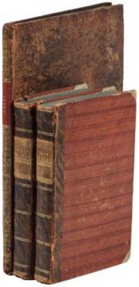
1802réf. E01512 volumes with Atlas. 4xxiv385 pages with xxii-xxiv lists books of voyages available from the publisher; 4418 pages with appendix containing vocabularies of the languages of Yukagir Yakut Tungoose Kamchatka the Aleutian Islands and Kadiak and inex. Atlas with title list of plates 14 engraved plates & large folding engraved map. Text volumes are small octavo 7¾" x 4½" 19th century quarter calf & boards spines tooled in gilt morocco lettering pieces; atlas is quarto 11" x 7½" in period tree calf spine tooled in gilt. Translated by J Castéra. Howes S-117 First French Edition. Martin Sauer was an English civil servant who knew Russian French and German. He became acquainted with Joseph Billings in St Petersburg in the 1780s. He agreed to join Billings expedition as his secretary and interpreter. It was agreed that he would write the official account but there is some controversy about his actives when he returned to St Petersburg in 1794. It has been suggested that he left hurriedly for England with much of the important archival material from the voyage including diaries and secret reports so that he could publish a record of the expedition before Russian authorities and scholars in the Academy of Sciences could review its details. Sauer's An account of the Geographical and Astronomical Expedition to the Northern Parts of Russia was published in London in 1802. It contains an abundance of detail about eastern Siberia and the Aleutian Islands and records the expeditions visits to Kodiak Island Prince William Sound and the coast south as far as Yakutat Bay. The chart was made by Aaron Arrowsmith from Sauer's notes and Billings observations and the whole complements well the other contemporary accounts of the expedition by the cartographer Gavriil Sarychev and the naturalist Carl Heinrich Merck. Aaron Arrowsmith 1750–1823 was an English cartographer engraver and publisher and founding member of the Arrowsmith family of geographers. He moved to Soho Square London from Winston County Durham when about twenty years of age and was employed by John Cary the engraver and William Faden. He became Hydrographer to the Prince of Wales ca. 1810 and subsequently to the King in 1820. In January 1790 he made himself famous by his large chart of the world on Mercator projection. Four years later he published another large map of the world on the globular projection with a companion volume of explanation. Condition: Some rubbing and wear to coves of both atlas and text volumes some chipping to spine ends small gouge at back of atlas and stamp to front end paper else in very good condition. Chez F Buisson hardcover
1802réf. E01512 volumes with Atlas. 4xxiv385 pages with xxii-xxiv lists books of voyages available from the publisher; 4418 pages with appendix containing vocabularies of the languages of Yukagir Yakut Tungoose Kamchatka the Aleutian Islands and Kadiak and inex. Atlas with title list of plates 14 engraved plates & large folding engraved map. Text volumes are small octavo 7¾" x 4½" 19th century quarter calf & boards spines tooled in gilt morocco lettering pieces; atlas is quarto 11" x 7½" in period tree calf spine tooled in gilt. Translated by J Castéra. Howes S-117 First French Edition. Martin Sauer was an English civil servant who knew Russian French and German. He became acquainted with Joseph Billings in St Petersburg in the 1780s. He agreed to join Billings expedition as his secretary and interpreter. It was agreed that he would write the official account but there is some controversy about his actives when he returned to St Petersburg in 1794. It has been suggested that he left hurriedly for England with much of the important archival material from the voyage including diaries and secret reports so that he could publish a record of the expedition before Russian authorities and scholars in the Academy of Sciences could review its details. Sauer's An account of the Geographical and Astronomical Expedition to the Northern Parts of Russia was published in London in 1802. It contains an abundance of detail about eastern Siberia and the Aleutian Islands and records the expeditions visits to Kodiak Island Prince William Sound and the coast south as far as Yakutat Bay. The chart was made by Aaron Arrowsmith from Sauer's notes and Billings observations and the whole complements well the other contemporary accounts of the expedition by the cartographer Gavriil Sarychev and the naturalist Carl Heinrich Merck. Aaron Arrowsmith 1750–1823 was an English cartographer engraver and publisher and founding member of the Arrowsmith family of geographers. He moved to Soho Square London from Winston County Durham when about twenty years of age and was employed by John Cary the engraver and William Faden. He became Hydrographer to the Prince of Wales ca. 1810 and subsequently to the King in 1820. In January 1790 he made himself famous by his large chart of the world on Mercator projection. Four years later he published another large map of the world on the globular projection with a companion volume of explanation. Condition: Some rubbing and wear to coves of both atlas and text volumes some chipping to spine ends small gouge at back of atlas and stamp to front end paper else in very good condition. Chez F Buisson hardcover books
réf. 238169Paris et Milan, 1800 - 1801 7 pièces en deux vol. in-8, demi-veau fauve, dos lisses ornés de dent-de-rat et filets dorés, pièces de titre crème, coins en vélin (reliure un peu postérieure). Des mouillures claires au premier volume.
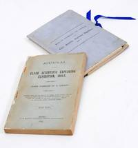
1893réf. 2712376Adelaide: C.E. Bristow 1893. Wrappers torn at edges but well repaired as are the boards of the map section. Octavo complete with maps; original wrappers and boards preserved in a brown morocco bookform box. First edition: one of 500 copies printed of the narrative of one of the last great Australian exploring expeditions written by the leader of the expedition and complete with its maps. Lindsay led this extensive expedition - it ran to eight men forty-four camels and five Afghan camel drivers - organised by the South Australian Branch of the Royal Geographical Society and equipped by Sir Thomas Elder to explore the unknown interior between South Australia and the west coast and to look for Leichhardt. Lindsay's exhaustive report includes the surveyor L.A. Wells's journal of the expedition. Also included is an extensive Aboriginal vocabulary collected by Wells from the Pidong tribe at the head of the Murchison River the Minninng tribe at Fraser Range from the Everard Ranges at Mount Illbillee and from the "Wallawe" tribe at Yarragabie Station Western Australia. He states "Appended is a list of native names which I have collected from four tribes met with during the expedition.". The separate large folding maps are original lithographs coloured to illustrate geological changes. Compiled and drawn by both Lindsay and Wells these maps show in great detail the earlier discoveries of Giles Gosse Forrest and Hunt as well as the route taken by the Elder explorers. . C.E. Bristow unknown
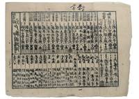
1853réf. 347481853. Three woodblock-printed sheets on mulberry paper. Mild edge wear old folds. A detailed revealing group of late Tokugawa samurai reference sheets recording the names ranks stipends heraldry standards and service obligations through which the shogunate and Edo public understood military readiness at the moment of Perry's arrival. Commodore Matthew C. Perry anchored off Uraga at the entrance to Edo Bay in July 1853. His arrival made visible the vulnerability of the Tokugawa capital and produced an immediate demand for information about coastal defence domain strength and the lords responsible for guarding the approaches to Edo. Kawaraban and related broadsides answered that demand in compressed visual form combining names crests military symbols income figures and geographical or administrative data. The first printed sheet appears to be an earlier roster of Edo office-holders or guard personnel. Its tabular format with names offices crests and standards records the recognitional system already in place within Tokugawa administration before the Perry crisis sharpened the public appetite for such information. The manuscript sheet is ruled into a large grid with headings formed from the twelve zodiac signs and the four seasons including Rat Ox Tiger Hare and the seasonal headings. The entries appear to record named houses Lords or retainers against recurring seasonal and cyclical categories probably for service attendance or ceremonial obligation. The third sheet is headed "Rekko yushinroku" here translated as "Register of Valiant Retainers of the Lords." It lists major daimyo houses and their principal retainers with domain or house headings names titles stipend figures in koku family crests standards and related insignia. Visible regional or house designations include "Kaga" "Owari" "Kii" "Satsuma" "Higo" and "Tosa." The sheet gives a graphic register of the daimyo world mobilised or imagined as mobilised around the defence of Edo Bay. Together the sheets preserve the administrative and visual language of Tokugawa defence at a moment of acute pressure. They are not formal shogunal orders and the first sheet may predate Perrys arrival but they show how late Edo Japan translated rank obligation military identity and coastal defence into portable tabular form. Their compression the names of Lords and retainers the scale of domains the crests and standards by which armed households could be recognised and the bureaucratic habits of a regime suddenly forced to account for its capacity to defend the country reveals these documents' immediacy and importance. unknown
1853réf. 347481853. Three woodblock-printed sheets on mulberry paper. Mild edge wear old folds. A detailed revealing group of late Tokugawa samurai reference sheets recording the names ranks stipends heraldry standards and service obligations through which the shogunate and Edo public understood military readiness at the moment of Perry's arrival. Commodore Matthew C. Perry anchored off Uraga at the entrance to Edo Bay in July 1853. His arrival made visible the vulnerability of the Tokugawa capital and produced an immediate demand for information about coastal defence domain strength and the lords responsible for guarding the approaches to Edo. Kawaraban and related broadsides answered that demand in compressed visual form combining names crests military symbols income figures and geographical or administrative data. The first printed sheet appears to be an earlier roster of Edo office-holders or guard personnel. Its tabular format with names offices crests and standards records the recognitional system already in place within Tokugawa administration before the Perry crisis sharpened the public appetite for such information. The manuscript sheet is ruled into a large grid with headings formed from the twelve zodiac signs and the four seasons including Rat Ox Tiger Hare and the seasonal headings. The entries appear to record named houses Lords or retainers against recurring seasonal and cyclical categories probably for service attendance or ceremonial obligation. The third sheet is headed "Rekko yushinroku" here translated as "Register of Valiant Retainers of the Lords." It lists major daimyo houses and their principal retainers with domain or house headings names titles stipend figures in koku family crests standards and related insignia. Visible regional or house designations include "Kaga" "Owari" "Kii" "Satsuma" "Higo" and "Tosa." The sheet gives a graphic register of the daimyo world mobilised or imagined as mobilised around the defence of Edo Bay. Together the sheets preserve the administrative and visual language of Tokugawa defence at a moment of acute pressure. They are not formal shogunal orders and the first sheet may predate Perrys arrival but they show how late Edo Japan translated rank obligation military identity and coastal defence into portable tabular form. Their compression the names of Lords and retainers the scale of domains the crests and standards by which armed households could be recognised and the bureaucratic habits of a regime suddenly forced to account for its capacity to defend the country reveals these documents' immediacy and importance. unknown books
1855réf. 46629Gotha, Julius Perthes, 1855-1874. 4to. Bound in 18 contemp. hcalf, some wear to the first 10 vols., some a bit rubbed. Some scattered brownspots to the first volumes. Gilt spines. Wear to top of spines. With a huge amount of original maps, plates, profiles etc., lithographed and engraved, large and folded and mainly in colour. This set does not include the ""Ergänzungsbände"".
1855réf. 46629Gotha Julius Perthes 1855-1874. 4to. Bound in 18 contemp. hcalf some wear to the first 10 vols. some a bit rubbed. Some scattered brownspots to the first volumes. Gilt spines. Wear to top of spines. With a huge amount of original maps plates profiles etc. lithographed and engraved large and folded and mainly in colour. This set does not include the "Ergänzungsbände". The first 19 lacking vol. 14 volumes of this importent periodical from its "Golden Period". "Petermann's Mittheilungen" became the leading geographic publication of the world and remained so until World War I. All the new geographical discoveries all the reports from the latest exploratory expeditions were published and flowed into Petermann's Geographische Anstalt and he took care to see that it was translated into cartographic form as quickly as possible. The maps soon came to have a reputation for containing the latest and the most accurate information available. Not only German but international readers as well came to see the 'Mitteilungen' as an indispensable organ for the world of geographical research. unknown
réf. H4141874. Albumin Prints ca. 145 x 129 cm 15 x 106 cm und 145 x 113 cm auf Kartontafeln montiert. Mit Beschriftung in deutscher Sprache. Eine Aufnahme ist etwas gebleicht die anderen sind in gutem Zustand und von guter Qualität. Die Photos wurden während des Aufenthalts der Korvette Gazelle 1874 in Monrovia gemacht. Sie zeigen Mitglieder der Expedition. Kommandant von Schleinitz führte die Korvette Gazelle 1874 bis 1876 auf einer Weltreise mit wissenschaftlichem Auftrag. Auf den Kerguelen-Inseln verbrachte die Expedition längere Zeit um den Venustransit zu beobachten. Mitte 1875 ging es weiter nach Neu Guinea. Viele Wissenschaftler forschten in den Bereichen Zoologie Botanik Geologie Meteorologie und Meeresforschung während Schleinitz selbst ethnologisches Material sammelte. Er benannte die Halbinsel nach seinem Schiff der Gazelle. Melanesien wurde erfirscht während auf der Rückfahrt Fiji Tonga und Samoa besucht wurden. Die Ergebnisse der Expedition wurden in einem fünfbändigen Werk publiziert. unknown
1618réf. 2417Paris, Gobert (texte) & Tauernier (cartes), 1618. Petit in-8 – 11,5 x 17 cm. Reliure de l’époque en vélin, dos lisse muet. Dans une chemise-étui moderne. 7 ff., 232 pp., 4 pl. Première édition française du récit populaire de Schouten sur son voyage avec Jacob Le Maire à la recherche d’un passage alternatif au détroit de Magellan, qui a été traduit en français, allemand, latin et anglais moins d’un an après la première édition néerlandaise. Le voyage historique de Schouten n’était que le troisième tour du monde, « au cours duquel le Cap Horn fut découvert et contourné pour la première fois » (Hill). Exemplaire orné de 4 planches dépliantes (sur les 8 usuelles) : mappemonde ornée des portraits de Magellan et Schouten, carte du Cap Horn, gravure de l’Ile Horn, carte de la côte de Nouvelle Guinée. Lors d’un voyage, un ancien propriétaire a fait tamponner le dos de l’étui (XXe) au moment de son passage au Cap Horn.
17514to [25 x 20 cm]; [ii], xxxvi, 280, xv (index) pp, 7 engraved maps, plans and plates including 6 folding, one being fldg table, engraved vignette head-pieces and tail-pieces. contemporary full leather, gilt spine title & design, raised bands, light cover wear, few tiny holes on front joint,marbled endpapers, endpaper labels of Le Chev du Blaisel & B. Mendel, few leaves with light marginal browning, else clean crisp, near fine. This is the first edition of the account of the great French Scientific Expedition to South America to measure an arc of the meridian at the equator to determine the dimension and shape of the earth. After the scientific measurements done north of the city of Quito in Ecuador, La Condamine then journeyed down the Amazon, being the first to explore that region. His measurements stood the test of time until the advent of GPS showed that the actual equator was somewhat further south, although the original monument and museums north of Quito still advertise themselves as the actual equator. The work includes a detailed plan of the city of Quito and a large map of what is now Ecuador. Hill 169: 'the greatest geographical event of the eighteenth century as regards South America. . . to measure one exact degree of meridian to determine the dimensions and shape of the earth. . . the work occupied eight years'. Sabin 38479. Norman 1250.
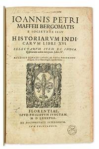
1588réf. E05544-5702 blank28 pages with woodcut device on title woodcut historiated initials and decorations. Folio 12 1/2" x 8 1/4" bound in contemporary vellum. European Americana 588/57; Palau 146976; Sabin 146976 Western Travellers in China 11 First edition of Maffei's great history of India. Ten Latin editions two in Italian and two in French appeared before 1621. Based on primary material it still remains a valuable account today. The work is divided into 16 books. Most of it deals with the Portuguese conquests and Jesuit missionary work in the East Indies and India up to about 1557 Borba de Moraes page 508 "a classic work on the subject . writes extensively about Brazil describing it very accurately"; Maffie was the firs author to use Jesuit letters extensively as well as many secular sources including Fernando Mendes Pinto. Condition: Contemporary velum with moderate wear re-backed in vellum with original spine label laid down; minor worming and foxing intermittent moderate damp staining pages 410 and 419 blank due to a printing error; early inscription and inked stamped on title page new end papers and paste-downs else a good to very good copy. Apud Philippum Juncatam hardcover
1588réf. E05544-5702 blank28 pages with woodcut device on title woodcut historiated initials and decorations. Folio 12 1/2" x 8 1/4" bound in contemporary vellum. European Americana 588/57; Palau 146976; Sabin 146976 Western Travellers in China 11 First edition of Maffei's great history of India. Ten Latin editions two in Italian and two in French appeared before 1621. Based on primary material it still remains a valuable account today. The work is divided into 16 books. Most of it deals with the Portuguese conquests and Jesuit missionary work in the East Indies and India up to about 1557 Borba de Moraes page 508 "a classic work on the subject . writes extensively about Brazil describing it very accurately"; Maffie was the firs author to use Jesuit letters extensively as well as many secular sources including Fernando Mendes Pinto. Condition: Contemporary velum with moderate wear re-backed in vellum with original spine label laid down; minor worming and foxing intermittent moderate damp staining pages 410 and 419 blank due to a printing error; early inscription and inked stamped on title page new end papers and paste-downs else a good to very good copy. Apud Philippum Juncatam hardcover books
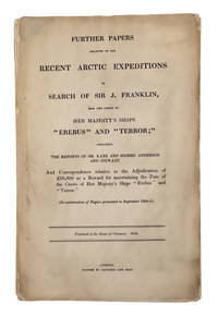
1856réf. 69186London. 1856. Parliamentary "Blue Book" on the Search for Franklin A rare Parliamentary paper relating to the lost Franklin expedition. This "blue book" a series of parliamentary reports named for their original blue paper wrappers contains a wealth of information about Franklin's expedition including detailed correspondence on the Second Grinnell Expedition with Kane's report and the Hudson's Bay Company's expedition down the Back River under Anderson and Stewart. Also includes Richard King's proposal to venture down the Back River to Montreal Island; the recovery and subsequent disposal of the Resolute; Collinson's report on Franklin relics; correspondence on the rewards for Franklin searches; and a list of American officers and men entitled to receive the Arctic Medal known today as the Polar Medal and given out by the British government to "all persons of every rank and class who have been engaged in the several Expeditions to the Arctic Regions whether of discovery or search between the years 1818 and 1855". Sir John Franklin's doomed 1845 expedition his fourth to the Arctic and third as commander set out in 1845 to search for the fabled Northwest Passage. In September 1846 the expedition's ships became trapped in the ice off of King William Island which would be their final resting place. The crew spent the next year and a half trapped there before attempting to walk south dying along the way in the arctic tundra hundreds of miles from the nearest European settlements. After three years without word the British Admiralty launched a massive search for the missing ships. Spurred by a large reward many expeditions from Britain and the United States set out on the hunt beginning in 1848 and continuing through the next decade. The British Parliament printed occasional reports of the various expeditions and related Arctic subjects during that time. These reports became known as the Arctic "blue books." One of the scarcer Franklin items rarely appearing on the market and with only a handful recorded in OCLC. Folio. Gathered signatures stitched. Soiling and edge wear to outer leaves minor scattered foxing else very good. ARCTIC BIBLIOGRAPHY 45249. TPL 3659. LANDE S910. unknown
1856réf. 69186London. 1856. Parliamentary "Blue Book" on the Search for Franklin A rare Parliamentary paper relating to the lost Franklin expedition. This "blue book" a series of parliamentary reports named for their original blue paper wrappers contains a wealth of information about Franklin's expedition including detailed correspondence on the Second Grinnell Expedition with Kane's report and the Hudson's Bay Company's expedition down the Back River under Anderson and Stewart. Also includes Richard King's proposal to venture down the Back River to Montreal Island; the recovery and subsequent disposal of the Resolute; Collinson's report on Franklin relics; correspondence on the rewards for Franklin searches; and a list of American officers and men entitled to receive the Arctic Medal known today as the Polar Medal and given out by the British government to "all persons of every rank and class who have been engaged in the several Expeditions to the Arctic Regions whether of discovery or search between the years 1818 and 1855". Sir John Franklin's doomed 1845 expedition his fourth to the Arctic and third as commander set out in 1845 to search for the fabled Northwest Passage. In September 1846 the expedition's ships became trapped in the ice off of King William Island which would be their final resting place. The crew spent the next year and a half trapped there before attempting to walk south dying along the way in the arctic tundra hundreds of miles from the nearest European settlements. After three years without word the British Admiralty launched a massive search for the missing ships. Spurred by a large reward many expeditions from Britain and the United States set out on the hunt beginning in 1848 and continuing through the next decade. The British Parliament printed occasional reports of the various expeditions and related Arctic subjects during that time. These reports became known as the Arctic "blue books." One of the scarcer Franklin items rarely appearing on the market and with only a handful recorded in OCLC. Folio. Gathered signatures stitched. Soiling and edge wear to outer leaves minor scattered foxing else very good. ARCTIC BIBLIOGRAPHY 45249. TPL 3659. LANDE S910. unknown books
1829réf. 005638London: Henry Colburn 1829. 478pp/maps. Engraved folding map frontis of Arabia. BM- notes two editions of this work in 1829; single volume quarto and a two volume octavo. This is the rare single volume edition. John Lewis Burckhardt 1784 - 1817 the son of a Swiss Colonel undertook the journey to Mekkah in 1814 disguised as an Arab; he had long since used the name Sheikh Ibrahim in his travels which he began in 1809 under the sponsorship of Sir Joseph Banks and the African Association. Burckhardt's description of the Hedjaz was the first accurate one to reach Europe. Burckhardt transmitted to the Association the most accurate and complete account of the Hedjaz including the cities of Mekka and Medina which has ever been received in Europe." The folding plans include Mekkah Medina Wady Muna and Arafat. Some light foxing to maps. Minimal library markings. Beautiful tight complete scarce book with great maps. First Edition. Library Binding. Very Good/No Jacket Issued. 4to - over 9¾" - 12" tall. Ex-Library. Henry Colburn
réf. 102116London H.M.S.O. 1877. . First edition; folio 33.5 x 21.5 cm; 16 folding maps a few small splits to folds 16 plates further illustrations in the text; contemporary blue half roan marbled boards lightly faded neat restoration to extremities a very good copy; viii 484 pp. One of the most valuable sources for the history of exploration in northern Canada. The Nares expedition so called after its commander George Nares 1831-1915 sailed in two ships HMS Alert and HMS Discovery in late May of 1875 in quest of the North Pole. The ships reached Lady Franklin Bay on North Ellesmere Island and the Alert went on to reach the extreme north of the island the highest latitude that had yet been reached by a ship. In April 1876 three separate sledge parties set out but the men showed serious signs of scurvy and several members died. Nares was forced to abandon the expedition and returned to England in September that year. Despite the difficulties faced by the expedition it did produce important scientific results including a study of Inuit dog disease and a volume of physical observations. The Nares expedition is one of the best documented Arctic expeditions with eight Parliamentary Blue Books alone devoted to it between 1875 and 1878. Arctic explorer Vilhjalmur Stefansson wrote 'The Arctic Blue Books are beyond comparison the most important tool of knowledge in this field.' London H.M.S.O., 1877. hardcover
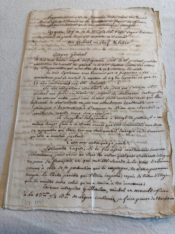
réf. 239889S.l., s.d. (janvier 1800) in-folio, [10] ff. n. ch., couverts de plusieurs écritures très lisibles, en feuilles.
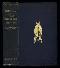
1889réf. 035576London: Sampson Low Marston Searle & Rivington. 1889. 1st Edition 1st Printing. Hardcover. Good/No Jacket. 8vo - over 7¾ - 9¾" tall. Good. Publishers cloth embossed with gilt lettering and emblem to upper cover. Front hinge cracked. Gift inscription in contemporaneous hand to free front endpaper. A touch of foxing. Two of the maps have a dog-eared fore-edge where they have not been folded quite flush with the page edges. Illustrated with tissue-guarded colour frontispiece of the ship tissue-guarded portrait of the author and 6 fold-out maps. xi i 531pp 32pp of publishers ads to rear. FIRST EDITION of the posthumously published journal by the captain who came closest to the site where Franklin's expedition ended. "In 1849 Collinson was appointed to command an expedition for the relief of Sir John Franklin by way of the Bering Strait; he himself had command of the Enterprise and with him was Commander Robert Le Mesurier McClure in the Investigator. The two ships sailed together from Plymouth on 20 January 1850 but unfortunately separated in the neighbourhood of Cape Horn and did not meet again. The Enterprise passed Point Barrow Alaska on 21 August but the ice forced Collinson to return south and winter in Hong Kong. In 1851 he was again hampered by ice and in 1852 was frozen in at Cambridge Bay for the winter. In 1853 the Enterprise was caught in the ice at Camden Bay and there passed a third winter. She reached Point Barrow on 8 August 1854 after being shut up in the Arctic entirely on her own resources for upwards of three years. Of the many who had searched for Franklin Collinson came closest to the place where the expedition had ended. Collinson's addition to geographical knowledge on this Arctic trip was very considerable and would have been tantamount to the discovery of the north-west passage had this not been already actually achieved by the men of the Investigator" DNB. Arctic Bibliography 3351; Hill 337; Ricks p 68; Tourville 986. Sampson Low, Marston, Searle, & Rivington. hardcover
réf. 50306For the lot of approximately 250 items $6000. a Correspondence with various government officials hunting guides and others involved with preparing and carrying out the trip including14 letters to Furlong typed and autograph one accompanied by four photographs of members of the expedition with trophies; five retained copies of letters from Furlong to the correspondents four telegrams seven typed and manuscript recapitulations of various aspects of the trip e.g. titles for the "Dance of the Nandi" film and a three page typed press release on the expedition dated Nairobi 27 March 1930 accompanied by a photograph of Furlong and two bearers with a leopard he has killed. b Two hunting licenses issued by the Uganda Protectorate to Furlong 22 April 1930 one "For a First Elephant" the other a "Visitor's Full Game License." c Three maps period road map of Kenya and Uganda published by Bullows and Roy for the Royal East Africa Automobile Assn.; Map Showing Cairo-Mombasa Route published by the Sudan Survey Dept Khartoum 1929; and a period National Geographic Society map of Africa. d An account book narrow 12mo 19 pp. 22 March - 8 June 1930 and approximately 125 receipts most partly printed for a wide range of services and material necessary for the trip. e 21 photographs in addition to those mentioned above many picturing Furlong in the field with his rifle and trophies some with Furlong's notations on verso and 34 unused photo postcards featuring tribesmen animals and scenery of East Africa. f 42 promotional pamphlets ca. 1925-1934 for the various parts of Africa along Furlong's route 36 of which are unrecorded on OCLC. The pamphlets were issued by African railway companies and governmental agencies outfitters e.g. Thomas Cook and "Safari Africa Limited" London ship lines and other travel agencies and taxidermy concerns. g A wooden carved string instrument from the Para Mountains in present day Tanzania with Furlong's ownership label "Col. Wellington Furlong / c/o Safariland Ltd. / Musical Instrument / Para Mountains" still attached; the instrument is shaped like a hollowed-out bread tray 27 x 7 1/2 inches three holes in the shape of crosses in the bottom six strings stretched across the opening. Furlong 1874-1967; American explorer army officer author artist and photographer embarked on this big game expedition in 1930 partly as an effort to recover relics of Sir Henry M Stanley in East and Central Africa. Gateway to the Sahara New York 1909 is among several books he published. A member of the Explorers Club he was the first American to explore the interior of Tierra del Fuego 1907-1908. Most of his personal papers are held by the Stefansson Collection at Dartmouth. unknown