1 357 résultats
réf. BL2086Albuquerque:: University of New Mexico Press N.D. Oblong 8vo. xiii 232 pp. Heavily illustrated with photographs index. Brown cloth gilt-stamped spine title dust-jacket. Burndy bookplate. Fine. ISBN: 0826328105 University of New Mexico Press, (N.D.). hardcover books
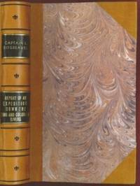
1853réf. E0014198 pages with 23 plates. Royal octavo 9 1/2" x 6" rebound in 3/4 leather with marbled boards and black label with gilt lettering to spine. 79 plates with one Buffalo Dance folding and some with a single tint in this first issue there are errors in the list of illustrations corrected in later issues viz. Landscapes etc. 23 plates numbered as 1-13 15-23 plus one unnumbered at end; Mammals 6 plates; Birds 5 plates numbered 1 3-6 plate 2 Struthus Canicops Woodhouse male is called for but not present and most likely not to be found in this issue; Reptiles 21 plates with 10a miss-numbered as 10 12 as 13 and 13 as 16; Fishes 3 plates; Plants 21 plates plate 21 Aploppus Nuttalii present but not called for. Includes Reconnaissance of the Zuni Little Colorado and Colorado Rivers Made in 1851 map as called for but includes Lithographed map Boundary of the Creek Country 24" x 36" laid in not called for. Senate Executive Document 59 Howes: 528 First edition. Survey of the watershed of the Canadian River and Red Fork of the Arkansas River in Indian Territory extending from Fort Smith to the border with Texas. The lands of the Cherokee Creek Seminole and Choctaw Indians are located. The map locates numerous forts including Smith Coffee Gibson and Old Fort Holmes and their connecting wagon roads. Talasee is shown at the site of Tulsa. This map was issued with the "Northern and Western Boundary Line of the Creek Country" report by Sitgreaves and Lt. J.C. Woodruff. The surveys were made in 1848 and 1850 but the report in which the map was issued wasn't published until 1858. After the conquest of New Mexico and California it was apparent that transportation and communications needed to be improved between these new territories and the rest of the United States east of the Mississippi. Geographical knowledge of most of this area particularly northwestern New Mexico now northern Arizona was very limited and inaccurate. Some maps of the day showed a river system that might provide a possible navigable water corridor between New Mexico and the Gulf of California via the Zuni Little Colorado and Colorado Rivers. In September of 1851 Captain Lorenzo Sitgreaves along with a small crew of topographers naturalists artists and support personnel and an escort of 30 infantrymen left the Zuni Pueblo in western New Mexico by pack train with instructions to explore and map the Zuni and Colorado Rivers and evaluate their navigability in light of a possible impending war with the Mormons in Utah. They traveled southwest along the Zuni River to its mouth and then headed northwest along the Little Colorado intending to follow it to the Colorado. When they reached Grand Falls northwest of present-day Winslow Arizona their guide Antoine Leroux advised them that it was unwise to follow the river any further because it flowed in a deep canyon for the rest of its course and emptied into the great canyon of the Colorado River. They left the river and struck off due west around the north side of the San Francisco Mountains discovering the Wupatki Indian Ruins along the way and looped southwestward around the south side of Bill Williams Mountain. The rest of their westward march followed near the future alignment of Route 66 to the Colorado River near the modern town of Bullhead City Arizona. After a difficult march south along the Colorado River they reached Camp Yuma on November 30. Of course Sitgreaves discovered that the Zuni and Little Colorado Rivers were not at all navigable and would be useless to transport troops and supplies. The Colorado River however was found to be navigable along the entire distance that he explored. Sitgreaves' official report "Report of an Expedition Down the Zuni and Colorado Rivers in 1851" was published in 1853. Condition: Foxing left margin trimmed as issued for folding all other plates present as called for in Howes as well as Lithographed map Boundary of the Creek Country laid in and not called for some folding. Rebound in attractive three quarter leather else a about very good. Robert Armstrong hardcover books
1954réf. 21020New York: E.P. Dutton 1954. Hardcover. Very good/near fine. First American edition signed on the front free endpaper by expedition members Edmund Hillary George Lowe and Charles Evans and the London Times correspondent James Morris now Jan Morris who accompanied the party. xx 300 pp with index photographic illustrations. Two-tone cloth boards have some old inert mildew spotting internally clean and sound. Original owner's name at top of front free endpaper well above the signatures. Dust jacket has minor creasing to top of front panel and one 1/4 inch closed tear. Original $6.00 price present. Account of the 1953 British Mount Everest Expedition which when Edmund Hillary and Tenzing Norgay reached the summit on May 29 was the first confirmed complete ascent. Hunt led the expedition with physician Charles Evans as his deputy. Evans was the leader of the first expedition to summit Kangchenjunga the world's third highest peak in 1955. George Lowe directed an Academy Award-nomnated documentary during the Everest expedition and went on to join the Commonwealth Trans-Antarctic Expedition--the first to reach the South Pole by land since Amundsen 1911 and Scott 1912--and to participate in many other notable mountaineering expeditions. Neate H135. E.P. Dutton hardcover books
1843réf. E01482 volumes. xxxvii23878 ad pages with frontispiece woodcuts in text and 7 steel-engraved plates; vi2474 pages with frontispiece woodcuts in texts and 10 steel-engraved plates. Royal octavo 9¼x5½" in publisher's original green cloth spine lettered in gilt covers decorative blind stamped. First Edition. In 1825 Edward Belcher accompanied Frederick William Beechey's expedition to the Pacific and Bering Strait as a surveyor. In 1836. he commanded a surveying ship on the north and west coasts of Africa and in the British seas. Belcher took up the work which Beechey had left unfinished on the Pacific coast of South America. He was on board the bomb vessel HMS Sulphur which was ordered to return to England in 1839 by the Trans-Pacific route. Belcher made various observations at a number of islands which he visited having been delayed by being dispatched to take part in the war in China in 1840. On 26 January 1841 the then Commander Belcher landed on Possession Point at the north shore Hong Kong Island and made the first British survey of Hong Kong harbor. After the war's end in 1842 he reached home and for his services was made a Knight Bachelor in the following year. He was then engaged in HMS Samarang in surveying work in the East Indies the Philippines Geomun-do Port Hamilton and other places until 1847. In 1852 Belcher led the last and largest Admiralty expedition to rescue Sir John Franklin. He was also to look for his former surveying officer in Hong Kong Richard Collinson and Robert McClure whose ships had not been seen after entering the Bering Strait. He did a great deal of sledge exploration rescued McClure and abandoned four of his five ships in the ice. He had five ships: Assistance Belcher Resolute Henry Kellett second mate George Nares the steam tenders PioneerSherard Osborn and Intrepid Leopold McClintock and the depot ship North Star William Pullen. Belcher and one tender were to enter Wellington Channel where Franklin was thought to be while Kellett was to go west to Melville Island and look for Collinson and McClure. North Star was to stay at Beechey Island as a supply base. He left the Nore in April 1850. By early winter Assistanceand Pioneer were frozen in at Northumberland Sound to the north of Wellington Channel while Resolute and Intrepid were frozen in off Melville Island Arctic—the first ships this far west since William Edward Parry in 1819. A great deal of exploration was done by man-hauled sledges. In April 1853 Leopold McClintock and others left the Resolute on sledges and returned 105 days later having covered 1400 miles and discovered Prince Patrick Island. Another party went west and discovered Robert McClure whose ship was frozen in at Mercy Bay. Belcher went north by sledge and found a channel at the northern tip of Devon Island hinting that Franklin might have used it to escape to Baffin Bay. When the ice broke up that summer he pushed his ships up Wellington Channel and became trapped again. By February 1854 Belcher was becoming increasingly worried about the safety of his ships and men. In April he ordered Kellett to abandon his ships and return by sledge to North Star. Belcher abandoned his two ships in late July. Aided by two ships that showed up at Beechey Island Phoenix and Breadalbane the whole party returned to England. Belcher went through a court martial which was automatic for any captain who had lost a ship. He was exonerated but his sword was returned to him 'without observation'. He never again received an active command. Curiously Resolute broke free of the ice and drifted all the way to Davis Strait where it was picked up by an American whaler. Condition: Some staining and wear to covers spines a bit faded ends chipped and worn rear joint of Vol. I with chipping and loss; hinges repaired at endpapers some light foxing and occasional mostly marginal damp staining within the three folding maps which should be loose in a pocket not present; overall good uncommon in the original cloth. Henry Colburn hardcover books
1779réf. BOOKS0003374282 pages lacking the map. Small quarto 10" x 7½" rebound in ¾ morocco & marbled boards spine lettered in gilt top edges gilt. Sabin 22572 First edition. Rare account of travels into the arctic most notably Nova Zemblya to the north of Europe. Twelve years earlier Engel wrote his notable work on explorations on the other side of the Arctic Circle Memoires et observations geographiques et critiques sur la situation des pays septentrionaux de l'Asie et de l'Amerique. Lausanne 1765. Condition: Rubbing to joints and extremities; some minor staining and soiling within hinge professionally repaired else a very good copy. Only five copies found on worldcat. F Sanuel Fetscherin hardcover books
1802réf. E01512 volumes with Atlas. 4xxiv385 pages with xxii-xxiv lists books of voyages available from the publisher; 4418 pages with appendix containing vocabularies of the languages of Yukagir Yakut Tungoose Kamchatka the Aleutian Islands and Kadiak and inex. Atlas with title list of plates 14 engraved plates & large folding engraved map. Text volumes are small octavo 7¾" x 4½" 19th century quarter calf & boards spines tooled in gilt morocco lettering pieces; atlas is quarto 11" x 7½" in period tree calf spine tooled in gilt. Translated by J Castéra. Howes S-117 First French Edition. Martin Sauer was an English civil servant who knew Russian French and German. He became acquainted with Joseph Billings in St Petersburg in the 1780s. He agreed to join Billings expedition as his secretary and interpreter. It was agreed that he would write the official account but there is some controversy about his actives when he returned to St Petersburg in 1794. It has been suggested that he left hurriedly for England with much of the important archival material from the voyage including diaries and secret reports so that he could publish a record of the expedition before Russian authorities and scholars in the Academy of Sciences could review its details. Sauer's An account of the Geographical and Astronomical Expedition to the Northern Parts of Russia was published in London in 1802. It contains an abundance of detail about eastern Siberia and the Aleutian Islands and records the expeditions visits to Kodiak Island Prince William Sound and the coast south as far as Yakutat Bay. The chart was made by Aaron Arrowsmith from Sauer's notes and Billings observations and the whole complements well the other contemporary accounts of the expedition by the cartographer Gavriil Sarychev and the naturalist Carl Heinrich Merck. Aaron Arrowsmith 1750–1823 was an English cartographer engraver and publisher and founding member of the Arrowsmith family of geographers. He moved to Soho Square London from Winston County Durham when about twenty years of age and was employed by John Cary the engraver and William Faden. He became Hydrographer to the Prince of Wales ca. 1810 and subsequently to the King in 1820. In January 1790 he made himself famous by his large chart of the world on Mercator projection. Four years later he published another large map of the world on the globular projection with a companion volume of explanation. Condition: Some rubbing and wear to coves of both atlas and text volumes some chipping to spine ends small gouge at back of atlas and stamp to front end paper else in very good condition. Chez F Buisson hardcover books
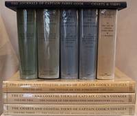
1955réf. E01069 volumes including the three atlas volumes and portfolio volume. Volume I: The Voyage of the Endeavour cclxxxiv696 pages with 20 maps 25 illustrations including color frontispiece appendix and index. Reprinted with addenda and corrigenda. Volume II: The Voyage of the Resolution and Adventure 1772-1775 clxx1028 pages with 19 maps 63 illustrations appendixes and index. Half-title gives II as number within the set. Reprinted with addenda and corrigenda. Volume III parts 1 and 2: The Voyage of the Resolution and Discovery 1776-1780 Part One ccxxiv718 pages with 17 maps and 64 illustrations. Half-title gives III as number within set. Admiralty instructions and the journal of the Third Voyage with supplementary extracts from journals or logs by James King Charles Clerke James Burney Richard Gilbert Thomas Edgar. Part 2: viii723-1647 with 2 maps 10 illustrations appendixes and index. Volume IV: The Life of Captain James Cook xi760 pages with 11 maps 38 illustrations bibliography and index. Written by J. C. Beaglehole. First separately published by A. and C. Black 1974 then for the Hakluyt Society. These volumes in royal octavo 9 1/2 x 6 1/2" bound in original publisher's deep blue cloth with blind stamped silhouette of Cook in gilt on front boards and gilt lettering to spines. Portfolio Charts & Views Drawn by Cook and his Officers and reproduced from the Original Manuscripts edited by R. A. Skelton. Pages viii with 58 loose maps charts plans profiles views and other illustrations some folding folio 15 3/4" x 10 1/2" in original blue cloth portfolio with gilt pictorial of cook on front in original jackets except for portfolio volume. The Charts & Coastal Views. Volume One: The Voyage of the Endeavour 1768-1771 With a Descriptive Catalog of all the known original surveys and coastal views and the original engravings associated with them. Together with original drawings of the Endeavour and her boats lxiv328 pages with color frontispiece 480 half-tone plates and index. Volume Two: The Voyage of the Resolution and Adventure 1772-1775 c332 pages with color frontispiece 23 color plates 320 half-tone plates and appendixes. Volume three: The Voyage of the Resolution and Discovery 1776-1780 . together with the running journal of James King 1779-80 cxxxvi319 pages with color frontispiece 22 color plates 298 half-tone plates and appendixes. Volumes chief editor Andrew David. Assistant Editors for the Views Rudiger Joppien and Bernard Smith. Folios 17 1/4" x 11" bound in original publisher's deep blue cloth with gilt lettering to spine and pictorial representation of the ship Victoria embossed in gilt on front covers. Hakluyt Society Extra Series 34a 34b 35 36a 36b 37 43 44 and 46. First printings. Condition: Lacks jacket for portfolio volume and the spine head is bumped. Jackets: Volume one volume three part two price clipped some jackets spines toned Charts & Coastal Views with some edge wear and closed tears else a near fine set in like jackets. Hakluyt Society hardcover books
réf. 30786Other: Other. Very Good. Hardcover. by Members of the Expedition. NY 1935. 325 pages clothbound no jacket very good condition. Binding a little rubbed and sunned but firm. . Other hardcover books
1856réf. E05603 volumes: xvii1537 pages with 90 lithographs plates including the usual expunged bathing plate many in color including 3 "facsimiles" of Japanese woodblock prints 2 folding; 6 maps and charts 2 folding; 79 woodcuts in the text; 2414414-1xi pages with 4 color lithographs of Chinese scenes; 2 uncolored natural history engraved plates; 6 hand-colored lithographs of birds; 10 hand-colored steel-engravings of fish; 5 lithographs of shells 2 hand-colored; 16 diagram plates of winds and currents; 14-page facsimile of Japanese language version of the U.S.-Japan treaty; 17 folding charts on 16 sheets; numerous woodcuts in the text; xliii17051 pages woodcut star charts throughout. Volume III titled "United States Japan Expedition. Observations on the zodiacal light from April 2 1853 to April 22 1855 . by Rev. George Jones A.M. chaplain United States Navy". Quarto 11½ x8 ¾" bound in the original blind stamped cloth. Volume 1 rebacked with the original cloth spine laid down. Hill 1332; Sabin 30968 First edition of the House Issue. Detailed and profusely illustrated account of Perry's expedition to open Japan to the West; Upon his return to the U.S. his chief duty for the following year was to compile his reports of the expedition aided by Francis Hawks. The first volume has the account of the voyage and lithographs of the travel; the second volume has the natural history reports by D.S. Green and others and includes hand-colored plates of Japanese fishes and shells. In addition to the artist W. Heine from whose drawings a great number of the lithographs were made the daguerreotypist E. Brown Jr. went on the expedition taking what were undoubtedly the earliest photographic images of Japan many of them reproduced lithographically in this work. This copy with the nude bathing plate which was not included on the list of plates and not issued in all copies. In advance of his voyage to the Far East Commodore Perry read widely amongst available books about Tokugawa Japan. His research even included consultation with the increasingly well-known Japanologist Philipp Franz von Siebold who had lived on the Dutch island of Dejima for eight years before retiring to Leiden in the Netherlands. In 1852 Perry embarked from Norfolk Virginia for Japan in command of a squadron in search of a Japanese trade treaty. Aboard a black-hulled steam frigate he ported Mississippi Plymouth Saratoga and Susquehanna at Uraga Harbor near Edo modern Tokyo on July 8 1853. His actions at this crucial juncture were informed by a careful study of Japan's previous contacts with Western ships and what could be known about the Japanese hierarchical culture. He was met by representatives of the Tokugawa Shogunate who told him to proceed to Nagasaki where there was limited trade with the Netherlands and which was the only Japanese port open to foreigners at that time. Perry refused to leave and demanded permission to present a letter from President Millard Fillmore threatening force if he was denied. Perry ordered his ships to attack several buildings around the harbor to demonstrate US naval power. The Commodore was fully prepared for more hostilities if his negotiations with the Japanese failed and threatened to use unrestrained fire if the Japanese refused to negotiate. He sent two white flags to them telling them to hoist the flags when they wished a bombardment from his fleet to cease and to surrender. Perry's ships were equipped with new Paixhans shell guns capable of wreaking great destruction with every shell. The Japanese military forces could not resist Perry's modern weaponry; the term "Black Ships" in Japan would later come to symbolize a threat imposed by Western technology. Perry returned in February 1854 with twice as many ships finding that the delegates had prepared a treaty embodying virtually all the demands in Fillmore's letter. Perry signed the Convention of Kanagawa on March 31 1854 and departed mistakenly believing the agreement had been made with imperial representatives. The agreement was made with the Shogun the de facto ruler of Japan. On his way to Japan Perry anchored off Keelung in Formosa modern day Taiwan for ten days. Perry and crew members landed on Formosa and investigated the potential of mining the coal deposits in that area. He emphasized in his reports that Formosa provided a convenient mid-way trade location. Formosa was also very defensible. It could serve as a base for exploration as Cuba had done for the Spanish in the Americas. Occupying Formosa could help the US to counter European monopolization of the major trade routes. President Franklin Pierce declined the suggestion remarking such a remote possession would be an unnecessary drain of resources and that he would be unlikely to receive the consent of Congress. When Perry returned to the United States in 1855 Congress voted to grant him a reward of $20000 in appreciation of his work in Japan. Perry used part of this money to prepare and publish a report on the expedition in three volumes titled Narrative of the Expedition of an American Squadron to the China Seas and Japan. He was also advanced to the grade of rear-admiral on the retired list when his health began to fail as a reward for his services in the Far East. Condition: Wear and fading to cloth first volume rebacked; large map detached several others with stub tears and splitting to folds; light foxing else good to very good. A O P Nicholson hardcover books
1749réf. E05292 volumes. 182 pages with fold out frontispiece map and three additional folding engravings; 319 pages with seven folding engravings. half-titles in each title pages improperly marked first volume as second and vice versa. Duodecimo 6 1/2" x 3 1/2" bound in original publisher's full uniform contemporary French sponged calf with gilt-tooled spines. First French edition after the 1748 English edition. Henry Ellis was a traveler hydrographer and colonial governor returned from Italy in 1746 just in time to find an expedition to search for a north-west passage on the point of sailing. He appears to have been in easy circumstances; his name stands in the list of subscribers to the north-west expedition and he had sufficient interest to get attached to it nominally as agent for the committee and really as hydrographer surveyor and mineralogist the expedition consisting of two vessels the Dobbs galley of 180 and California of 150 tons left Gravesend on 20 May 1746 joined the Hudson's Bay convoy in Hollesley Bay and finally sailed from Yarmouth on the 31st. They parted from the convoy on 18 June made Resolution Island on 8 July and after a tedious passage through Hudson's Straits rounded Cape Digges on 8 August and on the 11th 'made the land on the west side the Welcome in latitude 64° N.' Bad weather drove them to the southward and prevented their doing anything more that season. They wintered in Hayes River in a creek about three miles above Fort York where a quarrel with the agent of the Hudson's Bay Company gave an unwonted piquancy to the dark and weary days. They suffered much from scurvy the prevalence of which Ellis attributes to their having got two kegs of brandy from Fort York for their Christmas merrymaking and in a minor degree to the 'governor' not permitting the Indians to supply them with fresh provisions. On 29 May 1747 the ice broke up and they were able to warp to the mouth of their creek; on 9 June they got down to Fort York. There they were allowed to get some provisions and stores and on the 24th cleared the river and 'stood to the northward on the discovery'. On 1 July each of the two ships sent away her long-boat but owing apparently to some ill-feeling between the two captains without any prearranged plan for working in concert. The consequence was that they separately went over the same ground discovering naming and examining the several creeks and inlets on the west side of Hudson's Bay the double examination perhaps compensating for the confusion arising from the double naming. Before the season closed in they had satisfied themselves that the only possible exit from Hudson's Bay on the west must be through the Welcome and that very probably there was no way out except that on the east by which they had come in. The result may not seem much; but as it served to put an end to the idea that the passage must lie through Hudson's Bay it was at least so much gain to accurate knowledge. After 21 August the weather broke and they decided in council 'to bear away for England without further delay.' On the 29th they entered Hudson's Straits passed Resolution Island on 9 September and arrived at Yarmouth on 14 Octivwe. Ellis's share in the work of the expedition had really been very slender but the reputation of it has been commonly assigned to him by reason of the narrative which he published the following year under the title A Voyage to Hudson's Bay by the DobbsGalley and California in the years 1746 and 1747 for Discovering a North-West Passage 1748; a work which with many valuable observations on tides on the vagaries of the compass and on the customs of the Eskimos a people then practically unknown mingles a great deal of speculation on the certain existence of the passage on magnetism on fogs on rust and other matters all more or less ingenious but now known to be wildly erroneous. Such as it was the book commended its author to the scientific workers of the day and on 8 February 1748-9 he was elected a fellow of the Royal Society. Possibly in acknowledgment of his scientific labors but more probably by some family interest he was afterwards appointed successively governor of Georgia and of Nova Scotia from which employment he retired about 1770. He seems to have spent his later years as a wanderer on the continent was at Marseilles in 1775 and died at Naples on 21 January 1806. Condition: Some dark spot to spine else a very good copy. Ballard Fils hardcover books
1700réf. E0566xxiii43313 table pages with two folding maps of the Marsianes and Guam. Duodecimo 6 1/2 x 3 1/4" bound in contemporary full sheep with red label in gilt spine and five raised spine bands speckled red end pages. Brunet 28230 Cioranescu 41783 First edition. Charles Le Gobien was a French Jesuit writer founder of the Lettres édifiantes et curieuses a collection of reports from Jesuit missionaries in China. It is a major source of information for the history of Catholic missions and life in China in those times. Le Gobien was born at Saint-Malo Brittany. He entered the Society of Jesus on 25 November 1671. As professor of philosophy and especially while procurator of the Franco-Chinese mission he sought in a series of papers to awaken interest in the work of Christianizing Eastern Asia. In 1697 appeared at Paris his Lettres sur les progréz de la religion à la Chine. Apropos of Chinese Rites controversy he published among other things Histoire de l'édit de l'empereur de la Chine en faveur de la religion chrétienne avec un éclaircissement sur les honneurs que les Chinois rendent à Confucius et aux morts Paris 1698; and in the year 1700: Lettre à un Docteur de la Faculté de Paris sur les propositions déférées en Sorbonne par M. Prioux. Under the same date there appeared in Paris the Histoire des Isles Mariannes nouvellement converties à la religion chrétienne. The second part translated into Spanish by J. Delgado is found in the latter's Historia General de Filipinas Manila 1892. In 1702 Père Le Gobien published Lettres de quelques missionnaires de la Compagnie de Jésus écrites de la Chine et des Indes Orientales; this was the beginning of the collection soon to become celebrated under the title of Lettres édifiantes et curieuses écrites des missions étrangéres par quelques missionnaires de la Compagnie de Jésus. The first eight series were by Le Gobien the latter ones by Fathers Du Halde Patouillet Geoffroy and Maréchal. The collection was printed in thirty-six volumes duodecimo Paris 1703–76 and reissued in 1780-81 by Fathers Yves de Querbeux and Brotier in twenty-six volumes duodecimo omitting the prefaces. New editions appeared in 1819 1829–32 and 1838-43. One abridgment in four volumes octavo was entitled Panthéon Littéraire by L. Aimé Martin 1834–43. A partial English translation came out in London in 1714. The publication incited the Austrian Jesuit Stöcklein to undertake his Neuer Welt Bott about 1720 at first considered merely a translation but soon an independent and particularly valuable collection five volumes folio in forty parts substantially completing the Lettres Edifiantes. This is a history of the Christian missions in the Marianas or Ladrones Islands in the north-western Pacific the principal island of which is Guam. Reprinted in the text are several letters from early missionaries Medina Clain Sanvitores &c. The Jesuit mission was established there by Diego Luis de Sanvitores. Father Le Gobien never visited the Mariana islands but based his account chiefly on the relations and letters of missionaries sent to him from Rome Spain the Netherlands etc. Includes a letter by P. Clain about the discovery of the Caroline Islands. Condition: Rebacked with original spine laid down provenance: Jesuit College library with old stamps to front free endpaper half title and title page else about very good. Nicolas Pepie hardcover books
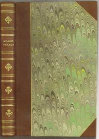
1818réf. E0061323 pages with a portrait frontispiece and five colored aquatints. Octavo 8 3/4" x 5 1/2" bound in attractive half leather with marbled boards and gilt lettering to spine. Hill 1168 Second and best edition The Alceste brought Lord Amherst to China to serve as ambassador and specifically to negotiate the China trade at the time a matter of dispute between China and Great Britain.M'Leod who was surgeon on the ship describes the voyage out the various calls in the East Indies including touching at Batavia surveying off Korea the visit to Okinawa another to Manila and the shipwreck off the coast of Sumatra and subsequent rescue from Malay pirates. A brief but interesting interview with Napoleon at St. Helena is also included in the narrative. This was one of the most popular travel books of its time portraying the Far East to a much wider audience than had been reached by earlier accounts. The idyllic descriptions of Lewchew undoubtedly appealed to the romantic sensibilities of the era. Indeed buoyed by its success M'Leod published another work recounting his time as a slaver A Voyage to Africa with some Account of the Manners and Customs of the Dahomian People. Condition: Attractive half rebind some foxing through out with no spotting to plates else a very good copy. John Murray hardcover books
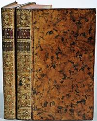
1799réf. biblio160First French edition of Bartram's Travels which chronicled his explorations of the southern British colonies in North America from 1773–1777 2 volumes. 457 pages with frontispiece engraved portrait by Bovinet Mico Chlucco Grana King of the Seminoles and one folding plate; 436 pages without title with large folding map by J.B. Poirson engraved by Alexandre Blondeau and folding plate. Octavo 8 1/4" x 5 1/4" bound in half leather with six spine compartments with red and black labels in gilt over original marbled boards. Translated by Pierre Vincent Benoist. Sabin 3871; Palau 251346; Howes B223; Field 94 First French edition. William Bartram was an American naturalist. The son of the naturalist John Bartram. As a boy he accompanied his father on many of his travels to the Catskill Mountains the New Jersey Pine Barrens New England and Florida. In 1773 he embarked upon a four-year journey through eight southern colonies. Bartram made many drawings and took notes on the native flora and fauna and the native American Indians. In 1774 he explored the St. Johns River where he had memorable encounters with aggressive alligators and also visited a principal Seminole village at Cuscowilla where his arrival was celebrated with a great feast. He met Ahaya the Cowkeeper chief of the Alachua band of the Seminole tribe. When Bartram explained to the Cowkeeper that he was interested in studying the local plants and animals the chief was amused and began calling him Puc Puggy the flower hunter.2 Bartram continued his explorations of the Alachua Savannah or what is today Paynes Prairie. William Bartram wrote of his experiences exploring the Southeast in his book Travels through North & South Carolina East & West Florida the Cherokee Country the Extensive Territories of the Muscogulges or Creek Confederacy and the Country of the Chactaws Containing an Account of the Soil and Natural Productions of Those Regions Together with Observations on the Manners of the Indians published in 1791 and which is today simply known as Bartram's Travels. It was considered at the time one of the foremost books on American natural history. Many of Bartram's accounts of historical sites were the earliest records including the Georgia mound site of Ocmulgee. In addition to its contributions to scientific knowledge Travels is noted for its original descriptions of the American countryside. Bartram's writing influenced many of the Romantic writers of the day. William Wordsworth Samuel Taylor Coleridge and François René de Chateaubriand are known to have read the book and its influence can be seen in many of their works. Ephraim George Squier and Edwin Hamilton Davis in their book Ancient Monuments of the Mississippi Valley name Bartram as "the first naturalist who penetrated the dense tropical forests of Florida." Condition: Some rubbing to original boards page 143 of volume one has small burn mark affecting text half title bound upside down in back old water stain to plate of volume two. Fold-out map has repair to first fold internally pages are clean and free of toning and foxing else a very good copy. Chez Carteret et Brosson and Dogour Duran hardcover books
1848réf. E0530614 pages illustrated with 64 lithographed or engraved plates 3 battle-plans plus some figure drawings within the text. Octavo 8¾x5¼" bound in original publisher's black cloth and paper spine label. Thirtieth Congress - First Session. Ex. Doc. NO. 41. Cowan page 195; Graff 1249; Howes E145; Wagner-Camp 148:5; Zamorano Eighty 33 First edition House of Representatives issues of the report containing the reports of Lieutenant Abert Colonel Cooke and Captain Johnson as well as that of Emory; the Senate issue only contained the Emory report. In 1844 Emory served in an expedition that produced a new map of Texan claims westward to the Rio Grande. He came to public attention as the author of the Notes of a Military Reconnaissance from Fort Leavenworth in Missouri to San Diego California published by the Thirtieth United States Congress in 1848. This report described terrain and rivers cities and forts and made observations about Indians Mexicans primarily in New Mexico Territory Arizona Territory and Southern California. It was and is considered one of the important chronicles and descriptions of the historic Southwest particularly noted for its maps. Emory was a reliable and conscientious cartographer. There is a story of testament as to Emory's dedication to accuracy that says John Bartlett his supervisor in the Corps of Topographical Engineers made him sign off on a misplaced boundary marker creating a sweet revenge for Emory who replaced him as Head of the International Boundary Commission in 1855. So accurate were his maps that when topographical engineers were surveying possible routes for the transcontinental railroad the most Southern route did not need to be surveyed thanks to the outstanding work by William H. Emory. But William H. Emory did more than just map the terrain; he also made notes about the plant life as well as the people who inhabited the sparsely populated southwest. Notating the social relations of some of the Native American people he wrote: "Women when captured are taken as wives by those who capture them but they are treated by the Indian wives of the capturers as slaves and made to carry wood and water; if they chance to be pretty or receive too much attention from their lords and masters they are in the absence of the latter unmercifully beaten and otherwise maltreated. The most unfortunate thing which can befall a captive woman is to be claimed by two persons. In this case she is either shot or delivered up for indiscriminate violence. Condition: Binding worn at edges and spine ends cloth splitting along front joint; occasional light foxing lacking the two maps as noted very good. Wendell & Van Benthuysen, Printers hardcover books
1925réf. 61378New York and London: Longmans Green & Edward Arnold & Co 1925. First American edition from British sheets. Large thick 8vo. xi 372 pp. Illustrated from photographs plates some in color double-page panorama large folding map at rear. With a commemorative stamp celebrating this expedition mounted on the front endpaper and signed by N.E. Odell one of the members of the expedition and a contributor of several chapters to this work underneath also underneath his ink inscription written in a local language Nepali or Hindi perhaps "The noblest lore of frontiers". Neate 573: "Norton climbed to a height of about 28100 feet without oxygen." Very good. Original gilt-stamped blue cloth. #8425. Longmans, Green & Edward Arnold & Co hardcover books
réf. 50306For the lot of approximately 250 items $6000. a Correspondence with various government officials hunting guides and others involved with preparing and carrying out the trip including14 letters to Furlong typed and autograph one accompanied by four photographs of members of the expedition with trophies; five retained copies of letters from Furlong to the correspondents four telegrams seven typed and manuscript recapitulations of various aspects of the trip e.g. titles for the "Dance of the Nandi" film and a three page typed press release on the expedition dated Nairobi 27 March 1930 accompanied by a photograph of Furlong and two bearers with a leopard he has killed. b Two hunting licenses issued by the Uganda Protectorate to Furlong 22 April 1930 one "For a First Elephant" the other a "Visitor's Full Game License." c Three maps period road map of Kenya and Uganda published by Bullows and Roy for the Royal East Africa Automobile Assn.; Map Showing Cairo-Mombasa Route published by the Sudan Survey Dept Khartoum 1929; and a period National Geographic Society map of Africa. d An account book narrow 12mo 19 pp. 22 March - 8 June 1930 and approximately 125 receipts most partly printed for a wide range of services and material necessary for the trip. e 21 photographs in addition to those mentioned above many picturing Furlong in the field with his rifle and trophies some with Furlong's notations on verso and 34 unused photo postcards featuring tribesmen animals and scenery of East Africa. f 42 promotional pamphlets ca. 1925-1934 for the various parts of Africa along Furlong's route 36 of which are unrecorded on OCLC. The pamphlets were issued by African railway companies and governmental agencies outfitters e.g. Thomas Cook and "Safari Africa Limited" London ship lines and other travel agencies and taxidermy concerns. g A wooden carved string instrument from the Para Mountains in present day Tanzania with Furlong's ownership label "Col. Wellington Furlong / c/o Safariland Ltd. / Musical Instrument / Para Mountains" still attached; the instrument is shaped like a hollowed-out bread tray 27 x 7 1/2 inches three holes in the shape of crosses in the bottom six strings stretched across the opening. Furlong 1874-1967; American explorer army officer author artist and photographer embarked on this big game expedition in 1930 partly as an effort to recover relics of Sir Henry M Stanley in East and Central Africa. Gateway to the Sahara New York 1909 is among several books he published. A member of the Explorers Club he was the first American to explore the interior of Tierra del Fuego 1907-1908. Most of his personal papers are held by the Stefansson Collection at Dartmouth. unknown books
1884réf. 39550Washington: GPO 1884. "Voluminous documentation on the bungled attempt to rescue Greely and his men. The rescue expedition consisted of the Yantic and the Proteus the latter being lost in Kane Basin. The head of the expedition never followed his orders for re-supplying Greely" -. Arctic Bib 18416. A very good copy in quarter calf over boards. sep 22 2017. 310 265 pp. b/w photo plates folding maps. GPO hardcover books
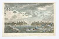
1797réf. 406875Paris: L'Imprimerie de la Republique 1797. Tape remnants from mounting along upper edge verso some foxing overall good condition and color. Hand-colored engraving by Dequevauviler after Nicolas Marie Ozanne. 9 7/8 x 15 3/4 inches image 11 x 17 inches sheet. A fine print from 'Atlas du voyage de la Perouse' depicting the capsizing of two rowboats in Alaska during La Perouse's 1786 expedition. The wreck took place off of the Port des Francais today known as Lituya Bay in Glacier Bay National Park Alaska. [L'Imprimerie de la Republique] unknown books
1964réf. 22638Glendale: Clark 1964. First Edition. 356pp. Illus. 2 maps 7 plates. Original small 4to cloth. First edition. Western Frontiersman Series Xl. With original prospectus laid in Clark hardcover books
1858réf. 4741baY2Toronto Ontario: John Lovell 1858. Book. Very good condition. Hardcover. First Edition. Octavo 8vo. Canada; Manitoba; Red River expedition 1857; Assiniboine and Saskatchewan expedition 1858; 258pages; 25.5cm; full black leather binding re-backed; inserted folded map: 35 x 77cm; part of Red River Valley north of 49th parallel to accompany report of H. Y. Hind's Canadian Red River expedition; small tear bottom left corner small breaks at 2 folds; detached folded map: 76.5 x 142cm; plan 'shewing' proposed route from Lake Superior to Red River settlement compiled from Dawson & Napier's maps T. Devine surveyor branch west Crown Lands Department Toronto 29th May 1858 Andrew Russell assistant commissioner; across map bottom: Profile of canoe route by Professor Hind horizontal scale 10 miles to 1 inch vertical scale 600 feet to 1 inch; center top of map: Plan of country between Red River settlement and Lake of the Woods scale 8 miles to inch; signed S. J. Dawson note-this is reduced copy of map from actual survey accompanying Dawson's report of 15th March 1858; Red River expedition under direction of George Gladman 1800-63 and Simon James Dawson 1820-1902; report by Henry Youle Hind 1823-1909; Canada Legislative Assembly Victoria 21 appendice No 3. A. 1858. First edition. John Lovell Hardcover books
1970réf. 31246Nicosia Cyprus: Republic of Cyprus 1970. 8vo pp. 16. Paper wraps. Illustrated with drawings plans and photographs. VG. Republic of Cyprus unknown books
1785réf. BOOKS0033095 volumes: 520 pages with frontispiece tables and six plates; 492 pages with tables 479 pages 587 pages 504 pages with nine plates. Octavo 8" x 5" bound in leather with raised spine bands and black labels with gilt lettering to spine. Complied by John Kent principally from Campbell's Lives of the Admirals Hill page 358 First Dublin edition. First published in London in 1776-1777. A London man of letters Campbell was quite successful with his numerous works of an historical and biographical nature. He collect a large and valuable library. He first published his Lives of the Admirals in four volumes in the years 1742 to 1744. There were several later editions. From 1744 to 1748 he compiled and published what became known as Campbell's enlarged edition of John Harris's Complete collection of voyages and travels originally published in 1702-1705. Campbell also made numerous important contributions to the Biographia Britannica under the signatures E and X including his own noble Scottish ancestors the Campbells. A memoir of him was inserted by Andrew Kippis in this same work. Campbell was an expert on the histories of Spain Portugal France and the British and the Dutch. In 1765he was appointed the royal agent for the province of Georgia and held that office until his death. There are many interesting references to him in James Boswell's Life of Johnson. John Kent published only tow editions of his compilation; this one and one published in London in 1776-1777. Condition: New spines with original leather boards. Volume one closed page edge tears with occasional page edges chipped only affecting margins. volume two damp stain to title gutter some occasional foxing. Some pages stained else a good to very good set Printed for J Williams hardcover books
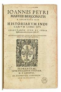
1588réf. E05544-5702 blank28 pages. Folio 12 1/2" x 8 1/4" title with wood cut printer's device bound in contemporary vellum. European Americana 588/57; Palau 146976; Sabin 146976 First edition of Maffei's great history of India. Ten Latin editions two in Italian and two in French appeared before 1621. Based on primary material it still remains a valuable account today. The work is divided into 16 books. Most of it deals with the Portuguese conquests and Jesuit missionary work in the East Indies and India up to about 1557 Borba de Moraes page 508 "a classic work on the subject . writes extensively about Brazil describing it very accurately"; Maffie was the firs author to use Jesuit letters extensively as well as many secular sources including Fernando Mendes Pinto. Condition: Contemporary velum with moderate wear re-backed in vellum with original spine label laid down; minor worming and foxing intermittent moderate damp staining pages 410 and 419 blank due to a printing error; early inscription and inked stamped on title page new end papers and paste-downs else a good to very good copy. Apud Philippum Juncatam hardcover books
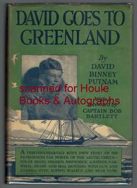
1926réf. 2222001First edition "October 1926". Octavo. Four page foreword by Bob Bartlett. Illustrated with 47 photographs and drawings by the Eskimo Kakutia; endpaper maps. Dust jacket unclipped; few nicks and creases. Very good. 167 pages. Signed and inscribed on verso of frontispiece by the publisher and father of the author: "From one who is merely. David's Dad! G. P. Putnam." G. P. Putnam's Sons hardcover books
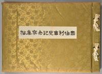
1918réf. 880611918. SIBERIAN EXPEDITION. Teikoku Gunjin Kyôiku-kai editors. SHIBERI JIHEN KINEN SHASHIN-CHÔ. Tôkyô Taishô Tsûshinsha Taishô 7 1918 Oblong folio bound western-style in cloth gilt. Illustrated throughout in collotype. Photos and cations on the International Siberian Expedition in support of the Whites against the Red Army in which the Japanese played a prominent role. 4 page folding panorama of Vladivostok harbor and views of the cities the countryside troops inhabitants diplomats war preparations etc. etc. One can feel the Winter coming. Very good condition throughout. Very scarce. unknown books