368 risultati
2007rif. BN499264Mariusz Adamski 2007. 2007. siegnac nieba. / reaching for the sky. siegnac nieba. / reaching for the sky. Polska Agencja Zeglugi Powietrznej. Polish Air Navigation Services Agency Herausgeber Editor Photos Mariusz Admaski Mariusz Adamski unknown
rif. BN168889Audio Navigation und Telematik für Kraftfahrzeuge Audio Navigation und Telematik für Kraftfahrzeuge Audio Navigation und Telematik für Kraftfahrzeuge unknown
rif. BN375463General Navigation - Air Transport Pilot´s Licence JAR-FCL Unknown Binding Unknown Binding General Navigation - Air Transport Pilot´s Licence JAR-FCL Unknown Binding Unknown Binding General Navigation - Air Transport Pilot´s Licence JAR-FCL Unknown Binding Unknown Binding unknown
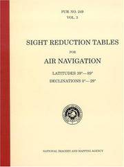
rif. BN604932PUB 249 Sight Reduction Tables for Air Navigation Volume 3: Latitudes 39° to 89° Declinations 0° to 29° Spiral-bound Jan 01 1878 PUB 249 Sight Reduction Tables for Air Navigation Volume 3: Latitudes 39° to 89° Declinations 0° to 29° Spiral-bound Jan 01 1878 PUB 249 Sight Reduction Tables for Air Navigation Volume 3: Latitudes 39° to 89° Declinations 0° to 29° Spiral-bound Jan 01 1878 unknown
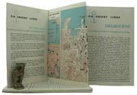
1962rif. 161834London: P&O Orient Lines 1962. Ten long single sheets folded into four five or six panels with text on one side and coloured maps on reverse the headings printed in blue & black; small cr. 8vo folded size; all numbered by hand near the top fore-corner of the upper panel with the number whited-out on number 2 Melbourne occasional slight soiling heavier on the Miami folder edges a trifle rubbed; P&O Orient Lines London 1962-1963. The folders were 'produced to assist passengers' and contain a brief history and description of each city including places of interest hotels shopping theatres currency information etc. P&O Orient Lines unknown
1990rif. BN151395U S Naval Inst Pr 1990. 1990. Marine Navigation: Piloting and Celestial and Electronic Nagivation Marine Navigation: Piloting and Celestial and Electronic Nagivation Marine Navigation - Hobbs Richard R. U S Naval Inst Pr unknown
1898rif. 80-54BGPO 1898. 1898. 740p. Folding Maps. Photos. Spine title "Naval Operations of the War with Spain". Covers the Destruction fo the USS Maine Operations in the Atlantic Cuba and Porto Rico and Pacific Manila. Original blue pebbled cloth. Heavy. Rubber stamp inside. Near Fine Copy. Hardcover. Near Fine. Book. GPO, 1898. Hardcover
2018rif. 2-4431567801Springer 2018. Paperback. New. reprint edition. 260 pages. 9.25x6.10x0.59 inches. Springer paperback
2020rif. x-9811370885Springer Nature 2020. Paperback. New. 300 pages. 9.25x6.10x0.71 inches. Springer Nature paperback
1878rif. 38742Brazil 1878. A few small holes affecting a few letters some folds reinforced on verso additions in manuscript. Broadside. 20 3/4x29 inches. The Companhia Nacional de Navegação a Vapor replaced the Companhia Brasileira de Navegação a Vapor as the government sponsored line along the southern route in 1872. Montevidio was the furthest stop of this important Brazilian shipping company from which it also provided river service to upper Brazil. The broadside contains a listing of the rates of passage from Rio de Janeiro to Montevideo as well as the limitations and restrictions for passengers which included a prohibition on weapons and flammable materials. unknown
1882rif. 17482New York: Leve & Alden's Publication Department 1882. Very good condition. Folding brochure with map of the St. Lawrence and Saguenay River and timetable with cover illustration of the river and with advertisement for Leve & Alden General Agents for the United States and list of ticket office locations. Yellow stock with black text. Descriptive text on points of interest along the route including Ha! Ha! Bay; with a Time Table commencing June 27 1882 "Until about September 10 1882" and listing departure times for the steamer "Saguenay" and "Union". With full page b&w map on the verso with the map of the Saguenay River at the top and below the map of the St. Lawrence "traversed by the Saguenay boats". The St. Lawrence route originates in Quebec and shows stops in Murray Bay Riviere du Loup and Tadousac. Lists Hon. Thomas McGreevy President Julien Chabot Manager and A. Gaboury Secretary of the Company. Folded 3 1/2 x 7 1/2". Unfolded 17 1/2 x 15". Very small area of loss at fold on lower map of St. Lawrence; short split at horizontal fold left edge o/w very good. Leve & Alden's Publication Department unknown
1898rif. 80-54GPO 1898. 1898. 740p. Folding Maps. Photos. Spine title "Naval Operations of the War with Spain". Original blue pebbled cloth. Heavy. Copy of Col. Robert D. Heinl jr USMC. Heinl wrote several of the official Marine Corps monographs on WW II battles in the Pacific. Fine Copy. Hardcover. Fine. Book. GPO, 1898. Hardcover
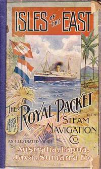
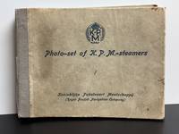
rif. 65033KPM / Royal Packet Steam Navigation Company. Batavia. 1912. . Deluxe edition of January 1912. Edited by W. LORCK. LII adverts 244 PP followed by LIII-CXXI adverts and b/w and colour illustrations plus 1 b/w plate : portrait of Her Majesty the Queen of the Netherlands; 1 plate "Time Table 1912; 1 folded plate "Accommodation plan of KPM Steel Screw Steamer "Tasman" and 2 colour plates: painting by C. H. Hoyt "Middle Harbour Sydney from Mosman Heights and "Samples of Javanese Art Work." . Papered boards with a colour illustration on front board by Tindall cloth spine. Front cover with small pieices missing at corners of front edge. Spine has been reinforced crudely. The first few pages up to VIII are somewhat damaged at the gutters without loss and most of Page III/IV has been torn off. The guide was published on superior glossy paper thus conserving its clarity and brightness. A very good copy of quite a rare item. 25.3 x 15.5. KPM / Royal Packet Steam Navigation Company. Batavia. 1912. hardcover
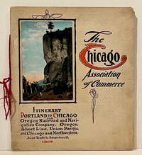
1909rif. 22859Chicago: Chicago Association of Commerce 1909. First Edition. Quarto; 8pp. Four string-tied and stapled leaves with ten 3 1/2" x 5 1/2" mounted colored illustrations each titled in red along with a map of the route. Near Fine copy in grey cardstock titled and color photograph tipped to front cover. Rare promotional piece; we fine only 1 copy at University of Michigan. This booklet was prepared by the Oregon Railroad & Navigation Company the Oregon Short Line Railroad the Union Pacific Railroad and the Chicago & Northwestern Railway as an itinerary for the approximately 40 Chicago merchants' return trip ". calling your attention to a few of the points of interest in a country of marvellous scenes wonderful accomplishments and a still more wonderful future." Lists 38 members of the Chicago Association of Commerce making the return trip. Uncommon attractive & elaborate promotional piece. Chicago Association of Commerce unknown
1939rif. 7103Np: Matson Navigation Company 1939. 1st. Paperback. First Edition. Folio. Vol. 1 No. 1 - 4 Jan. 1941-June 1941 Complete. Each issue 14pp. Numerous photo-illustrations; ads. Original photo-illustrated wrappers. Minor soiling and wear to extremities; front cover of No. 2 partially separated; otherwise near fine. Four numbers issued during the 4 day voyage on the Matson Line cruise ship from California to Hawaii California-Hawaii-Samoa-Fiji-New Zealand-Australia. Each number features a special theme-the first Hawaii's History; the second Scenic Attractions; the third Island Sports and Recreation; and fourth Native Life and Folklore. Matson Navigation Company paperback
rif. 248791882. Printed. One page 33 x 25cm small chip off one corner fold marks discreet repair to edges and fold just noticeable shadow caused by exposure to sun good condition. See Image. On otherwise blank version there is the small stamp of the Webster Collection no. '1569'. Note: In "Orient Line Guide: Chapters for Travellers by Sea and by Land" W.J. Loftie pubd 1890 i.e. a later edition the relevant plate only shows the outward journey not the homeward. I have found no other copy of the White/Hull edition 1882 on viaLibri. 1882. unknown
1931rif. 12296AmsterdamBatavia 1931. Accordion Binding 20 pages. Acceptable. 6" x 5" accordion bound with raised cloth binding. Tearing and fraying to bottom of outer spine. Significant bowing creasing soiling rubbing and bumping to outer and inner boards. Age wear to photographs. Stamped page numbers in silver ink. Minor creasing present to various pages. unknown
1896rif. 77014Washington DC: U.S. Department of the Navy Bureau of Navigation Hydrographic Office 1896. Presumed First Edition First printing thus. Map. Good. This was published at the Hydrographic Office in Washington D.C. in February 1896. No. 1530. Charles D. Sigabee Commander U.S. N. Hydrographer. Format is approximately 26 inches by 17 inches folded. This map is disbound from Volume I of the Commercial Directory of the American Republics compiled by the Bureau of American Republics International Union of American Republics Joseph P. Smith Director 1897 Title page from Directory is present. Taped to top right of map in margin is the statement "This chart is intended solely to show tracks of steam vessels on the ocean and no authority is assumed for the boundary lines as drawn between the countries." Map has some color differentiation and several inserts presenting distance information between major ports of call. Map has been folded with approximately the top third folded down. It is also folded into four sections of different lengths to fit as the frontis to the Directory. Map has some wear and soiling/staining. This is similar to the large-scale and detailed World chart on Mercator's projection produced by the British Admiralty under the "Superintendence of Captain Wharton R.N. F.R.S Hydrographer" engraved by Edward Weller and sold by J. D. Potter chart agent. The map has no internal landmass detail unless relevant to steam ship routes thus the Suez and Panama canals are marked as is the Canadian Pacific Railway. Panels along the lower edge list major ports and give distances dependent on routes taken and average knots-per-hour speeds with daily distances covered in miles. The world's major ports are linked by ship-routes each track with its relevant distance and so on. An interesting chart at the time steam took over from sail. Charles Dwight Sigsbee 1845 - 1923 was a Rear Admiral in the United States Navy. In his earlier career he was a pioneering oceanographer and hydrographer. He is best remembered as the captain of the USS Maine which exploded in Havana harbor Cuba in 1898. U.S. Department of the Navy, Bureau of Navigation, Hydrographic Office unknown
rif. 59127Neuchâtel Verlag Baconnière 1947 Auflage: 1. Leinen gebunden; blaue goldgeprägte Einbände / 3 Bände / Anz. Seiten: 278 35 144 / 225 x 305 cm / mit 35 ausfaltbaren Tafeln Schemata und Karten Bd. 2; 8 Schemata und 4 Karten 2 davon ausfaltbar Bd. 3 / Zustand: gut geringe bis leichte Gebrauchsspuren; Einbände gering fleckig Bd. 1 Bd. 3 fleckig Bd. 2 Rücken leicht gebräunt Schnitt mässig stockfleckig und etwas gebräunt Vorsatz bis Vortitel leicht fleckig Bd. 1 Mit Widmung des Direktors der Zellulosefabrik Attisholz sowie beiligendem Brief; Inhalt: Band 1: Technischer Generalbericht bearbeitet von Ing. H. Blattner Leiter der Studien Genfersee-Rhein: Allgemeines; Die Technischen Studien; Zusammenstellung der Gesamtkosten; Allgemeine Betrachtungen und Bemerkungen zu den technischen Ergebnissen der Projekte; Die technischen Schlussfolgerungen; Band 2: Tafelbeilagen; Band 3: Bericht über die volkswirtschaftliche und wirtschaftliche Beurteilung einer Schiffahrtsverbindung Genfersee-Rhein: Allgemeine Übersichtspläne; Projektabschnitt I Entreroches-Kanal; Projektabschnitt III Bielersee-Aaremündung in den Rhein; Graphische Fahrpläne Aarau - Aarwangen-Wynau - Bernerschachen - Beznau - Binnenschiffahrt - Brugg-Lauffohr - Eclépens-Orbe - Genfersee-Vufflens-la-Ville - Jura-Seen - Klein-Aarwangen - Klingnau - Olten-Gösgen - Orbe-Yverdon - Rüchlig - Rupperswil-Auenstein - Staustufen - Vufflens-la-Ville-Eclépens-Orbe - Wildegg-Brugg - Wynau-Olten Neuchâtel, Verlag Baconnière, 1947, Auflage: 1. unknown
2016rif. __4431563318Springer 2016. Paperback. New. reprint edition. 260 pages. 9.25x6.10x0.62 inches. Springer paperback
rif. DADAX4431544747Springer 2014-03-27. 2014. hardcover. New. 6.14x0.88x9.21. Buy with confidence. Excellent Customer Service & Return policy. Springer hardcover
1927rif. 59236Washington D.C.: Government Printing Office Hydrographic Office U.S. Navy 1927-1930. Three vols. 8vo. x 4 550; viii 4 560 pp.; 1 17 2 leaves. With 4 large folding colour maps 1 w/ toning at fore-edge from being improperly folded some edgewear numerous plates showing lighthouses. Two volumes uniformly bound in red publisher’s cloth gilt lettering front cover & spine darkening to spine fore-edges minor shelfwear dustsoiling minor paint drip at fore-edge 1 vol. Supplement in self-printed softcovers edgewear toning to fore-edges minor predation still VG- set. Third editions revised & updated of vols. I & II first edition of scarce Supplement of these coast pilot guides to South America and Antarctica in the 1920’s. Prior to modern GPS systems and satellite navigation these regularly updated and revised navigation handbooks provided key sailing instructions often drawing not only from Brazilian Argentine and British coast pilots as well as sailing reports from U.S. Navy vessels and those from merchant ships. The first large map delineates the requisite coast pilots for sailing in American waters and charts to be ordered from the Hydrographic Office while the second maps depict the sailing routes. The expanded 3rd edition is quite scarce with 1 copy located of both vols. in Worldcat NYPL. Government Printing Office, Hydrographic Office, U.S. Navy, paperback
1719rif. 59230Washington D.C.: Government Printing Office Hydrographic Office U.S. Navy 1917; 1930. Two vols. 8vo. ix 1 4 364 pp.; 19 mimeograph leaves. With 2 large folding colour map. First vol. in black publisher’s buckram silver lettering stamped on front cover & spine minor shelfwear slight interior toning shelfwear 2nd vol. mimeographed typescript & stapled at gutter margin minor dustsoiling edgewear predation to lower fore-edge tear to last leaf of blank lower portion still a VG set. First editions of these coast pilot guides to Arctic waters during and after World War I issued about the time of the Russian Revolution and offered key navigational guides for Naval forces during the ill-fated White Russia Revolution and over 13000 troops in the Polar Bear Expedition. Prior to modern GPS systems and satellite navigation these regularly updated and revised navigation handbooks provided key sailing instructions often drawing not only from Russian & British sources but also sailing reports from U.S. Navy vessels and those from merchant ships. The two maps serve as indexes to sailing charts to be ordered from the Hydrographic Office and keyed to sailing instructions within the coast pilots. The supplement is uncommon no copies located in Worldcat. Government Printing Office, Hydrographic Office, U.S. Navy, hardcover
1920rif. 59237Washington D.C.: Government Printing Office Hydrographic Office U.S. Navy 1920-1940. Five vols. 8vo. vi 638; v 1 287 1; 8 390 pp.; 1; 2 17 1 leaves. With 5 large folding colour maps numerous plates showing elevations. Three volumes uniformly bound in blue publisher’s buckram gilt lettering front cover & spine darkening to spines fore-edges minor shelfwear dustsoiling slightly shaken Supplements in self-printed softcovers edgewear toning to fore-edges minor chipping still VG- set. Third editions revised & updated of vols. I & II second edition of vol. II and 1st editions of both scarce Supplements of these coast pilot guides to British Columbia including lower Alaska and upper Washington in the years between the World Wars. Prior to modern GPS systems and satellite navigation these regularly updated and revised navigation handbooks provided key sailing instructions often drawing not only from Brazilian Argentine and British coast pilots as well as sailing reports from U.S. Navy vessels and those from merchant ships. The first large map delineates the requisite coast pilots for sailing in B.C. waters and charts to be ordered from the Hydrographic Office while the second maps depict the sailing routes to Asia the Soviet Union and the Arctic across the Pacific. Both editions of Vol. II are offered here with the expanded 3rd edition featuring nearly double the material and extra map of the 2nd. Government Printing Office, Hydrographic Office, U.S. Navy, paperback
1949rif. 2082402113503178Not Available 1949. Soft Cover. Fine. Number of books: 14 Not Available paperback