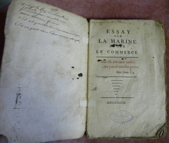
(BOUREAU-DESLANDES, André-François).Livre Rare Book
3 434 résultats
réf. 34584Sans lieu, 1743, 215x140mm, 176pages, broché. Couverture papier marbré, non rogné, coins cornés, cachet de bibliothèque sur la page de titre.
2004réf. 5179DBZürich, Brigitte Christen und Ueli Pauli. 2004. Gr.-8°. (38) Bl. mit vielen Illustrationen und mont. Fotos. Metall-Sprialbindung und Rohmetallschuber.
réf. 115282Rouen, de l’Imprimerie Privilégiée 1785, 165x90mm, XXVI - 338pages, veau moucheté de l’époque, dos à nerfs, pièce de titre, filets dorés, tranches rouges, petits dommages aux coiffes, autrement bon état.
réf. 80038Paris, Delalain fils - Lebour An IX. - 1801, 195x130mm, 1014pages, texte en deux colonnes, reliure plein veau de l’époque. Pièce de titre dorés au dos. Filets et encadrement dorés au dos à nerfs. Tranches rouge. Dos et charnières craquelés. Coiffes et coins abimés. Rousseurs faible et très marginales. Nouvelle édition soigneusement revue et augmentée d’un grand nombre d’articles relatifs aux productions naturelles de tous les pays, a l’industrie et au commerce des divers Peuples, d’après les découvertes de la Peyrouze, Mango-Parck et autre Voyageurs modernes; des chagements arrivés dnas les Etats de l’Europe, depuis dix années, avec la nouvelle division Administrative et Judiciaire de la France comparée a ses anciennes Provinces, la Population, Manufactures et Commerce des principales villes, le placement des Préfectures, Sous-Préfectures et Tribunaux; d’un Vocabulaire de Geographie ancienne, et d’une explication des Termes de Marine et de Navigation.
réf. 33327aafParis, Imprimerie nationale, M. DCCC. LXXII, 1882, in-4°, VIII + 506 p., avec des schémas, ex libris ´Maurice Ed. Perret´, reliure en demi-cuir rouge à coins, dos orné à caissons, coin lég. touché, bel exemplaire.
1920Very Good Turkish, Ottoman (1500-1928) Original color map. Elephant folio. (59x75 cm). In Ottoman script. [OTTOMAN MILITARY MAP of PATAGONIA and FALKLAND ISLANDS: ROUTE of DRESDEN] Alman kruvazörü Dresden'in takîbi ve tahrîbi. SMS Dresden cruiser's routes between 1913-1915 (World War 1) on the Patagonian shelf; western shores of South America, Patagonia and Falkland Islands. Dresden spent much of her career overseas. After commissioning, she visited the United States in 1909 during the Hudson-Fulton Celebration, before returning to Germany to serve in the reconnaissance force of the High Seas Fleet for three years. In 1913, she was assigned to the Mediterranean Division. She was then sent to the Caribbean to protect German nationals during the Mexican Revolution. In mid-1914, she carried the former dictator Victoriano Huerta to Jamaica, where the British had granted him asylum. She was due to return to Germany in July 1914, but was prevented by the outbreak of World War I from doing so. At the onset of hostilities, Dresden operated as a commerce raider in South American waters in the Atlantic, then moved to the Pacific Ocean in September and joined Maximilian von Spee's East Asia Squadron. Dresden saw action in the Battle of Coronel in November, where she engaged the British cruiser HMS Glasgow, and at the Battle of the Falkland Islands in December, where she was the only German warship to escape destruction. She eluded her British pursuers for several more months, until she put into Robinson Crusoe Island in March 1915. Her engines were worn out and she had almost no coal left for her boilers, so the ship's captain contacted the local Chilean authorities to have Dresden interned. She was trapped by British cruisers, including her old opponent Glasgow. The British violated Chilean neutrality and opened fire on the ship in the Battle of Más a Tierra. The Germans scuttled Dresden and the majority of the crew escaped to be interned in Chile for the duration of the war. The wreck remains in the harbor; several artifacts, including her bell and compass, have been returned to Germany.
réf. ria9780784415092_inpPaperback / softback. New. New Book; Fast Shipping from UK; Not signed; Not First Edition; Provides the current state of environmental preservation procedures for inland waterways. This technical report presents an overview of ecosystem sustainability procedures currently used. It examines environmental considerations for con paperback
1984280 pages. Index. Bibliography. Archival black and white photos abound, plus several in colour. Includes maps, timetables and scale drawings. "This is the dramatic story of the CPR's British Columbia sternwheelers and steam tugs through the races, boiling rapids, moonlit cruises, and gold rushes to their passing." - from dust jacket. Light wear to clean and unmarked book. Average wear and closed tears to back panel of dust jacket which is now preserved in glossy new archival-grade Brodart cover. Sound copy of this wonderful piece of B.C. history. Book
réf. 50035Paris Imprimerie Nationale 1977 in 4 (30,5 x 21,5) 2 volumes reliures toilées bleues ornée de l'éditeur, etui toilé assorti, dos et plats supérieurs titrés et otnés sur les plats supérieurs d'une vignette en couleurs contrecollée, 516 pages [1], et 579 pages [1], avec de nombreuses illustrations en noir et blanc et en couleurs, et 3 cartes dépliantes volantes insérées dans un soufflet sur le plat intérieur du tome 2. Collection ''Voyages et Découvertes''. Journaux de navigation établis et documentés par Etienne Taillemite. Bel exemplaire ( Photographies sur demande / We can send pictures of this book on simple request ) Poids du colis: 6 kgs
1930réf. 822DGca. 1930. Farbiges Aquarell. 18 x 10 cm.
1807réf. 55849Philadelphia: Published by B.B. Hopkins and Co. and sold by W.P. Farrand No. 170 Printed by T. & G. Palmer 1807. 8vo. xxiii 1 270; 271-275 1 40 16 15-16 17-220 4 pp. including binders instructions and publisher’s advertisement. With 7 copper-engraved plates & maps 6 engraved by Benjamin Tanner. Contemporary polished brown calf red & gilt morocco spine label chipping to head of spine minor edgewear occasional interior foxing & toning still a VG- copy from the library of John L. Gow 1797-1866 noted Pennsylvania attorney w/ ownership label and markings on front pastedown. First American edition of this classic navigation handbook which was first published in 1804 and here contained substantial corrections to the tables of the latitudes and longitudes of places on the American coast and in the West Indies as well as an improved system of finding the longitude by P. Delamar of Philadelphia. Mackay 1760-1809 was noted Scottish mathematician and astronomer taught navigation and instructed in methods of how to find longitude. Shoemaker 12965. Published by B.B. Hopkins and Co., and sold by W.P. Farrand, No. 170, Printed by T. & G. Palmer, unknown
1945réf. 39135Chatham: Shepherd Printing n. d. ca 1945. 1945. CANADA. 18" x 24" sheet one side opens to a half-sheet color map and numerous advertisements for lodging including the Joe Gawa Hotel one of Ontario's newest and finest hotels. The other side has 12 panels of promotional text regarding the various cruise packages of the beautiful Muskoka Lakes time tables and schedules and views of the inland waterways steamships R. M. S. Sagamo and the R. M. S. Cherokee. Some minor to light wear to the folds else a very good copy. Shepherd Printing, n. d. (ca 1945). unknown
réf. 118852sd Sans mention d'édition / Héliogravure Maurice Lescuyer, 16 Rue des Remparts-d'Ainay, Lyon / Visa N° 69. Section des Informations Maritimes. Secrétariat d'Etat à la Marine - Sans date (Approx. 1950) - Grand in-4, broché avec décor sur la première de couverture - 50 pages - Illustrations et reproductions photographiques en N&B in et hors texte (2 grandes illustrations de Jacques Touchet en couleurs hors texte) - Exemplaire numéroté N° 400 / 500
1927réf. 59226Washington D.C.: Government Printing Office Hydrographic Office U.S. Navy 1927-1928. Two vols. 8vo. 8 viii 424; 6 v 1 446 pp. With 4 large folding colour maps 1 double-sided elevation maps showing harbor entrances numerous photo plates. Beige publisher’s cloth black lettering front cover & spine darkening to spine fore-edges minor shelfwear dustsoiling still VG set. Third & Seventh editions revised & updated of these coast pilot guides to Central America and Mexico in the 1920’s. Prior to modern GPS systems and satellite navigation these regularly updated and revised navigation handbooks provided key sailing instructions often drawing not only from Mexican and West Indies sources but also governmental publications in the Panama Canal sailing reports from U.S. Navy vessels and those from merchant ships. The first large map delineates not only the requisite coast pilots for sailing in American waters but also the charts to be ordered from the Hydrographic Office. Government Printing Office, Hydrographic Office, U.S. Navy, hardcover
1940réf. Bing89SM025United states government printing office 1940. pamphlet. good. Prompt shipment with tracking. we ship in CLEAN SECURE NEW boxes 8vo acceptable pamphlet pages 276 book in acceptabl;e condition and prompted for shipping. Cover worn along tips and edges. Pages browning along for edges. United states government printing office unknown
1888réf. 0009730New York 1888. First edition. Map. Fine. 15 x 11 inches / 36 x 26 cm 3 folds matted glazed and framed. Very Scarcce This map was removed from an Annual Report. The black-and-white map shows the boundaries of Illinois in outline presenting the Illinois River improved passage from Chicago to Grafton where it pours into the Mississippi River. It also shows the Rock River traversing to the Quad Cities. Toward the east is the Illinois & Michigan Canal the DesPlaines River the Little Calumet River and the Little Kankakee River and Calumet Harbor. The map is attributed to Thomas H. Handburg. The University of Illinois-Urbana has a photocopy of it from the photocopy in the National Archives. I have not identified to which Annual Report this belonged Nor can I find another map attribued to Thomas H. Handburg. unknown
réf. BN324090Segeln Schnelle Hilfe an Bord: Manöver · Navigation · Technik · Sicherheit Schwarzmeier Thomas Segeln Schnelle Hilfe an Bord: Manöver · Navigation · Technik · Sicherheit Schwarzmeier Thomas Segeln Schnelle Hilfe an Bord: Manöver · Navigation · Technik · Sicherheit Schwarzmeier Thomas unknown
2007réf. BN499264Mariusz Adamski 2007. 2007. siegnac nieba. / reaching for the sky. siegnac nieba. / reaching for the sky. Polska Agencja Zeglugi Powietrznej. Polish Air Navigation Services Agency Herausgeber Editor Photos Mariusz Admaski Mariusz Adamski unknown
réf. BN168889Audio Navigation und Telematik für Kraftfahrzeuge Audio Navigation und Telematik für Kraftfahrzeuge Audio Navigation und Telematik für Kraftfahrzeuge unknown
réf. BN375463General Navigation - Air Transport Pilot´s Licence JAR-FCL Unknown Binding Unknown Binding General Navigation - Air Transport Pilot´s Licence JAR-FCL Unknown Binding Unknown Binding General Navigation - Air Transport Pilot´s Licence JAR-FCL Unknown Binding Unknown Binding unknown
réf. BN604932PUB 249 Sight Reduction Tables for Air Navigation Volume 3: Latitudes 39° to 89° Declinations 0° to 29° Spiral-bound Jan 01 1878 PUB 249 Sight Reduction Tables for Air Navigation Volume 3: Latitudes 39° to 89° Declinations 0° to 29° Spiral-bound Jan 01 1878 PUB 249 Sight Reduction Tables for Air Navigation Volume 3: Latitudes 39° to 89° Declinations 0° to 29° Spiral-bound Jan 01 1878 unknown
réf. ABE-1270472158DU 4 JANVIER AU 29 MARS 1890 (N°105 A 117)-RELIURE EDITEUR CUIR A COINS-5 NERFS-TITRE DORE SUR LE DOS ET LE PREMIER PLAT-LEGERES ROUSSEURS SUR CERTAINES PAGES-BEL ENSEMBLE (ETACA)
1898réf. 10577Paris, Bardey, 1898 ; in-8, broché ; 183 pp., 12 très grandes planches dépliantes.