3,257 results
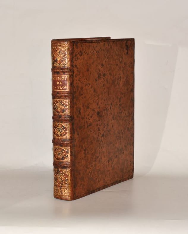
ref. 132919aafA Marseille, (Publié par Joseph Roux), 1764, in-8vo, oblong (planches 16x22), Feuille de titre gravé orné d'attributs marins + 119 plans (de 121), + 1 feuille de table. (Il manque les planches 9 Alcudia & 83 Porteporo), qqs taches d’eau, reliure en veau brun d’époque (16.5x22.5 cm).
1955ref. ABC_47446London 1955. 8vo. Published for the Hydrographic Department Admiralty Original blue cloth with yellow lettering on the spine and the front board the supplement is loosely inserted at the end of the volume: original printed paper wrappers stapled. With a folding map printed on both sides 2 coloured plates with diagrams printed on both sides 28 plates showing coastlines and occasionally a map many printed on both sides and many some illustrations in text. 2 LI = LIII: II plus 1 1 blank 1 blank 518 1 1 blank pp; Supplement: 20 pp. The essential standard sailing directions for the Red Sea and Gulf of Aden corresponding with zone NP64 on the official Admiralty charts. These nautical works - pilot guides and charts - were published by the United Kingdom Hydrographic Office which provides the necessary hydrographic and marine geospatial data to all kinds of maritime organisations across the world. The publications are not only used by the British Royal Navy but can also be found on board the majority of international merchant ships. The data provided in the pilot guides and other publications are compliant with SOLAS the Safety of Life at Sea treaty guidelines and are updated constantly in weekly "Notices to mariners" and supplements to and new editions of the pilot guides whenever necessary.The present copy is the 10th edition 1955 of the pilot guide with sailing directions and other information on the weather currents radar ranges etc. relating to the Red Sea and Gulf of Aden including the supplement issued in 1957. It includes an erroneous "advertisement to the eight edition" by the Hydrographer of the Navy Rear-Admiral Kenneth St Barbe Collins 1904-1982. The advertisement states that with the publication of "the ninth edition" presumably this volume the previous edition and its supplements are cancelled since the most up-to-date information has been compiled in the new edition and the weekly "Notices to mariners" that appeared after the publication of the 11th edition. The 10th edition of 1955 and its 1957 supplement were made redundant with the publication of the 11th edition in 1967. Each subsequent edition of the pilot supersedes the last which have appeared infrequently depending on newly available information from the mid-19th century until the present day.The front paste-down and recto of the first free endpaper contain a "caution" notice and room for the notation of "supplements and annual summaries of notices to mariners relating to this book" the first two pages are printed on red-pink paper. The binding shows minor signs of wear around the spine and corners of the boards the gutter after page II is somewhat weakened the head edge of the wrappers of the supplement are very slightly browned. Otherwise in very good condition. AFRICA MARITIME HISTORY MIDDLE EAST & ISLAMIC WORLD Arabian Peninsula & Gulf States East Africa Navigation hardcover
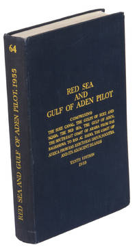
1955ref. K3CC18ANEAK3London: published by the Hydrographic Department Admiralty 1955. Original blue cloth with title on spine and front board; supplement with original printed paper wrappers. 8vo. With a folding map printed on both sides 2 coloured plates with diagrams printed on both sides 28 plates showing coastlines and occasionally a map many printed on both sides and many some illustrations in text. Including: Supplement no. 1-1957 relating to the Red Sea and Gulf of Aden pilot tenth edition . Tenth edition of a work "comprising sailing directions for the Suez canal the Gulf of Suez and the central track for power vessels through the Red sea Straits of Bab-al-Mandab and Gulf of Aden ." p. III and more areas. Besides navigation it deals with the climate weather and ocean streams of the area. The first chapter also gives and "general description of countries bordering the Red sea and Gulf of Aden" p. V. Including two copies of the supplement. Spine slightly discoloured otherwise in very good condition. published by the Hydrographic Department, Admiralty, hardcover
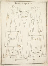
1753ref. 3742NAPLES: IGNAZIO RUSSO 1753. FIRST EDITION. Hardcover. Fine. Bound in contemporary vellum over boards. Foxing. Complete with the 15 engraved plates. Little is known of the author other than that he wrote another book on navigation in 1750. This work on the sector was translated into Spanish in 1758. By the time this book was published the design of the European sector had become standardized. Compare this design for example with that in the fourth edition of the works of Ozanam seventeen years earlier L’usage du compas de proportion 1736. The physical design of Pagnini’s instrument is better with pegs and decorative tenons to hold the two legs in alignment but the scales are essentially identical. The work is well illustrated with engravings showing exactly how a pair of dividers should be used to take the various lateral and transverse measurements. Pagnini provides eight tables that detail the exact markings for each scale. He also provides other material for reference use e.g. he includes not only a table for the construction of the line of metals but also one of their relative weights and their alchemical symbols etc. IGNAZIO RUSSO hardcover
1722ref. 4938Paris, Étienne Ganeau, 1722. 1722 2 vol. in-12° (163 x 102 mm) de: I. [6] ff. (titre, préface, approbation, privilège); 378 pp.; [3] ff. (table); II. [4] ff. (titre, table); 316 pp. Plein veau granité dépoque, dos à nerfs orné, titres et tomaisons de maroquin rouge, filet à froid encadrant les plats, roulette dorée sur les coupes, tranches jaspées de rouge. (Rares rousseurs ou tâches).
ref. 226885Paris, A. Cadart, s.d. (vers 1875) in-4, titre et 40 planches gravées à l'eau-forte, signées, en partie numérotées et généralement légendées, demi-chagrin olive, dos lisse orné de filets dorés, tranches mouchetées de rouge (reliure moderne).
1837ref. PHO-2280Paris, Arthus Bertrand, 1837, 2 volumes (3) grand in-4° (30x24,5cm), VIII pp., 742 pp., demi chagrin et coins époque, dos lisse avec auteur, titre et tomaison, frottements au dos, quelques rousseurs, défaut à la coiffe supérieure. Édition originale du texte du voyage du Bougainville autour du monde, manque l’atlas.
1778ref. PHO-434Paris, Hôtel de Thou, 1778. 6 volumes in-8, veau marbré, dos lisse orné , pièce de titre et tomaison , tranches rouge (rel. de l'époque) avec son ATLAS (260x220mm) , relié demi cuir (reliure moderne) illustré de 65 planches H.T., nombreuses dépliantes,bords brunis , déchirure à une carte sans manque. Traduction française par Suard du récit du deuxième voyage de Cook (1772-1775), depuis l'Angleterre jusqu'aux îles de Pâques. Les Observations de Forster forment les deux derniers tomes. Ex libris C. Du Mesnil.
1799ref. PHO-333Paris, Jansen, an VIII (1799) 2 vol. in-8 ,demi-veau havane, dos lisse orné (rel. Légt post., mors usagés et rongés) et un atlas in-folio en seconde édition (1817) brochure moderne en papier marbré. Texte :Tome I : xvi pp. (dont faux-titre et titre), 440 pp.Tome II : 332 pp. (dont le faux-titre et le titre), 109 pp., (1)f. Atlas : titre gravé, grande carte sur double page (Mer des Indes et une partie de celle du Sud, par Darbié du Bocage - volante) et 43 planches (vues, scènes, costumes, portraits et types, faune et flore) gravées sur cuivre par Dien, Copia, Pérée, etc., d'après Piron, Redouté, Audebert, etc. représentant des personnages, des scènes de vie, des armes, des vues, la faune et la flore. Nombreuses piqûres et taches d'humidité, mais papier solide, à bonnes marges.
ref. 135641aafA Paris, Chez H.L. Guerin & L. F. Delatour, M. DCC. LVII., (1757), in-4to, 2 ff. (faux-titre & titre imprimé en rouge et noir) + XXX + 520 pages + 15 planches gravées dépliantes hors-texte, ill. de qqs en-tête, de chapitre et culs-de-lampe gravées, pt cachet ovale sur titre (annulé), reliure de l'époque en plein veau, dos à cinq nerf richement orné or, pièce de titre en maroquin rouge, tranches rouges. Bel exemplaire.
1740ref. 0056271740 S. l. n. e. [Amsterdam, Pierre Mortier], 1740. In-quarto (257 X 205 mm) veau fauve marbré, supra-libris (lettre « V ») doré au centre des plats, dos à nerfs orné, pièce de titre maroquin grenat, tranches rouges (Reliure de l'époque) ; portrait-frontispice, (2) ff. de faux-titre et titre, XL-284 pages, 6 planches hors-texte. Quelques feuillets uniformément brunis.
ref. 230478Paris, Hachette et cie, 1866 2 vol. in-12, 352 pp. et 376 pp., demi-basane brune, dos lisse orné de filets dorés (reliure de l'époque). Dos frotté avec épidermures. Chocs sur une coupe au tome I. Rousseurs.
1875Very Good French Contemporary 1/4 leather bdg. with marbled boards. Small 4to. (27 x 19 cm). 23 p. (11 p. in Ottoman script (Old Turkish with Arabic letters; 12 p. in French), with rare 4 folded maps. A very good copy. First and only edition of this extremely rare bilingual book in French and Ottoman Turkish, including the first records on the formation and characteristics of storms to explain how storms and hurricanes occurred, which route they followed, and how they were conveyed to the regions that need to be warned by telegraph, for the vessels sailing in the seas, by French expert Coumbary who was founded the Rasathâne-i Âmîre [i.e. Ottoman Imperial Observatory]. Both the original French and Turkish translations of the work were published together in one volume. The work also included four maps which were drawn for this work only. The first map shows the movement of a storm that occurred on March 8, 1865, the second one shows the occurrence between the Tropic Cancer and Capricorn whirlwinds, storms in the Atlas and Indian oceans, the movements in the Bay of Bengal, the storms in different directions in the China Sea, the Gulfstream, Grönland, and Azores. The second observatory in the Ottoman era was established for meteorology. Before this center was established, beginning from the Reformation (1839), many meteorological observatories were built by foreigners in various cities such as Istanbul, Smyrna, Trebizond, Tekirdag, and Merzifon both as private and public establishments. The very first known temperature readings are the meteorological observations made by the Priest Dalmas at the St. Benôit monastery between 1839-1847. Later William Lane, an Englishman who came to Istanbul during the Crimean War, made observations at the British Cemetery at Haydarpasa. W. Noe, director of the Mekteb-i Fünûn-u Sahane made observations at the house in Kalyoncukulluk where he lived until the Beyoglu Fire in 1848; and finally, it is known that French engineer Ritter, who was invited by the government for waterworks in Kuruçesme (1856-1860) also conducted meteorological observations. Observations on precipitation and humidity conducted between 1875-1892 by an amateur observer on the Thomson Farm in Erenköy are invaluable on the subject of Istanbul's climate. These observations have been published in Budapest in 1928. Excellent observations on heat, pressure, and humidity, made in the summer residence of the Russian ambassador on Büyükada have also been published, in Annales St. Petersburg. In 1858, the French government established the first observatory communicating data over the telegraph, and in 1863, by compiling meteorological data in France, the French National Meteorological Network started operations. In 1868, upon the recommendation of the French government, the Rasathane-i Âmire was founded to convey meteorological forecasts to certain centers by telegraph. Instruments were purchased from leading European factories, and operations started on top of a hill 74 meters high on Pera. The first director was Mr. Aristide Coumbray, who came to Istanbul to renovate the telegraph network. (Instruments commissioned from France were set up at Mr. Coumbary's home, which stood at the garden of the Swedish Embassy. The observatory was later moved after its offices were prepared.) Coumbary represented Turkey in the first international meteorology congress, convened in Wien five years later in 1873. Rasathane-i Âmire worked by the same system as the National Meteorology Center in France. In the observation books of 1868 (August-November), names of affiliated stations are given to us Soulina, Köstence (Constantia), Varna, Burgaz, Valona, Elbasan, Durazzo, and Beirut. Later, stations in Izmir, Diyarbakir, Baghdad, and Fao were also added. The observatory founded by Aristide Coumbary in 1868 in Istanbul, operated until the end of the First World War. Özege 5735.; TBTK 7688, 10862.; Not in OCLC.
1913Very Good Turkish, Ottoman (1500-1928) Full leather new bdg. Original illustrated cover saved inside. Roy. 8vo. (24 x 17 cm). In Ottoman script (Old Turkish with Arabic letters). [12], 166, [2] p., b/w and color plates of Ottoman warships and scenes from naval wars, seven maps of the earliest examples of Ottoman cartography. Very rare second edition of this book on the history of Ottoman naval wars against Venetians began with the Crete campaign (War of Candia) in 1645 and lasted for years until 1656. The book was published first in 1729 in Müteferrika Printing House which was the first printing house in the Islamic world as the third printed book. This is the second edition including five maps of almost the same size (two paged) titled world map, The Mediterranean, The Archipelago (Aegean), The Adriatic Sea, and the compass-like in its first edition as well as two maps and twenty-six plates (some of them are color) and small illustrations of Ottoman ships as head of some carriage returns. Additional maps depict the city of Venice (from Kitab-i Bahriye [i.e. Book of Navigation) and the travels of Ottoman Admiral Sidi Ali Reis through the Sea of Oman. The Cretan War or the Fifth Ottoman-Venetian War, was a conflict between the Republic of Venice and her allies (chief among them the Knights of Malta, the Papal States, and France) against the Ottoman Empire and the Barbary States because it was largely fought over the island of Crete, Venice's largest and richest overseas possession. This account of Ottoman maritime warfare in Turkish, written in Safer 1067/November 1656. This date places the book in a moment of utmost danger for the Ottoman capital following the defeat of the Ottoman navy at the hands of the Venetians at the Dardanelles (4 Ramadan 1066/26 June 1656) and the subsequent loss of the islands of Lemnos and Tenedos. It is also written shortly after the appointment of Köprülü Mehmed Pasha as grand vizier (25 Dhulqada 1066/14 September 1656). Thus it is suggested to read it as a program of reform of the navy intended for a person whom Hadji Khalfa might have seen as the "man of the sword" who might revert the fate of the Empire. Of the four ulemâ [i.e. scholars] who wrote endorsements for the book, two are closely related to the Köprülü family. The first part is a history of Ottoman maritime campaigns from the beginning to 1067/1656, while the second is a systematic description of naval affairs, from administration and offices to shipbuilding, culminating in a list of 40 suggestions for the organization and strategy of the Ottoman navy, including the use of recent scientific and technological innovations. Thus the juxtaposition with history provides an argument for reform. Suggestions are largely centered around the traditional qanun-i qadim; there is no reference to high-board ships. The final pages include an important discussion of historical causality, explaining how divine omnipotence creates the consequence of historical causes, in reward for the righteous rule, or punishment of injustice. (Source: Ottomanhistorians). Özege 21273.
1895Very Good Turkish, Ottoman (1500-1928) Original handsome brown quarter leather binding with Ottoman lettered gilt to spine. Five raised bands to spine, separated from each other with lined gilt. Slight stains on the title page. Else a fine copy. Roy. 8vo. (23 x 16 cm). In Ottoman script (Old Turkish with Arabic letters). 99 p. Hegira: 1313 = Gregorian: 1895. Extremely rare first printed edition of this one of the earliest travel accounts, of an Ottoman admiral's early expeditions to the Indian Ocean, Arabian Sea, Red Sea, and Persian Gulf to counter Portuguese piracy and attacks on Muslim pilgrim ships, which describes the lands he has seen during his voyage from India to Constantinople by Sidi (Seydi) Ali Reis (1498-1563) sent by Sultan Suleiman the Magnificent covering the years 1553-1556. During these naval wars, after two marine battles against the Portuguese fleet and a great storm named The Elephant Typhoon (Tufan-i Fil) by the locals, Reis' remaining six galleys drifted to India. The fleet was unserviceable, resulting in his return home overland with 50 men. Reis then arrived at the royal court of the Mughal Emperor Humayun in Delhi, where he met the future Mughal emperor Akbar, who was twelve years old at the time. He returned to the Ottoman Land over Muslim states in South Asia; Afghanistan, Central Asia, and Iran. But he delayed his return because of the war between the Ottoman and the Safavid Empires in Iran. Finally, following the treaty of Amasya in 1555, he was able to return home and present his book of this narrative journey to the Sultan in 1557. This work offers an extensive insight into the Muslim situation in 16th century South and Central Asia and the Middle East, Islamic navigation, and Turkish - Portuguese relations as well as Persian, Afghan, and Indian geography, naval routes, flora, and fauna. Seydi Ali Reis, formerly also written Sidi Ali Reis and Sidi Ali Ben Hossein, was an Ottoman admiral and navigator. Known also as Katib-i Rumi, Galatali, or Sidi Ali Çelebi, he commanded the left wing of the Ottoman fleet at the naval Battle of Preveza in 1538. He was later promoted to the rank of fleet admiral of the Ottoman fleet in the Indian Ocean, and as such, encountered the Portuguese forces based in the Indian city of Goa on several occasions in 1554. Seydi was able to unite several Muslim countries on the coast of the Arabian Sea (such as the Makran Kingdom, Gujarat Sultanate, and Adal Sultanate) against the Portuguese. He is famous today for his books of travel such as the Mir'ât ül Memâlik [i.e. The Mirror of Countries], and his books of navigation and astronomy, such as the Mir'ât-i Kâinât (Mirror of the Universe) and the Kitâb ül Muhit: El Muhit fî Ilmi'l Eflâk ve'l Buhûr [i.e. Book of the Regional Seas and the Science of Astronomy and Navigation] which contain information on navigation techniques, methods of determining direction, calculating time, using the compass, information on stars, sun and moon calendars, wind and sea currents, as well as portolan information regarding the ports, harbours, coastal settlements and islands in the various regions of the Ottoman Empire. His books are translated into numerous languages including English, French, Italian, German, Greek, Arabic, Persian, Urdu, Russian, and Bengali, and are considered among the finest literary works dating from the Ottoman period. "When Sultan Suleiman had taken up his winter residence in Aleppo, I, the author of these pages, was appointed to the Admiralship of the Egyptian fleet and received instructions to fetch back to Egypt the ships (15 galleys), which some time ago had been sent to Basrah on the Persian Gulf. But, 'Man proposes, God disposes.' I was unable to carry out my mission, and as I realized the impossibility of returning by water, I resolved to go back to Turkey by the overland route, accompanied by a few tried and faithful Egyptian soldiers. I traveled through Gujarat, Hind, Sind, Balkh, Zabulistan, Bedakhshan, Khotlan, Turan, and Iran
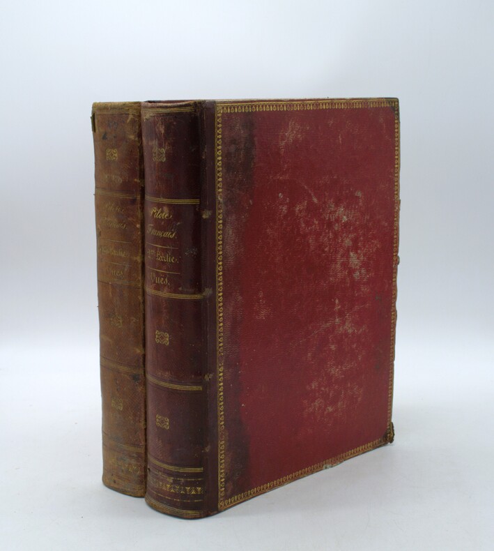
1822ref. PHO-2146Paris, Au Dépôt général de la Marine, 1822 et 1829. 2 volumes grands in-4 (34,5 × 27 cm), demi-maroquin à coins, dos lisses avec titres et tomaisons, guirlandes aux plats. Deux volumes de vues uniquement, toutes gravées et montées sur onglets. Premier volume : faux-titre, titre gravé illustré d’une Vue du Goulet de Brest, gravée par Schroeder, table des planches, et 91 vues à double page. Second volume : faux-titre, table des planches, 91 vues à double page, numérotées 79 à 169, et 20 planches de marées.
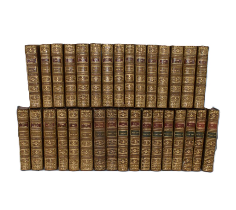
1780ref. PHO-2387Paris, Hôtel de Thou, Laporte, Moutardier, 1780/1801, 32 volumes in-8, basane époque, guirlande sur les plats, dos ornés, pièces de titre rouge et pour les tomes 22 à 32 ; pièces de tomaison vertes, triples filets aux plats, tranches rouges, fleurons légèrement différents pour les tomes 22 et 23. Quelques accidents aux coiffes, quelques épidermures au supplément, légers manques de matières sur quelques tomes, mouillure très claire sur quelques feuillets (2 tomes), le tout sans gravité. Ex-libris du Comte de Farcy de la Villedubois au dos du premier plat. Belle édition de l’Abrégé de l’Histoire des Voyages, elle se compose des 21 premiers volumes de 1780 publiés par La Harpe à l’Hôtel de Thou, des 2 volumes publiés en 1786 consacrés au troisième voyage de Cook et formant les volumes 22 et 23, chez Laporte, et des 9 volumes de suppléments publiés entre 1798 et 1801 par Delpuech-Comeiras et imprimé chez Moutardier. L’illustration est formée de l'atlas complet des 74 (+1 en double) cartes dépliantes des diverses parties du monde, dont la Carte dépliante de l'hémisphère austral montrant les routes des navigateurs les plus célèbres par James Cook, une carte de Tahiti, d'autres du Kamtchatka, du Spitzberg, des îles Antilles, etc, et de 4 cartes pour les tomes 22 à32 ainsi que 101 planches dont certaines dépliantes, les cartes et gravures en très bel état.
1937ref. 42801London: Golden Cockerel Press 1937. Hardcover. Introduction and notes by Owen Rutter. Illustrations by Lynton Lamb. Complete 2-volume set. Tall 4to. Brown beige and green cloth with gilt spine lettering. 435pp 259pp. Four wood engravings two across each two-page title pages. Very good. Bindings a tad corner and edgeworn and rubbed though internally fine and tight. First of this edition a handsome set of this beautifully-produced pair by the legendary British fine press. Limited to 300 sets this #205. Scarce and lovely. Golden Cockerel Press hardcover books
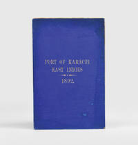
1892ref. 184592Karachi: Published by the Chairman Karachi Port Trust 1892. Traced in only one institutional library First edition of this scarce guide for pilots and mariners with the tipped-in compliments slip of the secretary of the Karachi Port Trust addressed in manuscript to the Swedish shipping firm K. O. F. Dalman. The guide details the specifications of the harbour mooring charges pilotage and towage charges and the size of recent trade. The four appendices include a July 1892 notice to mariners a list of steamers to leave port in the preceding year a name list for the Karachi's chamber of commerce and foreign consuls and the text of a Sind Gazette article on a recent survey by the port engineer. WorldCat records a copy at the University of Western Australia. Octavo pp. 34. Tissue-guarded frontispiece 3 colour folding maps regional map extending from Tibet to Arabia; plan of Karachi harbour plan of suggested additional wharfage. Original blue cloth front cover lettered in gilt. Text block now loose in covers but in itself sturdy cloth with some staining and marking wharfage plan with small closed tear just crossing neatline: very good. hardcover
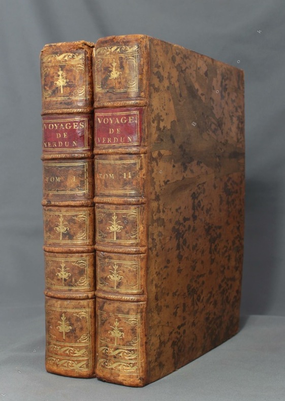
1778ref. 8670Paris, de l'Imprimerie Royale, 1778. 2 volumes in-4 de [4]-389-[1]-XIX-[3]; [8]-500-XXXII pages, plein veau marbré brun, dos à nerfs ornés de filets et fleurons dorés, pièces de titre en maroquin rouge, tranches mouchetées, petits accrocs aux coiffes supérieures, épidermures, coupes et coins frottés, tampon sur les pages de titre, quelques pâles rousseurs.
1753ref. 3742NAPLES:: IGNAZIO RUSSO 1753. FIRST EDITION. Quarto:. 23.6 x 17 cm. 8 56 Collation: a4 A-G4. 15 engraved plates engraved by Filippo de Grado. Bound in contemporary vellum over boards. Foxing. Complete with the 15 engraved plates. Little is known of the author other than that he wrote another book on navigation in 1750. This work on the sector was translated into Spanish in 1758. By the time this book was published the design of the European sector had become standardized. Compare this design for example with that in the fourth edition of the works of Ozanam seventeen years earlier L’usage du compas de proportion 1736. The physical design of Pagnini’s instrument is better with pegs and decorative tenons to hold the two legs in alignment but the scales are essentially identical. The work is well illustrated with engravings showing exactly how a pair of dividers should be used to take the various lateral and transverse measurements. Pagnini provides eight tables that detail the exact markings for each scale. He also provides other material for reference use e.g. he includes not only a table for the construction of the line of metals but also one of their relative weights and their alchemical symbols etc. Tomash & Williams P7; Riccardi ii 236 IGNAZIO RUSSO, unknown books
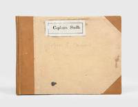
1928ref. 174745Likely Shanghai: 1928-34. Mariners are warned to exercise due caution when approaching and when in the waterways A collection of otherwise untraced notices to mariners compiled by a civilian captain who plied the lower Yangtse during the late 1920s and early 1930s. Yangtse shipping was regulated by the Maritime Customs Service which issued around 100 navigational advisories per year. During the late 1920s shipping traffic on the Yangtse rebounded after several years of decline during the Warlord Era. Low water however continued to pose problems for navigators and increased the need for effective river management. The 39 notices are technical directions concerning specific parts of the channel. They specify when vessels may and may not enter stretches of water warning of the persistent presence of Chinese craft not subject to the same notices offer guidance for navigating buoyed channels provide optimum bearings and relay a change to the position of the Bend and Gravener Island beacons due to the erosion of the channel. The majority date from 1929. The identify of the "Captain Smith" referenced on the front cover has proved elusive but he may be the individual pictured in photograph Sw13-045 G. Warren Swire collection SOAS. Landscape octavo. Contemporary brown half cloth binder with metal clasp spine lettered in gilt buff paper sides front board with manuscript label "Captain Smith" boards lined with pink paper typescript list of charts on inner front cover 39 sheets each typed one side only in black or blue most duplicate typescript a few top copy. Boards lightly soiled clasp rusted sheets generally well preserved a few creased or with holes near clasp legibility unaffected typescript list with a few losses to text: a very good example. hardcover
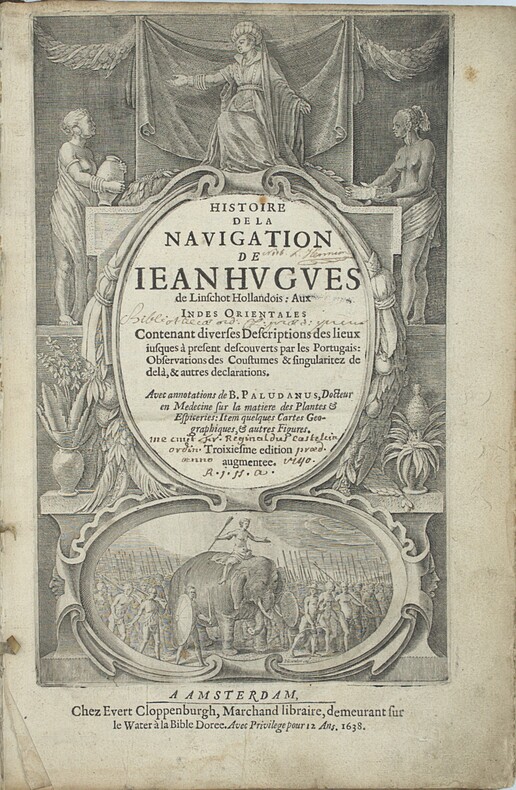
1638ref. PHO-2460Amsterdam : J.E. Cloppenburch, 1638, in-folio, 315 x 220mm, 4pp. (titre, préface, indice des chapitres) 206pp., titre avec des figures allégoriques (Asie, Afrique Europe) et une scène d’un roi sur éléphant, illustré du portrait de l’auteur, 29 (sur 36 ) planches gravées dépliantes à double page et vues de Johann et Baptiste ven Doetecom d'aprés Linschoten , les cartes sont absentes. Titre empoussiéré, quelques taches et mouillures, le dernier feuillet détaché. Reliure en partie détachée du corps de l’ouvrage. Provenance - « Fr. Reginaldus Castelin (?) ordin. 1740 » (ex-libris manuscrit ancien). – L. Hennion (ex-libris manuscrit ancien sur une garde). Bibliographie Sabin, n°20128. Leclerc, n°363. Cordier Japonica, 222. Gay, 260
1663ref. PHO-2278A Paris, chez Jacques Langlois, 1663-1666 3 parties en 1 volumes in-folio (38x25cm). Veau tacheté époque, dos à nerfs ornés avec pièce de titre en maroquin et tomaison, tranches jaspées rouges. Réparations au dos et coins, mouillure, quelques rousseurs, réparation au titre, renforcement à la carte. Complet de ses relations de voyage selon Brunet & Camus
1900ref. 176895Shanghai: Brewer & Co. c. 1900. From the Chefoo Bluff to Lamtong Head Sole edition untraced institutionally the copy of Vice-Admiral Seymour's chief of staff in Tianjin during the Boxer Uprising. This photographic guide is designed for "the navigator of this changeable and frequently foggy locality" preface. We have traced only one other copy which appeared in commerce in 2017. Navigators in the late Qing period could rely on only a small network of lighthouses and fixed navigational aids when sailing the Chinese coast. "In thick weather even a person familiar with the coast is at a loss to identify a well-known Islands with its summit" preface. The thirty views include the Chefoo Bluff in the Pechili Gulf the waters near the Hieshans Light House Zhejiang and Hong Kong's Lamtong Head. A concerted period of lighthouse-building in the 1910s and 1920s obviated the need for further publications of this kind. Provenance: though unmarked as such this copy was owned by Captain Edward Henry Bayly C.B. 1849-1904 Commander of the International Forces at Tianjin in June 1900. Bayly had a lifelong career in the Royal Navy. He was promoted to the rank of lieutenant in September 1873 commander in June 1887 and captain in January 1894 having served overseas in numerous ships. Bayly captained HMS Pelorus during the fleet review for Queen Victoria's diamond jubilee in 1897 and in 1899 became captain of the armoured cruiser HMS Aurora on the China station. During the Boxer Uprising he replaced the wounded John Jellicoe as chief of staff to Seymour was mentioned by Seymour in dispatches and remained at Tianjin until the withdrawal of naval forces. He retired at his own request in February 1904. Landscape octavo. With 30 mounted collotypes within red frames. Original red cloth front cover lettered in gilt white coated endpapers leaves hinged with white linen as issued. A little shaken binding sunned and stained contents well preserved a little toning at fore edges: a very good copy. hardcover