DALRYMPLE (Alexander), FRÉVILLE (M. de Trad.)Livre Rare Book

3 434 résultats
1774réf. PHO-2287Paris, Chez Saillant & Nyon, Pissot, 1774. In-8 (20,5x13cm) de 2ff.-XIV-1f. 502pp.- 1f., veau marbré époque, dos à nerfs orné avec pièce de titre grenat, tranches rouges, illustré de 3 cartes dépliantes in fine. Frottements, coins et coupes usés, coiffes arasées, débuts de fentes, quelques rousseurs
réf. 107091A Genève, chez Pellet, Imprimeur-Libraire, rue des Belles-Filles, 1778, 1 volume in-4 de 275x215x65 mm environ, 2 ff.blancs, faux-titre, titre, 35pages- 102 planches-87pages- 32 planches-31 pages-52 planches-14 pages-7 planches, 2ff.blancs, cartonnage en attente de reliure, titres manuscrits sur une étiquette blanche sur dos lisse, feuillets non rognés. Ce volume contient 193 planches (y compris les planches doubles, triples, bis, N°2 etc.)Une planche en 2 exemplaires en début de volume : Géométrie est en (suite de la pl.3 et pl. 4 et 5), petite galerie dans la marge interne sur quelques feuillets, bordures des planches frottées et fendillées par endroits, couverture usée, intérieur bon état.
réf. 236823À Amsterdam, Chez Pierre Mortier, 1756 in-12, XXXIX-(8)-312 pp., portrait-frontispice, 6 planches dépliantes, veau fauve moucheté, dos à nerfs orné, tranches rouges (reliure de l'époque).
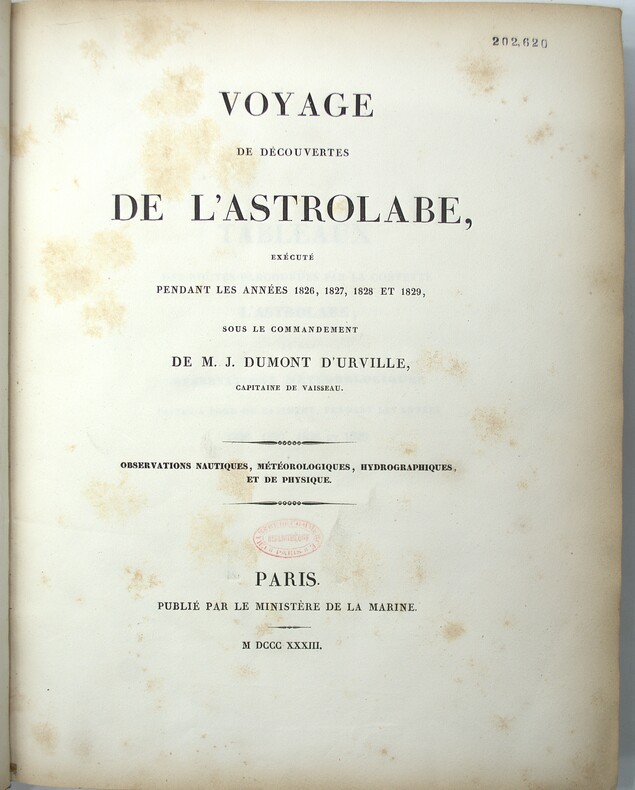
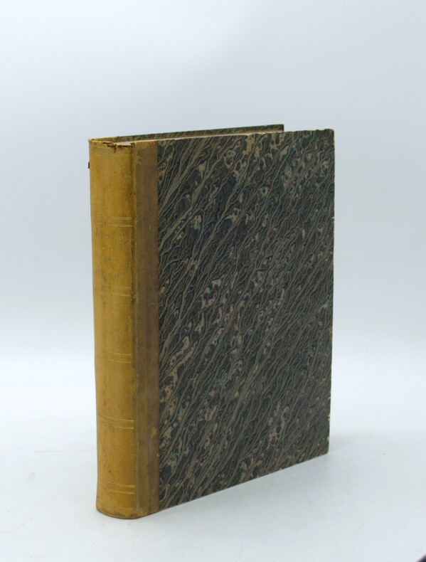
1833réf. PHO-2138Paris : Ministère de la marine, 1833-34. In-4, cartonnage papier marbré, dos lisse, tranches mouchetées (reliure de l'époque). Usures au cartonnage (coins, coiffes, frottements, etc…) Rousseurs, cachet au titre.
réf. 240647Paris, Dupain-Triel, an VII (1799) in-8, xvj pp., 224 pp., avec 7 planches dépliantes hors texte gravées sur cuivre par Gaitte, dont une carte, demi-basane brune, dos lisse cloisonné et fleuronné, pièce de titre cerise (reliure de l'époque). Rousseurs.
1893réf. 22201893 Librairie Ch. Delagrave, Paris, sans date (1893). In-folio, pleine percaline. 3 feuillets, 8 cartes rempliées montées sur onglet. Cartes générales des Services Français, et des Services Etrangers; carte Méditerranée et Mer Noiire; carte Asie, Océanie et Côtes d'Afrique; carte Europe Occidentale; carte Antilles et Mexique. En annexe Câbles sous-marins (lignes télégraphiques), et Lignes téléphoniques Internationales
1778réf. 234881London: printed for J. Mount T. Page and W. Mount 1778. The Second edition with an Appendix. Engraved title page chipped and defective 2 iii 1 86 pp. 1 vols. Small 4to. Original sewing with back wrapper only small chip at outer edge and stained first two leaves detached; engraved vignette title page waterstained and badly chipped with some loss to imprint. Still a remarkable survival of a rare and fragile book. The Second edition with an Appendix" Engraved title page chipped and defective 2 iii 1 86 pp. 1 vols. Small 4to. A Rare Manual of Navigation 1778. In his modest introduction Falck gives credit to the likes of Cornelius Douwes and Richard Harrison for inventing the method of determining latitude at sea by the use of solar tables. The appendix is a "Description of the Principles and Use of a plain Hadley's Quadrant and how to apply it in real Practice for taking a correct Altitude." This second edition is much rarer than the first which was published in 1771. It is also a good fifteen pages longer. Falck would have been considerably buoyed by the involvement of Mount and Page one of the foremost publishers of maritime material in eighteenth century London. Especially as the first edition was published at his own expence. ESTCT 59664 British Library only; OCLC: 84682637 2 copies in US printed for J. Mount, T. Page and W. Mount unknown books
1747réf. 234865London: Printed for W. and J. Mount and T. Page 1747. Later approximately eleventh edition. Illustrated with woodcuts diagrams and tables. 272 pp. 1 vols. Small 8vo. Modern quarter blue morocco and cloth. Half-title and title leaves silked at upper margin early mild dampstaining to text; a good solid copy. Later approximately eleventh edition. Illustrated with woodcuts diagrams and tables. 272 pp. 1 vols. Small 8vo. First published in 1694 and innumerable times since throughout the 18th-century. Printed for W. and J. Mount, and T. Page unknown books
1847réf. 1008098vo slate blue cloth stamped in gilt and blind illustrated with frontispiece and folding charts viii 21 429 3 24 pp.Wear to spine ends spine faded small splits to joints hinges cracked copious nautical notes to endpapers slight aging but text and charts are generally clean and unworn; about very good. This is rare first edition of what is known as "The Atlantic Navigator" which includes detailed sailing instructions for the North and South Atlantic. Includes ten folding charts and much of the text is from various captains and navigators familiar the routes contained in this work. The first numbered section of 21 pages is an 1847 supplement and the catalogue at the rear is dated 1851. Sabin noting 2300 only an 1854 fourth edition. James Imray, books
1713réf. 12951713 Prault père, Paris, 1713. 1 volume in-4 plein veau marbré d'époque, dos à cinq nerfs, orné de fleurons et caissons d'or, pièce de titre manquante, tranches rouges, LVI et 724 pages. Bel état malgré un accident à la coiffe supérieure et quelques feuillets très légèrement déboités.
réf. 561409CNM Marseille 1914 - 1917 Registre manuscrit in-8 de la Compagnie de Navigation Mixte comprenant 49 pages manuscrites et un nombre indéfini de feuillets vierges ( environ 200 ), recensant les attaques subies par les navires de la compagnie par les sous-marins allemand durant la première guerre mondiale. Document de première importance décrivant avec précision les évènements situés et datés, les protagonistes avec leurs noms et grades, les différents rapports et récompenses. Très beau manuscrit d'une belle écriture à la plume très lisible.Sont concernés:Les Vapeurs: "OMARA" "ALGERIEN" "TAFNA" "MASCARA" "Félix TOUACHE" "MEDJERDA" "MANSOURA" "La MARSA" "MOULOUNYA".
1801réf. PHO-1972Paris, Dentu, an IX (1801); Atlas seul, in-4 (33x24,5cm),composé de 7 planches gravées dépliantes dont une grande vue de la citadelle de Calcutta et un plan du Fort William.. Bel exemplaire, relié basane époque, roulette aux plats et à l’intérieur, tranches dorées, manque au dos, coins usés, intérieur frais.
First English Edition, engraved portrait frontispiece of De Witt, with the half-title on the recto, light damp-staining on lower margins of the first 8 leaves, with the 2 blank leaves at end, lvi, 492, [4] pp., contemporary panelled calf, spine gilt in compartments, slightly chipped at head and tail of spine, morocco label, a very good copy. This work is a translation of Court's "Aanwissing der heilsams politike Gronden en Maximen van de Republike van Holland", of 1699, which is in turn is an unauthorised revision and enlargement of his "Interest van Holland." of 1662. This translation wrongly attributes the work to Johan de Witt. The work had been circulated in manuscript and was published, without de la Court's permission, by de Witt "without doubt one of the greatest, if not the greatest statesman of his age"- Palgrave. Einaudi, 1370; Goldsmith, 3864; Kress, 2344
1747réf. 234865London: Printed for W. and J. Mount and T. Page 1747. Later approximately eleventh edition. Illustrated with woodcuts diagrams and tables. 272 pp. 1 vols. Small 8vo. Modern quarter blue morocco and cloth. Half-title and title leaves silked at upper margin early mild dampstaining to text; a good solid copy. Later approximately eleventh edition. Illustrated with woodcuts diagrams and tables. 272 pp. 1 vols. Small 8vo. First published in 1694 and innumerable times since throughout the 18th-century. Printed for W. and J. Mount, and T. Page unknown
1847réf. 1008098vo slate blue cloth stamped in gilt and blind illustrated with frontispiece and folding charts viii 21 429 3 24 pp.Wear to spine ends spine faded small splits to joints hinges cracked copious nautical notes to endpapers slight aging but text and charts are generally clean and unworn; about very good. This is rare first edition of what is known as "The Atlantic Navigator" which includes detailed sailing instructions for the North and South Atlantic. Includes ten folding charts and much of the text is from various captains and navigators familiar the routes contained in this work. The first numbered section of 21 pages is an 1847 supplement and the catalogue at the rear is dated 1851. Sabin noting 2300 only an 1854 fourth edition. James Imray,
réf. 11636François PYRARD de LAVAL contenant sa navigation aux Indes Orientales, aux Moluques, & au Brésil. Première partie. Un volume in 12 plein cuir fauve raciné à nerfs, pièce de titre chagrin rouge, filets et caissons dorés. X (Epistre-table des chapitres- Extrait du privilège du Roy) 738 pages. Sans la page de titre. REMY DALLIN –Samuel THIBOUST 1615(?). Un petit raccommodage à la coiffe supérieure .première page poussiéreuse. Sinon Bon exemplairepour être jugé comme espion à Lisbonne. Les tempêtes détournent sa route sur San Salvador de Bahia, au Brésil, puis le mènent, en Galice d’où il rejoint la Rochelle le 5 février 1611. Premier récit français sur les Indes.
1882Very Good Turkish, Ottoman (1500-1928) Paperback with original wrappers. Restored wrappers and spine masterfully. Roy. 8vo. (24 x 17 cm). In Ottoman script (Turkish with Arabic letters. 171, [1] p. Maps are missing. First and Only Edition of this early naval guide to the Mediterranean and Aegean Islands and shores prepared by Ottoman Admiral Süleyman Faik. Süleyman Faik, (1845-1909), was a general, after admiral and Chairman of the Turkish / Ottoman Navy General Staff, divisional. A comprehensive early printed guide to the Cezâyir-i Bahr-i Sefid [i.e. Ottoman Province of Archipelago] including the Aegean shores, the Archipelago, the Dardanelles, Rhodes, Cyprus, et alli. Only six copies in OCLC: 773143926, 67075343.; Özege 16579.; Not in ATYB: Askerî Tarih Yayinlari Bibliyografyasi [= Bibliography of Turkish History of Military Books].
1820In -4°, pp. VIII, (4), 591; legatura in mezza pelle con titolo e fregi al dorso. Con un appunto autografo di navigazione incollato a p. 327 In-4°, pp. VIII, (4), 591; half calf binding with ornaments and title at the back, with autographic note glued on page 327
1837réf. PHO-2143Paris, Arthus Bertrand, 1837, 1 volume (3) grand in-4° (30x24,5cm), VIII pp., 742 pp., demi basane époque, dos lisse avec auteur, titre et tomaison, frottements au dos, quelques rousseurs, défaut à la coiffe sup., de la bibliothèque de Cayrol avec son cachet et signature manuscrite.
First edition, [ii], 3-14pp., recent quarter calf, marbled boards, red morocco title label. Benjamin Lacam's proposal to establish a new shipping channel and harbour East of Saugor Sound, which avoided the dangers of the old approach to Calcutta via the Hoogly River. ESTC locates just three copies (C; MRu; Luk) all in the UK.
1859Sm. 8vo., Second Edition, with folding charts and tables in the text; strongly bound in contemporary black half calf, gilt back, a most attractive copy. The backstrip is titled 'Sailing Directions'. At the time of writing Becher was attached to the Hydrographic Office of the Admiralty. EXTREMELY SCARCE.
1772réf. PHO-1925Paris, Saillant & Nyon, 1772, 2 volumes in-8 (200x130), relié plein veau marbré époque, dos à nerfs orné, pièce de titre et tomaison, tranches rouges 2ff. xliii , 336pp-2ff.453pp,1ff-1ff. , illustré de 3 planches et 20 cartes dépliantes ( sur 21, manque la carte n°3), 2 cartes détachées, déchirures et léger manque en marge à 3 cartes , coins et coupes usés, coiffes absentes tome 2, petit manque au plat, charnière fendillée tome 2.
1774A Paris, de l'Imprimerie Royale, 1774. In-4 relié plein veau, dos à nerfs très orné, pièce de titre de maroquin rouge, tranches rouges. 2 feuillets blancs, titre, 1 feuillet blanc, xxiii + 248 pages, 2 feuillets blancs. Bien complet des deux planches dépliantes et d'un tableau : Plan du nouveau canal et pas de Trollhette dans la rivière de Gotha en Suède, et, Cours du Po de Primaro et des rivières de plaines, du Boulonnois et de la Romagne, avec quelques lignes proposées. Mors un peu fragile et petit manque en coiffe, coins émoussés. 2 feuillets blancs sont annotés de lettres du Baron d'Holbach copiées à la bibliothèque de Milan. Ex-libris. R.P Frisi , était Professeur royal de Mathématiques à Milan, membre de la Société Royale de Londres, de l'Institut de Bologne, des Académies, de Petersbourg, de Berlin & de Stockolm,etc. Correspondant de l'Académie royale des Sciences de Paris. Edition originale de la traduction française par De Serrey.
1911Features: Steel Bridge Across Chehalis River at Aberdeen Formally Opened - article with photo; The Panama Canal Route for Canadian Northwest Shipping; Photo of Charles M. Hays, president of the Grand Trunk Railway; Address to General Passenger Agents by Howard Elliott, president of the Northern Pacific Railway (four pages); Brief business biography of George W. Hibbard, General Passenger Agent of the C.M. & P.S., with photo; Bernard N. Baker's Steamship Line a Golden Opportunity; Puget Sound Tugboat Co. on the Columbia River; New Boilers for North Vancouver Ferries; Steamer Maunganui Launched; Review of the Charter Market; Casualties to Pacific Coast Shipping; Modern Aids to Navigation Demanded for Alaskan Waters - article including lengthy list of vessels lost; Excellent illustrated centerfold makes the case for lighthouses in Alaskan waters; Review of Marine Insurance and Shipping Law; Address by president of the San Francisco Merchants' Exchange, Robert Dollar, entitled "The American Merchant Marine As It Affects Our Foreign Commerce" - with photo of Dollar; and more. 44 pages including several pages of nostalgic ads, some illustrated in black and white, featuring local marine and rail interests. Printed upon glossy coated stock. Average wear. Binding intact. Few library markings to front cover. A well-preserved copy of this highly-informative memento of Pacific Northwest transportation over a century ago. 12" x 9". Magazine
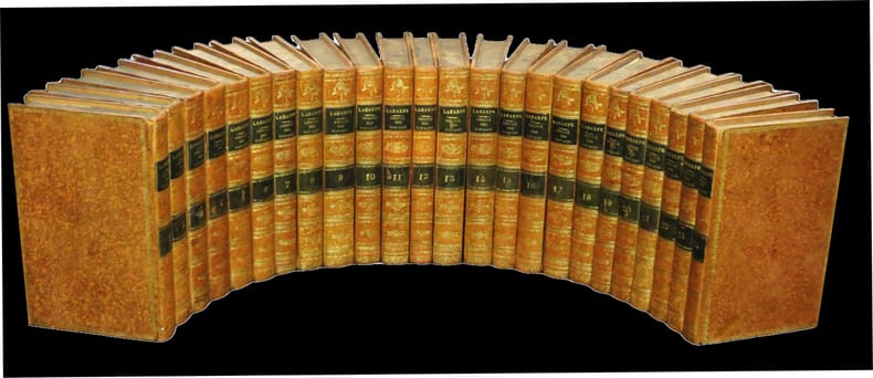
1820réf. 31213A Paris, chez Etienne Ledoux / de l'Imprimerie de Crapelet, 1820. 24 vol. vol. au format in-8 (213 x 135 mm) de xxviii - 463 pp. ; 2 ff. n.fol. et 496 pp. ; 2 ff. n.fol., 496 pp., 1 f. n.fol. et 1 f. bl. ; 2 ff. n.fol., 480 pp. et 1 f. n.fol. ; 2 ff. n.fol., 474 pp. et 1 f. n.fol. ; 2 ff. n.fol. et 435 pp. ; 2 ff. n.fol. et 473 pp. ; 2 ff. n.fol. et 475 pp. ; 2 ff. n.fol., 586 pp. et 1 f. n.fol. ; 2 ff. n.fol., 496 pp., 1 f. n.fol. et 1 f. bl. ; 2 ff n.fol., 508 pp. et 1 f. n.fol. ; 2 ff. n.fol. et 383 pp. ; 2 ff. n.fol. et 520 pp. ; 2 ff. n.fol. et 523 pp. ; 2 ff. n.fol. et 415 pp. ; 2 ff. n.fol. et 473 pp. ; 2 ff. n.fol. et 471 pp. ; 2 ff. n.fol., 488 pp. et 1 f. n.fol. ; 2 ff. n.fol., 378 pp. et 1 f. n.fol. ; 2 ff. n.fol, 429 pp. et 1 f. bl. ; 2 ff. n.fol. et 399 pp. ; 2 ff. n.fol. et 363 pp. ; 2 ff. n.fol. et 379 pp. ; 2 ff. n.fol., 346 pp. et 1 f. n.fol. Reliures uniformes de l'époque de pleine basane glacée et granitée fauve, filet, filet en pointillés et dentelle dorée encadrant les plats, dos lisses ornés de filets gras à froid, jeu de petits filets obliques dorés formant filets, roulettes dorées, larges fleurons romantiques dorés, pièces de titre et de tomaison de maroquin émeraude, titre doré, tomaison dorée, palette dorée en queue, filet doré sur les coupes, tranches jaspées.