Rümker, C. (Carl)Antiquariat.de

3 430 résultats
1857réf. SB-16616Hamburg, Perthes-Besser & Mauke, 1857. Sechste, mit stereotypirten Tafeln versehene Auflage XII, 372, XII, 546 S. Brauner Original-Ganzlederband mit goldgeprägtem Schiffsmotiv auf dem Vorderdeckel und dreiseitigem Blauschnitt. Einschlägiges Hand- und Lehrbuch der Schiffahrtskunde und nautischen Astronomie des Astronomen Carl Rümker (1788 -1862). Nach einer Lehrtätigkeit an der Hamburger Navigationsschule übernahm Rümker 1821 in Parramatta die Leitung der ersten australischen Sternwarte. Nach Deutschland zurückgekehrt, nahm er 1830 die ihm angetragene Direktorenstelle an der Hamburger Sternwarte an und kehrte zugleich, diesmal als Direktor, an die Navigationsschule zurück. Rümker gilt als einer der fähigsten Astronomen seiner Zeit. Er trat unter anderem durch Erstellung umfangreicher Sternkataloge mit über 7.000 bzw. 12.000 Sternpositionen hervor. Ein Berg auf dem Mond ("Mons Rümker") ist nach ihm benannt. Gliederung des Werkes: Trigonometrie - Steuermanns-Kunde - Astronomische Vorkenntnisse - Sphärische Astronomie - Astronomische Schiffs-Rechnung. Mit Kompaß-Illustration als Frontispiz, zahlreichen Textillustrationen sowie XLIV (jeweils mehrseitigen) nautischen Tafeln. Ferner mit folgenden Karten im Anhang: Ansicht eines Schiffes mit Erklärung der Takelage (mehrfach ausfaltbar); Allgemeine See-Karte (Weltkarte) 1849 (mehrfach ausfaltbar); Karte der Nordsee und des englischen Kanales (mehrfach ausfaltbar); Karte der magnetischen Meridiane und Parallelkreise mit den isogonischen Linien für 1830 (mehrfach ausfaltbar); Nördliche Hemisphäre (ausfaltbar); Südliche Hemisphäre (ausfaltbar).
1969réf. 2082702114611746Shiroyama Do 1969. Soft Cover. Fine. Number of books: 1 Shiroyama Do paperback
Madrid, en la Imprenta Real, 1832 (y) 1826. 4to.; LX-144 pp.(y) 39 pp., 1 h. Encuadernación de época en piel marbreada, con lomera ornada y tejuelo. Pequeña falta en el pie de la lomera.
1940réf. 794DGca. 1940 Ölgemälde auf Karton. 50 x 61 cm.
2016New English Original bdg. HC. 4to. (30 x 21 cm). In Turkish. 3 volumes set: (2162 p.), color and b/w ills. International Sympsium on Kara Mürsel Alp & History of Kocaeli II.= Uluslararasi Kara Mürsel [Karamürsel] Alp ve Kocaeli Tarihi Sempozyumu II. 3 volumes set. [In special box]. Edit: Haluk Selvi, M. Bilal Çelik, Ali Yesildal. A very heavy set. Symposium papers on the Ottoman / Turkish navigator Karamürsel Alp (14th century) and Kocaeli local history.
1923Very Good English Original b/w portolan chart. Folded. A little foxing and some pencil markings and notes in Ottoman script in its period. Oblong double elephant folio. (70 x 102 cm). In English. Bosphorus to Kerempeh from the Russian survey of 1834 with additions and corrections by Commander W. J. L. Wharton., R. N. 1872-80. It's written 'London published according to Act of Parliament at the Hydrographic Office of the Admiralty Jare. 16th 1854. Also shows Killa Bay (Shile Bay) from a survey by Lieut. Comm. W. R. Pristen and the midshipmen of H. M. S. Royal Sovereign, 1920. Topography partly from a Turkish map. Up side of map, engraved a view from sea of entrance of the Bosphorus, Rumili (sic. Rumeli) Lighthouse and environment with several hills. And also shows Amastra (Ancient Amastris) from Russian surveys, 1834-41; Kosku Bay from a surbey by Capt. Spratt R. N. 1854; and Sungul Bay (Zonguldak) from the Heraclee Companys plans to 1915. A rare navigation chart.
1911Very Good Turkish, Ottoman (1500-1928) In 1/4 aesthetic modern leather bdg. Demy 8vo. (21 x 14 cm). In Ottoman script. 222, [2] p. Roumi: 1327 = Gregorian: 1911. To send representative and make use of their impressions and experiences take very important place in the Ottoman westernization efforts. Enisi, one of representatives who were sent for this reason to Europe, deals with different aspects of Europe in his books. This book by Enisi includes his impressions in his European travel, especially France and Germany. First Edition. 5 copies in OCLC: 312586128.; Özege 1309.
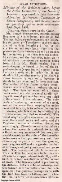
1831réf. 350541Knight and Lacey London 1831-32. Card Covers. Very Good Condition. The Mechanics' Magazine issues from November 1831 to January 1832 contained an extensive report on steam navigation accidents documenting the findings of a Select Committee of the House of Commons. This committee was formed to investigate the frequent calamities occurring in steam-powered vessels and to propose solutions to prevent future disasters. The report primarily written by Colonel Sibthorpe the committee chairman ran to approximately 70 columns and covered : Detailed accounts of steamship accidents including causes and consequences ; Technical assessments of steam engine failures and structural weaknesses in vessels ; Safety recommendations including improved boiler designs and operational protocols ; and economic and legislative considerations discussing the impact of regulations on steam navigation. These discussions were crucial in shaping early maritime safety regulations influencing the development of safer steamship designs and operational standards. The Mechanics' Magazine played a vital role in disseminating these findings to engineers shipbuilders and policymakers. The collection consists of the following seven complete issues: No. 433 Nov 26th 1831 to No. 439 Jan 7th 1832. Genuine Original and Packed with Innovation! This weekly magazine isn't just a fragment of history it's a window into the cutting-edge advancements of the Victorian era! Since 1823 The Mechanics' Magazine has tackled revolutionary topics from printing presses to vapor baths hydrostatics and hydraulics. It dives into breakthrough safety measures preventing explosive contaminated air while exploring the mechanics of oxy-hydrogen blowpipes and self-laying rail carriages. Every page crackles with Victorian-era engineering brilliance capturing the relentless drive for invention that shaped the modern world! This is an exclusive standalone issue carefully separated from its original volume; authentic original and uniquely crafted. It is not a reprint or reproduction but a distinct piece in its own right. Preserved in a modern card cover prepared for practicality - an unassuming but serviceable presentation that favours function over finery. Size: 13 x 21 cms. Category: Mechanics' Magazine; This item may require more postage than the rates shown for delivery outside the UK. If extra postage is required we will contact you before processing your order and you will be given the details and option to decline the extra cost. Knight and Lacey unknown
réf. 13349Journal hebdomadaire des Arts et Métiers Journal hebdomadaire des Arts et Métiers de la mécanique pratique, et découvertes, inventions, perfectionnements, procédés utiles, de l ‘industrie et de l’économie facturière, commerciale, rurale et domestique de l’Angleterre, etc. Tome second In 8 demi cuir, titre, tomaison, fers, roulette, filets dorés. XXXII-445 pages, pages de table des matières et d’errata. 20 planches hors-texte, la plupart dépliantes dont 3 avec déchirures, et une avec un petit manque de papier au niveau d’une pliure. Machines à vapeur, navigation chauffage, mécanique physique chimie, agriculture, économes Sautelet Charpenay & Cie. 1825. Peu courant.
1793réf. PHO-1089Paris, Maradan, 1793. 2 volumes in-8 (20 x 12,5 cm), veau moucheté, roulette dorée en encadrement, dos lisse orné, pièces de titre et de tomaison , (reliure époque). Seconde édition de la traduction française établie par le comte de Mirabeau, illustrée d'un portrait frontispice , de 3 portraits gravés Massard, Madame de Gouy et Mademoiselle Jouan, dont ceux du roi Abba Thulle et de sa famille ; et de 13 planches dépliantes (carte, plan, vues et objets ethnographiques), certaines signées par Pierre-François Tardieu.
2016réf. 2-4431563318Springer 2016. Paperback. New. reprint edition. 260 pages. 9.25x6.10x0.62 inches. Springer paperback
1820réf. xl2016A Paris, de l'imprimerie royale Broché 1820 In-4 (20 x 25,5 cm), broché, 75 pages, très belle carte de la navigation intérieure de la France en couleur ; mors fendus, manque sur le dos, bords des plats frottés, par ailleurs intérieur très frais, état correct. Livraison a domicile (La Poste) ou en Mondial Relay sur simple demande.
1812réf. 100692BBParis, Didot, 1812. 8°. XIII, 397 S., 1 Bl. mit 9 gefalt. Kupfertafeln. Hldr. um 1860 mit goldgepr. Rückentitel, Rückenverg. u. goldgepr. Deckelwappen (Schulpreis-Einband).
1896réf. 36686Wien, Fiume, Druck der kaiserlich-königlichen Hof- und Staatsdruckerei, 1896. gr. 8°, mit 8Tafeln und 116 in den Texht gedruckten Figuren, Bibl.Ex., Bezahlung per PayPal möglich, we accept PayPal, Einb. stark beschabt u. bestoßen u. angeschmutzt, fingerspurig, Schnitte angeschmutzt, altersbed. Bräunungen, stärkere Gebr.sp., kartoniert
réf. 3975Portland Oregon:: The Company; Press of C. H. Crocker . Fifty-nine halftones on 32 pp. Oblong 8vo dark gray/green pictorial wrappers. The Columbia River and Puget Sound Navigation Company was organized in 1891 by Captain U. B. Scott and John Leary. On p. 1 the company’s real name is revealed by "Compliments of Columbia River and Puget Sound Navigation Co. Portland Oregon" which was nicknamed the White Collar Line. [Portland, Oregon:: The Company; Press of C. H. Crocker, ,. unknown
réf. 3975Portland Oregon:: The Company; Press of C. H. Crocker . Fifty-nine halftones on 32 pp. Oblong 8vo dark gray/green pictorial wrappers. The Columbia River and Puget Sound Navigation Company was organized in 1891 by Captain U. B. Scott and John Leary. On p. 1 the company’s real name is revealed by "Compliments of Columbia River and Puget Sound Navigation Co. Portland Oregon" which was nicknamed the White Collar Line. [Portland, Oregon:: The Company; Press of C. H. Crocker, ,. unknown books
1924réf. 59232Washington D.C.: Government Printing Office Hydrographic Office U.S. Navy 1924; 1930. Two vols. 8vo. 608 pp.; 1 32 1 leaves. With1 large folding colour map. 1st vol. in light-green publisher’s buckram black lettering stamped on front cover & spines slight uniform toning darkening to spines shelfwear 2nd vol. w/ self-printed softcovers toning & minor predation minor chipping to fore-edges still VG- set w/ map in bright condition. Second edition of vol. 1 substantially revised & expanded 1st of 2nd of these very scarce coast pilot guides to waters of Indonesia drawing upon British Royal Navy coast pilots Australian Southeast Asian Polynesian and U.S. Navy reports. Prior to modern GPS systems and satellite navigation these regularly updated and revised navigation handbooks provided key sailing instructions. The map outlines the available charts for those covering the difficult sailing conditions through Java the Celebes Borneo Sumatra the Gulf of Siam the Celebes Timor and more. Worldcat locates only 4 copies of the first vol. Yale NYPL BN Mexico Stattsbibliotheck Berlin & 1 copy of the 2nd U of W. Government Printing Office, Hydrographic Office, U.S. Navy, paperback
1719réf. 59235Washington D.C.: Government Printing Office Hydrographic Office U.S. Navy 1917-1930. Nine vols. 8vo. x 4 470; 4 687 1; ix 1 586; ix 1 750 pp. plus publisher’s ads; ii 38; 5; 1 47; 1 60 3; 1 35 7 leaves. With 4 large folding colour maps. Four uniformly bound in tan publisher’s buckram black lettering front covers & spines minor soiling spotting fore-edges of covers darkening to spines very slight uniform interior toning; remaining Supplement vols. w/ self-printed softcovers toning to fore-edges minor chipping minor soiling chipping still VG set. First edition stated of vol. III and Supplements 2nd editions of other three vols. of these surprisingly scarce coast pilot guides to the Mediterranean Sea encompassing the coasts of Spain Morocco Algeria Tunisia Libya Egypt Palestine Turkey the Balearics and more draw upon British Royal Navy Ottoman Empire & Turkish coast pilots North African Russian & U.S. Navy reports. Prior to modern GPS systems and satellite navigation these regularly updated and revised navigation handbooks provided key sailing instructions. The maps outlines the available charts for the designated areas surrounding the Mediterranean Sea as well as detailing those for the Black Sea volume. Very uncommon to find complete set with all supplements to 1930. Government Printing Office, Hydrographic Office, U.S. Navy, paperback
1920réf. 59229Washington D.C.: Government Printing Office Hydrographic Office U.S. Navy 1920;1929. Two vols. 8vo. vii 1 4 500 pp.; 2 32 2 leaves. With 1 large folding colour map. First in dark blue publisher’s buckram lettering stamped on front cover & spine minor soiling edgewear slight uniform interior toning 2nd vol. in self-printed softcovers oxidized toning & predation to outer fore-edges front chipped corner still VG- set. First editions of these very scarce coast pilot guides to waters off the West coast of India just after World War I drawing upon British Royal Navy coast pilots and U.S. Navy reports. Prior to modern GPS systems and satellite navigation these regularly updated and revised navigation handbooks provided key sailing instructions often drawing not only from British & Indian sources but also sailing reports from U.S. Navy vessels and those from merchant ships. The map outlines the available charts for the coastline off of Bombay down to Cape Comorin the Maldives and Sri Lanka. Worldcat locates only 2 copies of the scarce supplement. Government Printing Office, Hydrographic Office, U.S. Navy, paperback
1930réf. 87257Paris, Duchartre & Van Buggenhoudt 1930 2 volumes. In-4. Reliures plein chagrin bleu marine, couvertures en couleurs et dos conservés, dos lisses, premiers plats ornés d’une composition figurative polychrome et mosaïquée, 282 pp., XVI planches hors texte monochromes tirées à part, III planches hors texte en couleurs, nombreuses illustrations en noir et blanc dans le texte - 411 pp., XI planches monochrome tirées à part, V hors texte en couleurs, nombreuses illustrations en noir et blanc dans le texte. Reliures légèrement frottées remarquables par leur esthétique.
2014réf. x-4431544747Springer Verlag 2014. Hardcover. New. 2014 edition. 247 pages. 9.00x6.25x0.75 inches. Springer Verlag hardcover
2021réf. DADAX981334668XSpringer 2021-03-24. 1st ed. 2021. hardcover. New. 6.14x0.81x9.21. Buy with confidence. Excellent Customer Service & Return policy. Springer hardcover
2019réf. x-9811370850Springer 2019. Hardcover. New. 300 pages. 9.25x6.10x0.87 inches. Springer hardcover
1900réf. 1865s.l., ca 1900. 35 X 26 cm (planches), 8 x 11 ou 5 x 6 cm (photos). 9 planches. Ensemble de 57 photographies originales sur papier, réparties sur 9 planches, titrées et illustrées à la main, à l'encre et à la gouache.Les photographies représentent des portraits (individuels ou collectifs), les loisirs et jeux (cerceau, croquet, bicyclette, balançoire, promenades, chasse, farniente...), des travaux des champs et sont accompagnées de légendes, souvent humoristiques. De nombreuses illustrations ornent également les planches : personnages, titres et motifs décoratifs, fleurs, frises, paysages ... Au verso des planches, 8 portraits de personnalités réalisés à l'encre : Etienne Marcel, Bailly, Ledru-Rollin, Turgot, Talleyrand, Eugène Cavaignac, Daguerre et Niepce, ainsi que des symboles (fleur de lys) ou armoiries et blasons éxécutés à l'encre et à la gouache. Très intéressant ensemble, qui reflète une certaine diffusion sociale de la pratique photographique - au sein de l'élite bourgeoise - à la fin du XIXe siècle, en lien avec l'évolution des techniques, à la fois en ce qui concerne la prise de vue et les procédés de tirage. Equipés d'appareils d'utilisation de plus en plus aisée, de nombreux amateurs immortalisent alors, comme ici, les petits et grands moments de la vie de tous les jours, constituant albums de souvenirs et collections privées qui consacrent le rôle désormais essentiel de l'image dans la culture de la Belle Epoque. L'auteur de ces clichés, qui ne manquait ni d'humour ni de talent, a par ailleurs enrichi son travail artisanal d'autres éléments esthétiques : décors et ornements graphiques issus de l'univers du livre (imitant fleurons,bandeaux, culs-de-lampe, séparations de chapitres...), dessins "classiques" (paysages, portraits), inspirés du mouvement Art Nouveau (fleurs, vignette "japonisante") ou influencés par la presse et l'affiche (typographie fantaisiste, caricatures,...).