LABADIE (J.-Émile)Livre Rare Book
3 430 résultats
1886réf. PHO-2650Paris, Veuve Ambroise Lefèvre, 1886, in-8 (22x14cm), 191 pp., une grande planche dépliante contenant 9 cartes en couleurs. Demi chagrin époque, dos à nerfs avec auteur et titre.
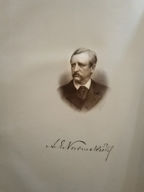
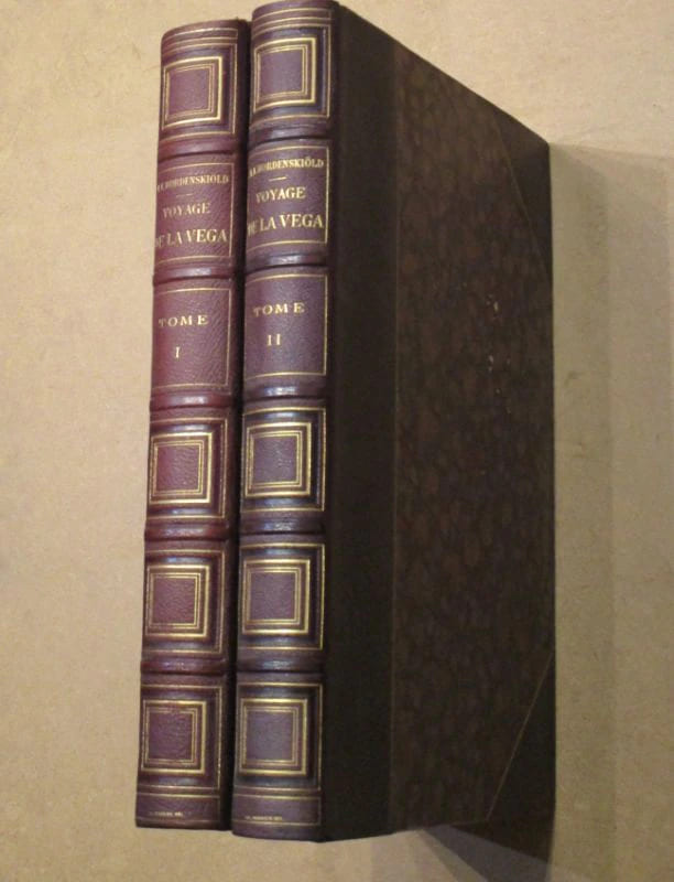
1883réf. WOC-2661Accompagné d'un résumé des voyages précédemment effectués le Long des Côtes Septentrionales de l'Ancien Continent. Ouvrage traduit du Suédois avec l'autorisation de l'auteur par MM. Charles Rabot (Membre de la Société de Géographie de Paris) et Charles Lallemand (Ingénieur au Corps des Mines). Contenant 293 gravures sur bois, 3 gravures sur acier et 18 cartes. Paris, Librairie Hachettes et Cie, 1883-1885. 2 volumes in-4 (28,5x3,5x20cm) reliés demi chagrin brun à coins, dos petits nerfs ornés de caissons dorés, double filets sur les plats, têtes dorées (reliure d'époques). [2]ff. n. ch., IV,481pp. + [2]ff. n.ch., 278pp.
réf. 119602Paris, Librairie Hachette et Cie, 1883-1885, 2 volumes de 190x280 mm environ, (3) ff., IV, 481 pages, (1) f. - (2) ff., 478 pages, (1) f. Complet des 2 frontispices et 19 cartes. Demi-reliure à coins, dos à nerfs portant titres et tomaisons dorés, tranche de tête dorée, gardes marbrées. Dos très légèrement insolés, coins frottés, quelques marques sur les plats, débuts de fente sur le mors interne du tome I, rousseurs principalement sur les tranches, sinon intérieur propre, bon état général.
1835réf. 6004Paris, Carilian-Goeury, 1835. 8vo. (20,3 x 12,5 cm). 19 S. Bibl.-Leinwandband d. Zt. mit goldgprägtem Titel u. Bibl.-Supralibros auf dem Vorderdeckel.
réf. 59127Neuchâtel Verlag Baconnière 1947 Auflage: 1. Leinen gebunden; blaue goldgeprägte Einbände / 3 Bände / Anz. Seiten: 278 35 144 / 225 x 305 cm / mit 35 ausfaltbaren Tafeln Schemata und Karten Bd. 2; 8 Schemata und 4 Karten 2 davon ausfaltbar Bd. 3 / Zustand: gut geringe bis leichte Gebrauchsspuren; Einbände gering fleckig Bd. 1 Bd. 3 fleckig Bd. 2 Rücken leicht gebräunt Schnitt mässig stockfleckig und etwas gebräunt Vorsatz bis Vortitel leicht fleckig Bd. 1 Mit Widmung des Direktors der Zellulosefabrik Attisholz sowie beiligendem Brief; Inhalt: Band 1: Technischer Generalbericht bearbeitet von Ing. H. Blattner Leiter der Studien Genfersee-Rhein: Allgemeines; Die Technischen Studien; Zusammenstellung der Gesamtkosten; Allgemeine Betrachtungen und Bemerkungen zu den technischen Ergebnissen der Projekte; Die technischen Schlussfolgerungen; Band 2: Tafelbeilagen; Band 3: Bericht über die volkswirtschaftliche und wirtschaftliche Beurteilung einer Schiffahrtsverbindung Genfersee-Rhein: Allgemeine Übersichtspläne; Projektabschnitt I Entreroches-Kanal; Projektabschnitt III Bielersee-Aaremündung in den Rhein; Graphische Fahrpläne Aarau - Aarwangen-Wynau - Bernerschachen - Beznau - Binnenschiffahrt - Brugg-Lauffohr - Eclépens-Orbe - Genfersee-Vufflens-la-Ville - Jura-Seen - Klein-Aarwangen - Klingnau - Olten-Gösgen - Orbe-Yverdon - Rüchlig - Rupperswil-Auenstein - Staustufen - Vufflens-la-Ville-Eclépens-Orbe - Wildegg-Brugg - Wynau-Olten Neuchâtel, Verlag Baconnière, 1947, Auflage: 1. unknown
réf. 4986Rochefort, Faye, 1765. Un volume in-8° plein veau (reliure postérieure), dos à nerfs sobre, titre doré, [1f.]bl., [1f.]faux-titre, [1f.]titre, [3ff.], 99 pages chiffrées, 261 ff. (non paginés) de tableaux, erratum. Suivi de: Tarif des proportions que doivent avoir les bois de construction, Arrêté à Brest le premier Décembre 1718. Rochefort, Faye, 1765. [1f.]titre, [3ff.], 4pl. Légères épidermures, légers manques à un coin et en queue. Bon exemplaire, intérieur frais.
réf. 224488Paris, A. Marescq aîné, 1880 in-8, [2] ff. n. ch., VII pp., 320 pp., demi-chagrin marine, dos à nerfs, tranches peigne jaspées (reliure de l'époque).
1792réf. PHO-1241Chez Briand, à Paris 1792, 2 tomes en 2 Vol. in-8 (13,5x21,8cm), (2) vj, 440pp. et (2) 483pp., relié plein basane tacheté , dos lisse orné avec pièces de titre et tomaison vertes , ex-libris manuscrit , coiffes et coins usés , charnières fendues , vieilles mouillures avec quelques traces .
1931réf. 12296AmsterdamBatavia 1931. Accordion Binding 20 pages. Acceptable. 6" x 5" accordion bound with raised cloth binding. Tearing and fraying to bottom of outer spine. Significant bowing creasing soiling rubbing and bumping to outer and inner boards. Age wear to photographs. Stamped page numbers in silver ink. Minor creasing present to various pages. unknown
1896réf. 77014Washington DC: U.S. Department of the Navy Bureau of Navigation Hydrographic Office 1896. Presumed First Edition First printing thus. Map. Good. This was published at the Hydrographic Office in Washington D.C. in February 1896. No. 1530. Charles D. Sigabee Commander U.S. N. Hydrographer. Format is approximately 26 inches by 17 inches folded. This map is disbound from Volume I of the Commercial Directory of the American Republics compiled by the Bureau of American Republics International Union of American Republics Joseph P. Smith Director 1897 Title page from Directory is present. Taped to top right of map in margin is the statement "This chart is intended solely to show tracks of steam vessels on the ocean and no authority is assumed for the boundary lines as drawn between the countries." Map has some color differentiation and several inserts presenting distance information between major ports of call. Map has been folded with approximately the top third folded down. It is also folded into four sections of different lengths to fit as the frontis to the Directory. Map has some wear and soiling/staining. This is similar to the large-scale and detailed World chart on Mercator's projection produced by the British Admiralty under the "Superintendence of Captain Wharton R.N. F.R.S Hydrographer" engraved by Edward Weller and sold by J. D. Potter chart agent. The map has no internal landmass detail unless relevant to steam ship routes thus the Suez and Panama canals are marked as is the Canadian Pacific Railway. Panels along the lower edge list major ports and give distances dependent on routes taken and average knots-per-hour speeds with daily distances covered in miles. The world's major ports are linked by ship-routes each track with its relevant distance and so on. An interesting chart at the time steam took over from sail. Charles Dwight Sigsbee 1845 - 1923 was a Rear Admiral in the United States Navy. In his earlier career he was a pioneering oceanographer and hydrographer. He is best remembered as the captain of the USS Maine which exploded in Havana harbor Cuba in 1898. U.S. Department of the Navy, Bureau of Navigation, Hydrographic Office unknown
réf. 11555In 4 , reliure éditeur pleine toile verte- dirigeable et titre en blanc sur le premier plat, titre en blanc au dos. Faux-titre, titre, 72 pages sur papier couché, nombreuses illustrations et gravures. Complet des 6 modèles descriptifs entièrement démontables. Les aéronats- l’aéroplane WRIGHT- l’aéroplane voisin Paris Librairie Commerciale Aristide QUILLET éditeur 1910. Très bon état proche de l’état de neuf.
2 Vols., folio, [2], 460; [2], [441]-990, [2, directions to the binder], [4, list of subscribers]pp., lacks most plates and maps, text age-toned and with occasional staining, cont. red morocco, rubbed and worn. With 8 plates and 3 torn and defective maps: Vol. I. Plate. p. 157. Plate. p. 203. Plate. p. 407. Vol. II. Frontispiece. Map. p. 541. Map. p. 580. Plates x 2. p.685. Map. p. 906. Plates x 2. p. 920.
First edition, 8vo (200 x 130 mm), vii, [1], 30pp., coloured folding map frontis., cont. half calf, marbled boards, spine defective at foot, gilt lettered red morocco label on upper cover. A poetical celebration of the opening of the port of Norwich by William Cole (1769-1835), Suffolk farmer, later clerk at the Norwich and Lowestoft Navigation Works. The plan for making Norwich a Port was first submitted by Crisp Brown on the 3rd of May, 1814, in which year William Cubitt, Civil Engineer, took a survey of the Navigation. The Royal Assent was granted on the 28th of May, 1827. Rare: Copac locating the BL and Oxford copies only.
réf. 248791882. Printed. One page 33 x 25cm small chip off one corner fold marks discreet repair to edges and fold just noticeable shadow caused by exposure to sun good condition. See Image. On otherwise blank version there is the small stamp of the Webster Collection no. '1569'. Note: In "Orient Line Guide: Chapters for Travellers by Sea and by Land" W.J. Loftie pubd 1890 i.e. a later edition the relevant plate only shows the outward journey not the homeward. I have found no other copy of the White/Hull edition 1882 on viaLibri. 1882. unknown
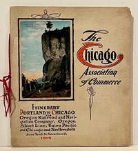
1909réf. 22859Chicago: Chicago Association of Commerce 1909. First Edition. Quarto; 8pp. Four string-tied and stapled leaves with ten 3 1/2" x 5 1/2" mounted colored illustrations each titled in red along with a map of the route. Near Fine copy in grey cardstock titled and color photograph tipped to front cover. Rare promotional piece; we fine only 1 copy at University of Michigan. This booklet was prepared by the Oregon Railroad & Navigation Company the Oregon Short Line Railroad the Union Pacific Railroad and the Chicago & Northwestern Railway as an itinerary for the approximately 40 Chicago merchants' return trip ". calling your attention to a few of the points of interest in a country of marvellous scenes wonderful accomplishments and a still more wonderful future." Lists 38 members of the Chicago Association of Commerce making the return trip. Uncommon attractive & elaborate promotional piece. Chicago Association of Commerce unknown
1939réf. 7103Np: Matson Navigation Company 1939. 1st. Paperback. First Edition. Folio. Vol. 1 No. 1 - 4 Jan. 1941-June 1941 Complete. Each issue 14pp. Numerous photo-illustrations; ads. Original photo-illustrated wrappers. Minor soiling and wear to extremities; front cover of No. 2 partially separated; otherwise near fine. Four numbers issued during the 4 day voyage on the Matson Line cruise ship from California to Hawaii California-Hawaii-Samoa-Fiji-New Zealand-Australia. Each number features a special theme-the first Hawaii's History; the second Scenic Attractions; the third Island Sports and Recreation; and fourth Native Life and Folklore. Matson Navigation Company paperback
1845Very Good French A fine original chromo-lithograph print from "Souvenirs de Constantinople" by Brindesi, printed in 1845. Framed, but will be sent no frame. 52x49 cm / 39x 44 cm print area. Stains on right bottom margins of the paper. The Ottoman navy, stationed in front of the Tophane Artillery barracks, is preparing to sail under the leadership of Kapudan Pasha's ship "Amiraute". Jean Brindesi was born in 1826 and worked primarily as a watercolour artist. During the Abdulmecid period (1831-1861), he worked on scenes involving soldiers in Istanbul. Two albums of lithographs after his drawings were produced by Lemercier in Paris: Elbicei Atika - Musee des Anciens Costumes Turcs de Constantinople, 1855, and Souvenirs de Constantinople, 1860; these two works are collections of picturesque views of the city of Constantinople. The originals are kept at the Istanbul Topkapi Palace Museum and at the University of Istanbul. (Source: Levantine Heritage).
réf. ORD-1233Avec l'examen des Documens qui établissent ou contestent leur existence; suivi 1° d'une Table exacte des déclinaisons de la boussole, avec les dates des époques où elles ont été observées; 2° D'une Série d'Expériences qui tendent à prouver qu'en vérifiant de temps en temps le profondeur de la mer, et sa chaleur relative, au moyen du thermomètre, on peut être averti des dangers sur la route d'un vaisseau, assez à temps pour les éviter, quoique le mauvais temps empêche de reconnaître la nature du fonds ou de faire des observations astronomiques; 3° D'un Tableau de faits propres à constater le cours des îles de glace du Groënland vers Terre-Neuve, etc. Traduit de l'anglais d'Edmond BLUNT. Paris. Mme Seignot. 1822. In-8 (130 x 198mm), VIII, 208 pages. Dos lisse basane brune, orné de frises et fleurons or, pièce de titre maroquin rouge, tranches marbrées. Les VIII premières pages lgt brunies sinon bon exemplaire. Peu courant (Polak, 898; Sabin, 6027; Quérard I, 361.)
réf. 204457 pages autographes ,IN4 broché,sans couvertures,ecriture lisible
1855280pp, index, 19pp + 2 plates, 332pp + table VG/none First edition, in French. Contemporary binding green hardback with gilt decoration and lettering on spines, binder’s and owner’s labels on pastedown of vol. I, previous owner presentation on preliminary, slightly offset on title, occasional light foxing inside, nice volumes overall in G-to-VG conditions. First two volumes of a 5-volume series printed between 1855 and 1860, each independent. Included in the first volume two plates containing maps (folded in the photos) of the Isthmus of Suez and of the Navigation Routes between European and American ports and the Indies. Prima edizione, in francese. Rilegatura coeva copertina rigida verde con decorazioni e scritte dorate al dorso, etichetta rilegatore e ex-libris sul retro della copertina, scritta proprietario al foglio preliminare leggermente trasmessa al frontespizio, sporadiche fioriture all'interno, nel complesso in condizioni piu' che buone. Primi due volumi, a se' stanti, di una serie di cinque pubblicata tra il 1855 e il 1860. Nel vol. I incluse due mappe ripiegate (Istmo di Suez e Rotte di Navigazione tra i porti europei ed americani e le Indie).
1878réf. 188051878 Paris, Dunod, 1878, - 1 vol. grand in-4 de 128 planches sur 129 planches sur double page (dont 19 dépl. et ) pour l’atlas;reliure demi velin,dos muet. 19e fascicule du Manuel de l'ingénieur des Ponts et Chaussées rédigé conformément au programme annexé au décret du 7 mars 1868 réglant l’admission des conducteurs des Ponts et Chaussées au grade d’ingénieur. Edition originale. Rare.
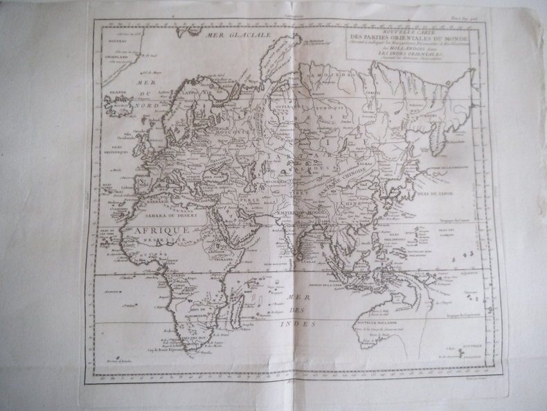
réf. 14520Nouvelle carte des parties orientales du Monde servant à indiquer les navigations, découvertes et établissements des Hollandois dans les Indes orientales suivant la dernière observation. Gravé par LATTRE gravure 370x350(coupé à la cuvette 500x350mm avec marges Rare carte avec l’Australie, océan pacifique, traces des nombreux explorateurs
18802 tomes: 348 + 392pp., 27cm., reliures cart. uniformes (plats marbrés, dos en toile avec titre doré, charnière sup. de t.2 restaurée), bon état, Publication du ministère des travaux publics (direction des travaux hydrauliques), tome 2 contient principalement des tableaux (avec indication de: désignation du port et du bassin et des biefs, distance kilométrique, niveau du couronnement, cote absolue, niveau au-dessus des fondations, longueur, ponts, etc…], B89650
Paris, chez Didot, Libraire, 1746. Folio; portada, XVII pp., XIV pp., 563 pp., 1 h., y 30 magníficas láminas grabadas por Chedel sobre dibujos de Cochin, 17 de ellas plegadas, en su mayor parte mapas. Las últimas cien páginas presentan ligeros rastros antiguos de humedad. Encuadernación de época en piel marbreada, fatigada, con lomera perdida en gran parte.
réf. 12123Paris, Librairie scientifique-industrielle de L. Mathias (Augustin), 1847, fort in-8° de 2 ff.n.ch. (fx-titre, titre)-944 pages, relié demi-chagrin bleu d'époque, titre or sur dos lisse orné de filets or et à froid, gardes de papier caillouté ; rousseurs fortes à plusieurs cahiers, pour autant très bon exemplaire de ce livre qui semble fort rare.