3.434 Ergebnisse
1926Best.-Nr. 59231Washington D.C.: Government Printing Office Hydrographic Office U.S. Navy 1926-1928. Two vols. 8vo. xxxii 4 788; ix 1 619 pp. With 5 large folding colour maps 2 double-sided. Uniformly bound in light-green publisher’s buckram gilt lettering stamped on front covers & spines slight uniform toning darkening to spines shelfwear still VG set w/ maps in bright condition. Third editions revised & expanded of these coast pilot guides to waters of the South Pacific Southeast Asia and Australasia encompassing New Zealand New Guinea the Gilbert Caroline Marshall Fiji Samoan Hawaiian New Hebrides and Indonesian Islands drawing upon British Royal Navy coast pilots Australian Southeast Asian Polynesian and U.S. Navy reports. Prior to modern GPS systems and satellite navigation these regularly updated and revised navigation handbooks provided key sailing instructions. The map outlines the available charts for the entire Pacific. Government Printing Office, Hydrographic Office, U.S. Navy, hardcover
1927Best.-Nr. 59236Washington D.C.: Government Printing Office Hydrographic Office U.S. Navy 1927-1930. Three vols. 8vo. x 4 550; viii 4 560 pp.; 1 17 2 leaves. With 4 large folding colour maps 1 w/ toning at fore-edge from being improperly folded some edgewear numerous plates showing lighthouses. Two volumes uniformly bound in red publisher’s cloth gilt lettering front cover & spine darkening to spine fore-edges minor shelfwear dustsoiling minor paint drip at fore-edge 1 vol. Supplement in self-printed softcovers edgewear toning to fore-edges minor predation still VG- set. Third editions revised & updated of vols. I & II first edition of scarce Supplement of these coast pilot guides to South America and Antarctica in the 1920’s. Prior to modern GPS systems and satellite navigation these regularly updated and revised navigation handbooks provided key sailing instructions often drawing not only from Brazilian Argentine and British coast pilots as well as sailing reports from U.S. Navy vessels and those from merchant ships. The first large map delineates the requisite coast pilots for sailing in American waters and charts to be ordered from the Hydrographic Office while the second maps depict the sailing routes. The expanded 3rd edition is quite scarce with 1 copy located of both vols. in Worldcat NYPL. Government Printing Office, Hydrographic Office, U.S. Navy, paperback
1920Best.-Nr. 59229Washington D.C.: Government Printing Office Hydrographic Office U.S. Navy 1920;1929. Two vols. 8vo. vii 1 4 500 pp.; 2 32 2 leaves. With 1 large folding colour map. First in dark blue publisher’s buckram lettering stamped on front cover & spine minor soiling edgewear slight uniform interior toning 2nd vol. in self-printed softcovers oxidized toning & predation to outer fore-edges front chipped corner still VG- set. First editions of these very scarce coast pilot guides to waters off the West coast of India just after World War I drawing upon British Royal Navy coast pilots and U.S. Navy reports. Prior to modern GPS systems and satellite navigation these regularly updated and revised navigation handbooks provided key sailing instructions often drawing not only from British & Indian sources but also sailing reports from U.S. Navy vessels and those from merchant ships. The map outlines the available charts for the coastline off of Bombay down to Cape Comorin the Maldives and Sri Lanka. Worldcat locates only 2 copies of the scarce supplement. Government Printing Office, Hydrographic Office, U.S. Navy, paperback
1926Best.-Nr. 59234Washington D.C.: Government Printing Office Hydrographic Office U.S. Navy 1926; 1930. Two vols. 8vo.viii 478 pp.; 1 22; 1 leaves. With 1 large folding colour map. First vol. in tan publisher’s buckram black lettering front cover & spine minor soiling spotting fore-edges of covers darkening to spine very slight uniform interior toning; 2nd. vol. w/ self-printed softcovers toning to fore-edges minor chipping still VG set. Second edition stated of vol. I and 1st edition of Supplement. These uncommon coast pilot guides to Eastern Mediterranean waters the Black Sea and the Sea of Azov draw upon British Royal Navy Ottoman Empire & Turkish coast pilots Russian & U.S. Navy reports. Prior to modern GPS systems and satellite navigation these regularly updated and revised navigation handbooks provided key sailing instructions. The maps outlines the available charts for the designated areas surrounding the Black Sea as well as detailing those for the extensive set of the Mediterranean Sea. Government Printing Office, Hydrographic Office, U.S. Navy, paperback
1927Best.-Nr. 59226Washington D.C.: Government Printing Office Hydrographic Office U.S. Navy 1927-1928. Two vols. 8vo. 8 viii 424; 6 v 1 446 pp. With 4 large folding colour maps 1 double-sided elevation maps showing harbor entrances numerous photo plates. Beige publisher’s cloth black lettering front cover & spine darkening to spine fore-edges minor shelfwear dustsoiling still VG set. Third & Seventh editions revised & updated of these coast pilot guides to Central America and Mexico in the 1920’s. Prior to modern GPS systems and satellite navigation these regularly updated and revised navigation handbooks provided key sailing instructions often drawing not only from Mexican and West Indies sources but also governmental publications in the Panama Canal sailing reports from U.S. Navy vessels and those from merchant ships. The first large map delineates not only the requisite coast pilots for sailing in American waters but also the charts to be ordered from the Hydrographic Office. Government Printing Office, Hydrographic Office, U.S. Navy, hardcover
1920Best.-Nr. 59233Washington D.C.: Government Printing Office Hydrographic Office U.S. Navy 1920-1930. Seven vols. 8vo. 4 365 1; 584; v 1 4 447 1 pp.; 2 22; 1; 2 57 1; 1 36 2 leaves. With 3 large folding colour maps numerous photo plates elevation views. Three uniformly bound in blue publisher’s buckram gilt lettering stamped on front covers & spines edgewear dustsoiling very slight uniform toning bowing to covers on vol. III some scuffing supplements all w/ self-printed softcovers edgewear rippling toning to fore-edges some predation still a G set w/ maps in bright condition. First editions stated of these uncommon coast pilot guides to Australian waters drawing upon British Royal Navy coast pilots Australian and U.S. Navy reports. Prior to modern GPS systems and satellite navigation these regularly updated and revised navigation handbooks provided key sailing instructions. The maps outlines the available charts for the designated areas surrounding Australia as well as those for the East Indies Pilot. First editions of these Hydrographic Office pilots are quite scarce and seldom seen with the supplements. Government Printing Office, Hydrographic Office, U.S. Navy, paperback
1924Best.-Nr. 59232Washington D.C.: Government Printing Office Hydrographic Office U.S. Navy 1924; 1930. Two vols. 8vo. 608 pp.; 1 32 1 leaves. With1 large folding colour map. 1st vol. in light-green publisher’s buckram black lettering stamped on front cover & spines slight uniform toning darkening to spines shelfwear 2nd vol. w/ self-printed softcovers toning & minor predation minor chipping to fore-edges still VG- set w/ map in bright condition. Second edition of vol. 1 substantially revised & expanded 1st of 2nd of these very scarce coast pilot guides to waters of Indonesia drawing upon British Royal Navy coast pilots Australian Southeast Asian Polynesian and U.S. Navy reports. Prior to modern GPS systems and satellite navigation these regularly updated and revised navigation handbooks provided key sailing instructions. The map outlines the available charts for those covering the difficult sailing conditions through Java the Celebes Borneo Sumatra the Gulf of Siam the Celebes Timor and more. Worldcat locates only 4 copies of the first vol. Yale NYPL BN Mexico Stattsbibliotheck Berlin & 1 copy of the 2nd U of W. Government Printing Office, Hydrographic Office, U.S. Navy, paperback
1719Best.-Nr. 59235Washington D.C.: Government Printing Office Hydrographic Office U.S. Navy 1917-1930. Nine vols. 8vo. x 4 470; 4 687 1; ix 1 586; ix 1 750 pp. plus publisher’s ads; ii 38; 5; 1 47; 1 60 3; 1 35 7 leaves. With 4 large folding colour maps. Four uniformly bound in tan publisher’s buckram black lettering front covers & spines minor soiling spotting fore-edges of covers darkening to spines very slight uniform interior toning; remaining Supplement vols. w/ self-printed softcovers toning to fore-edges minor chipping minor soiling chipping still VG set. First edition stated of vol. III and Supplements 2nd editions of other three vols. of these surprisingly scarce coast pilot guides to the Mediterranean Sea encompassing the coasts of Spain Morocco Algeria Tunisia Libya Egypt Palestine Turkey the Balearics and more draw upon British Royal Navy Ottoman Empire & Turkish coast pilots North African Russian & U.S. Navy reports. Prior to modern GPS systems and satellite navigation these regularly updated and revised navigation handbooks provided key sailing instructions. The maps outlines the available charts for the designated areas surrounding the Mediterranean Sea as well as detailing those for the Black Sea volume. Very uncommon to find complete set with all supplements to 1930. Government Printing Office, Hydrographic Office, U.S. Navy, paperback
1922Best.-Nr. 59239Washington D.C.: Government Printing Office Hydrographic Office U.S. Navy 1922; 1930. Two vols. 8vo. v 1 4 397 1 pp.; 1 60 2 leaves. With 1 large folding colour map. 1st vol. in green publisher’s buckram gilt lettering stamped on front cover & spine darkening to spine shelfwear minor scuffing; 2nd vol. Supplement in self-printed softcovers toning chipping & tears to fore-edges minor creasing to corner still VG- set. Third edition stated of vol. I 1st edition of Supplement vol. of these surprisingly scarce coast pilot guides detailing the sailing directions for the treacherous coasts of Great Britain France Belgium Netherlands German & Denmark notoriously treacherous for sailing and powered vessels. Prior to modern GPS systems and satellite navigation these regularly updated and revised navigation handbooks provided key sailing instructions drawing upon British French German Dutch & Danish sailing directions and charts. Worldcat locates no copies of the Supplement. Government Printing Office, Hydrographic Office, U.S. Navy, paperback
1719Best.-Nr. 59230Washington D.C.: Government Printing Office Hydrographic Office U.S. Navy 1917; 1930. Two vols. 8vo. ix 1 4 364 pp.; 19 mimeograph leaves. With 2 large folding colour map. First vol. in black publisher’s buckram silver lettering stamped on front cover & spine minor shelfwear slight interior toning shelfwear 2nd vol. mimeographed typescript & stapled at gutter margin minor dustsoiling edgewear predation to lower fore-edge tear to last leaf of blank lower portion still a VG set. First editions of these coast pilot guides to Arctic waters during and after World War I issued about the time of the Russian Revolution and offered key navigational guides for Naval forces during the ill-fated White Russia Revolution and over 13000 troops in the Polar Bear Expedition. Prior to modern GPS systems and satellite navigation these regularly updated and revised navigation handbooks provided key sailing instructions often drawing not only from Russian & British sources but also sailing reports from U.S. Navy vessels and those from merchant ships. The two maps serve as indexes to sailing charts to be ordered from the Hydrographic Office and keyed to sailing instructions within the coast pilots. The supplement is uncommon no copies located in Worldcat. Government Printing Office, Hydrographic Office, U.S. Navy, hardcover
1920Best.-Nr. 59238Washington D.C.: Government Printing Office Hydrographic Office U.S. Navy 1920; 1930. Two vols. 8vo. viii 4 577 1 pp.; 1 38 1 leaves. With 1 large folding colour map. 1st vol. in green publisher’s buckram gilt lettering stamped on front cover & spine darkening to spine shelfwear deep embossed circular indentation at gutter margin where brass weight held book open; 2nd vol. Supplement in self-printed softcovers toning chipping & tears to spine still G set. Second edition stated of vol. I 1st edition of Supplement vol. of these surprisingly scarce coast pilot guides detailing the sailing directions for the treacherous coasts of Norway & Sweden notoriously treacherous for sailing and powered vessels. Prior to modern GPS systems and satellite navigation these regularly updated and revised navigation handbooks provided key sailing instructions drawing upon British Norwegian Swedish & Danish coast pilots. Worldcat locates only 1 copy of the Supplement U of W. Government Printing Office, Hydrographic Office, U.S. Navy, paperback
1815Best.-Nr. 55781New York: Printed for Edmund M. Blunt Oct. 1815. 8vo. xvi 297 86 pp. plus 2 pp. publisher’s ads. Woodcut-engraved front of the Blunt New York Shop 9 of 15 maps & charts 1 w/ partial loss several w/ additional sailing instructions and printed notices pasted-in manuscript sailing instructions and notes on versos of some. Original calf spine & calf on rear cover perished shaken dampstaining & toning still fair reference copy from the library of Captain Thomas Hall II 1804-1829 son of Captain Thomas Hall 1778-1816 who was lost at sea while sailing from Charleston to Boston in Feb. 1829 which his brother Charles Hall 1810-1829 ownership markings on endpapers of both w/ manuscript note on verso of ffep. that this is “good for a pint of ale” facing clippings about new lighthouses ca. 1821 listing the Ten Pound Island stone tower light house first built on the site in 1821. Preserved in brick-coloured linen cloth clamshell slipcase w/ printed label on spine. Eighth edition of this early vital tool for American sea captains and navigators first published in a much shorter version of only 122 pp. in 1796 and the first edition to bear only Edmund Blunt’s name as author. The original commissioned from Captain Lawrence Furlong proved so crude and unusable that Blunt arranged for it to be edited and rewritten. Blunt’s Coast Pilots were the earliest works of their type published in North America to cover the Atlantic Coast of the U.S. with sailing directions tide tables tables of latitudes and longitudes and as this copy shows were often working evolving documents with additional manuscript annotations and printed additions including in this case the Charleston Harbour map which is not included in the binding instructions and supposedly left out of the 8th edition. Printed for Edmund M. Blunt, hardcover
1807Best.-Nr. 55849Philadelphia: Published by B.B. Hopkins and Co. and sold by W.P. Farrand No. 170 Printed by T. & G. Palmer 1807. 8vo. xxiii 1 270; 271-275 1 40 16 15-16 17-220 4 pp. including binders instructions and publisher’s advertisement. With 7 copper-engraved plates & maps 6 engraved by Benjamin Tanner. Contemporary polished brown calf red & gilt morocco spine label chipping to head of spine minor edgewear occasional interior foxing & toning still a VG- copy from the library of John L. Gow 1797-1866 noted Pennsylvania attorney w/ ownership label and markings on front pastedown. First American edition of this classic navigation handbook which was first published in 1804 and here contained substantial corrections to the tables of the latitudes and longitudes of places on the American coast and in the West Indies as well as an improved system of finding the longitude by P. Delamar of Philadelphia. Mackay 1760-1809 was noted Scottish mathematician and astronomer taught navigation and instructed in methods of how to find longitude. Shoemaker 12965. Published by B.B. Hopkins and Co., and sold by W.P. Farrand, No. 170, Printed by T. & G. Palmer, unknown
Best.-Nr. 1120119685.Gpaperback. Good. Access codes and supplements are not guaranteed with used items. May be an ex-library book. paperback
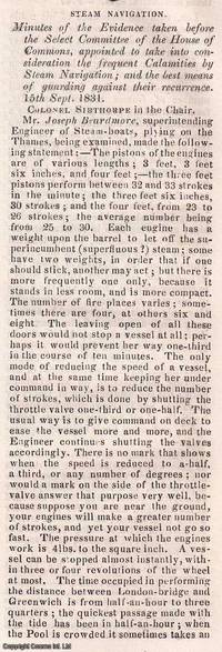
1831Best.-Nr. 350541Knight and Lacey London 1831-32. Card Covers. Very Good Condition. The Mechanics' Magazine issues from November 1831 to January 1832 contained an extensive report on steam navigation accidents documenting the findings of a Select Committee of the House of Commons. This committee was formed to investigate the frequent calamities occurring in steam-powered vessels and to propose solutions to prevent future disasters. The report primarily written by Colonel Sibthorpe the committee chairman ran to approximately 70 columns and covered : Detailed accounts of steamship accidents including causes and consequences ; Technical assessments of steam engine failures and structural weaknesses in vessels ; Safety recommendations including improved boiler designs and operational protocols ; and economic and legislative considerations discussing the impact of regulations on steam navigation. These discussions were crucial in shaping early maritime safety regulations influencing the development of safer steamship designs and operational standards. The Mechanics' Magazine played a vital role in disseminating these findings to engineers shipbuilders and policymakers. The collection consists of the following seven complete issues: No. 433 Nov 26th 1831 to No. 439 Jan 7th 1832. Genuine Original and Packed with Innovation! This weekly magazine isn't just a fragment of history it's a window into the cutting-edge advancements of the Victorian era! Since 1823 The Mechanics' Magazine has tackled revolutionary topics from printing presses to vapor baths hydrostatics and hydraulics. It dives into breakthrough safety measures preventing explosive contaminated air while exploring the mechanics of oxy-hydrogen blowpipes and self-laying rail carriages. Every page crackles with Victorian-era engineering brilliance capturing the relentless drive for invention that shaped the modern world! This is an exclusive standalone issue carefully separated from its original volume; authentic original and uniquely crafted. It is not a reprint or reproduction but a distinct piece in its own right. Preserved in a modern card cover prepared for practicality - an unassuming but serviceable presentation that favours function over finery. Size: 13 x 21 cms. Category: Mechanics' Magazine; This item may require more postage than the rates shown for delivery outside the UK. If extra postage is required we will contact you before processing your order and you will be given the details and option to decline the extra cost. Knight and Lacey unknown
Best.-Nr. P8557Compagnie de Navigation D' Orbigny: 1952 La Rochelle hardcover 170 pages. With a lot of information about the ships with photo's. French language hardcover
Best.-Nr. P22282British India Steam Navigation Company: 1959 UK softcover 22 pages with photos of the interior of the sister ships Kenya and Uganda. In very good conditon paperback
1937Best.-Nr. 31172Imray Laurie Norie & Wilson 1937. 4to. First Edition with frontispiece and plates; blue cloth gilt back a very good bright clean copy. This copy was formerly in the library of The Cruising Association and bears its bookplate on front paste-down and neat blind stamp on title. Traces the history of the firm of Imray and irs successors from 1670 to 1937. VERY SCARCE. Imray Laurie Norie & Wilson, hardcover
Best.-Nr. 61188LEHIGH COAL AND NAVIGATION COMPANY. Report of the Board of Managers of the Lehigh Coal and Navigation Company to the Stockholders. January 9 1843. Phila.: Printed by William S. Young 1843. 1st ed. 30 pp. Orig. printed wrappers. Very light scattered foxing else a very good copy. The report details expenses due to the great flood of January 1841 which necessitated repairs to be made from the mouth of the Lehigh to Mauch Chunk Pennsylvania with more work on the upper section of the river still to be done. Scarce Worldcat locates only six copies. unknown
2017Best.-Nr. Gyan-9789353153700Facsimile Publisher 2017. Hardcover. New. 28.94 x 22.59 x 2.27 cm. English Facsimile Publisher hardcover
1893Best.-Nr. 622006The Builder London 1893. Unframed Print. Very Good Condition. A double sheet print image area approx. 20 x 38 cms. The illustrations found in leading architectural journals of the nineteenth and early twentieth centuries such as The Builder Building News and The Architect are masterpieces of visual craftsmanship. These illustrations capture the elegance intricacy and stylistic flair of the period's architecture. Rich in ornamental detail and atmospheric depth they reflect not only the buildings themselves but the artistic sensibilities and design discourse of their age. THIS IS AN ORIGINAL PAGE FROM THE JOURNAL PRINTED AT THE DATE SHOWN IN THE TITLE NOT A REPRINT OR COPY. Category: Builder & Building News; PRINTS : Buildings & Places; Unframed Prints : Old. This item may require more postage than the rates shown for delivery outside the UK. If extra postage is required we will contact you before processing your order and you will be given the details and option to decline the extra cost. The Builder unknown
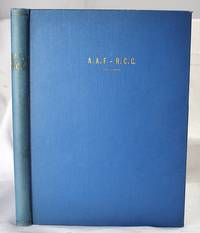
1944Best.-Nr. 2005200040Houston : Gulf Publishing Co 1944. First Edition. Hardcover. Very Good. The Army Air Corps: A Rare and fine collection of the Army Air Forces in World War II. Log of Navigation. 7 issues bound as one. Bound in full blue cloth. Good binding and cover. Original pictorial wraps bound in. Clean unmarked pages. Numerous photographs maps comics. Heavily illustrated an interesting periodical. "The approved publication of the AAF Training Command." Includes: "A Camera Trip Through Army Air Forces School Hondo Texas" - a smaller photo-pamphlet; AND Log of Navigation issues: April 1944. Vol. 2 no. 4; May 1944. Vol. 2 no. 5; June 1944. Vol. 2 no. 6; July 1944. Vol. 2 no. 7; September 1944 Vol. 2 no. 9; March 1945. Vol. 3. No. 3. From the former head of the U.S. Air Forces History Division. Houston : Gulf Publishing Co hardcover
Best.-Nr. UT8=2=18=22=KBGood. Rare hard to find copy. Apart from short note written on title page pages are free of writing or marks. Normal wear to page edges and cover such as some tanning minor creasing and scratching but still in good condition. We ship six days a week and provide tracking. unknown
1909Best.-Nr. 782161909. P&O London. 1909. First Edtion. Paperback. All edges gilt. Frontis colour maps and flags. A very lovely clean and fresh copy that has not been filled in at all. paperback