488 Ergebnisse
1807Best.-Nr. 55849Philadelphia: Published by B.B. Hopkins and Co. and sold by W.P. Farrand No. 170 Printed by T. & G. Palmer 1807. 8vo. xxiii 1 270; 271-275 1 40 16 15-16 17-220 4 pp. including binders instructions and publisher’s advertisement. With 7 copper-engraved plates & maps 6 engraved by Benjamin Tanner. Contemporary polished brown calf red & gilt morocco spine label chipping to head of spine minor edgewear occasional interior foxing & toning still a VG- copy from the library of John L. Gow 1797-1866 noted Pennsylvania attorney w/ ownership label and markings on front pastedown. First American edition of this classic navigation handbook which was first published in 1804 and here contained substantial corrections to the tables of the latitudes and longitudes of places on the American coast and in the West Indies as well as an improved system of finding the longitude by P. Delamar of Philadelphia. Mackay 1760-1809 was noted Scottish mathematician and astronomer taught navigation and instructed in methods of how to find longitude. Shoemaker 12965. Published by B.B. Hopkins and Co., and sold by W.P. Farrand, No. 170, Printed by T. & G. Palmer, unknown
Best.-Nr. DADAX3642335756New unknown
Best.-Nr. SONG0852969244Used: Good unknown
Best.-Nr. BN168889Audio Navigation und Telematik für Kraftfahrzeuge Audio Navigation und Telematik für Kraftfahrzeuge Audio Navigation und Telematik für Kraftfahrzeuge unknown
Best.-Nr. BN324090Segeln Schnelle Hilfe an Bord: Manöver · Navigation · Technik · Sicherheit Schwarzmeier Thomas Segeln Schnelle Hilfe an Bord: Manöver · Navigation · Technik · Sicherheit Schwarzmeier Thomas Segeln Schnelle Hilfe an Bord: Manöver · Navigation · Technik · Sicherheit Schwarzmeier Thomas unknown
Best.-Nr. BN375463General Navigation - Air Transport Pilot´s Licence JAR-FCL Unknown Binding Unknown Binding General Navigation - Air Transport Pilot´s Licence JAR-FCL Unknown Binding Unknown Binding General Navigation - Air Transport Pilot´s Licence JAR-FCL Unknown Binding Unknown Binding unknown
2007Best.-Nr. BN499264Mariusz Adamski 2007. 2007. siegnac nieba. / reaching for the sky. siegnac nieba. / reaching for the sky. Polska Agencja Zeglugi Powietrznej. Polish Air Navigation Services Agency Herausgeber Editor Photos Mariusz Admaski Mariusz Adamski unknown
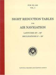
Best.-Nr. BN604932PUB 249 Sight Reduction Tables for Air Navigation Volume 3: Latitudes 39° to 89° Declinations 0° to 29° Spiral-bound Jan 01 1878 PUB 249 Sight Reduction Tables for Air Navigation Volume 3: Latitudes 39° to 89° Declinations 0° to 29° Spiral-bound Jan 01 1878 PUB 249 Sight Reduction Tables for Air Navigation Volume 3: Latitudes 39° to 89° Declinations 0° to 29° Spiral-bound Jan 01 1878 unknown
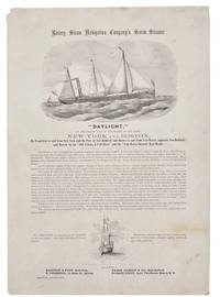
1860Best.-Nr. 42341New York 1860. Broadside 11-1/4" x 16." Two vignettes of ships engraved by Waters & Son. Light dusting upper left blank corner with a small chip. Very Good. The broadside touts describes and praises this "first-class steamer of 432 tons register." The Daylight's officers are listed its construction history described and its dimensions disclosed. The Daylight "is fitted up in a style unsurpassed by any of the Sound Propellers. The Ladies' Cabin contains seven state-rooms each having three berths and Gentlemen's Cabin has twenty-four berths. She has every modern convenience and every requisite for a sea-going steamer." The Union Navy acquired it in 1862 as an armed gunboat patrolling the Atlantic Coast and Virginia waterways. Not located on OCLC or AAS online site as of August 2026. unknown
Best.-Nr. BN635056ATPL Radio Navigation CBT CD-ROM Sep 20 2011 ATPL Radio Navigation CBT CD-ROM Sep 20 2011 ATPL Radio Navigation CBT CD-ROM Sep 20 2011 unknown
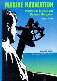
1990Best.-Nr. BN151395U S Naval Inst Pr 1990. 1990. Marine Navigation: Piloting and Celestial and Electronic Nagivation Marine Navigation: Piloting and Celestial and Electronic Nagivation Marine Navigation - Hobbs Richard R. U S Naval Inst Pr unknown
Best.-Nr. 35197613-nnew. unknown
Best.-Nr. 35197613like new. unknown
Best.-Nr. DADAX0792398335New unknown
1839Best.-Nr. 331758London: Smith Elder and Co 1839. Softcover. Good. First edition. Octavo. Disbound. 49pp. folding map. Lacking wrappers; title page and folding map detached from sewing; good. A scarce report establishes an early point for the English empire's interest in establishing a steam boat line in India and the methods by which they proposed to go about doing so. Commercial manufacturers and various merchants from Manchester Liverpool and India were enlisted to support the proposal and the report outlines navigational routes estimations of cost and the enthusiasm of changing maritime trading methods up and down the Ganges. The idea for an East India Inland Steam Navigation Company apparently began percolating in 1837 and this report fits nicely within the small pantheon of material devoted to this literature. Not in OCLC. One copy found at the British Library. Smith, Elder and Co unknown
Best.-Nr. DADAX022613900XNew unknown
Best.-Nr. DADAX0071493298New unknown
Best.-Nr. DADAX0313277397New unknown
Best.-Nr. DADAX0415691141New unknown
Best.-Nr. DADAX0470402288New unknown
Best.-Nr. DADAX0470516135New unknown
Best.-Nr. DADAX047052684XNew unknown
Best.-Nr. DADAX0471445347New unknown
Best.-Nr. DADAX0471445371New unknown