3 377 résultats
1986réf. 058800Los Angeles Air Force Station CA: Joint Program Office Air Force Systems Command Space Division 1986. Fourth Edition . Paper Back. Very Good/No Jacket. 8vo - over 7¾" - 9¾" tall. 74pp.; SC white w/blk.; slight rub w/lt.wear; inked-out PONs; cleantight pgs. YEE-82-009B. "This document has been prepared to acquaint potential users with the fundamental principles of the Navstar Global Positioning System GPS and the use of GPS equipment in host vehicles." illus. Joint Program Office, Air Force Systems Command, Space Division unknown
1952réf. 007395France: Société d'Editions Géographiques Maritimes et Coloniales 1952. Very informative book on the history of the Orbigny shipping Company FRENCH TEXT NO English translation. Original thick embossed and decorated card covers have been preserved and the whole book recased in a blue hard coverthis has been done for the Institute of Transport London single stamp on blank page. 170 pages in very bright clean condition just a few pencil marks on last couple of pages easily erased. Many B/w photographs facsimile documents and illustrations all present plus very informative text in FRENCH NO dustwrapper outer boards are clean and sound HEAVY BOOK 1.6 Kg with packing EXTRA POSTAGE REQUIRED FOR OVERSEAS.a very nice example of this book SEE IMAGES. DETAILED IMAGES AVAILABLE ON REQUEST. First Edition. Boards. Very Good/No Jacket. 11 x 8¾ Inches. Hardcover. Société d'Editions Géographiques, Maritimes et Coloniales Hardcover
1878réf. z015739Paris: Chargeurs Reunis Compagnie Francaise de Navigation a Vapeur 1878. Good. Letter of transmittal from a Compagnie Francaise de Navigation a Vapeur agent to James M. Lincoln of the Pacific Mail Steamship Co. New York. French language measures 8.5 by 10.5 inches recto only. Good. Chipping and paper repair to extremities edges toned else clean and unmarked. Chargeurs Reunis Compagnie Francaise de Navigation a Vapeur unknown
1896réf. 77014Washington DC: U.S. Department of the Navy Bureau of Navigation Hydrographic Office 1896. Presumed First Edition First printing thus. Map. Good. This was published at the Hydrographic Office in Washington D.C. in February 1896. No. 1530. Charles D. Sigabee Commander U.S. N. Hydrographer. Format is approximately 26 inches by 17 inches folded. This map is disbound from Volume I of the Commercial Directory of the American Republics compiled by the Bureau of American Republics International Union of American Republics Joseph P. Smith Director 1897 Title page from Directory is present. Taped to top right of map in margin is the statement "This chart is intended solely to show tracks of steam vessels on the ocean and no authority is assumed for the boundary lines as drawn between the countries." Map has some color differentiation and several inserts presenting distance information between major ports of call. Map has been folded with approximately the top third folded down. It is also folded into four sections of different lengths to fit as the frontis to the Directory. Map has some wear and soiling/staining. This is similar to the large-scale and detailed World chart on Mercator's projection produced by the British Admiralty under the "Superintendence of Captain Wharton R.N. F.R.S Hydrographer" engraved by Edward Weller and sold by J. D. Potter chart agent. The map has no internal landmass detail unless relevant to steam ship routes thus the Suez and Panama canals are marked as is the Canadian Pacific Railway. Panels along the lower edge list major ports and give distances dependent on routes taken and average knots-per-hour speeds with daily distances covered in miles. The world's major ports are linked by ship-routes each track with its relevant distance and so on. An interesting chart at the time steam took over from sail. Charles Dwight Sigsbee 1845 - 1923 was a Rear Admiral in the United States Navy. In his earlier career he was a pioneering oceanographer and hydrographer. He is best remembered as the captain of the USS Maine which exploded in Havana harbor Cuba in 1898. U.S. Department of the Navy, Bureau of Navigation, Hydrographic Office unknown
1996réf. 42091Alexandria VA: The Institute of Navigation 1996. First Edition. First Printing. good. 850 wraps illus. diagrams references index cover somewhat worn and soiled. The Institute of Navigation paperback
1939réf. 37919London: HMSO 1939. First Thus Printing. fair. 446 & 275 2-vol. set illus. some color diagrams maps index errata slip boards weak worn soiled and some edge tears. Ink notations and pencil erasures on front endpapers some page discoloration. This is an important snapshot of naval navigation practice at the eve of the Second World War. HMSO hardcover
1883réf. 4003Washington DC: GPO 1883. fair ex-lib. 176 plates fold-out illus. sm tears & soiling tables pencil notes ins fr bd bds scuffed & edges worn sm tears at spine & lib sticker. GPO unknown
1883réf. 4004Washington DC: GPO 1883. fair ex-lib. 119 plates fold-out illus. tables bds weak & sm tears bds scuffed & edges worn sm pcs missing at spine & lib sticker. GPO unknown
1927réf. 5373Washington DC: GPO 1927. Revised Edition. fair. 703 illus. figs foxing to fore-edge & ins bds stamps & ink name ins fr flylf bds scuffed edges of spine worn. This revised manual contains new material on the latest combat principles developed for infantry and machine-gun units. There is also much new material on medical tactics ashore field hygiene sanitation and first aid. The enlarged chapter on machine guns includes the Marine Corps Cole cart drill extended order drill gun emplacements classes of fire range cards and the Browning automatic rifle. GPO unknown
1884réf. 4002Washington DC: GPO 1884. fair ex-lib. 219 fold-out illus. tables fr bd weak pencil name ins fr bd lib stamps bds scuffed & edges worn sm tears at sp & lib sticker. GPO unknown
1995réf. biblio617Bethesda Md: Defense Mapping Agency Hydrographic / Topographic Center pub no 9 1995. Fine. 4to 873p ill maps full red cloth Defense Mapping Agency Hydrographic / Topographic Center, pub no 9 hardcover
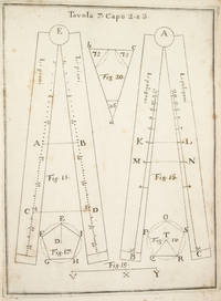
1753réf. 3742NAPLES: IGNAZIO RUSSO 1753. FIRST EDITION. Hardcover. Fine. Bound in contemporary vellum over boards. Foxing. Complete with the 15 engraved plates. Little is known of the author other than that he wrote another book on navigation in 1750. This work on the sector was translated into Spanish in 1758. By the time this book was published the design of the European sector had become standardized. Compare this design for example with that in the fourth edition of the works of Ozanam seventeen years earlier L’usage du compas de proportion 1736. The physical design of Pagnini’s instrument is better with pegs and decorative tenons to hold the two legs in alignment but the scales are essentially identical. The work is well illustrated with engravings showing exactly how a pair of dividers should be used to take the various lateral and transverse measurements. Pagnini provides eight tables that detail the exact markings for each scale. He also provides other material for reference use e.g. he includes not only a table for the construction of the line of metals but also one of their relative weights and their alchemical symbols etc. IGNAZIO RUSSO hardcover
réf. 321NAVIGATION BEZOUT Etienne Suite du cours de mathématiques à l'usage des gardes du pavillon et de la marine contenant le traité de navigation Paris P. H. Pierres 1793. 8° xii 296 pages 10 folding plates 44 leaves of tables ; contemporary green morocco flat spine gilt. Last part of Bezout's mathematical course dedicated to navigation. The plates were not bound in at the time but pasted to blank leaves so they could be fully unfolded while reading the text. The original edition was published between 1764 and 1769. Bezout was appointed examiner for the Marine Guard schools in 1764. His career was then mainly devoted to writing and teaching mathematics courses which were used for many years by candidates for military schools. This classic mathematics textbook was one of the main reference books for aspiring officers in the French royal armies in the second half of the 18th century. The last voume contains a treatise on navigation. A beautiful copy in contemporary green morocco.
1940réf. 34669Washington DC: United States Navy Department 1940. Edition of 1940. Wraps. Fair. Edition of 1940. A Fair copy. 8vo. 312 pp. bound in publishers printed tan wraps. Missing rear cover. Small losses from spine and front cover along with soiling. Pages are dog-earred. Text appear unmarked with some pages of notes laid in. A SCARCE title. United States Navy Department unknown
réf. 248791882. Printed. One page 33 x 25cm small chip off one corner fold marks discreet repair to edges and fold just noticeable shadow caused by exposure to sun good condition. See Image. On otherwise blank version there is the small stamp of the Webster Collection no. '1569'. Note: In "Orient Line Guide: Chapters for Travellers by Sea and by Land" W.J. Loftie pubd 1890 i.e. a later edition the relevant plate only shows the outward journey not the homeward. I have found no other copy of the White/Hull edition 1882 on viaLibri. 1882. unknown
1939réf. RiverPilotHUDSON RIVER NAVIGATION Godfrey's river and canal pilot: useful information for masters pilots mates and yachtmen navigating the Hudson River New York State Barge Canals and Long Island Sound. Compiled by Daisy M and Frank H Godfrey. Rome NY: Republican Printing Company 1939. 8vo 33pp; blue textured paper covers lettered in silver a fine copy overall. First and apparently only printing OCLC locating only two copies. Extensive listing of magnetic compass courseCayuga Ls including the Hudson River both North and South bound Oneida Lake Cayuga Lake Seneca Lake Erie Canal Oswego Canal Buffalo Harbor Long Island Sound and New Haven maint entrance to Stratford Point. Republican Printing Company paperback
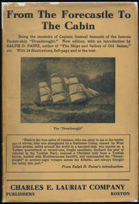
1924réf. 42805Boston: Charles E. Lauriat Co 1924. Hardcover. 8vo. Black cloth with gilt spine lettering and decoration pictorial dust jacket. xxvii 308pp. Top edge gilt. Frontispiece numerous full-page illustrations. Near fine/good plus. Jacket a bit edgeworn and lightly soiled with several small edge chips -- but complete and fairly attractive nonetheless. A tight attractive first of this edition following the 1887 true first edition described by Harold F. Smith: "One of the great packet commanders writes his autobiography giving a lively series of maritime adventures around the world." Very uncommon especially in a decent jacket. AMERICAN TRAVELLERS ABROAD S3. Charles E. Lauriat Co hardcover
1966réf. 38722New York: The Macmillan Company 1966. Hardcover. 4to. Red cloth with gilt lettering and emblem slipcase with color pictorial label. 207pp. Extensive illustrations most color maps pictorial endpapers. Fine/very good. Slipcase lightly edgeworn and sunned. A tighty and handsome first edition of this outstandingly illustrated gathering of primary source material. The Macmillan Company hardcover
réf. 1236977394.Gpaperback. Good. Access codes and supplements are not guaranteed with used items. May be an ex-library book. paperback
1897réf. 0005133New York: Harper & Brothers 1897. First American edition. Hardcover. Good. 16 color plates 120 photogravures 4 folding maps in pockets. Quartos green cloth Vol. 1 torn at head of spine inked 1897 inscriptions on blank pages. In the space of 280 years previous to 1893 the combined efforts of all the Arctic expeditions succeeded only in travelling 150 miles nearer the Pole. Dr. Nansen in three years penetrated 200 miles beyond the farthest point then reached. Originally published at $10. Publisher's advance prospectus in front pocket. 16 color plates 120 photogravures 4 folding maps in pockets. Bennett PRACTICAL GUIDE TO AMERICAN NINETEENTH CENTURY COLOR PLATE BOOKS p.82 - "The 16 colored plates are on a par with all the rest of this fine and honest and permanent work.". One of his aims was to explore arctic ocean currents. Nansen was awarded the Nobel Peace Prize in 1922. PRINTING AND THE MIND OF MAN 384; Arctic Bibliography 11983. Preceded by the Danish edition in 1897. 120 photogravures 4 folding maps in pockets. Harper & Brothers hardcover
1898réf. 80-54BGPO 1898. 1898. 740p. Folding Maps. Photos. Spine title "Naval Operations of the War with Spain". Covers the Destruction fo the USS Maine Operations in the Atlantic Cuba and Porto Rico and Pacific Manila. Original blue pebbled cloth. Heavy. Rubber stamp inside. Near Fine Copy. Hardcover. Near Fine. Book. GPO, 1898. Hardcover
1995réf. 281400PN. New. 1995. Soft Cover. Date is original print. This is a reprint edition . PN paperback
1980réf. 41070Annapolis: Naval Institute Press 1980. Hardcover. Small 4to. Blue cloth with gilt spine lettering pictorial dust jacket. xxii 448pp. Illustrations. Fine/near fine. A superb and tight first edition of this collection of biographical essays -- with choice autograph addition: Tipped to the front flyleaf is a 5" X 3" heavy stock card signed boldly in black ballpoint by Elmore R. Zumwalt n.p. dated 1986 September 4 in his hand. Fine. Zumwalt was the 19th and final of the naval figures discussed in this reference. Zumwalt 1920-2000 was the American navy's youngest four-star admiral ever and the commander in Vietnam who ordered the use of Agent Orange -- from which his own son contracted cancer. Zumwalt's original transmittal envelope is laid in as well. Naval Institute Press hardcover
1887réf. 40498N.p.: N.p. 1887. Paperback. 8vo. Self-cover. 7pp. Very good. Outer wrappers faintly soiled and mildly edgeworn. Probable sole edition of this bibliographically-cryptic pamphlet presenting the case of Lefferts W. Lloyd Catherine W. Mitchell and Samuel F. Engs each the administrator of the estate of a deceased versus the United States in this "French Spoliation Claim" -- claims made by U.S. citizens against France Holland and Spain for ships and goods seized by privateers prior to September 30 1800 at ports controlled by those countries -- a rather sizeable and definitely bizarre category of strange maritime documents with claims made by descendants into the 20th century. This particular claim involves John and Abraham Franklin and their ship "Hunter" commanded by William Whitlock. In 1798 she sailed from New York headed for France and then China but was captured by a Spanish and then a French privateer -- it all gets hairy and convoluted but in the end the ship and goods were damaged and the descendants seek $75000 in damages. N.p. paperback
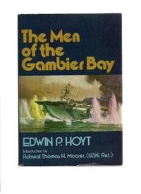
1979réf. 36377Middlebury VT: Paul S. Eriksson 1979. Hardcover. Introduction by Thomas H. Moorer. Small 4to. Blue cloth spine and tan paper over boards pictorial price-clipped dust jacket. xii 254pp. Illustrations maps map endpapers. Fine/near fine. Tight attractive first edition of this surprisingly uncomon history of this World War Two aircraft carrier. Paul S. Eriksson hardcover