Congres International de NavigationBiblio.com

3,430 results
ref. 0282878793.Gpaperback. Good. Access codes and supplements are not guaranteed with used items. May be an ex-library book. paperback
ref. 1390365034.Gpaperback. Good. Access codes and supplements are not guaranteed with used items. May be an ex-library book. paperback
ref. 0265531535.Ghardcover. Good. Access codes and supplements are not guaranteed with used items. May be an ex-library book. hardcover
ref. 0265716853.Gpaperback. Good. Access codes and supplements are not guaranteed with used items. May be an ex-library book. paperback
ref. 026784722X.Ghardcover. Good. Access codes and supplements are not guaranteed with used items. May be an ex-library book. hardcover
ref. 026789046X.Ghardcover. Good. Access codes and supplements are not guaranteed with used items. May be an ex-library book. hardcover
ref. 025911894X.Gpaperback. Good. Access codes and supplements are not guaranteed with used items. May be an ex-library book. paperback
ref. 0259750999.Gpaperback. Good. Access codes and supplements are not guaranteed with used items. May be an ex-library book. paperback
ref. 0331707853.Ghardcover. Good. Access codes and supplements are not guaranteed with used items. May be an ex-library book. hardcover
ref. 0259933163.Gpaperback. Good. Access codes and supplements are not guaranteed with used items. May be an ex-library book. paperback
ref. 0267287674.Ghardcover. Good. Access codes and supplements are not guaranteed with used items. May be an ex-library book. hardcover
ref. 033101209X.Gpaperback. Good. Access codes and supplements are not guaranteed with used items. May be an ex-library book. paperback
ref. 0260868841.Ghardcover. Good. Access codes and supplements are not guaranteed with used items. May be an ex-library book. hardcover
ref. 0331691108.Ghardcover. Good. Access codes and supplements are not guaranteed with used items. May be an ex-library book. hardcover
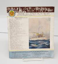
1934ref. 155424Sydney Australia: Printed by John Sands Ltd. 1934. Staplebound. Good. 12 p. 24 cm. Stapled. Colour illustration on back and front. B&w photos within. K.P.M. lists its head and branch offices throught the world illustrates its ships deck diagrams gives timetables general notes itineraries. Printed by John Sands Ltd. unknown
1980ref. 133049Shanghai 1980. First Edition. Hardcover. Good/Good. Unpaginated. 38 cm. 85 paintings of the Yangtze listed by author and described at rear. 56 are in colour. Blue hardcover in dustjacket. jacket has tears to edges. Book itself has shelf wear. Small ink notation on jacket flap. Ink inscription on brown front endpaper. Text in English and Chinese. hardcover
1859ref. 102259Richmond Va.: Ritchie Dunnavant & Co. 1859. First Edition. Paperback. Good. 45 p. 23 cm. Fold-out map of the Coal River at Boone and Kanawha Counties with minor repairs mild spotting a few tears. Rebound with original front cover applied and new back. Mild spotting former owner's label on title page. Includes president and directors of the company charter company stock by-laws rates of toll info on coal fields and shipping coal. Ritchie, Dunnavant & Co. paperback
1933ref. 90592Paris: Commission Internationale de Navigation Aeriennne 1933. Presumed First Edition First printing thus. Pamphlet. Good. The format is approximately 5 inches by 8 inches. TEXT IS IN FRENCH. 2 28 28 blank verso pages. Tabular Data. RARE SURVIVING COPY. The International Commission for Air Navigation ICAN was an international organization established by the Paris Convention of October 1919 which was the precursor to the current International Civil Aviation Organization ICAO . Its role was to establish international standards for managing air navigation. ICAN was truly active from 1922 to 1939 but ceased in 1947 when it was replaced by ICAO. In March 1919 an Aeronautics Commission of the Peace Conference was established at the initiative of President Clemenceau who rallied his allies and partners to his cause: President Wilson Alfred Milner United Kingdom and Vittorio Emanuele Orlando Italy. In less than four months the Commission and its military technical and legal subcommittees drafted the Convention regulating air navigation which was signed in Paris on October 13 1919 and which forms part of the treaties protocols and conventions of the Paris Peace Congress. The International Commission on Air Navigation was established by Article 34 of the Paris Convention. The convention entered into force on July 11 1922. It had been signed by fourteen states. At the first session held in Paris under the chairmanship of Raymond Poincaré he specified the role that the Commission was to play in the future and emphasized its innovative nature in the field of international law as it gave the Commission the power to make decisions binding on the contracting states by majority vote. Among the topics of this set of Aeronautical Instructions are Aerodromes Meterorological services phrases flight plans frontiers/boundaries Transportation and hazards to aviation. It addresses treaty/conventions and relevant Belgian legislation. Commission Internationale de Navigation Aeriennne unknown
1847ref. 1008098vo slate blue cloth stamped in gilt and blind illustrated with frontispiece and folding charts viii 21 429 3 24 pp.Wear to spine ends spine faded small splits to joints hinges cracked copious nautical notes to endpapers slight aging but text and charts are generally clean and unworn; about very good. This is rare first edition of what is known as "The Atlantic Navigator" which includes detailed sailing instructions for the North and South Atlantic. Includes ten folding charts and much of the text is from various captains and navigators familiar the routes contained in this work. The first numbered section of 21 pages is an 1847 supplement and the catalogue at the rear is dated 1851. Sabin noting 2300 only an 1854 fourth edition. James Imray,
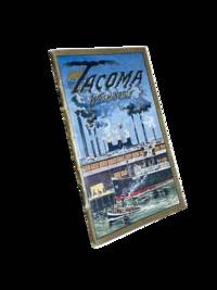
1911ref. 8633Tacoma: Tacoma Commercial Club and Chamber of Commerce 1911. First edition. 14x8cm 32pp. Full color and sepia photographic illustrations throughout. Single map. Detachable post card/order form present at rear. Staple bound in color lithographed card covers. Some edge rubbing and light wear else near fine. Beautiful and scarce promotional booklet a joint effort of the Oregon-Washington Railroad and Navigation Company Bureau of Community Publicity and the Tacoma Commercial Club and Chamber of Commerce. Photos of prominent buildings factories the port Mount Rainier and Stadium High School among others. Includes information on industry and culture of the fast-growing city. OCLC cites 4 holdings only including just 1 in the state of Washington. . Tacoma Commercial Club and Chamber of Commerce unknown
1986ref. 058800Los Angeles Air Force Station CA: Joint Program Office Air Force Systems Command Space Division 1986. Fourth Edition . Paper Back. Very Good/No Jacket. 8vo - over 7¾" - 9¾" tall. 74pp.; SC white w/blk.; slight rub w/lt.wear; inked-out PONs; cleantight pgs. YEE-82-009B. "This document has been prepared to acquaint potential users with the fundamental principles of the Navstar Global Positioning System GPS and the use of GPS equipment in host vehicles." illus. Joint Program Office, Air Force Systems Command, Space Division unknown
1952ref. 007395France: Société d'Editions Géographiques Maritimes et Coloniales 1952. Very informative book on the history of the Orbigny shipping Company FRENCH TEXT NO English translation. Original thick embossed and decorated card covers have been preserved and the whole book recased in a blue hard coverthis has been done for the Institute of Transport London single stamp on blank page. 170 pages in very bright clean condition just a few pencil marks on last couple of pages easily erased. Many B/w photographs facsimile documents and illustrations all present plus very informative text in FRENCH NO dustwrapper outer boards are clean and sound HEAVY BOOK 1.6 Kg with packing EXTRA POSTAGE REQUIRED FOR OVERSEAS.a very nice example of this book SEE IMAGES. DETAILED IMAGES AVAILABLE ON REQUEST. First Edition. Boards. Very Good/No Jacket. 11 x 8¾ Inches. Hardcover. Société d'Editions Géographiques, Maritimes et Coloniales Hardcover
1878ref. z015739Paris: Chargeurs Reunis Compagnie Francaise de Navigation a Vapeur 1878. Good. Letter of transmittal from a Compagnie Francaise de Navigation a Vapeur agent to James M. Lincoln of the Pacific Mail Steamship Co. New York. French language measures 8.5 by 10.5 inches recto only. Good. Chipping and paper repair to extremities edges toned else clean and unmarked. Chargeurs Reunis Compagnie Francaise de Navigation a Vapeur unknown
1896ref. 77014Washington DC: U.S. Department of the Navy Bureau of Navigation Hydrographic Office 1896. Presumed First Edition First printing thus. Map. Good. This was published at the Hydrographic Office in Washington D.C. in February 1896. No. 1530. Charles D. Sigabee Commander U.S. N. Hydrographer. Format is approximately 26 inches by 17 inches folded. This map is disbound from Volume I of the Commercial Directory of the American Republics compiled by the Bureau of American Republics International Union of American Republics Joseph P. Smith Director 1897 Title page from Directory is present. Taped to top right of map in margin is the statement "This chart is intended solely to show tracks of steam vessels on the ocean and no authority is assumed for the boundary lines as drawn between the countries." Map has some color differentiation and several inserts presenting distance information between major ports of call. Map has been folded with approximately the top third folded down. It is also folded into four sections of different lengths to fit as the frontis to the Directory. Map has some wear and soiling/staining. This is similar to the large-scale and detailed World chart on Mercator's projection produced by the British Admiralty under the "Superintendence of Captain Wharton R.N. F.R.S Hydrographer" engraved by Edward Weller and sold by J. D. Potter chart agent. The map has no internal landmass detail unless relevant to steam ship routes thus the Suez and Panama canals are marked as is the Canadian Pacific Railway. Panels along the lower edge list major ports and give distances dependent on routes taken and average knots-per-hour speeds with daily distances covered in miles. The world's major ports are linked by ship-routes each track with its relevant distance and so on. An interesting chart at the time steam took over from sail. Charles Dwight Sigsbee 1845 - 1923 was a Rear Admiral in the United States Navy. In his earlier career he was a pioneering oceanographer and hydrographer. He is best remembered as the captain of the USS Maine which exploded in Havana harbor Cuba in 1898. U.S. Department of the Navy, Bureau of Navigation, Hydrographic Office unknown
1996ref. 42091Alexandria VA: The Institute of Navigation 1996. First Edition. First Printing. good. 850 wraps illus. diagrams references index cover somewhat worn and soiled. The Institute of Navigation paperback