3 257 résultats
1912réf. 164939Sydney: Edward Lee & Co. 1912. 1st edition. Very Good. tall octavo. pictorial boards cxxi 243pp. colour & b/w plates text ills. maps Inc. folded plate "Accommodation plan of KPM Steel Screw Steamer "Tasman" chipped & spotted with some loss. Great ads. Signs of use & boards reinforced at spine with tape o/w a very good complete copy Edward Lee & Co. hardcover
1839réf. 331758London: Smith Elder and Co 1839. Softcover. Good. First edition. Octavo. Disbound. 49pp. folding map. Lacking wrappers; title page and folding map detached from sewing; good. A scarce report establishes an early point for the English empire’s interest in establishing a steam boat line in India and the methods by which they proposed to go about doing so. Commercial manufacturers and various merchants from Manchester Liverpool and India were enlisted to support the proposal and the report outlines navigational routes estimations of cost and the enthusiasm of changing maritime trading methods up and down the Ganges. The idea for an East India Inland Steam Navigation Company apparently began percolating in 1837 and this report fits nicely within the small pantheon of material devoted to this literature. Not in OCLC. One copy found at the British Library. Smith, Elder and Co unknown
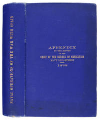
1898réf. 106031Washington: Government Printing Office 1898. Hardcover. very good. 1st Edition. 740pp. tipped-in erratapp. Octavo in original gilt lettered blue cloth with plates from photos and drawings some folding - including ship plans and elevations and folding maps including colour. Faint dampstain to edges of text block top corner else very good. very good Spine Title: "Naval Operations of the War with Spain.". An appendix to the official report by the United States Navy Department Bureau of Navigation "relating to the operations of the war with Spain and covering as well important operations of the Department before during and after the war." pp.3 grouped according to general subject. 1898 Government Printing Office hardcover
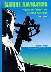
1990réf. BN151395U S Naval Inst Pr 1990. 1990. Marine Navigation: Piloting and Celestial and Electronic Nagivation Marine Navigation: Piloting and Celestial and Electronic Nagivation Marine Navigation - Hobbs Richard R. U S Naval Inst Pr unknown
réf. BN168889Audio Navigation und Telematik für Kraftfahrzeuge Audio Navigation und Telematik für Kraftfahrzeuge Audio Navigation und Telematik für Kraftfahrzeuge unknown
réf. BN324090Segeln Schnelle Hilfe an Bord: Manöver · Navigation · Technik · Sicherheit Schwarzmeier Thomas Segeln Schnelle Hilfe an Bord: Manöver · Navigation · Technik · Sicherheit Schwarzmeier Thomas Segeln Schnelle Hilfe an Bord: Manöver · Navigation · Technik · Sicherheit Schwarzmeier Thomas unknown
réf. BN375463General Navigation - Air Transport Pilot´s Licence JAR-FCL Unknown Binding Unknown Binding General Navigation - Air Transport Pilot´s Licence JAR-FCL Unknown Binding Unknown Binding General Navigation - Air Transport Pilot´s Licence JAR-FCL Unknown Binding Unknown Binding unknown
2007réf. BN499264Mariusz Adamski 2007. 2007. siegnac nieba. / reaching for the sky. siegnac nieba. / reaching for the sky. Polska Agencja Zeglugi Powietrznej. Polish Air Navigation Services Agency Herausgeber Editor Photos Mariusz Admaski Mariusz Adamski unknown
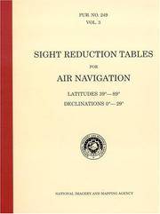
réf. BN604932PUB 249 Sight Reduction Tables for Air Navigation Volume 3: Latitudes 39° to 89° Declinations 0° to 29° Spiral-bound Jan 01 1878 PUB 249 Sight Reduction Tables for Air Navigation Volume 3: Latitudes 39° to 89° Declinations 0° to 29° Spiral-bound Jan 01 1878 PUB 249 Sight Reduction Tables for Air Navigation Volume 3: Latitudes 39° to 89° Declinations 0° to 29° Spiral-bound Jan 01 1878 unknown
réf. BN635056ATPL Radio Navigation CBT CD-ROM Sep 20 2011 ATPL Radio Navigation CBT CD-ROM Sep 20 2011 ATPL Radio Navigation CBT CD-ROM Sep 20 2011 unknown
1913réf. 7087Portland Oregon: Oregon-Washington Railroad & Navigation Co 1913. Fourth Edition. Stiff Illustrated Wrappers. Good. 8vo. Pp. 45 3. Frontis. scenic photograph. Illustrated with black & white halftone photo reproductions and one route map. Color illustrated wraps saddle-stapled. Light soiling and stains mellowed crease to back cover staples a tad oxidized trace of oxidized paperclip to head of the frontis. In sum a bright copy. Revised edition of the enticing 1911 tourism booklet lauding sites natural and man-made from Oregon to Alaska. Includes motoring tours and hiking in Mount Rainier National Park plus lakes and streams to cast the lure. The uncredited color illustrations are dreamy; the photography including a few shots by Asahel Curtis presents keen insight into early 1900s life in the Puget Sound Country. SMITH 7721. Preserved in a removable clear archival pouch with acid-free backing. Oregon-Washington Railroad & Navigation Co unknown
1873réf. 55613Washington Government Printing Office 1873. Royal8vo. Orig. full calf. Gilt boders and gilt lettering on covers. Gilt spine. Lithographed frontispiece in colour. XVI107203268 pp. 3 lithographed colourplates one large folded. unknown
1840réf. 41654Paris ca. 1840. Folio. 36x25 cm. Contemp. hcalf. Spine gilt but somewhat rubbed. 264 pp. numerous illustrations in margins and in the text. 2 folded maps. The text is handwritten and reproduced with an etching technique probably zinkography. Internally clean and fine. unknown
1748réf. 45802Paris L'Imprimerie Royale 1748. 4to. Without wrappers. Extracted from "Mémoires de l'Academie des Sciences. Année 1744.". Pp. 462-774 textillustrations. First printing of this importent paper in which Maupertuis proves that the Loxodromic line or Rhumbline is the shortest way between two points on the globe after he had proved by the measuring results that the globe is a spheroid. The paper is of great importence in the history of navigation. unknown
réf. 35197613-nnew. unknown
réf. 35197613like new. unknown
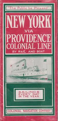
1915réf. 21548New York: Colonial Navigation Company. Very Good-. Softcover. One page separated and with staple binding weakening.; A stapled illustrated brochure promoting the steam ships Concord and Lexington as well as the; Oblong 8vo 8" to 9" tall; 12 pages . 1915. Colonial Navigation Company paperback
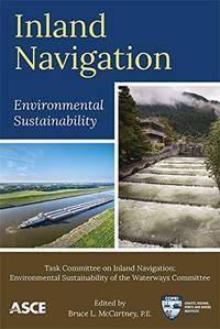
2019réf. __0784415099Amer Society of Civil Engineers 2019. Paperback. New. 180 pages. 8.98x5.98x0.55 inches. Amer Society of Civil Engineers paperback
1858réf. 54442n.p. n.d. 1858. 8vo pp. 20; self-wrappers; fine. UC-Riverside and AAS only in OCLC. In 1855 while charting the Rio de Plata Basin the United States ship U.S.S. Water Witch was fired upon by a Paraguayan fort killing the helmsman Samuel Chaney. This outraged the U.S. government who along with the U.S. & Paraguay Navigation Company decided to bring the incident to the Supreme Court. In 1858 began the Paraguay Expedition the purpose of which was to demand an apology from the Paraguyan government and to address alleged insults against the Navigation Company. The result of the expedition was that Paraguay apologized the Chaney's family was indemnified and a new advantageous commercial treaty between Paraguay and the United States was forged. unknown
1905réf. 100722Montreal: Desbarats & Co. 1905. Book. Good. Original Wraps. 8vo - over 7¾" - 9¾" tall. Title continued: With many illustrations of interesting places and scenes also a short description of the Ottawa River and points of interest to the tourist who may make the trip via the Grand River and Rideau Lakes through the most charming scenery in America between Montreal Ottawa and Kingston. 56 p. Folding map - Route of the Ottawa River Navigation Co. 35 illustrations. Covers worn with chips in spine. Top corner stained. A scarce guide book. Desbarats & Co. Paperback
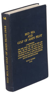
1955réf. ABC_47446London 1955. 8vo. Published for the Hydrographic Department Admiralty Original blue cloth with yellow lettering on the spine and the front board the supplement is loosely inserted at the end of the volume: original printed paper wrappers stapled. With a folding map printed on both sides 2 coloured plates with diagrams printed on both sides 28 plates showing coastlines and occasionally a map many printed on both sides and many some illustrations in text. 2 LI = LIII: II plus 1 1 blank 1 blank 518 1 1 blank pp; Supplement: 20 pp. The essential standard sailing directions for the Red Sea and Gulf of Aden corresponding with zone NP64 on the official Admiralty charts. These nautical works - pilot guides and charts - were published by the United Kingdom Hydrographic Office which provides the necessary hydrographic and marine geospatial data to all kinds of maritime organisations across the world. The publications are not only used by the British Royal Navy but can also be found on board the majority of international merchant ships. The data provided in the pilot guides and other publications are compliant with SOLAS the Safety of Life at Sea treaty guidelines and are updated constantly in weekly "Notices to mariners" and supplements to and new editions of the pilot guides whenever necessary.The present copy is the 10th edition 1955 of the pilot guide with sailing directions and other information on the weather currents radar ranges etc. relating to the Red Sea and Gulf of Aden including the supplement issued in 1957. It includes an erroneous "advertisement to the eight edition" by the Hydrographer of the Navy Rear-Admiral Kenneth St Barbe Collins 1904-1982. The advertisement states that with the publication of "the ninth edition" presumably this volume the previous edition and its supplements are cancelled since the most up-to-date information has been compiled in the new edition and the weekly "Notices to mariners" that appeared after the publication of the 11th edition. The 10th edition of 1955 and its 1957 supplement were made redundant with the publication of the 11th edition in 1967. Each subsequent edition of the pilot supersedes the last which have appeared infrequently depending on newly available information from the mid-19th century until the present day.The front paste-down and recto of the first free endpaper contain a "caution" notice and room for the notation of "supplements and annual summaries of notices to mariners relating to this book" the first two pages are printed on red-pink paper. The binding shows minor signs of wear around the spine and corners of the boards the gutter after page II is somewhat weakened the head edge of the wrappers of the supplement are very slightly browned. Otherwise in very good condition. AFRICA MARITIME HISTORY MIDDLE EAST & ISLAMIC WORLD Arabian Peninsula & Gulf States East Africa Navigation hardcover
réf. ria9780784415092_inpPaperback / softback. New. New Book; Fast Shipping from UK; Not signed; Not First Edition; Provides the current state of environmental preservation procedures for inland waterways. This technical report presents an overview of ecosystem sustainability procedures currently used. It examines environmental considerations for con paperback
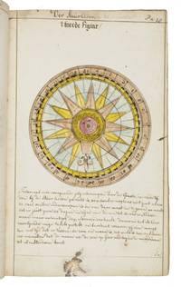
1735réf. LC4E9Q4RAGZBHolland 1735. Green paper wrappers made from a discarded prospectus or the wrapper of an instalment of a book ca. 1865 sewn at 6 stations some perhaps without supports later green cloth spine with the title in manuscript on the front wrapper. Folio 31.5 x 20.5 cm. A manuscript course in navigation written in brown ink on laid paper in a largely upright cursive hand with 6 colour figures including 2 volvelles about 100 black and white diagrams and numerous tables of data highlighted with a yellow wash. A detailed manuscript course in the art of navigation in folio format with figures in colour including two volvelles partly based on the very rare first edition in 8vo format of Klaas de Vries 1662-1730 Schat-kamer ofte konst der stier-lieden 1702; Crone 374 probably in the first issue not known to survive before the insertion of an additional quire between B and C. But the manuscript doesn't merely copy the printed book: at least much of the text differs and also at least some of the tabular data and some of the figures also have no direct equivalents in the printed book also not in later editions as far as we have seen. The colour illustrations include a compass rose 13.8 cm diameter with a ship in the centre directly copied from the folding engraved plate in De Vries and virtually the same size but the ship in the centre is copied in mirror image and De Vries's abstract floral decorations in the corners outside the circle are replaced by colour drawings of four different flowers one in each corner. The manuscript also directly copies De Vries's woodcut illustration of a human hand marked with the numbers "29" "9" and "19" on the thumb and the letters A B and C next to them presented as an aid to calculating the epact the number of days past the new moon on 1 January but the hand is rotated 180 degrees. Most of the examples of calculations use years in the period 1700-1711 though there are a few later ones one example uses the year 1809! which also largely agrees with the 1702 edition of De Vries though the examples are not identical. The clearest indication that the present manuscript follows the 1702 edition rather than a later one is that the tables giving differences between the positions of the sun and moon cover the years 1701-1704 as in the first edition before the insertion of an extra quire extending the tables to 1710 B8 was replaced at the same time not noted by Crone. All later editions we have seen give these tables and the examples of calculations for later years. Yet even in these tables the data in the present manuscript doesn't exactly agree with De Vries's. With a bookseller's ticket ca. 1901/1919. Very slightly browned with occasional minor spots or ink stains but still in good condition. The one leaf that appears to be lacking may have been deliberately cancelled by the compiler. The wrapper has a later cloth spine as noted and is somewhat worn. A fascinating manuscript course in navigation with volvelles and other figures in colour partly based on the very rare first 1702 edition of De Vries's handbook but not merely copying it.l For De Vries's 1702 handbook: Crone 374 collation not entirely correct. hardcover