rif. 59127Neuchâtel Verlag Baconnière 1947 Auflage: 1. Leinen gebunden; blaue goldgeprägte Einbände / 3 Bände / Anz. Seiten: 278 35 144 / 225 x 305 cm / mit 35 ausfaltbaren Tafeln Schemata und Karten Bd. 2; 8 Schemata und 4 Karten 2 davon ausfaltbar Bd. 3 / Zustand: gut geringe bis leichte Gebrauchsspuren; Einbände gering fleckig Bd. 1 Bd. 3 fleckig Bd. 2 Rücken leicht gebräunt Schnitt mässig stockfleckig und etwas gebräunt Vorsatz bis Vortitel leicht fleckig Bd. 1 Mit Widmung des Direktors der Zellulosefabrik Attisholz sowie beiligendem Brief; Inhalt: Band 1: Technischer Generalbericht bearbeitet von Ing. H. Blattner Leiter der Studien Genfersee-Rhein: Allgemeines; Die Technischen Studien; Zusammenstellung der Gesamtkosten; Allgemeine Betrachtungen und Bemerkungen zu den technischen Ergebnissen der Projekte; Die technischen Schlussfolgerungen; Band 2: Tafelbeilagen; Band 3: Bericht über die volkswirtschaftliche und wirtschaftliche Beurteilung einer Schiffahrtsverbindung Genfersee-Rhein: Allgemeine Übersichtspläne; Projektabschnitt I Entreroches-Kanal; Projektabschnitt III Bielersee-Aaremündung in den Rhein; Graphische Fahrpläne Aarau - Aarwangen-Wynau - Bernerschachen - Beznau - Binnenschiffahrt - Brugg-Lauffohr - Eclépens-Orbe - Genfersee-Vufflens-la-Ville - Jura-Seen - Klein-Aarwangen - Klingnau - Olten-Gösgen - Orbe-Yverdon - Rüchlig - Rupperswil-Auenstein - Staustufen - Vufflens-la-Ville-Eclépens-Orbe - Wildegg-Brugg - Wynau-Olten Neuchâtel, Verlag Baconnière, 1947, Auflage: 1. unknown
1883rif. 45065Washington DC: Government Printing Office 1883. Number 10 in the Navy Scientific Papers series. Discussions of modern iron technology include . Washington DC: Government Printing Office 1883. Number 10 in the Navy Scientific Papers series. Discussions of modern iron technology include "Unseaworthiness in Merchant Steamers;" "Passenger Steamers on the Long Ferry;" "Cellular Construction;" "Wave-making Resistance of Ships;" "Russian Yacht Lividia;" and "Injuries Sustained by the wreck of the Lividia." Bound as issued in pebbled blue flexible boards stamped in gilt. Call number on backstrip and no other markings. 23 cm. 176 pp. 13 b/w folding plates. Government Printing Office hardcover
rif. UT8=2=18=22=KBGood. Rare hard to find copy. Apart from short note written on title page pages are free of writing or marks. Normal wear to page edges and cover such as some tanning minor creasing and scratching but still in good condition. We ship six days a week and provide tracking. unknown
1833rif. 49821New York: G & C & H Carvill 1833. First Edition. Octavo. Original pebble-grained boards; paper spine title; 1-78-1582pp. Backstrip partially detached ; spine label faded barely legible; text fresh and unmarked - Good or better. Ex-U.S. Naval Lyceum with ink pressure stamp to endpapers and title page with de-accession dated 1927 on verso of title page. Pencil ownership inscription of a "Thos. J. Manning U.S. Navy" at head of title page. Verso of final text leaf prints a brief list of errata. G & C & H Carvill unknown
1920rif. 59237Washington D.C.: Government Printing Office Hydrographic Office U.S. Navy 1920-1940. Five vols. 8vo. vi 638; v 1 287 1; 8 390 pp.; 1; 2 17 1 leaves. With 5 large folding colour maps numerous plates showing elevations. Three volumes uniformly bound in blue publisher’s buckram gilt lettering front cover & spine darkening to spines fore-edges minor shelfwear dustsoiling slightly shaken Supplements in self-printed softcovers edgewear toning to fore-edges minor chipping still VG- set. Third editions revised & updated of vols. I & II second edition of vol. II and 1st editions of both scarce Supplements of these coast pilot guides to British Columbia including lower Alaska and upper Washington in the years between the World Wars. Prior to modern GPS systems and satellite navigation these regularly updated and revised navigation handbooks provided key sailing instructions often drawing not only from Brazilian Argentine and British coast pilots as well as sailing reports from U.S. Navy vessels and those from merchant ships. The first large map delineates the requisite coast pilots for sailing in B.C. waters and charts to be ordered from the Hydrographic Office while the second maps depict the sailing routes to Asia the Soviet Union and the Arctic across the Pacific. Both editions of Vol. II are offered here with the expanded 3rd edition featuring nearly double the material and extra map of the 2nd. Government Printing Office, Hydrographic Office, U.S. Navy, paperback
1926rif. 59231Washington D.C.: Government Printing Office Hydrographic Office U.S. Navy 1926-1928. Two vols. 8vo. xxxii 4 788; ix 1 619 pp. With 5 large folding colour maps 2 double-sided. Uniformly bound in light-green publisher’s buckram gilt lettering stamped on front covers & spines slight uniform toning darkening to spines shelfwear still VG set w/ maps in bright condition. Third editions revised & expanded of these coast pilot guides to waters of the South Pacific Southeast Asia and Australasia encompassing New Zealand New Guinea the Gilbert Caroline Marshall Fiji Samoan Hawaiian New Hebrides and Indonesian Islands drawing upon British Royal Navy coast pilots Australian Southeast Asian Polynesian and U.S. Navy reports. Prior to modern GPS systems and satellite navigation these regularly updated and revised navigation handbooks provided key sailing instructions. The map outlines the available charts for the entire Pacific. Government Printing Office, Hydrographic Office, U.S. Navy, hardcover
1927rif. 59236Washington D.C.: Government Printing Office Hydrographic Office U.S. Navy 1927-1930. Three vols. 8vo. x 4 550; viii 4 560 pp.; 1 17 2 leaves. With 4 large folding colour maps 1 w/ toning at fore-edge from being improperly folded some edgewear numerous plates showing lighthouses. Two volumes uniformly bound in red publisher’s cloth gilt lettering front cover & spine darkening to spine fore-edges minor shelfwear dustsoiling minor paint drip at fore-edge 1 vol. Supplement in self-printed softcovers edgewear toning to fore-edges minor predation still VG- set. Third editions revised & updated of vols. I & II first edition of scarce Supplement of these coast pilot guides to South America and Antarctica in the 1920’s. Prior to modern GPS systems and satellite navigation these regularly updated and revised navigation handbooks provided key sailing instructions often drawing not only from Brazilian Argentine and British coast pilots as well as sailing reports from U.S. Navy vessels and those from merchant ships. The first large map delineates the requisite coast pilots for sailing in American waters and charts to be ordered from the Hydrographic Office while the second maps depict the sailing routes. The expanded 3rd edition is quite scarce with 1 copy located of both vols. in Worldcat NYPL. Government Printing Office, Hydrographic Office, U.S. Navy, paperback
1920rif. 59229Washington D.C.: Government Printing Office Hydrographic Office U.S. Navy 1920;1929. Two vols. 8vo. vii 1 4 500 pp.; 2 32 2 leaves. With 1 large folding colour map. First in dark blue publisher’s buckram lettering stamped on front cover & spine minor soiling edgewear slight uniform interior toning 2nd vol. in self-printed softcovers oxidized toning & predation to outer fore-edges front chipped corner still VG- set. First editions of these very scarce coast pilot guides to waters off the West coast of India just after World War I drawing upon British Royal Navy coast pilots and U.S. Navy reports. Prior to modern GPS systems and satellite navigation these regularly updated and revised navigation handbooks provided key sailing instructions often drawing not only from British & Indian sources but also sailing reports from U.S. Navy vessels and those from merchant ships. The map outlines the available charts for the coastline off of Bombay down to Cape Comorin the Maldives and Sri Lanka. Worldcat locates only 2 copies of the scarce supplement. Government Printing Office, Hydrographic Office, U.S. Navy, paperback
1926rif. 59234Washington D.C.: Government Printing Office Hydrographic Office U.S. Navy 1926; 1930. Two vols. 8vo.viii 478 pp.; 1 22; 1 leaves. With 1 large folding colour map. First vol. in tan publisher’s buckram black lettering front cover & spine minor soiling spotting fore-edges of covers darkening to spine very slight uniform interior toning; 2nd. vol. w/ self-printed softcovers toning to fore-edges minor chipping still VG set. Second edition stated of vol. I and 1st edition of Supplement. These uncommon coast pilot guides to Eastern Mediterranean waters the Black Sea and the Sea of Azov draw upon British Royal Navy Ottoman Empire & Turkish coast pilots Russian & U.S. Navy reports. Prior to modern GPS systems and satellite navigation these regularly updated and revised navigation handbooks provided key sailing instructions. The maps outlines the available charts for the designated areas surrounding the Black Sea as well as detailing those for the extensive set of the Mediterranean Sea. Government Printing Office, Hydrographic Office, U.S. Navy, paperback
1927rif. 59226Washington D.C.: Government Printing Office Hydrographic Office U.S. Navy 1927-1928. Two vols. 8vo. 8 viii 424; 6 v 1 446 pp. With 4 large folding colour maps 1 double-sided elevation maps showing harbor entrances numerous photo plates. Beige publisher’s cloth black lettering front cover & spine darkening to spine fore-edges minor shelfwear dustsoiling still VG set. Third & Seventh editions revised & updated of these coast pilot guides to Central America and Mexico in the 1920’s. Prior to modern GPS systems and satellite navigation these regularly updated and revised navigation handbooks provided key sailing instructions often drawing not only from Mexican and West Indies sources but also governmental publications in the Panama Canal sailing reports from U.S. Navy vessels and those from merchant ships. The first large map delineates not only the requisite coast pilots for sailing in American waters but also the charts to be ordered from the Hydrographic Office. Government Printing Office, Hydrographic Office, U.S. Navy, hardcover
1920rif. 59233Washington D.C.: Government Printing Office Hydrographic Office U.S. Navy 1920-1930. Seven vols. 8vo. 4 365 1; 584; v 1 4 447 1 pp.; 2 22; 1; 2 57 1; 1 36 2 leaves. With 3 large folding colour maps numerous photo plates elevation views. Three uniformly bound in blue publisher’s buckram gilt lettering stamped on front covers & spines edgewear dustsoiling very slight uniform toning bowing to covers on vol. III some scuffing supplements all w/ self-printed softcovers edgewear rippling toning to fore-edges some predation still a G set w/ maps in bright condition. First editions stated of these uncommon coast pilot guides to Australian waters drawing upon British Royal Navy coast pilots Australian and U.S. Navy reports. Prior to modern GPS systems and satellite navigation these regularly updated and revised navigation handbooks provided key sailing instructions. The maps outlines the available charts for the designated areas surrounding Australia as well as those for the East Indies Pilot. First editions of these Hydrographic Office pilots are quite scarce and seldom seen with the supplements. Government Printing Office, Hydrographic Office, U.S. Navy, paperback
1924rif. 59232Washington D.C.: Government Printing Office Hydrographic Office U.S. Navy 1924; 1930. Two vols. 8vo. 608 pp.; 1 32 1 leaves. With1 large folding colour map. 1st vol. in light-green publisher’s buckram black lettering stamped on front cover & spines slight uniform toning darkening to spines shelfwear 2nd vol. w/ self-printed softcovers toning & minor predation minor chipping to fore-edges still VG- set w/ map in bright condition. Second edition of vol. 1 substantially revised & expanded 1st of 2nd of these very scarce coast pilot guides to waters of Indonesia drawing upon British Royal Navy coast pilots Australian Southeast Asian Polynesian and U.S. Navy reports. Prior to modern GPS systems and satellite navigation these regularly updated and revised navigation handbooks provided key sailing instructions. The map outlines the available charts for those covering the difficult sailing conditions through Java the Celebes Borneo Sumatra the Gulf of Siam the Celebes Timor and more. Worldcat locates only 4 copies of the first vol. Yale NYPL BN Mexico Stattsbibliotheck Berlin & 1 copy of the 2nd U of W. Government Printing Office, Hydrographic Office, U.S. Navy, paperback
1719rif. 59235Washington D.C.: Government Printing Office Hydrographic Office U.S. Navy 1917-1930. Nine vols. 8vo. x 4 470; 4 687 1; ix 1 586; ix 1 750 pp. plus publisher’s ads; ii 38; 5; 1 47; 1 60 3; 1 35 7 leaves. With 4 large folding colour maps. Four uniformly bound in tan publisher’s buckram black lettering front covers & spines minor soiling spotting fore-edges of covers darkening to spines very slight uniform interior toning; remaining Supplement vols. w/ self-printed softcovers toning to fore-edges minor chipping minor soiling chipping still VG set. First edition stated of vol. III and Supplements 2nd editions of other three vols. of these surprisingly scarce coast pilot guides to the Mediterranean Sea encompassing the coasts of Spain Morocco Algeria Tunisia Libya Egypt Palestine Turkey the Balearics and more draw upon British Royal Navy Ottoman Empire & Turkish coast pilots North African Russian & U.S. Navy reports. Prior to modern GPS systems and satellite navigation these regularly updated and revised navigation handbooks provided key sailing instructions. The maps outlines the available charts for the designated areas surrounding the Mediterranean Sea as well as detailing those for the Black Sea volume. Very uncommon to find complete set with all supplements to 1930. Government Printing Office, Hydrographic Office, U.S. Navy, paperback
1922rif. 59239Washington D.C.: Government Printing Office Hydrographic Office U.S. Navy 1922; 1930. Two vols. 8vo. v 1 4 397 1 pp.; 1 60 2 leaves. With 1 large folding colour map. 1st vol. in green publisher’s buckram gilt lettering stamped on front cover & spine darkening to spine shelfwear minor scuffing; 2nd vol. Supplement in self-printed softcovers toning chipping & tears to fore-edges minor creasing to corner still VG- set. Third edition stated of vol. I 1st edition of Supplement vol. of these surprisingly scarce coast pilot guides detailing the sailing directions for the treacherous coasts of Great Britain France Belgium Netherlands German & Denmark notoriously treacherous for sailing and powered vessels. Prior to modern GPS systems and satellite navigation these regularly updated and revised navigation handbooks provided key sailing instructions drawing upon British French German Dutch & Danish sailing directions and charts. Worldcat locates no copies of the Supplement. Government Printing Office, Hydrographic Office, U.S. Navy, paperback
1719rif. 59230Washington D.C.: Government Printing Office Hydrographic Office U.S. Navy 1917; 1930. Two vols. 8vo. ix 1 4 364 pp.; 19 mimeograph leaves. With 2 large folding colour map. First vol. in black publisher’s buckram silver lettering stamped on front cover & spine minor shelfwear slight interior toning shelfwear 2nd vol. mimeographed typescript & stapled at gutter margin minor dustsoiling edgewear predation to lower fore-edge tear to last leaf of blank lower portion still a VG set. First editions of these coast pilot guides to Arctic waters during and after World War I issued about the time of the Russian Revolution and offered key navigational guides for Naval forces during the ill-fated White Russia Revolution and over 13000 troops in the Polar Bear Expedition. Prior to modern GPS systems and satellite navigation these regularly updated and revised navigation handbooks provided key sailing instructions often drawing not only from Russian & British sources but also sailing reports from U.S. Navy vessels and those from merchant ships. The two maps serve as indexes to sailing charts to be ordered from the Hydrographic Office and keyed to sailing instructions within the coast pilots. The supplement is uncommon no copies located in Worldcat. Government Printing Office, Hydrographic Office, U.S. Navy, hardcover
1920rif. 59238Washington D.C.: Government Printing Office Hydrographic Office U.S. Navy 1920; 1930. Two vols. 8vo. viii 4 577 1 pp.; 1 38 1 leaves. With 1 large folding colour map. 1st vol. in green publisher’s buckram gilt lettering stamped on front cover & spine darkening to spine shelfwear deep embossed circular indentation at gutter margin where brass weight held book open; 2nd vol. Supplement in self-printed softcovers toning chipping & tears to spine still G set. Second edition stated of vol. I 1st edition of Supplement vol. of these surprisingly scarce coast pilot guides detailing the sailing directions for the treacherous coasts of Norway & Sweden notoriously treacherous for sailing and powered vessels. Prior to modern GPS systems and satellite navigation these regularly updated and revised navigation handbooks provided key sailing instructions drawing upon British Norwegian Swedish & Danish coast pilots. Worldcat locates only 1 copy of the Supplement U of W. Government Printing Office, Hydrographic Office, U.S. Navy, paperback
1815rif. 55781New York: Printed for Edmund M. Blunt Oct. 1815. 8vo. xvi 297 86 pp. plus 2 pp. publisher’s ads. Woodcut-engraved front of the Blunt New York Shop 9 of 15 maps & charts 1 w/ partial loss several w/ additional sailing instructions and printed notices pasted-in manuscript sailing instructions and notes on versos of some. Original calf spine & calf on rear cover perished shaken dampstaining & toning still fair reference copy from the library of Captain Thomas Hall II 1804-1829 son of Captain Thomas Hall 1778-1816 who was lost at sea while sailing from Charleston to Boston in Feb. 1829 which his brother Charles Hall 1810-1829 ownership markings on endpapers of both w/ manuscript note on verso of ffep. that this is “good for a pint of ale” facing clippings about new lighthouses ca. 1821 listing the Ten Pound Island stone tower light house first built on the site in 1821. Preserved in brick-coloured linen cloth clamshell slipcase w/ printed label on spine. Eighth edition of this early vital tool for American sea captains and navigators first published in a much shorter version of only 122 pp. in 1796 and the first edition to bear only Edmund Blunt’s name as author. The original commissioned from Captain Lawrence Furlong proved so crude and unusable that Blunt arranged for it to be edited and rewritten. Blunt’s Coast Pilots were the earliest works of their type published in North America to cover the Atlantic Coast of the U.S. with sailing directions tide tables tables of latitudes and longitudes and as this copy shows were often working evolving documents with additional manuscript annotations and printed additions including in this case the Charleston Harbour map which is not included in the binding instructions and supposedly left out of the 8th edition. Printed for Edmund M. Blunt, hardcover
1807rif. 55849Philadelphia: Published by B.B. Hopkins and Co. and sold by W.P. Farrand No. 170 Printed by T. & G. Palmer 1807. 8vo. xxiii 1 270; 271-275 1 40 16 15-16 17-220 4 pp. including binders instructions and publisher’s advertisement. With 7 copper-engraved plates & maps 6 engraved by Benjamin Tanner. Contemporary polished brown calf red & gilt morocco spine label chipping to head of spine minor edgewear occasional interior foxing & toning still a VG- copy from the library of John L. Gow 1797-1866 noted Pennsylvania attorney w/ ownership label and markings on front pastedown. First American edition of this classic navigation handbook which was first published in 1804 and here contained substantial corrections to the tables of the latitudes and longitudes of places on the American coast and in the West Indies as well as an improved system of finding the longitude by P. Delamar of Philadelphia. Mackay 1760-1809 was noted Scottish mathematician and astronomer taught navigation and instructed in methods of how to find longitude. Shoemaker 12965. Published by B.B. Hopkins and Co., and sold by W.P. Farrand, No. 170, Printed by T. & G. Palmer, unknown
rif. BN324090Segeln Schnelle Hilfe an Bord: Manöver · Navigation · Technik · Sicherheit Schwarzmeier Thomas Segeln Schnelle Hilfe an Bord: Manöver · Navigation · Technik · Sicherheit Schwarzmeier Thomas Segeln Schnelle Hilfe an Bord: Manöver · Navigation · Technik · Sicherheit Schwarzmeier Thomas unknown
rif. BN375463General Navigation - Air Transport Pilot´s Licence JAR-FCL Unknown Binding Unknown Binding General Navigation - Air Transport Pilot´s Licence JAR-FCL Unknown Binding Unknown Binding General Navigation - Air Transport Pilot´s Licence JAR-FCL Unknown Binding Unknown Binding unknown
2007rif. BN499264Mariusz Adamski 2007. 2007. siegnac nieba. / reaching for the sky. siegnac nieba. / reaching for the sky. Polska Agencja Zeglugi Powietrznej. Polish Air Navigation Services Agency Herausgeber Editor Photos Mariusz Admaski Mariusz Adamski unknown
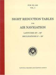
rif. BN604932PUB 249 Sight Reduction Tables for Air Navigation Volume 3: Latitudes 39° to 89° Declinations 0° to 29° Spiral-bound Jan 01 1878 PUB 249 Sight Reduction Tables for Air Navigation Volume 3: Latitudes 39° to 89° Declinations 0° to 29° Spiral-bound Jan 01 1878 PUB 249 Sight Reduction Tables for Air Navigation Volume 3: Latitudes 39° to 89° Declinations 0° to 29° Spiral-bound Jan 01 1878 unknown
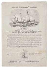
1860rif. 42341New York 1860. Broadside 11-1/4" x 16." Two vignettes of ships engraved by Waters & Son. Light dusting upper left blank corner with a small chip. Very Good. The broadside touts describes and praises this "first-class steamer of 432 tons register." The Daylight's officers are listed its construction history described and its dimensions disclosed. The Daylight "is fitted up in a style unsurpassed by any of the Sound Propellers. The Ladies' Cabin contains seven state-rooms each having three berths and Gentlemen's Cabin has twenty-four berths. She has every modern convenience and every requisite for a sea-going steamer." The Union Navy acquired it in 1862 as an armed gunboat patrolling the Atlantic Coast and Virginia waterways. Not located on OCLC or AAS online site as of August 2026. unknown
rif. BN635056ATPL Radio Navigation CBT CD-ROM Sep 20 2011 ATPL Radio Navigation CBT CD-ROM Sep 20 2011 ATPL Radio Navigation CBT CD-ROM Sep 20 2011 unknown
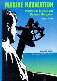
1990rif. BN151395U S Naval Inst Pr 1990. 1990. Marine Navigation: Piloting and Celestial and Electronic Nagivation Marine Navigation: Piloting and Celestial and Electronic Nagivation Marine Navigation - Hobbs Richard R. U S Naval Inst Pr unknown