488 résultats
1807réf. 55849Philadelphia: Published by B.B. Hopkins and Co. and sold by W.P. Farrand No. 170 Printed by T. & G. Palmer 1807. 8vo. xxiii 1 270; 271-275 1 40 16 15-16 17-220 4 pp. including binders instructions and publisher’s advertisement. With 7 copper-engraved plates & maps 6 engraved by Benjamin Tanner. Contemporary polished brown calf red & gilt morocco spine label chipping to head of spine minor edgewear occasional interior foxing & toning still a VG- copy from the library of John L. Gow 1797-1866 noted Pennsylvania attorney w/ ownership label and markings on front pastedown. First American edition of this classic navigation handbook which was first published in 1804 and here contained substantial corrections to the tables of the latitudes and longitudes of places on the American coast and in the West Indies as well as an improved system of finding the longitude by P. Delamar of Philadelphia. Mackay 1760-1809 was noted Scottish mathematician and astronomer taught navigation and instructed in methods of how to find longitude. Shoemaker 12965. Published by B.B. Hopkins and Co., and sold by W.P. Farrand, No. 170, Printed by T. & G. Palmer, unknown
1920réf. 59229Washington D.C.: Government Printing Office Hydrographic Office U.S. Navy 1920;1929. Two vols. 8vo. vii 1 4 500 pp.; 2 32 2 leaves. With 1 large folding colour map. First in dark blue publisher’s buckram lettering stamped on front cover & spine minor soiling edgewear slight uniform interior toning 2nd vol. in self-printed softcovers oxidized toning & predation to outer fore-edges front chipped corner still VG- set. First editions of these very scarce coast pilot guides to waters off the West coast of India just after World War I drawing upon British Royal Navy coast pilots and U.S. Navy reports. Prior to modern GPS systems and satellite navigation these regularly updated and revised navigation handbooks provided key sailing instructions often drawing not only from British & Indian sources but also sailing reports from U.S. Navy vessels and those from merchant ships. The map outlines the available charts for the coastline off of Bombay down to Cape Comorin the Maldives and Sri Lanka. Worldcat locates only 2 copies of the scarce supplement. Government Printing Office, Hydrographic Office, U.S. Navy, paperback
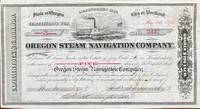
1518réf. 60240Seattle WA & Portland OR; San Francisco: Oregon Steam Navigation Company OSN Lithographers Britton Rey & Co. May 15 1874. Oblong 8vo. 9.5 x 5.25 in. 1 lithographed stock certificate printed in red & black image of OSN sidewheeler decorative borders signed by Wygant Ainsworth & Thompson at lower fore-edge transfer printed on verso signed by Edwin M. Lewis to Mrs. Kate J. Jones w/ stamps of paid dividends in 1878 and 1880. A nicely lithographed and rare original stock certificate issued in 1874 by Jay Cooke and the Northern Pacific Railroad to raise money for OSN after many of its original stockholders had sold out in 1867 as the Company continued to compete with Ben Holladay’s Pacific Mail Steamship Co. Unfortunately OSN became entangled with the declining financial woes of the Northern Pacific to the extent that by 1879 Henry Villard representing German Bondholders in 1879 purchased the OSN paid off the certificate holders by 1880 and the company disappeared into Villard’s transcontinental railroad. Edwin Lewis in Shasta OR transferred this certificate to Kate J. Jones May 1 1875 and shows the stamps of being paid off in dividends when the Northern Pacific absorbed OSN’s four railroads 26 steamboats and real estate in Portland Astoria The Dalles Umatilla OR and Vancouver WA. Oregon Steam Navigation Company (OSN), Lithographers, Britton, Rey & Co., unknown
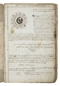
1710réf. ABC_46964The Netherlands 1710. Contemporary flexible paperboards. Folio 33.5 x 21.5 cm. With more than 300 mathematical figures and illustrations mainly full- half- and quarter-circle diagrams. The Dutch text is written in a clearly legible 18th-century cursive hand in brown ink. Early 18th-century Dutch manuscript on the art of navigation based on Klaas de Vries Schat-kamer ofte konst der stuurlieden . 1702. De Vries taught mathematics in Amsterdam his work proved very popular and appeared in numerous editions between 1702 and 1818. The author of the present manuscript unknown but was most likely a student of mathematics possibly even a student of De Vries himself at the beginning of the 18th century.The manuscript deals with several subjects regarding navigation including many different calculations for calendars for example the golden number the tides and determining the time at night. Furthermore theories and examples of correcting compass declination and determining the time of sunrise and sunset from the declination of the sun in combination with the pole star map reading and course calculation. It ends with approximately 50 sample problems in trigonometry and geometry showing the student author's mathematical work.Binding soiled edges frayed lacking the first 7 leaves quires 3 and 5 detached. With several ink stains the ink has bled through some leaves. Otherwise in good condition. An interesting manuscript on navigation probably from a Dutch student ca. 1702/13.l For De Vries's work: The Crone library 374 1st ed 1702. hardcover
1839réf. 331758London: Smith Elder and Co 1839. Softcover. Good. First edition. Octavo. Disbound. 49pp. folding map. Lacking wrappers; title page and folding map detached from sewing; good. A scarce report establishes an early point for the English empire's interest in establishing a steam boat line in India and the methods by which they proposed to go about doing so. Commercial manufacturers and various merchants from Manchester Liverpool and India were enlisted to support the proposal and the report outlines navigational routes estimations of cost and the enthusiasm of changing maritime trading methods up and down the Ganges. The idea for an East India Inland Steam Navigation Company apparently began percolating in 1837 and this report fits nicely within the small pantheon of material devoted to this literature. Not in OCLC. One copy found at the British Library. Smith, Elder and Co unknown
réf. 3975Portland Oregon:: The Company; Press of C. H. Crocker . Fifty-nine halftones on 32 pp. Oblong 8vo dark gray/green pictorial wrappers. The Columbia River and Puget Sound Navigation Company was organized in 1891 by Captain U. B. Scott and John Leary. On p. 1 the company’s real name is revealed by "Compliments of Columbia River and Puget Sound Navigation Co. Portland Oregon" which was nicknamed the White Collar Line. [Portland, Oregon:: The Company; Press of C. H. Crocker, ,. unknown
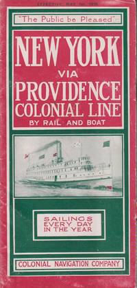
1915réf. 21548New York: Colonial Navigation Company. Very Good-. Softcover. One page separated and with staple binding weakening.; A stapled illustrated brochure promoting the steam ships Concord and Lexington as well as the; Oblong 8vo 8" to 9" tall; 12 pages . 1915. Colonial Navigation Company paperback
réf. 9788497001526New. unknown
1747réf. 234865London: Printed for W. and J. Mount and T. Page 1747. Later approximately eleventh edition. Illustrated with woodcuts diagrams and tables. 272 pp. 1 vols. Small 8vo. Modern quarter blue morocco and cloth. Half-title and title leaves silked at upper margin early mild dampstaining to text; a good solid copy. Later approximately eleventh edition. Illustrated with woodcuts diagrams and tables. 272 pp. 1 vols. Small 8vo. First published in 1694 and innumerable times since throughout the 18th-century. Printed for W. and J. Mount, and T. Page unknown
1815réf. 39889Lisbon: Simao Thaddeo 1815. hardcover. very good. 144pp. 8vo. Lisbon 1813. Second Edition. BOUND WITH: Taboa da Declinacao do Sol ao Meio Dia no Meridiano da Cidade de Lisboa . IV 64pp. 8vo full leather. Lisbon 1815. Scarce. Very good. Tables of latitude and longitude for marine navigation. Simao Thaddeo unknown
réf. 61188LEHIGH COAL AND NAVIGATION COMPANY. Report of the Board of Managers of the Lehigh Coal and Navigation Company to the Stockholders. January 9 1843. Phila.: Printed by William S. Young 1843. 1st ed. 30 pp. Orig. printed wrappers. Very light scattered foxing else a very good copy. The report details expenses due to the great flood of January 1841 which necessitated repairs to be made from the mouth of the Lehigh to Mauch Chunk Pennsylvania with more work on the upper section of the river still to be done. Scarce Worldcat locates only six copies. unknown
1887réf. 40498N.p.: N.p. 1887. Paperback. 8vo. Self-cover. 7pp. Very good. Outer wrappers faintly soiled and mildly edgeworn. Probable sole edition of this bibliographically-cryptic pamphlet presenting the case of Lefferts W. Lloyd Catherine W. Mitchell and Samuel F. Engs each the administrator of the estate of a deceased versus the United States in this "French Spoliation Claim" -- claims made by U.S. citizens against France Holland and Spain for ships and goods seized by privateers prior to September 30 1800 at ports controlled by those countries -- a rather sizeable and definitely bizarre category of strange maritime documents with claims made by descendants into the 20th century. This particular claim involves John and Abraham Franklin and their ship "Hunter" commanded by William Whitlock. In 1798 she sailed from New York headed for France and then China but was captured by a Spanish and then a French privateer -- it all gets hairy and convoluted but in the end the ship and goods were damaged and the descendants seek $75000 in damages. N.p. paperback
1896réf. 6694Washington. Government Printing Office. 1896. Bound in gilt titled royal blue cloth. Square 8vo. First Edition. Mild scuffing to covers corners gently rubbed mild foxing to prelims. A Very Good copy. Government Printing Office. hardcover