U S Commissioner of NavigationBiblio.com

433 risultati
rif. 033101209X.Gpaperback. Good. Access codes and supplements are not guaranteed with used items. May be an ex-library book. paperback
rif. 033133612X.Ghardcover. Good. Access codes and supplements are not guaranteed with used items. May be an ex-library book. hardcover
rif. 0331691108.Ghardcover. Good. Access codes and supplements are not guaranteed with used items. May be an ex-library book. hardcover
rif. 0260868841.Ghardcover. Good. Access codes and supplements are not guaranteed with used items. May be an ex-library book. hardcover
rif. 0266717624.Gpaperback. Good. Access codes and supplements are not guaranteed with used items. May be an ex-library book. paperback
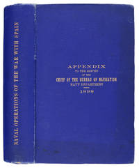
1898rif. 80-54BGPO 1898. 1898. 740p. Folding Maps. Photos. Spine title "Naval Operations of the War with Spain". Covers the Destruction fo the USS Maine Operations in the Atlantic Cuba and Porto Rico and Pacific Manila. Original blue pebbled cloth. Heavy. Rubber stamp inside. Near Fine Copy. Hardcover. Near Fine. Book. GPO, 1898. Hardcover
1898rif. 80-54GPO 1898. 1898. 740p. Folding Maps. Photos. Spine title "Naval Operations of the War with Spain". Original blue pebbled cloth. Heavy. Copy of Col. Robert D. Heinl jr USMC. Heinl wrote several of the official Marine Corps monographs on WW II battles in the Pacific. Fine Copy. Hardcover. Fine. Book. GPO, 1898. Hardcover
1898rif. 106031Washington: Government Printing Office 1898. Hardcover. very good. 1st Edition. 740pp. tipped-in erratapp. Octavo in original gilt lettered blue cloth with plates from photos and drawings some folding - including ship plans and elevations and folding maps including colour. Faint dampstain to edges of text block top corner else very good. very good Spine Title: "Naval Operations of the War with Spain.". An appendix to the official report by the United States Navy Department Bureau of Navigation "relating to the operations of the war with Spain and covering as well important operations of the Department before during and after the war." pp.3 grouped according to general subject. 1898 Government Printing Office hardcover
1719rif. 59230Washington D.C.: Government Printing Office Hydrographic Office U.S. Navy 1917; 1930. Two vols. 8vo. ix 1 4 364 pp.; 19 mimeograph leaves. With 2 large folding colour map. First vol. in black publisher’s buckram silver lettering stamped on front cover & spine minor shelfwear slight interior toning shelfwear 2nd vol. mimeographed typescript & stapled at gutter margin minor dustsoiling edgewear predation to lower fore-edge tear to last leaf of blank lower portion still a VG set. First editions of these coast pilot guides to Arctic waters during and after World War I issued about the time of the Russian Revolution and offered key navigational guides for Naval forces during the ill-fated White Russia Revolution and over 13000 troops in the Polar Bear Expedition. Prior to modern GPS systems and satellite navigation these regularly updated and revised navigation handbooks provided key sailing instructions often drawing not only from Russian & British sources but also sailing reports from U.S. Navy vessels and those from merchant ships. The two maps serve as indexes to sailing charts to be ordered from the Hydrographic Office and keyed to sailing instructions within the coast pilots. The supplement is uncommon no copies located in Worldcat. Government Printing Office, Hydrographic Office, U.S. Navy, hardcover
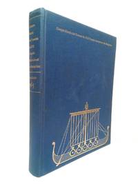
1967rif. 47805Stockholm Sundbyberg: Lo edita Le Comité Nordique d'Organisation Imp. Solna Tryckeri Sundbyberg 1967.- 414 p.: Ilustraciones fotográficas entre el texto; 4º 232 x 185 cm: Buena impresión sobre papel satinado de excelente calidad; Texto en francés;Tela Ed. lomo dorado y plancha dorada en la tapa anterior. Excelente estado. MARINA PIRATAS CORSARIOS BUCANEROS Livre en français Le Comité Nordique d'Organisation hardcover
1954rif. 47806Rome Roma: Edita el Secrètariat Général du Congrès Imp. du Sénat du dt. J. Bardi 1954.- XCV 450 pp.: Al principio in frontis 4 láminas con los retratos fotográficos de los responsables del Congreso siguen diversas ilustraciones entre el texto muchas a toda plana y dos mapas plegados; 4º 248 x 183 cm; Papel satinado; Texto en francés; Tela Ed. lomo dorado yplancha dorada en la tapa anterior. Mínimo desperfecto en la base del lomo. Por lo demás en muy buen estado. MARINA PIRATAS CORSARIOS BUCANEROS Livre en français Secrètariat Général du Congrès hardcover
rif. BN635056ATPL Radio Navigation CBT CD-ROM Sep 20 2011 ATPL Radio Navigation CBT CD-ROM Sep 20 2011 ATPL Radio Navigation CBT CD-ROM Sep 20 2011 unknown
rif. BN168889Audio Navigation und Telematik für Kraftfahrzeuge Audio Navigation und Telematik für Kraftfahrzeuge Audio Navigation und Telematik für Kraftfahrzeuge unknown
rif. 59127Neuchâtel Verlag Baconnière 1947 Auflage: 1. Leinen gebunden; blaue goldgeprägte Einbände / 3 Bände / Anz. Seiten: 278 35 144 / 225 x 305 cm / mit 35 ausfaltbaren Tafeln Schemata und Karten Bd. 2; 8 Schemata und 4 Karten 2 davon ausfaltbar Bd. 3 / Zustand: gut geringe bis leichte Gebrauchsspuren; Einbände gering fleckig Bd. 1 Bd. 3 fleckig Bd. 2 Rücken leicht gebräunt Schnitt mässig stockfleckig und etwas gebräunt Vorsatz bis Vortitel leicht fleckig Bd. 1 Mit Widmung des Direktors der Zellulosefabrik Attisholz sowie beiligendem Brief; Inhalt: Band 1: Technischer Generalbericht bearbeitet von Ing. H. Blattner Leiter der Studien Genfersee-Rhein: Allgemeines; Die Technischen Studien; Zusammenstellung der Gesamtkosten; Allgemeine Betrachtungen und Bemerkungen zu den technischen Ergebnissen der Projekte; Die technischen Schlussfolgerungen; Band 2: Tafelbeilagen; Band 3: Bericht über die volkswirtschaftliche und wirtschaftliche Beurteilung einer Schiffahrtsverbindung Genfersee-Rhein: Allgemeine Übersichtspläne; Projektabschnitt I Entreroches-Kanal; Projektabschnitt III Bielersee-Aaremündung in den Rhein; Graphische Fahrpläne Aarau - Aarwangen-Wynau - Bernerschachen - Beznau - Binnenschiffahrt - Brugg-Lauffohr - Eclépens-Orbe - Genfersee-Vufflens-la-Ville - Jura-Seen - Klein-Aarwangen - Klingnau - Olten-Gösgen - Orbe-Yverdon - Rüchlig - Rupperswil-Auenstein - Staustufen - Vufflens-la-Ville-Eclépens-Orbe - Wildegg-Brugg - Wynau-Olten Neuchâtel, Verlag Baconnière, 1947, Auflage: 1. unknown
1920rif. 59233Washington D.C.: Government Printing Office Hydrographic Office U.S. Navy 1920-1930. Seven vols. 8vo. 4 365 1; 584; v 1 4 447 1 pp.; 2 22; 1; 2 57 1; 1 36 2 leaves. With 3 large folding colour maps numerous photo plates elevation views. Three uniformly bound in blue publisher’s buckram gilt lettering stamped on front covers & spines edgewear dustsoiling very slight uniform toning bowing to covers on vol. III some scuffing supplements all w/ self-printed softcovers edgewear rippling toning to fore-edges some predation still a G set w/ maps in bright condition. First editions stated of these uncommon coast pilot guides to Australian waters drawing upon British Royal Navy coast pilots Australian and U.S. Navy reports. Prior to modern GPS systems and satellite navigation these regularly updated and revised navigation handbooks provided key sailing instructions. The maps outlines the available charts for the designated areas surrounding Australia as well as those for the East Indies Pilot. First editions of these Hydrographic Office pilots are quite scarce and seldom seen with the supplements. Government Printing Office, Hydrographic Office, U.S. Navy, paperback
rif. 0266226426.Ghardcover. Good. Access codes and supplements are not guaranteed with used items. May be an ex-library book. hardcover
1926rif. 59234Washington D.C.: Government Printing Office Hydrographic Office U.S. Navy 1926; 1930. Two vols. 8vo.viii 478 pp.; 1 22; 1 leaves. With 1 large folding colour map. First vol. in tan publisher’s buckram black lettering front cover & spine minor soiling spotting fore-edges of covers darkening to spine very slight uniform interior toning; 2nd. vol. w/ self-printed softcovers toning to fore-edges minor chipping still VG set. Second edition stated of vol. I and 1st edition of Supplement. These uncommon coast pilot guides to Eastern Mediterranean waters the Black Sea and the Sea of Azov draw upon British Royal Navy Ottoman Empire & Turkish coast pilots Russian & U.S. Navy reports. Prior to modern GPS systems and satellite navigation these regularly updated and revised navigation handbooks provided key sailing instructions. The maps outlines the available charts for the designated areas surrounding the Black Sea as well as detailing those for the extensive set of the Mediterranean Sea. Government Printing Office, Hydrographic Office, U.S. Navy, paperback
1920rif. 59237Washington D.C.: Government Printing Office Hydrographic Office U.S. Navy 1920-1940. Five vols. 8vo. vi 638; v 1 287 1; 8 390 pp.; 1; 2 17 1 leaves. With 5 large folding colour maps numerous plates showing elevations. Three volumes uniformly bound in blue publisher’s buckram gilt lettering front cover & spine darkening to spines fore-edges minor shelfwear dustsoiling slightly shaken Supplements in self-printed softcovers edgewear toning to fore-edges minor chipping still VG- set. Third editions revised & updated of vols. I & II second edition of vol. II and 1st editions of both scarce Supplements of these coast pilot guides to British Columbia including lower Alaska and upper Washington in the years between the World Wars. Prior to modern GPS systems and satellite navigation these regularly updated and revised navigation handbooks provided key sailing instructions often drawing not only from Brazilian Argentine and British coast pilots as well as sailing reports from U.S. Navy vessels and those from merchant ships. The first large map delineates the requisite coast pilots for sailing in B.C. waters and charts to be ordered from the Hydrographic Office while the second maps depict the sailing routes to Asia the Soviet Union and the Arctic across the Pacific. Both editions of Vol. II are offered here with the expanded 3rd edition featuring nearly double the material and extra map of the 2nd. Government Printing Office, Hydrographic Office, U.S. Navy, paperback
rif. P22282British India Steam Navigation Company: 1959 UK softcover 22 pages with photos of the interior of the sister ships Kenya and Uganda. In very good conditon paperback
rif. 0366447033.Ghardcover. Good. Access codes and supplements are not guaranteed with used items. May be an ex-library book. hardcover
1911rif. 19610Toronto: Niagara Navigation Company. Very Good. 1911. First Edition. Softcover. Water damage in the gutter at the bottom which does not show on the wraps. This brochure is both advertising and a timetable. As-is. ; 8vo 8" - 9" tall; 32 pages . Niagara Navigation Company paperback
rif. 0364128054.Gpaperback. Good. Access codes and supplements are not guaranteed with used items. May be an ex-library book. paperback
rif. 0364897430.Ghardcover. Good. Access codes and supplements are not guaranteed with used items. May be an ex-library book. hardcover
rif. 1333777043.Gpaperback. Good. Access codes and supplements are not guaranteed with used items. May be an ex-library book. paperback
rif. 0332162346.Ghardcover. Good. Access codes and supplements are not guaranteed with used items. May be an ex-library book. hardcover